The Trails
Guide
Maps
Miles/Ele
Permits
Resupply
Forum
Current Weather Conditions
Weather Notes
Northern High Sierras
Central High Sierras
Southern High Sierras
Gear
Gear List
Gettin Started
Layering
Discussion
Testing yourself and your gear
Gear Reviews
Trail Segment
Vogelsang High Sierra Camp
to the
John Muir Trail - Pacific Crest Trail
in
Lyell Canyon
Via
Ireland Creek
Section
Yosemite Valley to Lyell Canyon
BACKPACKING
YOSEMITE NATIONAL PARK
Section Hiking
Yosemite Valley
to
Lyell Canyon
via
Vogelsang
Languages
Languages
Trail Arts
The art of walking
Physical Preperation
Trail Skills
The trail
Off the trail
Scrambling
Maps
Navigation
Camp skills
Food
Resupply
Food
Other
Photo Catagories
Trail Stories
Trail Culture
News and Science
Links
Groups
Books
Terms and Conditions of Use
| Trail Guide INDEX Yosemite Valley to Lyell Canyon |
Trail Guide |
Trail Guide SOUTH JMT JMT-PCT Lyell Canyon to Donohue Pass |
7.5 Topo |
30 min |
MILES Yosemite Valley to Lyell Canyon MILES and ELEVATIONS |
TOPO MAP INDEX Central Yosemite |
Resupply South |
PERMITS National Forests & Parks Toiyabe & Stanislaus & Yosemite |
|
| Guide North JMT Tuolume Meadows to Ireland Creek |
|||||||||
Central and South Yosemite Guide
UNDER CONSTRUCTION
!
Vogelsang High Sierra Camp
to
John Muir Trail
in
Lyell Canyon
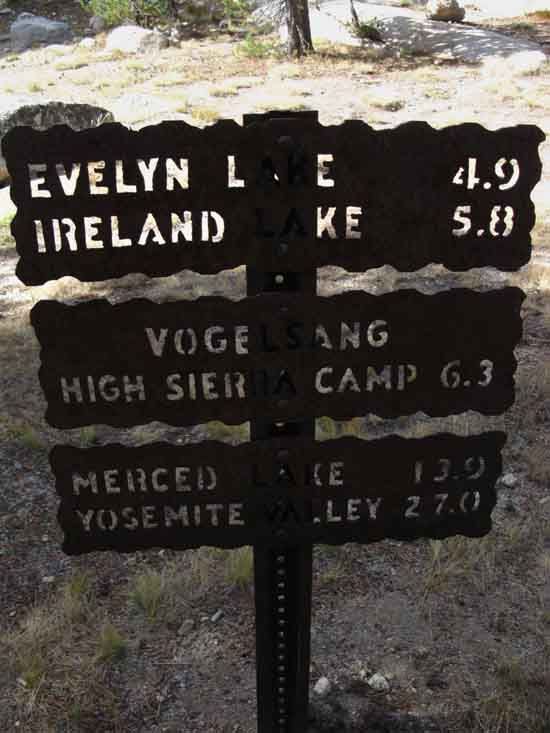
We Southbound hikers on the John Muir Trail will find our optimal junction with the John Muir Trail on the floor of Lyell Canyon 5.6 miles South of Tuolumne Meadows near Ireland Creek. Our other option down the North Flank of the Cathedral Range would be thorough Tuolumne Pass down to the Rafferty Creek trail junction located on the John Muir Trail 2.07 miles South Tuolumne Meadows. JMT Miles
Four-Way Trail Junction
Miles
End point is at Tuolumne Meadows Post Office
Miles
Vogelsang High Sierra Camp Maps and Miles
Tuolumne Meadows Area Map
Miles Yosemite Valley to Lyell Canyon
Further MAPS South Donohue Pass to Reds Meadow 15 Minute topo hiking map
Long View Back in Time
Backpacker Resources
Lakg the Tahoe to Yosemite Trail. |
|||||||||||||||||||||||||||||||||||||||||||||||||||
 |
||
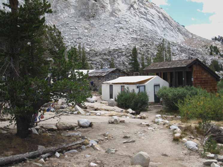
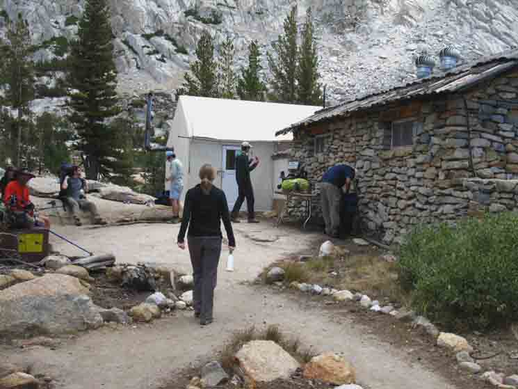
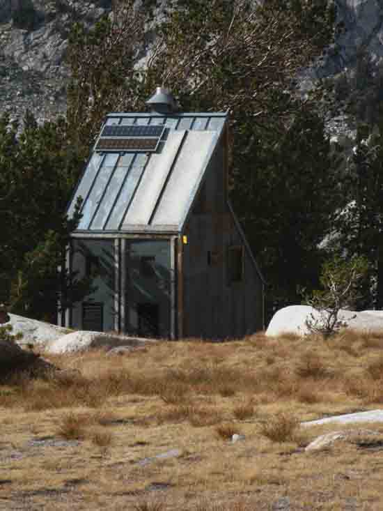
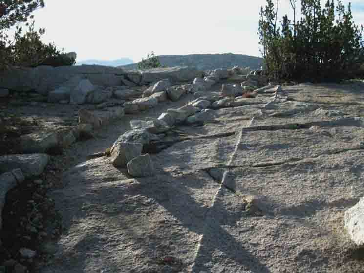
Vogelsang High Sierra Camp main buildings. The terrain has a worn-out look from decades of hooves and heels cutting the fragile groundcover. Access,
|
 |
||
Typical scene at Vogelsang High Sierra Camp in Yosemite.
|
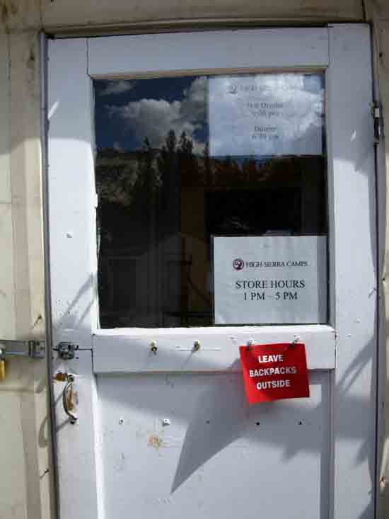
Store & Office
 |
||
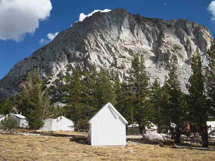
The store and office at Vogelsang High Sierra Camp.
|
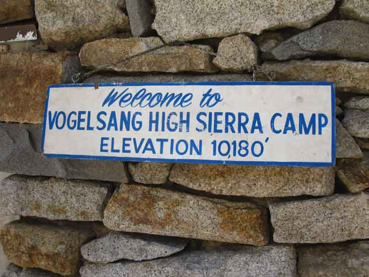 |
| The Vogelsang High Sierra Camp sign. |
Vogelsang High Sierra Camp
Yosemite Steel Plate Miles Signs Miles Figures in the Sierra Nevada
|
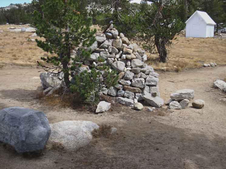
Great Carin at Vogelsang
Crossroads Trail Junction
 |
||
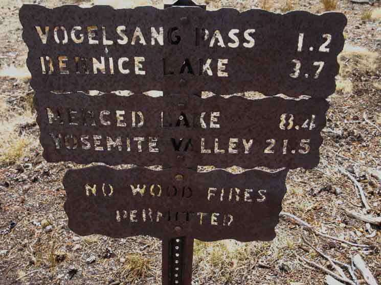
Great carin at Vogelsang High Sierra Camp four-way trail junction. We essentially have two choices at this four-way trail junction. Two of the trails proceed North over the Cathedral Range into Lyell Canyon and the Tuolumne Watershed. This map shows both Northbound routes down into Lyell Canyon where the intersect with the John Muir Trail: Tuolumne Meadows Hiking Map Two of the trails proceed South into the Merced Watershed draining through Yosemite Valley. This map shows all three of the trails we can find leading down to the Merced River and Merced Lake on the way down into Yosemite Valley: South Yosemite Hiking Map
|
Trails
from
Vogelsang
High Sierra Camp
via
Tuolumne Pass
 |
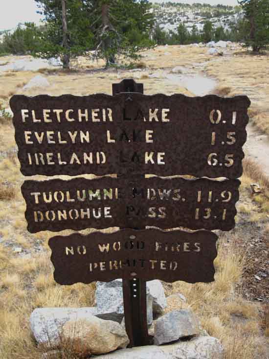
Tuolumne Pass Our distance to Tuolumne Pass from this Vogelsang trail junction is .74 of a mile, while the whole length of this trail from Vogelsang to the trail junction with the John Muir Trail in Lyell Canyon is 4.76 miles. Adding in the 1.46 miles South to the edge of the Tuolumne Meadows Car Campground puts the distance to Tuolumne Meadows at 6.22 miles. The new Yosemite Trail Miles Sign at that position on the Eastern end of the TM Car Campground puts this distance at 6.8 miles. This trail above can be used as one leg for putting together short backpacking loops out of Tuolumne Meadows when combined with the trail to the Northeast shown below. That trail Northeast drops us onto the floor of Lyell Canyon 6.24 miles South of Tuolumne Meadow's facilities. But not for us planning on hiking South along the John Muir Trail out the South end of Yosemite. |
Northeast
to
Lyell Canyon
 |
||
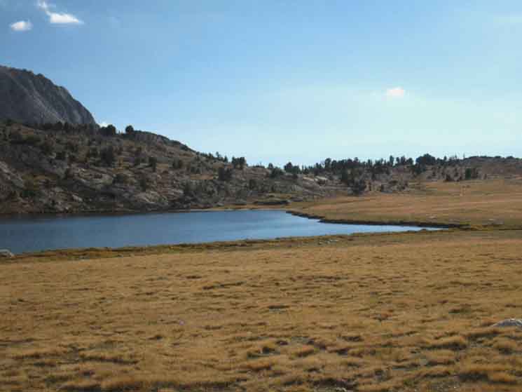
Lyell Canyon North South Where are We? Tuolumne Meadows is where we first diverted off the Sierra Crest to follow the John Muir Trail route backwards into Yosemite Valley. Arriving in Lyell Canyon marks the end of our last segment of trail from Yosemite Valley to Lyell Canyon, which is the end of The Golden Triangle portion of our hike around the Heart of Yosemite. Now we resume the line of our classic Tahoe to Whitney Crestline backpacking trip. Unless we are hiking The Golden Triangle as a stand-alone backpacking trip, then we still have to return to our starting point. My next destination is Reds Meadow along the route of the John Muir Trail. At Reds we'll catch the shuttle to Mammoth Lakes for our next resupply stop.
|
Back to the Valley
East then South
Back to the Valley
Southwest Route
 |
||
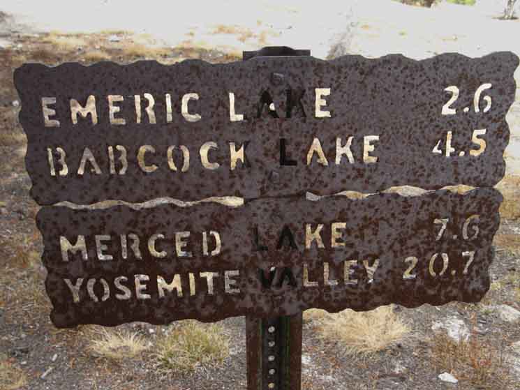
Merced Lake via Fletcher then Lewis Creeks
|
| Transitions
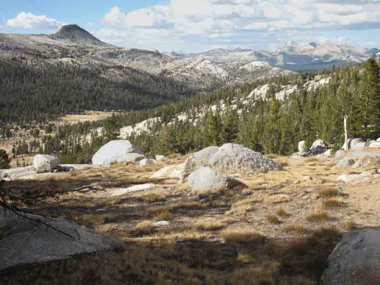
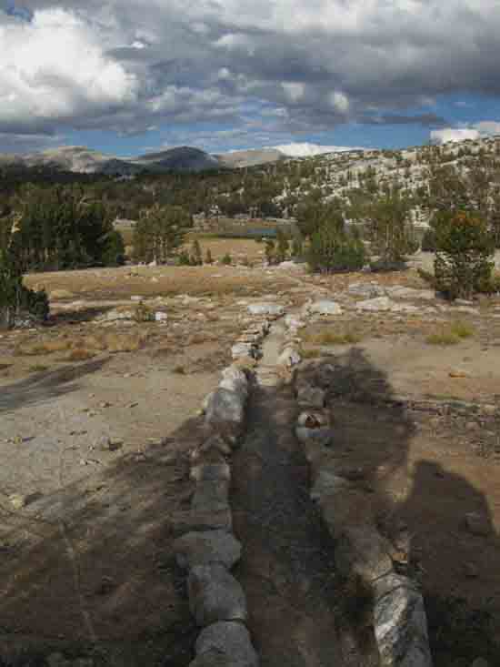
Exiting We'll drop into Lyell Canyon at a point 5.6 miles South of the where the Wilderness Boundary wraps around Southeastern corner of Tuolumne Meadows, but a total of 6.24 miles from the vital resources at the Tuolumne Meadows Post Office, Store, and Grill. Unless we are hiking South to Reds Meadow. Then our time and distance to our next resupply point at Reds is a bit longer, and our packs a bit heavier. Departing the Vogelsang Crossroads Trail Junction on the trail hiking to the Northeast towards Lyell Canyon via Evelyn Lake we begin climbing the low rise marking the Crestline of this part of the Cathedral Range. That crestline divides the Tuolumne River Watershed in front of us from the Merced River Watershed behind. We first hiked Southbound into the Merced Watershed through Cathedral Pass after arriving at Tuolumne Meadows along our Tahoe to Whitney backpacking trip. Now we're hiking back into the Tuolumne River Watershed. Let's take another look at this whole scene around Tuolumne Meadows where we begin and end this "Golden Triangle" portion of our Tahoe to Whitney hike. Tuolumne Meadows Area Map At Tuolumne Meadows we broke off the Sierra Crestline Trails to follow the John Muir Trail backwards to Yosemite Valley. Now we've finished our hike up the Merced River on our way back out of Yosemite Valley, and are just now crossing back over the top of the Cathedral Range to re-connect with the route of the John Muir Trail in Lyell Canyon about 6.25 miles South of the Tuolumne Meadows facilities, to complete our "Golden Triangle" hike. The "Golden Triangle" hike would be a good fifty-miler for the Scouts. I figure the Golden Triangle measures-in at around 55 miles. Therefore, it adds an extra 55 miles to fill in the trail space we miss between its departure from Tuolumne Meadows on the way down to Yosemite Valley and it's reacquiring the John Muir Trail 5.6 miles South of Tuolumne Meadows. I like those numbers, "55 for 5." Especially since those 55 miles cross the heart of the Yosemite National Park. I've hiked the whole Sierra Crestline across Yosemite four times, and across the North end more times than I can count. But hiking the Golden Triangle as part of a Tahoe to Whitney hike was special. Departing Vogelsang High Sierra Camp for Vogelsang via Evelyn Lake first requires we climb 280 feet over the low ridge features around the base of the North flank of Fletcher Peak to reveal Evelyn Lake laid out a nice flat below. |
 |
||
Hiking Northeast from the Vogelsang Trail Junction we see what I think is an important piece of Vogelsang's infrastructure off to our Right. I believe this is what brings Vogelsang's water to camp.
|
High Sierra Camp
 |
||
Continuing to hike a short distance Northeast we find the "guest" quarters laid out on the North end of the Vogelsang High Sierra Camp under the Northwestern Flank of Fletcher Peak.
|
Fletcher Lake
 |
||
Looking over our Right shoulder as we hike North out of the Vogelsang High Sierra Camp's four-way trail junction reveals Fletcher Lake. We really can't see Fletcher Lake until we climb a bit. We can see how the flat apron around Fletcher Lake begins rising as we pass North of the lake. This "flat" terrain is typical of the long meadowed ledge running South from Tuolumne Pass all the way down to Emeric Lake. It's not really a "ledge," but a series of almost-flat "shelves," running South in the slot between Vogelsang Peak to the South and Rafferty Peak to the North. Tuolumne Pass is the low point along the Cathedral Crestline at the top of this flat slot. Rafferty Creek creates another meadowed-flat just below the North Flank of Tuolumne Pass, as we can see to our Northwest, over our Left shoulder, as we climb a little higher. (second image below)
|
Townsley Lake
 |
||
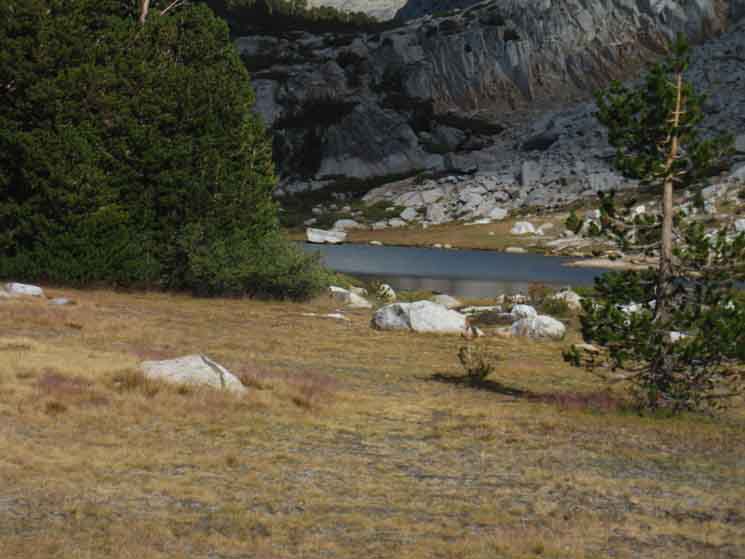
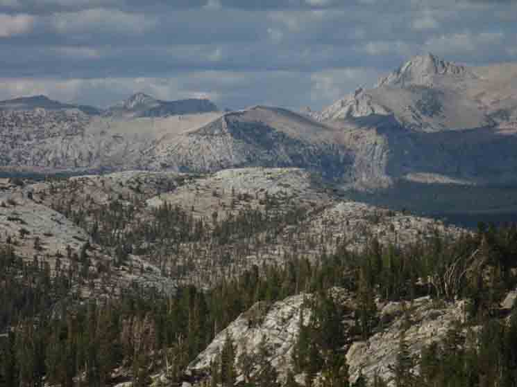
Continuing our climb just a short distance further South beyond Fletcher Lake gives us a look to our Southeast into the unique channel/slot cut under the Northeastern flank of Fletcher Peak, holding Townsley Lake in some kind of rocky captivity. Keep your eyes peeled to your Southeast or we will miss it! Tuolumne Meadows Hiking Map Keep your eyes open for the brief window of opportunity along the trail where we can see Townsley Lake as we're hiking South of Vogelsang High Sierra Camp.
|
View North
 |
||||
Rafferty Creek running down to Lyell Canyon below Tuolumne Pass. We can see how a nice meadowed-flat has formed below the North Flank of Tuolumne Pass, just as a series of flats run South from the South Flank of Tuolumne Pass towards the Merced River. I find the configuration of terrain interesting. It tells so many stories of its past to present, and shows us the future too, if we can read its line from past to present accurately. Johnson Peak rising on Left.
|
View North
 |
||
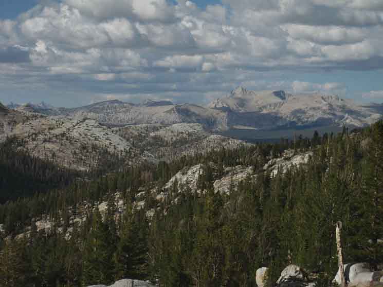
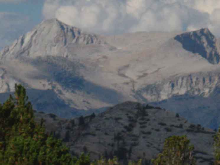
Mount Conness dominates Sierra Crest far to our North. Mount Conness is the high point of the Sierra wrapping around the Northeastern boundary of Yosemite. We hiked past the West Flank of Conness coming down Cold Canyon, then got another good look as we climbed up to and through Cathedral Pass hiking down to Yosemite Valley. Now we're going to be getting our last views of Conness as we approach and cross Donohue Pass hiking South out of Yosemite.
|
View South-Southwest
 |
||
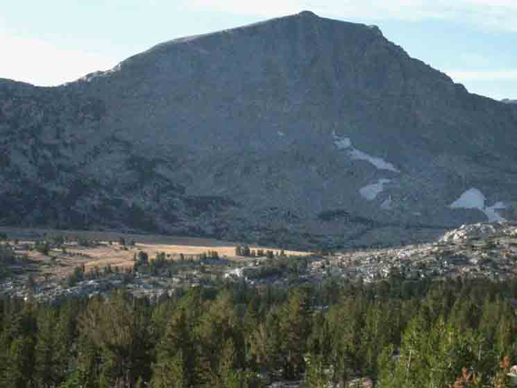
Northwestern flanks of Fletcher and Vogelsang Peaks to our South. Turning around to look South shows us the easy terrain we're crossing hiking South to Evelyn Lake from Vogelsang HSC, and we'll shortly begin our descent onto Lyell Canyon.
|
 |
||||
The gap above Evelyn Lake marking the high point of this segment of our hike from where we begin our descent into Lyell Canyon.
|
View Northeast
 |
||
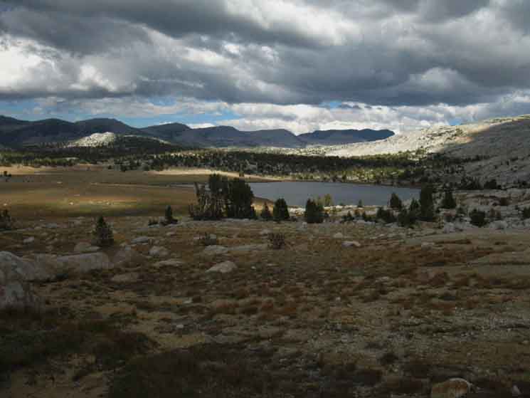
Cross through the gap on the low rise and Evelyn Lake in Yosemite comes into view. The line of rolling mountain-tops we see in the distance beyond Evelyn Lake is the Kuna Crest topping the East Wall of Lyell Canyon. Our next destination is to join up with the John Muir Trail on the floor of Lyell Canyon, located on the floor of Lyell Canyon between our position here atop the Cathedral Range and the Kuna Crest in the near distance. How we turn from there depends on the nature of our trip. As I'm on my way down to the Whitney Portal, I'm going to turn South for the hike up Lyell Canyon to exit the Yosemite Wilderness into the Ansel Adams Wilderness through Donohue Pass. Local hikers will likely turn North towards Tuolumne Meadows from the trail junction in Lyell Canyon, either to end their trips in Tuolumne Meadows, or resupply for the leg of their hike returning them to Yosemite Valley, or to their other starting trailheads. Tuolumne Meadows Hiking Map Check the map for context.
|
 |
||
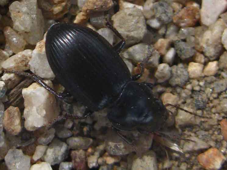
Staying observant to things close as well as far, we note this interesting Fat Beetle cruising by.
|
View Southwest
 |
||
Hiking down to Evelyn Lake we turn around looking Southwest across the lake to take note of the Northwestern Flank of Fletcher Peak in the distance beyond Evelyn Lake, knowing that Vogelsang High Sierra Camp sits at its base. Merced Lake to Lyell Canyon This view of the Northwestern Flank of Fletcher Peak beyond Evelyn Lake marks the position of Vogelsang High Sierra Camp, and gives us the measure of the low rise between Evelyn Lake and Vogelsang High Sierra Camp.
|
View a bit more to the Southwest
 |
||||
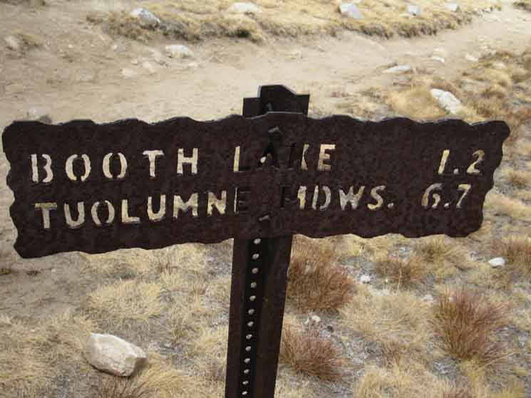
Adjusting our view a bit more to the Southwest we see the top of the cut of Rafferty Creek running up to its headwaters atop the North Flank of Tuolumne Pass. Turning around to face South from Tuolumne Pass puts us atop the headwaters of Emeric Creek. Emeric Creek runs South until it is subsumed in Fletcher Creek for its steep run down into the Merced River. We are looking to our Southwest at the position of Tuolumne Pass, though it's shaded and obscured by the terrain. Rafferty Creek runs up from the Right, the North, in that shaded canyon between our position and the shaded mount in the distance. Emeric Creek begins its run out of Booth Lake, which sits nestled-in under the descending shoulder of that shaded peak. We're looking at that position where Tuolumne Pass marks its low point in the Cathedral Crestline, though it's masked by the terrain and shaded from the setting Sun.
|
 |
||
Mount Conness dominates the distant Northern horizon.
|
 |
||
Virginia and Sheep Peaks in the North Yosemite Backcountry with Mount Conness marking its Eastern boundary. I identify the tallest peak on the Left as Virginia Peak. That faint nub rising in the distance beyond the lowest flank West Flank of Conness as Sheep Peak, while the highest mountain on the Right, or East side of the image is Mount Conness.
|
 |
||
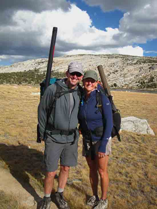
Jeff and Jenny Hawkins out for a fine hike around Yosemite to celebrate their 15th wedding anniversary. Congrats, and Happy Trails for the next 15!
|
 |
||
Hiking East from Evelyn Lake we see the low rise surrounding the valley holding a small unnamed lake.
|
East of Evelyn Lake
 |
||
coming over the low rise we find the small lake nestled in cozy between granite arms wrapping around it.
|
 |
||||
Campsite below Evelyn and above Ireland Lakes.
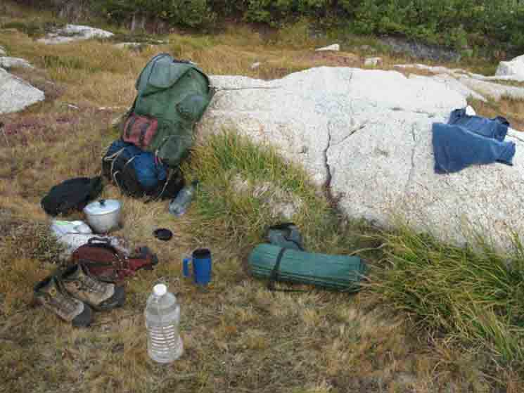
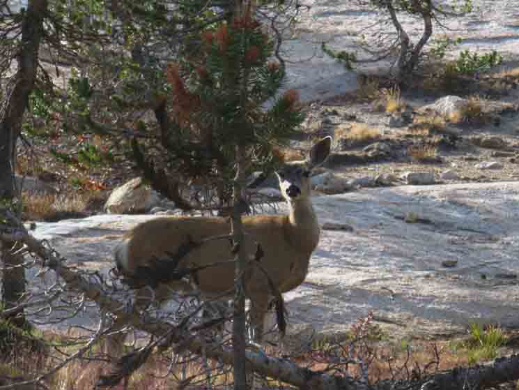
Continuing past Evelyn Lake to camp at the unnamed lake below brought great adventure. First, just exploring, meeting the local deer, marmots, and finding all sorts of interesting terrain decorated with all sorts of life. Then a young bear visited on the down-low, trying to sneak up on me, and really trying not to be spotted. A paranoid bear in Yosemite? That's a new one. It was young, so maybe the Rangers put the Fear of Humans in it, and was still remembering how big a pain in the ass we humans can be. Sometimes the Yosemite Bears forget that humans can generate as much Pain and Death as they provide "easy-pickings" sources of free food. The Rangers work hard to "train" the bears to stay away from people, which is only really necessary because the people have trained the bears to see people as an easy source of food. Stopping bad human behavior by stopping humans from providing food to bears, stops bears from learning that people are a resource to be exploited. This is a good objective, but likely impossible to realistically achieve. So the battles continue. Ranger vs. Tourist. Ranger vs. Backpacker. And my favorite, Bear vs. Backpacker, though I am always amused by bear chasing tourists out of their camps. The Tourists and Irresponsible Backpackers provide food. Bears constantly scout for expected food resources. Rangers chase food-seeking bears around, and Rangers scold food-providing backpackers and tourists. Bear rips door off car... Bear raids camp... Al chases bear away... Rinse and Repeat...
|
 |
||
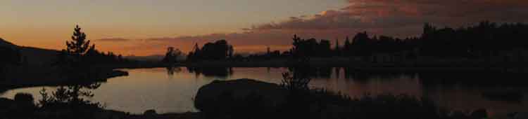
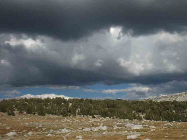
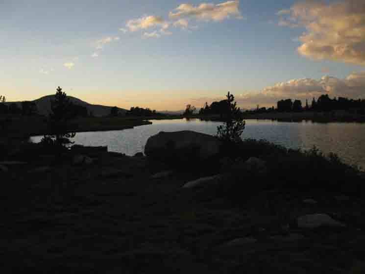
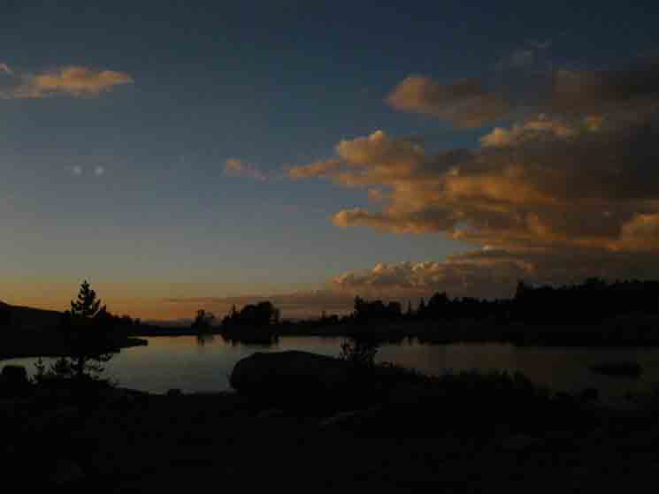
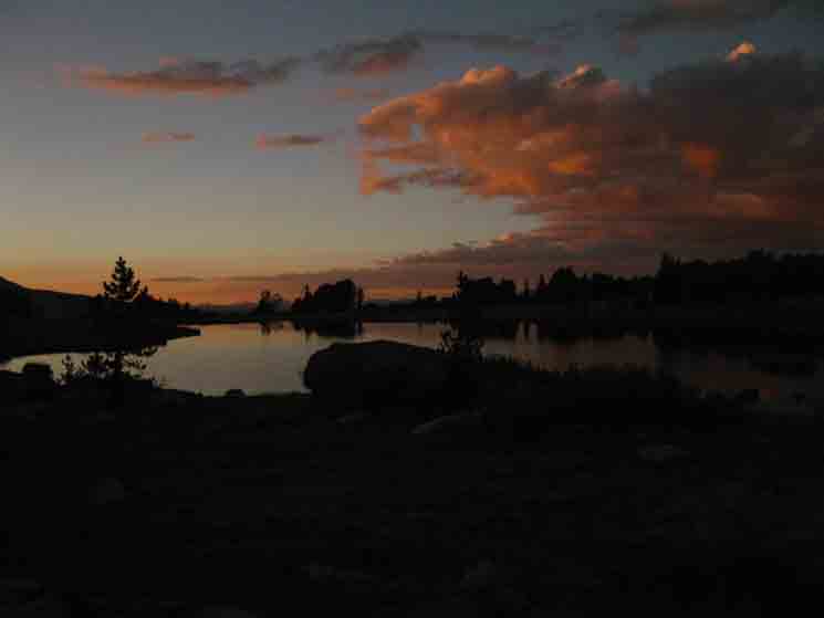
Sunset begins in earnest over East-Central Yosemite.
|
 |
||
Deepening.
|
 |
||
Sunset over the lake between Evelyn and Ireland Lakes near Vogelsang High Sierra Camp.
|
 |
||
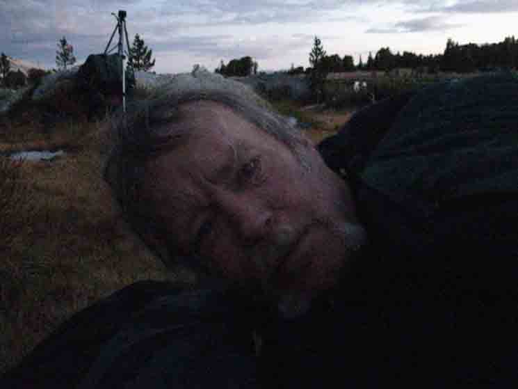
Morning in Yosemite. See that ridge behind us, to the Northeast, by the compass?
|
 |
||
Looking North from the unnamed lake East of Evelyn Lake to our East we see the top of the low ridge arm that is both wrapping around our little lake, while also being the Southwestern wall of the the valley below, to our East, which is holding Ireland Lake and its drainage through Ireland Creek running down into Lyell Canyon and the Tuolumne River. The 30 minute map shows this relationship. Central Yosemite Hiking Map Unfortunately, the 30 minute map above omits the little unnamed lake we camped at, which is included on the 15 minute version below: Merced Lake to Lyell Canyon Note how our trail finds the low point along the middle of the ridge we see above, wrapping around the East shore of our little unnamed lake.
|
View Southwest
Peak 11850 and Fletcher Peak
 |
||||
Turning to our Southwest as we climb to the low gap in the ridge reveals Peak 11850 and Fletcher Peak of this Cathedral Range in their positions near Vogelsang High Sierra Camp. Vogelsang HSC is located at the base of the Northwestern Flank of Fletcher Peak, who's shaded face we see descending on the far Right of the image above. So, the image above shows us the terrain of any potential cross-country routes from Vogelsang HSC to Ireland Lake. Just thinking out loud...
|
 |
||
Hiking East from the unnamed lake East of Evelyn Lake we reach the top of the rise surrounding our little unnamed lake passing over into the valley holding Ireland Lake and its drainage down into Lyell Canyon and the Tuolumne River. Over the rise to Ireland Lake.
|
Amelia Earhart Peak
 |
||
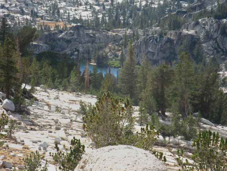
Coming over the rise we find Amelia Earhart Peak rising to the Southeast above Ireland Lake basin. Ireland Lake is out of sight beyond the interceding ridge in the bottom-Right corner of the image.
|
The Kuna Crest
 |
||
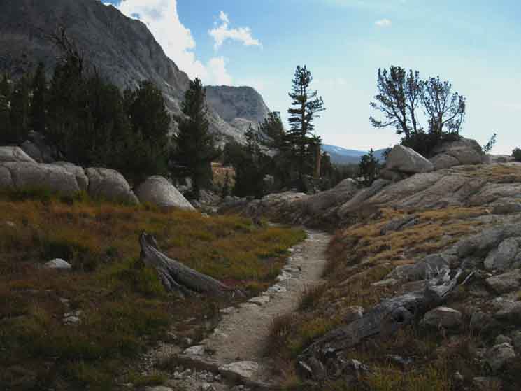
Terrain. Beautiful runs of carved granite in meadows scattered through forests making Yosemite unique. In the distance we can see the Kuna Crest on the other side of Lyell Canyon. This view consists of the line of peaks running North of Kuna Peak, which is just out of sight to the South, beyond the Right edge of the image.
|
 |
||
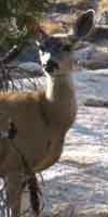
Locals
|
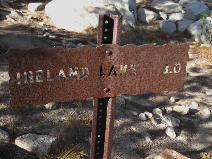
Ireland Lake Trail Junction
10410 feet 23.38 miles East of Yosemite Valley 16.54 miles West of John Muir Trail in Lyell Canyon
to
from
Tuolumne Meadows Area Map
Miles Yosemite Valley to Lyell Canyon
|
 |
||
Down-mountain to the John Muir Trail in Lyell Canyon, then North to Tuolumne Meadows or South to Donohue Pass on the JMT.
|
Trail Junction
 |
||
Three miles to Ireland Lake from its last trail junction.
|
 |
||
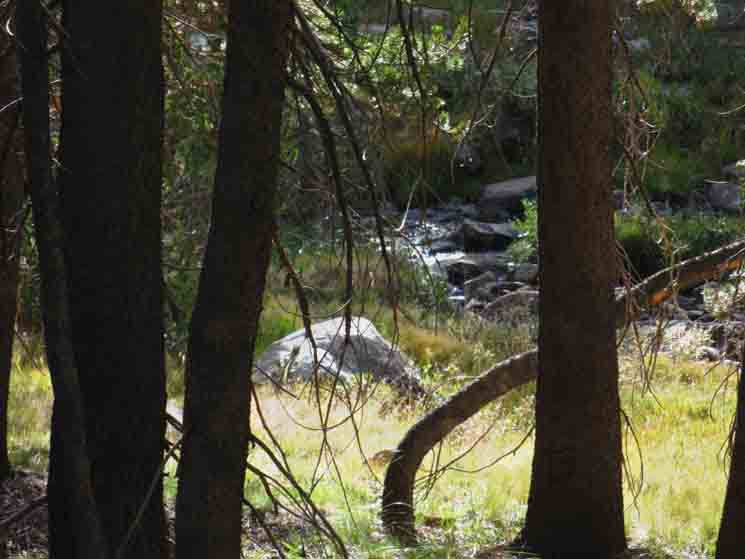
Tributary to Ireland Creek.
|
 |
||
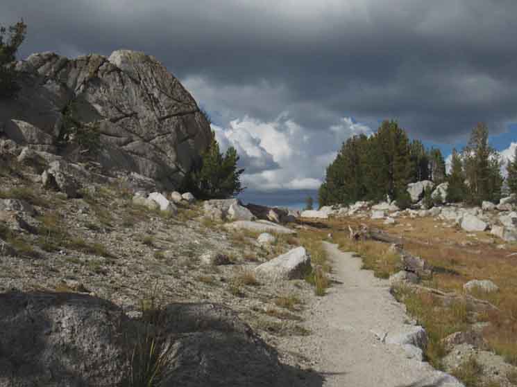
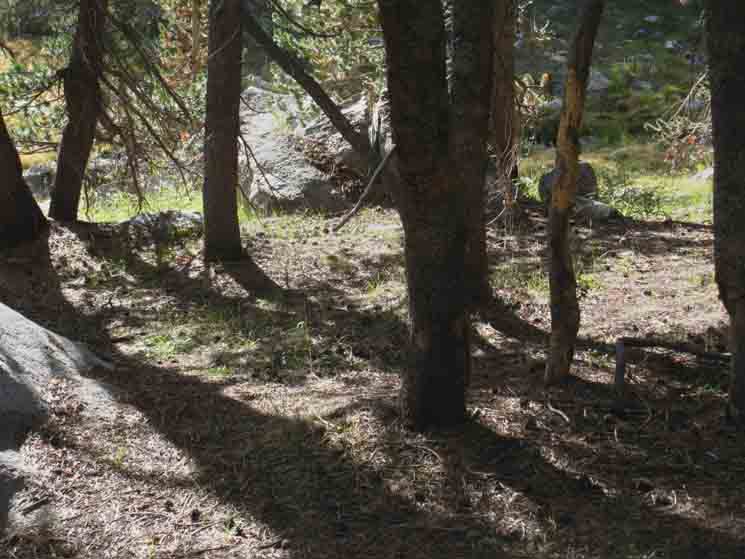
Campsites near Ireland Creek, backpacking Yosemite. We've seen numerous ideal spots with the compressed terrain indicative of campsites where folks have pitched tents.
|
Ridge
to
Potter Point
 |
||
Looking to our East we see the descending ridge running down to Potter Point bounding our run down into Lyell Canyon.
|
 |
||
Backpacking along Ireland Creek in Yosemite.
|
Tim
 |
||
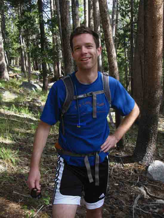
Yosemite and the John Muir Trail are venues for endurance races. We've met a few running the JMT speed runs over the years. Most unique folks. Above we meet Tim, who's in Yosemite and on the trails participating in a two night 50 K trail race.
|
Backpackers Camping
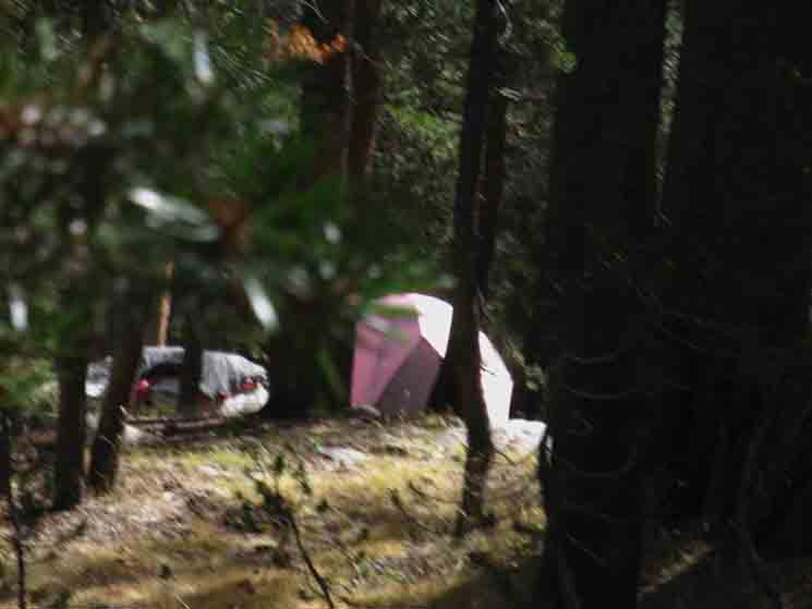 |
||
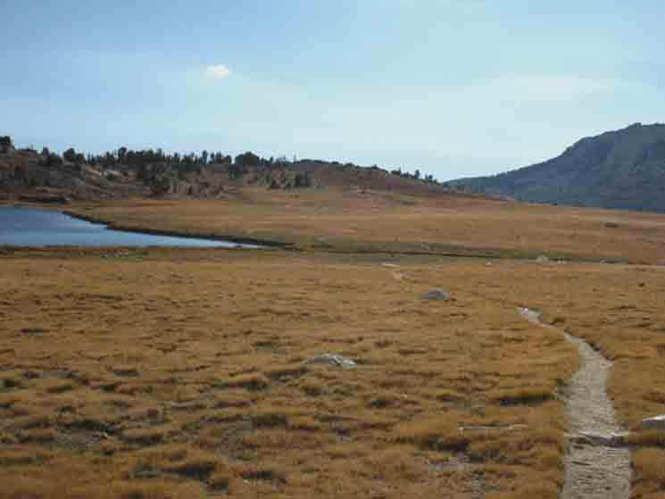
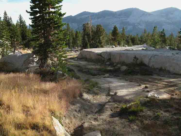
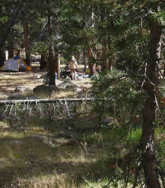
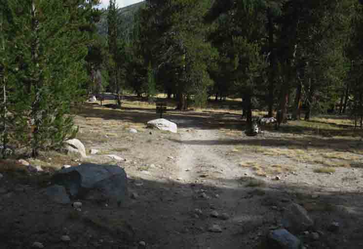
Hitting the floor of Lyell Canyon we first note some backpackers camping here, beyond the four-mile exclusion for camping around Tuolumne Meadows.
|
 |
||
More campers at the Ireland Lake junction in Lyell Canyon.
|
to
Ireland Lake
in
Lyell Canyon
 |
||
Trail junction to Vogelsang High Sierra Camp via Ireland Lake in Lyell Canyon.
|
Vogelsang High Sierra Camp
10410 feet 23.38 miles East of Yosemite Valley 16.54 miles West of John Muir Trail in Lyell Canyon
to
from
Tuolumne Meadows Area Map
Miles Yosemite Valley to Lyell Canyon
North & South John Muir Trail
|
JMT in Lyell Canyon
Southwest
to
Vogelsang High Sierra Camp
(Back the way we came-Up this Page Above)
 |
||
Miles to Vogelsang High Sierra Camp from Ireland Lake-Vogelsang trail junction along the John Muir Trail in Lyell Canyon. This is to the Southwest, back up the mountain the way we came down by Evelyn and Ireland Lakes from Vogelsang High Sierra Camp.
|
North
to
Tuolumne Meadows
 |
||||
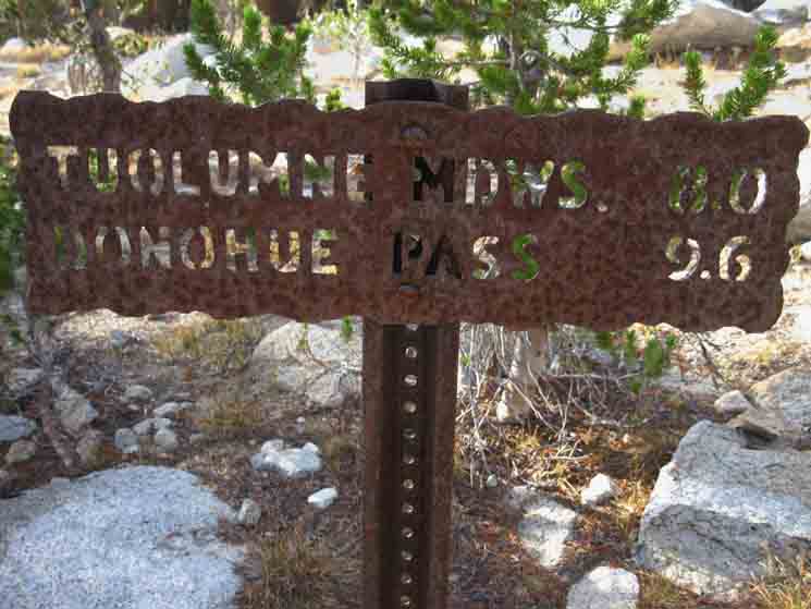
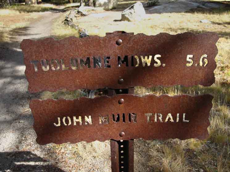
The John Muir Trail North down Lyell Canyon to Tuolumne Meadows. My measure is 5.63 miles to the Eastern Edge of the Tuolumne Meadows Car Campground, then another .61 of a mile to the Tuolumne Meadows Post Office, Store, and Grill. That's where we're really going, if we're hiking North to Tuolumne Meadows. Miles and Elevations v
|
| Next
Exiting Climbing to Donohue Pass out the top of Lyell Canyon.
On the page above we've made our way down to the John Muir Trail running South up the floor of Lyell Canyon along the laconic Tuolumne River between the Kuna Crest and the Cathedral Range. Now we point it South for the climb to Donohue Pass to hike out the South end of Yosemite National Park on the combined routes of the John Muir and Pacific Crest Trails. |
Backpacking |
The Golden Triangle Yosemite is a large National Park that I break down into North, Central, and South regions for the convenience of the Long Distance Backpacker. We hike into the most Northwestern region of Yosemite through Bond or Dorothy Lake Passes on the Tahoe to Yosemite and Pacific Crest Trails, respectively. To our East-Northeast are the Hoover Wilderness Trailheads, to our South-Southwest lays the Grand Canyon of the Tuolumne River. We arrive at roughly the center of the Sierra Nevada arriving at Tuolumne Meadows. Here the end of the Tahoe to Yosemite Trail is supplanted by the John Muir Trail heading South along the Sierra Crest from Tuolumne Meadows. Since I consider everything South of Tuolumne Meadow to be the South Sierra, our explorations of the center of Yosemite will be quite limited. Unless we take an alternative route that will run us down to Yosemite Valley and back up to the JMT 5.6 miles South of Tuolumne Meadows in Lyell Canyon.
THIS PAGE IS UNDER CONSTRUCTION: STAY TUNED FOR MUCH MORE! COME ON BACK NOW, 'YA HEAR? 7.5 Map: 30 min Map
|
Backpacking Trail Guide JMT-PCT North Tuolumne Meadows Southwest |
 |
Backpacking Trail Guide JMT |
Backpacker ForumsHave a great trip or story to relate about Yosemite or in the Sierra Nevada? Post it on Above we come to the Front Page of the High Backpacking Trails and Topics Forums. Below we break the forums down into categories:
The Trails Forum acts as your place to put up input, comments, relate your experiences, or ask questions about each segment and spot along the length of our combined TYT-PCT-JMT trails. The Forum is your place to supplement the trail guide. Anyone can post text comments in the existing forums, but only members can post up new topics, along with images, maps, and formatting. If you have experiences, comments, questions, or pictures and videos of the Pacific Crest Trail between Sonora Pass and Tuolumne Meadows, post up here as an unknown hiker or as a member: Forum Section
|
Trailhead
Contact
Alex Wierbinski

Backpacking Lake Tahoe to Mount Whitney
Your Guide to the High Sierra Crest, including the Tahoe to Yosemite, Pacific Crest, and John Muir Trails
