The Trails
Guide
Maps
Miles/Ele
Permits
Resupply
Forum
Current Weather Conditions
Weather Notes
Northern High Sierras
Central High Sierras
Southern High Sierras
Gear
Gear List
Gettin Started
Layering
Discussion
Testing yourself and your gear
Gear Reviews
Trail Segment
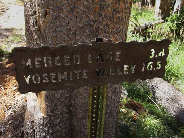
Merced Lake
to
Vogelsang High Sierra Camp
Section
Yosemite Valley to Lyell Canyon or Tuolumne Meadows
BACKPACKING
YOSEMITE NATIONAL PARK
Section Hiking
Yosemite Valley
to
Lyell Canyon
via
Vogelsang
Languages
Languages
Trail Arts
The art of walking
Physical Preperation
Trail Skills
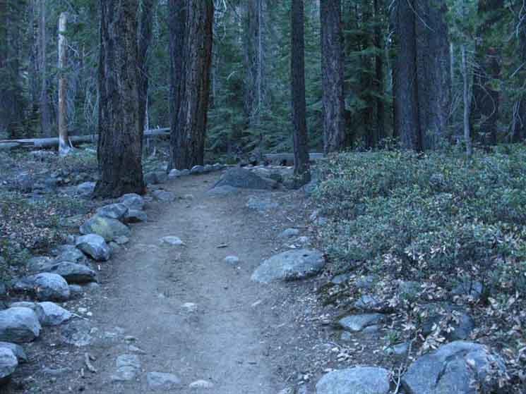
The trail
Off the trail
Scrambling
Maps
Navigation
Camp skills
Food
Resupply
Food
Other
Photo Catagories
Trail Stories
Trail Culture
News and Science
Links
Groups
Books
Terms and Conditions of Use
| Trail Guide INDEX Yosemite Valley to Lyell Canyon |
Trail Guide |
Trail Guide NORTHEAST Vogelsang HSC to Lyell Canyon |
7.5 Topo |
30 min |
MILES Yosemite Valley to Lyell Canyon MILES and ELEVATIONS |
TOPO MAP INDEX Central Yosemite |
Resupply South |
PERMITS National Forests & Parks Toiyabe & Stanislaus & Yosemite |
|
Merced Lake
High Sierra Camp
to
Vogelsang
High Sierra Camp
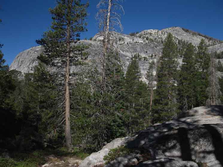
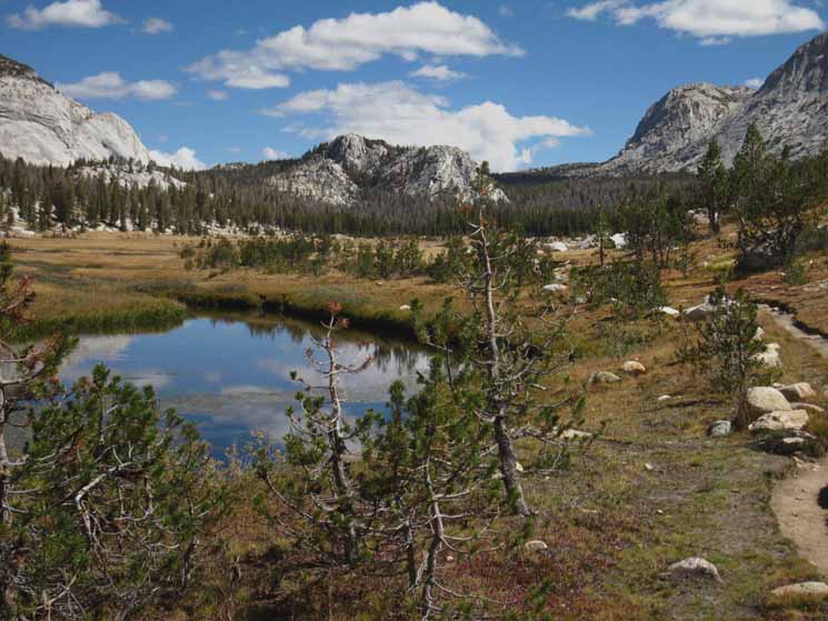
The Big Picture It is hard to pick favorites when each section is so beautiful, each in its own unique way.
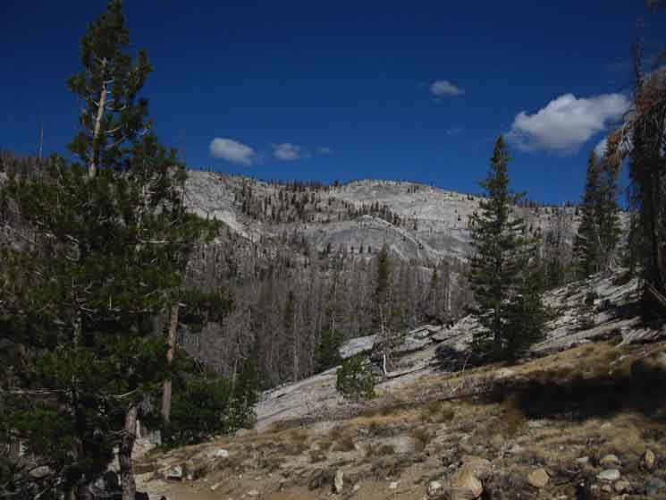
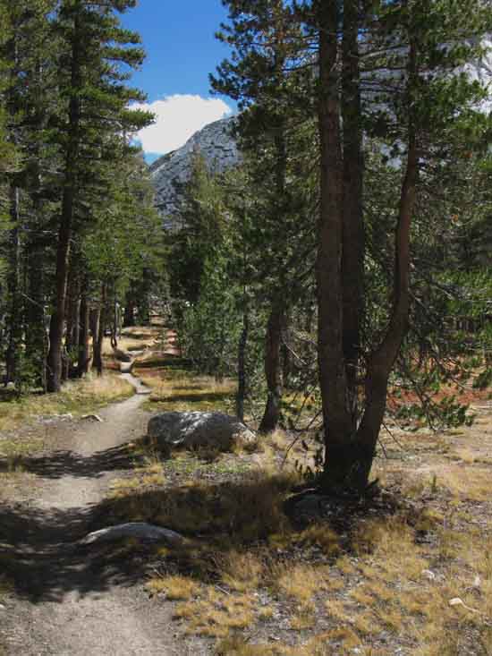
The Golden Triangle Our alternative route returning to the Sierra Crest started back out of the Happy Isles JMT Trailhead in Yosemite Valley, but we broke off the JMT above Little Yosemite by following the Merced River up to the historic Merced Lake High Sierra Camp. We'll take the route suiting our trip. Local loop hikers will likely hike back to Tuolumne Meadows through Tuolumne Pass, while long distance hikers will take the trail bringing us further South towards our next resupply point at Reds Meadow. This nifty alternative route back up to the JMT via the Merced River over the Cathedral Range via Vogelsang explores the other side of the heart of the Central Yosemite Wilderness, the one we looked into as we checked out the route of John Muir Trail dropping down into Yosemite Valley. The salient reality of this section of trail from Happy Isles Trailhead in Yosemite Valley to Vogelsang High Sierra Camp is that we are going to be climbing 23 of the roughly 26 miles from the Happy Isles Trailhead in Yosemite Valley to where we finally intercept the John Muir Trail in Lyell Canyon. The unceasing tempo of work along this route's constant climbing are mostly punctuated by lengths of even steep climbing.
The revealing statistic of this section of trail is...
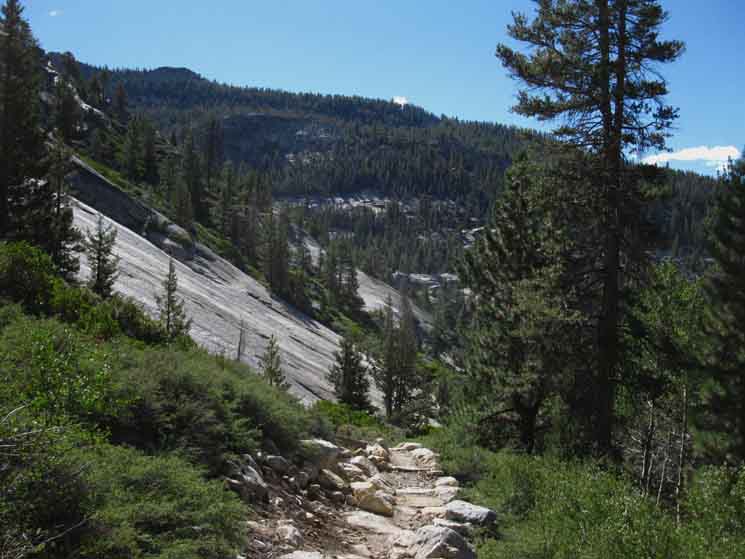
Thankfully, the majority of our hike from Yosemite Valley to Lyell Canyon is following the fairly gradual grade of the course of the Merced River from Nevada Falls to Merced Lake. The steeper parts of this hike are our initial short but brutally steep climb out of Yosemite Valley up to Nevada Falls, and then the longer steep climbing segment North out of the Merced River Canyon up to and over the Cathedral Crest.
The Little Picture
Climbing
Trails into Lyell Canyon Miles
Up and Down
Maps and Miles
Tuolumne Meadows Area Map
Miles Yosemite Valley to Lyell Canyon
MAPS South Donohue Pass to Reds Meadow 15 Minute topo hiking map
and Hiker Information
What do You Think? What do you suggest for success on these trails? I hike these trails "long," in that all of this guide information was collected hiking Tahoe to Whitney backpacking trips. Adding "shorter" perspectives would be in order. The Golden Triangle can be hiked as a local loop beginning from a number of points along the perimeter of the triangle, especially if we extend its potential circumference out to Tenaya Lake. Information about how you hiked the Golden Triangle as a loop or by hiking one of its sides, your pace, campsites, and scrambles along the way are all informative for a wide range of backpackers. The green forum link above leads to all the forum pages covering this section of the Golden Triangle Trail from Yosemite Valley to Lyell Canyon. That Golden Triangle Forum is for general information about the whole Golden Triangle Trail, while being further broken down into sub-forums covering each specific section of this fine hike. The comments link below is about the general conditions and challenges along this whole section of trail, and the comments links down the page below that are for comments about specific conditions and experiences along the various parts of our trail from Merced Lake to Vogelsang High Sierra Camp. The main point is to get as many backpacking folks to reflect their physical and psychological experiences to help the rest of us be properly prepped for the challenges found on these trails. Forewarned is Forearmed. |
||||||||||||||||||||||||||||||||||||||||||||||||||||||||||||||||
Video
Merced Lake to Vogelsang High Sierra Camp
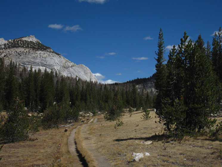
Merced Lake to Vogelsang Well, channels, actually. We find we have a choice between one of the two granite channels climbing the Cathedral's Southern flank. The great ridge capped by Vogelsang and Fletcher Peaks on the Cathedral Crest is itself flanked and drained by Fletcher Creek to its Northwest and Lewis Creek to its Southeast, wrapping up around it like the tines of a wishbone from where the creeks divide. Each creek also offers a trail route up to the Cathedral Crest along its respective gorge under opposite flanks of the Vogelsang Massif. The video above follows our route up Fletcher Creek. 7.75 miles
|
| Merced Lake Federal Facilities
Re-Crossing
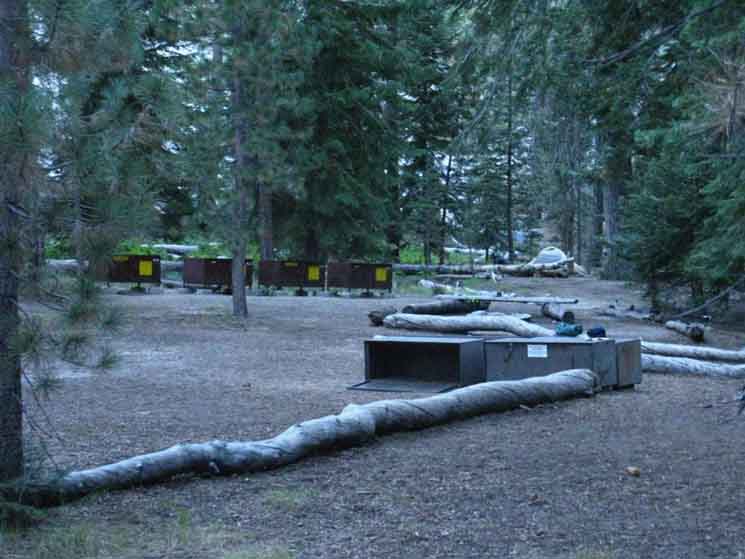
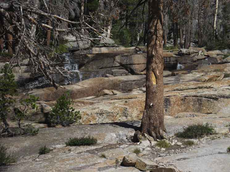
Merced Lake Backpacker and High Sierra Camps are a little physical and administrative cutout in the Central Yosemite Wilderness. Merced Lake's federal facilities are nestled in on a thin rock ledge extending off the Northeast edge of the almond-shaped granite bowl containing Merced Lake.
After finding the little, almost triangular thumb of densely forested terrain sticking out into the West end of Merced Lake Once our Eastbound trail hikes into the bowl it is restricted to the thin ledge of trail between the Northern Shore and the cliffs rising from near the water's edge until we approach the High Sierra and Backpackers Camp. We can see the invasive progress of waves of marsh, meadow, and forest are moving steadily downstream from Merced Lake's East Shore as we approach the federal facilities. We can also see the facilities are located as far above the East Shore of the lake as possible while still being in the bowl.
|
East Into
Merced Lake Federal Facilities
 |
||
Hiking upriver, East, into Merced Lake Federal Facilities.
|
Merced Lake
Backpackers Camp
 |
| Left, brings us North into the Backpackers Camp. |
Merced Lake
High Sierra Camp
 |
||
Right, South to the Merced Lake High Sierra Camp. Access,
|
Merced Lake Re-Crossing
7320 feet 12.1 miles East of Yosemite Valley 16.54 miles West of John Muir Trail in Lyell Canyon
to
to
Maps
Tuolumne Meadows Area Map
Miles Yosemite Valley to Lyell Canyon
|
Upriver
 |
||||
Miles East Solved
|
Downriver
 |
| Miles West Downriver from Merced Lake Federal Facilities. |
Continuing East
Backpacking
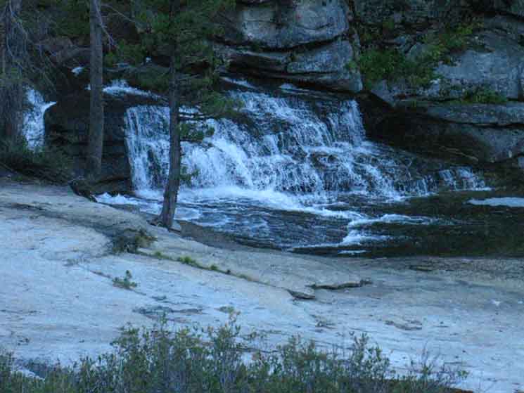
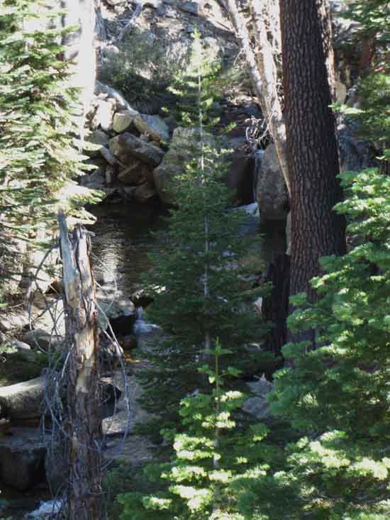
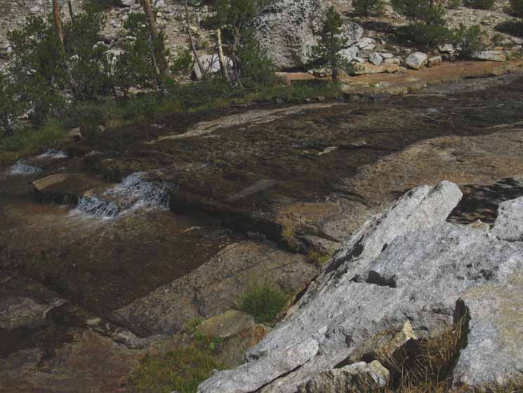
The gentle climbing portion of this hike continues as we make our way from the lower almond-shaped basin holding Merced Lake up into the much larger almond-shaped upper basin above it along the course of the Merced River. We have a gentle climb over a thin arm of low granite reaching South to close the narrow gap between the upper and lower basins. The Merced River makes it way into Merced Lake in the lower basin by wrapping around the South end of the arm to cascade into the expanding meadow and forest trying to fill the Merced Lake Basin before flowing into Merced Lake.
|
Cascade Feeding Merced Lake
 |
||
Our route pushes us down to the edge of the Merced River cascading into the lower basin as we make our way around the South end of the granite arm and into the bottom of the upper basin. Above is ono of our views as we hike upriver out of the Merced Lake Federal Facilities Cascade into the upper basin towards the Merced Lake Ranger Station, which is located at the trail junction ahead, roughly halfway across the length of the larger upper basin.
|
View Northeast through the Forest
Primeval
Corral on the West Edge of the Upper Basin
 |
||
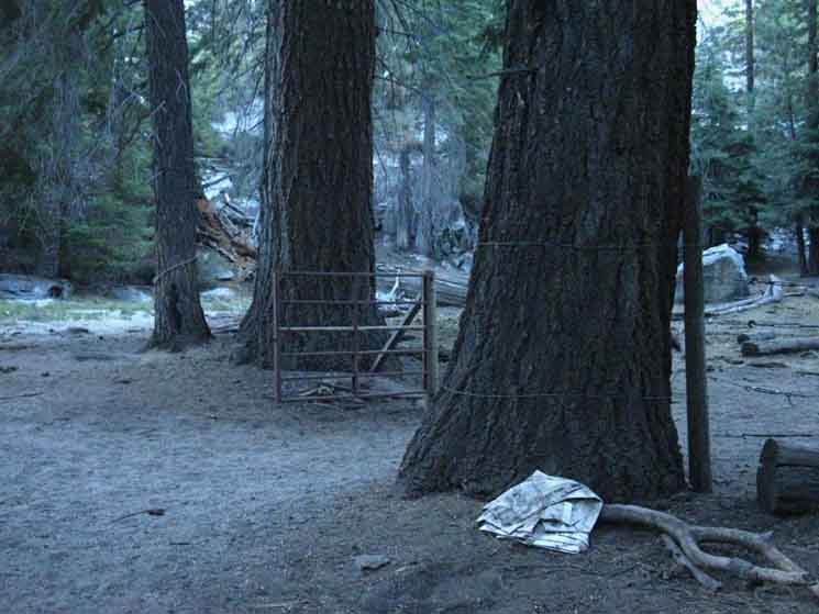
Horse pasture East of Merced Lake High Sierra Camp. I wanted to pick up the trash, but instead I anchored it under the branch for the return of the staff who left it there. They would likely burn it, or horse-pack it back to the stables for proper disposition. A Piece of Trash too Far
|
The Upper Basin
Wildlife
 |
||
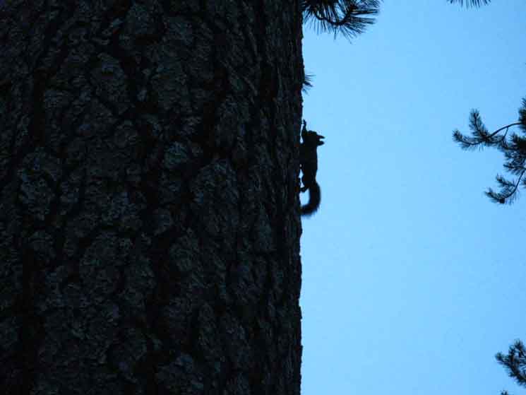
Bright morning sky profiles this Chipmunk moving quickly straight up the tree.
|
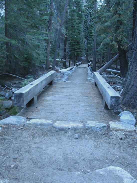
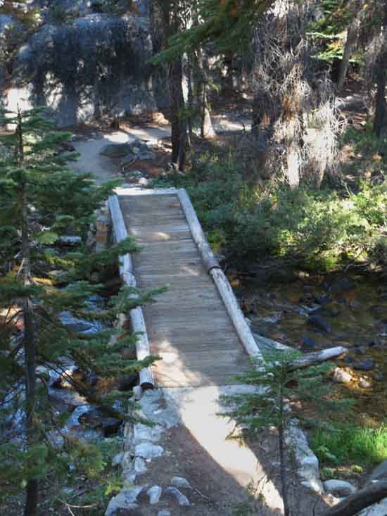
Lewis Creek Bridges
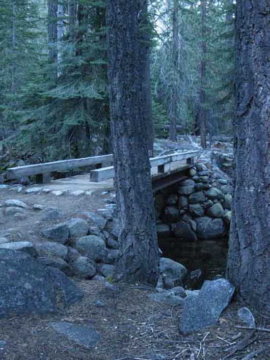 |
| First bridge to Merced Lake Ranger Station. |
Take
a
Reflective Moment
 |
||
Reflecting on Darkness, Light, and the Auditory Delights of the water for a fleeting moment. I find the sweet sounds of river running down mountain are mutually complimented by the shadows dancing to its delightful song between its shimmering reflecting lights.
|
Backcountry Construction
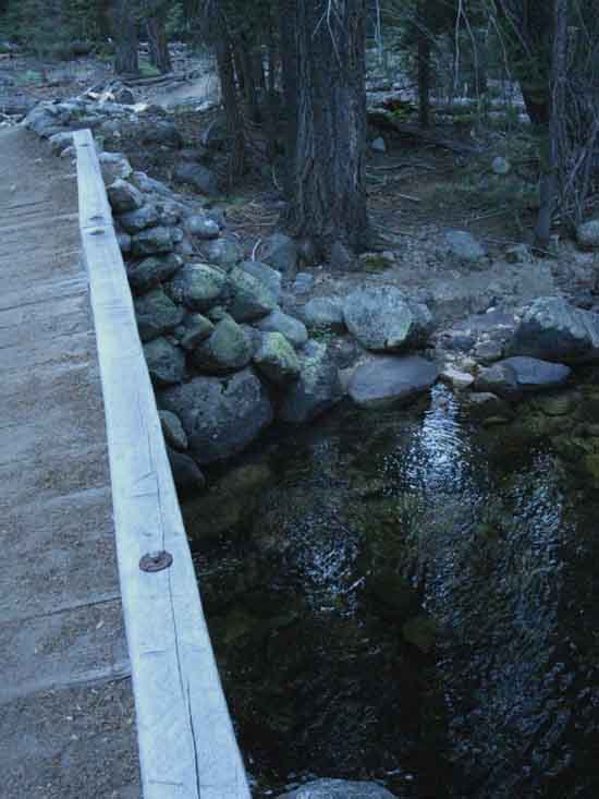 |
| First bridge over Lewis Creek. |
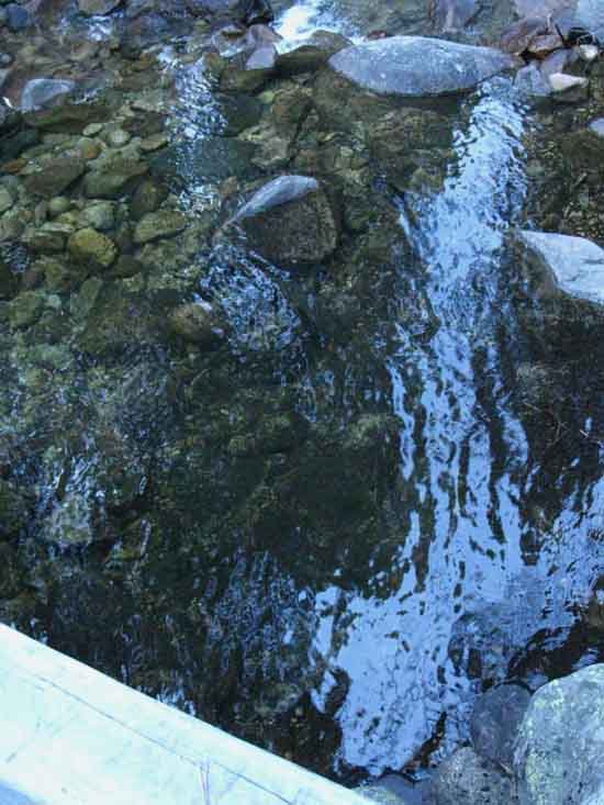
Line Up
 |
||
Two more follow the first in quick succession. The braiding of the creek here is likely a function of the depth of the sediment-fill of this basin, cut into regular channels by heavy episodes of runoff running down the mountain and cutting multiple channels during heavy thaw episodes.
|
Merced Lake Re-Crossing
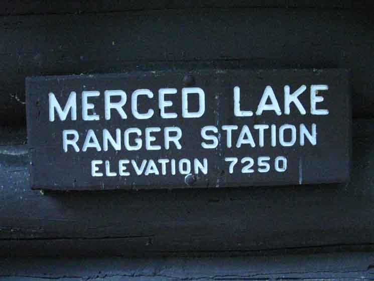
7250 feet 12.97 miles East of Yosemite Valley 16.54 miles West of John Muir Trail in Lyell Canyon
to
Maps
Tuolumne Meadows Area Map
Miles Yosemite Valley to Lyell Canyon
|
Miles North
Climbing out of the Merced River Canyon
to
Vogelsang High Sierra Camp
 |
||||||
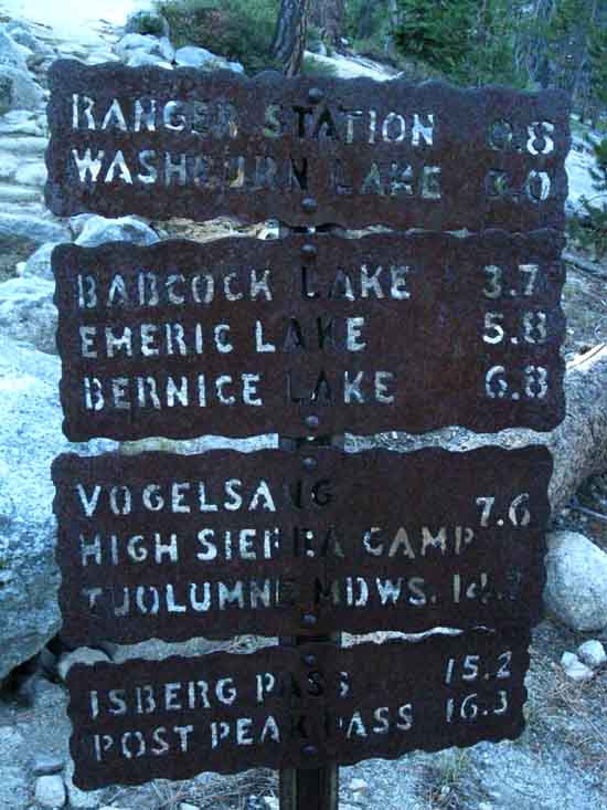
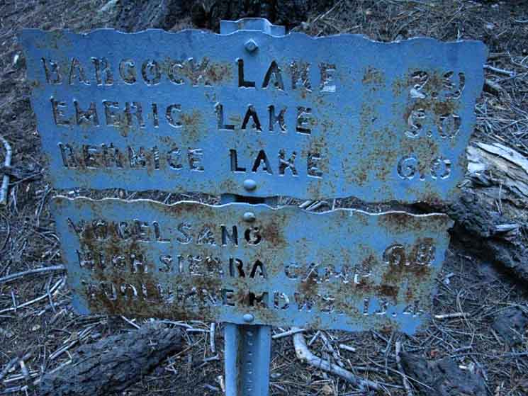
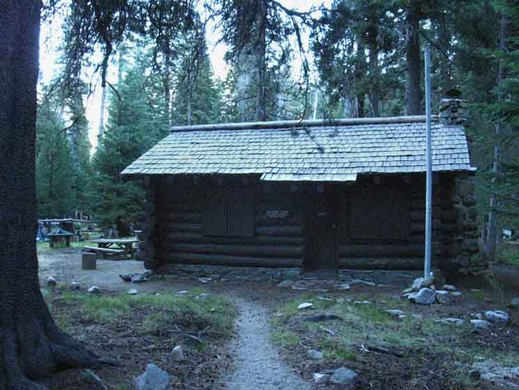
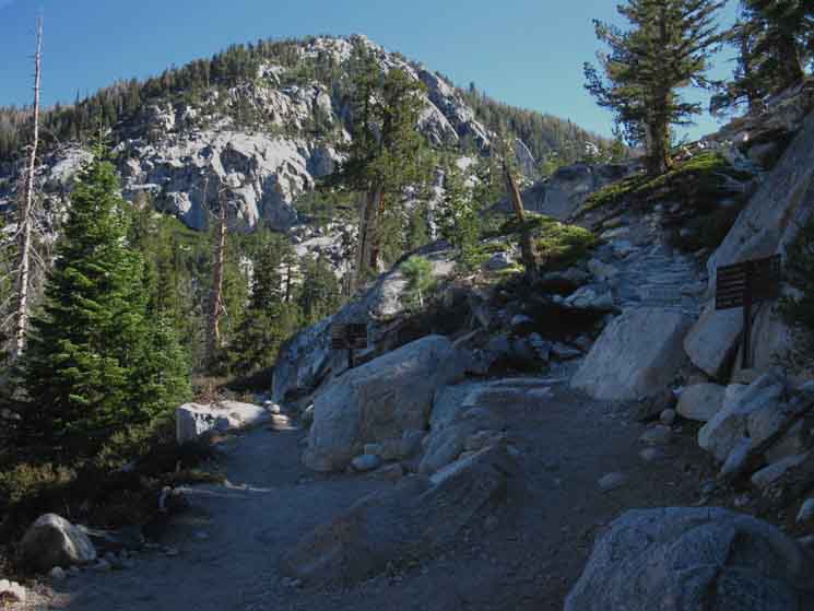
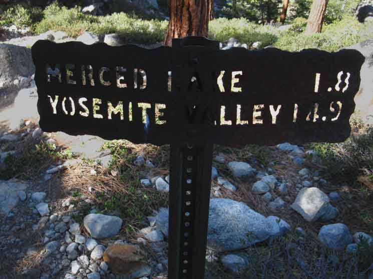
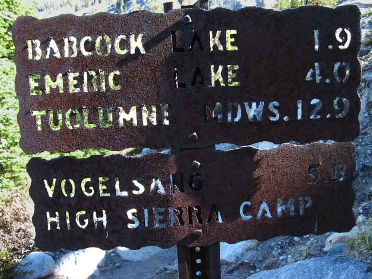
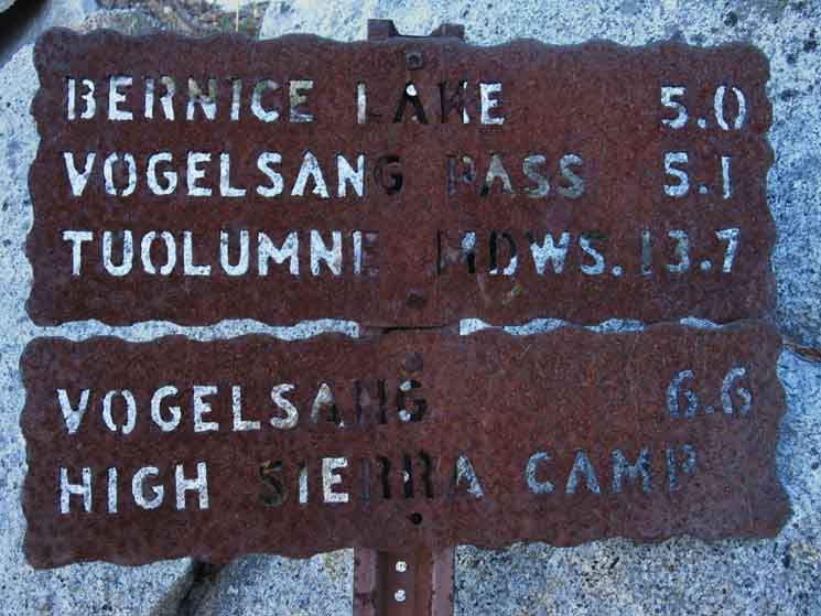
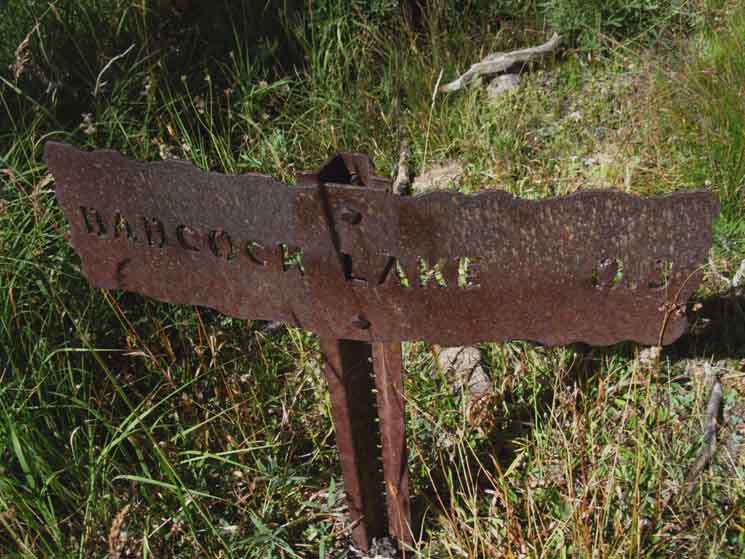
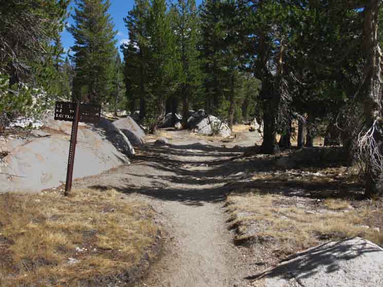
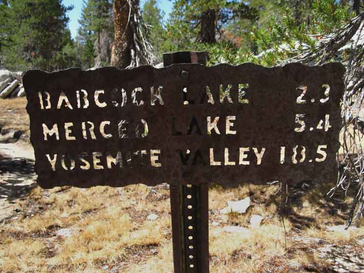
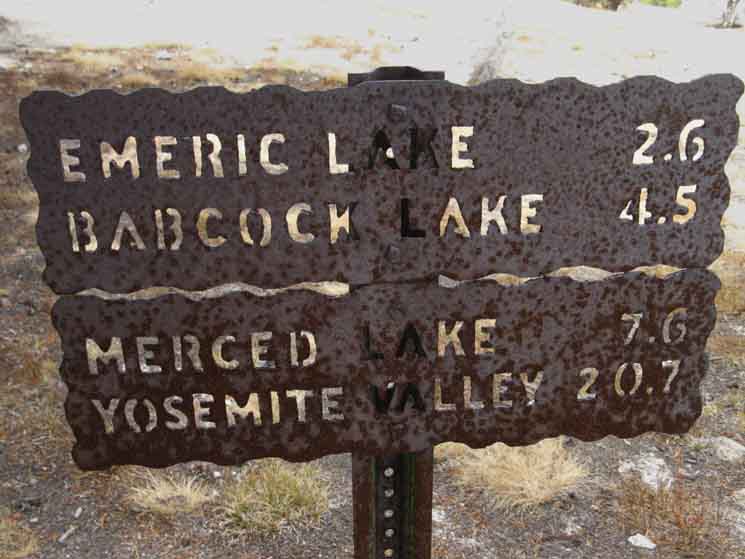
Miles to Vogelsang and Tuolumne Meadows High Sierra Camps from the Merced Lake Ranger Station. The rust-through on the painted sign makes it hard to read, so here's the sign's numbers: Babcock Lake 2.9 Vogelsang HSC 6.8 Hiking North from our position at Merced Lake Ranger Station is by far our quickest route to reconnect with the route of the Pacific Crest & John Muir Trails along the Sierra Crest. We do have another, but much longer alternative route from here. The route continuing up the Merced River and over Isberg Pass brings us down around the South end of the Ritter Range to Devils Postpile and Reds Meadow.
Also bit of wisdom to note from this sign is a perfect example of why you don't paint steel, unless you are going to constantly scrape and paint it. Why? because painted steel always rusts through.
|
Upriver
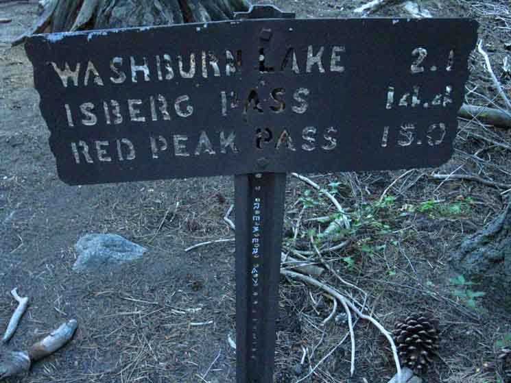 |
| Miles continuing upriver, East to Washburn Lake and beyond from Merced Lake Ranger Station. |
Downriver
 |
||
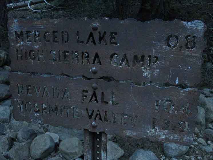
Miles sign for distances West from Merced Lake High Sierra Camp. Merced Lake .8
|
At the Junction Re-Crossing
|
 |
| v |
 |
||
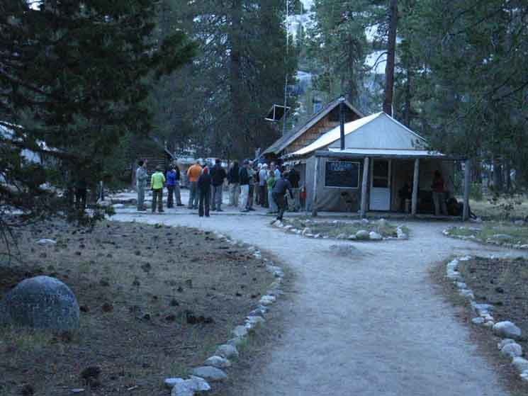
The Merced Lake Ranger Station.
|
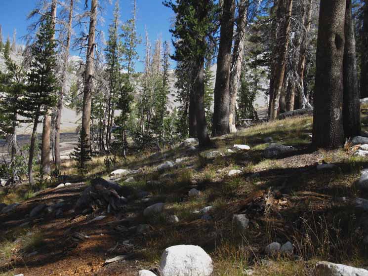
We Climb North Re-Crossing We essentially climb until we reach the crest of the Cathedral Range
|
 |
||
Lower Lewis Creek above Merced Lake Ranger Station.
|
 |
| Launch and landing. |
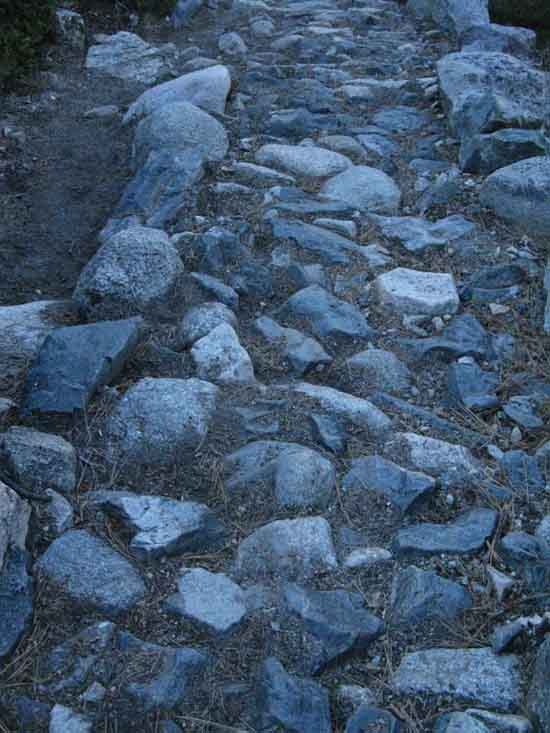
Assorted
Hard Trail Surfaces
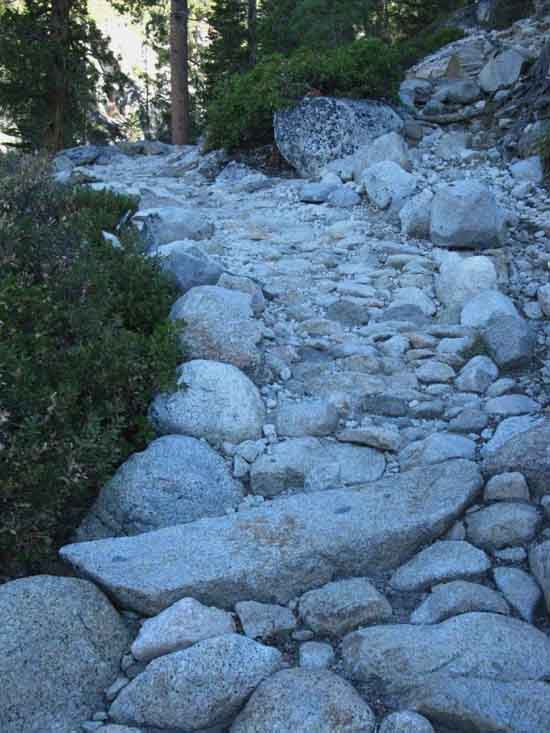 |
||
Trail climbing up to the Lewis-Fletcher Creeks divergence.
|
 |
| Which is also carrying us higher up, for a view before we decide which valley we are going to follow up to the Cathedral Crest. |
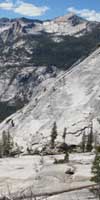
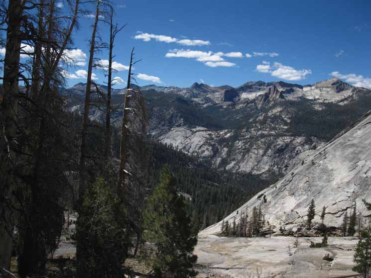
| First Good Views climbing towards Lewis & Fletcher Creeks Divergence First we get views South out of the Canyon we are climbing into. Then we climb high enough that we get fantastic views within the canyon, until we get even higher, and our views South out the top of Fletcher Creek's canyon approaching Babcock Lake encompass the whole Clarks Range wrapping around the South Yosemite Wilderness.
|
View Out the Canyon
South
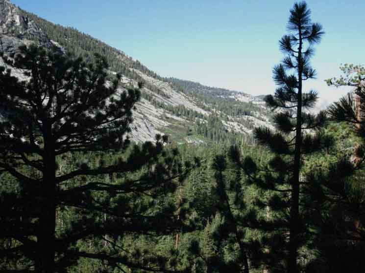 |
||
Climbing above forest and terrain to get our first long view down the Merced River Canyon.
|
Higher
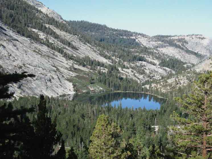 |
| Merced Lake unmasks from behind terrain as we climb. |
View
Inside the Canyon
 |
||
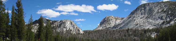
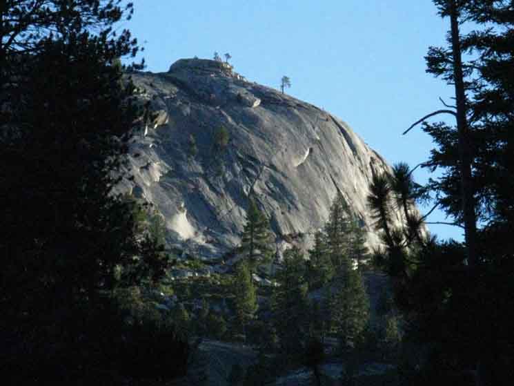
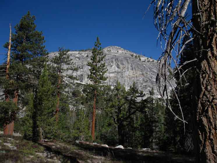
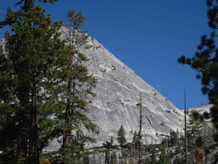
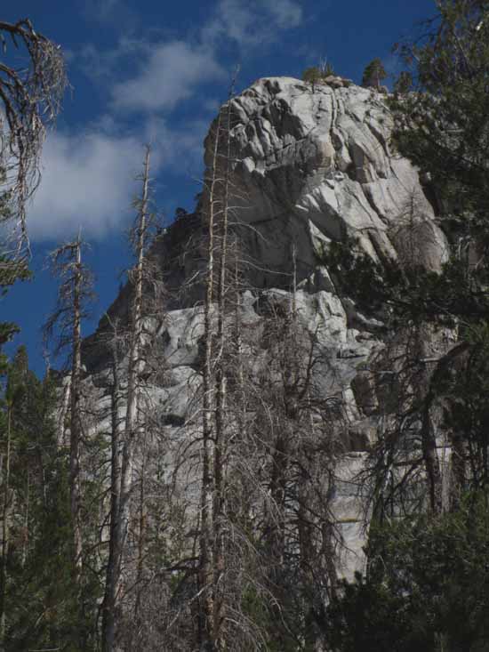
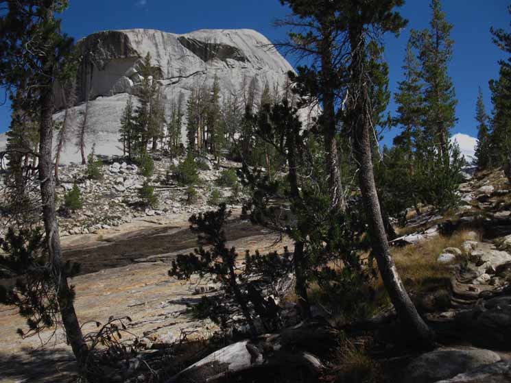
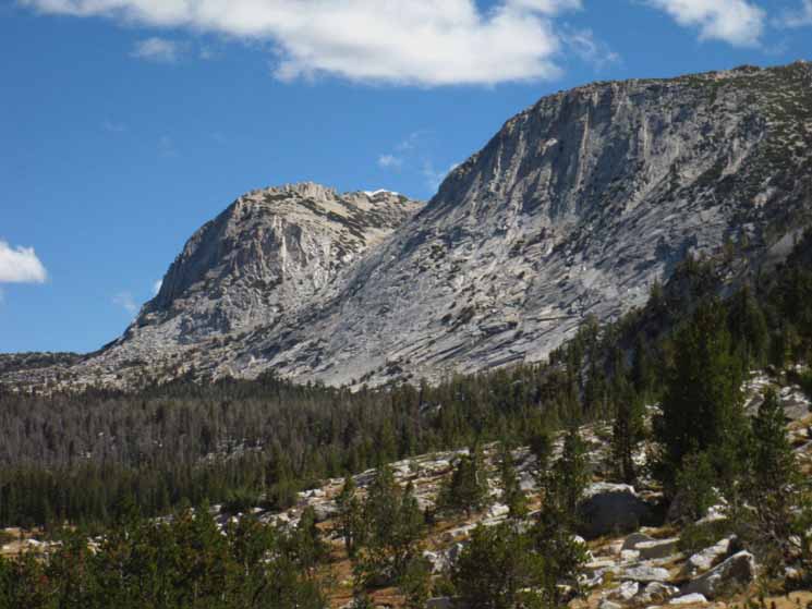
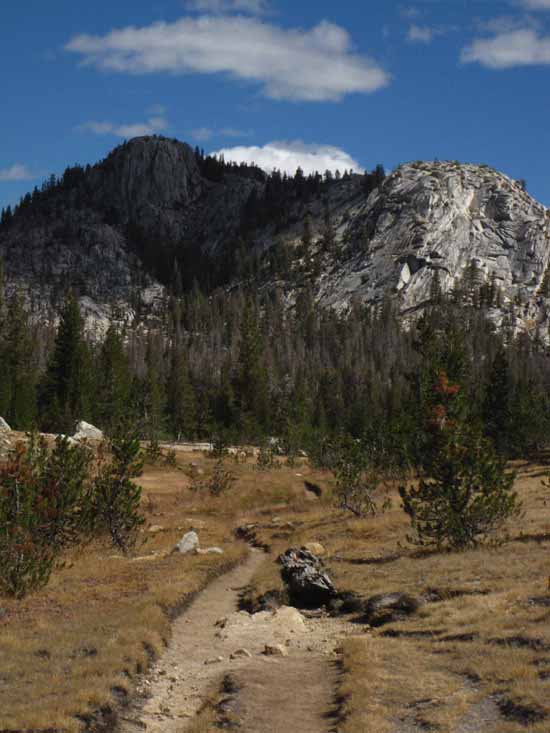
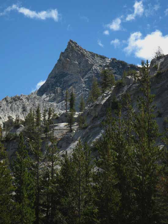
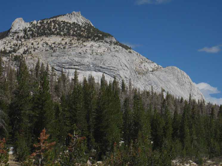
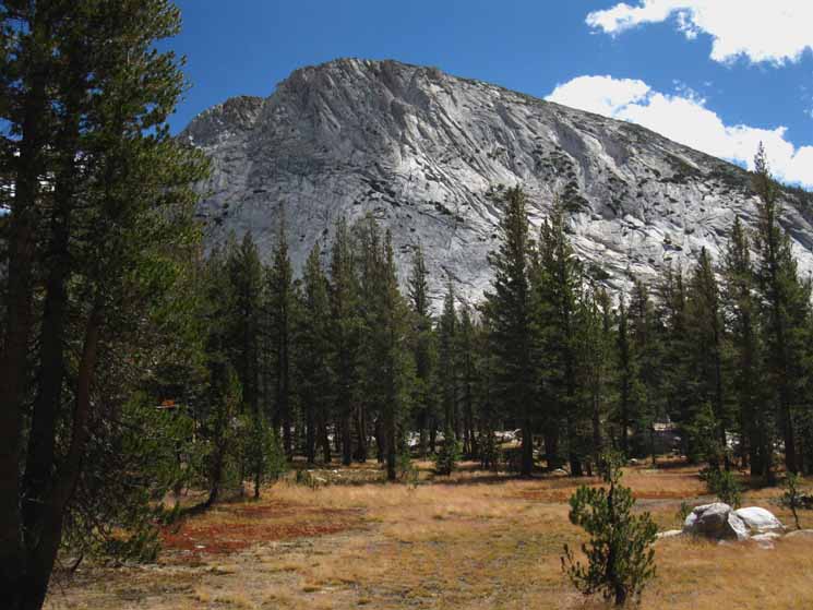
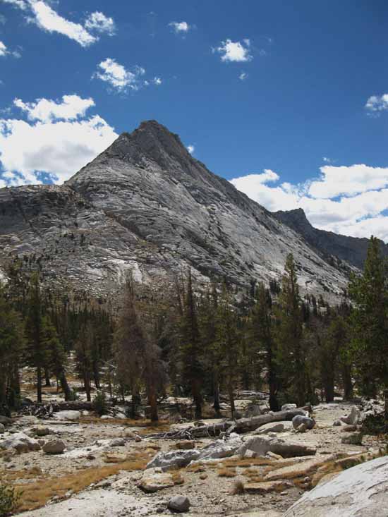
To our Northwest, our climbing Right, we pass under the base of this. Peak 8834 above the combined Fletcher-Lewis Creeks flowing down to the Merced River, between us and that block of granite. But to its East stands the great cone of granite that dominates this segment of trail, Peak 9288.
|
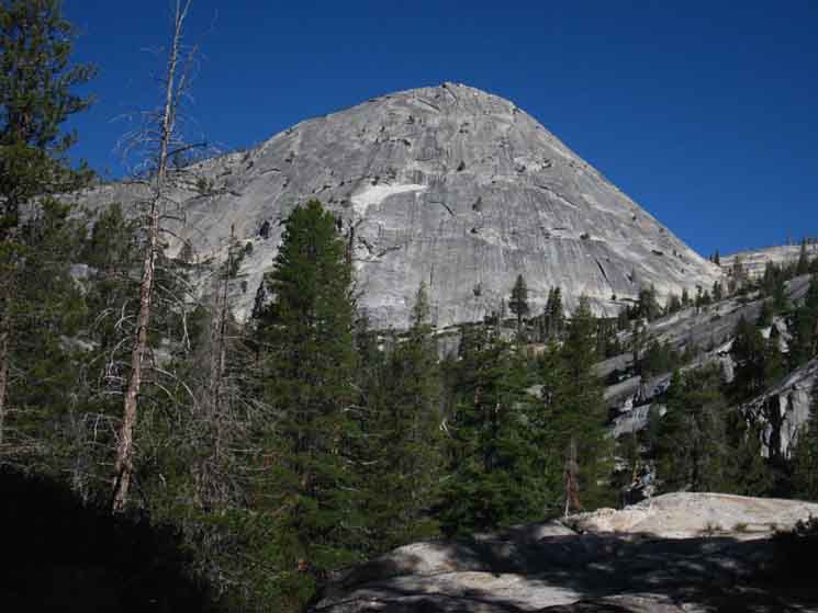
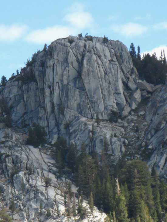
Peak 9288
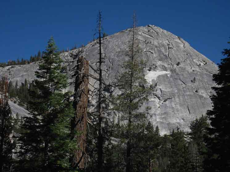 |
| Peak 9288 above Babcock Lake, Cathedral Range, Yosemite. |
Peak 9288
 |
||
Peak 9288 to our Northwest defines the terrain and the line of our route. Our trail will traverse along the edge of the Vogelsang Massif as we are now, with the destination of passing through the gap between the mountain's ridge-arms under the far-bottom Right, the South edge of Peak 9288 above. We are going to pass along its base between it on our Left and the edge of the Vogelsang Massif coming down from our Right, from the South side of the gap almost pictured above. Above we are actually traversing Northwest along the Southwestern nose of the Vogelsang Massif. That great granite rock we are looking at above over there runs up to Rafferty Peak on the Cathedral Crestline. Our route is following the easiest line climbing to the Cathedral Crest between these two mountain ridges, Rafferty and Vogelsang, descending off the Cathedral Crest. We're going to get some good views of these massifs rising to ascendancy. Upward Ho!
|
Fletcher Creek and Lewis Creeks Converge
8160 feet 14.03 miles East of Yosemite Valley 11.92 miles West of John Muir Trail in Lyell Canyon
to
Maps
Tuolumne Meadows Area Map
Miles Yosemite Valley to Lyell Canyon
|
Downmountain
 |
||
Trail junction between Lewis and Fletcher Creeks above Merced Lake.
|
Upmountain
via
Babcock Lake
 |
v |
Upmountain
via
Lewis Creek & Vogelsang Pass
 |
||
Tuolumne Meadows via Lewis Creek and Vogelsang Pass.
|
| Left-Northwest up Fletcher Creek which is down to the Lewis Creek Bridge
|
Down to Lewis Creek
 |
| Quick descent to Lewis Creek Bridge. |
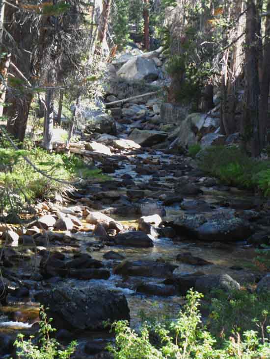
Lewis Creek
 |
||
Lewis Creek, Yosemite.
|
| down to the Lewis Creek Bridge
8120 feet 14.18 miles East of Yosemite Valley 11.76 miles West of John Muir Trail in Lyell Canyon
to
Maps
Tuolumne Meadows Area Map
Miles Yosemite Valley to Lyell Canyon
|
Lewis Creek Bridge
 |
| Lewis Creek Footbridge. |
Lewis Creek
 |
||
Looking up Lewis Creek from the bridge. Our trail continues Northwest. now traversing along Fletcher Creek.
|
Peak 9288
 |
| Oh! The view of Fletcher Creek's course up under and around vast amounts of granite up to Babcock Lake, on this route to Vogelsang Peak. |
 |
||
Set of ascending peaks rising to Peak 9890 to our Northwest. Fantastic line of Peaks leading up to the Rafferty Peak segment of Cathedral Range.
|
 |
| View South into Merced Canyon. |
View Northwest
Up mountain
 |
||
Climbing and looking Northwest along the very Western nose of the Vogelsang Massif-ridge arm up around to the Northwest flank of the Vogelsang Massif, first by the short trail to Babcock Lake.
|
View South
Climbing Higher
 |
||
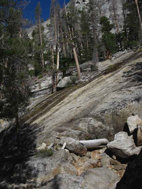
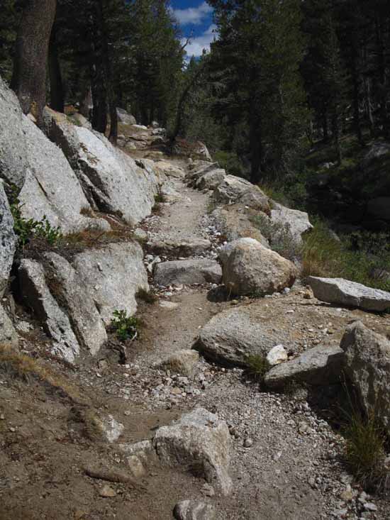
Switchbacks and crossing sheer slabs climbing along Fletcher Creek.
|
 |
| Awesome. |
 |
||
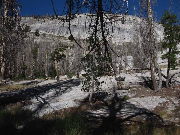
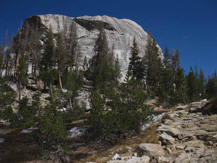
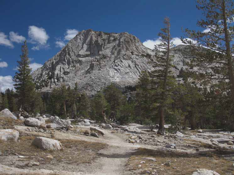
Amazing upper gorge flattening out into expansive, if not vast sheets of granite, under Peak 9288 and Babcock Lake.
|
 |
||
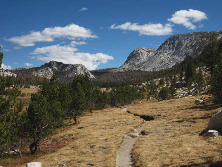
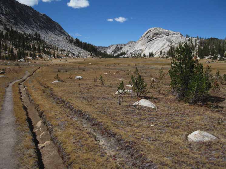
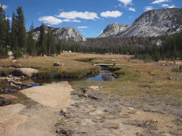
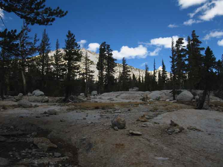
Finally our climb moderates into interwoven stringy strands of sickly lodgepole pines invading the gently ascending meadow. This high meadow/forest flat lays between the Rafferty capped ridge arm we are looking at to our North, and the ridgearm topped by Vogelsang and Fletcher Peaks, around who's base we have been following the line of our trail, rising to our Right.
|
 |
A not too healthy forest. Lodgepoles are subject to "runs" of blights, which takes out a strip of forest every now and again, and prone to avalanches during Winter. Yet the last couple of decades of slow but steady drying, of shortening Winters and lengthening of Fall into Winter appears to have seriously strained all the layers of forest, each at its own favorite altitude. |
| Babcock Lake Trail Spur Re-Crossing
8880 feet 15.83 miles East of Yosemite Valley 10.11 miles West of John Muir Trail in Lyell Canyon
to
Maps
Tuolumne Meadows Area Map
Miles Yosemite Valley to Lyell Canyon
|
 |
||
Babcock Lake Trail Junction. Hiking North into the Babcock Lake trail spur, off to our Left, from Merced Canyon.
|
 |
| To The Valley via Merced Lake. |
 |
||
Babcock Lake miles to Tuolumne Meadows. We will hike into Lyell Canyon to the South of Tuolumne Meadows, rather than to TM.
|
 |
| v |
| Hike to the Cathedral Crestline
|
 |
||
Southwestern nose of a great blade of granite rising out of the terrain as a shark fin breaks the ocean surface. A big old rocky shark fin.
|
 |
| View West-Northwest across intervening meadow at great ridgeline. We are following along the base of the granite feature rising to our Right, down to the meadow and Fletcher Creek. |
 |
||
Fletcher Creek. The closer we get to look at the various organic terrain features, such as meadows, forests, and Fletcher Creek, the more clearly we can see that they are all living on a very thin layer of organic material atop underlying granite. The trees grow as if out of rock, the creek flows on solid rock, the meadow seems little more than a thin mat stretched out over a solid-rock dance floor. Rock-Rock-Rock! The thickness of the life that lives on the thinness of the organic layer up here is an impressive testament to the power of life.
|
 |
| Hiking forest fringe along Fletcher Creek. |
 |
||
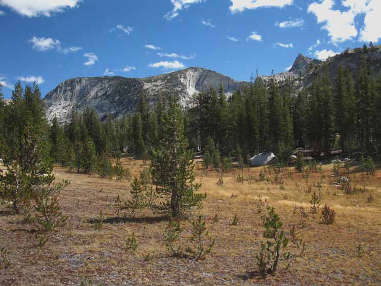
Vast granite block rises above Emeric Lake, dividing it from our trail. Climbing North out of the top of the meadow above Babcock Lake brings us to the base of an impressive block of granite. We see that our trail bends up and around where Fletcher Creek flows down around the Southeastern flank of this massive block.
|
Elephantine on a Terrestrial Scale
 |
Great block of Granite above Emeric Lake. |
 |
||
Flat flowing water. Fletcher Creek below Vogelsang High Sierra Camp.
|
Peaks
 |
||
Hiking North under fantastic views of the most distant circular mass of Fletcher Peak beyond Vogelsang Peak's West flank. We can see the whole form of Peak 1008 rising in the middle-Left distance.
|
 |
The Summit and Northwestern flank of Fletcher Peak behind Vogelsang's Northwestern face and crestline. Vogelsang High Sierra Camp is roughly located between the bases of the two peaks. |
View Northeast
Looking across the Cathedral Range
Tuolumne Pass on the Left ------ Vogelsang HSC & trail to Lyell Canyon to the Right
of
Peak 1008 in the Middle
 |
||
Looking Northeast across the Cathedral Range. Tuolumne Pass on the Left of Peak 1008, the rock rising in the middle of the image, while our Route into Lyell Canyon pass to its Right, between it and the line of Vogelsang and Fletcher's faces. We can also cut around the backside of 1008 to Tuolumne Pass from Vogelsang High Sierra Camp, as well as directly from the junction just ahead of our current position.
|
 |
| Peak 1008 between Rafferty and Vogelsang Peaks. |
 |
||
Peak 1008 detail.
|
Relaxed Pond Action
Back the Way we Came
View to the Southwest
 |
||
Trail South to Merced Lake from Vogelsang via Fletcher Creek. We're looking back at the granite feature dividing the trail from Emeric Lake, laying on the Right, the opposite Western side of the sloping dome in the middle-Right of the image above.
|
To our Northeast
 |
| Peak 11120, the secondary peak on the Vogelsang Massif. |
 |
||
Looking Northeast across the top of the Vogelsang Massif.
|
Rafferty Peak and Tuolumne Pass
 |
| v |
 |
||
Rafferty Peak rising to the West of Tuolumne Pass, to the Northwest of our position approaching Vogelsang High Sierra Camp.
|
View Northeast
Peak 1008--Fletcher Peak--Vogelsang Peak
 |
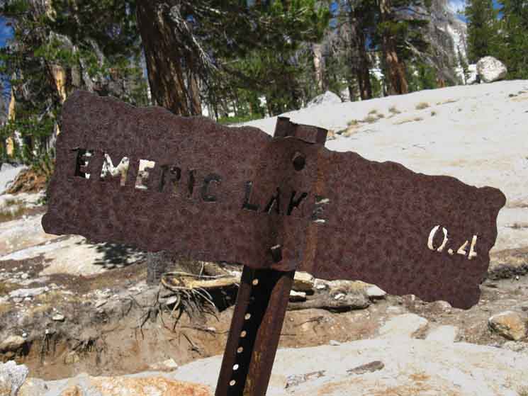
Fletcher Creek ford at the junction of the spur trail to Emeric Lake in the foreground. Peaks 1008 on Left, Fletcher distant, and Vogelsang Near-right. |
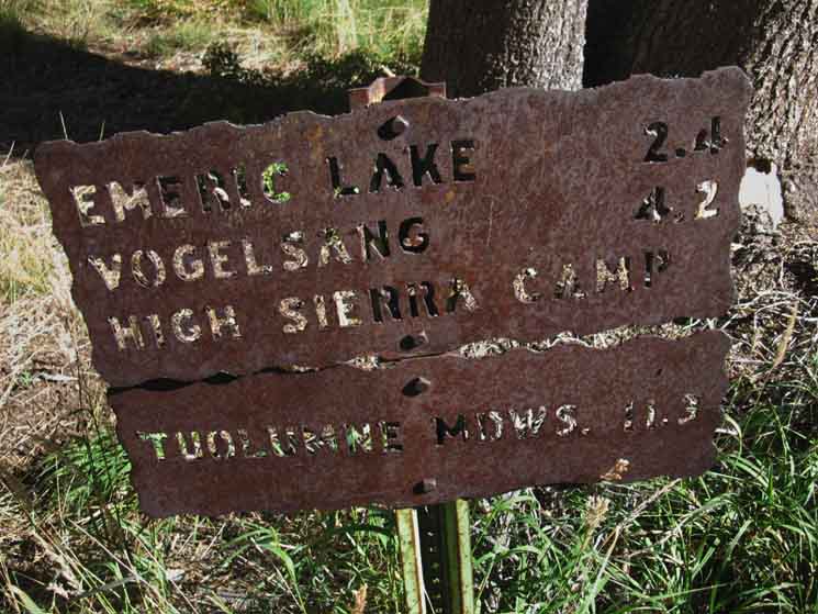
| Two Quick Trail Junctions or One Extended Trail Junction Crossing the ford moving upstream we encounter the Emeric Lake junction to our Left, leading .4 of a mile Southwest to Emeric Lake. Emeric Lake is positioned on the Northwestern base of the great granite block our route followed Fletcher Creek around its Southeastern flank. Just steps ahead the trail forks Northwest and Northeast. Northeast, to our Right, is the trail to Vogelsang High Sierra Camp.
|
Emeric Lake Trail Junction
 |
||
Emeric Lake, Tuolumne Pass, or the trail to Vogelsang confront us crossing Fletcher Creek approaching the Cathedral Crest. The trail splits around the rock ahead-center, and a spur trail branches off to our West, Left to Emeric Lake. The sign on our near-Left specifies the miles South down to Merced Lake, and then West down into Yosemite Valley. Let's take a look at it.
|
Southbound Sign
Back the Way we Came
 |
| Sign specifying miles to Merced Lake and Yosemite Valley from the Emeric Lake trail junction. |
Emeric Lake Trail Junction
Spur Southwest, Left, to Emeric Lake
 |
||
Trail sign specifying almost a half mile Southwest to Emeric Lake.
|
Emeric Lake Trail Junction
Northwest, Veering Left to Tuolumne Meadows via Tuolumne Pass
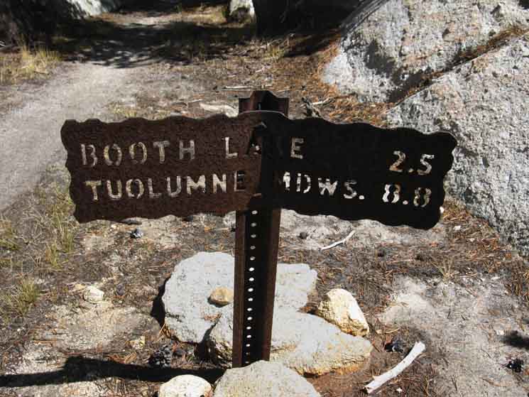 |
The trail to Tuolumne Meadows through Tuolumne Pass veers to the Left, the Northwest. Above is the miles sign to Tuolumne Meadows from the Emeric Lake trail junction via Tuolumne Pass. This would be the most direct route to Tuolumne Meadows for those returning to TM for another resupply before continuing South on the John Muir Trail. Or this trail potentially brings those backpackers hiking great loops around Yosemite to either their halfway point or their final destination, depending if your start point was from Tuolumne Meadows or Yosemite Valley. |
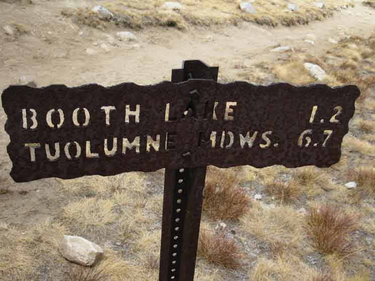
| Booth Lake-Tuolumne Pass Here our trail forks off to produce two parallel trails running Northeast. We are veering to our Right, taking the Southeastern trail running up to Vogelsang High Sierra Camp. The trail to our Left is for those hikers intent on reaching Tuolumne Pass without visiting Vogelsang High Sierra Camp.
Approaching
9400 feet 17.75 miles East of Yosemite Valley 8.19 miles West of John Muir Trail in Lyell Canyon
to
Maps
Tuolumne Meadows Area Map
Miles Yosemite Valley to Lyell Canyon
|
Emeric Lake Trail Junction
Northeast, Veering Right to Vogelsang High Sierra Camp
 |
||
Local Cathedral Range Backpacking Loop Either of the two routes above can swing us back to Tuolumne Meadows by distinct routes. Rather than cutting over to Tuolumne Pass from Vogelsang High Sierra Camp to return to Tuolumne Meadows, we can hike Northeast down to the JMT in Lyell Canyon, and return to Tuolumne Meadows by hiking North from there. These two routes to Tuolumne Meadows from Emeric Lake or Vogelsang High Sierra Camp can joined together to make a nifty little backpacking loop out of Tuolumne Meadows. I have our distance from our position here at Emeric Lake trail junction to Tuolumne Meadows via Vogelsang HSC to Lyell Canyon at 13.8 miles. Adding these miles to the 8.8 miles specified from Tuolumne Meadows via its namesake pass on the second sign above creates a backpacking loop 22.67 miles in circumference.
|
Hiking
To the Northeast
View Southeast, to our Right
 |
||
The Vogelsang Massif rises to our Southeast.
|
Northeast View
Forward To Vogelsang
 |
Our trail angles Northeast to the base of the Vogelsang Massif. |
Along the Base of Vogelsang
Our Direction is Northeast
 |
||
Rocky flat extending off the base of Vogelsang's rising face.
|
Rafferty Peak
View Northwest
 |
| Rafferty Peak appears almost directly to our North off our Left shoulder across the rocky flat. The right-side of the base of Rafferty marks the location of Tuolumne Pass on the Cathedral Crestline. |
Profile of Vogelsang
View Southeast
 |
||
Profile of Vogelsang Massif to our Southeast.
|
Out of Vogelsang Lake
 |
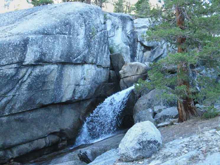
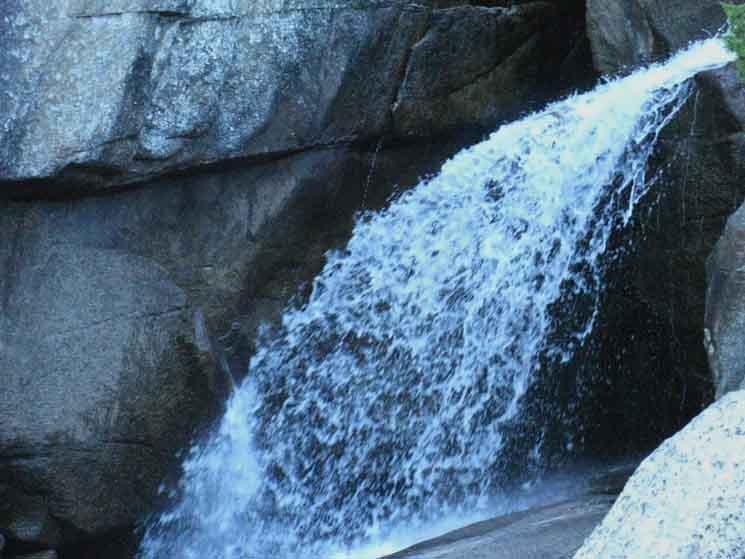
Waterfall along a source of Fletcher Creek out of Vogelsang Lake. We hear the rush of water of one of the founding branches of Fletcher Creek coming down through the forest wrapping around the mountain to our Right, the East, drawing our attention to the pretty little waterfall. The sound, the creek and its waterfall draw our attention to one of the sources of Fletcher Creek is Vogelsang Lake nestled in the gap dividing Vogelsang and Fletcher Peaks below Vogelsang Pass. |
Fletcher Peak
 |
||
Fletcher Peak stands out as we hike North into Vogelsang High Sierra Camp.
|
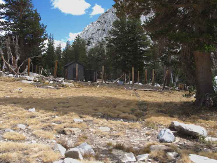
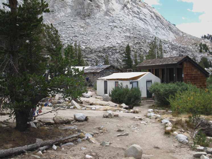
Vogelsang High Sierra Camp 10120 feet
Miles and Elevations Yosemite Valley to Vogelsang High Sierra Camp
Continuing North from Vogelsang on either of our two Northbound trail options brings us into Lyell Canyon. The nature of our trip typically determines which route is appropriate. The trail Northwest through Tuolumne Pass brings us to a point lower down Lyell Canyon and closer to Tuolumne Meadows, while the trail Northeast drops us higher up in Lyell Canyon, which is closer to Donohue Pass, for those of us continuing South. Our next resupply out of Yosemite Valley will be in Mammoth Lakes via the Reds Shuttle. And, I've also got a resupply bucket at Reds Meadow. Which route you prefer depends on what you're doing. Local Backpacking Loops Here's the situations from the Rafferty Creek trail junction along the John Muir Trail in Lyell Canyon
Ireland Creek trail junction along the John Muir Trail in Lyell Canyon Long Distance Backpackers South to Mount Whitney
Miles and Elevations
Miles
Four-Way Trail Junction
Miles
About Yosemite Backpacking Miles Figures From
|
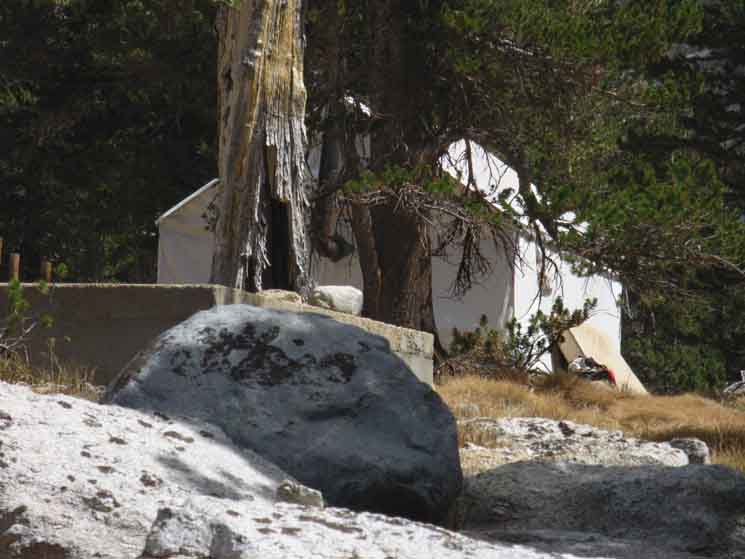 |
We note a staff tent cabin off from the main camp as we approach. |
 |
||
We note the corral as we hike North into Vogelsang High Sierra Camp. Being so close to the Tuolumne Stable only makes it necessary for a long day trip to supply
|
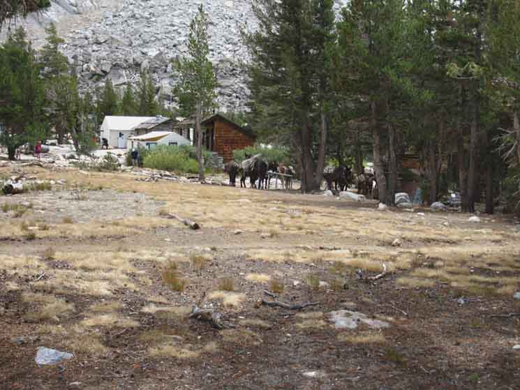 |
| Vogelsang High Sierra Camp facilities with horses and hikers. |
 |
||
Vogelsang High Sierra Camp main buildings. The terrain has a worn-out look from decades of hooves and heels cutting the fragile groundcover.
Access,
|
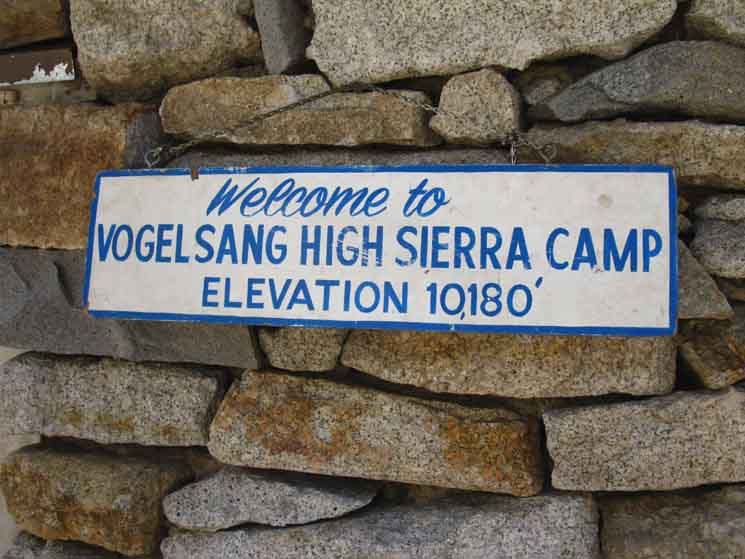 |
| The Vogelsang High Sierra Camp sign. |
| Vogelsang High Sierra Camp Four-Way Trail Junction
Four-Way Trail Junction
Yosemite Steel Plate Miles Signs Miles Figures in the Sierra Nevada
|
Great Carin at Crossroad
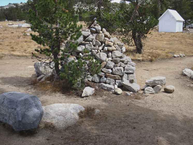 |
||
Great carin at Vogelsang High Sierra Camp trail junction.
|
Northwest
then
North
to
Lyell Canyon
Northeast
to
Lyell Canyon
 |
||
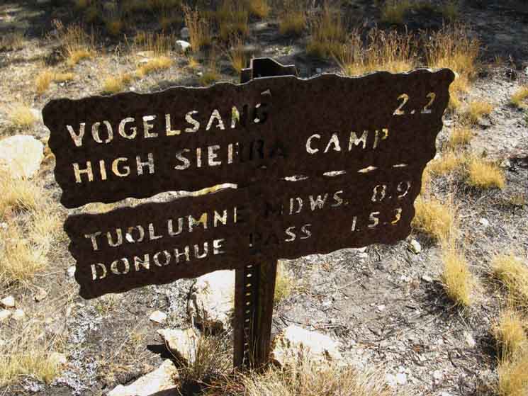
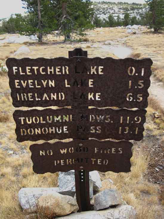
This sign notes the miles Northeast from Vogelsang High Sierra Camp to Tuolumne Meadows via Lyell Canyon. MILES and ROUTES
Miles and Elevations
|
East then South
to
Merced Lake
Southwest Route
 |
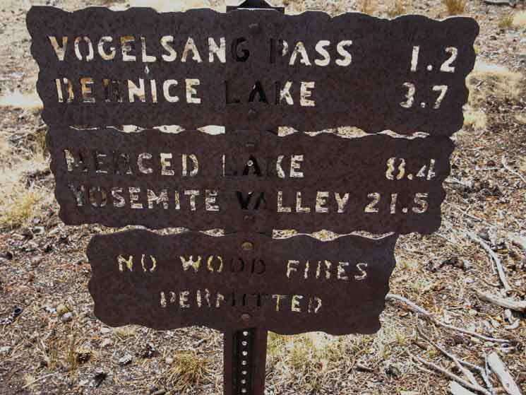
||
Miles from Vogelsang to Merced Lake via Emeric and Babcock Lakes, which would be back to Merced Lake the way we came.
|
| Next
Setting Up Down!
On the page above we've climbed from Merced Lake to Vogelsang High Sierra Camp atop the Cathedral Range. Next we will make our way down its Northeastern facing flank into Lyell Canyon where we join with the John Muir Trail at the Vogelsang High Sierra Camp junction 5.6 miles South of Tuolumne Meadows. Once we pick up the John Muir Trail in Lyell Canyon we begin hiking South to Donohue Pass and out exit out the South end of Yosemite National Park. Local hikers can point themselves North down Rafferty Creek to end local hikes at Tuolumne Meadows. |
West: Merced Lake to Little Yosemite Valley Northeast: Vogelsang HSC to Lyell Canyon
Backpacking |
The Golden Triangle Yosemite is a large National Park that I break down into North, Central, and South regions for the convenience of us Long Distance Backpackers. We are now departing the Central for the Southern Yosemite Wilderness. We hiked into the most Northwestern-most corner of Yosemite either through Bond or Dorothy Lake Passes depending on if we were hiking the Tahoe to Yosemite or Pacific Crest Trail. Entering the North Yosemite Backcountry we found the Hoover Wilderness Trailheads to our East-Southeast and the Grand Canyon of the Tuolumne River to our South-Southwest. Crossing the extensive North Yosemite Backcountry between these intermediate access points we arrived at roughly the center of the Sierra Nevada Mountain Range when we arrived at Tuolumne Meadows. Here we found the end of the Tahoe to Yosemite Trail supplanted along the South Sierra Crestline by the John Muir Trail from Tuolumne Meadows to our ultimate destination of hiking through the Whitney Portal. Options, Options, and More Options Unless we take advantage of the situation by crafting an alternative route as we hike across the length of Yosemite that runs us off the Sierra Crest following the John Muir Trail "backwards" down to Yosemite Valley. Hiking back out of the Valley we will only retrace our steps along the JMT over the stunning four miles up to Little Yosemite Valley. This is the Golden Triangle Route around the Heart of Yosemite. Hiking the Golden Triangle Route in conjunction with, or I should say in addition to our normal route of hiking the length of Yosemite along the Sierra Crest. Adding the Golden Triangle certainly gives us the broadest view possible of this magnificent park as we hike the Sierra Nevada from Tahoe to Whitney.
THIS PAGE IS UNDER CONSTRUCTION: STAY TUNED FOR MUCH MORE! COME ON BACK NOW, 'YA HEAR?
7.5 Detailed Hiking Maps
Tuolumne Meadows Region Backpacking Map
30 min Regional Backpacking Map
Miles and Elevations
Next Steps South |
Backpacking Trail Guide PCT-TYT North Little |
 |
Backpacking Trail Guide JMT South |
Backpacker Forums Have a great trip or story to relate about Yosemite or in the Sierra Nevada? Post it on Above we come to the Front Page of the High Backpacking Trails and Topics Forums. Below we break the forums down into categories:
The Trails Forum acts as your place to put up input, comments, relate your experiences, or ask questions about each segment and spot along the length of our combined TYT-PCT-JMT trails. The Forum is your place to supplement the trail guide. Anyone can post text comments in the existing forums, but only members can post up new topics, along with images, maps, and formatting. If you have experiences, comments, questions, or pictures and videos of the Pacific Crest Trail between Sonora Pass and Tuolumne Meadows, post up here as an unknown hiker or as a member: Forum Section
|
Trailhead
Contact
Alex Wierbinski

Backpacking Lake Tahoe to Mount Whitney
Your Guide to the High Sierra Crest, including the Tahoe to Yosemite, Pacific Crest, and John Muir Trails
