The Trails
Guide
Maps
Miles/Ele
Permits
Resupply
Forum
Current Weather Conditions
Weather Notes
Northern High Sierras
Central High Sierras
Southern High Sierras
Gear
Gear List
Gettin Started
Layering
Discussion
Testing yourself and your gear
Gear Reviews
Backpacking
Tyron Peak
to
Murray Canyon
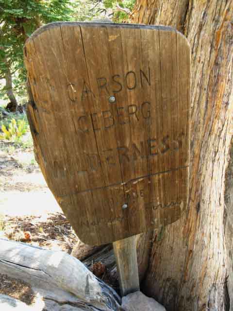
Carson Iceberg Wilderness
Hiking
The Pacific Crest Trail between Ebbetts Pass and Sonora Pass
Languages
Languages
Trail Arts
The art of walking
Physical Preperation
Trail Skills
The trail
Off the trail
Scrambling
Maps
Navigation
Camp skills
Food
Resupply
Food
Other
Photo Catagories
Trail Stories
Trail Culture
News and Science
Links
Groups
Books
Terms and Conditions of Use
| Trail Guide INDEX Highway 4 to Highway 108 |
North PCT Ebbetts Pass to Tyron Peak |
South PCT Murray Canyon to Boulder Lake Junction |
7.5 Topo |
30 min Map Ebbetts Pass to Sonora Pass |
Ebbetts Pass to Sonora Pass MILES AND ELEVATIONS |
ALL TOPO MAPS EBBETTS PASS TO SONORA PASS |
Resupply North Lake Alpine South Kennedy Meadows |
National Forests Toiyabe & Stanislaus |
all maps index |
Tyron Peak to Murray Canyon
in the
Carson-Iceberg Wilderness
5.95 miles on the PCT
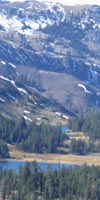
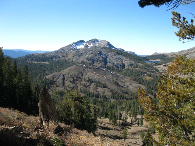
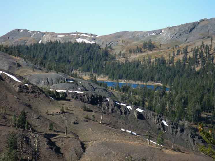
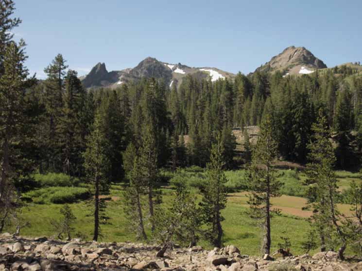
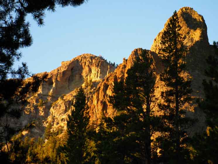
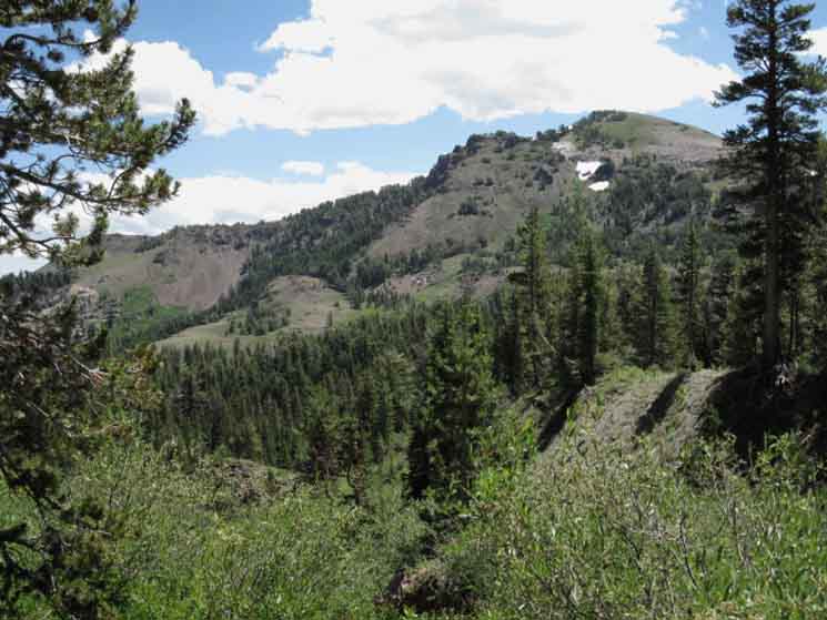
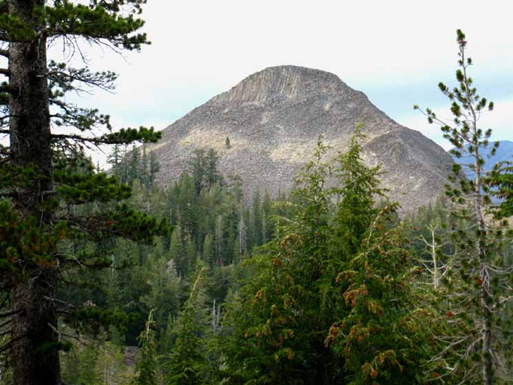
The View South from the high point of the Pacific Crest Trail across Tyron Peak. Since passing South of Carson Pass we've been hiking the East Flank of the Sierra almost exclusively, excepting our hike across the Western-draining flank of The Nipple above Blue Lakes. |
||
 |
||
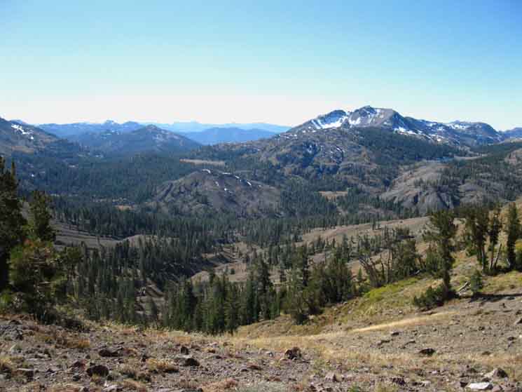
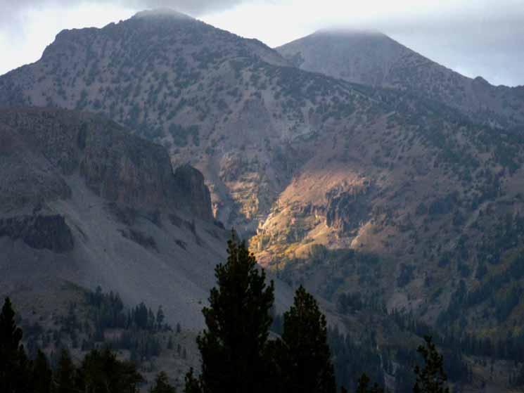
West Flank of the Sierra Nevada Hiram Peak dominates the scene in the middle-Right of the image. We can see slivers of blue where the Highland Lakes sit to the West, to the right of Hiram Peak. The Highland Creek Trail drops down the Western Flank beyond Highland Lakes on its way to Lake Alpine via Spicer Meadow Reservoir. The routes Arnot and Disaster Creek follow are visible to the East, or Left of Hiram Peak, respectively. The flow of Arnot and Disaster Creeks splits to pass East and West of Lightening Mountain, the pointed triangular peak visible to the Left of Hiram Peak in middle-distance. The Sierra Crest line, capped by Arnot, then Disaster and Boulder Peaks rises out of view on the Left side, the East side of the image above. That's where we're going and those are the next mountains we'll pass on the Southbound PCT.
I discuss these potential three routes West to the Tahoe to Yosemite Trail in depth on the previous trail guide page. The full Carson Iceberg Backpacking Map shows us all the connections between the PCT and TYT across this stunningly beautiful wilderness area. Carson Iceberg Wilderness Backpacking Map |
South from Tyron Peak The first three of the next six miles to Murray Canyon are downhill, the next three are through rolling-rising terrain. That's hiking South out of Wolf Creek Pass on the PCT. Murray and Golden Canyons represent a couple of changes in terrain. First, the rapid undulations of crossing multiple drainages are now replaced by crossing two much larger canyons. Second, we are drawing nearer to the main body of the East fork of the Carson River as we hike South, and arriving at the Murray Canyon trail junction marks our first views of the granites of its magnificent canyon emerging from the ocean of surrounding volcanic terrain, like an ancient god of hard rock emerging from its long buried soft volcanic tomb. Though the volcanic activity produced a lot of material, it is soft, and the buried hard rock of the granite has been biding its time as the slow but inextricable forces of gravity, erosion, and uplift are slowly re-revealing its almost timeless grandeur. I'm happy to even get a glimpse of this timeless dance living almost beyond the scope of perception. At Wolf Creek Pass we have to the options to break South off the Pacific Crest Trail to hike to Arnot or Disaster Creeks, or on to the Gardner Meadow Trailhead near Upper Highland Lake. Highland Lakes Backpacking Map From Gardner Meadow we can easily access Highland Creek Westbound down to Spicer Meadow Reservoir and the TYT. To our East the Elder Creek trail brings us first to Wolf Creek and shortly to the East end of Bull Canyon where we will see the trail West back to the PCT at the Bull Canyon trail junction above Noble Lake. Continuing Northeast down Wolf Creek from the East side of Bull Canyon brings us to its confluence with the East Carson River at the end of Wolf Creek Meadow, which is just a bit Southeast of Highway 4 above the turn down Monitor Pass Road. The East Fork of the Carson River continues North through Markleeville, where it picks up the the flows from the fan of creeks draining the South end of the Mokelumne Wilderness. We are continuing South on the Pacific Crest Trail towards Sonora Pass, on to Tuolumne Meadows, and eventually down to the Whitney Portal despite all of these fine potential short and medium distance backpacking loops opening up around us at Wolf Creek Pass. We will have to come back for some protracted study of this beautifully complex terrain. Carson Iceberg Wilderness
See the trail guide page to the North for the View from Tyron Peak Hiking the PCT South through the Carson-Iceberg Wilderness
Basic Facts High Point of the Pacific Crest Trail across Tyron Peak Ebbetts Pass to Sonora Pass The Murray Canyon trail junction is 5.95 miles South of Tyron Peak The Murray Canyon trail junction is 10.87 miles South of Ebbetts Pass The Murray Canyon trail junction is 18.57 miles North of Sonora Pass |
||||||||||||||||||||||||||||||
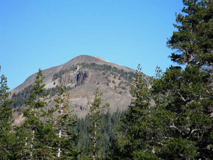
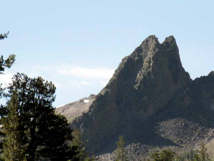
Tyron Peak
Tyron Peak to Murray CanyonThe Lay of the Land From Tyron Peak we have a mostly gradual and smooth 2.1 mile traverse down to Wolf Creek Pass. Deeply shaded Asa Lake offers excellent break and camping opportunities 1.69 miles South of the high point of the trail across Tyron Peak's 9320 foot shoulder. The flat around Asa Lake and its campsites show the typical signs of heavy use. This is not unexpected as Asa Lake is only 2.53 miles from the Gardner Meadow Trailhead on Highland Lakes Road. At Wolf Creek Pass we have potential to access the Southbound connector trail from the Pacific Crest Trail down to the Tahoe to Yosemite Trail at Jenkins Canyon via Gardner Meadow Trailhead through Highland Creek, as well as the options to hike down the Arnot and Disaster Creek trails to their trailheads on the Tahoe to Yosemite Trail along the Clarks Fork of the Stanislaus River. The 2.21 mile long trail Southwest from Wolf Creek Pass to the Gardner Meadow Trailhead passes by the trail junction leading South that splits up to form both the Disaster and Arnot Creek trails down to the Clarks Fork of the Stanislaus. From the Gardner Meadow Trailhead we can follow the Highland Lakes dirt road South past both Highland Lakes and the car campground between them, through the Highland Creek trailhead and on down Highland Creek to hook up with the Tahoe to Yosemite Trail at Jenkins Canyon. The Highland Lakes topo hiking map depicts this section of that route option. This web of trails connecting the PCT and TYT creates many options for many backpacking loops touring around the Carson Iceberg Wilderness. I discuss the potential for hiking loops of 20 to 80 miles around the Carson Iceberg Wilderness at the Jenkins Canyon and Boulder Lake trail junctions. But we are heading South on the Pacific Crest Trail. This time. I have guide pages connecting to the TYT via Wolf Creek Pass that you can explore below, we talk about our options hiking down Highland Creek on the Forum, and we have another trail from the PCT to the TYT via Boulder Lake and Creek further to our South on the next following trail guide page. This trail guide has pages hiking down two of the routes connecting the Pacific Crest Trail to the Tahoe to Yosemite Trail. One through Highland Creek and the other through Boulder Creek. Hiking South of Wolf Creek Pass on the Pacific Crest Trail we will find that the main branch of Wolf Creek offers nice camping before entering the canyons draining directly into the upper section of the East Carson River, first Murray, then Golden Canyon. South of Wolf Creek Pass we begin the long, undulating 22.42 mile climb, punctuated by one steep drop from the top of the East Fork of the Carson River's canyon down to river level. This section is mostly composed of rippling undulations of washboard terrain to begin the final climb from river level over ancient trails in the Headwaters Bowl of the East Carson River through the 10,240 foot Carson Gap where our Pacific Crest Trail finally escapes its long hike through East Carson watershed. Past the Carson Gap we have one last bit of climbing up to the 10,500 foot Sonora Gap before dropping down to Sonora Pass's 9624 feet to end our hike through the Carson-Iceberg Wilderness section of the Pacific Crest Trail. But first let's get ourselves down the 5.95 miles from Tyron Peak to the Murray Canyon trail junction.
|
Tyron Peak
to
Murray Canyon
on the
Pacific Crest Trail
VIDEO| All Videos TahoetoWhitney on YouTube. |
|||
Video: Tyron Peak to Murray Canyon Trail Junction. Time: 8:12
|
South
|
| Highland Lakes Backpacking Map USGS 15 minute hiking map |
Carson Iceberg Wilderness 30 minute backpacking Map |
The Highland Lakes feed the latter two watersheds. The Southwestern lake, which I call the "lower" Highland Lake (measuring the lakes from the Sierra Crestline), is the source of Highland Creek. Highland Creek runs Southwest to ultimately feed the North Stanislaus River through Spicer Meadow Reservoir. The Northeastern Highland Lake, which I call the "upper" Highland Lake, is the source of the North Fork of the Mokelumne.
Disaster and Arnot Creeks drain Southeast and Southwest, respectively, down to the Clarks Fork of the Stanislaus River. to the South of Highland Creek and just a bit West of the Northwestern flow of the East Fork of the Carson River.
Complex fingers of multiple drainages interlock through this complex Sierra Crest terrain.
But we will see none of these riparian features down there on the Western flank as we hike South on our Pacific Crest Trail route. This Western view is just a brief interlude, a tease, of the extensive forests, canyons, and rivers dropping off the Western flank of the Sierra as we will too quickly return to the Eastern flank as we approach Wolf Creek.
The PCT is almost exclusively an Eastern Sierra experience,
except for our brief view from here atop Tyron Peak, where we can see across the top of a series of Western watersheds.
We will shortly drop under forest cover and lose our grand broad view.
Soak it in. Orient ourselves with map and compass. Pick out the lines of the various trails, including our own.
The North Mokelumne, North Stanislaus via Highland Creek-Spicer Meadow Reservoir, and the Clarks Fork of the Stanislaus are riparian features along the Tahoe to Yosemite Route making its way South further down along the Western Flank of the Carson Iceberg Wilderness than our Pacific Crest Trail route. It's sweet terrain down there. This view of the West flank motivates me to go hike the Tahoe to Yosemite Trail!
It's also the reason I tie together segments of each trail when I hike through the Carson Iceberg Wilderness.
We on the PCT have been exploring the high ends of the creeks feeding the watershed of the East Fork of the Carson River since hiking South of Blue Lakes Road, and are finally moving directly towards the great river itself hiking South off this shoulder of Tyron Peak.
This motivates me to hike the Pacific Crest Trail!
The divergent beauty of Sierra terrain is as good an argument as any for eventually hiking both the Pacific Crest and Tahoe to Yosemite Trail routes through the Carson Iceberg Wilderness, if not tracing each route across the Northern Sierra.
For more detailed examinations of this amazing terrain within the Carson Iceberg Wilderness we can stitch together various segments of the PCT and TYT to craft vast or restrained loops to help us figure out this whole pretty puzzle of the Carson Iceberg Wilderness and its complex terrain.
Carson Iceberg Wilderness
30 minute backpacking Map
We were given the physical and abstract tools to reflect as well as affect the complexities of our environment. Our feet, hearts, and minds were made for this engagement. We are nothing without this most basic relationship.
Stitch segments of the PCT and TYT routes together into loop trips circling around the Carson Iceberg Wilderness. Loops of between 20 to 90 miles can be crafted around the Carson Iceberg's high altitude trails that make sense of the beauties of this place, and the space between your ears too.
The maps, mileage, and trail guide pages covering the TYT and PCT across Carson Iceberg Wilderness are designed to help you find it.
Carson Iceberg Wilderness
30 minute backpacking Map
| Ebbetts Pass to Wolf Creek Pass 15 minute backpacking MAP |
Ebbetts Pass to Sonora Pass Miles and Elevations |
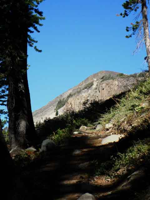
View South descending off the South Flank of Tyron Peak
Hiram Peak with Upper Highland Lake on its Northwestern side. The yellow slash of Upper Gardner Meadow sits nestled into Hiram Peak Northern ridge arm. |
 |
We can see the great volcanic feature of the Dardanelles peaking out half-way down the Western flank (Right side) of Hiram Peak. Spicer Meadow Reservoir and the TYT sit at the foot of that Dardanelle feature. We can see the ridge guiding the course of the Clarks fork of the Stanislaus in the distance at the end of the canyon on the Eastern (Left) flank of Hiram Peak. That dark ridge is identified being beyond and just a bit to the Left of the yellow slash of Upper Gardner Meadow. That distant dark shaded ridge we see beyond the Eastern flank of Hiram Massif is part of the great block of mountain terrain dividing the Clarks fork of the Stanislaus from the Middle Fork. The Clarks fork of the Stanislaus ends a few miles downriver where it merges into and becomes part of the Middle fork of the Stanislaus River. The map below depicts these relationships. South Carson Iceberg Wilderness Map Arnot Creek begins a bit past Upper Gardner Meadow, flowing along the base of the East flank of Hiram Peak. We are looking down to the Clarks Fork along the rough course of Arnot Creek, and though we cannot see it, the West flank of Lightening Mountain is rising just out of the frame of the image on the East, Left side of the image. Disaster Creek roughly mirrors the route of Arnot Creek down to the Clarks Fork, but runs down to the Clarks Fork along the base of the other side of Lightening Mountain, down along the base of its Eastern flank. |
Always
Turn-Around
 |
Looking back at Tyron Peak as we enter the forest above Asa Lake. |
Tyron Peak to the North
| Turning around to take a last peek North up at where the Pacific Crest Trail passes through the gap on the shoulder of Tyron Peak. | ||
 |
||
The Southbound Pacific Crest Trail follows a gentle trail traversing down and around the top of this steep wishbone shaped canyon before finding the tiny shelf of gentler, flatter terrain where Asa Lake is stationed.
|
Fawn Above Asa Lake
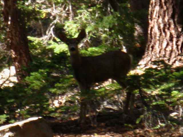 |
Fawn above Asa Lake, Carson Iceberg Wilderness. I try to keep my pack properly lashed and secured so it makes no noise while hiking. I try to stay balanced and quiet on the trail, trying to avoid kicking rocks, cones, or breaking twigs. I hike solo 99% of the time, so I generate no group noises. Keeping our breathing and the metabolic pain of hiking to a dull roar allows us to hear more external sounds than internal, making it possible to observe before being observed. Wed Sept 23 2009. |
Highland Lake
Last Look
 |
We've rotated past our long views down the canyon holding Highland Lakes and the other canyons too as we traverse down to our Southeast, until we get our last view of upper Highland Lake approaching Asa Lake across the Northernmost of the ancient volcanic mounds decorating this set of high elevation flats. We're looking Southwest across the volcanic mass rising out of the surrounding forests and meadows off the North flank of Hiram Peak, a feature we we could see from higher up. |
Wilderness Boundary
 |
||
Check out the map to precisely locate your position at Wilderness Boundary Markers. Crossing into the Carson Iceberg Wilderness also puts us back onto the Eastern Flank of the Sierra as Asa Lake drains into the upper reaches of Elder Creek. We'll subtly slide back onto the Western flank at Wolf Creek Pass, well, we'll be standing on the divide.
|
Stock Fence
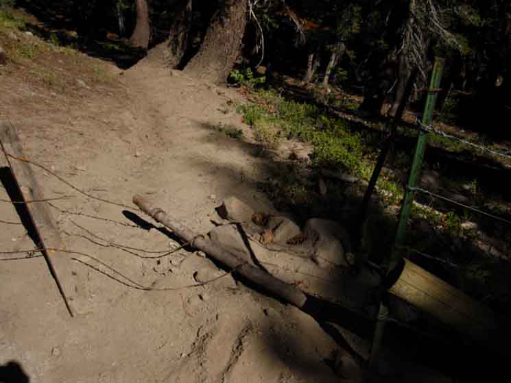 |
I don't mind grazing or stock or fences. But I don't like it when water sources are spoiled my man or man's beasts. |
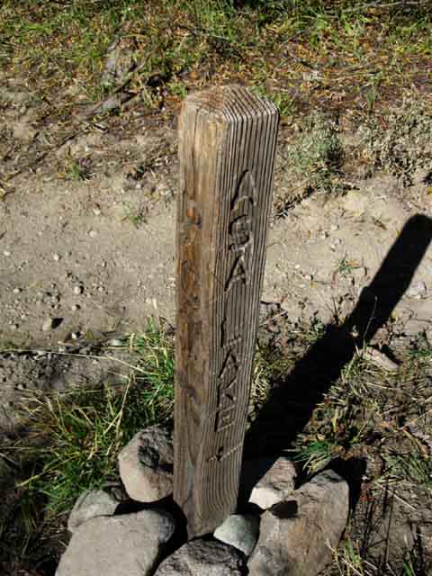
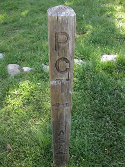
ASA Lake
approaching
|
| Ebbetts Pass to Wolf Creek Pass 15 minute backpacking MAP |
Ebbetts Pass to Sonora Pass Miles and Elevations |
Highland Lakes Backpacking Map
USGS 15 minute hiking map
1.69 miles South of the high point on Tyron Peak.
6.61 miles South of Ebbetts Pass.
Access from Highland Lakes Road
A very short 2.53 miles separates the Gardner Meadow Trailhead on Highland Lakes Road from Asa Lake.
Trail access
to the
North Shore of Asa Lake
| Duck marking Northern trail down to Asa Lake. | ||
 |
||
Southbound hikers will first encounter this junction above the North Shore of Asa Lake. The route of the Pacific Crest Trail wraps around the East shore of Asa Lake, where the post is located. |
Asa Lake
| The Pacific Crest Trail winds around Asa Lake. |
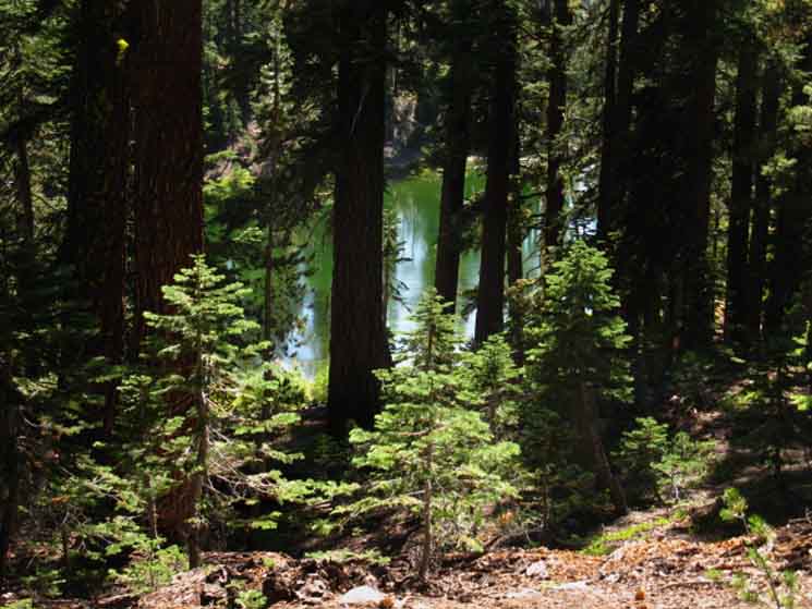 |
The PCT drops down from Tyron Peak to circle around the North to East shores above the flat apron wrapping around Asa Lake, where the majority of Asa Lake's campsites are located. Passing the Northern junction to the lake continuing South around the its East shore brings us down to a couple of additional campsites along the creek draining the lake, if we don't turn off the trail to visit Asa Lake itself. These sites offset from Asa Lake provide a bit more privacy during busy Summer weekends, when young families hike (or hike/carry) little kids out through the easy access via Gardner Meadow. |
Asa Lake Trail Junction
| Trail post on the far East side of Asa Lake where our PCT route wraps around Asa Lake. | ||
 |
||
Continuing North on the PCT will bring us up to level with Asa Lake's flat apron, or we can follow the trail this post marks up to the lake.
|
Asa Lake
| The flat apron on the North side of Asa Lake is flat, well shaded, and has many developed campsites. |
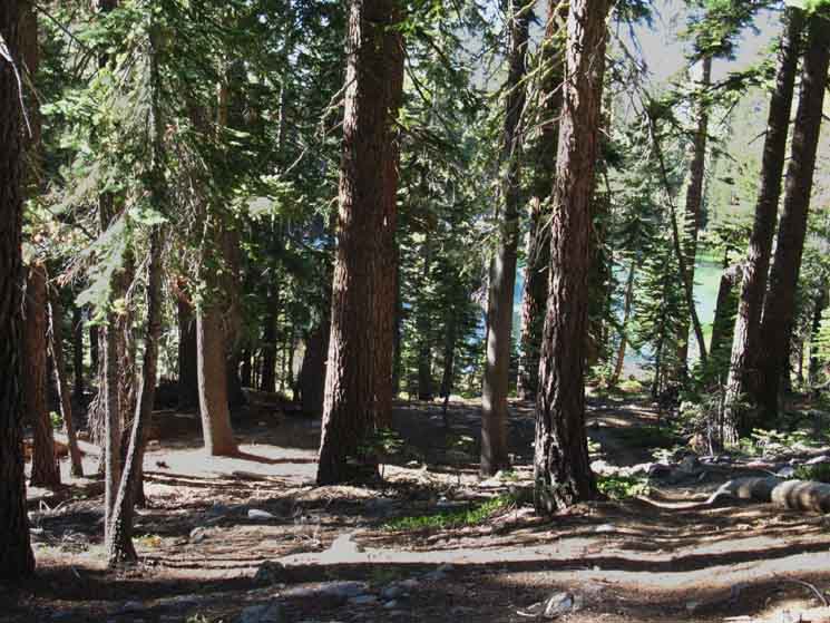 |
The heavy usage of Asa Lake is due to the close proximity of the dirt road out to Highland Lakes. But "heavy" is a relative term, especially for hikers in the Carson Iceberg Wilderness. I never see many backpackers in this area. It looks to me like this place mainly gets busy during the main Summer holiday weekends, and during the main Pacific Crest Trail hiking season. I believe the same is true about the car campground located between the Highland Lakes. It is always lightly used, even during Summertime, except for the main holiday weekends. |
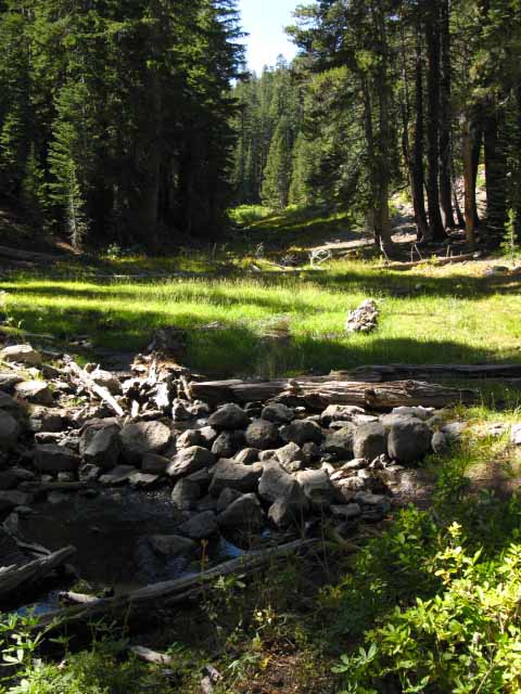 |
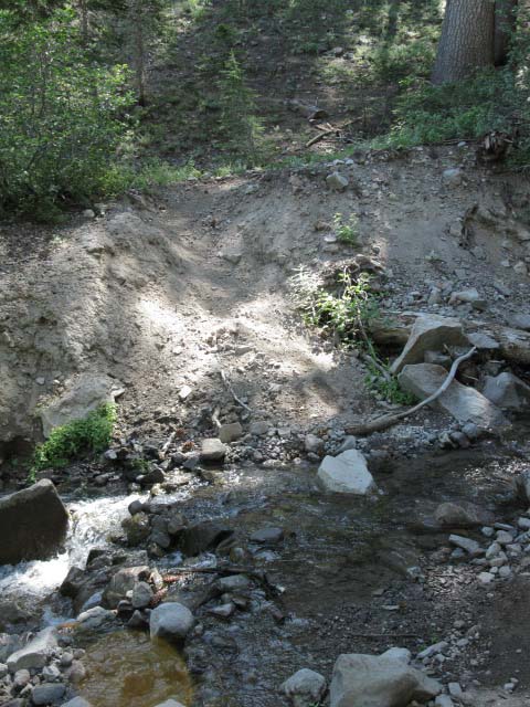
Just to the South of the Asa Lake trail junction we encounter the stream draining Asa Lake across a cute little meadow. On the other side of the trail across from the meadow there's a nice campsite. |
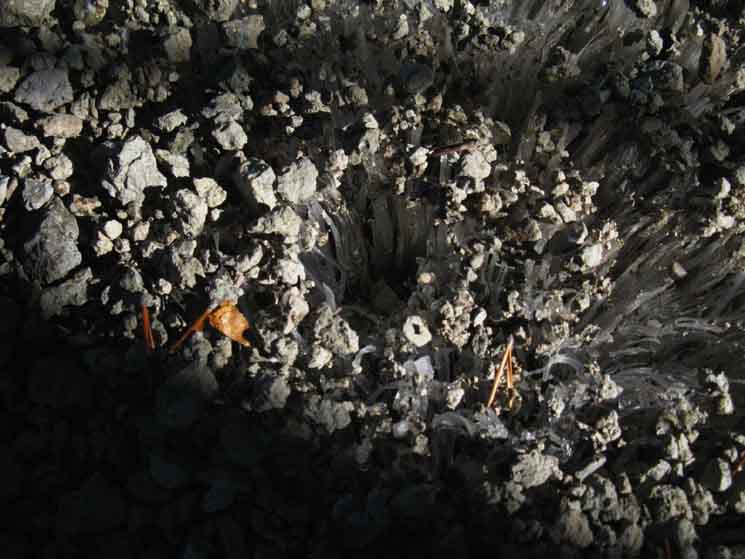
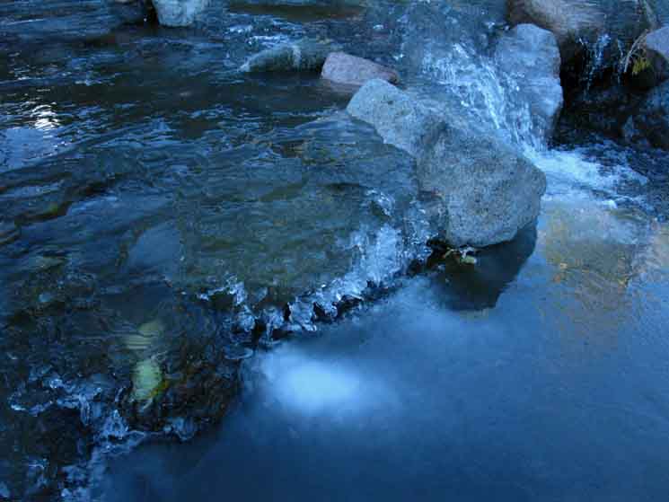
Ice Crystals
Frozen Crystal Garden Hiking between Asa Lake and Wolf Creek Pass I've always enjoyed the sight of ice crystals growing out of the ground. In fact, I've always enjoyed the effects of cold on terrain. |
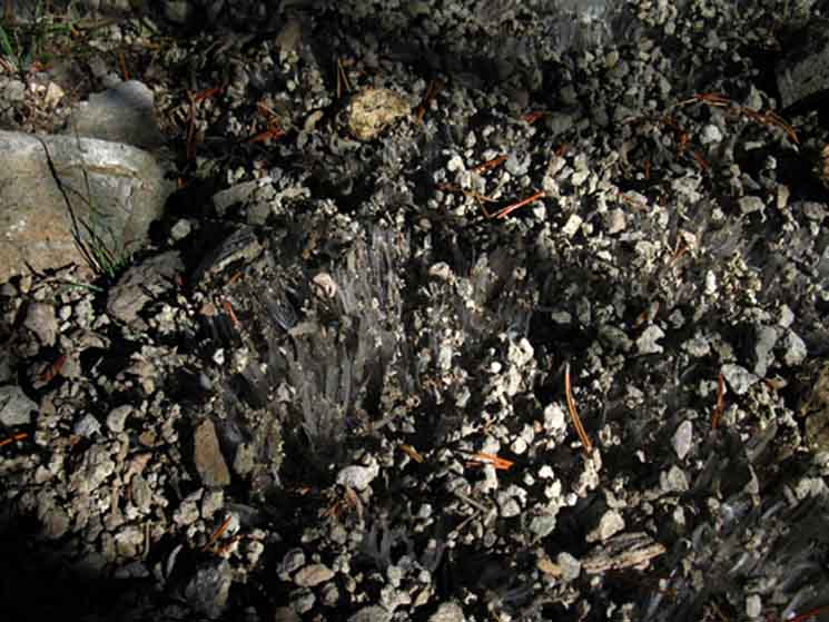 |
A whole sea of ice crystal-tendrils rose from the soil, lofting virtually all of the loose surface gravel to a uniform height above the natural level of the ground on the tips of the growing crystals. When first approaching this unusual surface I knew that something was "wrong," that the natural lay of the surface had been altered. I was alerted by the unusual uniform plane all the surface gravel had been lifted onto. It was too flat and uniform. I figure that this interesting crystal-growth freezing action is initiated when air temperatures drop fast and far enough to draw surface moisture, and moisture held in surface soils, into some kind of capillary ice crystal growth action. In this case across a significant area. I've seen all sorts of ice crystal growth, and its telltale remnants in segments of a strangely uniform "ruffled" trail surface left behind after melting, but never such an expansive zone of crystal growth. Above and below are pictures of the greatest extent of this phenomena I have ever seen. Early Spring and Late Fall travel brings us across many small examples of crystal growth, but this was big. It reached about 30 feet up the trail and ran off the sides of the trail into the surrounding forest bottom. "Solid" ground is an inch below the apparent surface. |
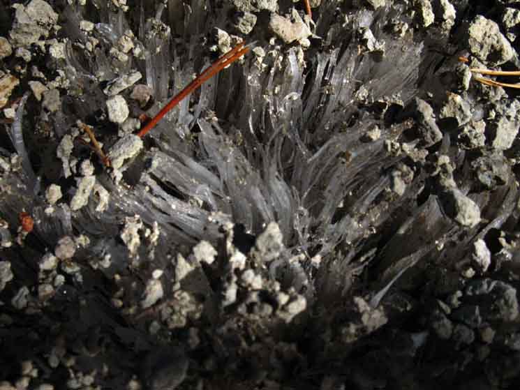
Ice Crystal Garden
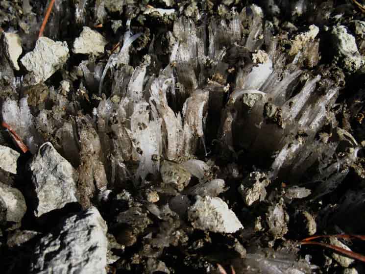 |
| A closer look reveals ice crystals growing out of High Sierra trail surface. |
Rocks taking a Ride
 |
We can see the growing ice crystals have lofted pebbles and small stones off the ground on their leading edges. |
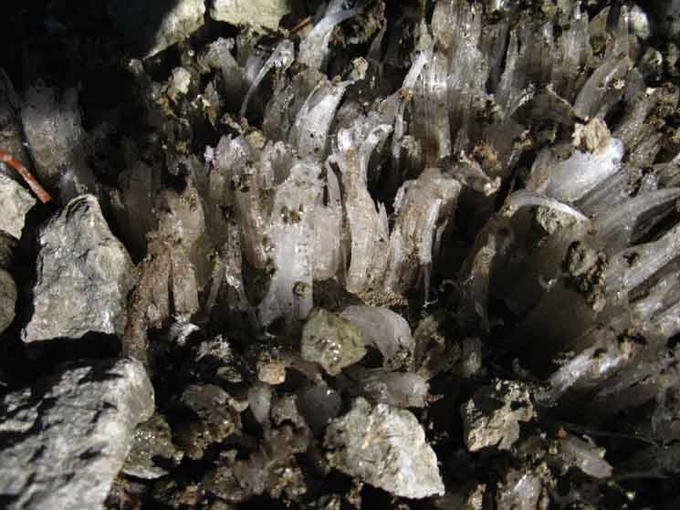
A Fragile Trail Surface
Beauty and Power of Water
 |
This great run of crystallized terrain had been accompanied by other normal and amazing cold effects over these days and nights of the cold snap. Interesting layering of clouds, bursts of hail and snow, and the most amazing of all, the main body of Wolf Creek flowing as slush. Below we see Wolf Creek flowing as a Great River of slush. Hey, when I see a fairly substantial body of running water semi-frozen and flowing in a "slush" state, a semi-liquid state, that rates both the "great" and the "river" designation. I promote any creek flowing as slush to "river" for as long as it's flowing as "thick" water! The crystal garden growing under the trail above and the river of slush below show us that the beauties of the High Sierra multiply as the temperatures drop with the approach of Winter, until they drop us into the beauty of the snow covered Sierra, the Winter Wonderland. When it gets really really cold I call it the Crystal Wonderland. |
Wolf Creek Pass
on the
Pacific Crest Trail
offering at Wolf Creek Pass Trail Guide Options Hiking Southwest out of Wolf Creek Pass towards Highland Lakes opens up three of the four routes linking the Pacific Crest to the Tahoe to Yosemite Trail across the Carson Iceberg Wilderness. Highland Lakes Backpacking Map These three trails open up a wide variety of route modifications for the Southbound Long Distance Backpacker, and even more local loop backpacking trips for those hikers wishing to remain within the Carson Iceberg Wilderness. We discuss our hiking options out of Wolf Creek Pass further below. We can check out the trail from the Highland Creek Trailhead on the far Southern Shore of the lower Western Highland Lake to our position here at Wolf Creek Pass on the Highland Lakes to Wolf Creek Pass trail guide page. We pass the trail branching off South to both Disaster and Arnot Creek trails along the trail to the Highland Creek Trailhead. The map of this area and its potential as a hub of backpacking loops around the Northern Carson Iceberg Wilderness can be seen clearly on the Highland Lakes to Wolf Creek Pass Topo Hiking Map. Though we are continuing South on the PCT through Wolf Creek Pass, we could also explore the option of hiking down to finish the Southern section of the Carson Iceberg Wilderness on the Tahoe to Yosemite Trail. This would not only add miles and elevation to this Ebbetts to Sonora Pass Section of the trail, but also means we would have to find our way to Saint Marys Pass on Highway 108 across very challenging segments of unmaintained trail along with a small bit of untrailed route finding where there apparently has not been a trail since the Saint Marys Pass Road was abandoned. I believe that was in the mid-1920s. I've read accounts and histories of the passes and roads over Sonora Pass. If I remember correctly the original route over Sonora and Saint Marys Pass was abandoned after repeated floodings had necessitated repeated costly repairs. The current route up on the rock above Deadman Creek was more challenging to build, compared to the easy route to the crest offered through the Clarks Fork, but the Deadman route up exposed granite has superior durability to the Clarks Fork route up the bottom of a often flooded canyon. Check out the Carson Iceberg Wilderness map to craft your own custom route across the Carson Iceberg Wilderness. Carson Iceberg Wilderness The black dotted routes on the above large scale map link to detailed maps. The red dots link to trail guide pages along the TYT and PCT routes, and selected connector routes. Each trail guide page has a link to the miles and elevations for that segment of trail. We can plan excellent long and short backpacking trips across or around the Carson Iceberg Wilderness on the Pacific Crest and Tahoe to Yosemite Trails with this mapping, mileage,and guide information. |
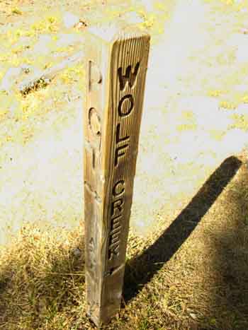
Wolf Creek Pass
| Wolf Creek Pass on the Pacific Crest Trail |
 |
Asa Lake is North of Wolf Creek Pass on the PCT. Elder Creek flows Northeast from Wolf Creek Pass. I generally don't hike too much to the Northeast of Wolf Creek Pass. It looks like a fine little loop out through Bull Canyon from above Noble Lake to the end of Bull Canyon down Elder Creek to the East end of Bull Canyon. Carson Iceberg Wilderness Hiking Map I've hiked down to the Silver King Meadow above Wolf Creek Meadow (which is where Elder Creek to Wolf Creek flows into the East fork of the Carson) following the East fork of the Carson River downriver out of the snow covered mountains during Winter. But, those mid-altitude meadows such as Wolf Creek and Silver King Meadows just seems a bit too far away from the high trails on the Sierra Crest during Summer. But they offer great access to the Sierra. If you want to replicate or accomplish a trans-Sierra backpacking trip you will likely cross a couple of these meadows on your way up the East flank. I've hiked up the East flank of the Sierra lots of times and places from the Highway 395 corridor. I always try to hitch up to the trailheads, but that's not possible during Winter, and not likely during late Fall and early Spring. So we walk! But, these mid-altitude meadows are a welcome avenue to quickly bail out of the harshness of the high altitude Sierra Crest when a nice Winter storm comes barrelling in unexpectedly off the North Pacific. |
Wolf Creek Pass
Four Trails
North and South PCT
Highland Lakes to the Southwest
Wolf Creek to the Northeast
| Wolf Creek Pass Trail Junction NORTHEAST |
Highland Lakes option |
|||||
 |
 |
|||||
Wolf Creek is to the Northeast of Wolf Creek Pass down Elder Creek. This is Wolf Creek lower down the Eastern Flank than where we will cross it 1.61 miles to our South on the PCT from Wolf Creek Pass. The trail Northeast down Elder Creek to Wolf Creek brings us to the East End of Bull Canyon. We passed the Bull Canyon trail hiking South past Noble Lake. Check it out on the |
The trail Southwest to Highland Lakes passes by the tops of both the Disaster and Arnot Creeks trails coming up from their trailheads along the TYT on Clarks Fork road. Those two trails are off of Highway 108. The trail down Highland Creek past Highland Lakes can bring us down to Lake Alpine on Highway 4. These trails open up the possibilities for many backpacking loops around the Carson Iceberg Wilderness from trailheads on both Highways 4 and 108. |
Wolf Creek Pass
| Ebbetts Pass to Sonora Pass NORTH AND SOUTH PCT |
 |
The Pacific Crest Trail climbs both to the North and South of Wolf Creek Pass. Wolf Creek Pass is a low point on the Sierra Crestline between the Eastern and the Western flanks of the Sierra Nevada Mountains. This place is swampy and full of mosquitoes during Spring! To our South and to the West we see the very upper reaches of the Western flank watersheds of the of the North Fork of the Mokelumne River reaching up through lower Gardner Meadow all the way up to us at Wolf Creek Pass. The furthest Highland Lake drains into the North Stanislaus via Highland Creek through Spicer Meadow Reservoir. Arnot and Disaster Creeks both feed the Clarks Fork of the Stanislaus, which contributes its flow to the Middle Stanislaus River just a couple of miles West of where Arnot Creek enters. Immediately to our East Elder Creek runs down the Eastern Flank of the Sierra into Wolf Creek, which flows down into the East Fork of the Carson River. This trail Northeast down the Eastern flank of the Sierra runs us through a canyon dropping down into a set of great meadows where the East Fork of the Carson River collects up the flows from the lesser creeks such as Elder, Silver, and Wolf Creeks below the Sierra Crest. Our PCT route continues South along the highest reaches of these creeks feeding the East Carson, until we finally see, then hike down to the East Fork of the Carson River itself. The East Carson is one of my favorite Sierra Rivers. |
Many Hiking Trip Options If we are not walking the length of the Tahoe to Yosemite Trail or following the Pacific Crest Trail route between Lake Tahoe to Mount Whitney we still have many great long distance backpacking options in and around the Carson Iceberg Wilderness, especially if we tie together segments of the PCT and TYT trails to make big hiking loops around the Carson Iceberg Wilderness. Hiking loops make trail "hubs" such as the junction at Wolf Creek Pass that links up with three different trails to the Tahoe to Yosemite Trail very important. The Carson-Iceberg Wilderness is worth exploring through short or medium distance section hikes,as well as part of a long distance backpacking trip along the Sierra Crest. We can craft grand backpacking loops of up to 90 miles staying within the Carson Iceberg Wilderness. Some of these routes are very isolated. One of my very favorite sections is the 9 miles (I've gotta check that...) of delightfully unmaintained and deteriorating trail along a most rough section of the East Carson River from Carson Falls up to the PCT. Just Delightful! Carson Iceberg Wilderness My point here is that we can select and connect segments of the Tahoe to Yosemite and Pacific Crest Trails to put together grand loops of very diverse characters of trail, levels of isolation, and varieties of terrain. Many Options Sections Our first backpacking option is to hike the length of either the TYT and/or the PCT trail section between the Northern boundary of the Carson Iceberg Wilderness on Highway 4 to its Southern boundary along Highway 108. That would make us "section hikers" along one or the other trail. Hiking sections of either the PCT or TYT routes is always fun. Loops Next, we can extend the section hike by crafting great medium to long distance loops around the Carson-Iceberg Wilderness by using the four main trails which connect the Tahoe to Yosemite route to the Pacific Crest Trail through the Carson Iceberg Wilderness. Next, we could craft loops tying together the PCT and TYT using the four connector trails tying these two classic trails together across the length of the Carson Iceberg Wilderness. Start at your favorite PCT or TYT trailhead around the perimeter of the Carson Iceberg Wilderness. Hike to the connector trail of your choice, change directions and trails. Walk back towards your trailhead until you come to the connector trail back to your original trail and trailhead. Check out this Carson Iceberg Wilderness topo hiking map that depicts our backpacking options connecting the PCT with the TYT into fantastic backpacking loops. Check out this article about a 50 mile loop around the Carson Iceberg Wilderness using bits of both trails. Then figure out the backpacking loop trip that perfectly fits your expectations, desires, and capacities. Wolf Creek Pass Wolf Creek Pass trail junction opens up access from the Pacific Crest Trail to three of the four trails connecting the Pacific Crest Trail with the Tahoe to Yosemite Trail across the length of the Carson-Iceberg Wilderness. Turning Southwest towards Gardner Meadow and Highland Lakes from Wolf Creek Pass opens up a wide range of local backpacking loops as well as excellent route options for the long distance backpacking hiking across the Carson Iceberg Wilderness. Hiking South down the trail towards Highland Lakes off of the Pacific Crest Trail at Wolf Creek Pass brings us first to the Arnot and Disaster Creek trail junction half-way to the Gardner Meadow trailhead, which is along our hike to Highland Lakes. Highland Lakes Backpacking Map Both the Arnot and Disaster Creek trails have Southern trailheads on the Clarks Fork Road along the Tahoe to Yosemite Trail. Clarks Fork Road is off Highway 108, the Sonora Pass Road. The Northern ends of both of these trails terminate along the trail to our Southwest linking Wolf Creek Pass on the Pacific Crest Trail to the Gardner Meadow Trailhead off the Highland Lakes Road. The Arnot and Disaster Creek trails are PCT-TYT connector trails number 2 and number 3, with the Highland Creek Trail being number 1. If we continued hiking Southwest towards Highland Lakes from Wolf Creek Pass past the Arnot and Disaster Creek trail junction we will emerge onto the Highland Lakes Road through the Gardner Meadow Trailhead. We'll hike down Highland Creek to the Tahoe to Yosemite Trail where it passes around the Northeast end of Spicer Meadow Reservoir. This Highland Lakes Trail down to the TYT is the Northernmost of the four PCT-TYT connector trails we will encounter hiking South across the Carson Iceberg Wilderness. The Arnot and Disaster Creek trails are the second and third trails connecting the PCT and TYT across the Carson Iceberg Wilderness, and the Boulder Lake trail is the fourth and Southernmost. Further South along the Pacific Crest Trail we will encounter two other trails linking up with the Tahoe to Yosemite Trail. The next is at the Golden Canyon-Paradise Valley trail junction, and the last is through the Boulder Lake trail junction. Once we hike South of Wolf Creek Pass along the PCT our options down to the TYT diminish. Carson Iceberg Wilderness The Paradise Valley trail from Golden Canyon leads West to Disaster Creek, which drains into the Clarks Fork of the Stanislaus across the Tahoe to Yosemite Trail at the very end of the Clarks Fork Road. This route is a variant of the Disaster Creek Trail coming down from Wolf Creek Pass, but here we join the Disaster Creek trail half-way down its canyon to the Clarks Fork from Wolf Creek Pass. The Boulder Lake trail, our fourth and shortest route connecting the PCT and TYT trail, follows a feeder stream of Boulder Lake down through a good-quality unmaintained trail route to Boulder Lake, and then down a good trail following Boulder Creek to the Boulder Lake trail junction on the Tahoe to Yosemite Trail along the Clarks Fork of the Stanislaus River a couple of miles above the end of the Clarks Fork Road. These four trails linking the PCT to the TYT mean that we can create great and small backpacking loops tying these connecting trails into sections of the Tahoe to Yosemite and Pacific Crest Trail. We can easily create 20 to 90 mile loops around the Carson Iceberg Wilderness using our wide selection of trailheads on Highway 4 to the North, Highway 108 to the South, the Clarks Fork Road off of Highway 108, and even from Highway 395 to the East. The Carson Iceberg is covered by a web of interlocked trails. More Information I also discuss the potential for hiking loops of 20 to 90 miles around the Carson Iceberg Wilderness at the Jenkins Canyon and Boulder Lake trail junctions. |
Northbound
on the
Pacific Crest Trail?
Wolf Creek PassRoute options for PCT Wolf Creek Pass
|
| Highland Lakes Backpacking Map USGS 15 minute hiking map |
Carson Iceberg Wilderness 30 minute backpacking Map |
Silver Valley Trailhead
on the
TYT
to
Wolf Creek Pass on the PCT
21.56 miles.
Hiking down to Lake Alpine from Ebbetts Pass?
Add another 7.02 miles bringing the total to 28.58 miles.
Hiking to Lake Alpine from the auto-accessible Highland Creek Trailhead at lower Highland Lake?
That brings the miles to Lake Alpine down to 17.82 miles.
Check out the
Wolf Creek Pass (PCT)
to
Lake Alpine (TYT)
Map
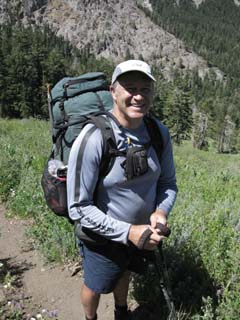
Team Opus July 2009
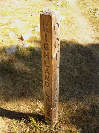
Team Opus hitting the trail South after camping near Wolf Creek Pass. This was a family and friends hiking team. |
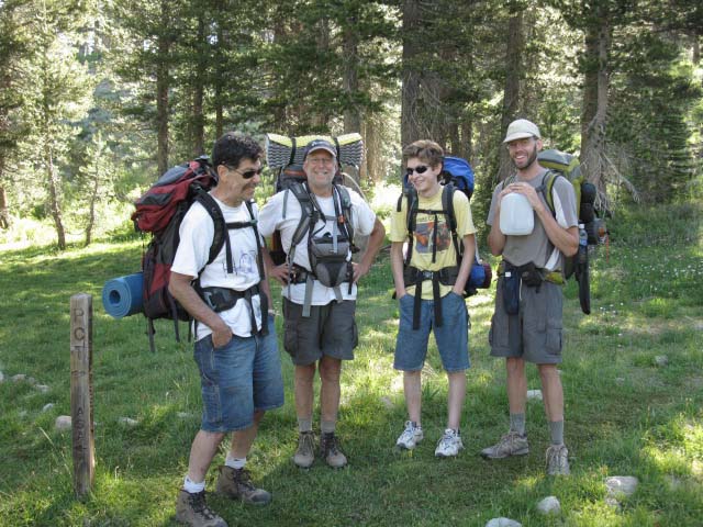 |
Tom, Dave, Steve and Cooper hiking Tahoe to Yosemite on the Pacific Crest Trail. July '09. I believe they are friend, granddad, son, and son in law. We'll see them down at the Swampy Lake too... |
Tyron Peak
 |
View Northwest of Tyron Peak from Wolf Creek Pass. |
Elder Creek
| Elder Creek Frozen on an October morning. |
 |
Early morning frosts and freezes are never unexpected in the Sierra. Wolf Creek Pass is a flat meadow type terrain being penetrated by lodgepole pines. On its East side the meadow drains to become Elder Creek, while on its West side the meadow runs West by Southwest and opens up into Lower Gardner Meadow. A seasonal tributary flows through Lower Gardner Meadow draining off the Northeast flank of Arnot Peak. This tributary joins with the other headwaters branch of the North Fork of the Mokelumne flowing to the North out of Lower Highland Lake. We'll see this upper tributary of the North Mokelumne running through forest and across meadows to our Southwest as we hike South from Wolf Creek Pass towards Wolf Creek. |
 |
Meadow-Headwaters of Elder Creek frozen. |
South on the Pacific Crest Trail
Wolf Creek Pass
|
| Asa Lake to East Carson River 15 minute backpacking MAP |
Ebbetts Pass to Sonora Pass Miles and Elevations |
Wolf Creek is 8.63 miles South of Ebbetts Pass.
Wolf Creek is 20.81 miles North of Sonora Pass.
Mini-gorge of metamorphic rock. The course of the seasonal stream running down to join the North Fork of the Mokelumne emerging from the upper Highland Lake. |
We have interacting zones of volcanic, metamorphic, and granite rock along our Pacific Crest Trail route through the amazing upper reaches of the East Fork of the Carson River. | |||||
 |
 |
|||||
This rock almost cooled into a Devils Postpile-type of column configuration, but did not quite reach that level of organization. |
But here we are still in the Western drainage of the North Fork of the Mokelumne River. Once we hike to the top of this rise we are on we will be in the Eastern Wolf Creek drainage, which feeds the East Carson River. We can make out a vertical column structure. |
The Arnot Peak Massif behind lush early Summer Meadows. Arnot Peak is the triangular mass rising on this side of the ridgline in the center of the image. |
 |
Note the Volcanic structure on the left of Arnot Peak eroded into the form of a shark's tooth. This area has great metamorphic and volcanic features eroded into the shapes of shark fins and teeth. These features are handy landmarks. |
| The Shark tooth. |
 |
The trail tracks along the base of this section of the Sierra Crest Line. |
On the East Flank of Arnot Peak
| Lava plug as part of volcanic features to our West, as we are Southbound approaching Wolf Creek. |
 |
Feature on the East side of the Arnot Massif. |
Arnot Peak Crestline South of Arnot Peak
 |
Arnot Peak Crestline hiking South past Arnot Peak. We're now dropping down to Wolf Creek. |
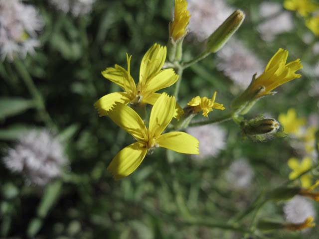
Pretty Flowers
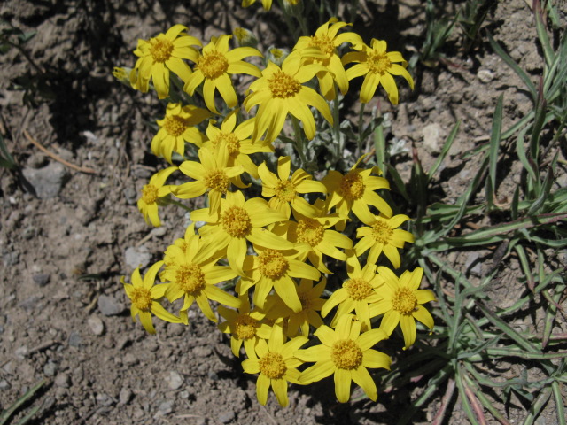
| Bolander's dandelion? | ||
 |
||
Yellow, High Sierra Flower, Bolander's dandelion? |
| Old barbed-Wire wounds on a lodgepole pine. |
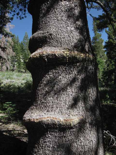 |
This is likely a remnant of barbed wire marking out old pasture land absorbed into the Carson Iceberg Wilderness. |
North Fork of the Mokelumne River
 |
Headwaters of the North fork of the Mokelumne River running off the Northwestern end of the Arnot Peak Massif. Well, this is the seasonal tributary flowing down to join the North Fork of the Mokelumne running out of the upper Highland Lake. This stream does not run too near the trail, but we can see it to our Southwest. |
Forest Trail
 |
Forest Trail South to Wolf Creek and on to the East Fork of the Carson River. |
Pacific Crest Trail Association
| Pacific Crest Trail Association. |
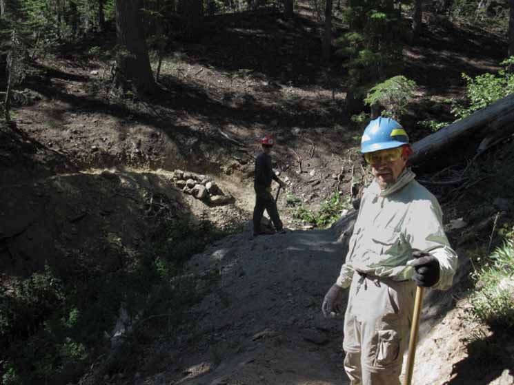 |
John, Dave, & crew. July 24, 2009. They were fixing up one of the Spring Thaw gullies that run hard during the melt, damaging the trail. Every fold in the mountainside holds one of these gullies, and they all degrade the trail bit by bit with each Spring Runoff flow. |
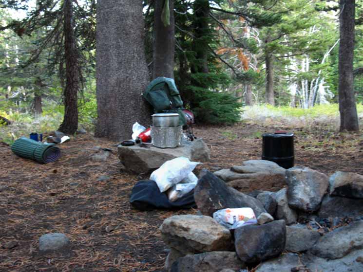
Wolf Creek Campsite
| Nice campsite on the North side of Wolf Creek. | ||
 |
||
The Wolf Creek campsite is expansive, has a big fire ring, nice boulders for cooking platforms, excellent year round water. and is a pleasant place.
|
| Kicking back against the tree. |
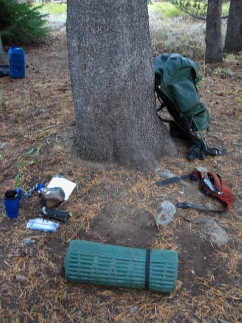 |
Sleeping pad is my footstool. |
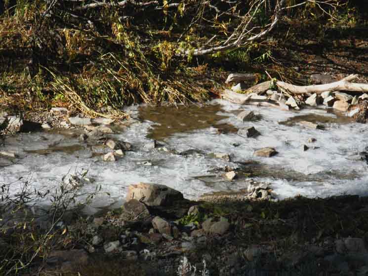
Wolf Creek Slushed
| Wolf Creek soft-frozen into layers of slush. |
 |
Late October. This is slush. There is no liquid water flowing in the river of slush above. Even the tiny cascades of splashing white water are nothing more than splashing water frozen in to place, frozen into crystal ice shaped as splashes, frozen to the slush. |
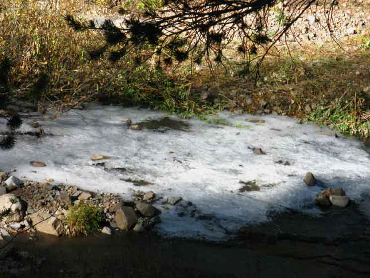
Ripples on the Water frozen in Place.
| A wave Frozen as it fell over the lip of the drop. That moving water froze in place as it was splashing is impressive... |
 |
Not much water was actually flowing. You can't see it, but a thin film of water is flowing over and through the hard frozen mini-cascade at the top of the image. It is negligible. Hard crystal ice is frozen in mid-splash every place water looks like it was cascading or splashing. What looks like pools of flowing water is a body of slush standing in place. All waves and ripples are frozen in place. I imagine the slush itself was moving very slowly, below my ability to perceive, as indicated by the staircase formation of layers as the slow moving mass of semi-solid water stacked up on its original surface as the lower layers lost its ability to flow over obstacles. The fact is that there is virtually no liquid water in the pictures above or below. |
| Water frozen into slush layers and stacked up. There is no liquid water visible in this image. |
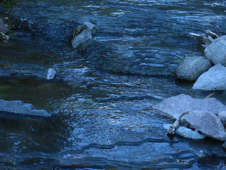 |
Seeing water configured as a staircase was beautiful. |
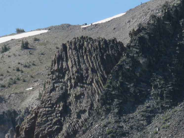
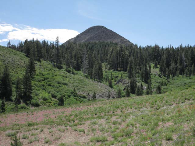
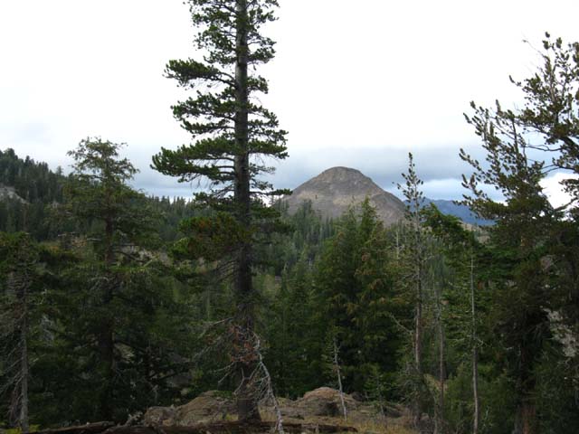
Wolf Creek to Shark fin 9362Unique Features Mark your Path Wolf Creek is followed by two of Wolf Creek's feeder drainages to the South. We get glimpses every now and then of an unusual metamorphic feature to our South as we hike in and out of these subordinate branches of Wolf Creek. I call this the "Northern Sharkfin" because it is one of two similar features that are situated on the North edge of Murray Canyon and the South end of Golden Canyon. The Northern Sharkfin is marked as Peak 9362 on our USGS topo maps. It marks the location of the Murray Canyon trail junction as well as our Southbound entrance into Murray Canyon. Entering Murray Canyon we are entering the immediate watershed of the East Carson River. Murray Canyon is a hanging canyon carved into the Western wall of the fantastic granite canyon of the upper section of the East Carson River. Golden Canyon lays immediately to the South of Murray Canyon along our trail and South on the canyon wall from Murray Canyon along the East Carson River. The "Southern Sharkfin," marked as Peak 9501 on our maps is situated on the Southern rim of Golden Canyon overlooking the Swampy Lake.
|
View South of the Shark fin
| Long distance shot of Northern Sharking, peak 9360. The volcanic material erodes into "shark tooth" shapes, while the metamorphic rock "un stacks" into great shark fin shapes. |
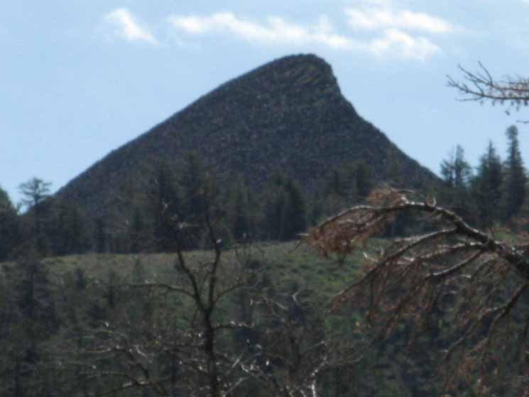 |
I use these unique features as landmarks. This feature marks our Southbound entrance to Murray Canyon. The trail down Murray Canyon to the East Carson River at Falls Meadow runs around this side of the base of peak 9360. |
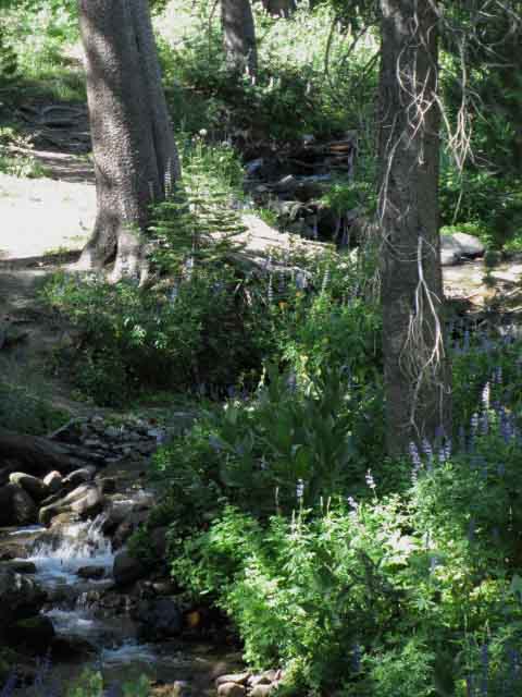
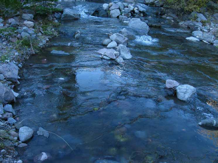
Wolf Creek
| Wolf Creek in liquid form during Summer. |
 |
Three tributaries of Wolf Creek cross the trail. |
Arnot Peak
| Arnot Peak bathed a golden glow of morning light. |
 |
Darkness, Light, Hot and Cold, Up and Down, the trails through nature are a kaleidoscope of feelings, sensations, sights, and experiences. Don't live your life without dipping it deeply into its primary sources. |
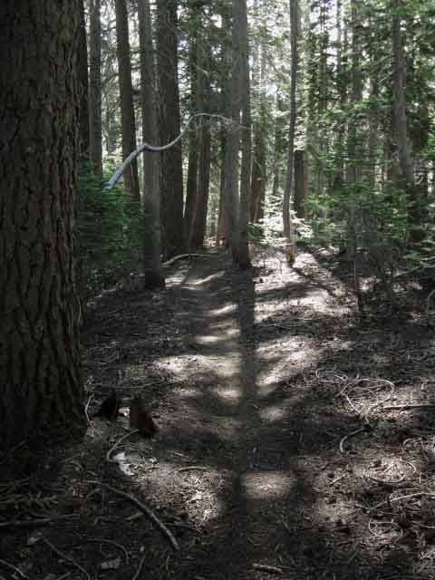
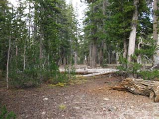
Forest South of Wolf Creek
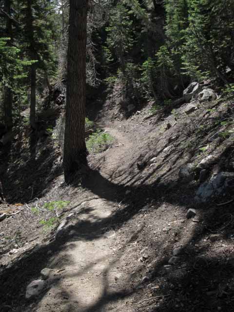 |
| Trail South of Wolf Creek Campsite. |
Pacific Crest Trail Section Hikers
| Scott and Andy. |
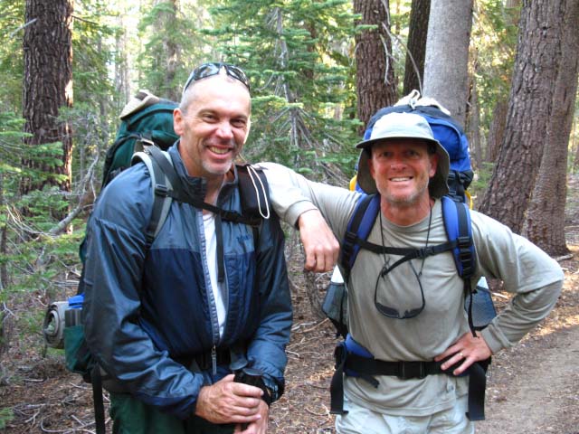 |
Pacific Crest Section Hikers. This Section (encountered sept '09): Tuolumne to Ebbetts Pass. After we talked for awhile about this trail guide project these dudes insisted that I take a nifty little camera case to protect my equipment. I had made a "backpacker bum" camera case out of duct tape... Thanks dudes! Your case still shields my camera. |
More Wolf Creek
| Middle tributary to Wolf Creek. |
 |
| Dried out in late July. |
| South tributary of Wolf Creek. | ||
 |
||
Running low in July. Prior to the recent run of very heavy Winters and snow in late Spring (2010 and 2011) we were in the middle of a multi-decade movement towards earlier Spring thaws and shorter Winters. Thus Wolf Creek's feeder creeks were drying out or diminishing by late July during the Summer of 2009.
|
Northeast View
Highland and Silver Peaks
| Sunray passing through Bull Canyon illuminating the Southeastern flank of Highland Peak. |
 |
Light snows and cold winds were highlighting our hike, and this sunray was a cold pleasure. As we approach Murray Canyon Southbound the route of the trail gives us occasional views to the Northwest over towards Highland and Silver Peaks until we enter an open meadow area where we can now get long views over at the East end of Bull Canyon and the East flanks of Highland and Silver Peaks, and the wide scope of the drainage of Wolf Creek passing Northeast under their Eastern flanks. Carson Iceberg Wilderness Backpacking Map |
Southeast View
| Looking Southeast we can see the Northern Shark fin (Peak 9360) marking the location of the Murray Canyon trail junction and the beginning of our trail route South across the upper reaches of Murray and Golden Canyons. | ||
 |
||
I told you I use terrain landmarks... We are looking Southeast across the expansive open meadow North of Murray Canyon.
|
Wolf Creek Drainage
| Looking Northeast at Wolf Creek drainage below the East flanks of Highland and Silver Peaks. We are crossing the open meadow area located North of Murray Canyon. |
 |
Wolf Creek runs down and joins the East Carson River on its way down to drain into the desert. As we approach Murray Canyon (South, to our Right) we are nearing the course of the East Carson River, but at its highest reach up the mountain. Wolf Creek joins the East Carson at the end of the rounded massif in the center of the image above. We can just make out the East end of Bull Canyon on the far Left of the mountain ridge above. We will follow the East Carson River upstream, South, through its headwaters bowl for 14.48 miles once we get into to its drainage, which begins South of the upcoming Murray Canyon trail junction. Murray Canyon drains into the East Carson River. Carson Iceberg Wilderness Backpacking Map |
High Sierra Flowers
| Sierra Flower, Yellow, Sierra Arnica | ||
 |
||
Dan hiking the Pacific Crest Trail by Annual Sections
| Dan hiking Murray Canyon | ||
 |
||
PCT Section Hiker. Late July 2009. |
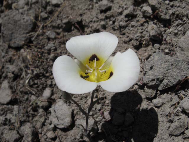
Flower
| High Sierra Flowers. White, Mariposa Lily, Smoky Mariposa, or closely related. 8320 feet, July 24 2009. |
 |
Murray Canyon along the Pacific Crest Trail
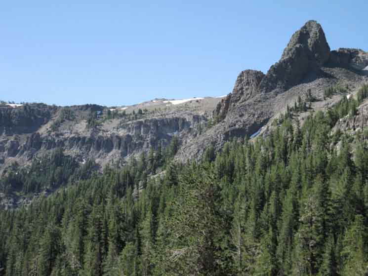
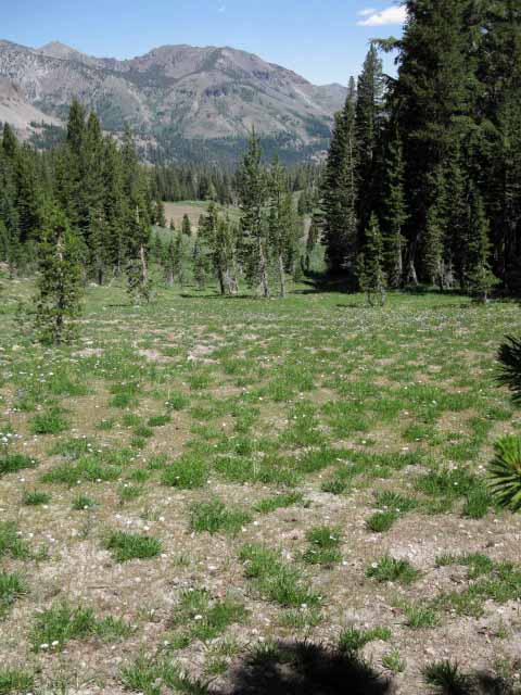
Murray Canyon Trail JunctionDown to Falls Meadow and Carson Falls Murray Canyon is a grand "hanging canyon" suspended in the Western Wall of the Sierra bounding the East Fork of the Carson River. So to is Golden Canyon, the next canyon immediately South of Murray Canyon. For the next 3.78 miles we will cross the upper reaches of these two canyons, hiking between the Northern and Southern Sharkfins. We will be passing from the Northern boundary of Murray Canyon through the Southern boundary of Golden Canyon. Shark fins of metamorphic rock mark both the Northern and Southern ends of these canyons. At any point in time that we can see either of them we can locate ourselves fairly precisely in the terrain. Though these sorts of landmark observations are helpful during Summer, they become vital during Winter travel.
The East Fork of the Carson River Trail at Falls Meadow is 2.95 miles East of the Murray Canyon trail junction. Murray Canyon is 10.87 miles South of Ebbetts Pass. Murray Canyon is 18.57 miles North of Sonora Pass. |
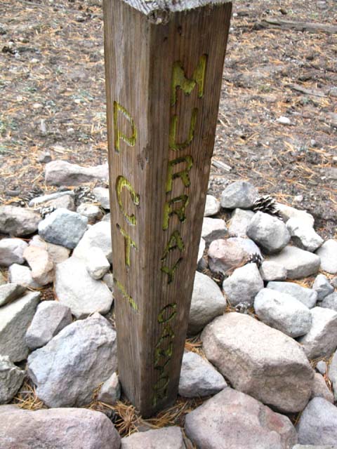
Murray Canyon Trail Junction
| Murray Canyon Trail Junction. | ||
 |
||
We are now officially in the drainage of the East Fork of the Carson River.
|
Into Murray Canyon
 |
||
South past the Murray Canyon trail junction we hike South to cross the upper end of Murray Canyon. Disaster Peak rises above the West ends of both Murray and Golden Canyons, though it is lined up behind Golden Canyon.
|
Murray Canyon Campsites1.5 miles South of Murray Canyon Trail Junction The Murray Canyon trail junction is located on the North side of Murray Canyon. There is a small feeder stream where the Pacific Crest trail crosses the center of Murray Canon that is not marked on the maps. But it is there, and there are a swath of campsites on its South side, as pictured below. The stream is captured in the video for this section, and you can see it is a trickle during late October of a very wet Summer. It will not be flowing during late August of a normal year, and it will terminate by late July during a dry year.
Murray Canyon is 12.37 miles South of Ebbetts Pass. Murray Canyon is 17.07 miles North of Sonora Pass. |
Murray Canyon Campsites
from Murray Canyon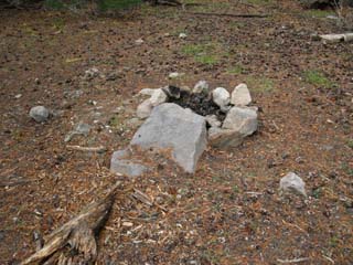
Looking North from a break in the spotty forest cover while crossing the upper reaches of Murray Canyon. We are looking back at the Northern Shark fin, Peak 9360, which marked our Southbound entrance into Murray Canyon. |
 |
Murray Canyon drains East, into the East Fork of the Carson River, to our Right. |
Peak 9360
 |
Murray Canyon trail at base of North Sharkfin. |
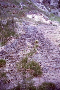
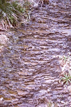
Sierra Water and Fording ConditionsThe Lay of the Land When the thaw starts running the snow line up the mountains every year we can see open trails coming soon, after the emerging trails stop flowing like creeks... Yet sometimes things happen. For the last two years (2010 and 2011) the Spring Thaw did not begin in earnest until after Summer had already technically begun. Don't plan your backpacking trips by the calendar, but by the conditions on the ground. Many times the two do not match. During these mismatched times unobservant and/or poorly prepared backpackers can suffer and even die. Spring Thaw Trail Conditions Well, during normal years the Spring Thaw fills the trails with flowing runoff, making them run as creeks towards the end of June and the beginning of July. The newly exposed soils can become so saturated that soil actually flows slowly down mountain. The example below is a uniquely terraced. Most mud flows are not terraced.
Sections of the trail will sink you in up to your ankles, if you are lucky. Spring Thaw Fording Conditions During the height of the Spring Thaw the smallest tributaries are raging and the main rivers are outright dangerous. As Spring warms into Summer the wide fan of the tributaries up into the edges of the drainage bowls start drying out, leaving only tired flows in the higher elevation main drainages. During drought years, or late during a dry Summer, even the main drainages start retreating down-mountain, leaving only a dry stream bed crossing the Pacific Crest Trail up high. Neither of these early or late conditions should be of too great concern to the mid-Summer hiker. Unless it is a very wet or a very dry year. Remember to base your trip plans on the conditions on the ground, not the date on the calendar. Observe the character of the transition of the seasons into Summer and the resulting conditions so you can understand the specific water availability, the fording conditions, and the weather and temps you will experience. |
Sierra Water and Fording Conditions
| Video: Sierra Water and Fording Conditions | ||
Video: Sierra Water and Fording Conditions. 1:45.
|
North: Ebbetts Pass to Tyron Peak South: Murray Canyon to Boulder Lake Junction
Tyron Peak |
Four Drainages During the length of this 5.97 mile trail section from Tryon Creek South to Murray Canyon we crossed between Eastern and Western flank Sierra drainages three times as we passed by four distinct river drainages. Looking North from Tyron Peak we could see Noble Creek feeding Silver Creek which flows into the East Fork of the Carson River. From the balance point between the Eastern and Western drainages of the Sierra on Tyron Peak we headed South and dropped into the Western Drainage. If you are heading North on the PCT make sure you turn around and take all of this in. Just a few short miles South on the PCT we again passed into the Eastern drainage approaching Wolf Creek, which drains East into the East Carson River, and a few miles South of Wolf Creek we enter the Eastern drainage of the East Carson River itself when we pass South of the Murray Canyon trail junction. The East Carson somewhat simplifies this complex terrain. Now we are following a single drainage laying at the bottom of the canyon to our East. The mighty gorge of the East Fork of the Carson River dominates our hike for the next 13 miles as the Pacific Crest Trail traces a serpentine route, first along the Sierra crest line far above its Western bank, until we switchback down to the base of the canyon as we approach the run up to its headwaters bowl. The East Carson River is unusual in that it flows North and South along the Sierra crest line, rather than West to East. It also defines a remarkable series of boundaries between volcanic and granite terrains. And then there are the sections of the upper river pinched between sheer granite walls of uniquely golden amber shaded granites. I'm ready to continue South into the heart of the East Fork of the Carson River, as you can plainly tell. We will see no Western drainage until we pass South out of Golden Canyon, where we get glimpses of the richly forested canyons of the Boulder Creek drainage opening up, and dropping down to the Tahoe to Yosemite Trail to our Southwest. The Boulder Creek trail will be our last chance to connect to the Tahoe to Yosemite Trail on our way South on the PCT to Sonora Pass. Maps 7.5 Map I 7.5 Map II 30 min Map Next page South |
Backpacking Trail Guide PCT to Tyron Peak |
South Wolf Creek Pass |
Backpacking Trail Guide PCT |
Backpacker ForumsHave a great Sierra Nevada trip or story to relate? A fine piece of gear? Or gear that failed?Post it on
|
North: Ebbetts Pass to Tyron Peak South: Murray Canyon to Boulder Lake Junction
Trailhead
Contact
Alex Wierbinski

Backpacking Lake Tahoe to Mount Whitney:
Your Guide to the High Sierra Crest, including the Tahoe to Yosemite, Pacific Crest, and John Muir Trails
