The Trails
Guide
Maps
Miles/Ele
Permits
Resupply
Forum
Current Weather Conditions
Weather Notes
Northern High Sierras
Central High Sierras
Southern High Sierras
Gear
Gear List
Gettin Started
Layering
Discussion
Testing yourself and your gear
Gear Reviews
Backpacking
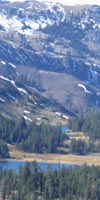
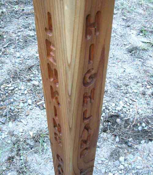
Jenkins Canyon up Highland Creek to Highland Lakes
Hiking
Up Highland Creek linking the Tahoe to Yosemite Trail to the Pacific Crest Trail
Languages
Languages
Trail Arts
The art of walking
Physical Preperation
Trail Skills
The trail
Off the trail
Scrambling
Maps
Navigation
Camp skills
Food
Resupply
Food
Other
Photo Catagories
Trail Stories
Trail Culture
News and Science
Links
Groups
Books
Terms and Conditions of Use
| Trail Guide INDEX Highway 4 to Highway 108 |
TYT South Rock Lake to Jenkins Canyon |
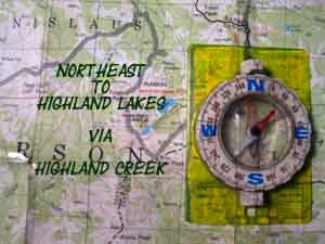
Northeast to PCT Highland Lakes to Wolf Creek Pass |
TYT to PCT |
30 min TYT Map Lake Alpine to Saint Marys Pass |
Lake Alpine to Saint Marys Pass MILES AND ELEVATIONS |
ALL TYT TOPO MAPS Lake Alpine to Saint Marys Pass |
RESUPPLY North Lake Alpine South Kennedy Meadows |
National Forest Stanislaus PERMITS |
all maps index |
Tahoe to Yosemite Trail
Route Variation or local trip option
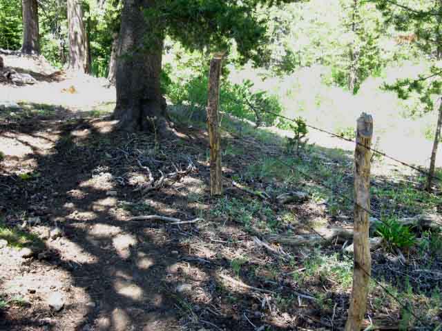
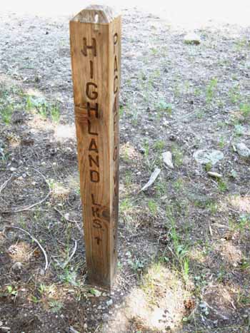
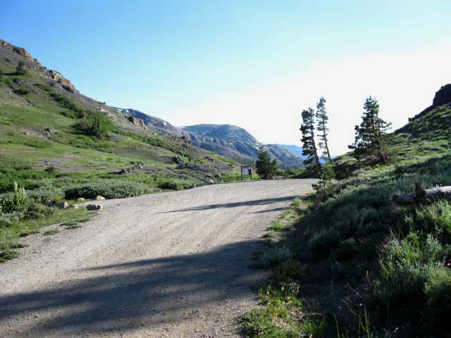
The Jenkins Canyon Trail JunctionUp Highland Creek
To the Pacific Crest Trail at Wolf Creek Pass via Gardner Meadow The Tahoe to Yosemite Trail turns Right up Jenkins Canyon here. But we are going to take a little detour and extend our TYT route with a few miles hiking on the Pacific Crest Trail. Turning up Highland Creek towards Highland Lakes to the Pacific Crest Trail at Wolf Creek Pass from our position here at the Jenkins Canyon trail junction on the Tahoe to Yosemite Trail extends our hike across the Carson Iceberg Wilderness by 8.89 miles. Hiking this variant off of the TYT route will not change where we end our hike across the Carson Iceberg Wilderness by much. The TYT Saint Marys Pass trailhead on Highway 108 is one mile West of the PCT Trailhead at Sonora Pass. Miles The mileage from where we passed through the Silver Valley Trailhead on the East side of Lake Alpine to our position here at the Jenkins Canyon trail junction is 11.38 miles. The Highland Lakes Trailhead is 6.46 miles up Highland Creek past this Jenkins Canyon trail junction, putting the distance from Silver Valley Trailhead to Highland Lakes at 17.84 miles. Another 3.72 miles of mostly downhill trail separates the Highland Lakes Trailhead from the Pacific Crest Trail at Wolf Creek Pass, via Gardner Meadow, putting the total miles from the Silver Valley Trailhead along the TYT at Lake Alpine to Wolf Creek Pass on the PCT at 21.56 miles. From Wolf Creek Pass Sonora Pass is another 22.42 miles South along the Pacific Crest Trail. Ebbetts Pass is 7.02 miles North on the PCT from Wolf Creek Pass. Maps Let's get a grip on our position on the maps. On the 7.5 maps we are at the Jenkins Canyon trail junction, faced with either heading up to Highland Lakes to hook up with the Pacific Crest Trail, or continuing South on the Tahoe to Yosemite Trail. These regional maps of the TYT and the PCT through the Carson Iceberg Wilderness show the relationship between these route options, and how hiking up Highland Creek to the PCT may tie together the best parts of the TYT and PCT through the Carson Iceberg Wilderness. Route Differences By diverting up Highland Creek we are trading the Southern 23.26 miles of the Tahoe to Yosemite Trail along the Western Flank of the Sierra from The Dardanelles to Saint Marys Pass via the Clarks Fork of the Stanislaus River for 32.15 miles hiking the PCT along the Eastern flank of the Sierra mostly hiking above or along the East Fork of the Carson River. You enter the Sierra Crest line at Wolf Creek Pass and follow it Sonora Pass on my hybrid route, while the TYT does not actually hike along the Sierra Crest line until you reach Saint Marys Pass! In terms of elevation we join the PCT route at Wolf Creek Pass at 8400 feet of elevation, and soon are hiking above 9000 feet. The TYT drops down to the 6000 foot level along the Clarks Fork Road and does not exceed 8000 feet until you near the headwaters of the Clarks Fork of the Stanislaus River. As far as social contact is concerned, the TYT drops onto 4 miles of paved Clarks Fork Road lined with a series of big car campgrounds and lots of people. The Highland Lakes option hikes by one quiet car campground along a remote dirt road. Mileage As mentioned, this TYT-PCT trail hybrid extends the length of the Tahoe to Yosemite Trail across the Carson Iceberg Wilderness by 8.89 miles. Let's compare the mileage of each route across the Carson Iceberg Wilderness: Lake Alpine to Sonora Pass, The TYT- PCT hybrid via Highland Lakes: 43.53 miles. Lake Alpine to Saint Marys Pass, The TYT: 34.64 miles. Ebbetts Pass to Sonora Pass, The PCT: 29.44 miles. I discuss my route preferences and the reasons why I switch from the TYT to the PCT and back to the TYT as I'm hiking South from Lake Tahoe to Tuolumne Meadows on the Rock Lake to Jenkins Canyon trail guide page. Below we will hike from Jenkins Canyon to Highland Lakes. |
| Comparative Information about our Carson Iceberg trail options | |
|
TYT Topo Hiking Maps |
PCT Topo Hiking Maps |
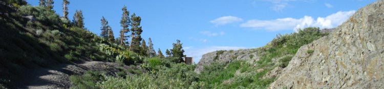
| A fine web of interrelated trails await you in the Carson-Iceberg Wilderness | |
You Are Here:
The Jenkins Canyon Trail Junction along the Tahoe to Yosemite Trail
Above: Straight through this junction leads to Highland Lake via Highland Creek and the PCT beyond. The TYT Route up Jenkins Canyon is to our Southbound Right.
Backpacker's Index
Jenkins Canyon to Highland Lakes Trailhead
|
|||||||||||||||||||||
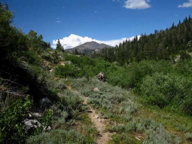
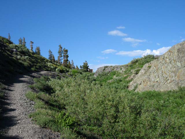
Climbing up Highland Creek past Jenkins Canyon
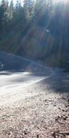
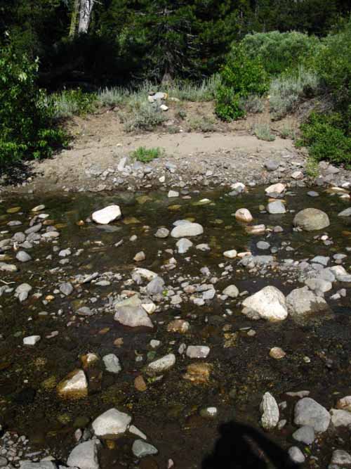
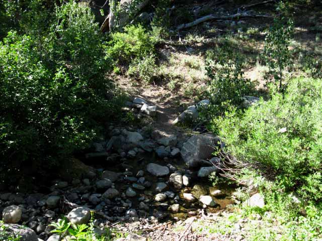
First steps up Highland Creek Hiking past the Jenkins Canyon trail junction we are first confronted by a short climb through shaded forest up and around steep channel cut by Highland Creek down mountain. At the top of this 200' climb Highland Creek turns East, the trail following it through some fine granite terrain along a fairly flat trail. The trail encounters and bends around the thinning edge of forest alongside Hiram Meadow to Hiram Cabin. Hiram Cabin is located above the meadow and out of the Spring Thaw flood zone in a glade big enough to make it unlikely the cabin will be crushed by a falling tree, but small enough you can feel the forest around you. Continuing upstream past Hiram Cabin we notice the meadow's location and shape. Hiram Meadow appears to be located in a natural flood zone below where Weiser and Highland Creeks convergence. I think it is likely this meadow is a function of Spring Thaw flooding. The Spring Thaws have also cut various deep channels through Hiram Meadow during the violence of their floods. It appears that the power of the Spring Thaw both feeds and maintains this large rough meadow, helping keep the encroaching forest at bay. The cows that graze Hiram Meadow also help keep it open. As we hike the half-mile from Hiram Cabin to the Highland Creek Ford Hiram Meadow expands to again put our trail along the edge of the thinning forest interface beside the meadow. This is a real pretty and relaxing environment, especially as the creeks are bringing down a cool flow of air from the upper canyons that breaks the grip of early Summer heat here at 7120 feet of elevation. Heat Safety is an important consideration on these lower altitude trails. Let's measure some trail distances Jenkins Canyon trail junction to Hiram Cabin: 1.28 miles. Jenkins Canyon trail junction to 1st Highland Creek Ford: 1.5 miles. Highland Lakes Trailhead from first ford: 4.96 miles |
Looking South Looking back down our climb around the steep fall of Highland Creek where it runs through a steep cut down the mountain just North of Jenkins Canyon. View down mountain towards Jenkins Canyon trail junction. |
 |
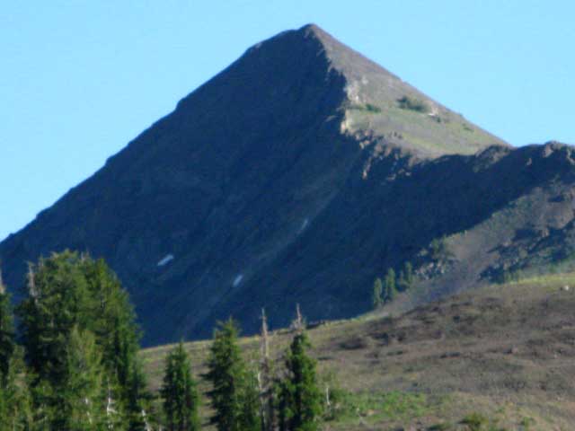
We have hiked to an elevation and slope angle where we can now see over the tree tops of the surrounding forest. Our view to the South-Southwest includes the rounded backside of Peak 7635 at center-right of the image, the Bald Peak I speak about and point out on the Rock Lake to Jenkins Canyon trail guide page. Though forested on the backside, as we can see here, the other side of Peak 7635 is quite barren. The peak poking its head over the rounded top of Peak 7635 is Peak 7871. In the background we can see the dark mass of the volcanic features of The Dardanelles, the portion of the feature marked as Peak 8948. |
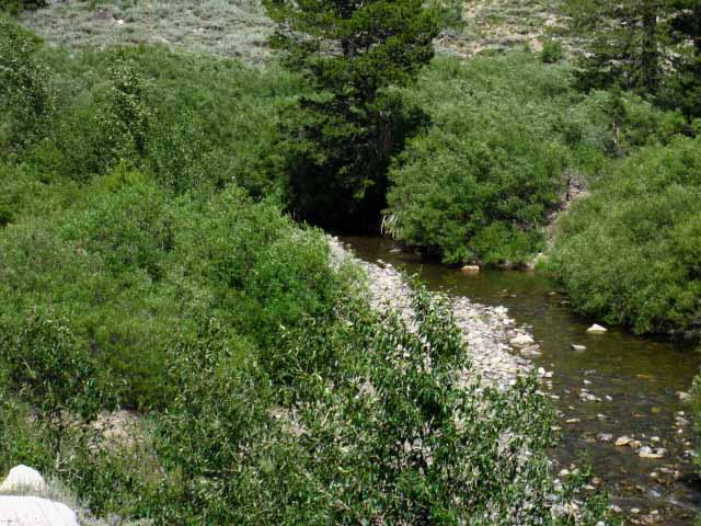
The Trail Rejoins Highland Creek
| Highland Creek and the Trail route again converge past Highland Creek's steep section. |
 |
After our brief climb around the steep cut of Highland Creek above the Jenkins Canyon trail junction the trail rejoins Highland Creek. Highland Creek and our trail turn East-Northeast into a mile-long section of almost-level gentle uphill hiking to the first Highland Creek Ford. |
| Highland Creek and Trail converge North of Jenkins Canyon. |
 |
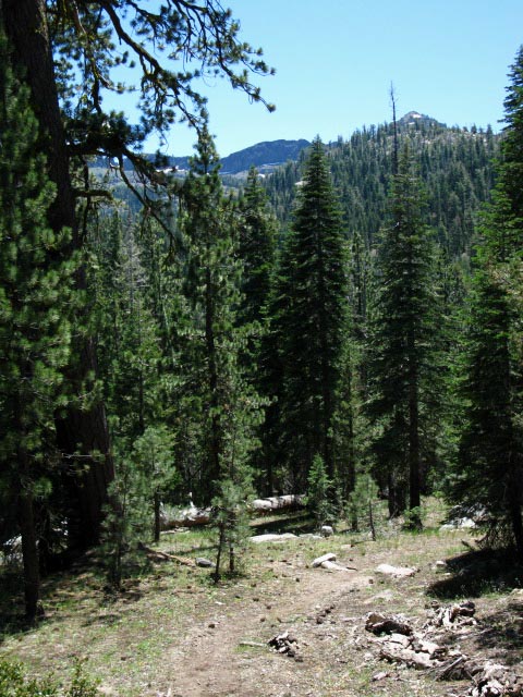
Highland Creek preserves a channel of granite terrain surrounded by great expanses of volcanic terrain. Note the dark volcanic rock on Northeastern side of The Dardanelles in the background behind the granite ridge. The overall impression we get hiking down the spine of the Northern Sierra is of a grand granite terrain that was overwhelmed and mostly submerged by a massive flood tide composed of a wide range of volcanic materials from hard lava to boiling lahars. And these mountain's valleys have been subsequently submerged by the waters nourishing the folly of men, such as in Hetch Hetch and Spicer Meadow Reservoir. To our South there is a spot along the Emigrant Trail between the High Emigrant Basin and the West Walker River where you can actually see where the furthest extent of a classic flow of ancient hard lava stopped, frozen in time, with the underlying granite terrain protruding out underneath of its volcanic cap. Above this convoluted lava cap much of the terrain is volcanic, below much is granitic. Fingers of each zone protrude into the heart of the other, as Highland Creek's granites protrude up the mountain between great volcanic peaks. Much like Winter snows do today, these ancient volcanic explosions left a volcanic "snow line" on the granite mountain flanks of the North Sierra. Our hike down the spine of the Sierra is a trip bouncing along this amazing geological interface. On the other side of the Emigrant Wilderness the Tahoe to Yosemite Trail runs exactly between the granite-volcanic interface passing through Brown Bear Pass, and this interface defines the route of Summit Creek, running between the granite white terrain along its SW shore and the volcanic red terrain of its NE bank. This kaleidoscope of intermixed terrains makes our hike through the Northern Sierra very interesting. We are currently experiencing another of these interface zones hiking up to Highland Lakes as the granite terrain is subsumed under the volcanic as we climb higher. |
Highland Creek approaching Hiram Cabin
| Almost flat trail approaching Hiram Cabin is wired on the South, blocking access to both Highland Creek and its creek side meadows hiding its meandering channel. |
 |
This section of the Carson Iceberg Wilderness, as around Noble Lake, Duck Lake, and Boulder Lake, i.e. virtually all of the Carson Iceberg, is under grazing leases. I personally know Lloyd Chichester out of the Antelope Valley, who's family has grazed the Eastern Sierra before grazing leases or even National Forests existed. The ranchers and their cowboys are generally great people who maintain important traditions for our country and culture. They have ridden and herded in the Sierra for generations. I also know we can do a much better job than we are presently doing to have both grazing and clean water in our High Sierra Lakes. |
Hiram Canyon
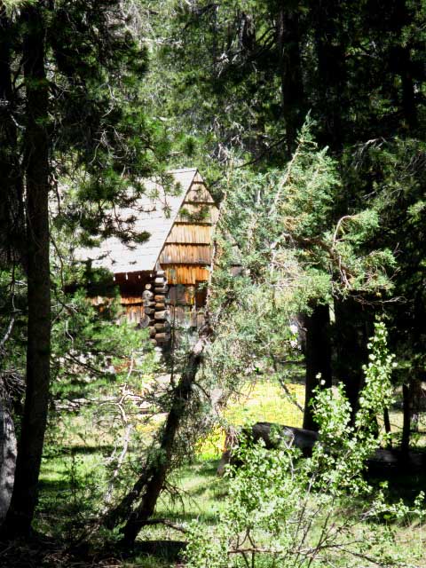
| First glimpse of Hiram Cabin through thick forests hiking North towards Highland Lakes. |
 |
About 15 years ago I was hiking towards Hiram Cabin when a line of about 14 kids came trudging towards me down this trail. They were a hoot to look at. All were dirty, bedraggled, and carrying various bits of trail crew gear. They had the look of a prison chain gang. Until I looked a bit closer. About half the kids were pumped up. They had the look of animated joy mixed with wonder that you can only get from the trail. Their eyes sparkled. Their step was animated. The other half of the kids looked like they were living in hell. Their eyes were dull and dejected. Their feet were dragging. This second group was hating every second of their existence in nature as much as the first was loving it. I recognized their colors as we approached each other on the trail: they were a California Conservation Corps crew. This encounter happened when the CCC was accepting kids as an alternative to incarceration, as well as being a jobs and nature program for youth. Back then I used to joke that the CCC stood for "California Criminal Corps."--hehe. Back then I always thought that about half the kids "got it," while the other half were just doing their time until they could run screaming out of the mountains. I stopped to talk with the CCC kids, and my first impressions were correct; about half the kids loved working in the mountains. These kids wanted to hike to Whitney with me. The other half of the kids would have rather been anywhere else in the world than the mountains. Nowadays, with the economy in a shambles, the CCC is very selective, only accepting top-flight, highly motivated kids. Back then, as today, the CCC is still the first step for kids to become professional Trail Crew. A successful season in the CCC will get you a National Forest Trail Crew position. Successful work on a NF crew will get you onto a National Park Trail Crew. Working on a NP Crew will qualify you for serious rock and explosives training, as well as Trail Crew leadership positions. Jenkins Canyon trail junction to Hiram Cabin: 1.28 miles. |
Hiram Cabin
| Hiram Cabin. As of July 2009 when this image was taken the cabin really needs a coat of oil on those dry bleached-out shingles. |
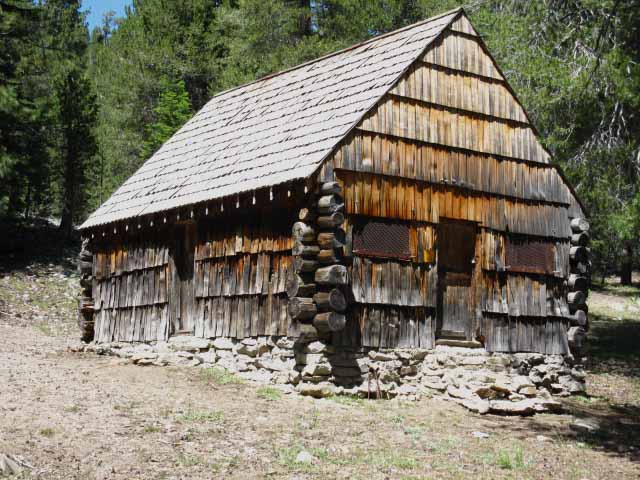 |
I've gotten one tour and a couple of looks inside Hiram Cabin over the years. Once when a science team was using the cabin, and the other time by CCC Trail Crew leaders, who were using the cabin as HQ, to store equipment and supplies for their crew. I think I've got images on film... somewhere... "Hiram L. Leavitt built a hostelry at the meadow on the route Bodie to Sonora, West Walker District." Page 34, history of Toiyabe National Forest. I wonder if this is the Hiram that Hiram Peak and the above cabin are named after. A bit of research revealed nothing but the bare quote above. I assume that this person is the Leavitt that the peak and the meadow along Highway 108 are named after. If you have information or insight, post up either in the Jenkins Canyon to Highland Lakes forum or the Sierra History and Monuments forum. |
"Chair Camp"
Chair Camp is located before the Pacific Valley trail junction and after you hike NE past Hiram Cabin. This camp is on the other side of the barbed wire fence. This camp is the best place to camp at the trail junction where Highland and Weiser Creeks intersect. You will see other campsites as you hike into the big meadow the flood zone created at the junction of Weiser and Highland Creeks here, just a short ways past Hiram Cabin, but this is the most comfortable site. |
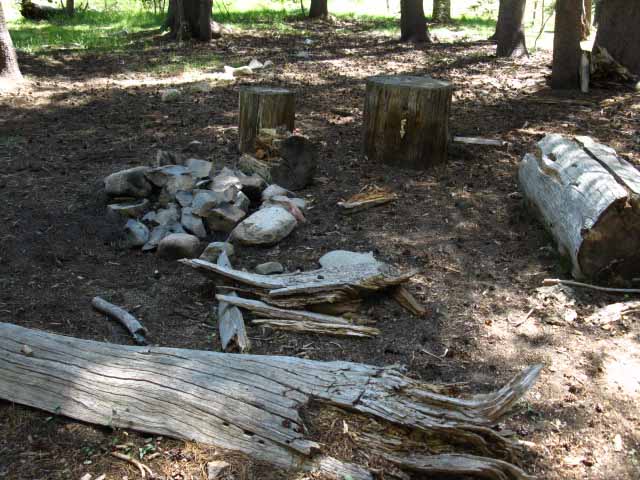 |
"Chair Camp" I call this finely developed little camp Chair Camp because it had sported a fine chair with a straight back carved out of a 3 foot long solid piece of a tree trunk. In 2009 that fine old chair had gone missing, but the camp remains. This camp looks like the base camp for the cowboys who come up every Fall to round up their grazing cattle. I've carefully climbed over the barbed wire fence a few times to enjoy the comforts of this camp. The Pacific Valley Trail and our first ford over Highland Creek are a few feet beyond Chair Camp. |
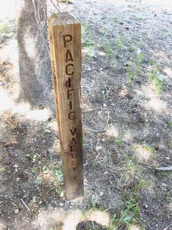
Pacific Valley-Highland Creek Trail Junction
| Pacific Valley trail junction with Highland Creek Trail. | Pacific Valley Trail up Weiser Creek. | |||||
 |
 |
|||||
| The trail to Highland Lakes fords Highland Creek a few feet past this trail junction. | This trail crosses the line of mountains on the North side of Highland Creek between Henry Peak and Peepsight Peak. This trail joins with the Paradise Valley Trail on its way to the Paradise Valley Road to Highway 4 at the head of Paradise Valley. |
Break Time at the Highland Creek Ford
Me, against my pack against the tree on the Southeast side of the Highland Creek Ford. The water was flowing to just below my knees, so I had to tie the boots to the pack. (2006?) My rolled-up ridgecrest sleeping pad instantly does double-duty as a seat pad at the base of my backpack backrest. |
 |
I call it a chair. I can make it almost anywhere. |
Up and Across Highland Creek past the Pacific Valley Trail Junction
Flow of Highland Creek on July 23rd 2009. Though running low in the image below, I've confronted the Highland Creek here during years when fording here was worrisome during exactly the same time of year. |
 |
During 2009 the Spring Thaw's charging of rivers and creeks had diminished weeks before. Conditions change radically from one year to the next, so keep track of the conditions at the end of Winter and observe the progress of the Spring Thaw so you can accurately determine and be prepared for the conditions you will encounter. Remember: The calendar and the conditions do not always match up! Use my custom Sierra Backpacker's Weather Page to check conditions on the ground and the flows in the rivers. Jenkins Canyon trail junction to 1st Highland Creek Ford: 1.5 miles. |
| Sage Meadow past lower Highland Creek ford. |
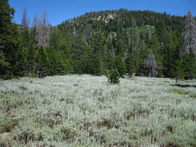 |
Highland Creek bends around the far side of the meadow as the trail moves East, away from the creek, to hike under the shadow of the ridge crest descending from the Eastern side of the canyon. |
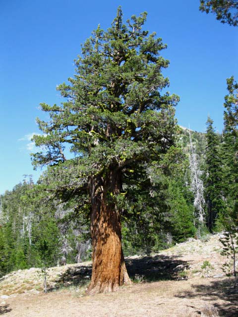
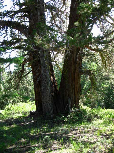
Massive Junipers
| Massive juniper trees grow along this section of the canyon. |
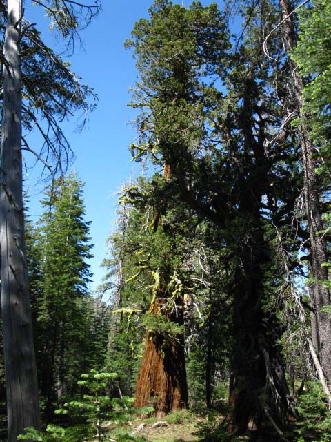 |
You will begin to notice distinctive massive trees as you gain a bit of elevation past the ford. Curious, you will approach one of these trees, and be surprised to see that it is a massive juniper. Research Information Research led me to specialized websites run by academic professionals, and an identification of these specimens by Professor Robert P. Adams of Baylor University. Professor Adams states that "...the big, beautiful juniper in your photos is now Juniperus grandis (formerly J. occidentalis var. australis). |
Resources
| More Information |
Professor Adams site Gymnosperm Database Comments-Questions? Tahoe to Whitney Living Things Forum: Juniper |
A Garden of Massive Junipers along Highland Creek
Massive juniper trunk. |
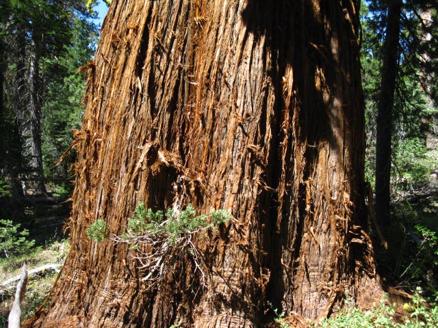 |
Juniperus grandis. The climate in the canyon along Highland Creek is apparently perfect for growing massive junipers. I am building this guide in layers of information, and I have yet to go through all my journals, but I'm pretty sure these Highland Creek junipers are the largest and biggest collection of huge juniper trees I've encountered between Tahoe and Mount Whitney.
|
| Looking up into the crown of a massive juniper tree. |
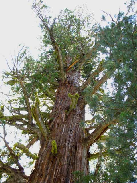 |
Just too cool. Junipers have been estimated to live up to 2000 years, and grow up to 120 feet in height. The group along Highland Creek have been growing for quite some time to reach their current massive dimensions. |
| Another massive Juniper, smaller than the one above, along the Highland Creek Trail. |
 |
| The specimens in more protected areas seemed larger than those growing on exposed areas, but the juniper above seems to be robust. |
| Granite face. Now we begin to move back towards Highland Creek. |
 |
| The Birth of Skree... |
| Granite steps, Highland Creek. |
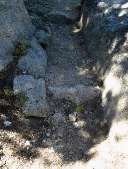 |
Great Trail Work. |
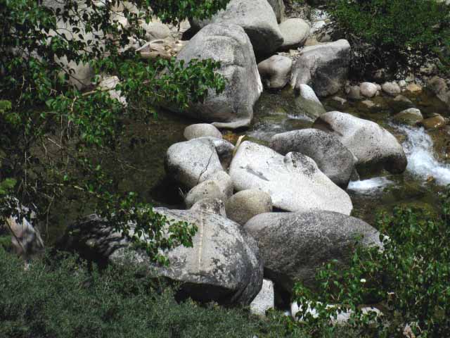
Second Highland Creek Ford
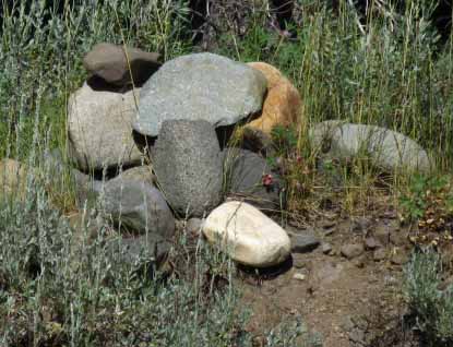
| Double Ford Spot, Highland Creek Trail, Carson Iceberg Wilderness. The map shows this location as the second Highland Creek Loop North of Hiram Cabin. When the map was made Highland Creek had not carved this loop through here, apparently. We can barely see a massive duck piled up directly ahead of us across the bow in the river and the gravel bar in-between. |
 |
The possibility to hike around the creek to our Left around this ford is well-blocked, so it is best to make the double ford here. Can you see the ducks on the high bank on the far side around the bend of Highland Creek? |
| Highland Creek Double Ford Duck, detail from image above. Because this works out to be an unusual "double-ford," trail crew, rangers, and your fellow hikers have taken the time to build a substantial duck on the far bank of the creek that we can see from our distant position. |
 |
When we get to the second ford you have to look about a bit to find the big duck piled up on the far bank that shows you the trail route on the other side, well really the same side, of Highland Creek. |
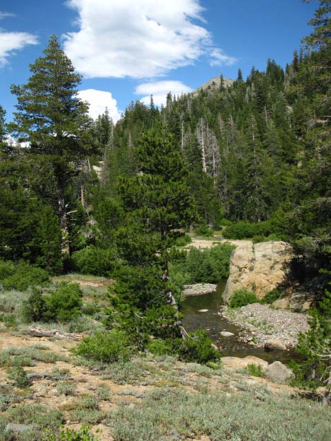
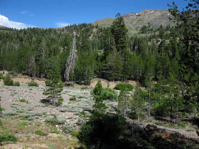
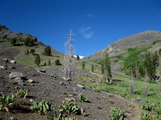
Folger Peak in the Distance
Dry section above second ford. The trail climbs above the Spring Thaw flood and Spring brush growth zones around Highland Creek, which gives us a good view of Folger Peak to our North-Northeast. Our trail turns Right to cut up the Highland Creek drainage flowing down from between Folger and Hiram Peaks. Hiram Peak sits to the Right of Folger Peak, but is hidden by the ridge arm. |
 |
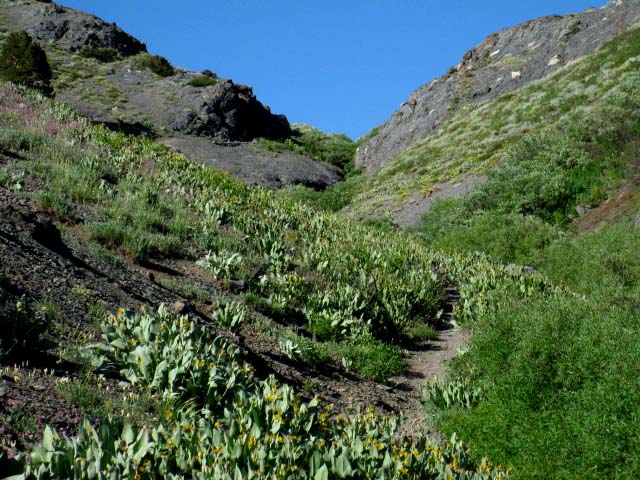
| What is really interesting is the range of terrains we are crossing... |
| Highland Creek coming out of the brush. Good trail design avoids areas that are flooded during the Spring Thaw and that sprout heavy brush during the Spring bloom. |
 |
As we hike up along Highland Creek we can hear haunting notes of distant chiming of melodious tones drifting in and out on the breeze, like ethereal wind chimes. What we are hearing are the sounds of the cowbells hanging off the necks of the cows moving about as they graze high up the steep canyons cutting deep up into the Sierra ridgeline on the Eastern side of Highland Creek's valley. I remember being initially befuddled by the faint tones dancing in and out of the extreme range of my hearing the first time I hiked through here in the early '90s. That confusion only lasted until I figured it out: It was fairies from from one of JR Tokliens Fantasy Tales having a hippy party in the moonlit high elevation meadows in this wonderland. |
Hiram Peak peeks over descending Ridge line
We see Folger marking the Northeast side of exit through Highland Creek's channel in the mountains, now we can see the tip of Hiram Peak, which makes up the Southeastern bank of Highland Creek where it drains out of the upper Highland Lake. The summit of Hiram Peak pokes over the Northeast ridge arm descending off of Airola Peak. |
 |
The hike up Highland Creek really brings us through a wonderland, a delightful place to walk through. The sounds and sights of Highland Creek flowing around granite boulders, through meadows, and into deep dark forests below rugged Sierra Ridgelines brings out parts of your mind only used in nature. And I'm not even referring to those sections of water-cut granite art Highland Creek carved above Spicer Meadow Reservoir below the Jenkins Canyon trail junction. (Video) The next time I walk through here I will take videos... ah, the modern world destroys the natural reality as it reveals it. Talk about irony. |
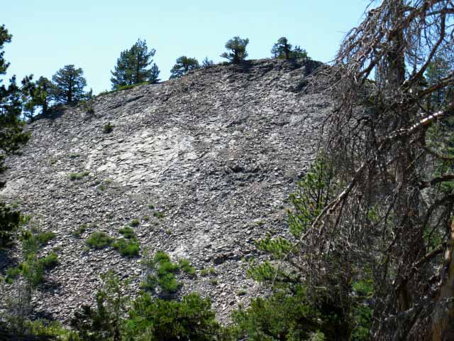
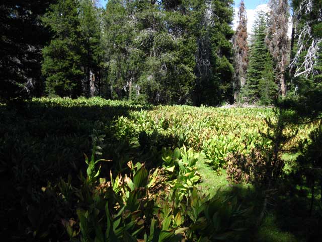
Below: Mule ears along the dark moist section of the Highland Creek Trail that is marked by a field of dots on the Dardanelles Cone USGS 7.5 topo map. Judging by this location's position below the junction of three drainages at the head of the Highland Creek Canyon, along with its visible characteristics, I figure these USGS map symbols designate the location of a regular Spring Thaw flood zone. Hiking through we can see that this area absorbs some powerfully violent energy every Spring, but that it has grown up trees and terrain around the impact zones of the thaw that allows prolific growth. The symbols on the USGS 7.5 topo map indicate "gravel," but this area is not graveled. The USGS explains their symbols policy as,
This is a wise policy, especially as terrain in areas such as this one are undergoing a rapid evolution season by season. Most terrain is moving on a number of different time frames. The trees and living thing among the trees are crafting the environment each generation. The roots of generations of trees work to lever out great granite blocks. Thousands of seeds fall to their death to create the soil the first saplings need to grow in, sacrificing themselves in their turn as the forest itself provides the soil for its relentless march up barren granite and volcanic mountains. The wind, rains, and snow are weathering the high peaks, and the runoff is powering the rivers carving the terrain between the peaks. The annual rain, snow, winds and runoff are feeding the forests and the animals, as well as driving the basic patterns of physical weathering and erosion. The rain, the runoff, and the rivers, working in conjunction with the plants and animals all work with each other to create physical circumstances where raw energy of nature passes into living energy of nature, with each force also working on completely different scales of time, though presently in chaotic conjunction. Together these forces create the fundamental reality we currently live within, and determine the nature of the reality we will live within. Our interpretations are ornamentation. Hey, you check the USGS map symbols and relate it with the terrain. |
|
 |
|
Hiking around a flood zone in the spotted area on the map that is pointed upstream, currently filled with paper plants (mule ears or whatever...) The pertinence of this channel being pointed upstream is that this area works as a surge channel when the combined flow from the convergence of creeks through here begins pushing water out of the creek's normal channels during high flow Spring Thaw incidents. That's what I figure the dotted area on the map here indicates. Trees have grown down into the rich soils trapped between the surge areas, further dampening the water flows that surge up here, while the paper plants fill the wet low areas long after the Spring surge has receded. The moisture trapped here keeps the paper plants green and growing large late into Summer. The Sierra Nevada Mountains are really very dry. During Winter they are frozen, during Spring they are flooded, and in between they are essentially dry and sun-baked, everything living off of the melting of the snow pack until the next snows come. The life in this area has worked to capture and hold moisture from the Spring Thaw deep into Summer, making it cool and marshy in here long after surrounding terrain has dried out. |
Airola Peak
| West flank of Airola Peak behind dry meadow across upper section of Highland Creek. |
 |
We are looking almost directly Southeast at the Western flank of Airola Peak. Check out this view looking almost directly South at the stair steps on the North side of Airola Peak from just below the Highland Lakes Trailhead. |
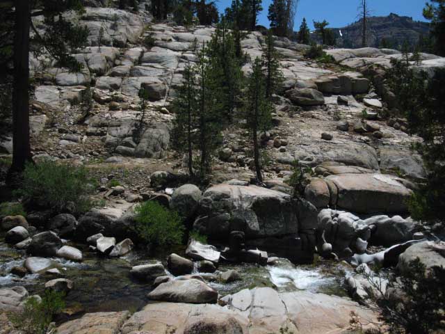
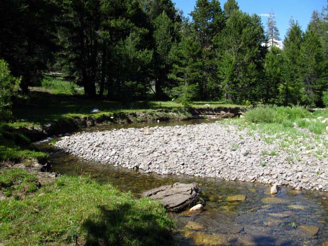
The Third Highland Creek Ford North of Hiram Canyon.
The Third Highland Creek Ford is Wide and Dry. It was dry enough that someone put up a duck halfway across the dry creek bed before I got here in late July of 2009! This is nice, as we walk up to a very wide though dry Highland Creek here, and the jumbled nature of the terrain along the far bank would have made identifying the continuing trail our first priority. But the elevated duck on the log pictured below made route-finding across this ford simple in 2009. But that will change. I call this a very temporary duck! |
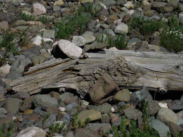 |
The next Spring Thaw washed this duck away. The duck rocks and the driftwood were swept away and this current configuration of the creek bed itself was remodeled by the next Spring Thaw. Such is life in the Sierra Nevada. You can see that this piece of wood had already been well water-treated, and it is still located high up the Highland Creek drainage. Needless to say, this piece of wood and the duck rocks stacked on top of it were long ago swept away. Such is the beauty and the power of the seasons in the Sierra. The power of the seasons in the Sierra Nevada Mountains defines the word "transitory," both through the delicate fragility of the transitory blossoming of life during the Spring Bloom, through the power of the Spring Thaw to rapidly sweep away vast stretches of mature forest and devour miles of paved roads in seconds, to the power to fuel great fires under Summer lightening. |
A Long View of the Sierra Nevada Mountains
Recent generations of humans around the Sierra Nevada have only experienced a small sliver of the range of conditions that created the Sierra Nevada we know today. Modern humans have not experienced the great volcanic, environmental, and tectonic activities that created the terrain features that characterize our Sierra Nevada Mountains today, but echoes of these times can be seen through fragments of cultural history. Muir and earlier correspondents with the Eastern Piute as well as the Spanish with the Western Indians reported that Indian language referred to the Sierra Nevada as the "Shining Mountains." This description of the Sierra does not fit the observable view of the Sierra today, thorough our very dirty air. This description of "Shining Mountains" is a better fit with the early Western descriptions of the Sierra Nevada Mountains by the Spanish, but as the Spanish name "Sierra Nevada" reflects the shape rather than the intensity of the view, I believe the indian term "Shining Mountains" refers to how the Sierra Nevada Mountain Range looked before the end of the last ice age 10 to 15 000 years ago. My readings in Sierra History indicate that the terms used by Native American tribes to describe the Sierra Nevada Mountain Range have their roots deep in the prehistoric experience of stone age people. Their names for this mountain range reflected the dominant characteristics of the mountains long after these characteristics had faded into nothing more than words. "Shining Mountains" and "Glowing Mountains" may well be the linguistic remnants of the glacial and the subsequent volcanic periods that carved the present form of the mountains that we experience today. Recent archeological scholarship is authoritatively putting the human presence in North and even South America up to 30,000 years ago, during the depths of the last Ice Age. The Sierra Nevada Mountains covered with glacial ice would have been visible shining in mid-day Summer sun for hundreds of miles. The Shining Mountains. After the initial violence of the volcanic eruptions 10,000 years ago that swept the Sierra clean of glaciers subsided, these mountains would have glowed for years. The Glowing Mountains. "Shining Mountains" described the Sierra Nevada under glaciers, "Glowing Mountains" described the Sierra Nevada capped with fresh lava. The impression of these events would have been indelibly imprinted on stone age cultures through descriptive terms, terms that outlasted memory itself. As you can see I believe that it is highly likely that people have been reflecting the Sierra Experience for quite some time, and that modern humans have not experienced huge parts of the cycles of nature that have crafted the physical environment that we live within. We forgot the rules. Though we are always walking through an Euclidean geometry of time and space, the time and space we are walking across over the Sierra Nevada is deep. The Sierra experience brings out thing from deep within our most basic talents as humans, as well as surrounding us with a history as stark as its present is beautiful. In the Sierra Nevada the rules become apparent. My rule in the mountains is to observe, analyze, and engage. This approach produces a perspective from which I can observe more, analyze more, and engage even more deeply. At best this process produces communications within myself, and between me and the environment. This state allows me to think. The essential conclusion I have drawn from this thought process is that engaging nature will fortify your inherent ability to observe and analyze clearly. This will clarify your perspective on the value and role of society, reveal the essence of the values that guide and motivate you in society as opposed to, or should I say in contrast to the forces that guide and drive you in nature. Experience in nature provides a compass point for direction in society. The thing about this trail guide is that after laying out the maps, the miles, the elevations and the pictures and videos, is that I let you into my head, into the thoughts, feelings, and impressions that direct engagement with nature provokes. The ultimate goal is to set your mind free. The feet, the legs, the lungs, and the pack they carry are all no more than our springboard, our portable beachhead into a completely different reality and experience. But without the fundamental foundations of fitness, proper gear, and good transitional experiences you will suffer, and this physical suffering will severely limit and negatively condition your ability to observe, analyze, and engage nature. We don't want that, so stay within yourself, within you skill and fitness levels, gradually building them up until you have what was so well called, "The Freedom of the Mountains." Nature built us, and submerging ourselves in Nature brings the best out of us, physically and perceptively. But modern humans have built vast human and physical structures that have separated us from nature, and from our own fundamental physical and perceptive skills. Hundreds of Millions of people have never experienced the nuances and power of life working through the physical reality outside of the brutal social materialism that defines their vast mega-cities. Their reflection of nature is, or would be unique, if they actually had a natural environment to reflect. So come on up and watch the ducks get built-up, and be washed away, every year. |
Third Ford
| The peaceful nature of this wide, dry, granite-boulder bed of Highland Creek during Summertime is deceptive. |
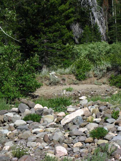 |
| The extra-wide bed of the creek reveals the intensity of the Spring Thaw. |
| Ford over Highland Creek is running in its small Summer channel. |
 |
| This ford is set up to show Spring time hikers where the ford is on the other side of a wide creek along here, just below where two other canyons contribute their flow to Highland Creek. |
Highland Creek Ducks
| Detail: Ducks on the other side of the dry ford. |
 |
The major fords and locations along the trail are marked with substantial ducks that will survive most of the conditions that Winter and Spring throw at them. |
| View Southeast from upper Highland Creek. |
 |
I took this image in 1998. I am pretty sure it's Airola Peak from the Northwest as I began the turn East up the final section of canyon towards Highland Lakes, but I'm going to have to check out the perspective to confirm the identification. This is an image looking Southeast from upper Highland Creek. The diffuse nature of the image is due to forest fires that were filling the sky with particulate matter. Fires in the Sierra fill the skies with smoke and ash that degrades photography, but is an integral part of the Sierra Experience. I once walked though a wildfire on the Western Flank of the Emigrant Wilderness between Emigrant and Pinecrest lakes. This story will be on the Grizzly Peak trail guide page. When I build it. |
Fourth Highland Creek Ford
| Last ford of Highland Creek. |
 |
| This last ford is high up the canyon below upper Highland Lake. |
| Double juniper up Highland Creek. |
 |
| Double Trouble! |
| Salt lick in a flat meadow in the last forested section below Highland Lake. |
 |
Winding up the last bit of trail in the forested section before hiking out into the exposed gorge below Highland Lakes I noted something shining in the corner of a lightly forested meadow section off to my Right, to the Southwest. So I had to hike over and see what the heck it was. The ranchers were keeping their cows salted up, as well as establishing "hang out" spots for their cows by maintaining salt licks. I figure that these salt licks will be among the first spots the cowboys start rounding up their stock in Fall. |
Out of the Forest Below Highland Lakes
| Final section of trail below Highland Lake Trailhead. |
 |
| The base of Folger Peak rises towards its summit to our Left, Hiram Peak to our Right, and Highland Lakes straight ahead between the two. |
| Final section of trail below Highland Lake Trailhead. |
 |
Verdant greens of late Spring decorating the rust colored volcanic mountains. |
Looking back to the Southeast
| Airola Peak from top of Highland Creek Trail. |
 |
| View of the Eastern flank of Airola Peak. |
Splashes of Color decorate the trail up to the Trailhead
| Lichen on lava below Highland Lake. |
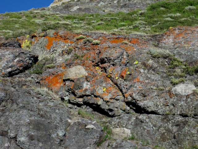 |
We can see blue sky where the trail up Highland Creek flattens out at the upper Highland Lake. |
Highland Creek from the Top
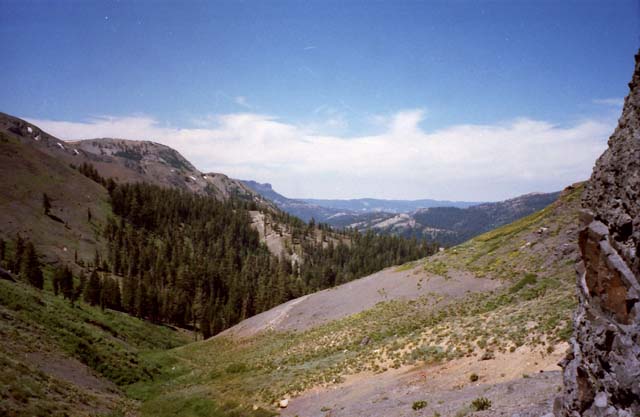
| Late afternoon shadows stretch across Highland Creek's long canyon down to Spicer Meadow Reservoir. |
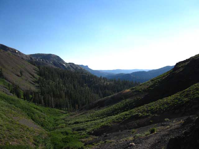 |
Peak 9366 is the high rounded mound at the middle-left edge of the image. We can see the Western ridge crest descending off of Iceberg Peak in front of Peak 9366, with the edge of Peak 8566 projecting out from behind Peak 9366. Behind Peak 9366 we can see The Dardanelles Cone projecting out of The Dardanelles at the furthest distant end of this ridge line above the Eastern shore of Highland Creek. The Dardanelles sit above the Southeastern shore of Spicer Meadow Reservoir towering over Highland Creek's inlet to the reservoir. The differences in lighting and contrast between the images above and below may help you to identify the individual features along the Eastern ridge line bounding Highland Creek's Southwestern course down to Spicer Meadow Reservoir. |
| Highland Creek Canyon in the morning. |
 |
| The two images above were taken at least 7 years apart. |
Approaching the Source of Highland Creek
| Approaching Highland Lake Trailhead. |
 |
You can see the back of the information board marking the Highland Lakes trailhead. That sign marks the end of this section of our hike, which has spanned 17.84 miles since passing through the Silver Valley Trailhead on the East side of Lake Alpine. |
| At the top of Highland Creek's Canyon. |
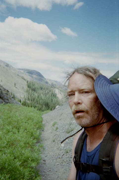 |
I am thrashed from the climb up. 1998. Up this Page: Hiking down Highland Creek towards the TYT at Jenkins Canyon. Down this Page: Hiking past Highland Lakes towards Gardner Meadow and the PCT at Wolf Creek Pass. |
Upper Highland Lake
| Upper Highland Lake from Highland Lakes Trailhead. |
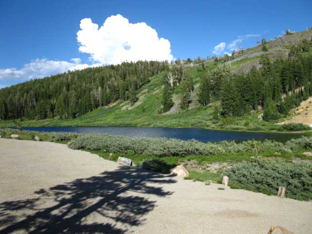 |
This upper lake which feeds Highland Creek is separated from the lower lake, which is the source of the North Fork of the Mokelumne River, by a thin neck of land running East and West. |
Highland Lakes Trailhead
| Highland Lakes Trailhead. |
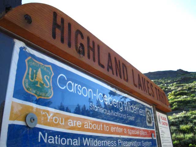 |
| You are surrounded by a special place. |
| Departing Highland Lakes Trailhead. We follow the Highland Lakes Road past the upper and lower Highland Lakes to the spur road off to the Gardner Meadow Trailhead. |
 |
I always hope to meet a person driving out just when I hit the road, to get a ride down to the Gardner Meadow Trailhead, but it never happens here. |
Highland Lakes Road
| Highland Lakes Road on Highway 4 in relation to Ebbetts Pass. | ||
| The Highland Lakes Road gives excellent access to the interior of the Carson Iceberg Wilderness. |
Planning on Hiking a "big" trail? The PCT? The TYT? The AT? In any case you should be "broken in." You should compile experience with backcountry travel, gear, weather, and above all, fitness. I repeatedly meet PCT hikers who suffer needlessly because of lousy preparation. Give yourself a break. Take an 80 mile hike or two before jumping into the deep end of the hiking world. Get to know your gear, and how to set it up in driving wind and rain. Get to know how your body responds to repeated high mileage days in hard conditions before making brave Hiking Plans for the PCT that your legs may not support...yet. Find out what you don't know through a few short trips before hitting the long trails. The information garnered on these prep trips can make the difference between a successful or an unsuccessful PCT hike. I give this warning because I repeatedly encounter PCT hikers who are completely unprepared for the conditions they encounter. It is very important that you find the flaws in your hiking plans, gear plans, or fitness before you hit the long trails... A little experience can go a real long ways... |
Guide to TYT: Rock Lake to Jenkins Canyon Guide to PCT: Highland Lakes to Wolf Creek Pass
The Tahoe to Yosemite Trail to the Pacific Crest Trail via Highland Creek |
Jenkins Canyon up Highland Creek to Wolf Creek Pass on the PCT via Gardner Meadow. Local Loops in the Carson Iceberg Wilderness This section of trail from Jenkins Canyon to Wolf Creek Pass linking the TYT and PCT opens up a wide range of loop trips around the Carson Iceberg Wilderness. Using bits of the PCT and TYT tied together by the Highland, Arnot, Disaster and Boulder Creek trails you can hike loops out of Highland Lakes from 20 to 70 miles. Highland Lakes is one of what I consider the "ring of trailheads" around this web of trails crisscrossing the center of the Carson Iceberg Wilderness. Along Highway 4 we have the Silver Valley Trailhead at Lake Alpine, Gardner Meadow and Highland Lakes Trailheads, and Ebbetts Pass as start points for big Carson Iceberg backpacking loops. On Highway 108 we have the Saint Marys and Sonora Pass Trailheads at the crest of the Sonora Road, and also have the Arnot, Disaster, and Clarks Fork Trailheads on the Clarks Ford Road off of Highway 108 about 13 miles West of the Crest. You can stage essentially the same loop trip through the Carson-Iceberg starting from any of these trailheads. The series of topo hiking maps below depicts all of these trails and trailheads at different levels of resolution from local to regional. The main trail routes on each map are highlighted with black dots, and the main trailhead and trail junctions are marked with red dots. Clicking the red dots will bring you to that location's trail guide page. The trail guide pages have the information about that location necessary for you to figure out a trip that's correct for you. Long Distance Backpackers TYT & Southbound hikers Long distance hikers on the Southbound TYT can use Highland Creek to provide an alternative route to the standard TYT route along the Clarks Fork of the Stanislaus up to Saint Marys Pass. Hiking up to the PCT via Highland Lakes for the sweet hike along the East Carson River up to Sonora Pass is an option if you've already hiked the Stanislaus on the TYT. Northbound PCT and Section Hikers The Highland Creek trail allows Northbound PCT hikers to walk into Lake Alpine to resupply, if they are so inclined. Most are not. PCT section hikers may want to take advantage of this "long-cut" to check out more of the Carson Iceberg Wilderness, walk into Lake Alpine for resupply, and to set themselves up to hike the adventurous non-maintained trail section that sits North of Lake Alpine between Lake Alpine and Carson Pass. The TYT and PCT rejoin just a bit North of Carson Pass. Each of the maps below is linked to its subsequent maps North and South so you can easily inspect and compare the PCT and TYT routes and their connecting trails, as you excitedly plan your big backpacking loop around the Carson Iceberg, if I reached my goal for this site. Remember to break in your legs, lungs, and boots before beginning any backpacking trip! Topo Hiking Maps: The Carson Iceberg Wilderness local 7.5 Hiking Topo Map 7.5 Hiking Topo Map Regional TYT 30 min Hiking Topo Map @ Jenkins Canyon PCT 30 min Hiking Topo Map @ Highland Lakes Miles Tahoe to Yosemite Trail Miles and Elevation Pacific Crest Trail Miles and Elevation Note that the miles and elevations pages cover the main PCT and TYT routes while the underlying trail guide pages provide side trail miles and elevations. |
Backpacker ForumsHave a great Sierra Nevada trip or story to relate? A fine piece of gear? Or gear that failed?Post it on: TahoetoWhitney.OrgIf you have experiences, comments, questions, or pictures and videos of the Trail between Lake Alpine and Sonora Pass, Post up here:Forum Section
|
Trailhead
Contact
Alex Wierbinski

Backpacking Lake Tahoe to Mount Whitney
Your Guide to the High Sierra Crest, including the Tahoe to Yosemite, Pacific Crest, and John Muir Trails
