The Trails
Guide
Maps
Miles/Ele
Permits
Resupply
Forum
Current Weather Conditions
Weather Notes
Northern High Sierras
Central High Sierras
Southern High Sierras
Gear
Gear List
Gettin Started
Layering
Discussion
Testing yourself and your gear
Gear Reviews
Backpacking
Highland Lakes to Wolf Creek Pass
Hiking
The Tahoe to Yosemite Trail to The Pacific Crest Trail in the Carson Iceberg Wilderness
Languages
Languages
Trail Arts
The art of walking
Physical Preperation
Trail Skills
The trail
Off the trail
Scrambling
Maps
Navigation
Camp skills
Food
Resupply
Food
Other
Photo Catagories
Trail Stories
Trail Culture
News and Science
Links
Groups
Books
Terms and Conditions of Use
| Trail Guide INDEX Highway 4 to Highway 108 |
Guide to TYT Jenkins Canyon to Highland Lakes |
Guide to PCT Wolf Creek Pass |
PCT 7.5 Topo Map Highland Lakes to Wolf Creek Pass |
30 min Topo Map Lake Alpine to Saint Marys Pass |
Lake Alpine to Saint Marys Pass MILES AND ELEVATIONS |
ALL TOPO MAPS Lake Alpine to Saint Marys Pass |
Resupply Resupply |
National Forest Stanislaus |
all maps index |
Highland Lakes
via
Gardner Meadow
to
The Pacific Crest Trail
via
Wolf Creek Pass
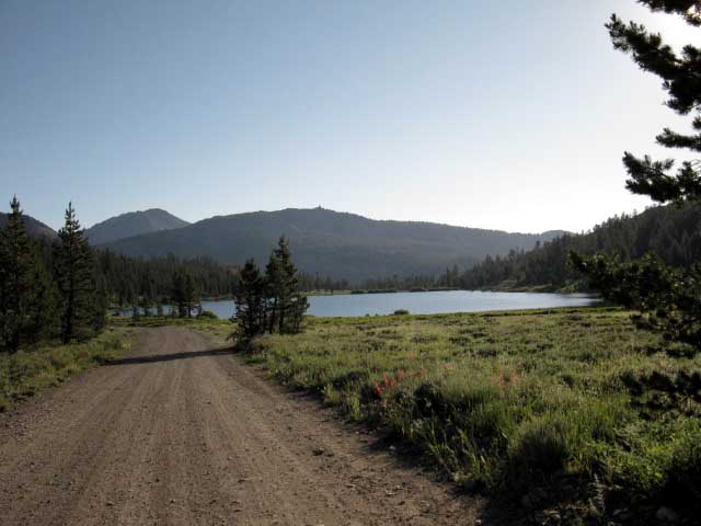
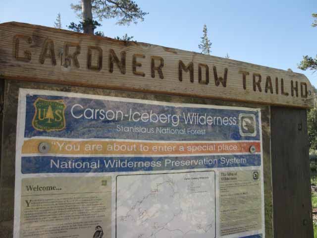
| Highland Lakes Trailhead, new Sign, '09. |
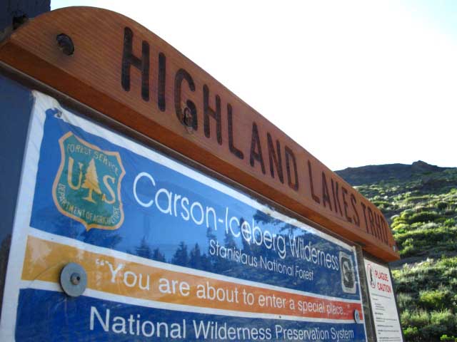 |
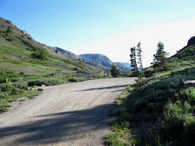
This trailhead is the end of the Highland Lakes Road. Highway 4 is seven miles to the Northwest. |
Highland Lakes TrailheadBetween Trailheads Hiking 6.46 miles up Highland Creek from the Jenkins Canyon trail junction brings us through the Highland Lakes Trailhead onto the Highland Lakes Road. Exiting the Highland Creek Trail through the Highland Lakes Trailhead we find a well-maintained dirt road leading us past the first Highland Lake feeding Highland Creek, past the campground between the lakes, around the lower Highland Lake where the North fork of the Mokelumne River originates to the short spur road off the main Highland Lakes Road to the Gardner Meadow Trailhead. We re-enter trail after our short 1.15 miles walk on Highland Lakes Road beside the lakes to the Gardner Meadow Trailhead. From Gardner Meadow it is a short hike to the Pacific Crest Trail at Wolf Creek Pass. The Gardner Meadow Trailhead is 1.09 miles from Wolf Creek Pass on the Pacific Crest Trail. The Highland Lakes Road continues Northwest past the Gardner Meadow spur road for about six miles out to Highway 4 just a bit West of Ebbetts Pass. |
Backpacker's Index
Highland Lakes Trailhead to Wolf Creek Pass via Gardner Meadow
|
|||||||||||||||||||||
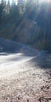
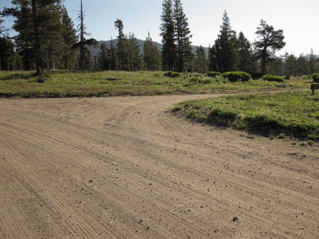
Hiking onto the Dirt Road
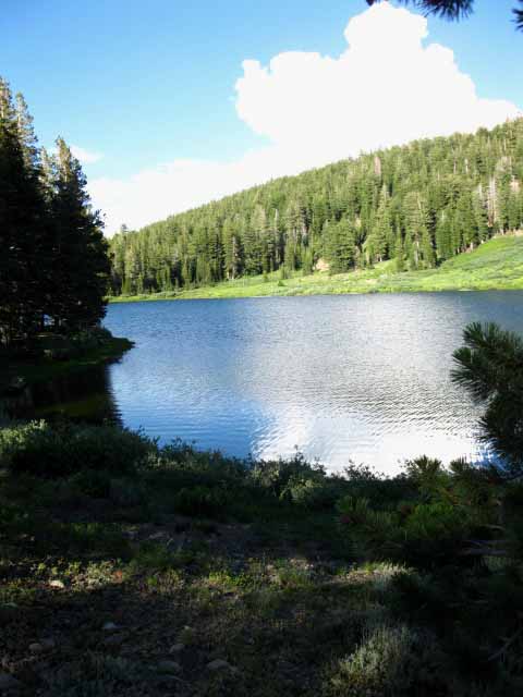
| The Southwest Highland Lake. |
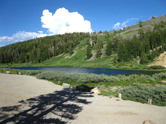 |
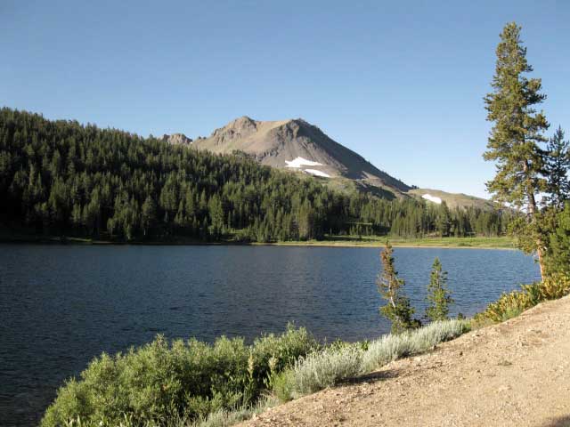
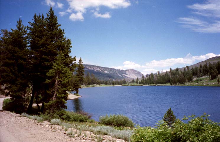
| Climbing to the top of the Highland Creek Trail we are rewarded by the relaxing beauty of the pure blue tones of Highland Lakes. |
Southwestern View
| Turning around to look Southwest at the end of the Highland Lakes Road and the Highland Lakes Trail running down Highland Creek behind the trailhead sign towards the Tahoe to Yosemite Trail at Spicer Meadow Reservoir. |
 |
Zero action at the trailhead, except me. |
Upper Highland Lake
| Hiking Northeast around the upper Highland Lake we are looking to our Northeast across the lake. Note that we are hiking around the Northwest side of both Highland Lakes. |
 |
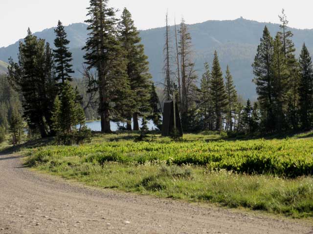
Hiking to the Northern end of this first lake past the Highland Lakes Trailhead we will see a faint vehicle track heading off the main dirt road to our Right between the lakes, across from the car campground on our Left. This dirt road leads to a few campsites under the forest between the Highland Lake. These car camping sites are located out of view to the left on the far shore of the upper Highland lake in the image above. I'm pretty sure that these sites are free, but I may be wrong. This is National Forest land, and camping is free in National Forests except where prohibited. The National Forests generally prohibit free car camping near their pay car campgrounds, so I suspect this little area is the overflow for the official car campground. |
Car Camping in the High Sierra Don't worry about free car camping at Highland Lakes. Keep your eyes open and you will see numerous free car campsites up and down the top of Highway 4 spanning from Lake Alpine to Pacific Valley, past Pacific Valley to well past Ebbetts Pass to the East. Keep your eyes open where streams and creeks cross the road, and for little dirt tracks that briefly circle off the road, as well as the National Forest's finely maintained network of dirt roads through the forests. Any or all of these terrain features may be harboring a nice little car camping site. Though you don't need a camping permit to car camp in National Forests, you do need a fire permit, even to use a camp stove in some National Forests. Though I've been to Highland Lakes around 12 times, I've never driven there, so my car camping experience at Highland Lakes is limited. I've free car camped in the National Forests along Highway 4 three or four times, always finding a nice old car camping site each time. If you have the skinny about the free car camping situation at Highland Lakes, post up your experiences and advice through either of the links below. Each aspect of this trail guide is designed to incorporate the experience of all who care to share it. Highland Lakes: Comments Car Camping Forum: Highway 4 |
Highland Lakes Campground
I always look forward to walking past the Highland Lakes car campground because of the fine folks I've met there over the years. I can recall an old couple spending a month of quiet camping there chatting me up, a fine father-son getaway camping trip who invited me into their campsite for a big steak dinner, a big family full of kids who were curious about the nuts and bolts of backpacking, and Ken. I've met many neighborly folks camping up here at Highland Lakes over the years. Stanislaus National Forest: Highland Lakes |
| Sunset at Highland Lake Campground. |
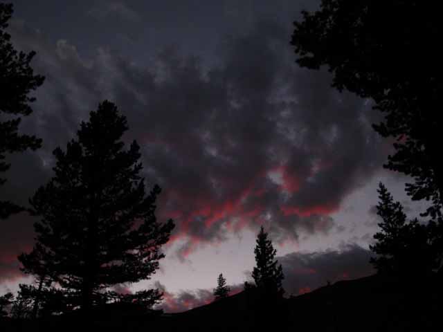 |
| Red at Night is a Backpacker's Delight. |
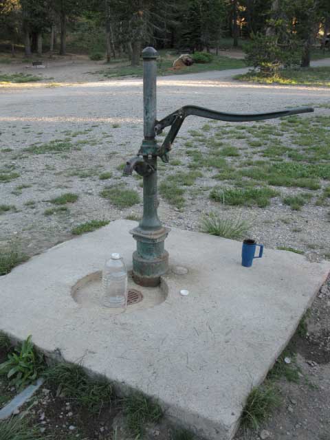
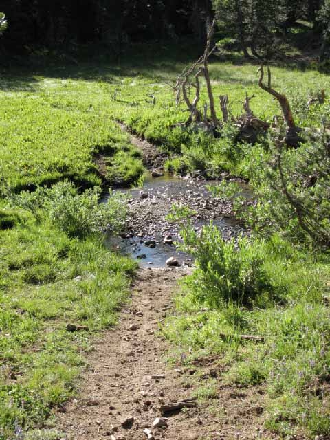
Highland Creek Water
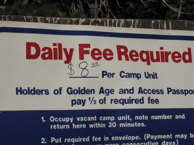
Highland Lakes Campground's Rules and Regulation
| The rules, regulations, and fees at Highland Lake Campground. |
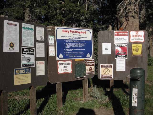 |
Driving past the lower Highland Lake you will see these boards announcing the presence of the campground behind. Stanislaus National Forest Information: Highland Lakes |
Views Northeast from Between Highland Lakes
| Walking the road just after sunrise towards Northeast Highland Lake and Gardner Meadow beyond. |
 |
Highland Peak in background Left. |
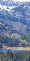
Highland LakesCar Campground, Highland Lakes and Gardner Meadow Trailheads Highland Lakes Geography Highland Lakes sit wedged between Folger Peak to their Northwest and Hiram Peak to their Southeast. Highland Creek drains Southwestward out of the upper Highland Lake. The North Fork of the Mokelumne River flows out of the lower Highland Lake, first to the Northeast, then Northwest, as it begins its great turn Southwest. The North Fork of the Mokelumne River flows Northwest along the Highland Lakes Road for a while, then turns Southwest following the great arcing channel it cut through these mountains, crossing over to the North side of Highway 4 flowing the very opposite direction it began out of lower Highland Lake. The North Fork of the Mokelumne is flowing almost directly South where it flows along the Western foot of Mount Reba where we forded it a couple of days ago at Camp Irene on our way Southbound along the Tahoe to Yosemite Trail to Lake Alpine. Now our alternative route up to the Pacific Crest Trail from the Tahoe to Yosemite Trail at Jenkins Canyon has brought us to Highland Lakes, the source of the North Mokelumne River. To the North of Highland Lakes sits the Sierra Crest, straddled by Tyron Peak and Peak 10082. To the East of Highland Lakes we approach Gardner Meadow, where the trails along Arnot and Disaster Creeks run 7.11 miles and 7.02 miles, respectively, down to the Tahoe to Yosemite Trail along the Clarks Fork of the Stanislaus River. Highland Creek Trailhead At the End of the Highland Lakes Road past both Highland Lakes Highland Lakes to Jenkins Canyon on the TYT: 6.46 miles. Highland Lakes to Silver Valley Trailhead, Lake Alpine, TYT: 17.84 miles.
The Gardner Meadow Trailhead Off the Spur road North of Highland Lakes Gardner Meadow Trailhead to Bear Tree Meadow trail junction to Tyron Peak: .27 mile. Gardner Meadow Trailhead to Arnot-Diaster Creek trail junction: 1.09 miles. Gardner Meadow Trailhead to Wolf Creek Pass on the PCT: 2.12 miles. |
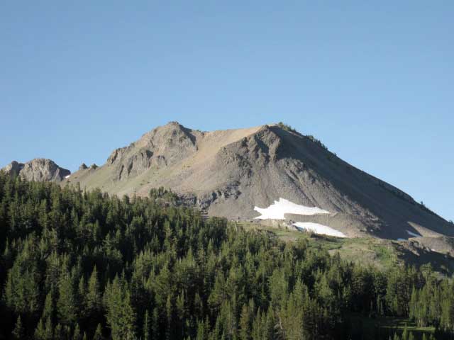
Hiram Peak
Hiram Peak
Looking Northeast towards Gardner Meadow and Wolf Creek Pass across the larger Northern Highland Lake. There are two ridgelines visible in the distance. The first is the lower ridge separating the upper reaches of Elder Creek at Wolf Creek Pass from Bull Canyon. This lower ridge is dappled with a shadow. Behind the low ridge in the foreground we can see the Eastern flank of Highland Peak behind. |
 |
This is were I watched the plane making hard and heavy turns setting up his run between mountaintops and along the river drainages to dive-bomb his load of fish into the lower Highland Lake. |
Gardner Meadow Turnoff
| Walking up to the turnoff to Gardner Meadow from Highland Lakes. |
 |
The Gardner Meadow Trailhead is down this very short spur road on the North side of Highland Lakes. |
Gardner Meadow Trailhead Road Sign
| Gardner Meadow trailhead road sign. |
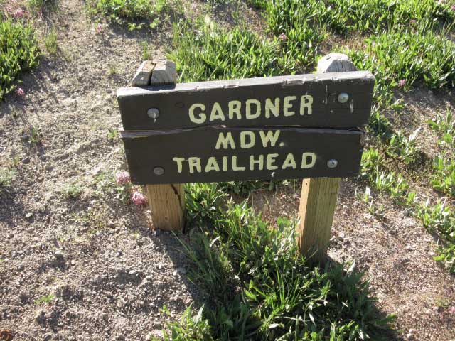 |
| Walking everywhere makes it easy for me to take pictures of the roadside attractions... |
Gardner Meadow Trailhead Parking
| Gardner Meadow trailhead parking. |
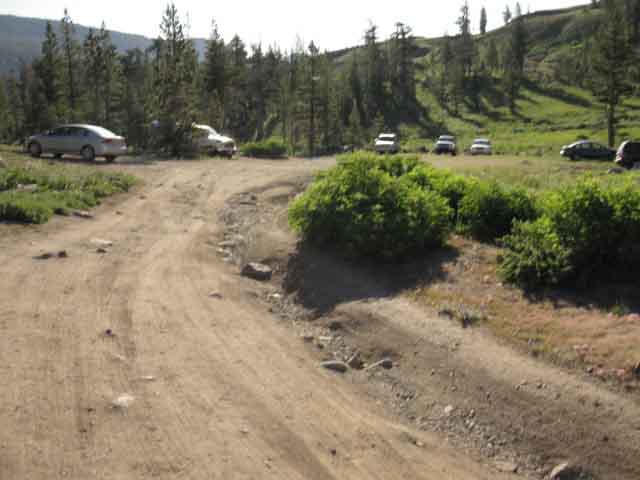 |
This trailhead gives easy access to the Pacific Crest Trail, as well as the top ends of the Arnot and Disaster Creek Trails down to the Clarks Fork. |
Road Map
| Highland Lakes Access from Highway 4. |
Zoom out to see other backpacker resources along Highway 4. |
Gardner Meadow Trailhead
| Gardner Meadow Trailhead. |
 |
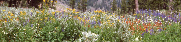
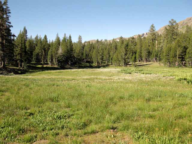
Gardner Meadow is known for effusive blooming during Spring and early Summer. |
The Gardner Meadow Trailhead Off the Spur road North of Highland Lakes Gardner Meadow Trailhead to Bear Tree Meadow trail junction to Tyron Peak: .27 mile. Gardner Meadow Trailhead to Arnot-Diaster Creek trail junction: 1.09 miles. Gardner Meadow Trailhead to Wolf Creek Pass on the PCT: 2.12 miles. |
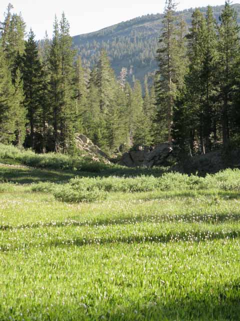
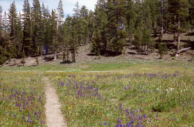
| Gardner Meadow Lupines fill sections of the trail leading to Gardner meadow. |
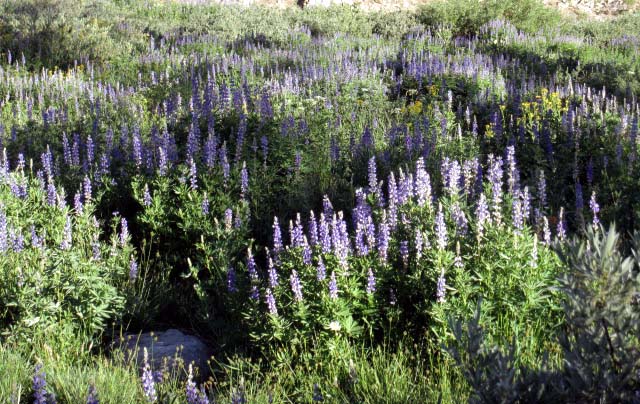 |
| This is a very lush area during Spring deep into Summertime. |
| Gardner Meadow Lupines. |
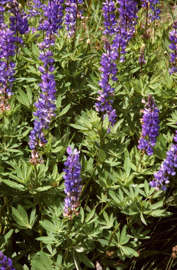 |
The colors here during the Spring bloom are breathtaking. |
View Northeast down to and across the North Fork of the Mokelumne
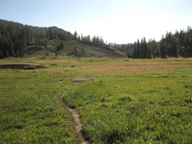
Hiking East through the Gardner Meadow Trailhead brings you through a zone of fragrant bloom that smells as pretty as it looks. I took the image below because the colors and smells of the bloom were overwhelming. This image also takes in a section of the Sierra Crest Line itself where the Pacific Crest Trail is coming South to meet us at Wolf Creek Pass. The ridge in the middle distance is the Sierra Crest dividing the East and West drainages off the Sierra Crest. We can see Highland Peak peeking over from the East side of the Sierra Crest. On the Left side of Highland Peak Silver Creek flows East, and on Highland Peak's Right, Wolf Creek. On this side of the Sierra Crest Line we can see the Western-draining North Fork of the Mokelumne River at the base of the valley below, beyond the blooming flowers. Hiking East we are approaching the Sierra Crest Line and the Pacific Crest Trail at Wolf Creek Pass. |
 |
The North Fork of the Mokelumne River runs below us through the foreground valley, Peak 10082 is the top of the Sierra Crest Line ridge running across the middle foreground of the image above, with Highland Peak sitting on the Eastern flank of the Sierra beyond. Tyron Peak, where the PCT crosses over the ridge in the middle foreground, is out of view to the Left along the ridge in the middle foreground. The PCT route between Tyron Peak and Asa Lake runs across the lightly forested area below the top of the Sierra Crest Line ridge in the middle foreground. |
Flowers Above, Flowers Below, Flowers all around Gardner Meadow
| Gardner Meadow Flower, Fuchsia? |
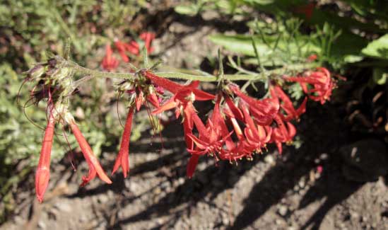 |
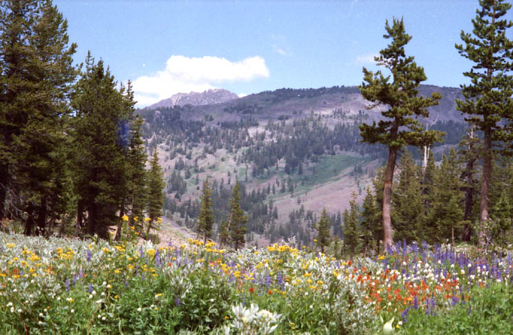
| High Sierra Wildflowers. |
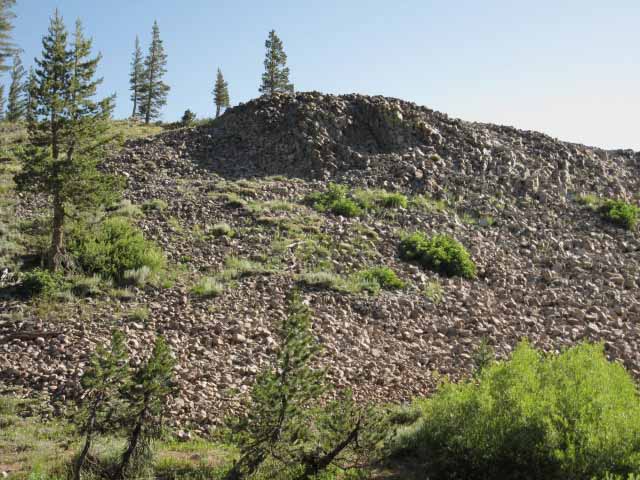
| Around North side of Hiram Peak. |
 |
The trail makes its way around rocky volcanic terrain tumbling off the North side of Hiram Peak. The silhouetted jagged crest line in the background is the West side of Arnot Peak and its ridgecrest. Between our position here at the foot of the North side of Hiram Peak and Arnot Peak sits Upper Gardner Meadow and Half Moon Lake. Half Moon Lake is the source of Arnot and Disaster Creeks, both of which have trails that follow these creeks down to both the Tahoe to Yosemite Trail and the Clarks Fork of the Stanislaus River. Note the sharktooth structure sticking up along the Left side of the Arnot Peak Massif. |
| Peak 9578 on the Sierra Crest line East of Tyron Peak and Peak 10082. Bull Canyon. |
 |
Elder Creek starts in the valley to the right of Peak 9578. |
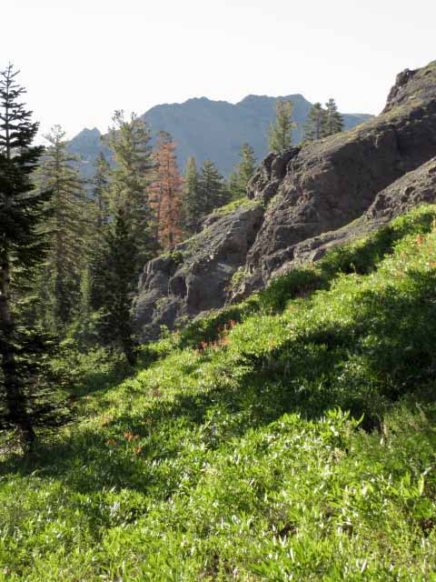
Carson Iceberg Wilderness
| Wilderness Boundary. |
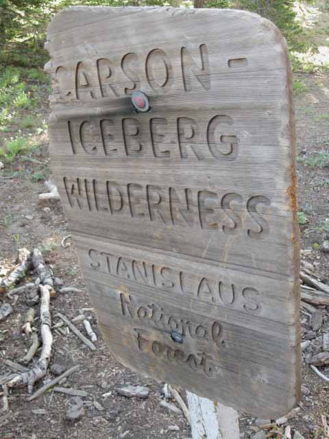 |
Just past the Arnot Disaster Creeks trail junction we re-enter the Carson Iceberg Wilderness. |
Alternative Route Options and Local Loops
The Northern Arnot and Disaster Creek Trail Junction
The Arnot and Disaster Creek trail junction is a "Twofer." A short ways South down this trail the Arnot and Disaster Creek trails split at Upper Gardner Meadow to follow their parallel drainage valleys down to the Clarks Fork of the Stanislaus River where both trails intersect with the Tahoe to Yosemite Trail route. We can see from the map that the Arnot and Disaster Creek Trails really open up our backpacking loop options between the Gardner Meadow Trailhead at Highland Lakes and the Arnot and Disaster Creek Trailheads along the Clarks Fork Road. Looking closely at the map we can see that just a bit further South along the Pacific Crest Trail that the Disaster Creek trail links up to the PCT at Golden Canyon, and even further South down the PCT that the Boulder Lake Trail directly links the PCT to the TYT just South of the end of the Clarks Fork Road. These four connector trails between the Tahoe to Yosemite and Pacific Crest Trail give you a lot of interesting loop options from both the Gardner Meadow and Highland Lakes Trailheads as well as the trailheads along the Clarks Fork of the Stanislaus River.
|
| The North end of the Arnot and Disaster Creek Trails. |
 |
From this junction it is 7.96 miles South along Arnot Creek to the Arnot Creek Trailhead. From this junction it is 7.02 miles South along Disaster Creek to the Disaster Creek Trailhead. Both the Arnot and Disaster Creek Trailheads are located on the Clarks Fork Road. |
View South
| Looking Northwest towards North Mokelumne River. |
 |
v |
Lower Gardner Meadow
| Metamorphic rock on the Northeast side of Gardner Meadow. |
 |
| Closer inspection indicates it is metamorphic, rather than granite or volcanic. Nifty. |
| Approaching the Pacific Crest Trail through Lower Gardner Meadow. |
 |
v |
Wolf Creek Pass
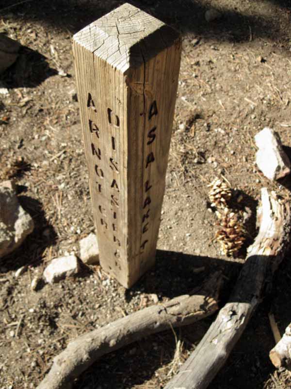
| Wolf Creek Pass on the Pacific Crest Trail. |
 |
| Asa Lake is North of Wolf Creek Pass. |
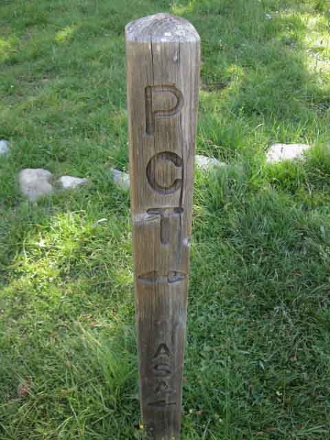
Wolf Creek Pass on the Pacific Crest Trail Pacific Crest Trail Guide Location
Pacific Crest Trail Guide Page
Hike North on the Pacific Crest Trail Hike South on the Pacific Crest Trail Nearby Access PCT |
| To the TYT Jenkins Canyon to Highland Lake |
Backpacking Trail Guide Southwest to the TYT via Gardner Meadow and Highland Lake: Up This Page Southwest to the TYT: |
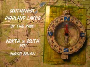 |
Backpacking Trail Guide PCT North PCT South |
North PCT: Tyron Peak to Murray Canyon South PCT: Murray Canyon to Boulder Lake junction
Highland Lakes |
Lake Alpine to Saint Marys Pass H THIS PAGE IS UNDER CONSTRUCTION: STAY TUNED FOR MUCH MORE! COME ON BACK NOW, 'YA HEAR? Maps 7.5 min Topo Hiking Map 30 min Topo Hiking Map Trail Guide South PCT North PCT Highland Creek to |
Backpacker ForumsHave a great Sierra Nevada trip or story to relate? A fine piece of gear? Or gear that failed?Post it on
|
North PCT: Tyron Peak to Murray Canyon South PCT: Murray Canyon to Boulder Lake junction
Trailhead
Contact
Alex Wierbinski

Backpacking Lake Tahoe to Mount Whitney
Your Guide to the High Sierra Crest, including the Tahoe to Yosemite, Pacific Crest, and John Muir Trails
