|
Last Years
2016
2018
2017
High Sierra
Backpacking Calendar
January February March April May June July August September October November December
The Calendar
of
Record
This calendar is designed for the four-season backpacker. This calendar anticipates important dates in the Sierra Nevada, from the beginning of Winter expectations of decreasing temps and increasing rains evolving into the fierce storms and hopefully deep snowpacks of Winter. Our calendar tracks the backpackers's year through the Spring Thaw into fine Summer conditions.
That's what this calendar is about.
We look for the dates when changing conditions determine the density of our gear must increase from Summer into Fall, and finally Winter thickness gives way through the rising temps of Spring to the date we can finally strip down to the Gear of Summer.
The points we transition to Fall and into Winter gear has been pushing later into each year just as Spring has started earlier and earlier over the past few decades.
The end result is that Winter has radically shortened.
This changes the dates when our trails and resupply spots open up, and when we can begin our long treks down the Sierra Crestline. It affects when we plan, pack, and send our resupply packages.
These changes up the odds for PCT hikers to finish in one longer and lengthening season.
But these changes also up the odds for backpackers to get "caught-out" by unexpected "early" or "late" season" storms that in earlier times would have been called, "normal."
Thus these calendars track the difference between "classic" Sierra seasonal conditions and the current conditions on the ground over as many years as I can watch the fun.
We will warn of the power of Nature as it's so beautifully expressed through Sierra Winters, while taking note of both its failures to produce expected precipitation, and the inevitable surprises such a complex system delivers.
We focus all this information understanding how each year's specific character affects the openings and closing dates of the Sierra for PCT hikers, and everyone else.
2014 Calendar 2015 Calendar
2016 Calendar
2018 Calendar
JANUARY 2018
If you have any interesting information, observations, or dates of note that should be on the calendar, let me know, and if they are pertinent to backpackers they go up.
Hiker1@TahoetoWhitney.com
Download
FONT |
Last Year
January 2017
North Desolation Wilderness
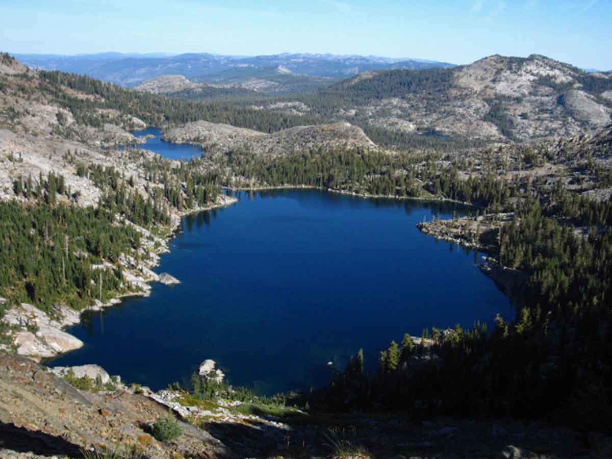 View North across Dicks and Fontanillis Lakes. Phipps Peak and Pass are the prominent peak in the middle-Right background. Note Middle Velma Lake nestled in below Phipps Peak. Our route from Meeks Bay on the West Shore of Lake Tahoe crossed Phipps Peak to join the Pacific Crest Trail in the Desolation Wilderness just a bit North of Middle Velma Lake.
Trail Guide Map Miles and Elevations
January 2017
| Sunday |
Monday |
Tuesday |
Wednesday |
Thursday |
Friday |
Saturday |
FULL WINTER CONDITIONS
2017: COLD
The Fall Gear has been stowed or complimented by the heavy Gear of Winter.
What's Going On?
See December of 2016 Reports
All
High Sierra Weather Info
Latest Daily Snow Depth Summary
Daily Sierra Snowpack % of Normal pdf
Daily Snow-Water & Percent of Average
All Precipitation-Snow Data
All Snow Surveys
SWC & Snow Depth
Yosemite-Hoover-Desolation
&
John Muir Trail Hikers:
Time to
Order Next Year's Permits!
Reserved permits for June 2017 now available from Yosemite, Hoover, and Desolation Wilderness Areas. In other words, Yosemite, Desolation, and Hoover Wilderness Areas all offer advanced reservations about six months ahead of your desired hiking dates.
This means now is the time to get your JMT permit application, along with other popular hikes, into the Man.
All Permits
Yosemite Permits Desolation Wilderness |
27
2016
Clear and Cold
Big Highs
The 26th:
Snow Depth,
24 hour high & low temps.
FULL COLD WEATHER GEAR
Carson Pass 26"
21 & -3
Ebbetts Pass 36"
24 & 4
Deadman Creek BAD
35
& -4
Leavitt Lake 72"
23 & 2
Tuolumne Meadows .48"
(depth suspect)
36 & -8
Tioga Pass/Dana 48"
(Temps BAD-Snow Suspect)
Gem Pass 54.3"
40 & 7
Mammoth Pass 62.2"
40 & 9
South Lake Cabin 6.39" H2O
43 & 2
Big Pine Sawmill 13.6"
33 & 0
Bishop Pass BAD
BAD
Charlotte Lake TEMPS
33 & -2
Upr Tyndall Creek 31.88"
30 & 14
Not much of a Winter Snowpack (sad), but hey, at least we have one!
ALL REPORTING STATIONS
All Snow and Rain Precipitation Forecasts,
&
Snow Depth and/or
Inches of Water |
28
2016
Clear and Cold
Big Highs |
29
2016
Clear and Cold
Big Gulf Alaska High, almost vast, with weak low moving EAST along its bottom edge...
Just what forces are "directing" our Winter this year, and during these "times?"
The Arctic no longer chills down to its typical low temps.
These higher Arctic temps radically change the path and behavior of the North Jet Stream.
Northern Jet Stream alterations
radically changes the weather all the way down through the mid-latitudes, where extra heat moving North from the Equator pushes change from the South.
The changes in the North Jet Stream have altered the patterning and positioning of typical seasonal High and Low patterns in the NE Pacific, and how they disperse temps & moisture to create storms, let alone where they push and pull these storms.
All the inputs have changed, as have outcomes.
I can't begin to tell you how serious these changes are, especially when vast populations are dependent on the OLD weather pattern filling global mountain ranges with snow for year-long drinking and growing...
Our fundamental planetary weather security is seriously compromised. We seem unaware or uncaring about allowing greed & corruption to steal and devour the last bits of our Natural "prosperity," which is undermining our most fundamental security. |
30
2016
Haze and Cold
|
31
2016
Overcast and warming, but still Cold
TOP
|
1
2017
Overcast and Warmer, with still Cold-sprinkles
New Year's Day
Permits
Permits for JUNE 18 2017 available from Yosemite TODAY.
Yosemite Permits
Desolation Wilderness
Hoover Wilderness
Snow Depth,
24 hour high & low temps.
Carson Pass 24"
31 & 19
Ebbetts Pass 37"
32 & 19
Deadman Creek BAD
33
& 9
Leavitt Lake 68"
32 & 19
Tuolumne Meadows .5"
(depth suspect)
40 & 0
Tioga Pass/Dana 44.2"
(Temps BAD-Snow Suspect)
Gem Pass 49.8"
36 & 17
Mammoth Pass 56.3"
38 & 17
South Lake Cabin 6.41" H2O
25 & 15
Big Pine Sawmill 12.3"
31 & 9
Bishop Pass BAD
BAD
Charlotte Lake TEMPS
17 & 4
Upr Tyndall Creek 28.37"
24 & 13
ALL REPORTING STATIONS
Backpackers
Full Winter Gear and precautions
REQUIRED |
2
2017
Heavy Clouds and Cool, light precip
Vast NE Pac High
in
Gulf Alaska
These Lows, this set of weak Low pressure zones bringing today's increasing precip are rotating counter-clockwise around the bottom of a Big High in Gulf Alaska!
This series of weak tropical Lows comes out of the Southwest along a most unique storm track. As I mentioned, the lows are bending SW then NE around the bottom of this vast High. beginning from North of the Hawaiian Islands...
This year has brought its precip almost exclusively from the Southwest.
First, by the great persisting Low in the Gulf Alaska which lasted through most of December.
Currently, by a set of weak lows on a downright strange storm track around the bottom of a vast Gulf Alaska High. Strange, at least for Winter storms. Winter storms typically go around the top of this High, which is normally positioned much lower this time of year...
Normal? Normally? Do those words "work" anymore?
These addresses always shows the current:
North Pacific
Surface Map
The day you click it is the day you see...
North Pacific
14 Day
Surface Map
Tahoe to Whitney Weather |
3
2017
Stormy and Cool, but still Cold-regular precip, light intensity strengthening to moderate into late PM
Snow Depth,
24 hour high & low temps.
Carson Pass BAD"
(7.7" H2O)
20 & 15
Ebbetts Pass 43"
19 & 14
Deadman Creek BAD
25
& 13
Leavitt Lake 83"
16 & 13
Tuolumne Meadows .53"
(depth suspect)
25 & 4
Tioga Pass/Dana 44.1"
(Temps BAD-Snow Suspect)
Gem Pass 49.1"
21 & 8
Mammoth Pass 53.3"
23 & 11
South Lake Cabin 6.42" H2O
25 & 15
Big Pine Sawmill 14.8"
23 & 13
Bishop Pass BAD
BAD
Charlotte Lake TEMPS
17 & 4
Upr Tyndall Creek 29.44"
23 & 9
ALL REPORTING STATIONS
All Snow and Rain Precipitation Forecasts,
&
Snow Depth and/or
Inches of Water |
4
2017
Stormy and Cool, but still Cold-regular precip, light to moderate intensity
|
5
2017
Clear and Cold
Huge tropical flow lining up from the Southwest, heavy precip expected from tomorrow night through next Friday:
7 Day Precip Forecast
Snow Depth,
24 hour high & low temps.
Carson Pass BAD"
(11.7" H2O)
33 & 29
Ebbetts Pass 61"
32 & 28
Deadman Creek BAD
29
& 21
Leavitt Lake 97"
31 & 26
Tuolumne Meadows .80"
(depth suspect)
29 & 27
Tioga Pass/Dana 71.2"
(Temps BAD-Snow Suspect)
Gem Pass 75.2"
26 & 21
Mammoth Pass 90.6"
(depth suspect)
30 & 27
South Lake Cabin 7.36" H2O
25 & 15
Big Pine Sawmill 43.2"
26 & 21
Bishop Pass BAD
BAD
Charlotte Lake TEMPS
15 & 20
Upr Tyndall Creek 55.74"
25 & 19
ALL REPORTING STATIONS
All Snow and Rain Precipitation Forecasts,
&
Snow Depth and/or
Inches of Water
NOTE
La Nina still puttering along...
|
6
2017
Storm Time
Tropical Pounding
RAIN ACROSS SIERRA CREST
Huge tropical flow transporting vast amount of warm moisture from the Southwest, heavy precip.
Raining Across the Sierra Crest
??
Late Report Posting:
Family Emergency |
7
2017
Storm Time
Tropical Pounding
Rain on the Sierra Crest.
Ground Saturating, All Rivers Rising.
TOP
|
8
2017
Storm Time
Snow Depth,
24 hour high & low temps.
Carson Pass 52"
(28.0" H2O)
36 & 25
Ebbetts Pass 66"
35 & 25
Deadman Creek 18.72 H20
34
& 21
Leavitt Lake 38" H20
35 & 24
Tuolumne Meadows 1.05"
(depth suspect)
43 & -3
Tioga Pass/Dana 81.9"
(Temps BAD-Snow Suspect)
Gem Pass 95.0 "
30 & 18
Mammoth Pass 109.7"
33 & 23
South Lake Cabin 8.47" H2O
33 & 21
Big Pine Sawmill 58.5"
31 & 18
Bishop Pass BAD
BAD
Charlotte Lake TEMPS
25 & 13
Upr Tyndall Creek 76."
31 & 29
ALL REPORTING STATIONS
All Snow and Rain Precipitation Forecasts,
&
Snow Depth and/or
Inches of Water
|
9
2017
Tropical Pounding
Cooling
Significantly
We are hoping rain on the Crest turns to Snow.
This cooling is dependent on the frontline shifting from coming out of the Southwest to Westerlies, to the front line shifting to coming out of dead West.
That shift will significantly cool the air behind the frontline from tropical to North Pacific Cold.
The change of temps across this Westerly frontline transforms tropical moisture ahead of the line into wet snow when it hits the cold air behind the frontline. Violently, typically.
Ice storm material for the Midwest...
Historic storm tracks draw frontlines with arctic air behind them, with low pressure zones riding a North Jet Stream from the Aleutians to Seattle.
Hitting the first line of the Cascades-Sierra drains much of the moisture out this historic storm track, which then deposits much of its remaining moisture onto the Rockies as ultralight crystal snow, the finest of powders.
That's the typical "Sierra Cement - Rocky Crystal" mechanism that is now borked...
Ice Storms for the midwest!
Track these motions on the Pacific Surface Map
on the
TW Weather Page.
|
10
2017
Tropical Pounding
Wind & Cooling
Serious snow accumulation...
Compare the 30 Day snow accumulation data against rising and falling temps at the NRCS Snowtel Site:
Snowtel Reports
Especially see the
"30-Day Daily Tables"
for each reporting station.
Warms tropical rain scours the crest of snow, but this moisture-rich air fills the Sierra with incredible amounts of snow when temps drop.
|
11
2017
Tropical Pounding
Storm Time
Serious snow accumulation...
Snow Depth,
24 hour high & low temps.
Carson Pass 86"
(29.2" H2O)
32 & 26
Ebbetts Pass 95"
31 & 25
Deadman Creek 21.48 H20
22
& 28
Leavitt Lake 37" H20
29 & 22
Tuolumne Meadows 1.52"
(depth suspect)
28 & 19
Tioga Pass/Dana 117.9"
(Temps BAD-Snow Suspect)
Gem Pass 120.2"
24 & 14
Mammoth Pass 135.1"
28 & 19
South Lake Cabin 8.73" H2O
26 & 17
Big Pine Sawmill 68.3"
25 & 16
Bishop Pass BAD
BAD
Charlotte Lake TEMPS
18 & 11
Upr Tyndall Creek 86.53"
22 & 13
ALL REPORTING STATIONS
All Snow and Rain Precipitation Forecasts,
&
Snow Depth and/or
Inches of Water |
12
2017
Storm Breaking Up
|
13
2017
Clearing
SNOW CAMPERS
Track snow, storms, and temps to determine character of Winter.
Winter Weather Reports
We are looking for big gaps, mountains of High Pressure between storms. |
14
2017
Clear
ALL REPORTING STATIONS
All Snow and Rain Precipitation Forecasts,
&
Snow Depth and/or
Inches of Water
NOTE
La Nina still puttering along...
TOP |
15
2017
Clear, Crisp, and Cool.
Snow Depth,
24 hour high & low temps.
Carson Pass 79"
(30.0" H2O)
37 & 15
Ebbetts Pass 90"
42 & 13
Deadman Creek 23.4 H20
52
& 6
Leavitt Lake 149"
38.8" H20
35 & 16
Tuolumne Meadows 1.64"
(depth suspect)
43 & -3
Tioga Pass/Dana 108.5"
(Temps BAD-Snow Suspect)
Gem Pass 120.2"
46 & 16
Mammoth Pass 109.7"
33 & 23
South Lake Cabin 8.78" H2O
47 & 5
Big Pine Sawmill 63"
40 & 2
Bishop Pass BAD
BAD
Charlotte Lake TEMPS
39 & 1
Jan 14th:
Upr Tyndall Creek 89.29"
22 & 12
ALL REPORTING STATIONS
All Snow and Rain Precipitation Forecasts,
&
Snow Depth and/or
Inches of Water |
16 MLK Day
2017
Increasing Light Precip.
|
17
2017
Moderate Precip
|
18
2017
Howling Winds, driving Precip, and Cool.
Wind damage and power outages not uncommon across N California.
Neither Highs nor Lows dominating the Gulf Alaska. Neither has the "traditional" jet stream out of the Northwest.
(from the perspective of the Sierra Nevada)
Lows are wandering about in the Northeastern-most Pacific, in the Gulf Alaska, as has become more and more common over the last 15 years.
December 2016 Report
Notice a difference from the last five years?
What's different?
The big, persistent High off/on the West Coast of the USA for the last five drought years has finally dropped South this Winter. Way South...
The end of 2016 and beginning of 2017 have been characterized by the big-assed Low that sat in Gulf Alaska for so long, which has drawn and is drawing much tropical moisture into the Sierra this Winter... by a most unusual transport mechanism.
La Nina finally losing power?
Global Sea Surface Temps
??
Late Report Posting:
Family Emergency |
19
2017
Broken Clouds, Scattered Precip in T-Storms.
Snow Depth,
24 hour high & low temps.
Carson Pass 94"
(30.5" H2O)
38 & 27
Ebbetts Pass 108"
37 & 25
Deadman Creek 24.96 H20
34
& 17
Leavitt Lake 167"
41.4" H20
38 & 24
Tuolumne Meadows 1.85"
(depth suspect)
29 & 17
Tioga Pass/Dana "
(Temps BAD-Snow Suspect)
Gem Pass 122.4"
36 & 12
Mammoth Pass 149.6"
33 & 18
South Lake Cabin 10.2" H2O
41 & 17
Big Pine Sawmill 70.4"
39 & 14
Bishop Pass BAD
BAD
Charlotte Lake TEMPS
34 & 8
??
(no longer reporting)
Upr Tyndall Creek 00"
0
& 00
ALL REPORTING STATIONS
All Snow and Rain Precipitation Forecasts,
&
Snow Depth and/or
Inches of Water |
20
2017
Moderate Precip & T-Storms.
BAD SNOW WARNING
see note below
2017
Current Snowpack:
Percent of Average for
January 20.
N Sierra: 143%
Cen. Sierra:168%
S Sierra: 197%
Ca State: 168%
Statewide Summary of Snow Water Content PDF
Next Reading: Feb. 3
|
21
2017
Day weakening into Scattered rain & T-Storms, then Night consolidating into steady moderate precip-cooling.
This is the "best" Winter since 2010-11, but this one is coming out of the SW and W, rather than the NW.
In fact, this amount of snow deposition reminds me of classic vast snowfalls of my youth and young "adulthood."
Last year's supercharged El Nino only brought us a weak Winter and thin snowpack.
This year's La Nina, which typically brings dry, cold Winters, is bringing us much more precip to the Sierra than last year's super powerful El Nino.
The world weather is producing counter-historical outcomes.
TOP |
22
2017
Steady Moderate Precip.
Snow Depth,
24 hour high & low temps.
Carson Pass 113"
(30.60" H2O)
25 & 19
Ebbetts Pass 131"
23 & 17
Deadman Creek 27.48 H20
27
& 15
Leavitt Lake 195"
41.6" H20
23 & 14
Tuolumne Meadows 2.18"
(depth suspect)
26 & 16
Tioga Pass/Dana 137.1"
(Temps BAD-Snow Suspect)
Gem Pass 141"
23 & 12
Mammoth Pass 180.2"
26 & 14
South Lake Cabin 10.4" H2O
28 & 16
Big Pine Sawmill 82.9"
26 & 14
Bishop Pass BAD
BAD
Charlotte Lake TEMPS
20 & 3
??
(no longer reporting)
Upr Tyndall Creek 00"
0
& 00
ALL REPORTING STATIONS
All Snow and Rain Precipitation Forecasts,
&
Snow Depth and/or
Inches of Water
|
23
2017
Spotty Light Precip., but diminishing downpour and T-storm activity persisting, if light!
|
24 End of Series of
Epic Winter Storms
2016-2017
Clearing to
Cold Blue Skies
COLD WARNING
Snow Depth,
24 hour high & low temps.
Carson Pass 119"
(31.20" H2O)
26 & 11
Ebbetts Pass 134"
22 & 12
Deadman Creek 28.8 H20
31
& -6
Leavitt Lake 197"
43.2" H20
22 & 8
Tuolumne Meadows 2.36"
(depth suspect)
23 & -9
Tioga Pass/Dana 139.1"
(Temps BAD-Snow Suspect)
Gem Pass 156"
25 & -3
Mammoth Pass 192.9"
28 & -5
South Lake Cabin 10.4" H2O
26 & -10
Big Pine Sawmill 86.4"
16 & -11
Bishop Pass BAD
BAD
Charlotte Lake TEMPS
22 & -15
??
(no longer reporting)
Upr Tyndall Creek 00"
0
& 00
COLD WARNING
ALL REPORTING STATIONS
Normal vs Recent Precip
All Snow and Rain Precipitation Forecasts,
&
Snow Depth and/or
Inches of Water
|
25
2017
Clear Blue to Cloudy Skies
COLD WARNING
High moving North: N East Pac & W US
(From Hawaii to Seattle) |
26
2017
Clear
Blue Skies
Current Status
Transport mechanism moving vast amounts of tropical moisture has NOT been disrupted, but pushed North.
Vast amounts of tropical moisture are still being propelled to the NE (from Hawaiian Waters & Lattitudes) between the Gulf Alaska Lows (bobbing about in Gulf Alaska) and the rising position of the East Pacific High moving N from Hawaii to the Northwest US Coast.
Tropical moisture transport has not stopped, NOT AT ALL, but has been shifted North by this rising East Pac High. This High will decline again, potentially steering these vast flows of tropical moisute to the Sierra again.
Near Future
If this mechanism reestablishes itself again this Winter we will see profound snowpacks. Historical.
Spring Prospects
If this transport mechanism brings tropical rains to the Sierra during the Spring Thaw, as it did during Fall, we will see the biggest Spring Thaw in living memory.
The cards building this hand are still on the table, and Nature is still dealing us Wild Cards:
Great Flood of 1862, Wiki |
27
2017
Clear
Blue Skies
High off CA Coast |
28
2017
Clear
Blue Skies
High off CA Coast
2016
Sierra approaching season-normal snow and precip for first time in years.
TOP |
29
2017
Overcast & Warming
High breaking down:
A Low NW of Hawaii is charging up, and lining up on North Sierra and NW US: Arrives late Tues or Weds. |
30
2017
Overcast & Warming
High breaking down, Low off coast of CA moving very slowly:
If this one "sits" on us, we will get pounded.
|
31
2017
Overcast & Warm
High breaking down, Low off coast of CA moving very slowly. |
1 |
2 |
3 |
4
TOP |
2017 NOTE
Early Jan
So far we've had a typically strange Winter, as we've increasingly had for the past couple of decades. The Fall and early Winter storm activity we've seen so far this season have all come out of the Southwest and West, rather than the typical-traditional Winter storm track out of the Northwest. These storms have been sufficient to put a reasonable, if low, percentage of normal snowpack onto the High Sierra for this time of year. My concern is the reasons why. See my note of December 29, 2016. So far, the conditions into early Jan:
Weak, warm Arctic.
High temps, low differential between lowest Lows and highest Highs. Little temp difference ahead/behind front lines.
Rebirth of the Great High?
Mid Month
Terrific transport of warm tropical moisture out of Southwest followed up by cold flow out of West; still nothing out the Northwest. What a world!
History:
2016 NOTE
"2016’s El Nino weather is forming up for a reasonable snowpack for the first time in five years. 2014 and 2015 were the earliest openings of the high trails I remember. The year before was one of the latest. Extremes have become the new normal. This year's El Nino is setting up for a high probability of extremes rain and snow hitting the West Coast of the US. Where? is the question. The El Nino tropical flows have been transported North around California by a persistent ridge of High Pressure.
Let's see how that sucker stands up, now that heavy tropical activity has begun North of Indonesia. (And then stood down) "
2017
Ironic Note: The huge El Nino of 2016, which indicates heavy precip, delivered a below-average snowpack to the Sierra last year. This year's La Nina, which typically indicates a cold, dry Winter, is delivering a huge snowpack.
NOTE
JANUARY 2017 ASSESMENT
January 20
Wow. Finally, a Winter. A real Winter. Not out of the typical direction we would expect Winter to come from (the NW), but at this point, who's quibbling? Not I. The real interesting part I take note of was the rain across the Sierra Crest on the 6th and 7th. Well, that's what we get when our Winter is coming out the Southwest, rather than the Northwest.
These same warm tropical flows during Winter have also been pushing increasing mid-Winter floods and rain turning into vast ice storms into the mid-West and even the South for years and years now, regardless of if these storms cross or go around the Sierra on their way East.
This change in the direction and character of our Winter Weather (from the Southwest, rather than the Northwest; being tropically warmer, wetter, and passing around, rather than across the Sierra) has not yet brought its worse effects to the Sierrra. Well, besides a deepening and enduring drought. Despite this interesting tropical respite we are experiencing, actually bringing tropical storms from Dec 2016 through today (Jan 20, 2017), "breaking" the drought we've been experiencing for the past six years.
Besides rain falling into the Sierra during mid-Winter not being "banked" as snow for the subsequent Summer, the fact we are watching rain falling on the Crest in January offers a bad omen for the storms of Spring. The Arctic has remained warm so far this Winter. This has weakened the N Jet Stream through the Gulf Alaska. Stationary Lows in Gulf Alaska have pulled significant tropical moisture Northeast into the Sierra.
We will see some amazing thaw events If that trend driving our Winter so far, of stationary or wandering Lows in Gulf Alaska sucking warm tropical storms out of the Southwest, continues into the Spring Thaw.
We could very well see the same transport mechanism of warm and dense precip out of the sub-tropics, that is currently driving snow accumulation in the Sierra, strip the High Sierra of snow as quickly as it was laid down. These warm conditions and storm transport out of the Southwest opens enduring prospects for both current and late-season rain on a deep, warm snowpack, then covered by more snow. These conditions in the sky and on the ground bring certain short and long term hazard effects into play.
Danger-Danger
In the short term we are faced with a range of very bad layering conditions in the snowpack. Most storms require a few days to fall down the mountain (avalanches) and for the snow itself to compress for easier travel. There are always danger zones left behind we must identify.
What we saw with the current deposition pattern of snow, rain, snow, and rain across the Sierra Crest will leave many areas where faults in the snowpack are preserved, far beyond the typical times it takes for gravity to settle snow. Areas that would typically be trustworthy will be untrustworthy.
These rain and snow layers will leave enduring zones of dangerous avalanche conditions that will remain until they are triggered or melt. Many of these danger zones will be beyond our ability to observe, and within zones we would normally consider safe by good common sense observations. Beware! That is why we observe so carefully. Our observations of weather resources, such as the real time reporting stations above, have given us temp and snow depth reports that tell us that rain has fallen on this year's snowpack. That tells us the snowpack contains significant hidden faults and threats. Beware!
Our technical reports give us valuable safety information if we intrepret them correctly.
In the longer trem of the enduring drought this rain falling on the Sierra Crest that we saw during the rains of the 6th and 7th fortells the potential for a seriously weak snowpack, both through the threat of Winter rains triggering a serious and rapid diminishment of the Winter snowpack, or even worse, triggering a precipitious thaw during Spring.
What I am most seriously concerned with at this time is the mechanism driving these powerful tropical flows setting up any time, but most especially as the Spring Thaw begins, when rising temps and river flows can threaten some serious Spring flooding. The whole San J Valley has been under 40 feet of water before, and it will happen again. This year is still "in the running" for epic outcomes.
Great Flood of 1862, Wiki
BOTTOM LINES
Drought-wise? Though we have a hell of a lot of snow and water now (finally), we certainly cannot count ourselves out of this drought until we've actually captured it. Our current snowpack now is only as good as it will be on the first day of Spring, and that's only beneficial if we can catch these Spring flows for Summertime use. That's the trick, and the prospect of warm rains makes that task even trickier.
Rain falling across the Sierra Crest during "Winter" is an instant and serious diminishment of "banked" snow providing water through Spring. Warm rains falling on the Crest during mid-Winter are also an "Omen," warning us of the much higer potential for warm rains much later during Spring, when the prospect of rain falling on a warm, wet, heavy snowpack of Spring gives pause to water managers (and all sensible folk) all over California.
Rains falling during the Spring Thaw creates a powerfull flow requiring water managers let most of the surging power of the Spring Thaw, and the water it is traveling through, flow straight through their system into the sea. Trying to contain/retain this type of power will bust all the dams.
The 22nd
Traditional Storm Track trying to form up, meaning a North Jet Stream across the Gulf Alaska from the Aleutians to the NW corner of the USA. Much cooler Storms/front lines now coming out of West and NW, rather than the warm storms out of the Southwest we experienced through December into mid January. Will this traditional cooling trend strengthen and deepen, or break back down into warm storms out of the Southwest?
The 24th
This is the third clear day during the Series of Storms that have struck since January 1. That adds up to twenty-one days of one degree or another of precipitation during the month of Janurary, so far. Even the days between the front lines brought rain, up to the 24th. Thus a huge snowpack sits on the Sierra, and much of the rest of California's soils are saturated, and our rivers, lakes, and creeks have risen to full, if not flood stages.
The environmental balance has shifted from deep Drought to fear of Flood and Slide. These radical storms and these radical changes in seasonal trends are signs of an unstable system flopping between extremes. I can't wait to see what happens next... Will the East Pac Ridge build in? Will tropical storms continue to deluge us from the Southwest? Will a normal storm track open up out of the Northwest? Will all the above happen in some strange "weather jumble?" We will see.
COLD WARNING
The 31st
High built in off Coast of California from 24th to the 29th, and is presently breaking down. It's role deflecting the flow of the Tropical Transport Mechanism to our North is now shifting to directing it towards us.
2014 Calendar 2015 Calendar 2016 Calendar |
Permits
Yosemite National Park and Desolation Wilderness accept reservations six months in advance for Summer backpacking dates.
June 2016 reservations are available in January, July in February, and so on.
Yosemite Permits
Desolation Wilderness
Hoover Wilderness
2014 Calendar 2015 Calendar
2016 Calendar |
BACKGROUND
The trajectory of the cold, rain, and snows of January provide both excellent backpacking experiences and establish the terms, a baseline for this year’s transition into Spring Conditions.
Regular storm activity laid atop a deep pack of Winter snows wrapped in cold temps indicate a long Winter into Spring transition.
Light snows and irregular storm activity sprinkled on a thin snow pack under high temperatures indicates an early and rapid transitions into Spring and Summer conditions.
Tahoe to Whitney
Top of Page |
February 2017
Summit City Canyon
January February March April May June July August September October November December
UNMAINTAINED TAHOE TO YOSEMITE TRAIL
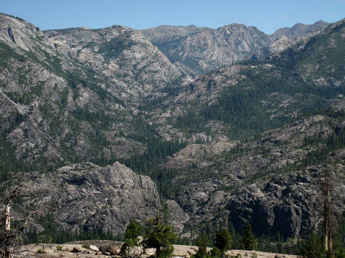
Above we see the full length of the Tahoe to Yosemite Trail's unmaintained route through Summit City Canyon in the Mokelumne Wilderness laid out at our feet. Note The Sisters in the upper Right hand corner, and Horse Canyon cutting deeply into Summit City Canyon in the upper-middle-left of the image. At the middle-bottom of the image above we can see the stony course of the bottom-end of Summit Creek just above where it enters the North Mokelumne River.
That point is just above where the North Mokelumne Rive begins its passage through its very narrow steep and sheer granite gorge (you gotta read this) just above where it runs past the Enchanted Forest. Below the Enchanted Forest the river runs through an even steeper and deeper cut of the river canyon from the Enchanted Forest to Camp Irene. Camp Irene is where we began this climb to our South up the NW flank of Mount Reba where we get this fantastic view of Summit City Creek's awesome canyon. We can actually see the river-bed rocks cascading down towards Camp Irene in the shot above. See 'em? That's bottom of Summit City Creek just above where it enters the North Mokelumne River.
Below that point we find the steep, deep, and narrow section where the catastrophic Spring Thaw of 1997 pushed up a massive log jam in this bottle-neck of a canyon just above Camp Irene, causing massive destruction in and around the 75 foot deep pool of surging, grinding, smashing timber backed up behind it, which swept away all in its path below it when it finally snapped.
Devastation swept across the landscape and down the river valley which can still be seen and felt today.
Less and less each year.
This year's massive rains, snowpack, and thaw activity will further heal those "wounds."
UPDATE
Feb 22 2017
This year's vast snowpack may rip the Sierra & most of California a "new one" if present precip trends continue into the rising heat of the Spring Thaw.
Labeled Image
Trail Guide Map Miles and Elevations
February 2017
It is Epic
| Sunday |
Monday |
Tuesday |
Wednesday |
Thursday |
Friday |
Saturday |
PRECAUTIONS AND OPPORTUNITY
Some backpackers are observing patterns and trajectory of Winter storms and temps to find Hiking Windows into the
Winter Wonderland.
Others are watching the snow activity/pack to determine when the trails will clear enough to begin their Pacific Crest Trail or John Muir Trail backpacking trips.
2017 UPDATE
Vast Snows on the Mountain!
Finally!
2017
FULL WINTER CONDITIONS
2017: COLD
The Fall Gear has long been stowed or complimented by the heavy Gear of Winter.
What's Going On?
See December of 2016 Reports
All
High Sierra Weather Info
Latest Daily Snow Depth Summary
Daily Sierra Snowpack % of Normal pdf
Daily Snow-Water & Percent of Average
All Precipitation-Snow Data
All Snow Surveys
SWC & Snow Depth
Summer of 2017 Backpacking Plans?
Yosemite-Hoover-Desolation
&
John Muir Trail Hikers:
Time to
Order Next Year's Permits!
Reserved permits for June 2017 now available from Yosemite, Hoover, and Desolation Wilderness Areas. In other words, Yosemite, Desolation, and Hoover Wilderness Areas all offer advanced reservations about six months ahead of your desired hiking dates.
This means now is the time to get your JMT permit application, along with other popular hikes, into the Man.
Feb 18
At this point in time I am estimating a powerful, potentially catastrophic Spring Thaw.
If the thaw occurs early or late depends on the Spring temps and precip patterns. We could have snow along the Sierra Crest through the whole Summer. Again, this depends on the profile of Spring temps and precip.
All Permits
Yosemite Permits Desolation Wilderness |
31
2017
First "REAL" Winter since the Winter of 2010-2011 |
1
2017
Overcast. Weak Low approaches out of W-SW
Snow Depth,
24 hour high & low temps.
Carson Pass 98"
(35.40" H2O)
45 & 24
Ebbetts Pass 115"
50 & 33
Deadman Creek 29.28 H20
48
& 20
Leavitt Lake 171"
48.8" H20
45 & 33
Tuolumne Meadows 2.47"
(depth suspect)
46 & 9
Tioga Pass/Dana 118.5"
(Temps BAD-Snow Suspect)
Gem Pass 130"
48 & 25
Mammoth Pass 162.4"
55 & 21
South Lake Cabin 10.9" H2O
53 & 21
Big Pine Sawmill 70.0"
47 & 24
Bishop Pass BAD
BAD
Charlotte Lake TEMPS
39 & 7
??
(no longer reporting)
Upr Tyndall Creek 00"
0
& 00
ALL REPORTING STATIONS
All Snow and Rain Precipitation Forecasts,
&
Snow Depth and/or
Inches of Water
2016
Above Average
Warmer Temps
&
Higher Humidity
Not a whole lot of strong weather, despite strong El Nino |
2
2017
Spotty Light Precip under Overcast.
Weak, slow-moving Low out of W-SW off the West Coast turns North.
ALL the Lows in the whole N Pacific are weak.
TOP |
3
2017
Weak Low & Front Offshore moving North under overcast with light showers.
2017
Current Snowpack:
Percent of Average for
February 3.
N Sierra: 145%
Cen. Sierra: 174%
S Sierra: 198%
Ca State: 171%
Statewide Summary of Snow Water Content PDF
Last Reading: Jan. 20
Also See
Norms, Accumulations, and Anomalies
|
4
2017
Steady waves of Light Precip, Cooling
Snow Depth,
24 hour high & low temps.
Carson Pass 108"
(35.50" H2O)
33 & 29
Ebbetts Pass 117"
32 & 27
Deadman Creek 30.12 H20
40
& 24
Leavitt Lake 173"
48.8" H20
31 & 25
Tuolumne Meadows x.xx"
(depth suspect)
38
& 4
Tioga Pass/Dana 126"
(Temps BAD-Snow Suspect)
Gem Pass 141"
35 & 19
Mammoth Pass 169.0"
34 & 22
South Lake Cabin 11.0" H2O
42 & 24
Big Pine Sawmill 72.4"
36 & 22
Bishop Pass BAD
BAD
Charlotte Lake TEMPS
34 & 2
??
(no longer reporting)
Upr Tyndall Creek 00"
0
& 00
ALL REPORTING STATIONS
All Snow and Rain Precipitation Forecasts,
&
Snow Depth and/or
Inches of Water
Winter Gear
Standard WARNING:
Be geared for
sub-freezing and sub-zero temps with wind chill
High Sierra Reporting Stations
2016:
NOT TOO COLD AT ALL. |
5
2017
Cloudy & Cool.
Showers & Light Precip continues between Frontlines, PM showers.
2016
5
RECORD
AND
NEAR RECORD
HIGH TEMPS
Great
Northeast Pacific Highs deflecting weak storms OUT OF THE SW around the Sierra. |
6
2017
Steady Showers, warm.
|
7
2017
Steady Showers, warm
Steady Precip for days bringing huge snow deposition and low elevation flooding.
Snow Depth,
24 hour high & low temps.
Carson Pass 120"
(36.00" H2O)
32 & 28
Ebbetts Pass 132"
31 & 27
Deadman Creek 32.16" H20
34
& 25
Leavitt Lake BAD "
49.9" H20
31 & 25
Tuolumne Meadows x.xx"
(depth & H2O suspect)
33
& 25
Tioga Pass/Dana 146.7"
(Temps BAD)
Gem Pass 156"
(suspect): 34.41" H2O
29 & 20
Mammoth Pass 191.1"
31 & 24
South Lake Cabin 11.5" H2O
33 & 27
Big Pine Sawmill 92.7"
30 & 24
Bishop Pass BAD
BAD
Charlotte Lake TEMPS
24 & 16
Upr Tyndall Crk 134.68"
30
& 23
ALL REPORTING STATIONS
Also See
Norms, Accumulations, and Anomalies
All Snow and Rain Precipitation Forecasts,
&
Snow Depth and/or
Inches of Water |
8
2017
PM:
Big Tropical Flow out of
SW hits the Coast of Ca.
PM:
Raining across
Sierra Crest
Most stations above freezing to 40 degrees
ALL STORMS THIS SEASON HAVE COME OUT OF THE
WEST &
SOUTHWEST: Warm Storms...
2017
No information about a 2017 ADZPCTKO
2017
La Nina looks ended by this date.
ADZPCTKO
"PLANNING STAGES"
2016
NONE IN 2016
TWO EVENTS
IN
2015
April 22-24
April 24-26 |
9
2017
AM:
Rain & Snow across
Sierra Crest
AM:
Most stations above freezing & below 40 degrees
2016
Record Level Temps
High Heat and Humidity...
Plum and Cherry trees blossoming at Sea Level. |
10
2017
Clearing & Drying
After nine days of various degrees of precip...
Snow Depth,
24 hour high & low temps.
Carson Pass 130"
(36.00" H2O)
41 & 31
Ebbetts Pass 150"
40 & 30
Deadman Creek 36.36" H20
40
& 27
Leavitt Lake BAD "
51.4" H20
38 & 29
Tuolumne Meadows x.xx"
(depth & H2O suspect)
36
& 28
Tioga Pass/Dana 168.9"
(Temps BAD)
Gem Pass 156" (suspect): 36.68" H2O
30 & 28
Mammoth Pass 216.1"
38 & 27
South Lake Cabin 12.0 H2O
42 & 27
Big Pine Sawmill 98.2"
39 & 25
Bishop Pass BAD
BAD
Charlotte Lake TEMPS
35 & 19
Upr Tyndall Creek 142.6 "
33
& 28
ALL REPORTING STATIONS
Also See
Norms, Accumulations, and Anomalies
All Snow and Rain Precipitation Forecasts,
&
Snow Depth and/or
Inches of Water
2016
VERY HOT
Echo Summit,
Carson Pass,
Ebbetts Pass,
Sonora Pass
All reach low to mid-fifty degree temps.
Tuolumne Meadows achieves 60 degrees F. |
11
2017
Clear & Drying, High Building
TOP |
12
2017
High moving South and East,
Overcast & Dry
Last Day
2016
CCC
Backcountry Trail Crew
Applications due |
13
2017
High Overcast, Altocumulus leading edge (?), & High Pressure Zone dropping South, Dry
Oroville Dam Crisis News
Oroville predicted to see 7.6 inches of precip next 7 days.
All Precip Forecasts, Averages, & Anomalies.
California Major Reservoir current and historical levels
2017
Plum and Cherry trees blossoming at Sea Level. |
14
2017
Clear and Warming.
Valentine's Day
TOP |
15
End of five day span
Between Storms
2017
Haze, clouds & moderate temps, but nonetheless, changing condions.
Snow Depth,
24 hour high & low temps.
Carson Pass 115"
(43.60" H2O)
46 & 22
Ebbetts Pass 136"
49 & 23
Deadman Creek 36.84" H20
45
& 14
Leavitt Lake BAD "
53.7" H20
48 & 26
Tuolumne Meadows x.xx"
(depth & H2O suspect)
48
& 9
Tioga Pass/Dana 151.1"
(Temps BAD)
Gem Pass depth" suspect
39.41" H2O
26 & 25 suspect
Mammoth Pass 191.0"
53 & 18
South Lake Cabin 12.3"
suspect H2O
52 & 15
Big Pine Sawmill 86.2"
45 & 12
Bishop Pass BAD
BAD
Charlotte Lake TEMPS
33 & 8
Upr Tyndall Creek 142.6 "
22 & 23 suspect
ALL REPORTING STATIONS
Also See
Norms, Accumulations, and Anomalies
All Snow and Rain Precipitation Forecasts,
&
Snow Depth and/or
Inches of Water |
16
2017
VERY EARLY AM
Gusts blowing through the Golden Gate indicate front line approaches this part of the Ca coast. A review of radar confirms,
with leading edge of front already bringing lots more tropical moisture to Oroville and the West Flank of the North Sierra rising above Oroville Dam, which feeds the reservoir behind it.
0330
Front lines up with GG Bridge, flow along front line moving from just West of South to just East of North, almost directly flowing from South to North, but slightly canted to the East.
Moisture is moving almost directly South to North along an extended length of this front line as it crosses the Western Coasline of the US.
The tail of this great frontline bends Southwest, tickling the Hawaiian Islands. Can you smell the Pineapples on the semi-tropical "breezes?" runing up the front line?
The low pressure zone anchoring the North end of this vast front is just crossing East into Canada a bit North of Vancouver.
Behind this frontline we see a gaggle of weak low pressure zones all being conducted Northeastward across the Central Pacific. These storms are being positioned by a strong low pressure to their North sitting on the base of the Aleutian Chain, and a lower than normal positioning of the NE Pacific High.
No abberant High is going to conduct these storms around us, as has been persistantly happening more and more over the past forty years. Nor has the North Pacific High sat in its "normal" position, in the South Gulf Alaska, for many, many years.
Nor has the N Pac High & its associated Hadley Cells, moved through their normal annual progression for a long time.
The cadence of the rhythm of Highs and Lows in the whole Northeast quadrant of the Pacific Ocean has changed.
I suspect these changes stretch across the whole planet. But, I can only attest to what I've seen here in my quadrant of this Earth over the few short decades of my observations.
Latest Weather Maps
Scroll down to the
"North Pacific Ocean Surface Weather Map"
Current Field of View
North Sierra & Northern California composite radar. (Scroll down for a view of Oroville centered in the radar's field of view.)
More Weather Resources
NWS Whole State Radar
All Precip Forecasts, Averages, & Anomalies.
All Tahoe to Whitney Radar Resources
Oroville Dam Crisis News & Information
California Major Reservoir's current vs. historical levels |
17
2017
Constant precip from light to moderate intensity. Except SoCal & S Sierra. They got pounded.
|
18
Between Storms, cloudy but little precip.
2017
Snow Depth,
24 hour high & low temps.
Carson Pass 121"
(43.60" H2O)
34 & 26
Ebbetts Pass 141"
34 & 24
Deadman Creek 37.8" H20
36
& 24
Leavitt Lake BAD "
54.4" H20
33
& 23
Tuolumne Meadows x.xx"
(depth & H2O suspect)
35
& 20
Tioga Pass/Dana 159.0"
(Temps BAD)
Gem Pass depth" suspect
41.33" H2O
temps suspect
Mammoth Pass 216.10"
32 & 26
South Lake Cabin 12.4"
suspect H2O
32 & 21
Big Pine Sawmill 95.9"
31 & 20
Bishop Pass BAD
BAD
Charlotte Lake TEMPS
32 & 14
Upr Tyndall Creek 175.5 "
23 & 23 suspect
ALL REPORTING STATIONS
Also See
Norms, Accumulations, and Anomalies
All Snow and Rain Precipitation Forecasts,
&
Snow Depth and/or
Inches of Water |
19
2017
Constant precip from light to moderate intensity.
Soil Saturation and rivers and creeks at high levels.
The Spring Thaw is going to be a MESS.
Yosemite Natural Firefall
History of,...
History
Tourist Fire Version
|
20 President's Day
2017
Constant precip from light to moderate intensity, diminishing.
BACKPACKER ALERT
February 20, 2017
PCT PLANS/START TIMES GOING TO BE ADJUSTED FOR
HEAVY SNOW
&
DANGEROUS THAW CONDITIONS THIS YEAR.
|
21
2017
Steady light precip, diminishing.
News of Note
Feb 2017:
Record Precip
Record Snopack
State fully saturated
Oroville Dam Crisis
TOP |
22
2017
Clearing and Cooling, High Building in Gulf Alaska.
NEWS REPORT
Skiing Until July 4?
2017
Snow Depth,
24 hour high & low temps.
Carson Pass 150"
(43.60" H2O)
31 & 24
Ebbetts Pass 169"
30 & 23
Deadman Creek 41.16" H20
26
& 7
Leavitt Lake BAD "
55.8" H20
29
& 21
Tuolumne Meadows x.xx"
(depth & H2O & Temps suspect)
xx
& xx
Tioga Pass/Dana 176.0"
(Temps BAD)
Gem Pass depth" suspect
45.79" H2O
temps suspect
Mammoth Pass Suspect "
xx & xx
South Lake Cabin 12.9"
suspect H2O
23 & 17
Big Pine Sawmill 101.3"
23 & 11
Bishop Pass BAD
BAD
Charlotte Lake TEMPS
18 & 2
Upr Tyndall Creek xx.x "
xx & xx suspect
ALL REPORTING STATIONS
Also See
Norms, Accumulations, and Anomalies
All Snow and Rain Precipitation Forecasts,
&
Snow Depth and/or
Inches of Water |
23
2017
Clearing and Cool. High Building in Gulf Alaska.
This Winter is very much different from last year's Winter:
2016
Carson Pass
53 & 28 degrees 26 inches
Ebbetts Pass
54 & 33 degrees 63 inches
Sonora Pass
53 & 27 degrees 55 inches
Tuolumne Meadows
55 & 14 degrees 51 inches
Last year we had the first "reasonable" Winter after four seasons running from minimal to no Winter precip. Last Winter was still warm and "weak." Last year did not bring sustained storms nor sustained cold. Not so during this Tropical Winter of 2017.
This season has brought sustained storms, and is colder than last year.
This year has brought as much precip as the classic floods during '70s, '80s, & '90s.
Yet the majority of the precip from these classic storm-years was carried to us out of the Northwest, supplemented by killer Tropical Flows out of the Southwest.
This year the vast majority of our precip has come exclusively out of the Southwest.
Thus this season is still a bit warmer than a season dominated by a "normal" storm track out of the Northwest, even while the Southwestern Tropical Storm Track is much wetter...
|
24
2017
Clear and Cool. High Building in Gulf Alaska.
COLD WARNING
|
25
2017
Clear and Cool. High Building in Gulf Alaska.
COLD STORM WARNING
Lows tracking towards West Coast US, around growing Gulf Alaska High's Southern and Eastern perimeter... they should precipitate lightly and pass East quickly.
These weak lows are passing over frigid temps on Sierra Crest.
After these upcoming tiny lows pass East, this evening, no substantial weather is anticipated until well after the first, until maybe the 5th.
2017
Snow Depth,
24 hour high & low temps.
Carson Pass 140"
(43.60" H2O)
28 & -3
Ebbetts Pass 160"
23 & 3
Deadman Creek 41.28" H20
28
& 9
Leavitt Lake BAD "
55.7" H20
17
& 4
Tuolumne Meadows x.xx"
(depth & H2O & Temps suspect)
xx
& xx
Tioga Pass/Dana 165.7"
(Temps BAD)
Gem Pass depth" suspect
45.79" H2O
temps suspect
Mammoth Pass
Suspect "
xx & xx
South Lake Cabin 12.9"
suspect H2O
30 & 10
Big Pine Sawmill 96.1"
27 & -5
Bishop Pass BAD
BAD
Charlotte Lake TEMPS
22 & -19
Upr Tyndall Creek xx.x "
xx & xx suspect
|
26
2017
Cear and Cool to Cold.
COLD STORM WARNING
We are entering a very much needed gap in the series of storms out of the Southwest that have dominated the last three month's weather.
The question is what "rolls in" next, after this big High in Gulf Alaska plays out?
Another High?
Back to the Lows?
In any cast,
Spring Instability Grows.
A lot of money depends on the answer... More Water Damage Disaster money?
Either way, Water is money.
Too much Water requires Disaster money. Too little Water drains all economic flows...
These questions complicate "our" water-capture strategies and reveal the vunerbilities of building vast megacities on the face of a changing, volitile, rapidly declining Natural World. |
27
2017
Cear and Cool to Cold.
Fierce T-Storm activity off NE Indonisia lofting huge plumes of Hot Tropical Moisture.
Watch the Tropical Weather
These are being deflected to S of Sierra by Big High in Gulf Alaska, moving South.
Watch rapid Gulf Alaska High Formation
(Esp the bottom animation)
Watch Pacific Ocean Highs & Lows
A Big Low in Gulf Alaska would have sucked these tropical plumes in...
See the Visible "Film." |
28
2017
Cear and Warming
The tropical weather observed & mentioned yesterday pounded San Diego and Southern-most US... |
1 |
2
TOP |
3
|
4 |
Classic Feb
NOTES
Short days and long cold nights are the bookends within which we plan our Winter backpacking trips.
High Sierra SNOW trips can be followed up by exciting trips into the moderate Winter Climate of Death Valley. Best time to see DV.
UPDATE
2017 Reports
Feb 16
2017
VERY EARLY AM
Gusts blowing through the Golden Gate indicate front line approaches this part of the Ca coast. A review of radar confirms,
with leading edge of front already bringing lots more tropical moisture to Oroville and the West Flank of the North Sierra rising above Oroville Dam, which feeds the reservoir behind it.
0330
Front lines up with GG Bridge, flow along front line moving from just West of South to just East of North, almost directly flowing from South to North, but slightly canted to the East.
Moisture is moving almost directly South to North along an extended length of this front line as it crosses the Western Coasline of the US.
The tail of this great frontline bends Southwest, tickling the Hawaiian Islands. Can you smell the Pineapples on the semi-tropical "breezes?" runing up the front line?
The low pressure zone anchoring the North end of this vast front is just crossing East into Canada a bit North of Vancouver.
Behind this frontline we see a gaggle of weak low pressure zones all being conducted Northeastward across the Central Pacific. These storms are being positioned by a strong low pressure to their North sitting on the base of the Aleutian Chain, and a lower than normal positioning of the NE Pacific High.
No abberant High is going to conduct these storms around us, as has been persistantly happening more and more over the past forty years. Nor has the North Pacific High sat in its "normal" position, in the South Gulf Alaska, for many, many years.
Nor has the N Pac High & its associated Hadley Cells, moved through their normal annual progression for a long time.
The cadence of the rhythm of Highs and Lows in the whole Northeast quadrant of the Pacific Ocean has changed.
I suspect these changes stretch across the whole planet. But, I can only attest to what I've seen here in my quadrant of this Earth over the few short decades of my observations.
Latest Weather Maps
Scroll down to the
"North Pacific Ocean Surface Weather Map"
Current Field of View
North Sierra & Northern California composite radar. (Scroll down for a view of Oroville centered in the radar's field of view.)
More Weather Resources
NWS Whole State Radar
All Precip Forecasts, Averages, & Anomalies.
All Tahoe to Whitney Radar Resources
Oroville Dam Crisis News & Information
California Major Reservoir's current vs. historical levels
BACKPACKER ALERT
February 20, 2017
Feb 23
2017
Last year we had the first "reasonable" Winter after four seasons running from minimal to no Winter precip. Last Winter was still warm and "weak." Last year did not bring sustained storms nor sustained cold. Not so during this Tropical Winter of 2017.
This season has brought sustained storms, and is colder than last year.
This year has brought as much precip as the classic floods during '70s, '80s, & '90s.
Yet the majority of the precip from these classic storm-years was carried to us out of the Northwest, supplemented by killer Tropical Flows out of the Southwest.
This year the vast majority of our precip has come exclusively out of the Southwest.
Thus this season is still a bit warmer than a season dominated by a "normal" storm track out of the Northwest, even while the Southwestern Tropical Storm Track is much wetter...
Feb 24
2017
COLD WARNING
Clear and Cool. High Building in Gulf Alaska.
Feb 25
2017
COLD STORM WARNING
Clear and Cool. High Building in Gulf Alaska.
Lows tracking towards West Coast US, around growing Gulf Alaska High's Southern and Eastern perimeter... they should precipitate lightly and pass East quickly.
These weak lows are passing over frigid temps on Sierra Crest.
After these upcoming tiny lows pass East, this evening, no substantial weather is anticipated until well after the first, until maybe the 5th.
Feb 26
2017
COLD STORM WARNING
Cear and Cool to Cold.
We are entering a very much needed gap in the series of storms out of the Southeast that have dominated the last three month's weather.
The question is what "rolls in" next, after this big High in Gulf Alaska plays out?
Another High?
Back to the Lows?
In any cast,
Spring Instability Grows.
A lot of money depends on the answer... More Water Disaster money?
Either way , Water is money.
Too much Water requires Disaster money. Too little Water drains all economic flows...
These questions complicate "our" water-capture strategies and reveal the vunerbilities of building vast megacities on the face of a changing, volitile, rapidly declining Natural World.
2014 Calendar 2015 Calendar
2016 Calendar |
Are Weather Conditions
Moderating?
Accelerating?
March can be Great for Snow Backpacking.
Reports: 24-hour Highs, Lows, & Snow Depth.
UPDATE
2017 Report
February 2017 High Sierra News
2016
OBSERVATIONS
AND
TRACKING
UPDATE
2016 Report
Feb. 15 Report
Great High Pressure Zones persisting off California Coast transporting El Nino Moisture from the Southwest around us to the North.
Very high temps and humidity persisting.
First Two Weeks of Feb:
Summer Conditions in the Depths of Winter... Spring Bloom conditions and plant activity.
Last Two Weeks of Feb:
Summer Conditions persisting in the Depths of Winter... with a couple of very weak fronts passing through. Spring Bloom continues unabated... setting up for a frost to pare-back this freakish, premature Spring Bloom.
Feb 2016 resumed the patter of the last few "Winters," being no Winter, with very unseasonably warm temps and high humidity. And no rain or snow worthy of talking about.
But this "Winter" is not "over," not by a longshot. A fierce El Nino just began its Northward journey from the Southern Hemisphere, North. eventually up into the prevailing Westerly Winds of the Northern Hemisphere. Or, the El Nino will create its own winds.
FEB 27 2016
Notably weak and warm Feb. El Nino only apparent through elevated temps and humidity. No indications of heavy tropical storm activity amidst tropical atmospheric conditions.
Considerations
WHEN WILL THE SIERRA OPEN in 2016?
TRACKING 2016 CONDITIONS
2014 Calendar 2015 Calendar
2016 Calendar |
WEATHER STATUS
2017
Then and Now
BASED ON RECENT MULTI-YEAR DROUGHT TRENDS
General:
Our Observations of how this series of Unusual Seasons works out determines our
Range of Hiking Possibilities and the Gear Necessary to Explore them as Winter breaks into Spring and on into Summer.
2017
We have been in a deep drought, who's basic patterns appear broken.
This year's difference seems to be a product of the lack of a big-assed East Pacific High blocking the NW Jet Stream. We have in fact had Gulf Alaska Lows which have been drawing tropical moisture out of the Pacific Ocean around Hawaii. These Lows in Gulf Alaska have set up tropical moisture transfer mechanisms along their front lines bringing vast amounts of tropical moisture to the Sierra Nevada and the NW corner of the US.
This mechanism has sustained itself from November through February 20, 2017.
The Classic Feb. Question
Piercing Cold this month or just “Normal" Cold?
2016 Answer:
Hot as heck 1st through the 15th. No Cold.
2017 Answer:
Vast Rain and Snowfall from tropical sources typically bring wet, heavy, snow to the Sierra that is subject to chances of of being subjected to rainfall across the Sierra Crest. So it has been during 2017.
Therefore this season could be catagorized as having "warm" Winter conditions, despite the occasional plunges in temps we've seen a couple of times this Winter.
Last year's warmth during Feb was Summer-like, having little resemblence to typical "Wintertime" temps and weather patterns. The Winter heat of 2015 was even more abberent.
This year we are having real Wintertime conditions for the first time since the Winter of 2010-2011, yet this year's temps strike me as being a bit "warm" for typical Winter conditions.
The Classic Feb. Question
Heavy Snow Storms or None at All?
2017 Answer:
Feb. 15 Report
We have gotten pounded with record precip & snow.
Early Implications
1> Not an early start year for PCT-JMT hikers.
2> Potentially dangerous fording and trail conditions Spring & early in Summer.
3> Moist conditions all Summer long feeding mosquitoes all Summer long.
2016 Answer:
Feb. 15 Report
No Storms of significance to 15th.
No real storms hitting the Sierra for over two weeks, snow looking funky, coming apart, but high humidity bringing light snow when temps drop...
Snowpack retreating.
2017 Answer:
Adding Complexity
La Nina.
Weakening as of Jan 25. Diminishing, maybe ending...
|
Last Year
2015 Prognostication:
FIERCE DROUGHT
"All signs indicate a very early opening of the Sierra Nevada this year."
2015 was the
"Earliest, hottest, driest. Earliest opening of Sierra in Summer conditions I remember, ever. NO WINTER."
The descriptions roll on... of the EPIC DROUGHT YEAR of 2015.
Last Year
2016 Prognostication
See
Backpacker Alert
Feb. 1 2016:
OMG !
"Boiling El Nino verses the Vast High Pressure Ridge..."
Feb. 15 2016 Update
I still see a "normal-to-late" opening of the high trails, not opening until mid-July to fully clear the high passes of snow.
BUT, the upcoming shifts in weather are going to better resolve and clarify the confused-complex El Nino vs Ridging situation.
At this point in time I still see most of El Nino's moisture being transported around the Sierra by High Pressure Ridging, with enough of El Nino breaking through, every now and again,
to leave a slightly above-average Spring snowpack in late Spring after the melting and rain are all figured in.
Feb. 15 2016 Update
I am thinking a heavy early Spring snowpack hit by heavy Spring rains in late June and early July...
Last Two Weeks of Feb 2016:
Summer Conditions have risen and are persisting in the Depths of Winter... with a couple of very weak fronts passing through. Spring Bloom continues unabated... setting up for a frost to pare-back this freakish, premature Spring Bloom.
Feb 2016 resumed the pattern of the last few "Winters," being no Winter conditions at all, with very unseasonably warm temps and high humidity. And no rain or snow worth talking about.
But this "Winter" is not "over," not by a longshot. Our fierce but presently distant El Nino just began its Northward journey from the Southern Hemisphere, eventually to move up into the prevailing Westerly Winds of the Northern Hemisphere. Or, El Nino will create its own winds.
Brave New World
In terms of "normal" Winters blowing down to us on the "old" jet stream out of the Bearing Straight, we have not had one of those for too many years. Few speak to the fact that the directions of our seasonal prevailing winds long ago changed, and what that means.
2-26-16
Weather Report and Predictions |
This Year
2017 Prognostication
See
Backpacker Alert
Feb. 1 2016:
OMG !
"Tropical Transport Mechanism out of Southwest "
Feb. 15 2016 Update
Feb. 15 2016 Update
Last Two Weeks of Feb 2016:
Brave New World
In terms of "normal" Winters blowing down to us on the "old" jet stream out of the Bearing Straight, we have not had one of those for too many years. Few speak to the fact that the directions of our seasonal prevailing winds long ago changed, and what that means.
2-26-16
Weather Report and Predictions |
Tahoe to Whitney
Top of Page |
March 2017
The Tahoe to Yosemite Trail across Emigrant Wilderness
January February March April May June July August September October November December
Trail Guide Map Miles and Elevations
March 2017
| Sunday |
Monday |
Tuesday |
Wednesday |
Thursday |
Friday |
Saturday |
OBSERVE
The Winter and its Snowpack.
HEAVY? LIGHT?
Character and Sources of Storms?
Are Spring Conditions arriving with Spring?
Snowpack Status Sierra Reporting Stations
2017
UPDATE
March 1 2017
February was epic, breaking all sorts of snow, rain, and runoff records.
Current Status
March is coming in softly, bringing a very needed break from the almost continious precipitation we've received over the last three months.
Nonetheless, we enter a critical phase of this Wet Winter of 2017. The mountains are full of snow, all the terrain has saturated, the rivers run high, the reservoirs overflow.
We really needed this break in the weather!
Spring Prospects
The character of the Weather through the end of Winter into Spring is going to determine exactly how the vast snow pack on the Sierra Crest melts. Warm temps and heavy precipitation will bring widespread danger and damage to much of California.
A dry and slowly warming end of Winter through Spring weather pattern, such as the drought pattern we experienced through the Winters of 2012-2015, but much cooler, is about the only safe Spring Thaw scenario I can imagine.
My prediction is that the run of strange weather will continue. Whatever weather comes, I will bet that it will likely be unexpected.
For instance, March:
"In like a Lion and out like a Lamb?"
As this March is coming "In like a Lamb" it would not surprise me a bit if it went "out like a Lion." We should expect the unexpected during these strange times.
No Stranger Land
Though these are strange times under even stranger weather, I fear both these strange times and weather will continue unabated until we finally respect and reflect the balances of Nature.
Don't hold your breath!
Mother Nature's Wild Ride is just Beginning.
The
"Spring-O-Meter"
Just how early is spring arriving in your neighborhood? Find out .. .
US GEOLOGICAL SURVEY, February 23, 2017. |
28
Summer Hiking
Plans
Permits
Question
Are our permit/hiking plans & times In agreement with the progress to Spring?
2017
Answer
I doubt it, if you expected to begin backpacking early this Spring/Summer without full snow gear...
Evidence
Skiing until July?
Record Snowpack
Impending HUGE Spring Thaw on the way.
The Feb 20 Backpacker alert discusses how this much snow can affect PCT & JMT hiker's plans:
BACKPACKER ALERT
February 20, 2017
PCT PLANS/START TIMES GOING TO BE ADJUSTED FOR
HEAVY SNOW
&
DANGEROUS THAW CONDITIONS THIS YEAR.
Hoover Wilderness
Permit Reservations
now accepted |
1
2017
Cear and Warming
Snow Depth,
24 hour high & low temps.
Carson Pass 134"
(43.60" H2O)
36 & 2
Ebbetts Pass 159"
36 & 11
Deadman Creek 41.4" H20
45
& 2
Leavitt Lake BAD "
56.6" H20
32
& 11
Tuolumne Meadows x.xx"
(depth & H2O & Temps suspect)
48
& -10
Tioga Pass/Dana 159.9"
(Temps BAD)
Gem Pass depth" suspect
45.92" H2O
temps suspect
Mammoth Pass
Suspect "
xx & xx
Last: FEB 18
South Lake Cabin 12.9"
suspect H2O
48 & 5
Big Pine Sawmill 91"
40 & 3
Bishop Pass BAD
BAD
Charlotte Lake TEMPS
36 & -9
Upr Tyndall Creek 150.91"
xx & xx suspect
2017
Current Snowpack:
Percent of Average for
March 1.
N Sierra: 159%
Cen. Sierra: 191%
S Sierra: 201%
Ca State: 185%
Statewide Summary of Snow Water Content PDF
Last Reading:
February 3
Also See
Norms, Accumulations, and Anomalies
2016
Snotel Station Reports Current Snow Depth
Carson Pass
47 & 26 degrees, 64"
Ebbetts Pass
49 & 30 degrees, 58"
Sonora Pass
48 & 30 degrees, 50''
Tuolumne Meadows
23 & 53 degrees, 43" |
2
2017
Cear and Warming |
3
2017
Overcast. First visible indication of slow moving Front descending from North after TEN DAYS of virtually no rain, which we really, really needed.
We did get light precip on Feb 25 & 26, but that was some very weak precip during an otherwise dry ten days.
Cold Semi-stationary Lows have been forming, persisting, and wandering about Gulf Alaska. These Lows also calved-off the Lows experienced on Feb 25-6, and have deepened and are pushing the impending Front coming tomorrow.
Our big High has begun to drop South over the past couple of days as these lows have strengthened.
Other Factors
Big T-Storms off NE Indonisia are firing up.
Arctic looks clear (big Highs)...and
All the pieces for whatever is coming this Spring are coming together in dynamic motion right now.
We will see.
2016
Very Light Rain,
Finally, "Winter-like" conditions followed by five days of lite precip.
|
4
2017
Overcast. Cooling. Late heavy precip from slow moving Front descending from North.
TOP
|
5
2017
Cloudy but clearing.
Cold. Jet Stream out of NW bringing cold air.
Showers trailing slow moving Front that passed from the North.
The Weather Page
|
6
The Critical Question
of 2017:
"What's
Next?"
2017
Currently
Cloudy but clearing, front passed South, High Building.
Cold Jet Stream out of NW bringing cold air.
Next 7 Days
Formation & activity of Lows to SW of Ca., above Hawaii are "firing up," but so is a High persisting off the Ca Coast.
Expect these Lows and the Hawaiian tropical moisture dragged up along their attendant front lines to be transported to the North around Ca. by this High over next 7 days.
Animated Weather Maps
Predicted Precip Animations & Charts
This forecast means California and the High Sierra are dodging a bullet.
Problems would have built up, rather than diminished if this currently impending bit of tropical activity was pointed at California and the Sierra. |
7
2017
Cold, Cloudy, but Warming
High Building off Ca Coast
Snow Depth,
24 hour high & low temps.
Carson Pass 138"
(44.90" H2O)
25 & 12
Ebbetts Pass 163"
23 & 10
Deadman Creek
(42.48" H20)
39
& 11
Leavitt Lake SNO " BAD
(57.1" H20)
29
& 6
Tuolumne Meadows x.xx"
(SNO " Depth & H2O Suspect)
44
& -1
Tioga Pass/Dana 161.4"
(Temps BAD)
Gem Pass
(SNO " Depth Suspect)
45.78" H2O
temps suspect
Mammoth Pass
Suspect SNO "
55 & 14
Last: FEB 18
South Lake Cabin
(12.9" H2O suspect)
47 & 24
Big Pine Sawmill
88.9"
42 & 19
Bishop Pass
BAD-
BAD
Charlotte Lake
TEMPS ONLY
38 & 4
Upr Tyndall Creek 148.33"
xx & xx suspect |
8
2017
Clear, Cool, and Warming.
High Building off Ca Coast
2017
Weather
Status & Potential |
9
2017
Clear, Cool with rising humidity, and Warming.
Big High off Ca Coast
ALL REPORTING STATIONS
Also See
Norms, Accumulations, and Anomalies
|
10
2017
Hazy, humid, and Warming.
High off Ca Coast
11:17-11:30 AM
Huge Lightening Storm Northeast of Reno, West of Pyramid Lake. |
11
2017
Clearing, Warming, Big stationary High along Ca Coast.
TOP |
12
PDT
Information
Move clocks one hour forward.
Why do we think we can manipulate Time & Nature, when the main thing we are changing, screwing-up, is ourselves?
Well, Nature too...
2017
Clear, Warm, stationary Big High along Ca Coast.
FUTURE
High dropping South on 14th, Lows consolidating & deepening in Gulf Alaska by 14th:
These are the
outlines of Tropical Moisture Transport Mechanism.
Will the system shift back to "Tropical Wet" mode?
Tahoe to Whitney
&
PCT--JMT hikers
Order food, prep resupply packages, and repair gear.
Planning-Training. Resupply |
13
2017
Clear, HOT, stationary Big High along Ca Coast.
No precip since the 6th.
Mountain Temps Rising.
Snow Depth,
24 hour high & low temps:
Carson Pass 122"
(48.90" H2O)
58 & 28
Ebbetts Pass 145"
57 & 32
Deadman Creek
(42.84" H20)
62
& 21
Leavitt Lake SNO " BAD
(53.5" H20)
51
& 35
Tuolumne Meadows x.xx"
(SNO " Depth & H2O Suspect)
59
& 17
Tioga Pass/Dana 147.4"
(Temps BAD)
Gem Pass
(SNO " Depth Suspect)
45.68" H2O
temps suspect
Mammoth Pass
Suspect SNO "
60 & 23
Last Vaiid Sno: FEB 18
South Lake Cabin
(12.9" H2O suspect)
58 & 20
Big Pine Sawmill
80.5"
53 & 18
Bishop Pass
BAD- BAD
Charlotte Lake
TEMPS ONLY
51 & 14
Upr Tyndall Creek
O.00"
xx & xx suspect
(station not reporting)
ALL REPORTING STATIONS
Also See
Norms, Accumulations, and Anomalies
|
14
2017
Clear, HOT, stationary Big High along Ca Coast.
Snow Water Content
vs.
Snow Depth? |
15
2017
Marine Layer, changing, Low consolidating in Gulf Alaska, stationary Big High along Ca Coast moving South.
2016
Sustained period of no rain beginning now until April 9. |
16
2017
Marine Layer, changing, Low consolidating in Gulf Alaska, stationary Big High along Ca Coast moving South, but reforming.
TTM setting up to begin Monday-Tuesday next?
(Tropical Transport Mechanism)
TOP |
17
The
Big Green
One
Saint Pat's Day
|
18
2017
Marine Layer, changing, Low breaking apart in Gulf Alaska, stationary Big High along Ca Coast moving & splitting apart, but reforming to the South.
We've had a Big High since the Sixth, beginning to break down since the 14th, and it's now lapsing.
This same High that has been transporting tropical moisture around its Northern perimeter, and around us, to points North of the Oregon border, mostly up through Seattle, is now moving far enough South to transport that moisture here.
Since the Sixth we've seen a constant line of weak Lows moving NE out of the SW which end up wandering around Gulf Alaska before dispelling or moving East
These Lows will roll across the Sierra if the High moves and stays South.
My focus moves to the Southwestern portion of the North Pacific when the High & Low patterns in the East Pacific off the California Coast "open" a sub-tropical transport alley between them.
When that happens I look to the traditional "hot spot" for storms off the NE coast of Indonesia.
The potentially monster storms born there can spew huge amounts of hot tropical moisture right to the top of the troposphere.
From that vantage point their disposition depends on the configuration and motions of Pacific Highs and Lows.
Right now a great storm off the coast of Indonesia has reached its end and is fizzling out:
Tropical Storm Activity
The other thing I look at is the water temps around there, off the NE coast of Indonesia. They appear to be chilling out.
Pacific Ocean Temps
Both the storm activity and the water temps were just "High and Hot," respectively, and have just relaxed as our potential storm window has opened up. Us Lucky Dogs! This reduces the moisture coming our way, for now.
Things could fire up again quite quickly. |
19
TRAINING TIME
Doing the JMT, PCT, TYT, TW?
If you are not training for the trip now you are an idiot.
WHY?
I Want Skittles!
2017
Marine Layer, changing, Low breaking apart in Gulf Alaska, stationary Big High along Ca Coast moving & splitting apart, but reforming to the South.
No precip since the 6th.
Mountain Temps Cooling.
Snow Depth,
24 hour high & low temps:
Carson Pass 114"
(63.83" H2O)
48 & 36
Ebbetts Pass 133"
47 & 35
Deadman Creek
(43.08" H20)
50
& 37
Leavitt Lake SNO " BAD
(44.8" H20)
42
& 36
Tuolumne Meadows x.xx"
(SNO " Depth & H2O Suspect)
48
& 22
Tioga Pass/Dana 135.6"
(Temps BAD)
Gem Pass
(SNO " Depth Suspect)
45.61" H2O
temps suspect
Mammoth Pass
199.7"
(50.6" SUSPECT)
55 & 28
Last Vaild Snow:
FEB 18
South Lake Cabin
(13.2" H2O suspect)
49 & 32
Big Pine Sawmill
72.3"
47 & 33
Bishop Pass
BAD- BAD
Charlotte Lake
TEMPS ONLY
41 & 16
Upr Tyndall Creek
O.00"
xx & xx suspect
(station not reporting)
ALL REPORTING STATIONS
Also See
Norms, Accumulations, and Anomalies
Snow Water Equivalent, Density, Temp, and Snow Depth |
20
Prime Equinox
(2017-Light Precip)
This is the first day of Nature's Year, if no longer of man's.
Now Winter ends and growth begins at this one of the two points our Earth is balanced between its annual extremes.
This Equinox could be called "heat and growth coming," the other, "heat and growth going."
These two Equinoxes are our year's major transition points.
May you find Fine Trails and Beautiful Vistas decorating many challenging and exciting backpacking trips through Nature's Wonders this upcoming new year and season.
2017
Vernal Equinox
First Day of Spring
03:29 PM PDT in SF.
The Vernal Equinox Archaeoastronomy.com
2017
First of two weak fronts attached to two weak lows off the N Ca Coast.
Light Precip
Weak Lows have been wandering about Gulf Alaska for days...
|
21
2017
Light Precip
Tails of two weak fronts attached to two weak lows off the N Ca Coast are dragging broken clouds to clearing conditions. The next Low & associated front is about a day out.
It's not these two storms this week we have to worry about. It's the third, much more powerful one now forming in the East Pac and moving our way. We are going to see serious problems if that storm is reinforced by tropical activity from off the NW coast of Indonesia.
Then, the prospect of an enduring series of warm tropical Spring rains on a record breaking snow pack brings the possibility of local and widespread catastrophic Spring thaw events.
Resources Note
I've "thickened" up the Pacific Satellite resources on the Weather Page.
A recent reorganization of the NWS sat page eliminated the classic whole-Pacific and NE Pacific water vapor satellite views.
I found replacements, but they did not provide full-area coverage of the scale necessary to see these monumental relationships, as had the previous views.
I finally found the full-Pacific satellite view again, but in IR rather than water vapor, along with a fantastic NE Pacific view, and a nice large-scale view of N & S America.
My goal was to find another view of the totality of our Pacific Ocean "storm generator," which is now linked on the
Weather Page.
|
22
BACKPACKER ALERT
2017
Showers, Clearing
Snow Depth,
24 hour high & low temps:
Daily Snow Sensor Report
Carson Pass 122"
(64.2" H2O)
36 & 29
Ebbetts Pass 133"
(80.4" H2O)
34 & 28
Deadman Creek
(44.28" H20)
32
& 23
Leavitt Lake
SNO " BAD
(45.5" H20)
45
& 26
Carson-Walker
Tuolumne Meadows x.xx"
(SNO " Depth & H2O Suspect)
28
& 18
Tioga Pass/Dana
136.5"
(Temps BAD)
Tuolumne-Merced
Gem Pass
SNO " Depth Suspect
(47.4" H2O)
temps suspect
Mammoth Pass
200.5"
(50.6 SUSPECT)
33 & 24
Mammoth Mountain
South Lake Cabin
(13.3" H2O) suspect
33 & 22
Big Pine Sawmill
77.5"
28 & 18
Mono Lake-Owens Basin
Bishop Pass
BAD- BAD
Charlotte Lake
TEMPS ONLY
28 & 5
Kings River
Upr Tyndall Creek
O.00"
xx & xx suspect
(station not reporting)
Kern
ALL REPORTING STATIONS
Also See
Norms, Accumulations, and Anomalies
A
easonal Pivot Point
Heat moving North into North Pacific. Hot Water moving North. |
23
2017
HIKER REPORT
2017
Hazy-Clearing. Break between Fronts.
Cayenne Reports
2017
Reports and assesses Spring and Summer High Sierra Prospects.
Cayenne
2017
Instagram Photo
Elephant Back BURIED
Elephant Back
TOP |
24
2017
Front. Moderate intensity precip. Last bit passing Sierra during AM 25th.
|
25
2017
Front passed, Clearing.
Weather Page
Snow Depth,
24 hour high & low temps:
Daily Snow Sensor Report
Carson Pass 124"
(65.5" H2O)
34 & 28
Ebbetts Pass 146"
(81.7" H2O)
33 & 25
Deadman Creek
(44.88" H20)
44
& 23
Leavitt Lake
SNO " BAD
(41.2" H20)
35
& 27
Carson-Walker
Tuolumne Meadows x.xx"
(SNO " Depth & H2O Suspect)
43
& 23
Tioga Pass/Dana
144.2"
(Temps BAD)
Tuolumne-Merced
Gem Pass
SNO " Depth Suspect
(48.12" H2O)
temps suspect
Mammoth Pass
216.1"
(50.63 SUSPECT)
33 & 24
Mammoth Mountain
South Lake Cabin
(13.3" H2O) suspect
47 & 23
Big Pine Sawmill
73.0"
38 & 20
Mono Lake-Owens Basin
Bishop Pass
BAD- BAD
Charlotte Lake
TEMPS ONLY
36 & 15
Kings River
Upr Tyndall Creek
O.00"
xx & xx suspect
(station not
reporting again)
Kern
ALL
REPORTING STATIONS
Daily
Snow Sensor Report
INFO:
Snow Water Content
vs.
Snow Depth?
Snow Water Equivalent, Density, Temp, and Snow Depth |
26
2017
Front passed, Clearing, yet the sky kept spitting, "spray," an indication of the degree of saturation of this tropical air we are experiencing.
This wetness leaked over from the huge Low that moved North up the West Pac last week to the end of the Aleutian Chain today.
Beware warming temps bringing tropical rains!
This thing is going to warm up quickly, if the trends of the last 20 years continue through this Spring...
2017
Cayenne Reports
Dude, we had 180 mile ridge gust out here – INSANE!!! The cornices on some of the high altitude passes will not melt out on the north facing aspects this summer. NOAA is calling for over a foot of snow this weekend. The high country just keeps getting hit.
I did not even go into how many down trees, eroded trails and washed out bridges will be encountered. Not a good year for the novice backpacker or hiker. Can anybody say, “backcountry glissading accident or swift water rescue”? |
27
2017
Current Snowpack:
Percent of Average for
March 27.
N Sierra: 145%
Cen. Sierra: 174%
S Sierra: 166%
Ca State: 163%
Statewide Summary of Snow Water Content PDF
Last Reading:
March 1
|
28
2017
Clear. Big High building off Coast of California.
Weather Page
Daily Snow Sensor Report
Below: Watershed Snow Water Content Charts followed by individual reporting station's Snow Depth and
24 hour high-low temps:
Tahoe Basin Watershed
Carson-Walker
Watersheds
Carson Pass 121"
(66.2" H2O)
38 & 22
American-Yuba Watersheds
Ebbetts Pass 143"
(86.2" H2O)
40 & 20
Leavitt Lake
SNO " BAD
(41.2" H20 last)
(39.9" H20 this)
BOTH WRONG
ITS HUGE THERE
33
& 27
Mokelumne-Stanislaus Watersheds
Deadman Creek
(45.12" H20)
42
& 19
Tuolumne-Merced
Watersheds
Tuolumne Meadows x.xx"
(SNO " Depth & H2O Suspect: Chart Above)
52
& 15
Tioga Pass/Dana
140.2"
(Temps BAD)
Mammoth Mountain Ski
Mono Lake-Owens Basin
Gem Pass
SNO " Depth Suspect
(48.32" H2O)
temps suspect
Mammoth Pass
216.1"
(50.76" H2O)
50 & 17
South Lake Cabin
(13.3" H2O) suspect
53 & 17
Big Pine Sawmill
70.9"
42 & 14
Kings River
Bishop Pass
BAD- BAD
Charlotte Lake
TEMPS ONLY
38 & 9
Kern Watershed
Upr Tyndall Creek
O.00"
xx & xx suspect
(station not
reporting again)
ALL
REPORTING STATIONS
Daily
Snow Sensor Report
All CDEC Snow Info
Figure it Out:
Snow Water Content
vs.
Snow Depth?
Snow Water Equivalent, Density, Temp, and Snow Depth |
29
2017
Clear. Vast High building off Coast of California, Temps building.
Current
Pac Surface Map
General Weather Status
Tropical Activity Moderate off NE coast of Indonesia.
Vast Low in N Cen Pac sucking up most Tropical Moisture from Indonesia...
VAST HIGH OFF CA COAST deflecting most of the rest of this moisture around us.
TEMPS WARMING,
But still cool.
Our expanding stationary High will warm things up and begin the Spring Thaw in earnest during the next couple of days.
Weather Page River Resources |
30
2017
Clear. Vast High building off Coast of California, Temps building. Windy
SAFETY FIRST
Cayenne's First Aid Approach
2017
"I honestly think that very few people will complete the PCT this year because the Cascades have had an amazing amount of snow too. Crater Lake, Mt. Bachelor, Mt. Hood and Mt. Baker are all having record snow years too."
TOP |
31
2017
Clear. Vast High building off Coast of California, Temps building. Windy
|
1
2017
Current Snowpack:
Percent of Average for
April 1.
N Sierra: 147%
Cen. Sierra: 175%
S Sierra: 166%
Ca State: 164%
Statewide Summary of Snow Water Content PDF
Cal Coop Snow Survey
Last Readings:
March 27
March 1
|
NOTES:
Are heavy storms rolling in? From the North or South? Is a pattern forming? Breaking? A new one reforming?
2017
March 3
First visible indication of slow moving Front descending from North after TEN DAYS of virtually no rain, which we really, really needed.
We did get light precip on Feb 25 & 26, but that was some very weak precip during an otherwise dry ten days.
Cold Semi-stationary Lows have been forming, persisting, and wandering about Gulf Alaska. These Lows also calved-off the Lows (to the East) experienced on Feb 25-6, and have deepened and are pushing the impending Front coming tomorrow.
Our big High has begun to drop South over the past couple of days as these lows have strengthened.
Other Factors
Big T-Storms off NE Indonisia are firing up.
Arctic looks clear (big Highs).
All the pieces for whatever is coming this Spring are coming together in dynamic motion right now.
We will see.
2017
March 6
The Critical Question
of 2017:
"What's
Next?"
Currently
Cloudy but clearing. Cold Jet Stream out of NW bringing cold air.
Next 7 Days
Formation & activity of Lows to SW of Ca., above Hawaii are "firing up," but so is a High persisting off the Ca Coast.
Expect these Lows and the Hawaiian tropical moisture dragged up along their attendant front lines to be transported to the North around Ca. by this High over next 7 days.
Animated Weather Maps
Predicted Precip Animations & Charts
This forecast means California and the High Sierra are dodging a bullet.
Problems would have built up, rather than diminished if this currently impending bit of tropical activity was pointed at California and the Sierra.
2017
March 8, 2017
Today we have exited a brief 2+ day spell of frontal activity after six fairly dry days. Now we look forward to another six or seven days of low or no precipitation. These are more rainless days over two weeks than we had during the months of Dec, Jan, and Feb.
This break is vitally necessary for current and future conditions. Besides recovery from disasterous flooding, this break is allowing a completely over-saturated Earth to recover while letting the human infrastructure built upon it drain as much capacity as possible before the snow begins to melt.
We face upcoming "moments of truth," when the rising tempertures begin to melt this epic snow-pack in earnest, measured against reservoir capacity. Will the Water Manager's predictions match reality? Will they be able to bleed-off excess reservoir capacity fast enough to avoid breaking the system while still preventing, or at least not causing widespread flooding? These are the Questions.
All, "bets will be off," if the Skies of Spring begin transporting tropical moisture from Hawaii towards California and the Sierra. As conditions have all Fall and Winter long, so far.
Until now.
This begs the question, is this big gap in the weather we are seeing just one big "sucker hole," or has the weather, "turned a corner?" The answer lays in the Instability of Spring.
It appears we have "turned a corner," from the enduring pattern of a persistant low in Gulf Alaska drawing tropical moisture out of the SW. So far no other pattern has yet established a convincing persistance in the face of the lengthening days. This (potential) inconsistancy itself is saying something in the context of lengthening days and the rising trajectory of the Sun.
It looks to me like the inconsistancy of Spring has begun.
Neither blasts of fridig Arctic Fronts out of the Northwest, nor vast transport mechanisms carrying torrential tropical downpours out of the Sub-Tropics would surprise me at this time of year. The answer lays in the simple question, "where will the High go?" Let's look at three likely outcomes, or the "patterns" our future outcomes will "cycle" through.
1> Everything goes around us if the coastal ridging we've seen the last five years sets up again. This would be represented by a persistant High off the Ca. coast.
2> A "normal" Hadly-Cell High in Gulf Alaska for this time of year would likely bring intermittent cold showers out of NW through Spring.
3> A High positioned "low" in relation to Ca. coast could combine with Lows in Gulf Alaska to construct "Tropical Transport Mechanism," bringing heavy rains.
At this point I expect the future to cycle through all these positions at least once before our Spring rainstorms dispell into the heat of Summer. The character of this Spring will be established by which positions predominate.
2017
March 12, 2017
Clear, Warm, High stationary Big High along Ca Coast.
FUTURE
High dropping South on 14th, Lows consolidating & deepening in Gulf Alaska by 14th:
These are the
outlines of Tropical Moisture Transport Mechanism.
Will the system shift back to "Tropical Wet" mode?
2017
March 15, 2017
CHANGING
2017
March 18, 2017
CHANGING-PROSPECTS
Marine Layer, changing, Low breaking apart in Gulf Alaska, stationary Big High along Ca Coast moving & splitting apart, but reforming to the South.
We've had a Big High since the Sixth, beginning to break down since the 14th, and it's now lapsing.
This same High that has been transporting tropical moisture around its Northern circumference, and around us, to points North of the Oregon border is now moving far enough South to transport that moisture here.
Since the Sixth we've seen a constant line of weak Lows moving NE out of the SW which end up wandering around Gulf Alaska before dispelling or moving East
These Lows will roll across the Sierra if the High moves and stays South.
My focus moves to the Southwestern portion of the North Pacific when the High & Low patterns in the East Pacific off the California Coast "open" a sub-tropical transport alley between them.
When that happens I look to the traditional "hot spot" for storms off the NE coast of Indonesia.
The potentially monster storms born there can spew huge amounts of hot tropical moisture right to the top of the troposphere.
From that vantage point their disposition depends on the configuration and motions of Pacific Highs and Lows.
Right now a great storm off the coast of Indonesia has reached it end and is fizzling out:
Tropical Storm Activity
The other thing I look at is the water temps around there, off the NE coast of Indonesia. They appear to be chilling out.
Pacific Ocean Temps
Both the storm activity and the water temps were just "High and Hot," respectively, and have just relaxed as our potential storm window has opened up. This reduces the moisture coming our way, for now.
Things could fire up again quite quickly.
I must note that this has been a freakish Winter. It has been a "tropical" Winter with all the action dominated by storms out of the South and Southwest. Mostly the Southwest. We've only had a couple of Lows make it this far South this Fall and Winter. The Norhtwest has little to do with our weather anymore. The weather and its dominate center have decisively shifted from North to South.
2017
March 22
BACKPACKER ALERT
2017
March 22
Cayenne Reports
Reports and assesses Spring and Summer High Sierra Prospects.
Review
High Sierra Weather |
|
THE QUESTION
Have temps risen enough to start shifting into lighter Spring Gear from our heavy Winter Gear?
Correct Layering is Vital.
2014 Calendar 2015 Calendar
2016 Calendar
2017
OBSERVATIONS AND TRACKING
The Feb 20 Backpacker alert discusses how this much snow can affect PCT & JMT hiker's plans:
BACKPACKER ALERT
March 22, 2017
BACKPACKER ALERT
February 20, 2017
2017
PCT PLANS-START TIMES
ARE
GOING TO BE ADJUSTED
BY
HEAVY SNOW
&
DANGEROUS
Spring
THAW CONDITIONS THIS YEAR.
2016
OBSERVATIONS AND TRACKING
WHEN WILL THE SIERRA OPEN in 2016?
TRACKING 2016 CONDITIONS |
The nature of our Snow Backpacking trips are determined by the character of the snow.
Why?
Deep, soft, wet snow makes for rough going, as does fresh powder.
Cold hard well-packed snow can be faster than good trail.
2017:
BAD SNOW WARNINGS
See Jan 6-7, and Feb 8-9, among other examples of rain across the Sierra Crest
Tahoe to Whitney
Top of Page |
April 2017
April Snowstorm climbs the East Sierra
over
Carson Falls
Sitting below the Pacific Crest Trail on the Eastern Edge of Carson Iceberg Wilderness-Stanislaus National Forest
January February March April May June July August September October November December
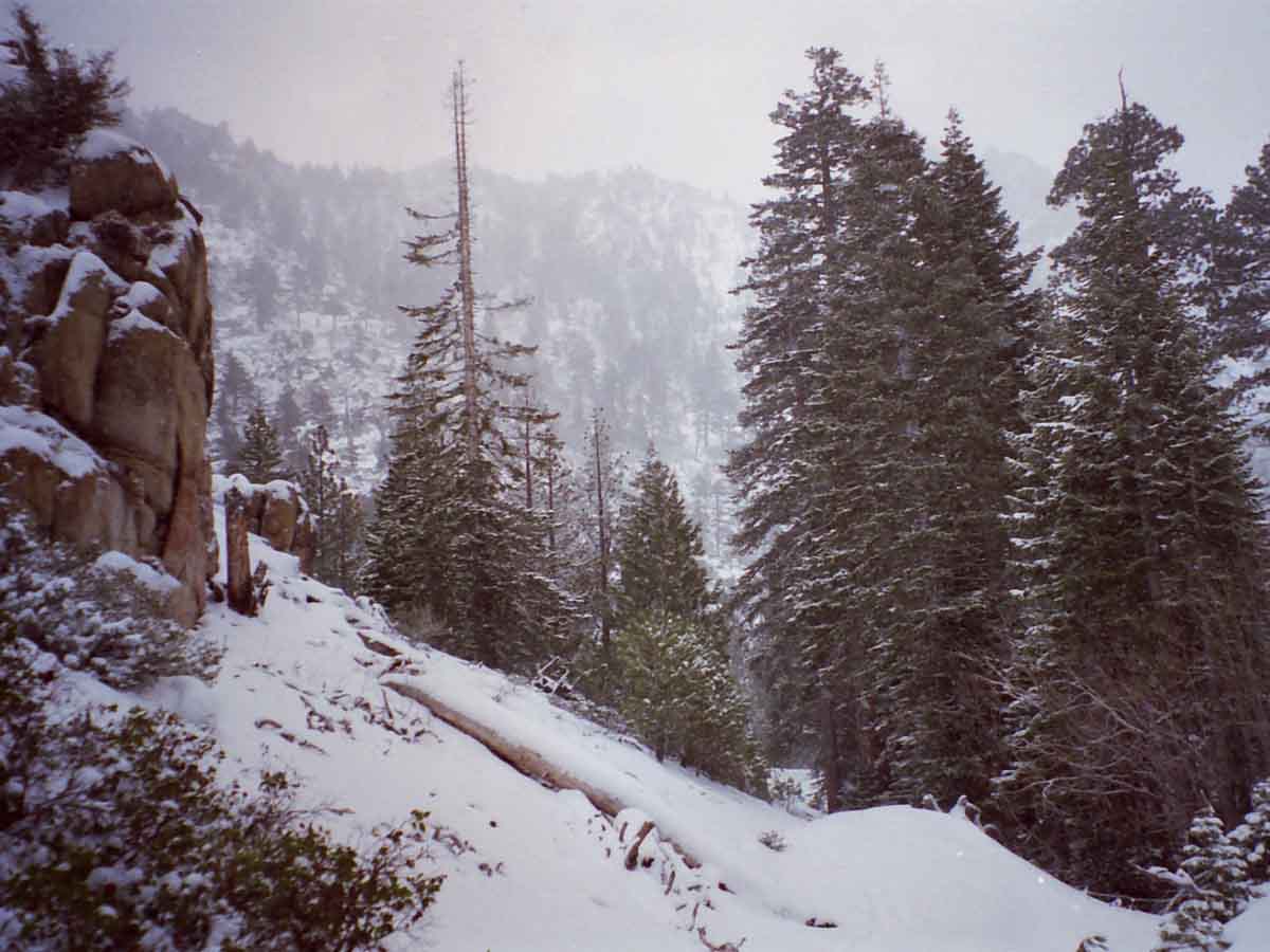
Looking back, Northwest by the compass, as we climb South up into the East Carson River up towards the PCT under a light Snow in April of 2000.
The PCT runs the ridge in the background. We'll get up there soon. At the position above we are climbing up to Carson Falls on our way following the East Carson River a bit short of nine miles
up to the PCT.
Entry was through Rodriquez Flat, above the town of Walker on Highway 395.
Trail Forum Map Miles and Elevations (PCT)
April 2017
January February March April May June July August September October November December
| Sunday |
Monday |
Tuesday |
Wednesday |
Thursday |
Friday |
Saturday |
"Open"
Spring Conditions?
NOT THIS YEAR:
HUGE PACK ON THE CREST
Typically,
Access Depends on Conditions.
Conditions on the ground, NOT a date on the calendar determines our gear and skills requirements.
Spring has been clearing mountain trails earlier and earlier over the the last twenty-five years, and especially the last seven years.
THAT TREND DIED THIS YEAR
CONDITIONS CRAZY ON THE GROUND
DEEP, DEEP SNOW ON SIERRA CREST
RAGING RIVERS COMING SOON
April 1, 2017:
BACKPACKER ALERT
EXPECT DELAYED
RESUPPLY SPOT OPENINGS
Resupply Information
Bottom Line
No snow skills? No snow gear?
NO GO!!
Especially during these Crazy Climate Times.
Snowpack Status Sierra Reporting Stations
Trans-Sierra Highway Information
ADZPCTKO 2017?
De-formalized this year
Another victim of too much Wild?
More
High Sierra
Backpacker
Information
Guide Trailhead
Guide Index
High Sierra Magazine
Blog-Forums |
28
2017
Clear. Big High building off Coast of California.
Weather Page
Daily
Snow Sensor Report
2017
Below: Watershed Snow Water Content Charts followed by individual reporting station's Snow Depth and
24 hour high-low temps:
Tahoe Basin
Watershed
Carson-Walker
Watersheds
Carson Pass 121"
(66.2" H2O)
38 & 22
American-Yuba Watersheds
Ebbetts Pass 143"
(86.2" H2O)
40 & 20
Leavitt Lake
SNO " BAD
(41.2" H20 last)
(39.9" H20 this)
BOTH WRONG
ITS HUGE THERE
33
& 27
Mokelumne-Stanislaus Watersheds
Deadman Creek
(45.12" H20)
42
& 19
Tuolumne-Merced
Watersheds
Tuolumne Meadows x.xx"
(SNO " Depth & H2O Suspect: Chart Above)
52
& 15
Tioga Pass/Dana
140.2"
(Temps BAD)
Mammoth Mountain Ski
Mono Lake-Owens Basin
Gem Pass
SNO " Depth Suspect
(48.32" H2O)
temps suspect
Mammoth Pass
216.1"
(50.76" H2O)
50 & 17
South Lake Cabin
(13.3" H2O) suspect
53 & 17
Big Pine Sawmill
70.9"
42 & 14
Kings River
Bishop Pass
BAD- BAD
Charlotte Lake
TEMPS ONLY
38 & 9
Kern Watershed
Upr Tyndall Creek
O.00"
xx & xx suspect
(station not
reporting again)
ALL
REPORTING STATIONS
Daily
Snow Sensor Report
All CDEC Snow Info
Figure it Out:
Snow Water Content
vs.
Snow Depth?
Snow Water Equivalent, Density, Temp, and Snow Depth |
29
2017
Clear. Vast High building off Coast of California, Temps building.
Current
Pac Surface Map
General Weather Status
Tropical Activity Moderate off NE coast of Indonesia.
Vast Low in N Cen Pac sucking up most Tropical Moisture from Indonesia...
VAST HIGH OFF CA COAST deflecting most of the rest of this moisture around us.
TEMPS WARMING,
But still cool.
Our expanding stationary High will warm things up and begin the Spring Thaw in earnest during the next couple of days.
Weather Page River Resources |
30
2017
Clear. Vast High building off Coast of California, Temps building. Windy.
SAFETY FIRST
Cayenne's First Aid Approach
2017
"I honestly think that very few people will complete the PCT this year because the Cascades have had an amazing amount of snow too. Crater Lake, Mt. Bachelor, Mt. Hood and Mt. Baker are all having record snow years too."
TOP |
31
2017
Clear. Vast High building off Coast of California, Temps building. Windy.
PREVIOUS:
BACKPACKER ALERT
March 22, 2017
More
High Sierra
Backpacker
Information
Guide Trailhead
Guide Index
High Sierra Magazine
Blog-Forums |
1
2017
BACKPACKER ALERT
April 1, 2017
Standing
Terrain Hazard Alert
Current Snowpack:
Percent of Average for
April 1.
N Sierra: 147%
Cen. Sierra: 175%
S Sierra: 166%
Ca State: 164%
Statewide Summary of Snow Water Content PDF
Cal Coop Snow Survey
Last Readings:
March 27
March 1
2017
Clear. Big High building off Coast of California. Staying cold on the Crest.
Weather Page
Daily Snow Sensor Report
2017
Below: Watershed Snow Water Content Charts followed by individual reporting station's Snow Depth and
24 hour high-low temps:
Tahoe Basin Watershed
Carson-Walker
Watersheds
Carson Pass 119"
(66.2" H2O)
35 & 20
American-Yuba Watersheds
Ebbetts Pass 139"
(86.2" H2O)
36 & 18
Leavitt Lake
SNO 243 " BAD (?)
(41.2" H20 last)
(92.1" H20 this)
LATEST CORRECT?
ITS HUGE THERE
33
& 27 (SUSPECT)
Mokelumne-Stanislaus Watersheds
Deadman Creek
(45.85" H20)
45
& 22
Tuolumne-Merced
Watersheds
Tuolumne Meadows x.xx"
(SNO " Depth & H2O Suspect: see Chart Above)
38
& 23
Tioga Pass/Dana
137.3"
(Temps BAD)
Mammoth Mountain Ski
Mono Lake-Owens Basin
Gem Pass
SNO " Depth Suspect
(48.42" H2O)
temps suspect
Mammoth Pass
216.1" (Suspect)
(51.24" H2O)
40 & 18
South Lake Cabin
(13.3" H2O) suspect
47 & 9
Big Pine Sawmill
70.3"
46 & 15
Kings River
Bishop Pass
BAD- BAD
Charlotte Lake
TEMPS ONLY
40 & 18
Kern Watershed
Upr Tyndall Creek
O.00"
xx & xx suspect
(station not
reporting again)
ALL
REPORTING STATIONS
Daily
Snow Sensor Report
All CDEC Snow Info
Figure it Out:
Snow Water Content
vs.
Snow Depth?
Snow Water Equivalent, Density, Temp, and Snow Depth
2016
Snow Depth
Carson Pass
49 & 23 degrees, 75"
Ebbetts Pass
48 & 23 degrees, 75"
Sonora Pass
33
& 28 degrees, 69"
Tuolumne Meadows
17 & 50 degrees, 34.5"
(2015: JB declares Water Emergency) |
2
2017
Clear. Big High building off Coast of California. Staying cold on the Crest.
High-Low pattern in North Pacific opening up a potential tropical transport window in four-five days?
Weather Page
|
3
2017
Clear. Big Highs moving East off of Coast of California.
Big Low forming in Gulf Alaska.
CREST WARMING UP,
Alley between Low & High for Tropical Moisture Transport opening up.
Substantial blast of precip heading our way in 4-5 days. Question is, how warm will it be?
Warm rains across the crest bring disaster.
2017
Below: Watershed Snow Water Content Charts followed by individual reporting station's Snow Depth and
24 hour high-low temps:
Tahoe Basin
Watershed
Tahoe Reporting Stations
On a Map
Scroll over stations for snow & temps. Click for
full report.
American-Yuba Watersheds
Carson-Walker
Watersheds
Carson Pass 114"
(66.6" H2O)
53 & 30
Ebbetts Pass 136"
(86.7" H2O)
53 & 30
Leavitt Lake
SNO --- " BAD (?)
(91.2" H20 last)
(" H20 no report)
LAST CORRECT?
ITS HUGE THERE
33
& 27 (SUSPECT)
Mokelumne-Stanislaus Watersheds
Deadman Creek
(45.96" H20)
51
& 24
Tuolumne-Merced
Watersheds
Tuolumne Meadows x.xx"
(SNO " Depth & H2O Suspect: see Chart Above)
51
& 21
Tioga Pass/Dana
134.4"
(Temps BAD)
Mammoth Mountain Ski
Mono Lake-Owens Basin
Gem Pass
SNO " Depth Suspect
(48.59" H2O)
temps suspect
Mammoth Pass
216.1" (Suspect)
(52.2" H2O)
59 & 30
South Lake Cabin
(13.3" H2O) suspect
59 & 31
Big Pine Sawmill
67.2"
46 & 28
Kings River
Bishop Pass
BAD- BAD
Charlotte Lake
TEMPS ONLY
37 & 9
Kern Watershed
Upr Tyndall Creek
O.00"
xx & xx suspect
(station not
reporting again)
Ca Dept Wa Wa
REPORTING STATIONS
Daily
Snow Sensor Report
All CDEC Snow Info
Figure it Out:
Snow Water Content
vs.
Snow Depth?
Snow Water Equivalent, Density, Temp, and Snow Depth
2016
Clear and Warming
2015 STORMLETS
A set of Weak "Stormlets"
cross North Sierra |
4
2017
Hazy from cold trop Front off shore stretching from North of Hawall to the Low it's anchored to in Gulf Alaska.
There are a set of Lows behind this Front, each carrying potentially more moisture.
Why? Right now increasing T Storm activity is hugging N Coast of Indonisa, and its surrounding waters are warming.
Temps in the Cen Pac are currently rising. More moisture is pouring into the atmosphere down there.
That potentially charges up the transport mechanisms.
All the cards are still on the table for a wide range of epic Spring Thaw outcomes. The game certainly is on, and we will see how it all plays out.
TOP |
5
2017
Hazy from cold trop Front off shore stretching from North of Hawall to the Low it's anchored to in Gulf Alaska.
There are a set of Lows behind this Front, each carrying potentially more moisture.
STEADY CREST WARMING
2017
Below: Watershed Snow Water Content Charts followed by individual reporting station's Snow Depth and
24 hour high-low temps:
Tahoe Basin
Watershed
Tahoe Reporting Stations
On a Map
Scroll over stations for snow & temps. Click for
full report.
American-Yuba Watersheds
Carson-Walker
Watersheds
Carson Pass 112"
(66.6" H2O)
52 & 26
Ebbetts Pass 133"
(86.3" H2O)
53 & 30
Leavitt Lake
247"
(91.2" H20 last)
(106.8 H20 this report)
CORRECT?
ITS HUGE THERE
xx
& xx (no report)
Mokelumne-Stanislaus Watersheds
Deadman Creek
(45.96" H20)
50
& 26
Tuolumne-Merced
Watersheds
Tuolumne Meadows x.xx"
(SNO " Depth & H2O Suspect: see Chart Above)
52
& 17
Tioga Pass/Dana
131.9"
(Temps BAD)
Mammoth Mountain Ski
Mono Lake-Owens Basin
Gem Pass
SNO " Depth Suspect
(48.64" H2O)
temps suspect
Mammoth Pass
200.4"
(53.64" H2O)
55 & 29
South Lake Cabin
(13.3" H2O) BAD
51 & 26
Big Pine Sawmill
65.1"
46 & 25
Kings River
Bishop Pass
BAD- BAD
Charlotte Lake
TEMPS ONLY
42 & 19
Kern Watershed
Upr Tyndall Creek
0.00"
xx & xx suspect
(station not
reporting again)
Meso West
REPORTING STATIONS
Daily
Snow Sensor Report
All CDEC Snow Info
Figure it Out:
Snow Water Content
vs.
Snow Depth?
Snow Water Equivalent, Density, Temp, and Snow Depth |
6
STORM WARNING
2017
Temps above freezing overnight along N Sierra Crest. AM precip, scattered showers through day strengthening into evening.
This storm is adding to the difficulty of those few PCT hikers who have the skill and gear necessary to access the existing massive snow pack at this early date.
Those who were attempting to cross the snow covered Sierra without the proper gear are currently being schooled, and are trying to figure how they can get down and out as quickly as possible.
Daytime Temps above freezing to 10,000 feet or so... which means lots of cold, freezing rain with sleet into snow, depending on how high or low we go. Nasty.
For Something Completely Different,
(Than 2017!):
See 2015 Report
2015: KM to Open last weekend
of this month.
2016
Heat Wave Records
24 hr High-Low & Snow Dp.
2016 Station REPORTS
Carson Pass
54 & 31 degrees, 69"
Ebbetts Pass
53 & 31 degrees, 67"
Sonora Pass
54
& 28 degrees, 55"
Tuolumne Meadows
63 & 25 degrees, 25" |
7
STORM WARNING
2017
Temps above freezing until 6 pm last evening brought rain then HEAVY SNOW:
AVALANCHE DANGER
Steady showers, cooling.
2017
Below: Watershed Snow Water Content Charts followed by individual reporting station's Snow Depth and
24 hour high-low temps:
Tahoe Basin
Watershed
Tahoe Reporting Stations
On a Map
Scroll over stations for snow & temps. Click for
full report.
American-Yuba Watersheds
Carson-Walker
Watersheds
Carson Pass 127"
(68.4" H2O)
39 & 30
Ebbetts Pass 148"
(86.8" H2O)
39 & 30
Leavitt Lake
238"
(91.2" H20 Earlier)
(106.8 H20 Last report)
CORRECT?
ITS HUGE THERE
xx
& xx (no report)
Mokelumne-Stanislaus Watersheds
Deadman Creek
(46.8" H20)
35
& 28
Tuolumne-Merced
Watersheds
Tuolumne Meadows x.xx"
(SNO " Depth & H2O Suspect: see Chart Above)
40
& 28
Tioga Pass/Dana
141.4"
(Temps BAD)
Mammoth Mountain Ski
Mono Lake-Owens Basin
Gem Pass
SNO " Depth Suspect
(51.15" H2O)
temps suspect
Mammoth Pass
216.1"
(56.44" H2O)
41 & 25
South Lake Cabin
(13.3" H2O) BAD
40 & 25
Big Pine Sawmill
77.2"
35 & 24
Kings River
Bishop Pass
BAD- BAD
Charlotte Lake
TEMPS ONLY
34 & 18
Kern Watershed
Upr Tyndall Creek
0.00"
xx & xx suspect
(station not
reporting again)
NOTE
Check the watershed charts If the individual snow depth sensors above are malfunctioning. We can use them to figure depth from water content.
Check the Meso West chart for more temps and depths, as well as the Snotel and Ca Dept of Water Resouces networks of sensors. |
8
STORM WARNING
2017
AM STORM diminishing into messy remnants clearing into what looks like will be a brief visit from a clear, cool High.
COLD WARNING TONIGHT
There is a weak, but potentially very wet Low & front behind it. Messy times ahead.
2017
Below: Watershed Snow Water Content Charts followed by individual reporting station's Snow Depth and
24 hour high-low temps:
Tahoe Basin
Watershed
Tahoe Reporting Stations
On a Map
Scroll over stations for snow & temps. Click for
full report.
American-Yuba Watersheds
Carson-Walker
Watersheds
Carson Pass 132"
(69" H2O)
33 & 28
Ebbetts Pass 156"
(89.4" H2O)
32 & 28
Leavitt Lake
238" (same-BAD)
(91.2" H20 Earlier)
(106.8 H20 Last)
CORRECT?
ITS HUGE THERE
xx
& xx (no report)
Mokelumne-Stanislaus Watersheds
Deadman Creek
(47.6" H20)
32
& 17
Tuolumne-Merced
Watersheds
Tuolumne Meadows x.xx"
(SNO " Depth & H2O Suspect: see Chart Above)
32
& 21
Tioga Pass/Dana
147.4"
(Temps BAD)
Mammoth Mountain Ski
Mono Lake-Owens Basin
Gem Pass
SNO " Depth Suspect
(52.67" H2O)
temps suspect
Mammoth Pass
216.1"-STUCK
(57.76" H2O)
32 & 21
South Lake Cabin
(--.-" H2O) BAD
32 & 19
Big Pine Sawmill
91.7"
31 & 17
Kings River
Bishop Pass
BAD- BAD
Charlotte Lake
TEMPS ONLY
26 & 12
Kern Watershed
Upr Tyndall Creek
0.00"
xx & xx suspect
(station not
reporting again)
Meso West
REPORTING STATIONS
Daily
Snow Sensor Report
All CDEC Snow Info
Figure it Out:
Snow Water Content
vs.
Snow Depth?
Snow Water Equivalent, Density, Temp,
and
Snow Depth |
9
COLD WARNING
2017
Clear & Cold as long as the High off the Coast of Ca. holds up. A Day? Through tomorrow?
Weak Front attached to Low exiting Gulf Alaska will drag across N Sierra late on the 10th.
Weak, but steady Sierra storm activity 11th through 14th. Messy.
WARNINGS
ANOTHER COLD NIGHT
MASSIVE SNOWPACK
ANOTHER STORM COMING
Snow Pack Extent, 4-9
Investigate Snowpack
All Snow Tools
2017
Last 12 Hours Temps High & Low
Last Night
COLD
TEMPS
Carson Pass 29 & 9
Forestdale Creek 26 & 9
Ebbetts Pass 22 & 11
Poison Flat 26 & 6
Slide Canyon 29 & -3
Charlotte Lake 26 & -3
2017 NOTE
Freeking Cold, esp. with winds hitting low double digits.
New Station Added
Check out the Marines complete weather reporting station at Pickel Meadow on Hwy 108 for wind chill factor. Though low in elevation, it gives a full report in the shadow of the East Flank.
New Station added to the List:
Marine Base
FULL REPORT
VIS-CHIL-WEA-MB & WIND
6748 feet
27 & 8
Oh-RAh!
Jarhead Pals
2016
Rain & Snow
Across Sierra Crest
See
Regional Snow Analysis Sierra Nevada for this date
2016 Station
REPORTS
Carson Pass
54 & 35 degrees, 66"
Ebbetts Pass
54 & 36 degrees, 48"
Sonora Pass
51
& 34 degrees, 51"
Tuolumne Meadows
52 & 32 degrees, 19" |
10
2017
Clear & warming with approach of front.
April 1 Backpacker Alert:
Travel Hazard in Effect.
WATCHES
Cold Hazard
Storm Weather Hazard
2017
Below: Watershed Snow Water Content Charts followed by individual reporting station's Snow Depth and
24 hour high-low temps:
Tahoe Basin
Watershed
Tahoe Reporting Stations
On a Map
Scroll over stations for snow & temps. Click for
full report.
American-Yuba Watersheds
Carson-Walker
Watersheds
Carson Pass 126"
Snow
(70.3" H2O)
42 & 9
Ebbetts Pass 152" Snow
(91" H2O)
37 & 11
Leavitt Lake
238" (Snow, same-BAD)
(91.2" H20 Earlier)
(106.8 H20 Last)
CORRECT?
ITS HUGE THERE
XX
& xx (no report)
Marine Base
FULL REPORT
VIS-CHIL-WEA-MB-WIND
6748 feet
51 & 24
Mokelumne-Stanislaus Watersheds
Deadman Creek
(47.76" H20) (?)
43
& 15
Tuolumne-Merced
Watersheds
Tuolumne Meadows x.xx"
(SNO " Depth & H2O BAD: use Chart Above)
44
& 3
Tioga Pass/Dana
143.6" Snow
(Temps BAD)
Mammoth Mountain Ski
Mono Lake-Owens Basin
Gem Pass
SNO " Depth Suspect
(52.71" H2O)
temps suspect
Mammoth Pass
216.1"-STUCK
(58.12" H2O)
49 & 10
South Lake Cabin
(--.-" H2O) BAD
42 & 11
Big Pine Sawmill
83.5" Snow
41 & 8
Kings River
Bishop Pass
BAD- BAD
Charlotte Lake
TEMPS ONLY
41 & 1
Kern Watershed
Upr Tyndall Creek
0.00"
xx & xx suspect
(station not
reporting again)
Meso West
REPORTING STATIONS
Daily
Snow Sensor Report
All CDEC Snow Info
Figure it Out:
Snow Water Content
vs.
Snow Depth?
Snow Water Equivalent, Density, Temp,
and
Snow Depth |
11
2017
Overcast & warm with landfall of weak front.
Light Precip N Ca.
SOME TEEN TEMPS
LAST NIGHT
Sloppy. Weak, gusty, & messy.
Afternoon: high 30s at 10000 feet up & down Crest. |
12
STORM WARNING
2017
Weak warm front across Sierra, looks like afternoon rain and snow across crest.
Nasty, Wet, Cold Conditions...
It is a more dangerous cold when it's warmer and wetter than frozen-solid cold.
Backpacking
Plans?
Are our hiking plans and conditions on the ground in agreement?
2015
Earliest trail Opening in High Sierra History developing this year.
2016
Slight Below Average Snow,
EXCESSIVE HEAT.
Tahoe to Whitney Plan
2017
Record snowfall getting ready to unleash a record-level thaw.
TOP |
13
STORM WARNING
CLEARING
2017
Weak warm front clearing, almost across Sierra.
2017
Below: Watershed Snow Water Content Charts followed by individual reporting station's Snow Depth and
24 hour high-low temps:
Tahoe Basin
Watershed
Tahoe Reporting Stations
On a Map
Scroll over stations for snow & temps. Click for
full report.
American-Yuba Watersheds
Carson-Walker
Watersheds
Carson Pass 132"
Snow
(71.5" H2O)
42 & 33
Ebbetts Pass 158"
Snow
(91.5" H2O)
41 & 32
Leavitt Lake
263" Snow, same-BAD)
(91.2" H20 Earlier)
(91.4 H20 this)
CORRECT?
ITS HUGE THERE
XX
& xx (no report)
Marine Base
FULL REPORT
VIS-CHIL-WEA-MB-WIND
6748 feet
44 & 32
Mokelumne-Stanislaus Watersheds
Deadman Creek
(48.6" H20)
44
& 25
Tuolumne-Merced
Watersheds
Tuolumne Meadows x.xx"
(SNO " Depth & H2O BAD: use Chart Above)
48
& 27
Tioga Pass/Dana
146.4" Snow
(Temps BAD)
Mammoth Mountain Ski
Mono Lake-Owens Basin
Gem Pass
SNO " Depth Suspect
(53.15" H2O)
temps suspect
Mammoth Pass
216.1"-STUCK
(58.44" H2O)
49 & 27
South Lake Cabin
(--.-" H2O) BAD
48 & 29
Big Pine Sawmill
78.9" Snow
44 & 26
Kings River
Bishop Pass
BAD- BAD
Charlotte Lake
TEMPS ONLY
43 & 19
Kern Watershed
Upr Tyndall Creek
0.00"
xx & xx suspect
(station not
reporting again)
2017
Note that snow levels declined and rose over the last two days as rain then snow fall alternated. |
14
COLD WARNING
2017
Clearing with brief High building in & out between Spring Storms...
Cooling.
WATCHES
Cold Hazard Rising
Truncated Report Today:
Al fell down and could not get up!
APPROACHING:
STORM CONDITION
NIGHTS OF THE 16th-20th
WEATHER HAZARD
Last Storm Weather Hazard Ending COLD, next storm approaches.
NEW ORDER
Temp & Snow Tables by Watershed and Highway Corridor |
15
COLD WARNING
2017
Clearing with brief High building in & out between Spring Storms...
WATCHES
Cold Hazard Decreasing with approach of storm
2017
Below: Watershed Snow Water Content Charts followed by individual reporting station's Snow Depth and
24 hour high-low temps:
Tahoe Basin
Watershed
Tahoe Reporting Stations
On a Map
Scroll over stations for snow & temps. Click for
full report.
American-Yuba Watersheds
Carson-Walker
Watersheds
Carson Pass 128"
Snow
(71.7" H2O)
41 & 9
Ebbetts Pass 155"
Snow
(93.5" H2O)
40 & 16
Leavitt Lake
263" Snow, last-BAD)
(91.2" H20 Earlier)
(NO REPORT)
?
ITS HUGE THERE
XX
& xx (no report)
Marine Base
FULL REPORT
VIS-CHIL-WEA-MB-WIND
6748 feet
49 & 20
Mokelumne-Stanislaus Watersheds
Deadman Creek
170.7 Snow
(48.72" H20)
44
& 11
Tuolumne-Merced
Watersheds
Tuolumne Meadows x.xx"
(SNO " Depth & H2O BAD: use Chart Above)
48
& 11
Tioga Pass/Dana
142" Snow
(Temps BAD)
Mammoth Mountain Ski
Mono Lake-Owens Basin
Gem Pass
SNO " Depth Suspect
(53.4" H2O)
temps suspect
Mammoth Pass
216.1"-STUCK
(58.76" H2O)
52 &18
South Lake Cabin
(--.-" H2O) BAD
54 & 20
Big Pine Sawmill
76.9" Snow
45 & 17
Kings River
Bishop Pass
BAD- BAD
Charlotte Lake
TEMPS ONLY
40 & 9
Kern Watershed
Upr Tyndall Creek
0.00"
xx & xx suspect
(station not
reporting again)
NEW
Temp & Snow Tables by Watershed and Highway Corridor
Scroll down to see the...
NEW
All & Selected
Spring Thaw River Flow Information
Also See
All High Sierra Snowpck Data.
Date-Adjustable High Sierra Snowpack Status
Also See
All Snowpck Data on Weather Page |
16
STORM WARNING
2017
Wet, Weak, & Warm Spring Storms are here...
WATCHES
Cold ended, NEW Storm Warning, Thaw, & Flooding too...
Truncated Report Today:
Al fell down and could not get up! |
17
STORM WARNING
2017
Wet, Weak, & Warm Spring Storms are here...
2016
Hot Day
ROADS OPENED AROUND THIS DATE
2015
ROAD REPORTS
ROAD CLOSURE HISTORY
2017
Below: Watershed Snow Water Content Charts followed by individual reporting station's Snow Depth and
24 hour high-low temps:
Tahoe Basin
Watershed
Tahoe Reporting Stations
On a Map
Scroll over stations for snow & temps. Click for
full report.
American-Yuba Watersheds
Carson-Walker
Watersheds
Carson Pass 128"
Snow
(72.3" H2O)
47 & 33
Ebbetts Pass 155.5"
Snow
(93.9" H2O)
47 & 31
Leavitt Lake
267" Snow
(94.5" H20)
42
& 30
Marine Base
FULL REPORT
VIS-CHIL-WEA-MB-WIND
6748 feet
50 & 25
Mokelumne-Stanislaus Watersheds
Deadman Creek
170.7 Snow (BAD)
(49.44" H20)
46
& 30
Tuolumne-Merced
Watersheds
Tuolumne Meadows x.xx"
(SNO " Depth & H2O BAD: use Chart Above)
48
& 29
Tioga Pass/Dana
143.4" Snow
(Temps BAD)
Mammoth Mountain Ski
Mono Lake-Owens Basin
Gem Pass
SNO " Depth Suspect
(53.42" H2O)
temps suspect
Mammoth Pass
216.1"-STUCK
(58.76" H2O)
50 & 28
South Lake Cabin
BAD" H2O) BAD
50 & 30
Big Pine Sawmill
75.0" Snow
45 & 29
Kings River
Bishop Pass
BAD- BAD
Charlotte Lake
TEMPS ONLY
37 & 21
Kern Watershed
Upr Tyndall Creek
0.00"
xx & xx suspect
(station not
reporting again)
NEW
Temp & Snow Tables by Watershed and Highway Corridor
Scroll down to see the...
NEW
All & Selected
Spring Thaw River Flow Information
Also See
All High Sierra Snowpck Data.
Date-Adjustable High Sierra Snowpack Status
Also See
All Snowpck Data on Weather Page
2016
Hot Day
As last year, we experienced substantial offshore flows last week, (7th-10th) this year due to a low pressure zone to our South.
Big High Pressure Building
(2015 HOT DAY)
See 2015 Report
|
18
STORM WARNING
2017
Wet, Weak, & Warm Spring Storms are here...
Sierra got pounded last night. By "pounded," I mean overnight temps stayed above freezing up to 9500 feet last night.
Check the station readings today compared to yesterday...
I called a Flood Watch on the 16th, and this thing is getting wetter & wetter.
It's warming up & getting ready to cut loose...
ACTIVE HAZARDS
Spring Travel Dangers
INCREASING
Wet-Cold
Snowpack Softening
Stream & Creek Undercutting.
Fords Rising
High Sierra
Snow Analyses
All Snow Data
Especially See the
APRIL 1 BACKPACKER
ALERT
Auga-Alerts? |
19
2017
Front clearing, clearing skies bring cooling. Clear Spot. Spring Instability, next front coming quickly this evening! Weak:
STORM WARNING
COLD WARNING
COLD
2017
REPORT
Kennedy Meadows
Pack Station
Report from Matt Bloom of Kennedy Meadows Pack Station.
"PCT hikers in the snow for a long ways & time this year."
"KM will be Opening for Trout Season on APRIL 28, come on up."
Sonora Pass: "It looks like Sonora Pass will open between Memorial Day Weekend and Mid-June, is my guess right now, but this depends on weather."
This will be a slow Summer in the mountains and a short season for the High Country."
Make your time count!
2015
Carson Pass 2 inches
Road Open
Ebbetts Pass 0 inches
Road Open
Sonora Pass 2 inches
Road Open
2017
Below: Watershed Snow Water Content Charts followed by individual reporting station's Snow Depth and
24 hour high-low temps:
Tahoe Basin
Watershed
Tahoe Reporting Stations
On a Map
Scroll over stations for snow & temps. Click for
full report.
American-Yuba Watersheds
Carson-Walker
Watersheds
Carson Pass 128"
Snow
(73.4" H2O)
40 & 25
Ebbetts Pass 162.0"
Snow
(95.4" H2O)
46 & 26
Leavitt Lake
278" Snow
(99.3" H20)
37
& 21
Marine Base
FULL REPORT
VIS-CHIL-WEA-MB-WIND
6748 feet
48 & 23
Mokelumne-Stanislaus Watersheds
Deadman Creek
170.7 Snow (BAD)
(50.4" H20)
51
& 6 --WOW!
Tuolumne-Merced
Watersheds
Tuolumne Meadows x.xx"
(SNO " Depth & H2O BAD: Use Chart Above)
45
& 12
Tioga Pass/Dana
148.1" Snow
(Temps BAD)
Mammoth Mountain Ski
Mono Lake-Owens Basin
Gem Pass
SNO " Depth Suspect
(54.38" H2O) Suspect
temps suspect
Mammoth Pass
216.1"-STUCK
(59.32" H2O)
39 & 11
South Lake Cabin
BAD" H2O) BAD
46 & 9
Big Pine Sawmill
78.9" Snow
40 & 6
Kings River
Bishop Pass
BAD- BAD
Charlotte Lake
TEMPS ONLY
44 & 0
Kern Watershed
Upr Tyndall Creek
0.00"
xx & xx suspect
(station not
reporting again)
|
20
COLD WARNING
2017
Weak Front through last night, clear, High building.
Current Snowpack
VAST
Percent of Average for
April 1.
N Sierra: 182%
Cen. Sierra: 197%
S Sierra: 182%
Ca State: 189%
Compare against previous years.
Statewide Summary of Snow Water Content PDF
Cal Coop Snow Survey
Last Readings:
April 1
March 27
March 1
2016:
Hot
THE BLOB RETURNS
NW US
NONE IN 2017
"De-Formalized"
ADZPCTKO.org
NONE IN 2016
TWO
2015 EVENTS
April 22-24
April 24-26
TOP |
21
NICE WEATHER WARNING
2017
Did not get cold at all last night on first look. Big High building, Clearing Nice with a warm start.
NEW
Temp & Snow Tables by Watershed and Highway Corridor
Scroll down to see the...
NEW
All & Selected
Spring Thaw River Flow Information
Also See
All High Sierra Snowpck Data.
Date-Adjustable High Sierra Snowpack Status
Also See
All Snowpck Data on Weather Page |
22
2017
Cloudy as big weak front line passes overhead as this High builds in.
It's warming up. This thaw is about to cut loose.
2014
KM Opening
Very Early
2014
Small Storm REPORT
2017
Below: Watershed Snow Water Content Charts followed by individual reporting station's Snow Depth and
24 hour high-low temps:
Tahoe Basin
Watershed
Tahoe Reporting Stations
On a Map
Scroll over stations for snow & temps. Click for
full report.
American-Yuba Watersheds
Carson-Walker
Watersheds
Carson Pass 121"
Snow
(73.5" H2O)
57 & 20
Ebbetts Pass 150.0"
Snow
(95.8" H2O)
58 & 25
Leavitt Lake
265" Snow
(98.9" H20) Suspect
56
& 33
Marine Base
FULL REPORT
VIS-CHIL-WEA-MB-WIND
6748 feet
56 & 29
Mokelumne-Stanislaus Watersheds
Deadman Creek
170.7 Snow (BAD)
(50.88" H20)
60
& 27 --WOW!
Tuolumne-Merced
Watersheds
Tuolumne Meadows x.xx"
(SNO " Depth & H2O BAD: Use Chart Above)
55
& 22
Tioga Pass/Dana
139.8" Snow
(Temps BAD)
Mammoth Mountain Ski
Mono Lake-Owens Basin
Gem Pass
SNO " Depth Suspect
(54.06" H2O) Suspecttemps suspect
Mammoth Pass
216.1"-STUCK
(59.52" H2O)
63 & 30
South Lake Cabin
BAD" H2O) BAD
58 & 30
Big Pine Sawmill
73.6" Snow
54 & 23
Kings River
Bishop Pass
BAD- BAD
Charlotte Lake
TEMPS ONLY
42 & 18
Kern Watershed
Upr Tyndall Creek
0.00"
xx & xx suspect
(station not
reporting again)
NEW
Temp & Snow Tables by Watershed and Highway Corridor
Scroll down to see the...
NEW
All & Selected
Spring Thaw River Flow Information
Also See
All High Sierra Snowpck Data.
Date-Adjustable High Sierra Snowpack Status
Also See
All Snowpck Data on Weather Page |
23
2017
Staying cool |
24
2017
Sloppy high clouds part of weak front attached to weak Low passing onshore in central Washington.
2016
Post Stormlet
Snotel Station Reports
Carson Pass
44 & 21 degrees, 56"
Ebbetts Pass
46 & 21 degrees, 49"
Sonora Pass
45 & 21 degrees, 47"
Tuolumne Meadows
47 & 23 degrees, 0"
2017
Below: Watershed Snow Water Content Charts followed by individual reporting station's Snow Depth and
24 hour high-low temps:
Tahoe Basin
Watershed
Tahoe Reporting Stations
On a Map
Scroll over stations for snow & temps. Click for
full report.
American-Yuba Watersheds
Carson-Walker
Watersheds
Carson Pass 118"
Snow
(73.6" H2O)
48 & 33
Ebbetts Pass 149.0"
Snow
(95.9" H2O)
45 & 31
Leavitt Lake
264" Snow
(98.9" H20) Suspect
39
& 31
Marine Base
FULL REPORT
VIS-CHIL-WEA-MB-WIND
6748 feet
50 & 35
Mokelumne-Stanislaus Watersheds
Deadman Creek
170.7 Snow (BAD)
(50.76" H20)
48
& 25
Tuolumne-Merced
Watersheds
Tuolumne Meadows x.xx"
(SNO " Depth & H2O BAD: Use Chart Above)
30
& 19
Tioga Pass/Dana
140.4" Snow
(Temps BAD)
Mammoth Mountain Ski
Mono Lake-Owens Basin
Gem Pass
SNO " Depth Suspect
(53.93" H2O) Suspecttemps suspect
Mammoth Pass
216.1"-STUCK
(59.64" H2O)
51 & 28
South Lake Cabin
BAD" H2O) BAD
50 & 34
Big Pine Sawmill
70.8" Snow
44 & 34
Kings River
Bishop Pass
BAD- BAD
Charlotte Lake
TEMPS ONLY
35 & 17
Kern Watershed
Upr Tyndall Creek
0.00"
xx & xx suspect
(station not
reporting again)
NEW
Temp & Snow Tables by Watershed and Highway Corridor
Scroll down to see the...
NEW
All & Selected
Spring Thaw River Flow Information
Also See
All High Sierra Snowpck Data.
Date-Adjustable High Sierra Snowpack Status
Also See
All Snowpck Data on Weather Page |
25
2017
Sloppy high clouds part of weak front attached to weak Lows passing onshore in central Washington.
This pattern of Lows, fairly cold Lows coming across the North-Centrail Pacific and rotating aound the top a High off the Central-South California Coast has rotated this cold, wet, semi-tropical moisture around its Northern perimeter and down its Eastern edge, which has swept these high clouds, overcast, and spitting weather across the Sierra Crest for the last four days.
TOP |
26
2017
Staying cool, cloudy, with weak unstable weather.
High growing and moving North off the Coast of Caliornia, but the West Pacific is brewing up some huge tropical storms & tropical activity...
Sloppy precip should be ending as High builds in and moves North.
2017
Below: Watershed Snow Water Content Charts followed by individual reporting station's Snow Depth and
24 hour high-low temps:
Tahoe Basin
Watershed
Tahoe Reporting Stations
On a Map
Scroll over stations for snow & temps. Click for
full report.
American-Yuba Watersheds
Carson-Walker
Watersheds
Carson Pass 117"
Snow
(73.7" H2O)
47 & 23
Ebbetts Pass 146.0"
Snow
(96.1" H2O)
49 & 26
Leavitt Lake
260" Snow
(99.4" H20) Suspect
45
& 24
Marine Base
FULL REPORT
VIS-CHIL-WEA-MB-WIND
6748 feet
50 & 32
Mokelumne-Stanislaus Watersheds
Deadman Creek
000.0 Snow (BAD)
(51.12" H20) (?)
46
& 33
Tuolumne-Merced
Watersheds
Tuolumne Meadows x.xx"
(SNO " Depth & H2O BAD: Use Chart Above)
47
& 31
Tioga Pass/Dana
136.8" Snow
(Temps BAD)
Mammoth Mountain Ski
Mono Lake-Owens Basin
Gem Pass
SNO " Depth Suspect
(53.93" H2O) Suspecttemps suspect
Mammoth Pass
216.1"-STUCK
(60.00" H2O)
52 & 32
South Lake Cabin
BAD" H2O) BAD
55 & 34
Big Pine Sawmill
68.1" Snow
49 & 30
Kings River
Bishop Pass
BAD- BAD
Charlotte Lake
TEMPS ONLY
36 & 16
Kern Watershed
Upr Tyndall Creek
0.00"
xx & xx suspect
(station not
reporting again)
NEW
Temp & Snow Tables by Watershed and Highway Corridor
Scroll down to see the...
NEW
All & Selected
Spring Thaw River Flow Information
Also See
All High Sierra Snowpck Data.
Date-Adjustable High Sierra Snowpack Status
Also See
All Snowpck Data on Weather Page |
27
2017
Staying cool, cloudy, with weak unstable weather.
High bigger & stronger.
2016
Weak Front/low pressure
Light Precip.
Potential for Rain across
Northern Sierra Crest
ALL PRECIP FORECAST RESOURCES
Radar Resources
Satellite Views
Run Rain & Snow Models |
28
2017
High built in off West Coast of Ca, moisture still out there, but being deflected around us.
The series of weak lows dragging weak wet fronts continues around the perimeter of this High.
High strengthening.
Clear & warming.
Snowpack lost three inches since measurement on the 26th.
SEE THE LATEST
HIGH SIERRA NEWS
NEW
Temp & Snow Tables by Watershed and Highway Corridor
Scroll down to see the...
NEW
All & Selected
Spring Thaw River Flow Information
Also See
All High Sierra Snowpck Data.
Date-Adjustable High Sierra Snowpack Status
Also See
All Snowpck Data on Weather Page |
29
2017
High built in off West Coast of Ca growing, vast amounts of tropical moisture are still out there (N Cen Pac), but being deflected, transported around us by this large High.
This tropical moisture will hit us when the High-Low configuration decides it will hit us.
Tropical moisture feeding "Spring Instability" out of the tropics is sufficient, if not greater than "average," yet the Arcitc's excess warmth this Winter into Spring is keeping the Spring lows generated by the rising Equatorial heat from deepening as they are carried North.
Rising temps under this High are going to begin the thaw in earnest, though overnight temps have been remaining low. |
30 |
1
Spring Gear
Lighter than Winter, Heavier than Summer Gear. Maybe Now?
2017
Below: Watershed Snow Water Content Charts followed by individual reporting station's Snow Depth and
24 hour high-low temps:
Tahoe Basin
Watershed
Tahoe Reporting Stations
On a Map
Scroll over stations for snow & temps. Click for
full report.
American-Yuba Watersheds
Carson-Walker
Watersheds
Carson Pass 108"
Snow
(73.7" H2O)
56 & 30
Ebbetts Pass 136.0"
Snow
(96.2" H2O)
57 & 36
Leavitt Lake
251" Snow
(103.1" H20) Suspect
53
& 35
Marine Base
FULL REPORT
VIS-CHIL-WEA-MB-WIND
6748 feet
45 & 20
Mokelumne-Stanislaus Watersheds
Deadman Creek
000.0 Snow (BAD)
(51.36" H20) (?)
52
& 31
Tuolumne-Merced
Watersheds
Tuolumne Meadows x.xx"
(SNO " Depth & H2O BAD: Use Chart Above)
57
& 24
Tioga Pass/Dana
133.0" Snow
(Temps BAD)
Mammoth Mountain Ski
Mono Lake-Owens Basin
Gem Pass
SNO " Depth Suspect
(52.77" H2O) Suspecttemps suspect
Mammoth Pass
216.1"-STUCK
(60.00" H2O)
63 & 32
South Lake Cabin
(BAD" & H2O) BAD
63 & 28
Big Pine Sawmill
61.4" Snow
52 & 25
Kings River
Bishop Pass
BAD- BAD
Charlotte Lake
TEMPS ONLY
45 & 21
Kern Watershed
Upr Tyndall Creek
0.00"
xx & xx suspect
(station not
reporting again)
NEW
Temp & Snow Tables by Watershed and Highway Corridor
Scroll down to see the...
NEW
All & Selected
Spring Thaw River Flow Information
Also See
All High Sierra Snowpck Data.
Date-Adjustable High Sierra Snowpack Status
Also See
All Snowpck Data on Weather Page
MAY 1-6, 2017
|
2
Current Snowpack
VAST
Percent of Average for
May 2.
N Sierra: 198%
Cen. Sierra: 201%
S Sierra: 178%
Ca State: 194%
Compare against previous years.
Statewide Summary of Snow Water Content PDF
Cal Coop Snow Survey
Last Readings:
April 20
April 1
March 27
March 1
|
3 |
4 |
5
TOP |
6 |
Top of Page
Conditions Vs. Plans
Is there a huge snowpack?
None?
Have you Late Spring or Early Summer Hiking Plans?
Current conditions will tell you if your early season hiking plans are possible.
Let's compare:
APRIL 8 STATUS 2015
8% of Average Snowpack
APRIL 8 STATUS 2016
73% of Average Snowpack
APRIL 7 STATUS 2017
161% of Average Snowpack
APRIL 19 STATUS 2016
85% of Average Snowpack
APRIL 20 STATUS 2017
189% of Average Snowpack
2016
Things are very different this year than the past 5 years. Early heat this year may do more to close the trail than open it.
Rather than early dry conditions we may well face early and enduring early-season soggy conditions.
2017
IT'S ON
Ca Dept of Water Resources
High Sierra Backpacker Weather
SPRING THREATS ON FULL DISPLAY
BACKPACKER ALERT
April 1, 2017
The most important topic of this date is the massive snowpack on the Sierra Crest and the extreme danger it poses to PCT hikers. The dangers of High Altitude Snow Travel will soon be supplemented by very dangerous fording conditions when this snowpack begins to thaw.
These conditions require skills, gear, and fitness to assure any level of safe travel as of this date. Undercutting and safety along the banks of creeks emerging from snow cover is currently increasing, as will the difficulty of travel conditions increase as the pack softens under the increasing heat of Spring.
Extremely difficult travel conditions will soon shift from hard snow that defies traction to wet snow offering no foundation. We will shortly transition from barely clinging to the mountain-side to sinking up to our waists with each step. As Spring progresses cold mornings will bring the former condition, warm afternoons the latter.
The same temp shift driving the changing character of the snow pack will soon drive even the highest river fords to levels unsafe for fording, and make the major rivers raging torrents of destruction. These temp shifts change the character of the Sierra.
The snowpack itself will become sopping wet, saturating anything and anyone in contact with it. These are the times that hikers without sufficient insulation can find cold combining with exhaustion to degrade decision making as well as technical execution & style to create very dangerous situations. I see Wet, cold, and tired PCT hikers surrounded by a sea of deep, wet, energy-sucking snow divided by an endless series of raging torrents of typically tiny High Sierra creeks surging like rivers, each supercharged by Spring's mighty flows.
The trails will be flowing like creeks, when we get down to them. And they will lead to the mighty rivers, which will be downright scary, once this massive snow pack begins to melt in earnest.
|
STATUS NOTES
2017 OBSERVATIONS AND TRACKING
2017
WEATHER NOTE
of
April 19th
Note the pattern of a series of Highs & Lows I mentioned on the 15th has sustained itself through the 19th, & looks likely to contain one more wet pulse.
The pattern has seen
Wet, Warm frontal/Lows followed by brief clear, cold Highs. Rapidly. This current cool High is giving way to another frontal Low, & it will warm into the 20th with that moisture as this pattern then breaks, followed by cooling with the clearing/High building from 21th to 24th.
Then some heat will build in from the 22nd, unless this series of Highs-Lows come back...
FULL NOTE-COMMENTS
APRIL 9 ANALYSIS
As of April 9 extreme Spring Snow travel conditions are reasonably predictable through July, barring any extreme heating or tropical rain activity. Both extreme heating and tropical rains are very possible, if not likely.
We will have some warm ups, we will have some downpours.
As of this day the pack has not softened appreciably, nor has the Spring Thaw begun to gut the pack. We are still facing classic cold Spring conditions, which are the easiest phase of Spring Snow Travel.
This will change rapidly.
A soft snowpack is very difficult to travel across, though a soft snowpack is a lot harder to fall off of. The danger of falling off the mountain will shortly be replaced by grasping, sucking snow that draws you down into it, and refuses to let go. It tries to work you to death, rather than toss you off the mountain... Very difficult...
When the snow gets soft the trails will be flowing like creeks, the creeks like rivers, and the rivers unpassable, once this snowpack gets to that level of saturation. Everything will get saturated, wet, and cold. Eveything.
Your gear better keep you warm when wet.
Thus this current "cold" part of the Spring Thaw is actually the best and easiest terrain for rapid movement, if the Spring Traveler is properly and throughly equipped, in fine physical condition, and capable of snow navigation without trail, sign, or ranger to guide.
We can still stay dry and on top of the snow.
These deep cold Spring conditions are not ideal conditions for lightly geared hikers, nor will they be for quite some time. Deep Cold and hard snow will first turn soft, and the transition from Dry to Wet cold is very dangerous.
Warm wet snow is much more dangerous than cold dry snow.
The key PCT questions will come in a series,
"When will the Thaw begin to soften and the snow become wet enough to make soft-snow passage very difficult and fording very dangerous?"
That time is approaching right now, as I write this on the 9th.
Then the next question will be, "when will enough of the Thaw pass to allow safe passage of key fords?"
We are Watching.
APRIL, 2018
2016 OBSERVATIONS AND TRACKING
Snowpack Tracker
WHEN WILL THE SIERRA OPEN in 2016?
TRACKING 2016 CONDITIONS |
It is TIME
Consult with Resupply Location Information to assure resupply buckets are mailed in a timely fashion.
Some will go early, some will be mailed later...
High Sierra Backpacker Resupply
2017
Epic.
NEWS
Let's Ski through July
2016
The potential for warm rains scouring the crest of snow long before the traditional date of the end of freezing temps, which was on May 26 2015.
The end of Freezing Temps may arrive in April or early May this Year, as indicated by trends.
The tropical storm of April 7 to 10 has brought above-freezing overnight temps to the North Sierra on April 9, which is just plumb crazy.
FREEZER FORECAST
The Past Prologues the Future
2014 Calendar 2015 Calendar
2016 Calendar
2015 REPORT
APRIL 2015 ASSESMENT
Earliest Trans-Sierra Highway Openings on Record?
YUP. |
RESUPPLY TIPS
Always use plastic buckets to ship your resupply:
Any container a mouse can chew through or water can penetrate is at risk.
Think about what you'd like, as well as what you need in your resupply bucket.
A bottle of fine wine or quality whiskey is a nice thing on a cold Sierra night at the resupply with the bros...
Tahoe to Whitney
Top of Page |
May 2017
Forsyth Peak
January February March April May June July August September October November December
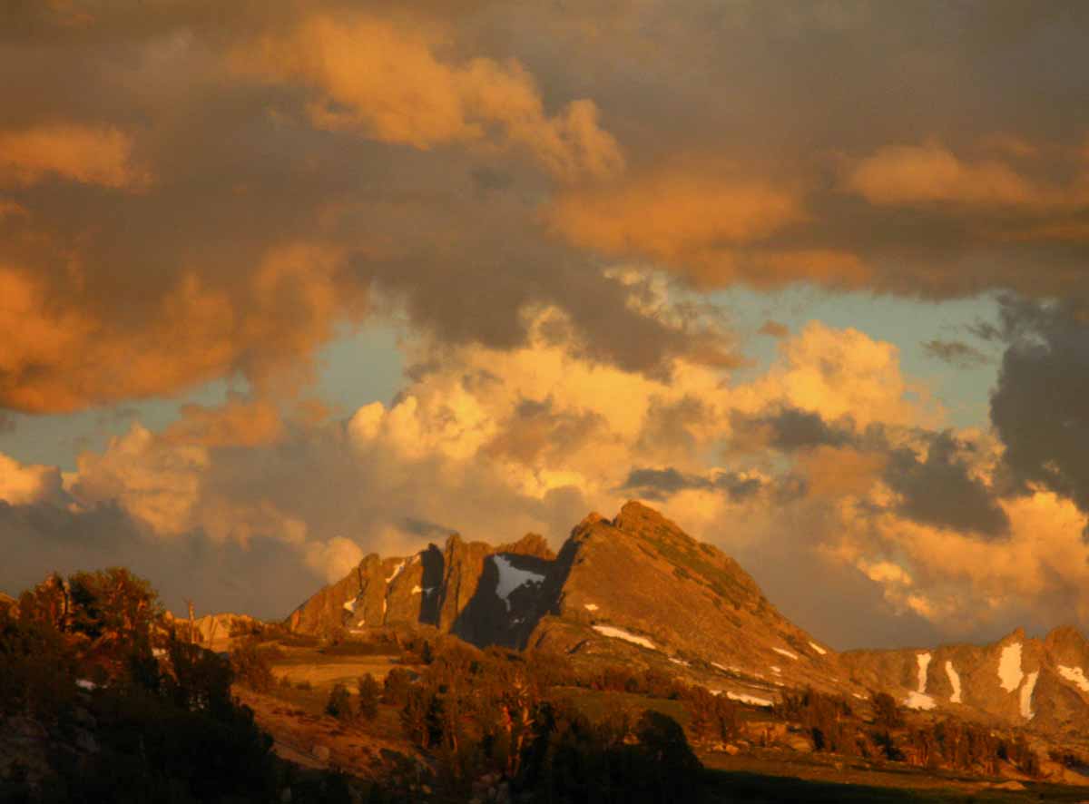
A glimpse at Forsyth Peak in the very Northwest corner of Yosemite National Park under the soft but fierce pastel clouds of a thunderstorm dying as sunset approaches.
Trail Guide Map Miles and Elevations
May 2017
See Last
Week of April 23-29
January February March April May June July August September October November December
| Sunday |
Monday |
Tuesday |
Wednesday |
Thursday |
Friday |
Saturday |
Last Spring Snow Trips?
Once the Spring Thaw gets going the rivers and creeks will rage, making fording very dangerous.
REPORT
|
More
High Sierra
Backpacker
Information
Guide Trailhead
Guide Index
High Sierra Magazine
Blog-Forums |
April 26
Scouting Trips Page
When will the PCT-TYT, High Altitude Sierra Trails open in 2015?
2016
Observations
2017
Staying cool, cloudy, with weak unstable weather.
High growing and moving North off the Coast of Caliornia, but the West Pacific is brewing up some huge tropical storms & tropical activity...
Sloppy precip should be ending as High builds in and moves North.
2017
HIGH SIERRA
SNOWPACK
Below: Watershed Snow Water Content Charts followed by individual reporting station's Snow Depth and
24 hour high-low temps:
Tahoe Basin
Watershed
Tahoe Reporting Stations
On a Map
Scroll over stations for snow & temps. Click for
full report.
American-Yuba Watersheds
Carson-Walker
Watersheds
Carson Pass 117"
Snow
(73.7" H2O)
47 & 23
Ebbetts Pass 146.0"
Snow
(96.1" H2O)
49 & 26
Leavitt Lake
260" Snow
(99.4" H20) Suspect
45
& 24
Marine Base
FULL REPORT
VIS-CHIL-WEA-MB-WIND
6748 feet
50 & 32
Mokelumne-Stanislaus Watersheds
Deadman Creek
000.0 Snow (BAD)
(51.12" H20) (?)
46
& 33
Tuolumne-Merced
Watersheds
Tuolumne Meadows x.xx"
(SNO " Depth & H2O BAD: Use Chart Above)
47
& 31
Tioga Pass/Dana
136.8" Snow
(Temps BAD)
Mammoth Mountain Ski
Mono Lake-Owens Basin
Gem Pass
SNO " Depth Suspect
(53.93" H2O) Suspecttemps suspect
Mammoth Pass
216.1"-STUCK
(60.00" H2O)
52 & 32
South Lake Cabin
BAD" H2O) BAD
55 & 34
Big Pine Sawmill
68.1" Snow
49 & 30
Kings River
Bishop Pass
BAD- BAD
Charlotte Lake
TEMPS ONLY
36 & 16
Kern Watershed
Upr Tyndall Creek
0.00"
xx & xx suspect
(station not
reporting again) |
April 27
2017
Staying cool, cloudy, with weak unstable weather.
High bigger & stronger.
|
April 28
2017
High built in off West Coast of Ca, moisture still out there, but being deflected around us.
The series of weak lows dragging weak wet fronts continues around the perimeter of this High.
High strengthening.
Clear & warming.
Snowpack lost three inches since measurement on the 26th.
SEE THE LATEST
HIGH SIERRA NEWS
NEW
Temp & Snow Tables by Watershed and Highway Corridor
Scroll down to see the...
NEW
All & Selected
Spring Thaw River Flow Information
Also See
All High Sierra Snowpck Data.
Date-Adjustable High Sierra Snowpack Status
Also See
All Snowpck Data on Weather Page
2015 A
Super Hot Day
WHAT’S UP??
High Sierra Weather
2015:
Earliest Spring-Summer transition in
RECORDED HISTORY. |
April 29
2017
High built in off West Coast of Ca growing, vast amounts of tropical moisture are still out there (N Cen Pac), but being deflected, transported around us by this large High.
This tropical moisture will hit us when the High-Low configuration decides it will hit us.
Tropical moisture feeding "Spring Instability" out of the tropics is sufficient, if not greater than "average," yet the Arcitc's excess warmth this Winter into Spring is keeping the Spring lows generated by the rising Equatorial heat from deepening as they are carried North.
Rising temps under this High are going to begin the thaw in earnest, though overnight temps have been remaining low.
TOP
|
April 30
See the
Week of April 23-29, 2017, above.
2017
High Sierra Highways
All Trans-Sierra Highways closed. Extensive road damage due to heavy storms, and much damage expected from thaw and to be revealed when snow clears.
2017 High Sierra Road History
2016
All Trans-Sierra Highway
Closed for Winter.
(Open at this time in 2015)
Caltrans
High Sierra Highways Condition and Status
ROAD CLOSURE HISTORY
|
1 Monday, May 1
Spring Gear
Lighter than Winter, Heavier than Summer Gear. Maybe Now?
2017
Heat building
2017
HIGH SIERRA
SNOWPACK
Below: Watershed Snow Water Content Charts followed by individual reporting station's Snow Depth and
24 hour high-low temps:
Tahoe Basin
Watershed
N Sierra Reporting Stations
On a Map
Scroll over stations for snow & temps. Click for
full report.
American-Yuba Watersheds
Carson-Walker
Watersheds
Carson Pass 108"
Snow
(73.7" H2O)
56 & 30
Ebbetts Pass 136.0"
Snow
(96.2" H2O)
57 & 36
Leavitt Lake
251" Snow
(103.1" H20) Suspect
53
& 35
Marine Base
FULL REPORT
VIS-CHIL-WEA-MB-WIND
6748 feet
45 & 20
Mokelumne-Stanislaus Watersheds
Deadman Creek
000.0 Snow (BAD)
(51.36" H20) (?)
52
& 31
Tuolumne-Merced
Watersheds
Tuolumne Meadows x.xx"
(SNO " Depth & H2O BAD: Use Chart Above)
57
& 24
Tioga Pass/Dana
133.0" Snow
(Temps BAD)
Mammoth Mountain Ski
Mono Lake-Owens Basin
Gem Pass
SNO " Depth Suspect
(52.77" H2O) Suspecttemps suspect
Mammoth Pass
216.1"-STUCK
(60.00" H2O)
63 & 32
South Lake Cabin
(BAD" & H2O) BAD
63 & 28
Big Pine Sawmill
61.4" Snow
52 & 25
Kings River
Bishop Pass
BAD- BAD
Charlotte Lake
TEMPS ONLY
45 & 21
Kern Watershed
Upr Tyndall Creek
0.00"
xx & xx suspect
(station not
reporting again)
NEW
Temp & Snow Tables by Watershed and Highway Corridor
Scroll down to see the...
NEW
All & Selected
Spring Thaw River Flow Information
Also See
All High Sierra Snowpck Data.
Date-Adjustable High Sierra Snowpack Status
Also See
All Snowpck Data on Weather Page
|
2 Tuesday
2017
Heat Wave
2017
Current Snowpack
VAST
Percent of Average for
May 2.
N Sierra: 198%
Cen. Sierra: 201%
S Sierra: 178%
Ca State: 194%
Compare against previous years.
Statewide Summary of Snow Water Content PDF
Cal Coop Snow Survey
Last Readings:
April 20
April 1
March 27
March 1
-----2016-----
Snotel Station Reports Snow Depth REPORT
Carson Pass
49 & 31 degrees, 55"
Ebbetts Pass
50 & 30 degrees, 50"
Sonora Pass
48 & 25 degrees, 46"
Tuolumne Meadows
49 & 22 degrees, 0"
See 2015 Report |
3 Wednesday
2017
Heat Wave
-----2016-----
Spring Instability
Persistent Low-Latitude
Lows to our E & SE (Texas-Gulf Mexico) have been circulating tropical moisture from East to West, generating offshore winds, T-Storms, and generally weak unstable weather.
High Pressure Cells in Pacific strengthening and moving North.
These High-Low configurations create unique air transport patterns:
West Coast Trough in play.
More
High Sierra
Backpacker
Information
Guide Trailhead
Guide Index
High Sierra Magazine
Blog-Forums
TOP |
4 Thursday
2017
Heat Wave & High broken.
Low pushing East with weak front passing over Sierra as next High builds in.
-----2017-----
Weaker pattern of instability than in 2016. More during March-April this year, but less in late April & May. So far.
Until now? Lows East of Sierra look set to draw tropical moisture across Sierra for next couple of days.
-----2016-----
Weaker pattern of instability than in 2015.
2017
HIGH SIERRA
SNOWPACK
Below: Watershed Snow Water Content Charts followed by individual reporting station's Snow Depth and
24 hour high-low temps:
Tahoe Basin
Watershed
N Sierra Reporting Stations
On a Map
Scroll over stations for snow & temps. Click for
full report.
American-Yuba Watersheds
Carson-Walker
Watersheds
Carson Pass 104"
Snow
(73.7" H2O)
64 & 40
Ebbetts Pass 130.0"
Snow
(96.5" H2O)
67 & 39
Leavitt Lake
244" Snow
(103.1" H20) Suspect
60
& 37
Marine Base
FULL REPORT
VIS-CHIL-WEA-MB-WIND
6748 feet
77 & 38
Mokelumne-Stanislaus Watersheds
Deadman Creek
000.0 Snow (BAD)
(51.24" H20) (?)
63
& 33
Tuolumne-Merced
Watersheds
Tuolumne Meadows x.xx"
(SNO " Depth & H2O BAD: Use Chart Above)
65
& 29
Tioga Pass/Dana
128.7" Snow
(Temps BAD)
Mammoth Mountain Ski
Mono Lake-Owens Basin
Gem Pass
SNO " Depth Suspect
(52.77" H2O) Suspecttemps suspect
Mammoth Pass
197.9"
(60.28" H2O)
70 & 35
South Lake Cabin
(BAD" & H2O) BAD
67 & 35
Big Pine Sawmill
57.1" Snow
57 & 30
Kings River
Bishop Pass
BAD- BAD
Charlotte Lake
TEMPS ONLY
51 & 24
Kern Watershed
Upr Tyndall Creek
0.00"
xx & xx suspect
(station not
reporting again) |
5 Friday
2017
Clearing as instability-front passes & next High builds in.
Light sprinkles across North Sierra last night.
Lows East of Sierra look set to draw tropical moisture across Sierra for next couple of days out of the Southwest.
STORM WARNING
Weak snow-rain precip through Monday
WEATHER CONDITIONS Forecasts & Analysis
Run the Models
Also See
Regional Snow Analysis Sierra Nevada for this date
National Weather Service
Quantitative Precipitation Forecasts:
RAIN FORECASTS
High Sierra Weather |
6 Saturday
2017
Saturday Afternoon Showers across N Sierra.
------2016------
RAINY DAY IN SIERRA
TEMPS & SNOW DEPTH
MESOWEST stations
Carson Pass
49 & 33 degrees, 51"
Ebbetts Pass
43 & 31 degrees, 46"
Sonora Pass
47 & 32 degrees, 43"
Tuolumne Meadows
29 & 48 degrees, 0"
HUGE SNOW LOSS DAY |
7
2017
Low from East brings Offshore Winds & Showers from Tahoe South.
|
8 2nd Monday in May
COLD WARNING
(Not Very Cold, but...)
Clearing brings potential cooling, esp in wake of this little active low that crossed East-West:
-----2017-----
As during this exact same week last year in 2016, a weak "tropical" Low moved from East to West South of the Sierra bringing light "tropical" precip.
Classic Spring Instability, but from the South and East.
Waves of showers & snow stripped then added snow pack in the North Sierra, while the highest positions actually got some inches of added snow this weekend.
The lowest, everybody from 9 thou down lost inches. Above that altitude gained snowpack.
The point of this is that Nothing comes out of the NW anymore... ALL the fundamental seasonal patterns have fundamentally changed.
2017
HIGH SIERRA
SNOWPACK
Below: Watershed Snow Water Content Charts followed by individual reporting station's Snow Depth and
24 hour high-low temps:
Tahoe Basin
Watershed
N Sierra Reporting Stations
On a Map
Scroll over stations for snow & temps. Click for
full report.
American-Yuba Watersheds
Carson-Walker
Watersheds
Carson Pass 100"
Snow
(74.5" H2O)
41 & 31
Ebbetts Pass 129.0"
Snow
(98.0" H2O)
40 & 29
Leavitt Lake
241" Snow
(104.2" H20) Suspect
37
& 29
Marine Base
FULL REPORT
VIS-CHIL-WEA-MB-WIND
6748 feet
53 & 33
Mokelumne-Stanislaus Watersheds
Deadman Creek
000.0 Snow (BAD)
(51.96" H20)
46
& 31
Tuolumne-Merced
Watersheds
Tuolumne Meadows x.xx"
(SNO " Depth & H2O BAD: Use Chart Above)
48
& 33
Tioga Pass/Dana
132.9" Snow
(Temps BAD)
Mammoth Mountain Ski
Mono Lake-Owens Basin
Gem Pass
SNO " Depth Suspect
(46.98" H2O) Suspecttemps suspect
Mammoth Pass
197.9" (SUSPECT)
(60.32" H2O)
36 & 31
South Lake Cabin
(BAD" & H2O) BAD
42 & 28
Big Pine Sawmill
61.6" Snow
34 & 25
Kings River
Bishop Pass
BAD- BAD
Charlotte Lake
TEMPS ONLY
30 & 14
Kern Watershed
Upr Tyndall Creek
0.00"
xx & xx suspect
(station not
reporting again) |
9
More
High Sierra
Backpacker
Information
Guide Trailhead
Guide Index
High Sierra Magazine
Blog-Forums
NEW
Temp & Snow Tables by Watershed and Highway Corridor
Scroll down to see the...
NEW
All & Selected
Spring Thaw River Flow Information
Also See
All High Sierra Snowpck Data.
Date-Adjustable High Sierra Snowpack Status
Also See
All Snowpck Data on Weather Page |
10
BIG NEWS
2017:
Summer "Opening" of Trails "Put-Off" until it happens.
Late July?
I mean clear trails across the High Passes. On the Crest Trails.
Maybe not at all this Summer.
EVERY YEAR:
Permits
Make Sure we have our long distance Summer permit plans worked out.
Desolation, Hoover, and Yosemite all begin accepting reservations 6 months in advance.
That would be in January...
Tahoe to Whitney
CONCERNS 2015:
EL NINO
BACKPACKER ALERT
TOP |
11
2017
Big High moving in.
Quantitative Precipitation Forecasts:
RAIN FORECASTS
2017
HIGH SIERRA
SNOWPACK
Below: Watershed Snow Water Content Charts followed by individual reporting station's Snow Depth and
24 hour high-low temps:
Tahoe Basin
Watershed
N Sierra Reporting Stations
On a Map
Scroll over stations for snow & temps. Click for
full report.
American-Yuba Watersheds
Carson-Walker
Watersheds
Carson Pass 91"
Snow
(74.5" H2O)
59 & 35
Ebbetts Pass 119.0"
Snow
(98.0" H2O)
60 & 41
Leavitt Lake
232" Snow
(104.1" H20) Suspect
54
& 38
Marine Base
FULL REPORT
VIS-CHIL-WEA-MB-WIND
6748 feet
73 & 32
Mokelumne-Stanislaus Watersheds
Deadman Creek
000.0 Snow (BAD)
(52.2" H20)
59
& 27
Tuolumne-Merced
Watersheds
Tuolumne Meadows x.xx"
(SNO " Depth & H2O BAD: Use Chart Above)
55
& 27
Tioga Pass/Dana
123.7" Snow
(Temps BAD)
Mammoth Mountain Ski
Mono Lake-Owens Basin
Gem Pass
SNO " Depth Suspect
(46.32" H2O) Suspecttemps suspect
Mammoth Pass
183.5"
(60.36" H2O)
62 & 33
South Lake Cabin
(BAD" & H2O) BAD
62 & 32
Big Pine Sawmill
53.0" Snow
54 & 29
Kings River
Bishop Pass
BAD- BAD
Charlotte Lake
TEMPS ONLY
48 & 20
Kern Watershed
Upr Tyndall Creek
0.00"
xx & xx suspect
(station not
reporting again) |
12
2017
Windy as Big High Builds above Hawaii with Low riding its clock-wise NE perimeter to Seattle... as the High off the coast of the USA grows Huge...
Let's look at the
Big Picture
The Pacific Ocean
Set this for 14 days
&
Display Loop Below
All
High Sierra Weather And the factors creating it |
13 Saturday
2017
Windy on the East perimeter of this vast High
2016
Trans-Sierra Highways
OPEN
(Weather Permitting)
VVR Guide Information
Vermilion Valley Resort Website
Reported first JMT hiker
on
May 14 2015
2015 Opening
Early! |
14
2017
Weak Low/instability off coast of Seattle threatening to drop to South following around NE perimeter of the vast High STILL filling East Pacific under-below Gulf Alaska.
This configuration is a classic wintertime, "storm gate is open" position. Except it's Springtime.
You know things in Nature are "off" when normal patterns are weird...
For Hikers this sloppy weather means tough hiking in soft, wet snow with surging fords if high elevation showers scour the snowpack.
|
15
3RD Monday of May
2017
WEAK STORM WARNING
2017
A weak Low tracking around the Northeast edge of the Vast High off coast of Ca may be dragging a Cold Front from NW to SE across the Sierra this week.
What I call,
"a little Spring Spinner."
For Hikers this sloppy weather means tough hiking in soft, wet snow with surging fords if high elevation showers scour the snowpack.
2017
HIGH SIERRA
SNOWPACK
Below: Watershed Snow Water Content Charts followed by individual reporting station's Snow Depth and
24 hour high-low temps:
Tahoe Basin
Watershed
N Sierra Reporting Stations
On a Map
Scroll over stations for snow & temps. Click for
full report.
American-Yuba Watersheds
Carson-Walker
Watersheds
Carson Pass 86"
Snow
(74.5" H2O)
43 & 27
Ebbetts Pass 114.0"
Snow
(98.0" H2O)
42 & 25
Leavitt Lake
230" Snow
(104.3" H20) Suspect
37
& 23
Marine Base
FULL REPORT
VIS-CHIL-WEA-MB-WIND
6748 feet
52 & 27
Mokelumne-Stanislaus Watersheds
Deadman Creek
000.0 Snow (BAD)
(51.96" H20)
40
& 26
Tuolumne-Merced
Watersheds
Tuolumne Meadows x.xx"
(SNO " Depth & H2O BAD: Use Chart Above)
41
& 26
Tioga Pass/Dana
122.0" Snow
(Temps BAD)
Mammoth Mountain Ski
Mono Lake-Owens Basin
Gem Pass
SNO " Depth Suspect
(48.27" H2O) Suspect
temps suspect
Mammoth Pass
174.9"
(60.36" H2O)
42 & 26
South Lake Cabin
(BAD" & H2O) BAD
41 & 26
Big Pine Sawmill
53.0" Snow
54 & 29
Kings River
Bishop Pass
BAD- BAD
Charlotte Lake
TEMPS ONLY
31 & 12
Kern Watershed
Upr Tyndall Creek
0.00"
xx & xx suspect
(station not
reporting again)
2018 |
16
2017
Weak Lows around Seattle dragging weak cold front across N Ca. & N Sierra
Want to Watch?
The
High Sierra
Weather Page:
All Satellite Views
All Radar Views
All Snow-Precip Forecasts
All High Sierra
ZONE FORECASTS
NEW
High Sierra
Temp & Snow Tables by
Watershed & Highway Corridor
Scroll down to see the...
NEW
All & Selected
High Sierra
Spring Thaw River Flow Information
Also See
All
High Sierra Snowpack Data Sources.
Date-Adjustable High Sierra Snowpack Status
Also See
All Snowpck Data on Weather Page |
17
2017
High building in off NW US, off Seattle.
Let's look at the
Big Picture
The Pacific Ocean Weather Map
Set this for "14 days,"
&
"Display Loop Below."
US Weather Map
All
High Sierra Weather
Tracking
the factors creating it
Trail Guide
Trailhead
High Sierra Forums
The Backpacker's Blog
|
18
2017
High building in off NW US, off Seattle.
2015
Bloom reported PCT hikers hiking down closed Hwy 108 for resupply on the 19th.
(KM PACK STATION)
TOP |
19
2017
High building in off NW US, off Seattle. Heat.Wave Building. |
20 Saturday
2017
HOT
Quantitative Precipitation
Forecast
VVR Anticipates 2016 Opening on May 20, ferry and resupply operations JUNE 1 |
21
2017
HOT
|
22 4th Monday in May
2017
HOT
2017
HIGH SIERRA
SNOWPACK
Below: Watershed Snow Water Content Charts followed by individual reporting station's Snow Depth and
24 hour high-low temps:
Tahoe Basin
Watershed
N Sierra Reporting Stations
On a Map
Scroll over stations for snow & temps. Click for
full report.
American-Yuba Watersheds
Carson-Walker
Watersheds
Carson Pass 72 "
Snow
(74.5" H2O)
61 & 34
Ebbetts Pass 100.0"
Snow
(98.3" H2O)
62 & 41
Leavitt Lake
223" Snow
(104.6" H20) Suspect
58
& 38
Marine Base
FULL REPORT
VIS-CHIL-WEA-MB-WIND
6748 feet
74 & 31
Mokelumne-Stanislaus Watersheds
Deadman Creek
000.0 Snow (BAD)
(53.4" H20)
62
& 32
Tuolumne-Merced
Watersheds
Tuolumne Meadows x.xx"
(SNO " Depth & H2O BAD: Use Chart Above)
64
& 27
Tioga Pass/Dana
114.8" Snow
(Temps BAD)
Mammoth Mountain Ski
Mono Lake-Owens Basin
Gem Pass
SNO " Depth Suspect
(48.26" H2O) Suspect
temps suspect
Mammoth Pass
165.8"
(67.2" H2O)
67 & 36
South Lake Cabin
(BAD" & H2O) BAD
65 & 31
Big Pine Sawmill
43.0" Snow
58 & 29
Kings River
Bishop Pass
BAD- BAD
Charlotte Lake
TEMPS ONLY
50 & 27
Kern Watershed
Upr Tyndall Creek
0.00"
xx & xx suspect
(station not
reporting again)
2018 |
23
2017
Costal Fog breaking heat.
The
High Sierra
Weather Page
All
Satellite
Views
All
Radar
Views
All
Snow-Precip Forecasts
All High Sierra
ZONE
FORECASTS
All High Sierra
POINT
FORECASTS
NEW
High Sierra
Temp & Snow
Tables
by
Watershed & Highway Corridor
Scroll down to see the...
NEW
All & Selected
High Sierra
Spring Thaw River Flow
Information
MORE SNOW
INFORMATION
Also See
All
High Sierra Snowpack Data Sources.
Date-Adjustable High Sierra Snowpack Status
Also See
All Snowpck Data on Weather Page |
24
2017
Costal Fog breaking heat.
Passive weather.
See
Current High Sierra Trail and Terrain News
TOP |
25
2017
Costal Fog breaking heat.
2015 First Clear Day
over Sierra Nevada since May 6.
2017
HIGH SIERRA
SNOWPACK
Below: Watershed Snow Water Content Charts followed by individual reporting station's Snow Depth and
24 hour high-low temps:
Tahoe Basin
Watershed
N Sierra Reporting Stations
On a Map
Scroll over stations for snow & temps. Click for
full report.
American-Yuba Watersheds
Carson-Walker
Watersheds
Carson Pass 69"
Snow
(74.6" H2O)
67 & 40
Ebbetts Pass 94.0"
Snow
(98.3" H2O)
66 & 47
Leavitt Lake
219" Snow
(104.7" H20) Suspect
61
& 44
Marine Base
FULL REPORT
VIS-CHIL-WEA-MB-WIND
6748 feet
73 & 40
Mokelumne-Stanislaus Watersheds
Deadman Creek
000.0 Snow (BAD)
(53.4" H20)
59
& 39
Tuolumne-Merced
Watersheds
Tuolumne Meadows x.xx"
(SNO " Depth & H2O BAD: Use Chart Above)
58
& 26
Tioga Pass/Dana
111.4" Snow
(Temps BAD)
Mammoth Mountain Ski
Mono Lake-Owens Basin
Gem Pass
SNO " Depth Suspect
(46.96" H2O) Suspect
temps suspect
Mammoth Pass
158.6"
(67.2" H2O)
61 & 37
South Lake Cabin
(BAD" & H2O) BAD
62 & 44
Big Pine Sawmill
39.2" Snow
57 & 47
Kings River
Bishop Pass
BAD- BAD
Charlotte Lake
TEMPS ONLY
49 & 24
Kern Watershed
Upr Tyndall Creek
0.00"
xx & xx suspect
(station not
reporting again) |
26
2017
Memorial Day
High Sierra Hazard Warning
See
Current High Sierra Trail and Terrain News |
27 Saturday
2017
Mild |
28
2017
Mild, Clear
Sno-Park Permits
End of permit restrictions for use of Sno-Park parking lots.
LATEST
HIGH SIERRA
TRAIL NEWS
MORE
HIGH SIERRA
Backpacker
RESOURCES
The
High Sierra
Weather Page:
All
High Sierra Satellite
Views
All
High Sierra Radar
Views
All
Snow-Precip
High Sierra Forecasts
All High Sierra
ZONE
FORECASTS
All High Sierra
POINT
FORECASTS
NEW
High Sierra
Temp & Snow
Tables
by
Watershed & Highway Corridor
Scroll down to see the...
NEW
All & Selected
High Sierra
Spring Thaw River Flow
Information
MORE SNOW
INFORMATION
Also See
All
High Sierra Snowpack Data Sources.
Date-Adjustable High Sierra Snowpack Status
Also See
All Snowpack Data
on the
Weather Page
|
29 Monday
Memorial Day
2017
Clear, Mild-Cooler, very weak Low passing across mid-Ca. & Sierra via Tahoe:
THUNDERSTORMS
POSSIBLE
Big Low setting up in Gulf Alaska.
Yet we've had a strong High bouncing around off the West Coast of Ca for a while now, deflecting all tropical moisture around us, mostly to the South...
2017
Memorial Day
High Sierra Hazards Warning
----2016--HOT--------
Memorial Day
Classic High Sierra
OPENING DAY
2015 and 2016
Lake Alpine Lodge
OPEN
Depending on Weather
--2016--
--Clear Sky-Hot
24 hr High & Low+Snow:
Carson Pass
60 & 35 degrees, 8"
Ebbetts Pass
60 & 41 degrees, 0"
Sonora Pass E Flank
60 & 34 degrees, 0"
Deadman Creek
upper meadow
54 & 31 degrees, 26"
Tioga Pass DM
?? & ?? degrees, 23" ??
2017
HIGH SIERRA
SNOWPACK
Below: Watershed Snow Water Content Charts followed by individual reporting station's Snow Depth and
24 hour high-low temps:
Tahoe Basin
Watershed
N Sierra Reporting Stations
On a Map
Scroll over stations for snow & temps. Click for
full report.
American-Yuba Watersheds
Carson-Walker
Watersheds
Carson Pass 58"
Snow
(74.6" H2O)
63 & 38
Ebbetts Pass 81"
Snow
(98.3" H2O)
62 & 45
Leavitt Lake
208" Snow
(104.7" H20) Suspect
58
& 44
Marine Base
FULL REPORT
VIS-CHIL-WEA-MB-WIND
6748 feet
76 & 32
Mokelumne-Stanislaus Watersheds
Deadman Creek
000.0 Snow (BAD)
(53.4" H20)
66
& 31
Tuolumne-Merced
Watersheds
Tuolumne Meadows x.xx"
(SNO " Depth & H2O BAD: Use Chart Above)
64
& 28
Tioga Pass/Dana
104.5" Snow
(Temps BAD)
Mammoth Mountain Ski
Mono Lake-Owens Basin
Gem Pass
SNO " Depth Suspect
(45.36" H2O) Suspect
temps suspect
Mammoth Pass
158.6"
(67.2" H2O)
61 & 37
South Lake Cabin
(BAD" & H2O) BAD
62 & 36
Big Pine Sawmill
32.3" Snow
55 & 30
Kings River
Bishop Pass
BAD- BAD
Charlotte Lake
TEMPS ONLY
49 & 24
Kern Watershed
Upr Tyndall Creek
0.00"
xx & xx suspect
(station not
reporting again) |
30
MORE
HIGH SIERRA
Backpacker
RESOURCES
Sierra Highways
CalTrans
Trans-Sierra Highways
April-May
Trans-Sierra Highway News
Trail Guide Index
HIGH SIERRA
Backpacker
NEWS
April-May
High Sierra
Trail, Terrain,
&
Weather News
April-May
High Sierra News
Current
HIGH SIERRA
Mountain Safety Incidents
Top of Calendar |
31
Review
May of 2017
against
May of 2016
Snow cover was gone by the end of May last Year. |
1
TOP |
2 |
3 Saturday
|
Top of Page
MAY, 2018
NOTES:
TRACKING SIERRA CONDITIONS CAREFULLY
The High Sierra resupply spots are all opening up this month or early the next, a good sign that we should have our trip plans and logistics down and done by now.
We have planned-out every overnight campsite we will sleep at and every individual calorie we will consume by now, meaning that we are about ready to finalize our buckets, seal them up, and determine the exact timing of their shipment to best match our anticipated arrival date.
2017:
SIERRA HIGHWAYS ALL CLOSED FOURTH WEEK OF MAY
Review May 2017 against May 2016
2016:
SIERRA HIGHWAYS OPENING SECOND WEEK OF MAY
2015:
A Deluge of wet and sloppy weather, rain, hail, snow and lightening begins.
The beginning of a sloppy Summer of 2015.
2015
Earliest Opening of Roads and Trails in History?
MAY 1 STATUS 2015
2% of Average Snowpack
MAY 1 STATUS 2016
55% of Average Snowpack
MAY 1 STATUS 2017
194% of Average Snowpack
|
Generally,
May gives us a good indication of the unfolding trajectory of Spring.
Specifically,
2016
It is clear that the most powerful and enduring El Nino in history had the effect of leaving us with about half a "normal" snowpack in May.
The big "takeaway" from all these past forty years is the significant changes in fundamental weather patterns.
Weather patterns have broken down in lockstep with the unlimited growth of population, offshore production, and consumption.
Our pattern must change if we hope to pull the weather patterns back into fruitful configurations.
2016:
"Spring" bloomed in Feb.!
"Summer" heat is rising in Late May!
OPENING DATE ASSESMENT
opening of the High Trails across Mountain Passes.
North Sierra opens by May 29.
South Sierra still in Spring Snow Conditions
May 29
High Sierra Backpacker Weather
2017:
Memorial Day
Ten feet of snow on the Crest
Huge bloom everywhere else from the overwhelming supply of water after so long with so little. |
The Tahoe to Whitney Trail Guide and Forum have been built, funded, and supported by my individual efforts, with help from friends and family.
THANKS!
If you feel these efforts are valuable to you,
you are invited to support them here:
This is the first full and free classic trail guide of and on the web.
A True "Digital Book,"
and a whole lot more....
Why Support Tahoe to Whitney?
Mission Statement |
|
MAY, 2018
May marks the center-point of openings of our High Sierra Resupply facilities
Kennedy Meadows Pack Station opened last month.
The Tuolumne Meadows Post Office, Reds Meadow Pack Station, VVR, and Muir will all open next month
Tahoe to Whitney
Top of Page |
June 2017
Magical pond on the South end of Seavy Pass
January February March April May June July August September October November December
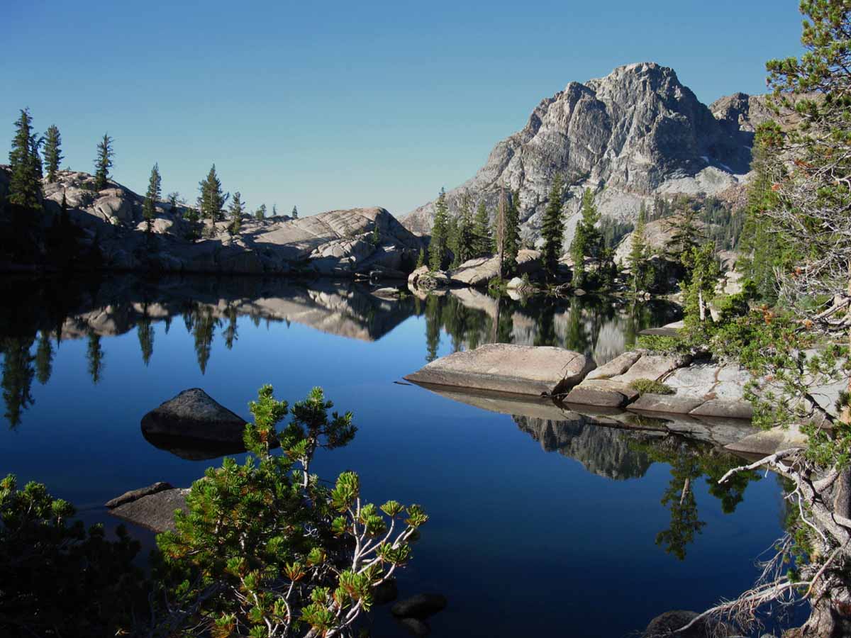 Seavy Pass is the high point in a wide bowl filled with beautiful ponds atop the ridge separating Bensen Lake from Kerrick Canyon along the combined TYT-PCT routes through the North Yosemite Backcountry. Above we are passing around the Southernmost pond before beginning the great descent to Bensen Lake.
Trail Guide Map Miles and Elevations
June 2017
January February March April May June July August September October November December
| Sunday |
Monday |
Tuesday |
Wednesday |
Thursday |
Friday |
Saturday |
Transitional Month
Not so much during 2017
The Sierra Crest still has between four feet on it in the North Sierra to 10 in the South.
More
High Sierra
Backpacker
Information
Guide Trailhead
Guide Index
High Sierra Magazine
Blog-Forums
|
30
2016
Ebbetts Pass
Clear of Snow
Elev: 8765 ft
2016
Sonora Pass
Clear of Snow
(East Flank Station)
8827 ft
TOP |
31 |
1
VVR
Opens
Depending on Weather
CLOSED 2017
Current VVR Information
Resupply Boxes accepted and available for pickup
June 1st 2017
Ferry begins operation
June 15th 2017
Anticipated Opening
June 9th 2017
Anticipated Closing
October 9th, 2017
The
High Sierra
Weather Page
All
Satellite
Views
All
Radar
Views
All
Snow-Precip
Forecasts
All High Sierra
ZONE
FORECASTS
All High Sierra
POINT
FORECASTS
NEW
High Sierra
Temp & Snow
Tables
by
Watershed & Highway Corridor
Scroll down to see the...
NEW
All & Selected
High Sierra
Spring Thaw River Flow
Information
MORE SNOW
INFORMATION
Also See
All
High Sierra Snowpack Data Sources.
Date-Adjustable High Sierra Snowpack Status
Also See
All Snowpck Data on Weather Page
|
2
2016
Early Season Heat wave Building
SEVEN DAY
TEMP GRAPHIC
Rain, wind, snow too.
2017
Clear, Mild-Cooler, with a rather large High over East Pac moving East, assuring more pacific weather.
The Salient fact is that there is little pressure difference between Highs and Lows, very little temp difference before and after front lines. IT is weak, likely a result of the extreme Arctic Warming and warm Arctic Winter we experienced affecting Spring. I figure late Summer will really heat up, if I am correct.
2017
HIGH SIERRA
SNOWPACK
Below: Watershed Snow Water Content Charts followed by individual reporting station's Snow Depth and
24 hour high-low temps.
Last: May 29
Tahoe Basin
Watershed
N Sierra Reporting Stations
On a Map
Scroll over stations for snow & temps. Click for
full report.
American-Yuba Watersheds
Carson-Walker
Watersheds
Carson Pass 47 "
Snow
(74.4" H2O)
57 & 34
Ebbetts Pass 68"
Snow
(98.3" H2O)
58 & 36
Leavitt Lake
198" Snow
(104.9" H20) Suspect
55
& 36
Marine Base
FULL REPORT
VIS-CHIL-WEA-MB-WIND
6748 feet
73 & 33
Mokelumne-Stanislaus Watersheds
Deadman Creek
000.0 Snow (BAD)
(53.4" H20)
60
& 33
Tuolumne-Merced
Watersheds
Tuolumne Meadows x.xx"
(SNO " Depth & H2O BAD: Use Chart Above)
64
& 30
Tioga Pass/Dana
98.6" Snow
(Temps BAD)
Mammoth Mountain Ski
Mono Lake-Owens Basin
Gem Pass
SNO " Depth Suspect
(43.57" H2O) Suspect
temps suspect
Mammoth Pass
136.5"
(67.2" H2O)
66 & 35
South Lake Cabin
(BAD" & H2O) BAD
63 & 35
Big Pine Sawmill
25.8" Snow
57 & 31
Kings River
Bishop Pass
BAD- BAD
Charlotte Lake
TEMPS ONLY
50 & 23
Kern Watershed
Upr Tyndall Creek
0.00"
xx & xx suspect
(station not
reporting again) |
3
KENNEDY
MEADOWS
2017
ADULT HORSEPACKER
CAMP-SCHOOL
(NOT THIS YEAR:LATER?)
2017
Clearing after typical "Marine Layer" of Stratus sitting off most of the length of the West Coast of the USA pushes back from the coastline.
This "Marine Layer" is keeping temps down.
2016 Early Season Heat wave STRONG
VALLEY TEMPS TO 100s
2016
Carson Pass
8353 ft
Clear of Snow today
49 & 30°, 0"
Ebbetts Pass
51 & 31°, 7"
Sonora Pass E Flank
67 & 41°, 0"
Deadman Creek
Upper meadow West flank just below Sonora Pass
72 & 34°, 16"
Tioga Pass DM
xx & xx°, 17"? |
4 Sunday
2016
HEATWAVE, moderating.
REPORT
Heavy West Coast Trough pulling significant tropical moisture North. |
5
The
High Sierra
Weather Page
All
Satellite
Views
All
Radar
Views
All
Snow-Precip
Forecasts
All High Sierra
ZONE
FORECASTS
All High Sierra
POINT
FORECASTS
NEW
High Sierra
Temp & Snow
Tables
by
Watershed & Highway Corridor
Scroll down to see the...
NEW
All & Selected
High Sierra
Spring Thaw River Flow
Information
MORE SNOW
INFORMATION
Also See
All
High Sierra Snowpack Data Sources.
Date-Adjustable High Sierra Snowpack Status
Also See
All Snowpck Data on Weather Page |
6
2017
Impending Weather?
North Sierra Precip This Week?
Wednesday to Weekend?
All High Sierra Zone Forecasts
All High Sierra Precip Forecasts
2017
HIGH SIERRA
SNOWPACK
Below: Watershed Snow Water Content Charts followed by individual reporting station's Snow Depth and
24 hour high-low temps.
Last: June 2
Tahoe Basin
Watershed
N Sierra Reporting Stations
On a Map
Scroll over stations for snow & temps. Click for
full report.
American-Yuba Watersheds
Carson-Walker
Watersheds
Carson Pass 38"
Snow
(74.4" H2O)
63 & 38
Ebbetts Pass 55"
Snow
(98.3" H2O)
63 & 42
Leavitt Lake
186" Snow
(104.9" H20) Suspect
59
& 45
Marine Base
FULL REPORT
VIS-CHIL-WEA-MB-WIND
6748 feet
77 & 32
Mokelumne-Stanislaus Watersheds
Deadman Creek
000.0 Snow (BAD)
(53.4" H20)
65
& 30
Tuolumne-Merced
Watersheds
Tuolumne Meadows x.xx"
(SNO " Depth & H2O BAD: Use Chart Above)
66
& 31
Tioga Pass/Dana
89.9" Snow
(Temps BAD)
Mammoth Mountain Ski
Mono Lake-Owens Basin
Gem Pass
SNO " Depth Suspect
(40.72" H2O) Suspect
temps suspect
Mammoth Pass
124.1"
(83.04" H2O)
67 & 38
South Lake Cabin
(BAD" & H2O) BAD
65 & 38
Big Pine Sawmill
17.1" Snow
58 & 34
Kings River
Bishop Pass
BAD- BAD
Charlotte Lake
TEMPS ONLY
53 & 24
Kern Watershed
Upr Tyndall Creek
0.00"
xx & xx suspect
(station not
reporting again) |
7
2017
3 pm precip hits North Ca Coast, Northernmost Sierra.
TOP
|
8
2017
3 pm precip hits North Ca Coast, Northernmost Sierra.
2015
T-storms and Rain from
TS BLANCA (2015)
Raining on the Sierra Crest
1.1 inches of precip predicted over Sierra next 7 days.
|
9
2017
1 am precip hits central Sierra.
A very small amount of snow accumulation took place, followed by accelerated melting as majority of precip fell-falling as light rain.
"Sloppy" conditions next three-four days.
FIVE DAY SNOW MODEL
2017
HIGH SIERRA
SNOWPACK
Below: Watershed Snow Water Content Charts followed by individual reporting station's Snow Depth and
24 hour high-low temps.
Last: June 6
Tahoe Basin
Watershed
N Sierra Reporting Stations
On a Map
Scroll over stations for snow & temps. Click for
full report.
American-Yuba Watersheds
Carson-Walker
Watersheds
Carson Pass 35" Snow
8388 feet
(74.5" H2O)
46 & 39
Ebbetts Pass 50"
8660 feet
Snow
(98.7" H2O)
47 & 38
Leavitt Lake
9602 feet, East Flank
181" Snow
(105.1" H20) Suspect
44
& 36
Marine Base
6748 feet East Flank
FULL REPORT
VIS-CHIL-WEA-MB-WIND
65 & 48
Mokelumne-Stanislaus Watersheds
Deadman Creek
9250 feet, West Flank
000.0 Snow (BAD)
(53.4" H20)
46
& 36
Tuolumne-Merced
Watersheds
Tuolumne Meadows
8600 feet, West Flank
x.xx"
(SNO " Depth & H2O BAD: Use Chart Above)
57
& 37
Tioga Pass/Dana
9798 feet
89.9" Snow
(Temps BAD)
Mammoth Mountain Ski
Mono Lake-Owens Basin
Gem Pass
10750 feet
SNO " Depth Suspect
(39.24" H2O) Suspect
temps suspect
Mammoth Pass
9500 feet
117.6"
(83.04" H2O)
51 & 34
South Lake Cabin
9580 feet, East Flank
(BAD" & H2O) BAD
57 & 41
Big Pine Sawmill
10200 feet, East Flank
12.3" Snow
51 & 37
Kings River
Bishop Pass
11972 feet
BAD- BAD
Charlotte Lake
10398 feet, West Flank
TEMPS ONLY
54 & 23
Kern Watershed
Upr Tyndall Creek
0.00"
xx & xx suspect
(station not
reporting again) |
10 Saturday
2017
Clear. We can see a tall mass of tropical moisture flowing West under Aleutian Chain.
This moisture's rapidly moving high altitude aspects are being directed towards us by the Low to it's North and the High to it's South.
Snow above 6500 feet across Norht Sierra Tomorrow.
Satellite View
KENNEDY
MEADOWS
PACK STATION
2017
ADULT HORSEPACKER
CAMP-SCHOOL
ENDS
(Doubt it even started? Check with KM for details.) |
JUNE 11
Sunday
2017
Anticipate day of North Sierra Snow
2017
Clear on coast as weak low rapicly crosses N Sierra.
Snow reports coming later today after the Low clears the Sierra.
2017
HIGH SIERRA
SNOWPACK
Below: Watershed Snow Water Content Charts followed by individual reporting station's Snow Depth and
24 hour high-low temps.
Last: June 9
Tahoe Basin
Watershed
N Sierra Reporting Stations
On a Map
Scroll over stations for snow & temps. Click for
full report.
American-Yuba Watersheds
Carson-Walker
Watersheds
Carson Pass 31" Snow
8388 feet
(74.8" H2O)
46 & 34
Ebbetts Pass 42"
8660 feet
Snow
(98.9" H2O)
45 & 33
Leavitt Lake
9602 feet, East Flank
176" Snow
(105.5" H20) Suspect
42
& 31
Marine Base
6748 feet East Flank
FULL REPORT
VIS-CHIL-WEA-MB-WIND
63 & 46
Mokelumne-Stanislaus Watersheds
Deadman Creek
9250 feet, West Flank
000.0 Snow (BAD)
(52.68" H20)
40
& 27
Tuolumne-Merced
Watersheds
Tuolumne Meadows
8600 feet, West Flank
x.xx"
(SNO " Depth & H2O BAD: Use Chart Above)
43
& 26
Tioga Pass/Dana
9798 feet
80.2" Snow
(Temps BAD)
Mammoth Mountain Ski
Mono Lake-Owens Basin
Gem Pass
10750 feet
SNO " Depth Suspect
(39.24" H2O) Suspect
temps suspect
Mammoth Pass
9500 feet
111.2"
(83.12" H2O)
44 & 27
South Lake Cabin
9580 feet, East Flank
(BAD" & H2O) BAD
48 & 29
Big Pine Sawmill
10200 feet, East Flank
5.1" Snow
46 & 26
Kings River
Bishop Pass
11972 feet
BAD- BAD
Charlotte Lake
10398 feet, West Flank
TEMPS ONLY
43 & 19
Kern Watershed
Upr Tyndall Creek
0.00"
xx & xx suspect
(station not
reporting again) |
12
Reds Meadow
Accepts resupply packages
KENNEDY MEADOWS
PACK STATION
2017
KIDS HORSEPACKER
CAMP-SCHOOL
I
BEGINS
RESOURCES
The
High Sierra
Weather Page
All
Satellite
Views
All
Radar
Views
All
Snow-Precip
Forecasts
All High Sierra
ZONE
FORECASTS
All High Sierra
POINT
FORECASTS
NEW
High Sierra
Temp & Snow
Tables
by
Watershed & Highway Corridor
Scroll down to see the...
NEW
All & Selected
High Sierra
Spring Thaw River Flow
Information
MORE SNOW
INFORMATION
Also See
All
High Sierra Snowpack Data Sources.
Date-Adjustable High Sierra Snowpack Status
Also See
All Snowpck Data on Weather Page
|
13
2017
Sonora Pass Opens
2017
Clear across Ca coast & Western Nevada as stationary high brings increasing temps next four days.
A Heat Wave is Building over the next four days.
The clarity today brings a clear view from orbiting satellites of the vastness of the snow-pack remaining on the Sierra Crest.
High Sierra
Satellite Views
Our Sat View of the snow can be contrasted and better understood when viewed against our
HIGH SIERRA
snowpack status
MORE
HIGH SIERRA
Backpacker
RESOURCES
CalTrans
Trans-Sierra Highways
All
Trans-Sierra Highway News
Trail Guide Index
HIGH SIERRA
Backpacker
NEWS
Latest
High Sierra
Trail, Terrain,
&
Weather News
Latest
High Sierra News
Latest
HIGH SIERRA
Mountain Safety Incidents
Top of Calendar |
14
2015 REPORTS
HEAT WAVE BUILDING,
LAST BITS of the
Sierra Snowpack
Our past
Sets the Table
for the
FUTURE
TOP |
15 |
16
2017
HEATWAVE WEATHER HAZARD WARNING
Hanford-San J
Potential Heat Risks Map
Heat Timeline
Sacto Valley & High Sierra
Heat & Thaw:
Mono Flooding Hazards
Merced Flooding Outlook
In Addition to
Snow Travel Hazard
Fording Hazard
FIRST DAY MUIR RANCH RESUPPLY SERVICE 2016
MUIR RANCH WEBSITE
Ramadan Begins
KENNEDY
MEADOWS
PACK STATION
2017
KIDS HORSEPACKER
CAMP-SCHOOL
I
ENDS
2017
HIGH SIERRA
SNOWPACK
Below: Watershed Snow Water Content Charts followed by individual reporting station's Snow Depth and
24 hour high-low temps.
Last: June 11
Tahoe Basin
Watershed
N Sierra Reporting Stations
On a Map
Scroll over stations for snow & temps. Click for
full report.
American-Yuba Watersheds
Carson-Walker
Watersheds
Carson Pass 18" Snow
8388 feet
(74.7" H2O)
62 & 38
Ebbetts Pass 28"
8660 feet
Snow
(99.0" H2O)
64 & 45
Leavitt Lake
9602 feet, East Flank
166" Snow
(105.7" H20) Suspect
62
& 44
Marine Base
6748 feet East Flank
FULL REPORT
VIS-CHIL-WEA-MB-WIND
80 & 34
Mokelumne-Stanislaus Watersheds
Deadman Creek
9250 feet, West Flank
000.0 Snow (BAD)
(52.68" H20)
72
& 35
Tuolumne-Merced
Watersheds
Tuolumne Meadows
8600 feet, West Flank
x.xx"
(SNO " Depth & H2O BAD: Use Chart Above)
76
& 35
Tioga Pass/Dana
9798 feet
75.3" Snow
(Temps BAD)
Mammoth Mountain Ski
Mono Lake-Owens Basin
Gem Pass
10750 feet
SNO " Depth Suspect
(36.11" H2O) Suspect
temps suspect
Mammoth Pass
9500 feet
100.8"
(83.4" H2O)
70 & 41
South Lake Cabin
9580 feet, East Flank
(BAD" & H2O) BAD
74 & 38
Big Pine Sawmill
10200 feet, East Flank
1.3" Snow
67 & 37
Kings River
Bishop Pass
11972 feet
BAD- BAD
Charlotte Lake
10398 feet, West Flank
TEMPS ONLY
56 & 25
Kern Watershed
Upr Tyndall Creek
0.00"
xx & xx suspect
(station not
reporting again) |
JUNE 17
Delays on General Highway in Kings Canyon
Bishop Creek Shuttle to start today
Saturday
2017
HEATWAVE WEATHER HAZARD WARNING
KENNEDY
MEADOWS
PACK STATION
2017
KIDS HORSEPACKER
CAMP
II
BEGINS
2015
Tuolumne Meadows Post Office reports busiest times ever.
RESOURCES
The
High Sierra
Weather Page
All
Satellite
Views
All
Radar
Views
All
Snow-Precip
Forecasts
All High Sierra
ZONE
FORECASTS
All High Sierra
POINT
FORECASTS
|
18 Sunday
Father's Day
2017
HEATWAVE WEATHER HAZARD WARNINGS
2016
Heat Wave Building |
19
2017
HEATWAVE WEATHER HAZARD WARNINGS
Heat Hazard
Fording Hazard
Snow travel Hazard
Hanford-San J
Potential Heat Risks Map
Heat Timeline
Sacto Valley & High Sierra
Heat & Thaw:
Mono Flooding Hazards
Merced Flooding Outlook
|
20
Summer
Solstice
2017
First Day
of
Summer
21:24 Zulu Time
2017
HEATWAVE WEATHER HAZARD WARNINGS
Heat forecast through Thursday
2015
North Sierra SNOW FREE
South Sierra rapidly losing thin pack along crestline.
2017
HIGH SIERRA
SNOWPACK
Below: Watershed Snow Water Content Charts followed by individual reporting station's Snow Depth and
24 hour high-low temps.
Last: June 16
Tahoe Basin
Watershed
N Sierra Reporting Stations
On a Map
Scroll over stations for snow & temps. Click for
full report.
American-Yuba Watersheds
Carson-Walker
Watersheds
Carson Pass 8" Snow
8388 feet
(74.8" H2O)
74 & 47
Ebbetts Pass 12"
8660 feet
Snow
(99.1" H2O)
75 & 53
Leavitt Lake
9602 feet, East Flank
150" Snow
(105.7" H20) Suspect
73
& 53
Marine Base
6748 feet East Flank
FULL REPORT
VIS-CHIL-WEA-MB-WIND
92 & 46
Mokelumne-Stanislaus Watersheds
Deadman Creek
9250 feet, West Flank
000.0 Snow (BAD)
(52.68" H20)
75
& 39
Tuolumne-Merced
Watersheds
Tuolumne Meadows
8600 feet, West Flank
x.xx"
(SNO " Depth & H2O BAD: Use Chart Above)
80
& 41
Tioga Pass/Dana
9798 feet
66.3" Snow
(Temps BAD)
Mammoth Mountain Ski
Mono Lake-Owens Basin
Gem Pass
10750 feet
SNO " Depth Suspect
(31.44" H2O) Suspect
temps suspect
Mammoth Pass
9500 feet
77.3"
(83.4" H2O)
79 & 47
South Lake Cabin
9580 feet, East Flank
(BAD" & H2O) BAD
78 & 48
Big Pine Sawmill
10200 feet, East Flank
2.1" Snow
69 & 42
Kings River
Bishop Pass
11972 feet
BAD- BAD
Charlotte Lake
10398 feet, West Flank
TEMPS ONLY
61 & 34
Kern Watershed
Upr Tyndall Creek
0.00"
xx & xx suspect
(station not
reporting again)
|
21
Lakes Basin Road in Mammoth to open today
2017
HEATWAVE WEATHER HAZARD WARNINGS
Special
WEATHER
Circumstances
EXTREME DANGER WARNING
Latest
High Sierra
Trail, Terrain,
&
Weather News
Latest
High Sierra News
Latest
HIGH SIERRA
Mountain Safety Incidents
2015
Muir Ranch
Begins offering resupply package pickup
Trail Guide
INDEX
All
High Sierra Forecasts
|
22
2017
HEATWAVE WEATHER HAZARD WARNINGS
Special
WEATHER
Circumstances
EXTREME DANGER WARNING
2015
REPORTS:
This looks like the end of the Spring Instability and advent of full-blown Summer HEAT.
ENSO inputs seem to be going IR batshit... |
23
KENNEDY
MEADOWS
PACK STATION
2017
KIDS HORSEPACKER
CAMP
II
ENDS
2017
HEATWAVE WEATHER HAZARD WARNINGS
Heat Warnings expiring today-this afternoon.
SE Flank Flood Warnings expiring tomorrow: see
ALL HIGH SIERRA WEATHER ZONE FORECASTS
NOTE:
Hot temps continue...
2017
HIGH SIERRA
SNOWPACK
Below: Watershed Snow Water Content Charts followed by individual reporting station's Snow Depth and
24 hour high-low temps.
Last: June 20
Tahoe Basin
Watershed
N Sierra Reporting Stations
On a Map
Scroll over stations for snow & temps. Click for
full report.
American-Yuba Watersheds
Carson-Walker
Watersheds
Carson Pass 1 " Snow
8388 feet
(74.9" H2O)
72 & 49
Ebbetts Pass 5"
8660 feet
Snow
(99.8" H2O)
71 & 48
Leavitt Lake
9602 feet, East Flank
140" Snow
(105.6" H20) Suspect
71
& 48
Marine Base
6748 feet East Flank
FULL REPORT
VIS-CHIL-WEA-MB-WIND
87 & 44
Mokelumne-Stanislaus Watersheds
Deadman Creek
9250 feet, West Flank
000.0 Snow (BAD)
(53.4" H20)
72
& 40
Tuolumne-Merced
Watersheds
Tuolumne Meadows
8600 feet, West Flank
x.xx"
(SNO " Depth & H2O BAD: Use Chart Above)
78
& 41
Tioga Pass/Dana
9798 feet
59.8" Snow
(Temps BAD)
Mammoth Mountain Ski
Mono Lake-Owens Basin
Gem Pass
10750 feet
SNO " Depth Suspect
(28.25" H2O) Suspect
temps suspect
Mammoth Pass
9500 feet
65.8"
(83.4" H2O)
79 & 47
South Lake Cabin
9580 feet, East Flank
(BAD" & H2O) BAD
66 & 46
Big Pine Sawmill
10200 feet, East Flank
2.2" Snow
71 & 43
Kings River
Bishop Pass
11972 feet
BAD- BAD
Charlotte Lake
10398 feet, West Flank
TEMPS ONLY
59 & 32
Kern Watershed
Upr Tyndall Creek
0.00"
xx & xx suspect
(station not
reporting again)
|
24 Saturday
2017
HEATWAVE WEATHER HAZARD WARNINGS
EXPIRED
FLOOD
HAZARD WARNINGS
EXTENDED
2017
Flood Warnings extended along length of East Sierra. in pm precip hits North Ca Coast, Northernmost Sierra.
2015
REPORTS:
Heat Wave Building in,
Thunderstorm Mechanism is operating, enhanced by trough bringing moisture-rich air North.
Valley temps up to 103 this next week. These temps can drive fierce T-Storms. |
25 Sunday
WARNINGS
through
Fourth of July
Fording Hazard
Snow travel Hazard |
26 |
27
TOP
|
28
Road to Spicer Open
"ACCESS HAZARD" WARNING
SNOWPACK
RESOURCES
NEW
High Sierra
Temp & Snow
Tables
by
Watershed & Highway Corridor
Scroll down to see the...
NEW
All & Selected
High Sierra
Spring Thaw River Flow
Information
MORE SNOW
INFORMATION
Also See
All
High Sierra Snowpack Data Sources.
Date-Adjustable High Sierra Snowpack Status
Also See
All Snowpck Data on Weather Page |
29
Tioga Pass Opens
WEATHER
RESOURCES
The
High Sierra
Weather Page
All
Satellite
Views
All
Radar
Views
All
Snow-Precip
Forecasts
All High Sierra
ZONE
FORECASTS
All High Sierra
POINT
FORECASTS
|
30
Ebbetts Pass Opens
2017
HIGH SIERRA
SNOWPACK
Below: Watershed Snow Water Content Charts followed by individual reporting station's Snow Depth and
24 hour high-low temps.
Last: June 23
Tahoe Basin
Watershed
N Sierra Reporting Stations
On a Map
Scroll over stations for snow & temps. Click for
full report.
American-Yuba Watersheds
Carson-Walker
Watersheds
Carson Pass 00" Snow
8388 feet
(74.9" H2O)
67 & 38
Ebbetts Pass 00"
8660 feet
Snow
(99.7" H2O)
67 & 46
Leavitt Lake
9602 feet, East Flank
112" Snow
(105.7" H20) Suspect
65
& 47
Marine Base
6748 feet East Flank
FULL REPORT
VIS-CHIL-WEA-MB-WIND
83 & 34
Mokelumne-Stanislaus Watersheds
Deadman Creek
9250 feet, West Flank
000.0 Snow (BAD)
(53.64" H20)
72
& 37
Tuolumne-Merced
Watersheds
Tuolumne Meadows
8600 feet, West Flank
x.xx"
(SNO " Depth & H2O BAD: Use Chart Above)
74
& 36
Tioga Pass/Dana
9798 feet
40.7" Snow
(Temps BAD)
Mammoth Mountain Ski
Mono Lake-Owens Basin
Gem Pass
10750 feet
SNO " Depth Suspect
(28.25" H2O) Suspect
temps suspect
Mammoth Pass
9500 feet
33.1"
(83.4" H2O)
72 & 43
South Lake Cabin
9580 feet, East Flank
(BAD" & H2O) BAD
73 & 45
Big Pine Sawmill
10200 feet, East Flank
1.0" Snow
69 & 39
Kings River
Bishop Pass
11972 feet
BAD- BAD
Charlotte Lake
10398 feet, West Flank
TEMPS ONLY
58 & 29
Kern Watershed
Upr Tyndall Creek
0.00"
xx & xx suspect
(station not
reporting again)
|
1 Saturday
WARNINGS
through
Fourth of July
Fording Hazard
Snow travel Hazard
THINK AHEAD
CCC
Backcountry Trail Crew
Applications due
EARLY FEB 2018 |
Top of Page
NOTES: The Snowpack on the Sierra, storm activity, and temps during June are going to allow us to get a bead on when the Sierra Trails across the High Passes will start opening up, as well as the trails approaching them.
High Sierra Backpacker Weather
When the snows melt millions of mosquitoes rise from the saturated soils. It starts low down the mountain early in Spring and rises up the mountainside as Spring progresses. Be ready for the rising clouds of mosquitoes.
High Sierra MOSQUITOES
MARCH 2015 OBSERVATION REGARDING SPRING-EARLY SUMMER:
Everybody will open early, unless prohibited by use agreements. The issue driving behavior in June is going to be fires, not snowpack. This year is shaping up to have the hottest Wintertime temperatures pushing earliest opening of the Sierra trails and resorts with the least amount of snow and rain recorded since the Western settlement of California.
JUNE 2015 REPORTS:
A very warm unsettled month of May has brought continued unsettled Weather conditions into June. The overnight temps have been above freezing since late May, and the tropical remnants of Blanca appear to be scouring the remaining snow off the South Sierra quite quickly on June 10.
I expect a regular groove to be cut by hikers through what snow remains in the South Sierra mountain Passes along the JMT by the start of June.
2014 Calendar 2015 Calendar
2016 Calendar
|
Permits
Only remnants of reserved permits are available out of Yosemite, Mount Whitney Zone, and Desolation Wilderness.
Through-hiker permits into or across these areas are still available.
Permits
June 24 2015 REPORTS:
ENSO activity seems to be tormenting the central-East US with tropical moisture appearing as tornadoes and T-storms. The "gunsight" that points this energy our way is not seasonally adjusted to point at the Sierra, but it looks like the "clip" is full.
This means that as Fall cooling beings these tropical flows could be pointed our way, if ocean heating trends continue.
Or not. We could just as easily maintain drought conditions. I put the chances at tropical El Nino Fall rains at 50-50 from today's perspective. |
JUNE 2015 & 2016
ASSESMENTS
Tropical Thunderstorms, Rain and Snowstorms from supercharged El Nino torment lightly-geared PCT Hikers.
2015 NO THAW TO SPEAK OF: IT IS OVER.
2016 THAW PROGRESSING ON "TRADITIONAL," if a bit-A MONTH-earlier than "AVERAGE" SIERRA THAW TIMELINE.
The real danger of June is found between the swollen banks of rivers and even normally small placid creeks, surging with the power of the Spring Thaw. (Not this year)
During heavy Spring Thaws one can hear the grinding of unseen great granite boulders as supercharged river flows easily roll them downstream. (Not this year)
Carefully assess all river crossings, have contingency plans for being knocked down and losing your pack, and turn around if the dangers are too great. (All Years)
Tahoe to Whitney
Top of Page |
July 2017
Volunteer and Double Peaks
January February March April May June July August September October November December
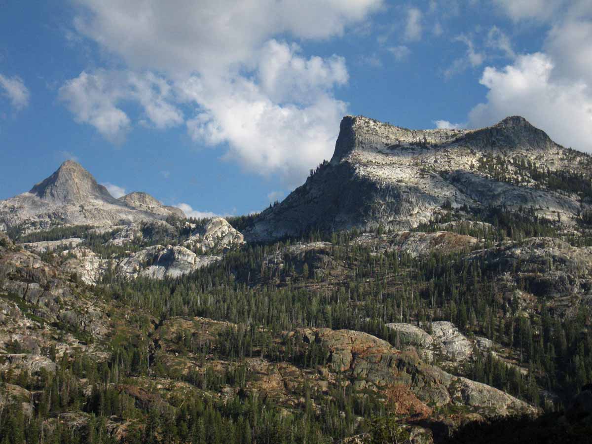
Descending towards Bensen Lake we observe the massive climb following our descent when we continue South from Bensen. This is one of the hardest sections of the whole Tahoe to Whitney hike.
North Yosemite Backcountry
Trail Guide Map Miles and Elevations
July 2017
January February March April May June July August September October November December
| Sunday |
Monday |
Tuesday |
Wednesday |
Thursday |
Friday |
Saturday |
JULY 2017
Backpackers
Shift to Summer Gear well under way. Be ready for last bursts of Spring Weather.
Ignore the Calendar.
Gear up for the Conditions on the Ground, not a Date on the Calendar.
High Sierra Backpacker Weather
ON THE TRAIL
2015 REPORTS
July 2015
Current chances of experiencing
SEVERE WEATHER are INCREASED.
|
27
|
28
2016
Hot and Clear
2015 REPORTS:
Vast Tropical Flows |
29
TOP
|
30 |
1
WARNINGS
through
Fourth of July
Fording Hazard
Snow travel Hazard
Tuolumne Meadows
Post Office
OPEN
Depending on Weather
(OPENED MID JUNE 2015!!)
High Sierra Weather |
2
2016
Hot and Clear
|
3
|
4
Fourth of July
WEATHER
RESOURCES
The
High Sierra
Weather Page
All
Satellite
Views
All
Radar
Views
All
Snow-Precip
Forecasts
All High Sierra
ZONE
FORECASTS
All High Sierra
POINT
FORECASTS
|
5
2017
HIGH SIERRA
SNOWPACK
Below: Watershed Snow Water Content Charts followed by individual reporting station's Snow Depth and
24 hour high-low temps.
Last: June 30
Tahoe Basin
Watershed
N Sierra Reporting Stations
On a Map
Scroll over stations for snow & temps. Click for
full report.
American-Yuba Watersheds
Carson-Walker
Watersheds
Carson Pass 00" Snow
8388 feet
(74.9" H2O)
70 & 47
Ebbetts Pass 00"
8660 feet
Snow
(99.8" H2O)
68 & 53
Leavitt Lake
9602 feet, East Flank
97" Snow
(105.7" H20) Suspect
64
& 52
Marine Base
6748 feet East Flank
FULL REPORT
VIS-CHIL-WEA-MB-WIND
86 & 45
Mokelumne-Stanislaus Watersheds
Deadman Creek
9250 feet, West Flank
000.0 Snow (BAD)
(53.28" H20)
68
& 46
Tuolumne-Merced
Watersheds
Tuolumne Meadows
8600 feet, West Flank
x.xx"
(SNO " Depth & H2O BAD: Use Chart Above)
74
& 37
Tioga Pass/Dana
9798 feet
23.6" Snow
(Temps BAD)
Mammoth Mountain Ski
Mono Lake-Owens Basin
Gem Pass
10750 feet
SNO " Depth Suspect
(28.25" H2O) Suspect
temps suspect
Mammoth Pass
9500 feet
16.3" Snow
(83.4" H2O)
71 & 45
South Lake Cabin
9580 feet, East Flank
(BAD" & H2O) BAD
72 & 50
Big Pine Sawmill
10200 feet, East Flank
.3" Snow
65 & 44
Kings River
Bishop Pass
11972 feet
BAD- BAD
Charlotte Lake
10398 feet, West Flank
TEMPS ONLY
57 & 32
Kern Watershed
Upr Tyndall Creek
0.00"
xx & xx suspect
(station not
reporting again) |
6
2017
WARNINGS
through
Mid-July
Heat Hazard
Fording Hazard
Snow travel Hazard
TRANSPO
Most 2017
Trans-Sierra Highways & Road NEWS
Very Late Openings
High Points:
June 21
Bishop Creek Shuttle runs
June 21
Lakes Basin Road open, Mammoth
June 28
Road to Spicer Open
Reds Road Closed
June 29
Tioga Pass Opens
June 30
Ebbetts Pass Opens
High Sierra Transportation Resources
HISTORY
2016
Beautiful weather in the Sierra. Warm to Hot.
2015 REPORTS:
Serious Tropical Flows
drawn North by local low pressure zone moving East across Sierra bringing days of fierce Thunderstorms, Lightening, and Torrential Rains. |
7
2017
HEATWAVE WEATHER HAZARD WARNINGS
FLOOD
HAZARD WARNINGS
See each ZONE for specific warnings:
High Sierra
Zone Forecasts
HAZARD
WARNINGS & MAP
Heavy Lightening in South Sierra:
(3:40 PM)
special weather statement
On current radar
(FIERCE! 22:38 GMT)
Lightening Forecasts
NEW
High Sierra
Temp & Snow
Tables
by
Watershed & Highway Corridor
Scroll down to see the...
NEW
All & Selected
High Sierra
Spring Thaw River Flow
Information
MORE SNOW
INFORMATION
Also See
All
High Sierra Snowpack Data Sources.
Date-Adjustable High Sierra Snowpack Status
2015 REPORTS:
Tropical Storms
Reno Floods. |
8
2017
WARNINGS
through
Mid-July
Heat Hazard
Fording Hazard
Snow travel Hazard
Current Backpacker Alert
Current Mountain Safety News
TOP |
9 Sunday |
10
2017
Our heat hazards have degraded into warnings, but it is still concerningly warm. Caution advised!
Backpacker Alert, Currently
Snow is rising above 10, 000 feet, but still thick above that point, and in protected aspects far below.
Snow Info
Terrain is still saturated. Reds Meadow Road still closed, the Tuolumne Store, Cafe, and Post Office are still closed, while the High Sierra Camps are not opening at all this year.
Trail News: July 10
We have gone from flood to drought-heat wave conditions in the snap of a finger.
Fire and Smoke now join snow terrain and dangerous fords as hazards we must be watching out for.
All Fire & Smoke Resources
2017
HIGH SIERRA
SNOWPACK
Below: Watershed Snow Water Content Charts followed by individual reporting station's Snow Depth and
24 hour high-low temps.
Last: July 5
Tahoe Basin
Watershed
N Sierra Reporting Stations
On a Map
Scroll over stations for snow & temps. Click for
full report.
American-Yuba Watersheds
Carson-Walker
Watersheds
Carson Pass 00" Snow
8388 feet
(74.8" H2O)
73 & 50
Ebbetts Pass 00"
8660 feet
Snow
(99.7" H2O)
71 & 56
Leavitt Lake
9602 feet, East Flank
84" Snow
(105.6" H20) Suspect
71
& 53
Marine Base
6748 feet East Flank
FULL REPORT
VIS-CHIL-WEA-MB-WIND
91 & 46
Mokelumne-Stanislaus Watersheds
Deadman Creek
9250 feet, West Flank
000.0 Snow (BAD)
(53.4" H20)
72
& 43
Tuolumne-Merced
Watersheds
Tuolumne Meadows
8600 feet, West Flank
x.xx"
(SNO " Depth & H2O BAD: Use Chart Above)
76
& 42
Tioga Pass/Dana
9798 feet
1.3" Snow
(Temps BAD)
Mammoth Mountain Ski
Mono Lake-Owens Basin
Gem Pass
10750 feet
SNO " Depth Suspect
(28.25" H2O) Suspect
temps suspect
Mammoth Pass
9500 feet
5.9" Snow
(83.4" H2O)
74 & 47
South Lake Cabin
9580 feet, East Flank
(BAD" & H2O) BAD
71 & 51
Big Pine Sawmill
10200 feet, East Flank
.0" Snow
68 & 45
Kings River
Bishop Pass
11972 feet
BAD- BAD
Charlotte Lake
10398 feet, West Flank
TEMPS ONLY
61 & 37
Kern Watershed
Upr Tyndall Creek
0.00"
xx & xx suspect
(station not
reporting again) |
11
2017
Baja Ca Hurricane: see 2015 note of 14th.
2017
Heavy snow at high altitudes preserves the
SNOW TRAVEL HAZARD,
but now mostly limited to higher up the flanks & crest.
Continuing high runoff flows maintain the
FORDING HAZARD.
HOT TEMPS PERSIST,
and must be monitored.
FIRE & SMOKE
hazards are present & increasing.
MOSQUITOES are a THREAT.
Water & Snow Hazards are gradually narrowing as this unique season progresses, while Heat, Fire, and Skeeter threats are rapidly rising.
George & Sue
Married
2015
HAPPY ANNEVERSARY!
Ceremony at Burst Rock in Emigrant Wilderness, followed by a backpacking honeymoon into the Emigrant Backcountry.
And Tahoe afterwards...
WEATHER
RESOURCES
The
High Sierra
Weather Page
All
Satellite
Views
All
Radar
Views
All
Snow-Precip
Forecasts
All High Sierra
ZONE
FORECASTS
All High Sierra
POINT
FORECASTS |
12
MOSQUITOES
Mosquitoes rise when the snows melt.
Mosquitoes are typically THICK.
2015 REPORTS:
Skeeters are thin. Early for thin...
|
13
TOP |
14
2017
Heat Advisories.
Warm to Hot.
2016
Beautiful weather in the Sierra. Warm to Hot.
2015 REPORTS:
Remnants of Baja Ca Hurricane drawn North into LA, South Deserts, and bringing more tropical storms to Sierra Nevada:
LA Floods
Hwy 10 Closed by Flash Flood |
15 Saturday
2017
Heat Advisories.
Warm to Hot.
2016
Beautiful weather in the Sierra. Warm to Hot.
2015 REPORTS:
It has been a "Tropical Summer," so far. This trend began in mid-May. |
16 Sunday
2016
Hot and Clear
2015 REPORTS:
It has been a "Tropical Summer," so far. This trend began in mid-May. |
17
2017
Heavy snow at high altitudes preserves the:
SNOW TRAVEL HAZARD,
but now mostly limited to higher up the flanks & crest.
Still lots of snow on parts of Sierra Crest, less on others.
High Altitude Trips are STILL SNOW TRIPS
Date-Adjustable High Sierra Snowpack Status
Amazing Sat Views
Continuing high runoff flows maintain the
FORDING HAZARD.
HOT TEMPS PERSIST,
and must be monitored.
FIRE & SMOKE
hazards are present & increasing.
MOSQUITOES are a THREAT.
Water & Snow Hazards are gradually narrowing as this unique season progresses, while Heat, Fire, and Skeeter threats are rapidly rising.
2017
HIGH SIERRA
SNOWPACK
Below: Watershed Snow Water Content Charts followed by individual reporting station's Snow Depth and
24 hour high-low temps.
Last: July 10
Tahoe Basin
Watershed
N Sierra Reporting Stations
On a Map
Scroll over stations for snow & temps. Click for
full report.
American-Yuba Watersheds
Carson-Walker
Watersheds
Carson Pass 8" Snow
8388 feet
(74.4" H2O)
72 & 48
Ebbetts Pass 00"
8660 feet
Snow
(99.7" H2O)
74 & 54
Leavitt Lake
9602 feet, East Flank
49" Snow
(105.6" H20) Suspect
69
& 53
Marine Base
6748 feet East Flank
FULL REPORT
VIS-CHIL-WEA-MB-WIND
89 & 47
Mokelumne-Stanislaus Watersheds
Deadman Creek
9250 feet, West Flank
000.0 Snow (BAD)
(53.4" H20)
69
& 38
Tuolumne-Merced
Watersheds
Tuolumne Meadows
8600 feet, West Flank
x.xx"
(SNO " Depth & H2O BAD: Use Chart Above)
74
& 38
Tioga Pass/Dana
9798 feet
.7" Snow
(Temps BAD)
Mammoth Mountain Ski
Mono Lake-Owens Basin
Gem Pass
10750 feet
SNO " Depth Suspect
(28.25" H2O) Suspect
temps suspect
Mammoth Pass
9500 feet
5.1" Snow
(83.48" H2O)
75 & 48
South Lake Cabin
9580 feet, East Flank
(BAD" & H2O) BAD
75 & 52
Big Pine Sawmill
10200 feet, East Flank
2.0" Snow
69 & 45
Kings River
Bishop Pass
11972 feet
BAD- BAD
Charlotte Lake
10398 feet, West Flank
TEMPS ONLY
62 & 37
Kern Watershed
Upr Tyndall Creek
0.00"
xx & xx suspect
(station not
reporting again) |
18
SNOW
Also See
All
High Sierra Snowpack Data Sources.
Date-Adjustable High Sierra Snowpack Status
Amazing Sat Views
ZONES
&
HAZARDS
High Sierra
Zone Forecasts
HAZARD
WARNINGS & MAP
WEATHER
RESOURCES
The
High Sierra
Weather Page
All
Satellite
Views
All
Radar
Views
All
Snow-Precip
Forecasts
All High Sierra
ZONE
FORECASTS
All High Sierra
POINT
FORECASTS
|
19
2017
FULL SMOKE-FIRE ALERT
Detwiler Fire
Smoke inundates Tahoe-Carson-Reno areas, (alert)
All backpackers and visitors to the Sierra should check smoke and fire conditions. Smoke can be a real problem, even with no fire in near proximity.
Fire & Smoke
CalFire
Inciweb Fed
Smoke
All Recent Trail News
Heat threat dissapated
into warm temps-not cool, but warm. Heat to increase again this weekend, so be heat and fire aware.
Tropical Power Marching North
A unique configuration of factors has formed up a "storm generation machine" (news) in the waters off of Central America for the past couple of weeks. A line of storms aimed at Hawaii have been deflected, swatted away to the Southwest and disrupted by the rotation of the powerful, persistant High covering the NE Pacific.
Now these big tropical storms are marching far enough North that remnants of their massive moisture plumes could be swept East on prevailing winds, and across the Sierra during the next week-weeks.
This means that the chances of tropical thunderstorms and downpours are increasing.
Beware the Lightening
Best Sat View: IR SE Pacific
All
Satellite
Views
|
20
FULL SMOKE-FIRE ALERT
Detwiler Fire
ZONES
&
HAZARDS
High Sierra
Zone Forecasts
HAZARD
WARNINGS & MAP
TOP |
21
2017
Heat Hazard Rising
Heat Warnings in effect this weekend
Fire Hazard
Smoke Hazard
Fording Hazard
Snow Travel Hazard
(High Elevations)
See
Exact Line of High Sierra Snow Cover
High Sierra
Fire & Smoke
Information
CalFire
Inciweb Fed
Smoke
Check the Heat Intensity for Sunday
Forecast Graphical Interface
|
22 Saturday |
23 Sunday
|
24 |
25
TOP |
26
2017
A Warm Week
Heavy Tropical Forces
Weather Notes |
27
"The New Normal"
The Drought Never Ended |
28
Detwiler Fire being brought under control, Tahoe Basin Fire Resrtictions. |
29 |
30 Sunday
2017
Heat Hazard Rising
Heat Warnings in effect this week, building to Thursday peak.
Fire Hazard
Smoke Hazard
Fording Hazard
Snow Travel Hazard
(High Elevations)
See
Exact Line of High Sierra Snow Cover
Fire & Smoke
CalFire
Inciweb Fed
Smoke
Check the Heat Intensity for Thursday.
Forecast Graphical Interface
|
31
Safety News
Fording Fatality on PCT.
Detwiler Fire 90% contained.
Trail News
July 31, 2017
2017
Heavy snow at high altitudes preserves the:
SNOW TRAVEL HAZARD,
but now mostly limited to higher up the flanks & crest.
Still lots of snow on parts of Sierra Crest, less on others.
High Altitude Trips are STILL SNOW TRIPS
Date-Adjustable High Sierra Snowpack Status
Amazing Sat Views
Continuing high runoff flows maintain the
FORDING HAZARD.
HOT TEMPS PERSIST,
and must be monitored.
FIRE & SMOKE
hazards are present & increasing.
MOSQUITOES are a THREAT.
Water & Snow Hazards are gradually narrowing as this unique season progresses, while Heat, Fire, and Skeeter threats are rapidly rising.
2017
HIGH SIERRA
SNOWPACK
Below: Watershed Snow Water Content Charts followed by individual reporting station's Snow Depth and
24 hour high-low temps.
Last: July 17
Tahoe Basin
Watershed
N Sierra Reporting Stations
On a Map
Scroll over stations for snow & temps. Click for
full report.
American-Yuba Watersheds
Carson-Walker
Watersheds
Carson Pass 00" Snow
8388 feet
(74.4" H2O)
73 & 49
Ebbetts Pass 00"
8660 feet
Snow
(99.7" H2O)
73 & 53
Leavitt Lake
9602 feet, East Flank
00" Snow
(105.6" H20) Suspect
68
& 52
Marine Base
6748 feet East Flank
FULL REPORT
VIS-CHIL-WEA-MB-WIND
88 & 45
Mokelumne-Stanislaus Watersheds
Deadman Creek
9250 feet, West Flank
000.0 Snow (BAD)
(53.4" H20)
73
& 43
Tuolumne-Merced
Watersheds
Tuolumne Meadows
8600 feet, West Flank
x.xx"
(SNO " Depth & H2O BAD: Use Chart Above)
74
& 30
Tioga Pass/Dana
9798 feet
.1" Snow
(Temps BAD)
Mammoth Mountain Ski
Mono Lake-Owens Basin
Gem Pass
10750 feet
SNO " Depth Suspect
(28.25" H2O) Suspect
temps suspect
Mammoth Pass
9500 feet
6.3" Snow
(83.48" H2O)
77 & 51
South Lake Cabin
9580 feet, East Flank
(BAD" & H2O) BAD
74 & 50
Big Pine Sawmill
10200 feet, East Flank
.30" Snow
70 & 43
Kings River
Bishop Pass
11972 feet
BAD- BAD
Charlotte Lake
10398 feet, West Flank
TEMPS ONLY
60 & 36
Kern Watershed
Upr Tyndall Creek
4.47"
71 & 50
(station
reporting again!) |
1
High Sierra
Fire & Smoke
Information
CalFire
Inciweb Fed
Smoke
Check the Heat Intensity building to Thursday.
Forecast Graphical Interface
WEATHER
RESOURCES
The
High Sierra
Weather Page
All
Satellite
Views
All
Radar
Views
All
Snow-Precip
Forecasts
All High Sierra
ZONE
FORECASTS
All High Sierra
POINT
FORECASTS
|
2 |
3 |
4
TOP |
5 Saturday |
Top of Page
Standard JULY NOTES:
I’ve seen years when the snowpack sticks through the Summer, and years where the snowpack clears by mid-June. The past four decades the average annual snowpack has radically declined and the date the snow clears has gotten earlier and earlier.
Independent of the long term trends our trip planning and gear selection are guided by careful observations of the character of each season’s weather. This year is no different.
2015 REPORTS:
Freak Tropical Weather blowing North bringing unsettled weather into the Sierra since late May, and certainly persisting through now, mid-July. The El Nino conditions in the East-Central Pacific are already epic by July 22, which is very early in the timing of a typical El Nino "season."
This indicates a high probability of our already tropically-unsettled weather being supercharged by a heavy El Nino building into Fall. We will see. This tropical weather has served to suppress what would have been a disastrous fire season, and has served to put the drought on "suspended animation," somewhat retarding its progress.
Last two times I saw El Ninos like this (over last 40+ years) California suffered epic Fall flooding. Epic.
|
|
DANGERS
Monitor weather for afternoon Thunderstorms
Beware of dangerous fording conditions
Mosquito conditions are typically going Hog Wild during this time of year.
Not during 2015!
Mosquito Populations are still being depressed by the drought conditions, despite the Spring and Summer tropical rains.
2014 Calendar 2015 Calendar
2016 Calendar |
July brings the peak of the Summer Thunderstorm Season in the High Sierra. These are local weather, caused by heat waves in the San Joaquin Valley swept up the West Sierra Flank.
Hot wet air on a fast ride up the West Sierra flank to high elevations squeezes out what can be substantial daily rain and lightening activity lasting between 2 pm and sunset.
Don’t cross open ground under one of these storms. They are deadly. Lightening and Fording are the leading causes of High Sierra backpacker deaths.
2015 HISTORY
This year's constant series of thunderstorms are tropically born, not local. These thunderstorms are the product of distant moisture-rich tropical air being driven North by air currents generated by the intense tropical thunderstorm activity that generated them in the first place. These moisture rich airs are then sucked across the Sierra by an aberrant series of stubborn unstable low pressure zones over California and the West Coast of the U.S.
Tahoe to Whitney
Top of Page |
August 2017
View down Tuolumne River from Glen Aulin High Sierra Camp
January February March April May June July August September October November December
View down the Tuolumne River while hiking across the footbridge just South of Glen Aulin High Sierra Camp at morning sunlight lighting up the canyon.
Trail Guide Map Miles and Elevations
August 2017
January February March April May June July August September October November December
| Sunday |
Monday |
Tuesday |
Wednesday |
Thursday |
Friday |
Saturday |
Prime Time Backpacking
Mosquitoes diminishing to irrelevance.
Hot Temps moderate into cool backpacking.
Lowering Sun brings increasing contrasts to terrain.
Hiker Traffic Decreasing.
MONTH OF FIRE
|
25 |
26 |
27 |
28 |
29
|
| Sunday |
Monday |
Tuesday |
Wednesday |
Thursday |
Friday |
Saturday |
30 |
31 |
1
THINK AHEAD
CCC
Backcountry Trail Crew
Applications due
EARLY FEB 2017
NWS Hazard
WARNINGS
&
National Hazard Map
Check the Heat Intensity for Thursday.
Forecast Graphical Interface
Fire & Smoke
CalFire
Inciweb Fed
Smoke
|
2
2017
HEAT WAVE BUILDING
T-Strom Warnings
Storm Warnings
yet:
Heavy snow at high altitudes mostly in the South Sierra preserves the:
SNOW TRAVEL HAZARD,
but now mostly limited to higher up the flanks & crest of the South Sierra.
Still lots of snow on South Sierra & protected parts of North Sierra Crest, less on others.
Protected areas full of snow in N & S Sierra.
High Altitude Trips are STILL SNOW TRIPS
Date-Adjustable High Sierra Snowpack Status
Amazing Sat Views of Sierra Snowpack
Continuing high runoff flows maintain the
FORDING HAZARD.
HOT TEMPS PERSIST,
ARE GROWING,
and must be monitored. Big Heat Building.
FIRE & SMOKE
hazards are present & increasing.
MOSQUITOES are a HUGE THREAT.
Lightening Hazard
Water & Snow Hazards are gradually narrowing as this unique season progresses, while Heat, Fire, and Skeeter threats are HIGH & rapidly rising.
Trail News
August, 2017
2017
HIGH SIERRA
SNOWPACK
Below: Watershed Snow Water Content Charts followed by individual reporting station's Snow Depth and
24 hour high-low temps.
Last: July 31
Tahoe Basin
Watershed
N Sierra Reporting Stations
On a Map
Scroll over stations for snow & temps. Click for
full report.
American-Yuba Watersheds
Carson-Walker
Watersheds
Carson Pass 00" Snow
8388 feet
(75.1" H2O)
77 & 52
Ebbetts Pass 00"
8660 feet
Snow
(99.7" H2O)
79 & 58
Leavitt Lake
9602 feet, East Flank
00" Snow
(105.6" H20) Suspect
74
& 57
Marine Base
6748 feet East Flank
FULL REPORT
VIS-CHIL-WEA-MB-WIND
91 & 46
Mokelumne-Stanislaus Watersheds
Deadman Creek
9250 feet, West Flank
000.0 Snow (BAD)
(53.4" H20)
77
& 48
Tuolumne-Merced
Watersheds
Tuolumne Meadows
8600 feet, West Flank
x.xx"
(SNO " Depth & H2O BAD: Use Chart Above)
79
& 44
Tioga Pass/Dana
9798 feet
.7" Snow
(Temps BAD)
Mammoth Mountain Ski
Mono Lake-Owens Basin
Gem Pass
10750 feet
SNO " Depth Suspect
(28.25" H2O) Suspect
temps suspect
Mammoth Pass
9500 feet
3.2" Snow
(83.48" H2O)
81 & 58
South Lake Cabin
9580 feet, East Flank
(BAD" & H2O) BAD
76 & 51
Big Pine Sawmill
10200 feet, East Flank
.30" Snow
70 & 46
Kings River
Bishop Pass
11972 feet
BAD- BAD
Charlotte Lake
10398 feet, West Flank
TEMPS ONLY
63 & 38
Kern Watershed
Upr Tyndall Creek
4.47"
71 & 50
(station
reporting again!) |
3
2017
HEAT WAVE
&
A Vast Tropical Plume...
Weak Low a couple hundred miles off San Francisco is dragging a vast plume of tropical moisture Northwest, up across the whole length of S. CA & across S Arizona from Central Mexico.
It is a plume of fully moisture-charged TROPICAL AIR.
This plume is generating some serious electricity. Lightening & lightening-caused fires should be watched for and expected.
It's serious blowback from this interesting tropical weather trend/activity.
Lightening Probs
This current Sat View of West US shows the Low & its Plume to you, if you click it this morning.
This sat shows current conditions, so you will see what's up at the time you click it...
All Sat Views
HAZARDS
Inspect the current hazard reports and the National Hazard Map:
NWS
High Sierra Hazard
WARNINGS
&
National Hazard Map
Check Heat Intensity:
Real Time
Reporting Stations
Scroll-Over stations for Temps
Forecast Graphical Interface
Fire & Smoke
CalFire
Inciweb Fed
Smoke |
4
TOP
|
5 |
| Sunday |
Monday |
Tuesday |
Wednesday |
Thursday |
Friday |
Saturday |
6
Cold Evenings
August evenings are getting colder and colder.
Begin adding layers as Fall conditions emerge.
|
7 |
8
|
9 |
10
|
11 |
12
Seasonal Shift
Big Changes
(any effect?)
|
13
Backpacker Alert Update
Almost Normal Conditons:
Still Snow on Crest
Fords Higher than Normal
|
14 |
15
Mosquitoes
Mosquitoes die as terrain dries.
August 15 is the drop-dead date during “normal” Years
2017 IS NOT
A
NORMAL YEAR
HIGH SIERRA
Mosquito News |
16 |
17 |
18
TOP |
19 |
20
|
21 |
22
Season-Long
April 1 to Aug 22
BACKPACKER ALERT
TERMINATED
"Season-Normal" Hazards Continue.
Current Potential Hazards
Heat Waves
Fording Danger
Lightening Danger
Fire & Smoke
Mosquitoes
Mountain Safety Page |
23 |
24 |
25
Review
the
August 2017
Trail News
|
26
HEAT WARNING
Next 3 Days
Excessive Heat
National Hazard Map
2016-17
High Sierra
Season Review
|
| Sunday |
Monday |
Tuesday |
Wednesday |
Thursday |
Friday |
Saturday |
27
HEAT WARNING
Next 2 Days
Excessive Heat |
28
HEAT WARNING
Last Day?
NO!
Excessive Heat
National Hazard Map
Resource
All High Sierra Forest & Park
Fire, Fire Restrictions, and Alert Status.
|
29
HEAT WARNING
Extended through Labor Day Weekend.
Excessive Heat
National Hazard Map
All High Sierra Forecasts
High Sierra Hazards
TOP |
30 LABOR DAY HAZARDS
HEAT WARNING
Extended through Labor Day Weekend.
Excessive Heat
All
High Sierra
FORECASTS
Potential
Labor Day
Hazards
HEAT WAVE
NWS
High Sierra Weather Hazard
WARNINGS
&
National Hazard Map
FORDING
Fording Hazards in the High Sierra
All River Flow and Stage Information
LIGHTENING
Lightening Information
Lightening Probs
FIRE & SMOKE
hazards are present & increasing.
CalFire
Inciweb Fed
Smoke
Mosquitoes
|
31
RISING RECORD-LEVEL HEAT
INTENSE FIRES
(Western US Burning)
DENSE, WIDESPREAD SMOKE |
1
RISING RECORD-LEVEL HEAT
INTENSE FIRES
(Western US Burning)
DENSE, WIDESPREAD SMOKE |
2
RECORD-LEVEL HEAT
INTENSE FIRES
(Western US Burning)
DENSE, WIDESPREAD SMOKE |
Top of Page
Typical Year : Wet years extends the mosquitoes’ reign past the 15th, Dry years shorten it.
Wet basins and lakes that hold water on vast sheets of solid granite below their green-grass coverings feed the mosquitoes later into the season than terrain that drains.
Thus we will find “holdout zones” where local mosquito populations remain high long after the surrounding terrain has dried out. My advice when you encounter one of these zones: RUN!
2015: Drought. Weird tropical weather through July. August to typical conditions, but under extreme drought context. Thus August began running up into one of the worse fire seasons ever. September's weather will decide. Massive El Nino Conditions are boiling the Central Pacific. Somebody is going to get flooded.
|
Stay Alert
Though August is wonderful, it also potentially puts us into range of early-season storms and temp plunges.
It’s getting time to start supplementing our Summer gear with bits of our thicker Fall Gear.
2014 Calendar 2015 Calendar
2016 Calendar |
The diminishing heat of Summer days are intermixing with the deepening chill of cold nights warning of approaching Fall conditions.
The Summer “high season” is now over, and trail traffic diminishes. The PCT hikers are long gone, and the JMT hikers are down to a trickle by the end of August.
The normal unpredictability of Sierra temp changes and storms are increasing, and so too should our gear selection start thickening up with bits of extra Fall insulation, to match the rising potential of cold conditions as the seasons change.
2015
HISTORY
The threats are fire and tropical weather.
The enduring trend of shortening Winters and the subsequent diminishment of Rain and Snowpack during the last 25 years has evolved into a completely different weather pattern. The storms out of the Northwest, in fact the whole North Pacific Weather Pattern has been disrupted. I would say it has been shattered.
The various unhinged elements of our old pattern have not re-established a new pattern, but two things are clear. First, our traditional pattern of Winter storms out of the Northwest has been shattered. It will likely re-occur every 3 to 7 years on a diminishing cycle, but it is done as the dominant feature of Winter weather on the whole Northwest Coast of the US.
Second, the temperatures and humidity have risen to levels un-natural for the North Latitudes.
The establishment of this new weather pattern is now re-ordering the type and distribution of plant and animal life rapidly, through fire.
New plants, animals, and trees will replace those burned.
For backpackers this means that the rising threats into this year's September are massive fires and unexpected tropical downpours. |
Tahoe to Whitney
Top of Page |
September 2017
Stunning colors of sunset in the John Muir Wilderness
Looking Northeast from near Island Pass at Blacktop Peak and its massive massif.
January February March April May June July August September October November December
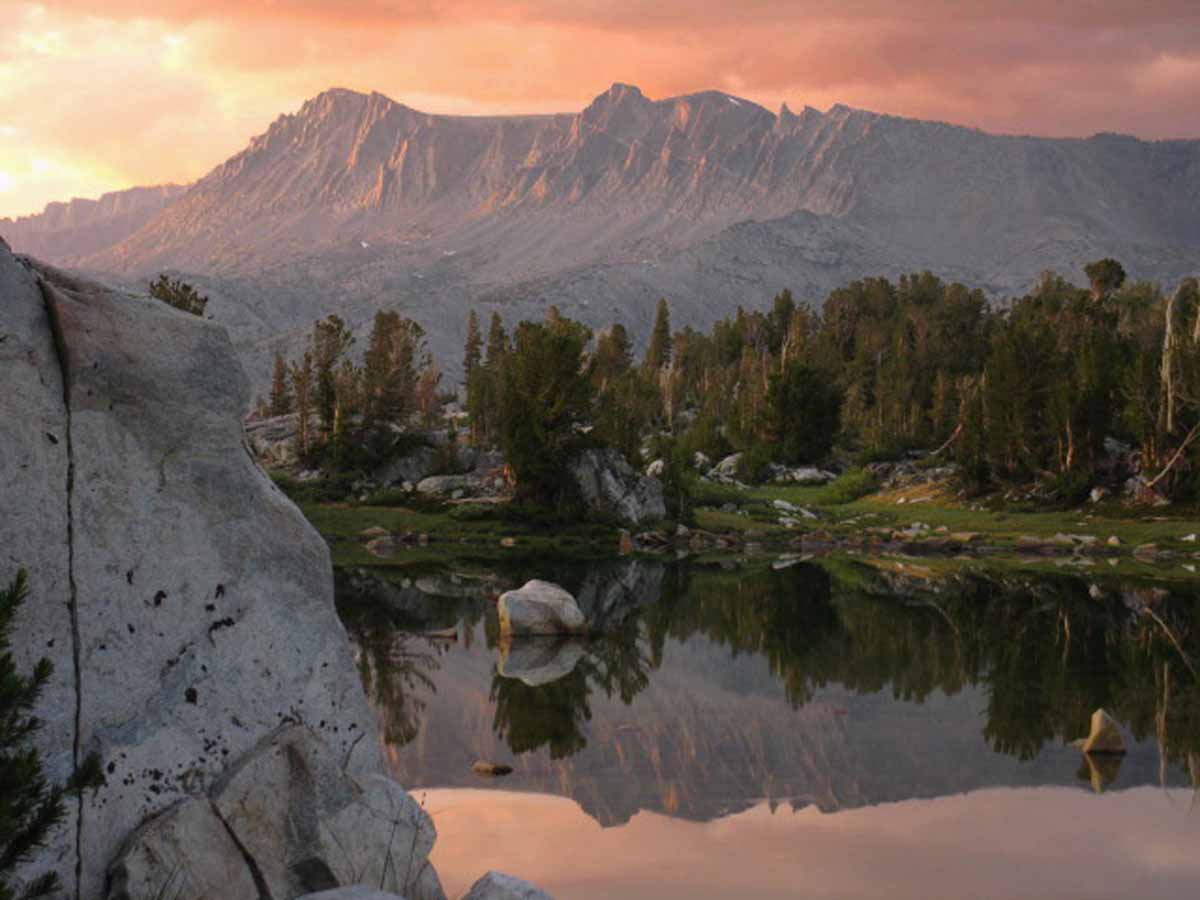
Massif under Blacktop Peak from unnamed lake in Island Pass. Donohue Pass and Peak are to the Left out of the image.
Trail Guide Map Miles and Elevations
September 2017
January February March April May June July August September October November December
| Sunday |
Monday |
Tuesday |
Wednesday |
Thursday |
Friday |
Saturday |
FIRE DANGERS
In 2016 we dodged a bullet, a bullet of fire.
2015 HISTORY
EL NINO BOILING THE CENTRAL NORTH PACIFIC
FIRES BURNING ACROSS CALIFORNIA.
For backpackers these conditions require awareness of potential Fire and Tropical Downpours.
Fire and Smoke Information
El Nino Report
Huge Fires Burning: Rough Fire Continues |
29
HEAT WARNING
Extended through Labor Day Weekend.
Excessive Heat
National Hazard Map
All High Sierra Forecasts
High Sierra Hazards
|
30
LABOR DAY HAZARDS
HEAT WARNING
Extended through Labor Day Weekend.
Excessive Heat
All
High Sierra
FORECASTS
Potential
Labor Day
Hazards
HEAT WAVE
NWS
High Sierra Weather Hazard
WARNINGS
&
National Hazard Map
FORDING
Fording Hazards in the High Sierra
All River Flow and Stage Information
LIGHTENING
Lightening Information
Lightening Probs
FIRE & SMOKE
hazards are present & increasing.
CalFire
Inciweb Fed
Smoke
Mosquitoes
|
31
RISING RECORD-LEVEL HEAT
INTENSE FIRES
(Western US Burning)
DENSE, WIDESPREAD SMOKE |
1
RISING RECORD-LEVEL HEAT
INTENSE FIRES
(Western US Burning)
DENSE, WIDESPREAD SMOKE
|
2
RECORD-LEVEL HEAT
INTENSE FIRES
(Western US Burning)
DENSE, WIDESPREAD SMOKE
TOP
|
| Sunday |
Monday |
Tuesday |
Wednesday |
Thursday |
Friday |
Saturday |
3
RECORD-LEVEL HEAT
INTENSE FIRES
(Western US Burning)
DENSE, WIDESPREAD SMOKE
|
4
LABOR DAY
STILL HOT
INTENSE FIRES
(Western US Burning)
DENSE, WIDESPREAD SMOKE |
5
ABOVE NORMAL
INTENSE FIRES
(Western US Burning)
DENSE, WIDESPREAD SMOKE
Echo Chalet
Closes (No longer a Resupply Spot)
Check out
Lake of the Sky Outfitters
|
6
We just experienced a record-level Heat Wave bringing extreme fire and smoke hazards.
Though the Heat Wave has broken, Fire and Smoke conditions and hazards are still elevated. |
7
WEST COAST FOG
Showers expected this weekend:
LIGHTENING
Lightening Information
Lightening Probs
All High Sierra Forecasts
High Sierra Hazards
2015 Butte Fire |
8
Warm |
9
Warm-Hot
|
| Sunday |
Monday |
Tuesday |
Wednesday |
Thursday |
Friday |
Saturday |
10
Warm-Hot
2015 Valley Fire |
11
Tropical Low
Severe T-Storms
Hot-Humid
LIGHTENING
Lightening Information
Lightening Probs
All High Sierra Forecasts
High Sierra Hazards
Muir Ranch
Resupply Service stops accepting resupply buckets
Call Muir for Exact Date
|
12
Tropical Low
T-Storms
Hot-Humid
LIGHTENING
Lightening Information
Lightening Probs
NEWS
The Tropics are Here
All High Sierra Forecasts
High Sierra Hazards |
13
Cooling
ALL
High Sierra Weather
Tuolumne
Meadows
Store, Grill, Post Office
Approaching closing date.
New
High Sierra Hazards
Status-Tracking
TOP |
14
Overnight Temps Cooling
Still Warm
Story
Lake Tahoe sees first snowfall of 2017-18 season,
Sierra Sun, September 14, 2017.
2017
HIGH SIERRA
Temp Check
First Snow reported in Sierra. Let's check our reporting station temps.
Below: Watershed Snow Water Content Charts followed by individual reporting station's Snow Depth and
24 hour high-low temps.
Last: August 2
Tahoe Basin
Watershed
N Sierra Reporting Stations
On a Map
Scroll over stations for snow & temps. Click for
full report.
American-Yuba Watersheds
Carson-Walker
Watersheds
Carson Pass ? "
8388 feet
(79.1" H2O)
62 & 42
Ebbetts Pass 01"
8660 feet
Snow
(103.3" H2O)
65 & 40
Leavitt Lake
9602 feet, East Flank
00" Snow
(108.8" H20) Suspect
60
& 40
Marine Base
6748 feet East Flank
FULL REPORT
VIS-CHIL-WEA-MB-WIND
69 & 38
Mokelumne-Stanislaus Watersheds
Deadman Creek
9250 feet, West Flank
000.0 Snow (BAD)
(--.-" H20)
66
& 33
Tuolumne-Merced
Watersheds
Tuolumne Meadows
8600 feet, West Flank
x.xx"
(SNO " Depth & H2O BAD: Use Chart Above)
67
& 32
Tioga Pass/Dana
9798 feet
.-" Snow
(Temps BAD)
Mammoth Mountain Ski
Mono Lake-Owens Basin
Gem Pass
10750 feet
SNO " Depth Suspect
(--.--" H2O) Suspect
temps suspect
Mammoth Pass
9500 feet
2.7" Snow
(84.2" H2O)
62 & 37
South Lake Cabin
9580 feet, East Flank
(BAD" & H2O) BAD
63 & 38
Big Pine Sawmill
10200 feet, East Flank
.30" Snow
58 & 32
Kings River
Bishop Pass
11972 feet
BAD- BAD
Charlotte Lake
10398 feet, West Flank
TEMPS ONLY
-- & -- BAD
Kern Watershed
Upr Tyndall Creek
4.47"
57 & 38
(station
reporting again!) |
15
2017
Still Warm
KEY POINT TODAY
FALL GEAR CHANGE UPON US:
The Fall Gear Change is Upon Us.
NOTE:
Temp Drop in 2017: Sept 15
Temp Drop in 2016: Oct 31
Temp Drop in 2015: Oct 14
Temp Drop in 2014: Oct 2
Snow possible next week in higher elevations,
Lake Tahoe News, September 15, 2017.
Conditions are looking quite pristine for the next five days, with normal (cool) temps on the crestline, not too many fires, smoke, or people out.
We may be looking at a fine Fall backpacking season, after the snow-packed and flooded Spring which was followed (when trails finally opened), by widespread fire & smoke.
WE will have to keep close eye on rising storm & cold snap potentials, but the best backpacking of this year looks like it is just now, finally opening up.
Nonetheless,
The Fall Gear Change is Upon Us. |
16
Next Six Days Probability of Freezing Temps.
Right Now:
Surface Low Tracks |
| Sunday |
Monday |
Tuesday |
Wednesday |
Thursday |
Friday |
Saturday |
17
Still Warm
2017
High Altitude Wind Warnings Monday & possible showers &/or snow later this week.
KEY POINT
The Fall Gear Change is Upon Us.
FALL CONSIDERATIONS
Best Time for High Sierra Backpacking this Year?
|
18
Next Six Days Probability of Freezing Temps.
Right Now:
Surface Low Tracks
|
19
KEY POINT
FALL GEAR CHANGE UPON US:
The Fall Gear Change is Upon Us.
TOP |
20 |
21
Snow Closes Tioga & Sonora Passes |
22
First day of Fall
First Measurable Snow
Falls on Sierra Crest
Sierra Snow Analysis
All Snow Tracking Tools
First day of Fall
2017
20:02 UTC
13:02 PDT
What IT Means
Time
History and Mechanics of Time & Space
Shadows
of
the
Physical Spheres
on
June 20 & September 22:
DAY ZEROS
Balanced between
Light & Dark.
Watch E'm!
(NASA VIDEO)
cool tool
Physical Effects
Cooler Temps!
Shorter Days!
Note Weather Changes.
Thicker Gear for Fall:
Sept 15
The Fall Gear Change is Upon Us.
Sept 17
High Sierra Status
FALL CONSIDERATIONS
Next Six Days Probability of Freezing Temps.
Right Now:
Surface Low Tracks
ALL SNOW INFO
GEAR LIST
Crestline
Reporting Stations
Carson Pass
8388 feet
Ebbetts Pass
8660 feet
Leavitt Lake
9602 feet
Marine Base
6748 feet East Flank
Deadman Creek
9250 feet
Tuolumne Meadows
8600 feet
Tioga Pass/Dana
9798 feet
Gem Pass
10750 feet
Mammoth Pass
9500 feet
South Lake Cabin
9580 feet
Big Pine Sawmill
10200 feet
Bishop Pass
11972 feet
Charlotte Lake
10398 feet
Upr Tyndall Creek
11441 feet
|
23
COLD
Next Six Days Probability of Freezing Temps.
KEY POINT
The Fall Gear Change is Upon Us
2017
FIRST
"substantial"
HIGH SIERRA
--FALL SNOW--
&
Temp Check
Second Snow reported in Sierra. Let's check our reporting station snow & temp readings.
Below: Watershed Snow Water Content Charts followed by individual reporting station's Snow Depth and
24 hour high-low temps.
Last: September 14
Tahoe Basin
Watershed
N Sierra Reporting Stations
On a Map
Scroll over stations for snow & temps. Click for
full report.
American-Yuba Watersheds
Carson-Walker
Watersheds
Carson Pass (error) "
8388 feet
(79.9" H2O)
40 & 23
Ebbetts Pass 4"
8660 feet
(105.1" H2O)
40 & 23
Leavitt Lake
9602 feet, East Flank
4 " Snow
(110.9" H20) Suspect
37
& 20
Marine Base
6748 feet East Flank
FULL REPORT
VIS-CHIL-WEA-MB-WIND
23 & 30
Mokelumne-Stanislaus Watersheds
Deadman Creek
9250 feet, West Flank
000.0 Snow (BAD)
(--.-" H20)
37
& 13
Tuolumne-Merced
Watersheds
Tuolumne Meadows
8600 feet, West Flank
1.10" Snow
(SNO " Depth & H2O BAD? See Chart Above)
39
& 17
Tioga Pass/Dana
9798 feet
1.80" Snow
(Temps BAD)
Mammoth Mountain Ski
Mono Lake-Owens Basin
Gem Pass
10750 feet
SNO " Depth Suspect
(--.--" H2O) Suspect
temps suspect
Mammoth Pass
9500 feet
7.80" Snow
(85.64" H2O)
44 & 18
South Lake Cabin
9580 feet, East Flank
(BAD" & H2O) BAD
44 & 19
Big Pine Sawmill
10200 feet, East Flank
2.00" Snow
36 & 17
Kings River
Bishop Pass
11972 feet
BAD- BAD
Charlotte Lake
10398 feet, West Flank
TEMPS ONLY
-- & -- BAD
Kern Watershed
Upr Tyndall Creek
5.09"
41 & 21
(station
reporting again!) |
| Sunday |
Monday |
Tuesday |
Wednesday |
Thursday |
Friday |
Saturday |
24
|
25
Potential Hazard COLD
Though weather is now trending warmer, we have already crossed the Autumunal Temp Drop Point this year, making high altitudes subject to "unexpected" cold temps.
Nonetheless,
We are looking at the next week being PRISTINE FALL
HIGH SIERRA
BACKPACKING CONDITIONS
for the
careful backpacker
Fall Considerations
Next Six Days Probability of Freezing Temps.
All High Sierra Forecasts
High Sierra Hazards
ALL
High Sierra Weather
KEY POINT
The Fall Gear Change is Upon Us |
26
2017
HIGH SIERRA
--FALL--
Temp Check
Second Snow reported in Sierra. Let's check our reporting station snow & temp readings.
Below: Watershed Snow Water Content Charts followed by individual reporting station's Snow Depth and
24 hour high-low temps.
Last: September 23
Tahoe Basin
Watershed
N Sierra Reporting Stations
On a Map
Scroll over stations for snow & temps. Click for
full report.
American-Yuba Watersheds
Carson-Walker
Watersheds
Carson Pass 0 "
8388 feet
(80.1" H2O)
41 & 32
Ebbetts Pass 1 "
8660 feet
(105.3" H2O)
51 & 32
Leavitt Lake
9602 feet, East Flank
1 " Snow
(110.9" H20) Suspect
48
& 30
Marine Base
6748 feet East Flank
FULL REPORT
VIS-CHIL-WEA-MB-WIND
62 & 23
Mokelumne-Stanislaus Watersheds
Deadman Creek
9250 feet, West Flank
000.0 Snow (BAD)
(--.-" H20)
32
& 51
Tuolumne-Merced
Watersheds
Tuolumne Meadows
8600 feet, West Flank
.57" Snow
(SNO " Depth & H2O BAD? See Chart Above)
(Temps BAD)
Tioga Pass/Dana
9798 feet
4.90" Snow
(Temps BAD)
Mammoth Mountain Ski
Mono Lake-Owens Basin
Gem Pass
10750 feet
SNO " Depth Suspect
(--.--" H2O) Suspect
temps suspect
Mammoth Pass
9500 feet
3.30" Snow
(85.72" H2O)
54 & 32
South Lake Cabin
9580 feet, East Flank
(BAD" & H2O) BAD
54 & 28
Big Pine Sawmill
10200 feet, East Flank
1.20" Snow
46 & 24
Kings River
Bishop Pass
11972 feet
BAD- BAD
Charlotte Lake
10398 feet, West Flank
TEMPS ONLY
-- & -- BAD
Kern Watershed
Upr Tyndall Creek
11441 feet
5.72"
56 & 33
(station
reporting again!) |
27
Potential Hazards
HOT
Days
COLD
Nights
The
High Sierra
Weather Page:
Next Six Days Probability of
Freezing Temps
All
High Sierra Satellite
Views
All
High Sierra Radar
Views
All
Snow-Precip
High Sierra Forecasts
All High Sierra
ZONE
FORECASTS
All High Sierra
POINT
FORECASTS
NEW
High Sierra
Temp & Snow
Tables
by
Watershed & Highway Corridor
Galactic
Boo-Day
Happy Boo Day! |
28
warm-clear
2017
Tuolumne Meadows
RESUPPLY FACILITIES
CLOSE
High Sierra Highway
Closure Dates
YOSEMITE
Facilities, Roads, & Trails
CLOSURE DATES
TOP |
29
warm-clear
KEY POINTS
The Fall Gear Change is Upon Us
Fall Considerations
All High Sierra
ZONE
FORECASTS |
30
warm-clear
Muir Ranch
Last day to pickup resupply buckets.
Call Muir for Exact Date
Crestline
Reporting Stations
Carson Pass
8388 feet
Ebbetts Pass
8660 feet
Leavitt Lake
9602 feet
Marine Base
6748 feet East Flank
Deadman Creek
9250 feet
Tuolumne Meadows
8600 feet
Tioga Pass/Dana
9798 feet
Gem Pass
10750 feet
Mammoth Pass
9500 feet
South Lake Cabin
9580 feet
Big Pine Sawmill
10200 feet
Bishop Pass
11972 feet
Charlotte Lake
10398 feet
Upr Tyndall Creek
11441 feet
All High Sierra
Reporting Stations |
| Sunday |
Monday |
Tuesday |
Wednesday |
Thursday |
Friday |
Saturday |
| 1 |
2 |
3 |
4 |
5 |
6 |
7 |
Top of Page
Typical Year: The chances of early season cold and even an unexpected snow storm require we gear-up for the expected and the unexpected.
Each month is getting colder, bringing rising potential for some serious unexpected early snow as each day passes. Though hiking the Fall conditions of August, September and October offer some of the most spectacular views and beautiful experiences the High Sierra Nevada Mountain Range offers, we're also under expanding threat and increasing potential for a wide range of Winter weather conditions. We've got to keep an eye on the sky, as always. But especially during Fall.
2015 HISTORY : High temperatures and a boiling El Nino make snow seem like an unlikely memory and impossible future. Cauldrons of hot water from the West Coast of Mexico down to the South of Peru and reaching West across the Central Pacific have created a center of fierce tropical storm production in the Central-East Pacific generating lines of hurricanes it is pushing East-Northeast across the Central Pacific.
A persistent trough over California has been sucking vast unconsolidated chunks of this tropical moisture North in the early days of September. Here's what I see:
El Nino storms will miss California if the weird tropical high that has been setting up over the North Pacific during the drought Winters reestablishes itself and persists. This High will transport El Nino moisture around California and the High Sierra. This High is forming up as strongly in mid-September as are El Nino conditions. That makes sense, as it's the same un-natural heat in water and sky driving both.
We may see a historic flow of tropical moisture into California and the High Sierra If the Winter High Pressure Zone does not set up over the North Pacific, and North Pacific Surface heating and Arctic "weakness" (Another warm Winter Arctic) perpetuates the breakdown of the North Pacific Jet Stream.
Warming Arctic Winters are feeding the growing pattern of Winter storms coming out of the tropics from the West and Southwest. In the case of a warm Arctic Winter without building a Winter High over the North Pacific could transport potentially historically unparalleled storm activity moving vast amounts of tropical moisture across California and the High Sierra.
In other words, we could get slammed or shut down.
In either case these conditions are unique in the span of human history. Enjoy the ride.
|
The Season is Tapering Down
Labor Day marks the beginning of the end of the Summer Backpacking Season in the High Sierra.
Resupply Facilities begin closing up for the Season.
Danger
The potential for low temps is increased. Early season storm possibilities rise significantly.
Carefully begin monitoring weather conditions while
considering Fall additions to Insulation and Gear.
2014 Calendar 2015 Calendar
2016 Calendar |
September brings the full pallet of Fall beauty as cold conditions return to the High Sierra.
From the golden grasses around diminished lakes to the great sweeps of bright yellow aspens bursting through the uniform evergreen canopy, beauty is bursting forth even as much of life slows down to settle into its Winter sleep.
The weight of the bear-proof can be left behind, but the pack gets heavier as the necessity of thicker insulation and Winter travel gear demands we carry greater weight.
Well, not yet. But we are now watching carefully for the physical signs of impending Fall and the approach of Winter.
2015 HISTORY
BACKPACKER ALERT
The threats are fire and tropical weather.
The enduring trend of shortening Winters and the subsequent significant diminishment of Rain and Snowpack during the last 25 years has evolved into a completely different weather pattern. The storms out of the Northwest, in fact the whole North Pacific Weather Pattern has been disrupted. I would say it has been shattered.
The various unhinged elements of our old pattern have not re-established a new pattern (they are still changing!), but two facts are crystal clear. First, our traditional pattern of Winter storms out of the Northwest has been shattered. It will likely re-occur every 3 to 7 years on a diminishing cycle. Winters dominated by storms out of the Northwest is done as the dominant feature driving Winter weather on the whole Northwest Coast of the US.
(I see two factors driving the Degradation of the North Pacific Winter Weather Pattern:
Factor A> The significant warming of the Arctic Circle during Winter has diminished the polar region's ability to draw West Pacific storms up to the perimeter of its once powerful spinning vortex of brutal cold, to "power them up," and toss them across the West Coast of the US.
Factor B> The warmth of the North Pacific ocean surface and atmosphere during Winter in N Latitudes has deflected the path of the typical North Pacific Winter Jet Stream across the Northeast Pacific, leaving the West Coast of the US dry.
The combined effects of the warming Arctic Circle and North Pacific Jet Stream changes are also responsible for the great "slides" South of Cold Arctic air masses over the Mid-West and East Coast over the last few Winters, causing those "polar vortexes."
Typical Winter storm patterns are not being drawn up to the Arctic Circle, they are not being fired up by the spinning vortex of the North Polar Region during Winter, nor are the resulting super-charged storms riding the Jet Stream down to California. That's the pattern that's over, the old pattern that drove fertility in California and the High Sierra.)
Second, the temperatures and humidity have risen to levels un-natural for the North Latitudes. We appear to be moving towards a tropical "Wet and Dry"-season type of pattern at 38 N. We'll see. We've loosened the forces of chaos, now we will see what happens, and where they end up.
The establishment of new basic metrological conditions in the North Pacific and Arctic Ocean assures that this new weather pattern has just now begun to re-order the type and distribution of plant and animal life rapidly under its changed footprint, forcing all to adjust to the new reality. Here in California that will be through fire for the trees, and lack of water for the animals and humans.
New plants, animals, and trees more suited to the hotter, drier climate will replace those burned, until they too are supplanted.
For backpackers this means that the rising threats into this year's September are massive fires and unexpected tropical downpours. |
Tahoe to Whitney
Top of Page |
October 2017
Black Giant rises in pinks of setting sun beyond Muir Pass with Wanda Lake shimmering in the foreground
January February March April May June July August September October November December
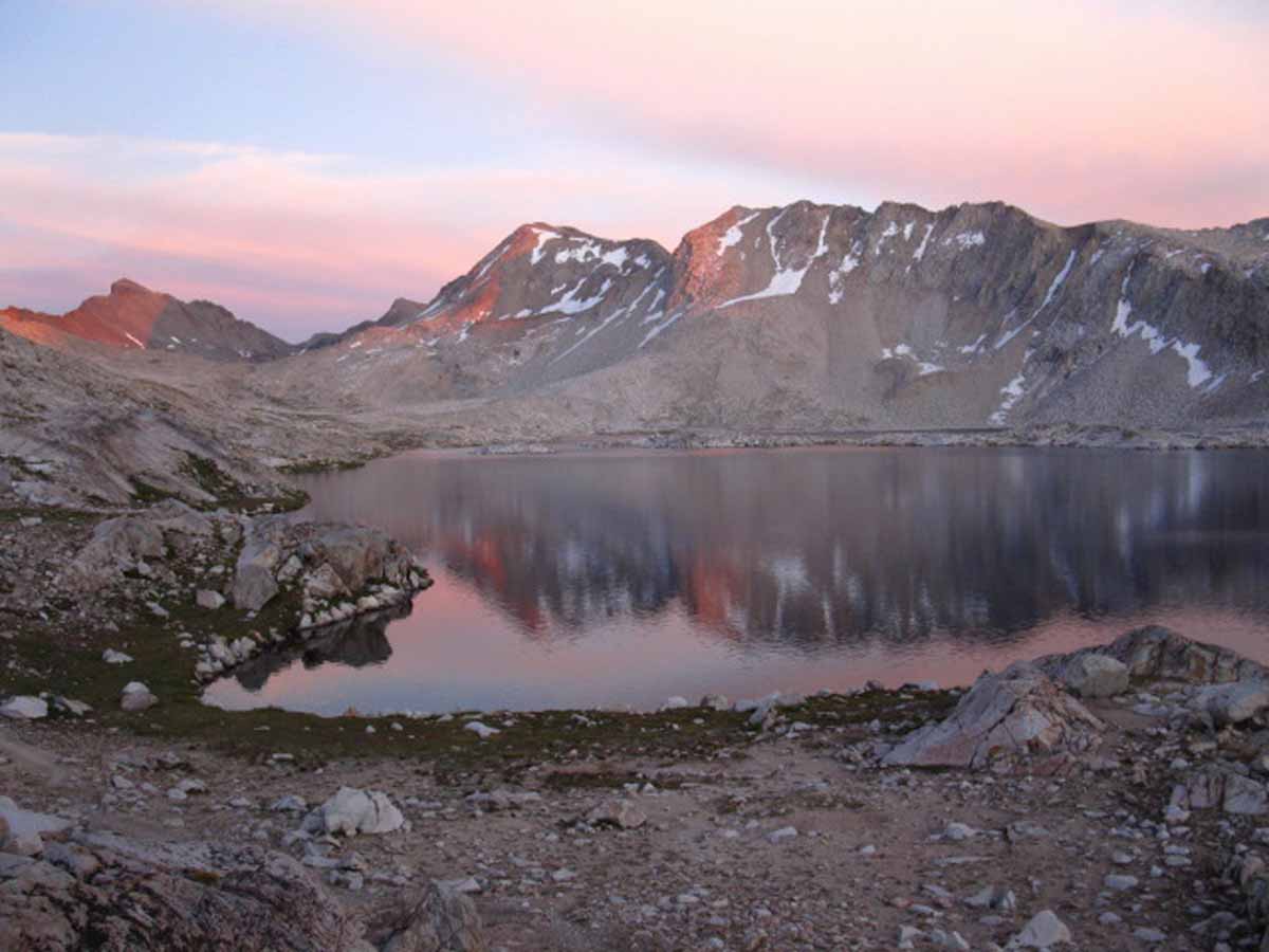
The Black Giant backdrops Muir Pass from our campsite on a rise above Lake Wanda.
Just look at that! Tomorrow we scramble.
Trail Guide Map Miles and Elevations: Not yet online
October 2017
Top of Page
January February March April May June July August September October November December
| Sunday |
Monday |
Tuesday |
Wednesday |
Thursday |
Friday |
Saturday |
Danger
Every couple of years late season backpackers are surprised by an Early-Season Snowstorm.
Two feet of unexpected snow strands backpackers.
ARE WE READY for the UNEXPECTED?
2016
Was one of those years.
How's 2017 working out?
|
SEPTEMBER
26
2017
HIGH SIERRA
--FALL--
Temp Check
Still after the Second Snow reported in Sierra. Let's check our reporting station snow & temp readings.
Below: Watershed Snow Water Content Charts followed by individual reporting station's Snow Depth and
24 hour high-low temps.
Last: September 23
Tahoe Basin
Watershed
N Sierra Reporting Stations
On a Map
Scroll over stations for snow & temps. Click for
full report.
American-Yuba Watersheds
Carson-Walker
Watersheds
Carson Pass 0 "
8388 feet
(80.1" H2O)
41 & 32
Ebbetts Pass 1 "
8660 feet
(105.3" H2O)
51 & 32
Leavitt Lake
9602 feet, East Flank
1 " Snow
(110.9" H20) Suspect
48
& 30
Marine Base
6748 feet East Flank
FULL REPORT
VIS-CHIL-WEA-MB-WIND
62 & 23
Mokelumne-Stanislaus Watersheds
Deadman Creek
9250 feet, West Flank
000.0 Snow (BAD)
(--.-" H20)
32
& 51
Tuolumne-Merced
Watersheds
Tuolumne Meadows
8600 feet, West Flank
.57" Snow
(SNO " Depth & H2O BAD? See Chart Above)
(Temps BAD)
Tioga Pass/Dana
9798 feet
4.90" Snow
(Temps BAD)
Mammoth Mountain Ski
Mono Lake-Owens Basin
Gem Pass
10750 feet
SNO " Depth Suspect
(--.--" H2O) Suspect
temps suspect
Mammoth Pass
9500 feet
3.30" Snow
(85.72" H2O)
54 & 32
South Lake Cabin
9580 feet, East Flank
(BAD" & H2O) BAD
54 & 28
Big Pine Sawmill
10200 feet, East Flank
1.20" Snow
46 & 24
Kings River
Bishop Pass
11972 feet
BAD- BAD
Charlotte Lake
10398 feet, West Flank
TEMPS ONLY
-- & -- BAD
Kern Watershed
Upr Tyndall Creek
11441 feet
5.72"
56 & 33
(station
reporting again!)
|
SEPTEMBER
27
Potential Hazards
HOT
Days
COLD
Nights
The
High Sierra
Weather Page:
Next Six Days Probability of
Freezing Temps
All
High Sierra Satellite
Views
All
High Sierra Radar
Views
All
Snow-Precip
High Sierra Forecasts
All High Sierra
ZONE
FORECASTS
All High Sierra
POINT
FORECASTS
NEW
High Sierra
Temp & Snow
Tables
by
Watershed & Highway Corridor
Galactic
Boo-Day
Happy Boo Day! |
SEPTEMBER
28
warm-clear
2017
Tuolumne Meadows
RESUPPLY FACILITIES
CLOSE
High Sierra Highway
Closure Dates
YOSEMITE
Facilities, Roads, & Trails
CLOSURE DATES |
SEPTEMBER
29
warm-clear
KEY POINTS
The Fall Gear Change is Upon Us
Fall Considerations
All High Sierra
ZONE
FORECASTS
TOP |
SEPTEMBER
30
warm-clear
Muir Ranch
Last day to pickup resupply buckets.
Call Muir for Exact Date
Crestline
Reporting Stations
Carson Pass
8388 feet
Ebbetts Pass
8660 feet
Leavitt Lake
9602 feet
Marine Base
6748 feet East Flank
Deadman Creek
9250 feet
Tuolumne Meadows
8600 feet
Tioga Pass/Dana
9798 feet
Gem Pass
10750 feet
Mammoth Pass
9500 feet
South Lake Cabin
9580 feet
Big Pine Sawmill
10200 feet
Bishop Pass
11972 feet
Charlotte Lake
10398 feet
Upr Tyndall Creek
11441 feet
All High Sierra
Reporting Stations |
| Sunday |
Monday |
Tuesday |
Wednesday |
Thursday |
Friday |
Saturday |
1
warm-clear
NEW WATER YEAR
Reds Meadow
Stops
accepting Resupply Packages
Tuolumne Meadows
Facilities closed for sure!
2017 REPORT
(Sept 28)
Tuolumne Meadows
RESUPPLY FACILITIES
CLOSE |
2
warm-clear |
3
warm-clear
EXCEPT
EVER-PRESENT FALL HAZARD
Unexpected Snow
Sonora Pass & Tioga Passes Closed Tuesday
KEY POINTS
The Fall Gear Change is Upon Us
Fall Considerations
Hazard Status
Hazard Map
Potential Hazards
HOT
Days
COLD
Nights
Fire & Smoke
Hazards
are
Diminished
but still
HIGH
Impending Weather
The
High Sierra
Weather Page:
Next Six Days Probability of
Freezing Temps
All
High Sierra Satellite
Views
All
High Sierra Radar
Views
All
Snow-Precip
High Sierra Forecasts
All High Sierra
ZONE
FORECASTS
All High Sierra
POINT
FORECASTS
NEW
High Sierra
Temp & Snow
Tables
by
Watershed & Highway Corridor |
4
warming-clear
Crestline
Reporting Stations
Carson Pass
8388 feet
Ebbetts Pass
8660 feet
Leavitt Lake
9602 feet
Marine Base
6748 feet East Flank
Deadman Creek
9250 feet
Tuolumne Meadows
8600 feet
Tioga Pass/Dana
9798 feet
Gem Pass
10750 feet
Mammoth Pass
9500 feet
South Lake Cabin
9580 feet
Big Pine Sawmill
10200 feet
Bishop Pass
11972 feet
Charlotte Lake
10398 feet
Upr Tyndall Creek
11441 feet
All High Sierra
Reporting Stations
|
5
Hot
Potential Hazards
HOT
Days
HEAT WARNING
Through Weekend
RISING
to
RECORD-LEVEL HEAT?
HIGH FIRE DANGER
(Western US Dry)
Selected Locations
Inciweb:Tahoe Basin
Inciweb: Yosemite
Inciweb: SEKI
SMOKE THREAT
Fire & Smoke
CalFire
Inciweb Fed
Smoke
and
COLD
Nights
All High Sierra
Reporting Stations |
6
EVER-PRESENT FALL HAZARDS
Sonora Pass & Tioga Passes Closed Tuesday
Fall Gear Change
Fall Considerations
Check out...
Hazard Status
&
All High Sierra
ZONE
FORECASTS,
All High Sierra
Reporting Stations,
&
Trail News
Salmon Running
Aspen Flaming
&
Bring a Sky Map
with your
Terrestial Map
TOP |
7
2016 Very Hot
|
| Sunday |
Monday |
Tuesday |
Wednesday |
Thursday |
Friday |
Saturday |
8
2017
FIRESTORM
About 10:30 pm
Overnight 30 mph standing winds, with gusts to 50, blows
Napa & Santa Rosa firestorms into being
2016 Very Hot
|
9 Columbus Day
morning saw..
Napa & Santa Rosa firestorms roaring:
INTENSE FIRES
Napa, Sonoma, Mendo Burning
DENSE, WIDESPREAD SMOKE
All
October High Sierra News, So Far...
Fire & Smoke
CalFire
Inciweb Fed
Smoke
Columbus Day
|
10
INTENSE FIRES
Napa, Sonoma, Mendo Burning
DENSE, WIDESPREAD SMOKE
Nor Cal Fire & Smoke Information
When Will overnight Freezing Temps Happen?
What are the chances?
What are the temps Now?
|
11
INTENSE FIRES
Napa, Sonoma, Mendo Burning
DENSE, WIDESPREAD SMOKE
Nor Cal Fire & Smoke Information
TOP |
12
INTENSE FIRES
Napa, Sonoma, Mendo Burning
DENSE, WIDESPREAD SMOKE
Nor Cal Fire & Smoke Information
Kennedy Meadows Pack Station
On Highway 108,
Closes Today
|
13
INTENSE FIRES
Napa, Sonoma, Mendo Burning
DENSE, WIDESPREAD SMOKE
Nor Cal Fire & Smoke Information
VVR Closes
Depending on Weather |
14
INTENSE FIRES
Napa, Sonoma, Mendo Burning
DENSE, WIDESPREAD SMOKE
Nor Cal Fire & Smoke Information
2016
A Sweet, "throwback" Fall Storm
2015
FALL TEMP DROP
Freezing Overnight Temperatures in North-central and Northwestern United States.
NOTE:
Temp Drop in 2017:
Sept 15
Temp Drop in 2016:
Oct 31
Temp Drop in 2015:
Oct 14
Temp Drop in 2014:
Oct 2 |
| Sunday |
Monday |
Tuesday |
Wednesday |
Thursday |
Friday |
Saturday |
15
INTENSE FIRES
GENERALLY HOLDING?
Napa & Sonoma Burning
DENSE, WIDESPREAD SMOKE
Nor Cal Fire & Smoke Information
|
16
FIRES
DIMINISHING
Napa & Sonoma Burning
DENSE, WIDESPREAD SMOKE
Nor Cal Fire & Smoke Information |
17
HAZARD WARNING
First "Sizable" Sierra Storm approaching the Winter of 2018?
FIRES
DIMINISHING
Napa & Sonoma Burning
DENSE, WIDESPREAD SMOKE
Nor Cal Fire & Smoke Information
TOP |
18
|
19
Light to Moderate Precip.
3rd set of storms.
|
20
Partially cloudy.
Regional Snow Analyses;
Sierra Nevada
ALL SNOW REPORTS
Satellite View
of the
Sierra Today
2017
HIGH SIERRA
--FALL--
Temp Check
Third Snow reported in Sierra. Let's check our reporting station snow & temp readings.
Below: Watershed Snow Water Content Charts followed by individual reporting station's Snow Depth and
24 hour high-low temps.
Last: September 26
NEW WATER YEAR
Tahoe Basin
Watershed
N Sierra Reporting Stations
On a Map
Scroll over stations for snow & temps. Click for
full report.
American-Yuba Watersheds
Carson-Walker
Watersheds
Carson Pass 1 "
8388 feet
(0.1" H2O)
51 & 37
Ebbetts Pass 2 "
8660 feet
(0.6" H2O)
50 & 35
Leavitt Lake
9602 feet, East Flank
1 " Snow
(1.10" H20) Suspect
48
& 32
Marine Base
6748 feet East Flank
FULL REPORT
VIS-CHIL-WEA-MB-WIND
50 & 35
Mokelumne-Stanislaus Watersheds
Deadman Creek
9250 feet, West Flank
000.0 Snow (BAD)
(--.-" H20) (BAD)
54
& 20
Tuolumne-Merced
Watersheds
Tuolumne Meadows
8600 feet, West Flank
1.72" Snow
58
& 26
Tioga Pass/Dana
9798 feet
-.--" Snow (BAD)
(1.05" H20) (BAD?)
(Temps BAD)
Mammoth Mountain Ski
Mono Lake-Owens Basin
Gem Pass
10750 feet
SNO " Depth Suspect
(--.--" H2O) Suspect
temps suspect
Mammoth Pass
9500 feet
5.28" Snow
(0.4" H2O)
564 & 28
South Lake Cabin
9580 feet, East Flank
(BAD" & H2O) BAD
59 & 34
Big Pine Sawmill
10200 feet, East Flank
2.50" Snow
52 & 31
Kings River
Bishop Pass
11972 feet
BAD- BAD
Charlotte Lake
10398 feet, West Flank
TEMPS ONLY
-- & -- BAD
Kern Watershed
Upr Tyndall Creek
11441 feet
5.33"
54 & 28
(station
reporting again!) |
21
|
| Sunday |
Monday |
Tuesday |
Wednesday |
Thursday |
Friday |
Saturday |
22
|
23
Record Level Hot
Winds gust to 40 mph Overnight
TOP
|
24
Record Level Hot
DEAD CALM
South Sierra Red Flag Warning
so far
A Super-Hot, Dry & Windy October of 2017.
|
25
Hot:
Heat Wave
5 degrees cooler!
Big Bear & South:
Red Flag Warning
NWS
WATCHES & WARNINGS
7 Day Wind Forecasts
7 Day Heat Forecasts
All Graphical Forecasts
All
Sierra Forecasts
October
2017
High Sierra Trail News
High Sierra General News
|
26
Hot:
Heat Wave
|
27
Hot-Very Warm
2016
Weak Storm Fronts Crossing West Coast US
Out of the Southwest
Very Warm temps, not strong precip, rain falling up to 9000 feet.
Third Storm of October
Persistent Low now moving South and East in Gulf of Alaska will continue dragging tropical moisture North for DAYS.
Not strong, but persistent. |
28
Heat Breaks;
Marine Layer off Coast cools things considerably
Six Days Rain Forecast
by
Six hour animated increments (Flash)
(With Six days by Chart) |
| Sunday |
Monday |
Tuesday |
Wednesday |
Thursday |
Friday |
Saturday |
29
Temperate |
30
Temperate |
31
Temperate
Halloween
THE 2017 QUESTION
When is the First Real Storm going to hit the Sierra Nevada?
When will two feet fall?
First N Sierra Rains predicted
6pm Thursday running through 6pm Monday
Run the Animation
All Rain & Snow Tools
All Forecasts
2016
Diminishing Rains
WARM RAINS
2015 BACKPACKER ALERT
2015 NOTE
First Winter Storm
Warning & Storm |
1 |
2
TOP |
3 |
4 |
Top of Page
NOTES: Cold conditions are a reality, even without unexpected snow and storms. Nighttime temps are cold and can PLUNGE.
2017
2016
NOTE on TYPICAL OCTOBER ISSUES
Oct
A La Nina streak of Central-East Pacific very cold water was building, now is pulsing through mid-October.
This is generally indicative of a very cold dry Winter in the Sierra and West Coast.
ENSO GRAPHIC
I describe the factors controlling the outcome of the great planetary forces at play: An El Nino beyond all historical conceptions transitioning into La Nina conditions. A Great North Pacific High that is acting as persistent this season as the last four, and finally, an Arctic Circle that is not the spinning disc of fierce cold that traditionally draws the jet stream up to it.
(Oct 24 Update: Rising low "tendencies" over the NE Pacific have coalesced into a big, but not very deep, low pressure zone that established itself over the NE Pacific off Seattle a few days ago. It has been large and fairly stationary for a few days now.)
RUN THE SURFACE MAP
Mid-Pacific Weather Factors are all out of kilter. How they come to a balance between their competing and cooperating forces will determining exactly how the power and influences of this burbbeling La Nina will influence our Winter weather.
A La Nina typically brings cold, dry Winters. Not so far. We've seen a more "normal" an October than I've seen for decades.
2014 Calendar 2015 Calendar 2016 Calendar
2016
SPECIFIC OBSERVATIONS
Oct 16
Wow. We are experiencing the outlines of a classic, "traditional" wet Fall. Is this just a "wet" aberration in the progress of increasingly drier, warmer Winter weather? Or are these storms heralding a return to a snow covered Sierra Winter, for at least this year? The answer to these questions hinges on a number of "big" questions.
Will the North Pacific High reform and deflect the wet jet stream around us again this Winter? Will the Arctic cool down and behave normally? Will the La Nina strengthen, weaken, or disappear? All of these major weather "factors" have been behaving strangely. I expect their strange and surprising behaviors to continue, which will continue to bring unusual configurations of weather as they interact with each other in brand-new ways to produce brand-new weather patterns with new characters and behaviors.
Stay tuned. The real greatest show on the planet is playing itself out on the L, L, & G stages of life right in front of us!
(That's "Liquids, Land Masses, & Gasses." )
Oct 24 Update
Rising and persisting low-pressure "tendencies" over the NE Pacific have coalesced into a big, but not very deep, low pressure zone that established itself in a stationary over the NE Pacific off Seattle a few days ago. It has been large and fairly stationary for a few days now.
This concentration of persisting low pressure has sucked these warm storm fronts up from the Southwest, out from the waters and skies around Hawaii, since October 14.
Oct 29 2016
High Temps bring cold rains on the verge of being snow flurries, while snow flurries melt upon hiker contact: THIS IS VERY DANGEROUS.
Excellent Gear Required.
We must be able to stay warm in freezing rains.
RUN THE SURFACE MAP |
HIGH SIERRA
Winter Backpacker
WEATHER RESOURCES
ALL SNOW
INFORMATION
Snowfall
on the
Ground
Rain-Snow
Probabilities
Rain-Snow
Forecasts |
The Tweener
October is the last month we can almost rely on great backpacking weather.
We can bank on serious early-season storms every few years. Don’t get stuck out without the gear necessary to survive, keep traveling, and enjoy it.
This is one of those years...
2016
Wow. Two Oct storms by the 14th gives this Winter a more "typical," feel of a "traditional" wet Fall than we've been getting used-to over the past twenty years.
This is potentially a good omen for a fantastic Winter backpacking season in the Sierra.
This means those backpackers who've gotten accustomed to fine, clear weather in Fall better re-assess your Fall hiking plans for more traditional cold & wet conditions.
Winter Backpackers?
Get Ready to Rumble!
HAZARD ALERT
Oct 29 2016
High Temps bring cold rains on the verge of being snow flurries, while snow flurries melt upon hiker contact:
THIS IS VERY DANGEROUS.
Excellent Gear Required.
We must be able to stay warm in freezing rains.
2014 Calendar 2015 Calendar
2016 Calendar |
October in the High Sierra is stunningly beautiful, but potentially very dangerous.
Every few years a strong unexpected Winter Storm comes in early and dumps a couple of unexpected feet of snow on the High Sierra.
Leaving detailed trip plans with an outside monitor is required. Packing Winter Gear elements, knowing how to survive and travel in the snow, and having contingency plans is REQUIRED.
Tahoe to Whitney
Top of Page |
November 2017
Looking back at the two Palisades Lakes below, with the Palisades Mountains
rising to their Right as we climb through shattered rock to Mather Pass
January February March April May June July August September October November December
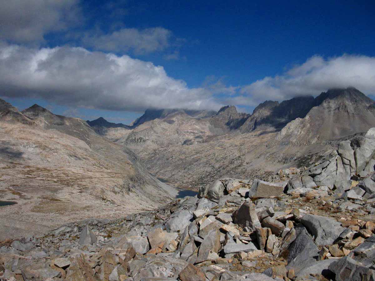
Turning around to take a last look at the Pallisade Lakes below, the Palisades Range surrounding them on the Right, and us hiking through the shattered rock leading South to Mather Pass.
Trail Guide Map Miles and Elevations: Not yet online
November 2017
January February March April May June July August September October November December
| Sunday |
Monday |
Tuesday |
Wednesday |
Thursday |
Friday |
Saturday |
Deploy Winter Gear
Our “base” layers are typically brought from Fall to Winter Standards during the month of November.
Our shell layers are thickened to Winter Standards as well.
Winter Shell, boots, socks, gloves and camp gear all come into play. I love my down snow-camp booties!
Retire the water filter and bear canister.
Probabilities of Overnight Freezing Next Five Days
Current Weather Map
2017 Status
Despite last Winter's extreme snowpack cancelling the early & middle of the Summer of 2017 Backpacking Season (for all but the strongest & most skilled) before it melted out, the end of the Summer into Fall turned brutally tropical HOT & DRY, again bringing record temps, record fires, vast smoke coverage, and sure looking exactly like every one of the last 7 or 8 preceeding, "drought Falls."
Except for last Winter's massive snowpack, you'd think the drought never really ended.
We need another wet Winter to put another nail into the drought's coffin. Let's watch how this Winter Evolves.
What Brings This Winter of 2017-2018?
Predictions and Probabilities for the Upcoming Winter
We enter November 2017 coming off
a
HEAT WAVE
moderating into
Temperate Weather
&
First Substantial Storm approaching
Winter of 2018
WINTER GEAR REQUIRED
November 3
2016 Status
High temp storms out of the Southwest have been bringing
wet and snow conditions to the High Sierra. Wet and Cold conditions create a special kind of hazard that must be anticipated.
Early storms in Oct 2016 brought some drought relief to North Cal and snow along the whole Sierra Crest, it did little to alleviate SoCal Drought
We enter November 2016 with
a
COLD & WET GEAR ALERT |
31
CCC
Backcountry Trail Crew
Applications due
EARLY FEB 2018
2017
Temperate-Cooling
End of Daylight Savings
Halloween
THE 2017 QUESTION
When is the First Real Storm going to hit the Sierra Nevada?
We've had 3 (?) weak episodes of weather across the crest so far this Fall, 2 of which caused brief closures of Tioga Pass.
When will two feet fall?
First N Sierra Rains predicted
6pm Thursday running through 6pm Monday
Run the Animation
All Rain & Snow Tools
All Forecasts
HISTORY OF THIS DATE
2015 BACKPACKER ALERT
2015 NOTE
First Winter Storm
Warning & Storm
2016
Diminishing Rains
WARM RAINS
2016
COLD TEMP ALERT
added to
COLD-
WET ALERT
2016
La Nina burbbling along in East Pac just below Equator.
A big persistent low pressure zone sitting for weeks in and around Gulf Alaska |
1
2017
CLEAR & COOL
Key Sierra Nevada Snow and Temp Reporting Stations
Crestline
Reporting Stations
Carson Pass
8388 feet
Ebbetts Pass
8660 feet
Leavitt Lake
9602 feet
Marine Base
6748 feet East Flank
Deadman Creek
9250 feet
Tuolumne Meadows
8600 feet
Tioga Pass/Dana
9798 feet
Gem Pass
10750 feet
Mammoth Pass
9500 feet
South Lake Cabin
9580 feet
Big Pine Sawmill
10200 feet
Bishop Pass
11972 feet
Charlotte Lake
10398 feet
Upr Tyndall Creek
11441 feet
All High Sierra
Reporting Stations
Sno-Park Permits
Required for use of Sno-Park parking lots through May 30. |
2
2017
CLEAR to CLOUDY
First N Sierra Rains predicted
6pm Thursday running through 6pm Monday
Run the Animation
All Rain & Snow Tools
All Forecasts
no rain-precip today...
TOP |
3
2017
CLOUDY
BACKPACKER ALERT
Moderate/weak-strength storm bringing up to 2 feet of snow to the Sierra Crest over this upcoming weekend.
Winter Gear Required.
Woo-Hooo!
Winter Storm Watch In Effect Above 7,000 Feet,
Sierra News Online, November 2, 2017.
NWS Watch, Warning, Advisory Display,
with links to local NWS Office Hazard Warnings.
All Rain-Snow-Precip Tools
All Radar
All High Sierra Forecast Zones
Graphical Interface Forecast Display
Everything
The High Sierra Outdoors-folks Weather Page
Let's
Gear-Up for Winter
On September 15 the temps and conditions shifted enough to require shifting our gear setup from Summer to Fall gear kits.
FALL GEAR CHANGE UPON US,
Sept 15, 2017.
Now we've hit the Winter Line, and we've got to deploy the necessary elements of our Winter Gear Kit. Not the whole thing, but some serious Winter gear needs to come out now.
Four-Season High Sierra Gear List
This storm should finally end the Fire Season, too...
|
4
2017
LIGHT PRECIP
Caltrans Closing Sierra Highway for Weekend, maybe the season.
4th Set of Storms.
2016
Very Warm & Clear
High (above freezing)
overnight temps persist except at the highest altitudes.
Probabilities of Overnight Freezing Next Five Days |
| Sunday |
Monday |
Tuesday |
Wednesday |
Thursday |
Friday |
Saturday |
5
End of Daylight Savings
2017
Clearing,
Crisp, & Cool
See
2017 Weather Note
Last Storm
"...was a "dud," only producing up to two inches of snow, rather than the forecast potential of two feet."
All Snow Resources
Seven Day
NWS
Precipitation
Forecast
CHARTS
All Precip Tools
Crestline
Reporting Stations
Carson Pass
8388 feet
Ebbetts Pass
8660 feet
Leavitt Lake
9602 feet
Marine Base
6748 feet East Flank
Deadman Creek
9250 feet
Tuolumne Meadows
8600 feet
Tioga Pass/Dana
9798 feet
Gem Pass
10750 feet
Mammoth Pass
9500 feet
South Lake Cabin
9580 feet
Big Pine Sawmill
10200 feet
Bishop Pass
11972 feet
Charlotte Lake
10398 feet
Upr Tyndall Creek
11441 feet
All High Sierra
Reporting Stations
|
6
2017
Clear,
Crisp, & Cool
|
7
2017
Clear,
Crisp, & Cool
A Huge Low is sitting up in Gulf Alaska, dragging a vast plume of tropical moisture Northeast.
That's the persistant location of the High-Low formation that set up, "The Blob," from 2013-15.
More Blob
That Low's predicted trajectory to the Southeast should drag some snow across the Sierra by late Wednesday or early Thursday.
Rain Probs
Snow Probs
All Precip Info |
8
2017
Moderate Precip:
Afternoon-Overnight
5th Set of Storms.
TOP |
9
2017
Moderate Precip,
Diminishing, Clearing & Cloudy.
Road Conditions & News
2017
HIGH SIERRA
--FALL--
Temp-Snow Check
Fifth time Snow reported in Sierra this Fall. Let's check our reporting station snow & temp readings.
Below: Watershed Snow Water Content Charts followed by individual reporting station's Snow Depth and
24 hour high-low temps.
Last: October 20
NEW WATER YEAR
Tahoe Basin
Watershed
N Sierra Reporting Stations
On a Map
Scroll over stations for snow & temps. Click for
full report.
American-Yuba Watersheds
Carson-Walker
Watersheds
Carson Pass 4"
8388 feet
(1.5" H2O)
41 & 35
Ebbetts Pass 1"
8660 feet
(1.6" H2O)
41 & 33
Leavitt Lake 3"
9602 feet, East Flank
(1.80" H20) Suspect
39
& 33
Marine Base
6748 feet East Flank
FULL REPORT
VIS-CHIL-WEA-MB-WIND
xx & xx:
(New readout page sucks...)
Mokelumne-Stanislaus Watersheds
Deadman Creek
9250 feet, West Flank
000.0 Snow (BAD)
(--.-" H20) (BAD)
46
& 26
Tuolumne-Merced
Watersheds
Tuolumne Meadows
8600 feet, West Flank
0.00" Snow
53
& 18
Tioga Pass/Dana
9798 feet
-.--" Snow (BAD)
(1.05" H20) (BAD?)
(Temps BAD)
Mammoth Mountain Ski
Mono Lake-Owens Basin
Gem Pass
10750 feet
SNO " Depth Suspect
(--.--" H2O) Suspect
temps suspect
Mammoth Pass
9500 feet
1.94" Snow
(0.6" H2O)
51 & 27
South Lake Cabin
9580 feet, East Flank
(BAD" & H2O) BAD
53 & 29
Big Pine Sawmill
10200 feet, East Flank
2.50" Snow
52 & 31
Kings River
Bishop Pass
11972 feet
BAD- BAD
Charlotte Lake
10398 feet, West Flank
TEMPS ONLY
-- & -- BAD
Kern Watershed
Upr Tyndall Creek
11441 feet
5.28"
49 & 30
(station
reporting again!)
2016
Zero precip predicted for High Sierra next five days:
Five Day Precip Prediction
All the Latest Rain-Snow Prediction Tools/Models
Six Day Temp/Weather graphical forecasts
Vast Low Pressure Zone Persists in Gulf Alaska
All Snow Tracking Tools |
10
2017
Light Precip, Showers, Cooling.
A significant cold-air transport mechanicsm has configured itself along the Eastern Shore of the Pacific, chaining up cold air flows propelled by a massive High moving SE across the Gulf Alaska with a couple of Lows along the West Coast of the US.
This configuration has set up a "wave" of cold air, a weak front from the North that is today displacing warmer tropical flows from the South, noticably cooling things down.
This link brings you to the current N Pac Weather Map of the date you click it.
The Null School EARTH, Wind set at 500 hPa, shows this cold air's path from the North.
The Northernmost of the two Lows currently sitting stacked-up along the continental coast near & North of Vancover will bring another, colder Front Southeast, but the question is how far South?
During the next three days we will see if a blocking ridge deflects the center of this cold, stormy Low North, around the Sierra.
Either way, we gonna get hit, but it looks like the strongest bits will be passing around to the North of the Sierra.
Snowline at 7000 overnight(s), looking like cold rains sweeping Sierra Crest today.
These are dangerous condition, being cold, windy & wet. I refer you to this 2016 alert describing the dangers:
Hazard Alert
NEW
Snowfall Probability Map
Old
Snowfall Probability Map
All Current Conditions
MesoWest
Reporting
by
Watershed |
11
Veterans Day
Clearing & Cloudy |
| Sunday |
Monday |
Tuesday |
Wednesday |
Thursday |
Friday |
Saturday |
12
2017
Clear & Delightful
Showers late evening
|
13
2017
Light Precip
Waves of Precip expected through Thurs, returning over Weekend.
Winter Storm Warnings
All Sierra Forecast Zones
All Forecasts
All Snow Reporting
2017
HIGH SIERRA
--FALL--
Temp-Snow Check
Sixth time Snow reported in Sierra this Fall. Let's check our reporting station snow & temp readings.
Below: Watershed Snow Water Content Charts followed by individual reporting station's Snow Depth and
24 hour high-low temps.
Last: Nov 9
NEW WATER YEAR
Tahoe Basin
Watershed
N Sierra Reporting Stations
On a Map
Scroll over stations for snow & temps. Click for
full report.
American-Yuba Watersheds
Carson-Walker
Watersheds
Carson Pass 3"
8388 feet
(1.6" H2O)
46 & 36
Ebbetts Pass 0"
8660 feet
(1.6" H2O)
47 & 35
Leavitt Lake 1"
9602 feet, East Flank
(1.80" H20) Suspect
43
& 33
Marine Base
6748 feet East Flank
FULL REPORT
VIS-CHIL-WEA-MB-WIND
xx & xx:
(New readout page sucks... & Tech issues)
Mokelumne-Stanislaus Watersheds
Deadman Creek
9250 feet, West Flank
000.0 Snow (BAD)
(--.-" H20) (BAD)
45
& 32
Tuolumne-Merced
Watersheds
Tuolumne Meadows
8600 feet, West Flank
0.54" Snow
51
& 18
Tioga Pass/Dana
9798 feet
-.--" Snow (BAD)
(0.00" H20) (BAD?)
(Temps BAD)
Mammoth Mountain Ski
Mono Lake-Owens Basin
Gem Pass
10750 feet
SNO " Depth Suspect
(--.--" H2O) Suspect
temps suspect
Mammoth Pass
9500 feet
1.94" Snow
(0.6" H2O)
48 & 29
South Lake Cabin
9580 feet, East Flank
(BAD" & H2O) BAD
49 & 39
Big Pine Sawmill
10200 feet, East Flank
3.00" Snow
44 & 35
Kings River
Bishop Pass
11972 feet
BAD- BAD
Charlotte Lake
10398 feet, West Flank
TEMPS ONLY
-- & -- BAD
Kern Watershed
Upr Tyndall Creek
11441 feet
5.28"
49 & 30
(station
reporting again!)
|
14
2017
Clear between fronts
Full Winter Gear
All Fall Gear elements have typically been replaced by Winter Gear by or at this date.
Each year varies...
FOUR-SEASON GEAR
2017
Fall to Winter Gear Transition: November 3
Summer to Fall Gear Transition: September 15
TOP |
15
2017
Light Precip
Winter Storm Warnings
Good Set of
Weather Resources
All Snow Tracking Tools
All
Weather Resources
Crestline
Reporting Stations
(Compare with the 13th)
Carson Pass
8388 feet
Ebbetts Pass
8660 feet
Leavitt Lake
9602 feet
Marine Base
6748 feet East Flank
Deadman Creek
9250 feet
Tuolumne Meadows
8600 feet
Tioga Pass/Dana
9798 feet
Gem Pass
10750 feet
Mammoth Pass
9500 feet
South Lake Cabin
9580 feet
Big Pine Sawmill
10200 feet
Bishop Pass
11972 feet
Charlotte Lake
10398 feet
Upr Tyndall Creek
11441 feet
All High Sierra
Reporting Stations |
16
2017
Moderate Precip
Winter Storm Warnings
All Sierra Forecast Zones
All Forecasts
End of 5th
Set of Storms.
|
17
2017
Clearing to Clear
The Winter of 2018 Backpacking Season Begins
HAZARD STATUS
Weekend Looking Clear!
Snow Terrain & early Winter Temp Warnings in Effect.
Clear Skies will bring a temp drop.
COLD
Night
High Sierra Weather:
Fall Season Situation Report, November 17, 2017
All
Snow Tracking Tools
MODIS
SIERRA SATELLITE
Visible
SIERRA SATELLITE
All
Weather Resources
2017
HIGH SIERRA
--FALL--
Temp-Snow Check
After-report of seventh set of Snow-storms, or "stormlets" coming across Sierra this Fall. Let's check our reporting station snow & temp readings.
Below: Watershed Snow Water Content Charts followed by individual reporting station's Snow Depth and
24 hour high-low temps.
Last: Nov 13
NEW WATER YEAR
Tahoe Basin
Watershed
N Sierra Reporting Stations
On a Map
Scroll over stations for snow & temps. Click for
full report.
American-Yuba Watersheds
Carson-Walker
Watersheds
Carson Pass 14"
8388 feet
(6.2" H2O)
37 & 32
Ebbetts Pass 20"
8660 feet
(7.8" H2O)
35 & 33
Leavitt Lake 12+"
(errors)
9602 feet, East Flank
(5.10" H20) Suspect
34
& 32
Marine Base
6748 feet East Flank
FULL REPORT
VIS-CHIL-WEA-MB-WIND
xx & xx:
(New readout page sucks... & Tech issues)
Mokelumne-Stanislaus Watersheds
Deadman Creek
9250 feet, West Flank
000.0 Snow (BAD)
(12.2" H20) (BAD?)
33
& 27
Tuolumne-Merced
Watersheds
Tuolumne Meadows
8600 feet, West Flank
4.7" Snow
35
& 28
Tioga Pass/Dana
9798 feet
-.--" Snow (BAD)
(18.5" H20) (BAD?)
(Temps BAD)
Mammoth Mountain Ski
Mono Lake-Owens Basin
Gem Pass
10750 feet
SNO " Depth Suspect
(7.68" H2O) Suspect
temps suspect
Mammoth Pass
9500 feet
1.94" Snow
(5.64" H2O)
32 & 28
South Lake Cabin
9580 feet, East Flank
(Snow BAD")
15.7 H2O (BAD?)
46 & 28
Big Pine Sawmill
10200 feet, East Flank
3.00" Snow
31 & 26
Kings River
Bishop Pass
11972 feet
BAD- BAD
Charlotte Lake
10398 feet, West Flank
TEMPS ONLY
-- & -- BAD
(The coldest station)
Kern Watershed
Upr Tyndall Creek
11441 feet
5.28"
31 & 26
(station
reporting again!) |
18
View of Sierra on November 18 by the...
MODIS
SIERRA SATELLITE
...showing the first, and a nice "base coat," of the 2018 snowpack.
|
| Sunday |
Monday |
Tuesday |
Wednesday |
Thursday |
Friday |
Saturday |
19
2017
Waves of High Haze
The biggest parts of a series of Lows and Fronts are passing to the North of us over the next five days, with the forcasted exceptions of Monday and Friday, when the bottom ends of thes Fronts and Storms will bring light rains and some snow, mostly across the North Sierra Crest.
Thus this week may offer the first windows into our first snow backpacking oppertunities of the season.
The threats are first, that the storms centers and Frontal "Tails," come unexpectedly South, second, that they do not, and windows of clear skies bring colder than expected temps, and third, on the other hand, that it stays warm, and sloppy semi-frozen rainy snow falls across the Sierra Crest, which is always challenging in freezing conditions.
See the Hazard Alert below-right.
|
20
2017
CLEARING
Waves of Tropical Moisture (Front) & Tropical Haze passing to the N of Tahoe, kept mostly N of High Sierra by a rising Wedge of High pressure moving N off US West Coast. |
21
2017
CLEARING
VERY WARM
Looks like the next potential weather will be on the 25th
All Precip Tools
Winter Storm Warnings
All Sierra Forecast Zones
All Snow Tracking Tools
Crestline
Reporting Stations
(Compare with the 17th)
Carson Pass
8388 feet
Ebbetts Pass
8660 feet
Leavitt Lake
9602 feet
Marine Base
6748 feet East Flank
Deadman Creek
9250 feet
Tuolumne Meadows
8600 feet
Tioga Pass/Dana
9798 feet
Gem Pass
10750 feet
Mammoth Pass
9500 feet
South Lake Cabin
9580 feet
Big Pine Sawmill
10200 feet
Bishop Pass
11972 feet
Charlotte Lake
10398 feet
Upr Tyndall Creek
11441 feet
All High Sierra
Reporting Stations
|
22
2017
Waves of Tropical Haze & Clearing tendencies...
WARMER
Special Weather Statement
Eastern Sierra Counties
"...STRONG WINDS THIS WEEKEND WITH SNOW OVER THE PASSES BY LATE
SUNDAY..."
"A potent Pacific storm will move inland this weekend and bring
rain, mountain snow and gusty winds. The winds will begin Saturday
afternoon and continue through Sunday night. Precipitation will
begin as rain, even at the passes, as snow levels start high.
Snow levels will begin to fall Sunday with snow over the passes
possible by sunset Sunday. Expect holiday weekend travel impacts
due to winds and snow over the passes."
MORE: RENO NWS
OBSERVATION
The vast majority of this activity spoken of in the Special Statement above will pass North of the Tahoe Basin.
Persistant-looking Highs/High setting up over the Four Corners Area are possibly going to bring Warmth North around its Southwestern Perimeter while deflecting Pac Storms North around the Sierra Nevada along its Northwestern edge, for the remainder of this month.
Drier and Warmer Yet, If this particular configuration of High & Low Pressure Zones persists or grows.
BACKPACKER HAZARD
Climate Prediction Center
|
23
Thanksgiving Day
View of Sierra on November 21 by the...
MODIS
SIERRA SATELLITE
...showing the first, and a nice "base coat," of the 2018 snowpack.
TOP
|
24
2017
Waves of Tropical Haze-Warm & Humid
|
25
2017
Waves of Tropical Haze-Warm & Humid
|
| Sunday |
Monday |
Tuesday |
Wednesday |
Thursday |
Friday |
Saturday |
26
2017
Cold Front transporting tropical mositure from E of Hawaii.
Though the air behind the Front is Cold, the moisture in front of it is warm, from Hawaii.
Thus it's warmer than typical.
Moderate Precip, mostly N Sierra
All High Sierra
Reporting Stations
8th individual storm.
5th Set of Storms, if you consider that last set of fronts to hit as being one storm, or each individually.
View of Sierra on November 26 by the...
MODIS
SIERRA SATELLITE
|
27
2017
The Great Front Line of Tropical Moisture is passing South:
Sat View
All Sat Views
Clearing,
Crisp, & Cool
Clearing Brings Cold:
COLD
Night Tonight
2017
HIGH SIERRA
--FALL--
Temp-Snow Check
After-report of seventh Snow-storms across Sierra this Fall. Let's check our reporting station snow & temp readings.
Below: Watershed Snow Water Content Charts followed by individual reporting station's Snow Depth and
24 hour high-low temps.
Last: Nov 17
NEW WATER YEAR
Tahoe Basin
Watershed
N Sierra Reporting Stations
On a Map
Scroll over stations for snow & temps. Click for
full report.
American-Yuba Watersheds
Carson-Walker
Watersheds
Carson Pass 15"
8388 feet
(7.7" H2O)
46 & 33
Ebbetts Pass 23"
8660 feet
(10.10" H2O)
47 & 33
Leavitt Lake 41"
(errors)
9602 feet, East Flank
(11.80" H20)
44
& 31
Marine Base
6748 feet East Flank
FULL REPORT
VIS-CHIL-WEA-MB-WIND
xx & xx:
(New readout page sucks... & Tech issues)
Mokelumne-Stanislaus Watersheds
Deadman Creek
9250 feet, West Flank
000.0 Snow (BAD)
(14.4" H20) (BAD?)
46
& 19
Tuolumne-Merced
Watersheds
Tuolumne Meadows
8600 feet, West Flank
5.57" Snow
50
& 21
Tioga Pass/Dana
9798 feet
18.97" Snow (BAD)
(--.--" H20) (BAD?)
(Temps BAD)
Mammoth Mountain Ski
Mono Lake-Owens Basin
Gem Pass
10750 feet
SNO " Depth Suspect
(9.25" H2O) Suspect
temps suspect
Mammoth Pass
9500 feet
28.9" Snow
(8.24" H2O)
43 & 20
South Lake Cabin
9580 feet, East Flank
(Snow BAD")
15.8 H2O)
55 & 23
Big Pine Sawmill
10200 feet, East Flank
7.40" Snow
50 & 20
Kings River
Bishop Pass
11972 feet
BAD- BAD
Charlotte Lake
10398 feet, West Flank
TEMPS ONLY
-- & -- BAD
(The coldest station)
Kern Watershed
Upr Tyndall Creek
11441 feet
13.73"
45 & 18
(station
reporting again!) |
28
2017
Clearing, Looks Like a window of access until Friday Night.
HAZARD STATUS
Two Issues
1> Winter Storm & Temp Potential.
2> Full Winter Gear
The progression of this year's gear status change points began on September 15th, when Summer Gear was switched out for our Fall setup.
This was followed up on November 3, when we brought out the
Winter Gear
Selection, though I would characterize it as a Winter "lite" setup.
Full Winter Gear is now Required. We have reached the seasonal interface when temperatures can plunge to below zero.
Cold Safety Chart
GEAR
Careful assesment of weather and gear is now critical to trip planning.
Check the MODIS View for today by adjusting the time slider.
COLD
Night Last Night
Cold Night Tonight
Today's high & low temps were ten degrees colder than Yesterday's 24 hour range, listed at Left, and are going to be colder this evening, by my reckoning.
Weather Note
La Nina is Powerful and Widespread on Nove 22, as shown on today's
Ocean Temp Anomalies
All La Nina Information |
29
2017
Clear, Crisp, and Cool between fronts
COLD
Night Last Night
Cold Night Tonight
Lows from the mid-20s to mid-teens last night.
Crestline
Reporting Stations
(Compare with the 27th)
Carson Pass
8388 feet
Ebbetts Pass
8660 feet
Leavitt Lake
9602 feet
Marine Base
6748 feet East Flank
Deadman Creek
9250 feet
Tuolumne Meadows
8600 feet
Tioga Pass/Dana
9798 feet
Gem Pass
10750 feet
Mammoth Pass
9500 feet
South Lake Cabin
9580 feet
Big Pine Sawmill
10200 feet
Bishop Pass
11972 feet
Charlotte Lake
10398 feet
Upr Tyndall Creek
11441 feet
All High Sierra
Reporting Stations |
30
2017
Clear, Crisp, and Cool between fronts
Winter Storm Warnings
All Sierra Forecast Zones
All Precip Forecasts |
1
December 1 entry
TOP
|
2 |
Top of Page
NOTES:
Highways 120 and 4 will close for the season with the first heavy snowfall.
November Road News
4, 108, & 120 closed on the 14th.
Weather Notes
November 5, 2017
This first "cold" storm-front of the season that just passed through the Sierra over the last two days was a "dud," producing up to two inches of snow, rather than the forecast potential of two feet. There's a reason for that, and more was brought by this last front than snow alone. It's a harbinger of the season, our first looks at this Winter's pattern formation.
This first "cold" storm-front of the season that just passed through over the last two days was running from just NE of Hawaii, across the bottom, across the South end of a vast cold High coming Southeast out of the Bearing Straight & across Gulf Alaska. That High is now dropping South out of the Gulf Alaska, and it is currently bringing our next low down around its Eastern edge.
The next cold storm-front we are watching today is now bending Northwest from a Low sitting off the coast of Washington (to the East of the High), as this front is being pushed down and around the N Pac High, along with its attached Low, to the Southeast draging its seriously cold front along behind it.
"Behind" this next Low is another Low sitting above at the top of the N Pac High that's itself sliding South across Gulf Alaska.
That next Low, and the prospective Low behind it, are "loaded-up" to the North of the East Pac High, which is the configuration of the classic "West Coast Storm Gate." The "gate" depends on the location of the East Pacific High. At the proper location the East Pac High conducts Lows and their associated Fronts around its Northern perimeter, across the Aleutians around the top of its bulge, to "fire them up," then sweeps them down the Eastern edge of the High into the West Coast of the USA. That's the classic N Pac Storm Gate bringing Winter to the Sierra Nevada.
What we are seeing is the first formations of the classic Storm Gate as the chill of Fall deepens into Winter. Will this formation hold? Will the East Pac High slide North into the "void" created by a warmer Arctic, blocking the West Coast of the US, as was typical of our drought years? Was this drought position of the N Pac High "transitory," with the drought, or is this more Northern position of the East Pac High the new way Winter works in our "new," much warmer world's new weather pattern?
I'm thinking it's the latter, judging by the slow, decades-long Northern creep of the Winter-time positioning of the East Pac High. Nonetheless, the Forecasts show the beginnings of a classic "Storm Gate" formation over the next few days, bringing a couple of more Lows & their Associated Cold Fronts across the Sierra from the North. Classic.
The question is, "Will the Gate formation hold?" Will it predominate this Winter? That would be great news for the Sierra Forests, putting the dagger of final death into the heart of the drought.
This link below always shows the latest run of Animated, and the latest detailed N Pacific Weather Maps. If you view the animated map on Nov. 5 you will see the scenario I explained.
Animated Pacific Weather Maps
Pacific Weather Map
High Sierra Weather Page
All Maps
Tracking Sierra Nevada Weather
Fall to Winter, 2017
High Sierra Trail, Terrain, & Related News, Science & Events
November 2017
2016
We are emerging from the first wet October I can remember since the Fall of 2010.
Nov 3 2016
So far I would characterize this Fall as Wet & Warm characterized by persistent NEast Pacific low dragging tropical fronts to the NE. This shape of the atmosphere has almost excluded Southern California from the flows of precip out of the Southwest, while the South Sierra still received a good dusting of snow.
The pressure, wind and temp factors necessary to bring cold storms out of the Northwest across the Aleutians to the Sierra have not set up, leaving the door open for continued warm storm activity out of the Southwest.
I believe that these warm, wet storms in high altitude conditions are very dangerous, and a real pain in the ass for dedicated Winter Travelers. During snow travel water is best when it is deeply frozen and cannot melt upon body contact when either falling from the sky or through ground contact. These current conditions of warm on the ground snow and warm falling snow melting upon body contact both create the potential for very hazardous cold and wet conditions to quickly evolve.
Remember what always happens after we get drenched? It freezes! Traveling through warm snow does not require snow falling to get us wet. Everything we touch melts!
My best Winter trips have been the coldest. Deep Cold creates a unique stability.
Anticipate the worse, expect the best, and we will be prepped and ready for the rest.
2015
EL NINO HISTORY:
A series of front lines "tied" to Central Pacific low pressure zones have been "dragged" across the West Coast by the lows.
The North end of the front lines are tied to the Low, while the line of the front runs Southwest to be anchored in East-Central Pacific tropical activity. Vast amounts of tropical moisture are transported along the front line between the low to the Northeast and the High to the Southwest.
So far these front lines transporting tropical moisture have been squarely pointed at Seattle in the Northwest corner of the US. |
HIGH SIERRA
Winter Backpacker
WEATHER RESOURCES
ALL SNOW
INFORMATION
Snowfall
on the
Ground
Rain-Snow
Probabilities
Rain-Snow
Forecasts |
HAZARD ALERT
November 4, 2017
BACKPACKER ALERT
WINTER GEAR REQUIRED
Moderate/weak-strength storm bringing up to 2 feet of snow to the Sierra Crest over this upcoming weekend.
Winter Gear Required.
Let's
Gear-Up for Winter
On September 15 the temps and conditions shifted enough to require shifting our gear setup from Summer to Fall gear kits.
FALL GEAR CHANGE UPON US,
Sept 15, 2017.
Now we've hit the Winter Line, and we've got to deploy the necessary elements of our Winter Gear Kit. Not the whole thing, but some serious Winter gear needs to come out now.
Four-Season High Sierra Gear List
2016
(& 2017, Too)
HAZARD ALERT
Oct 29 to Present, 2016
Nov 10 to Present, 2017
High Temps bring cold rains on the verge of being snow flurries, while snow flurries melt upon hiker contact:
THIS IS VERY DANGEROUS.
Excellent Gear Required.
We must be able to stay warm in freezing rains.
And warm after the rains end and the evening chill descends.
Even if the sky is clear we must anticipate the type of hazards that both clear skies or unexpected storm activity could bring.
Today those risks would be both unexpected very cold conditions and unexpected storm activity in "warm" conditions capable of bringing freezing rain.
GEAR ALERT
Oct 16 to Present, 2016
Excellent insulation layers required.
A gear kit designed for these potentially very harsh wet AND cold conditions is mandatory.
Not quite a full Winter setup is yet demanded, but one designed to deal with potentially very wet conditions accentuated by plunging cold temps.
Tricky!
Date Vs. Conditions on the Ground
The calendar says Winter Conditions, but what are the conditions on the ground?
Late season clarity can quickly shift to blizzard conditions.
Hope for the best, pack gear for the worse.
High Sierra Winter Weather
2014 Calendar 2015 Calendar
2016 Calendar |
With or without snow on the Sierra, November brings very cold temps, and clear skies can turn dark and unleash heavy snow very quickly.
Summertime backpackers are tracking the trajectory of Winter conditions to guess-timate the date snows will clear from the high trails during Spring.
Wintertime backpackers are carefully tracking conditions to determine the best times to access the Winter Wonderland, if and when Winter comes across the 2017-18 divide.
Tahoe to Whitney
Top of Page |
December 2017
Iconic sawtooth ridgeline on Mount Whitney
South of the final gentle climb to the Mount Whitney plateau
January February March April May June July August September October November December
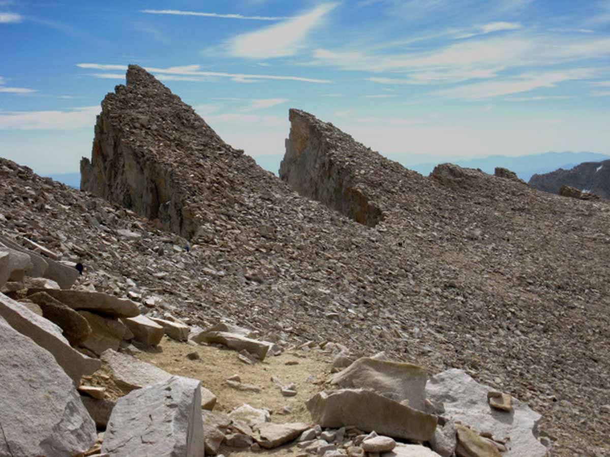
Hiking past the iconic sawtooth ridge on our last steps to the great almost-flat plateau that is the crest of Mount Whitney.
Trail Guide Map Miles and Elevations: Not yet online
December 2017
January February March April May June July August September October November December
| Sunday |
Monday |
Tuesday |
Wednesday |
Thursday |
Friday |
Saturday |
Full Winter Gear
Time to pull out the full Winter Gear. A thick base layer with thick insulation and shell layers necessary.
Yosemite-Hoover-Desolation
&
John Muir Trail Hikers:
Time to Order Next Year's Permits
All Snow Information
December
Road News & Status Links |
28
2017
Clearing, Looks Like a window of access until Friday Night.
HAZARD STATUS
Two Issues
1> Winter Storm & Temp Potential.
2> Full Winter Gear
The progression of this year's gear status change points began on September 15th, when Summer Gear was switched out for our Fall setup.
This was followed up on November 3, when we brought out the
Winter Gear
Selection, though I would characterize it as a Winter "lite" setup.
Full Winter Gear is now Required. We have reached the seasonal interface when temperatures can plunge to below zero.
Cold Safety Chart
GEAR
Careful assesment of weather and gear is now critical to trip planning.
Check the MODIS View for today by adjusting the time slider.
COLD
Night Last Night
Cold Night Tonight
Today's high & low temps were ten degrees colder than Yesterday's 24 hour range, listed at Left, and are going to be colder this evening, by my reckoning.
Weather Note
La Nina is Powerful and Widespread on Nove 22, as shown on today's
Ocean Temp Anomalies
All La Nina Information |
29
2017
Clear, Crisp, and Cool between fronts
COLD
Night Last Night
Cold Night Tonight
Lows from the mid-20s to mid-teens last night.
Crestline
Reporting Stations
(Compare with the 27th)
Carson Pass
8388 feet
Ebbetts Pass
8660 feet
Leavitt Lake
9602 feet
Marine Base
6748 feet East Flank
Deadman Creek
9250 feet
Tuolumne Meadows
8600 feet
Tioga Pass/Dana
9798 feet
Gem Pass
10750 feet
Mammoth Pass
9500 feet
South Lake Cabin
9580 feet
Big Pine Sawmill
10200 feet
Bishop Pass
11972 feet
Charlotte Lake
10398 feet
Upr Tyndall Creek
11441 feet
All High Sierra
Reporting Stations
2017
Clear, Crisp, and Cool between fronts
Winter Storm Warnings
All Sierra Forecast Zones
All Precip Forecasts
|
30
2017
Clear, Crisp, and Cool between fronts
Winter Storm Warnings
All Sierra Forecast Zones
All Precip Forecasts
|
1
2017
Clear with a bit of wisp, humid temerate feel, still, between fronts...
See
Last Week of November
Observe
Storm, Temp and Weather Patterns to properly time upcoming Winter Trips.
TOP
|
2
2017
Haze building into thickening, but weak, tropical conditions as a weak cold front crosses the Sierra, light precip overnight.
9th set of Precip-Incident since advent of rains
|
| Sunday |
Monday |
Tuesday |
Wednesday |
Thursday |
Friday |
Saturday |
3
2017
Clearing Nicely, with a High building in along the coast for the next week bringing clear and crisp days with cold nights
2017
HIGH SIERRA
--FALL--
Temp-Snow Check
Update after nine sets of precip events have crossed the Sierra, the Last clearing out this evening.
Let's check our reporting station snow & temp readings.
Below: Watershed Snow Water Content Charts followed by individual reporting station's Snow Depth and
24 hour high-low temps.
Last: Nov 27
NEW WATER YEAR
Tahoe Basin
Watershed
N Sierra Reporting Stations
On a Map
Scroll over stations for snow & temps. Click for
full report.
American-Yuba Watersheds
Carson-Walker
Watersheds
Carson Pass 16"
8388 feet
(7.9" H2O) +.2
42 & 31 -
Ebbetts Pass 22" -1
8660 feet
(10.10" H2O) +1.3
43 & 30 -
Leavitt Lake 42" +1
(errors)
9602 feet, East Flank
(11.80" H20) +.2
39
& 29 -
Marine Base
6748 feet East Flank
FULL REPORT
VIS-CHIL-WEA-MB-WIND
xx & xx:
(New readout page sucks... & Tech issues)
Mokelumne-Stanislaus Watersheds
Deadman Creek
9250 feet, West Flank
000.0 Snow (BAD)
(14.4" H20) (BAD?)
43
& 18 -
Tuolumne-Merced
Watersheds
Tuolumne Meadows
8600 feet, West Flank
4.17" Snow -1.4
49
& 25 +/-
Tioga Pass/Dana
9798 feet
15.81" Snow -3.6
(--.--" H20) (BAD)
(Temps NONE)
Mammoth Mountain Ski
Mono Lake-Owens Basin
Gem Pass
10750 feet
SNO " Depth Suspect
(9.6" H2O) Suspect
temps suspect
Mammoth Pass
9500 feet
31.0" Snow +1.1
(8.84" H2O)
45 & 22 +
South Lake Cabin
9580 feet, East Flank
(Snow BAD")
15.8 H2O) =
46 & 29 -/+
Big Pine Sawmill
10200 feet, East Flank
2.50" Snow -2.4
42 & 23 -/+
Kings River
Bishop Pass
11972 feet
BAD- BAD
Charlotte Lake
10398 feet, West Flank
TEMPS ONLY
-- & -- BAD
(The coldest station)
Kern Watershed
Upr Tyndall Creek
11441 feet
13.53" -.2
31 & 25 -/+
(station
reporting again!)
All High Sierra
Reporting Stations
|
4
2017
Near-Clear with some intense winds & gusts. Cold night.
All Forecasts
View of Sierra on December 4 by the...
MODIS
SIERRA SATELLITE
|
5
2017
Clear-er, calm & gentle, will be colder tonight.
COLD
Night Last Night
Cold Night
Tonight
All Snow Information
REALTIME
High Sierra Crestline
Reporting Stations
(Compare with the 3rd)
Carson Pass
8388 feet
Ebbetts Pass
8660 feet
Leavitt Lake
9602 feet
Marine Base
6748 feet East Flank
Deadman Creek
9250 feet
Tuolumne Meadows
8600 feet
Tioga Pass/Dana
9798 feet
Gem Pass
10750 feet
Mammoth Pass
9500 feet
South Lake Cabin
9580 feet
Big Pine Sawmill
10200 feet
Bishop Pass
11972 feet
Charlotte Lake
10398 feet
Upr Tyndall Creek
11441 feet
All High Sierra
Reporting Stations
|
6
2017
Clear, crisp, calm & gentle.
SOCAL FIRES
See Trail News
Vast, Persistant Blocking Ridge since 3rd, forecast through 13th, & looks Longer & Stronger than that...
THE RIDGE
TOP |
7
2017
Clear-ish, mistyness, calm & gentle afternoon. Warm days, cool nights.
Vast, Persistant Blocking Ridge
This is good snow travel weather.
The "misty" aspect is tropical moisture from the South buffeting the South edge of the great High along the West Coast, as it is drawn North in the persistant trough that's accompained the rise of this persistant High, for over a decade... |
8
2017
Clear-ish, wispy-mistyness, calm & gentle afternoon. Warm days, cool nights.
Vast, Persistant Blocking Ridge
All Snow Information
All High Sierra
Reporting Stations |
9
2017
Clear-ish, calm & gentle, Warm days, cool nights.
Vast, Persistant Blocking Ridge
High Sierra Ski resorts around Tahoe generally opening this weekend.
All Sierra Forecast Zones
All Precip Forecasts
The Sierra
on
December 9
by...
MODIS
SIERRA SATELLITE |
| Sunday |
Monday |
Tuesday |
Wednesday |
Thursday |
Friday |
Saturday |
10
2017
Clear-ish, calm & gentle, Warm days, cool nights.
Vast, Persistant Blocking Ridge
The Sierra
on
December 10
by...
MODIS
SIERRA SATELLITE |
11
2017
Clear-ish, calm & gentle, Warm days, cool nights.
Vast, Persistant Blocking Ridge
COLD
Nights
Balmy
Days
2017
HIGH SIERRA
--FALL--
Temp-Snow Check
After-report of nine Snow-storms across Sierra this Fall.
The last storm was on the second, clearing the third.
Let's check our reporting station snow & temp readings.
Below: Watershed Snow Water Content Charts followed by individual reporting station's Snow Depth and
24 hour high-low temps.
Last: Dec 3
NEW WATER YEAR
Tahoe Basin
Watershed
N Sierra Reporting Stations
On a Map
Scroll over stations for snow & temps. Click for
full report. "+/- & =" are changes since last reading.
American-Yuba Watersheds
Carson-Walker
Watersheds
Carson Pass 14" -2
8388 feet
(8.3" H2O) +.4
50 & 26 +/-
Ebbetts Pass 18 " -4
8660 feet
(10.10" H2O) +1.6
54 & 30 +/=
Leavitt Lake 35" -7
(errors)
9602 feet, East Flank
(12.2" H20) +.4
48
& 31 +/+
Marine Base
6748 feet East Flank
FULL REPORT
VIS-CHIL-WEA-MB-WIND
xx & xx:
(New readout page sucks... & Tech issues)
Mokelumne-Stanislaus Watersheds
Deadman Creek
9250 feet, West Flank
000.0 Snow (BAD)
(14.4" H20) (BAD?)
56
& 18 +/=
Tuolumne-Merced
Watersheds
Tuolumne Meadows
8600 feet, West Flank
6.03" Snow +1.86
55
& 14 +/-
Tioga Pass/Dana
9798 feet
14.63" Snow -1.18
(--.--" H20) (BAD)
(Temps NONE)
Mammoth Mountain Ski
Mono Lake-Owens Basin
Gem Pass
10750 feet
SNO " Depth Suspect
(9.6" H2O) Suspect
temps suspect
Mammoth Pass
9500 feet
29.48" Snow -1.52
(8.84" H2O) +.2
54 & 26 + /+
South Lake Cabin
9580 feet, East Flank
(Snow BAD")
(15.8 H2O) =
50 & 24 +/-
Big Pine Sawmill
10200 feet, East Flank
2.60" Snow +.1
45 & 19 +/-
Kings River
Bishop Pass
11972 feet
BAD- BAD
Charlotte Lake
10398 feet, West Flank
TEMPS ONLY
-- & -- BAD
(The coldest station)
Kern Watershed
Upr Tyndall Creek
11441 feet
13.21" -.38
43 & 29 +/+
(station
reporting again!)
All High Sierra
Reporting Stations |
12
2017
Clear-ish, calm & gentle, Warm days, cool nights.
Nothing at all, no Lows nor any precip is expected to come anywhere near having the power to break through the Vast High dominating the West Coast of the USA, at least through the 20th.
This is a Vast High, a ridge of Titanic porportions, and proving itself to be as self-recharging, as persistant in sustaining its own position, as it is being sustained by powerful High Pressure Cells moving East across the SouthPacific.
Progress of the Season
All Sierra Forecast Zones
All Precip Forecasts
All Snow Information |
13
2017
Clear-ish, calm & gentle, Warm days, cool nights.
Vast, Persistant Blocking Ridge
TOP
|
14
2017
Clear-ish, calm & gentle, Warm days, cool nights.
Vast, Persistant Blocking Ridge |
15
RED FLAG WARNINGS
Weak Front
Passing through the High, all precip far to the North.
CENTRAL & SOUTH SIERRA
All Warnings
2015 CHANGE POINT |
16
Winds Decreasing |
| Sunday |
Monday |
Tuesday |
Wednesday |
Thursday |
Friday |
Saturday |
17
Mild, Balmy Day, Cool Night
Vast, Persistant Blocking Ridge
|
18
Clouds, still warm days, cool nights.
Vast, Persistant Blocking Ridge
Progress of the Season
All Sierra Forecast Zones
All Precip Forecasts
All Snow Information
|
19
Clouds, preceeding cold front from North.
Should hit this evening.
Light Sierra Storm Warning
2017
HIGH SIERRA
--FALL--
Temp-Snow Check
After-report of nine Snow-storms across Sierra this Fall.
The last storm was on the second, clearing the third.
Let's check our reporting station snow & temp readings.
Below: Watershed Snow Water Content Charts followed by individual reporting station's Snow Depth and
24 hour high-low temps.
Last: Dec 11
NEW WATER YEAR
Tahoe Basin
Watershed
N Sierra Reporting Stations
On a Map
Scroll over stations for snow & temps. Click for
full report. "+/- & =" are changes since last reading.
American-Yuba Watersheds
Carson-Walker
Watersheds
Carson Pass 14" -2
8388 feet
(8.4" H2O) +.1
50 & 30 =/+
Ebbetts Pass 20" +2
8660 feet
(11.70" H2O) +1.6
52 & 31 -/+
Leavitt Lake 36" +1
(errors)
9602 feet, East Flank
(12.2" H20) +.4
49
& 32 +/+
Marine Base
6748 feet East Flank
FULL REPORT
VIS-CHIL-WEA-MB-WIND
xx & xx:
(New readout page sucks... & Tech issues)
Mokelumne-Stanislaus Watersheds
Deadman Creek
9250 feet, West Flank
000.0 Snow (BAD)
(14.64" H20) (BAD?) +.24
46
& 21 -/+
Tuolumne-Merced
Watersheds
Tuolumne Meadows
8600 feet, West Flank
5.33" Snow -0.7
48
& 17 -/+
Tioga Pass/Dana
9798 feet
14.03" Snow -0.60
(--.--" H20) (BAD)
(Temps NONE)
Mammoth Mountain Ski
Mono Lake-Owens Basin
Gem Pass
10750 feet
SNO " Depth Suspect
(9.57" H2O) Suspect
temps suspect
Mammoth Pass
9500 feet
29.02" Snow -0.28
(9.08" H2O) +.24
49 & 29 - /+
South Lake Cabin
9580 feet, East Flank
(Snow BAD")
(15.8 H2O) =
45 & 27 -/+
Big Pine Sawmill
10200 feet, East Flank
2.90" Snow +.3
40 & 23 -/+
Kings River
Bishop Pass
11972 feet
BAD- BAD
Charlotte Lake
10398 feet, West Flank
TEMPS ONLY
-- & -- BAD
(The coldest station)
Kern Watershed
Upr Tyndall Creek
11441 feet
12.55" -.66
48 & 22 +/-
(station
reporting again!)
All High Sierra
Reporting Stations
|
20
WEAK COLD FRONT
COLD
Nights
Cool
Days
First
Very Cold Night
under
clear skies following behind the weak cold front.
REPORT
TOP |
21
First Day of Winter
Cold & Dark Equinox
NASA VIDEO
ANNUAL CYCLE OF LIGHT
Vast, Persistant Blocking Ridge
Tahoe Region
Wind Advisory
&
COLD WARNING
Though there is
No Official Cold Warning,
it's going to get real cold tonight.
2017
HIGH SIERRA
--WINTER--
Temp-Snow Check
After-report of ten* Snow-storms across Sierra this Fall.
The last storm was last night, clearing today.
Let's check our reporting station snow & temp readings.
Below: Watershed Snow Water Content Charts followed by individual reporting station's Snow Depth and
24 hour high-low temps.
Last: Dec 19
NEW WATER YEAR
Tahoe Basin
Watershed
N Sierra Reporting Stations
On a Map
Scroll over stations for snow & temps. Click for
full report. "+/- & =" are changes since last reading.
American-Yuba Watersheds
Carson-Walker
Watersheds
Carson Pass 16" +2
8388 feet
(8.7" H2O) +.3
35 & 13 -/-
Ebbetts Pass 23" +3
8660 feet
(12.20" H2O) +.5
34 & 12 -/-
Leavitt Lake 40 " +4
(errors)
9602 feet, East Flank
(12.4" H20) +.2
32
& 8 -/-
Marine Base
6748 feet East Flank
FULL REPORT
VIS-CHIL-WEA-MB-WIND
xx & xx:
(New readout page sucks... & Tech issues)
Mokelumne-Stanislaus Watersheds
Deadman Creek
9250 feet, West Flank
000.0 Snow (BAD)
(14.64" H20) (BAD?) +.0.0
21
& 6 -/-
Tuolumne-Merced
Watersheds
Tuolumne Meadows
8600 feet, West Flank
4.27" Snow -1.06
25
& -1 -/-
Tioga Pass/Dana
9798 feet
15.32" Snow +1.31
(--.--" H20) (BAD)
(Temps NONE)
Mammoth Mountain Ski
Mono Lake-Owens Basin
Gem Pass
10750 feet
SNO " Depth Suspect
(9.66" H2O) +0.9 Suspect
temps suspect
Mammoth Pass
9500 feet
36.29" Snow +7.27
(9.16" H2O) +.08
22 & 6 -/-
South Lake Cabin
9580 feet, East Flank
(Snow BAD")
(15.8 H2O) =
25 & 2 -/-
Big Pine Sawmill
10200 feet, East Flank
0.30" Snow -2.6
21 & -4 -/-
Kings River
Bishop Pass
11972 feet
BAD- BAD
Charlotte Lake
10398 feet, West Flank
TEMPS ONLY
-- & -- BAD
(The coldest station)
Kern Watershed
Upr Tyndall Creek
11441 feet
12.48" -.07
18 & 4 -/-
(station
reporting again!)
All High Sierra
Reporting Stations
* We've had more than ten fronts come across the Sierra, and periods of spitting snow, but only ten fronts of any substance. |
22
COLD WARNING
Though there is
No Official Cold Warning,
it's going to get real cold tonight.
Vast, Persistant Blocking Ridge
2017
Over the last three nights the 24 hour high and low temp range both dropped 30 degrees.
Last night's range of 24 hour highs and lows were 10 degrees cooler than the previous evening's, which were 20 degrees cooler than the night before that, the evening of the 18th to the morning of the 19th.
Last Night's
Overnight
Lows
Carson Pass 11
Ebbetts Pass 9
Leavitt Lake 4
Deadman Creek 13
Tuolumne Meadows 8
Mammoth Pass 5
South Lake Cabin 2
Big Pine Sawmill -4
Upper Tyndall Creek 3 |
23
COLD
Nights
Cool
Days
We saw our first cloud cover in a long time when the weak storm blew through on the 18-19th, followed by three days of cold clarity.
These were the first deep cold mid-Winter temps. this season.
Now some clouds from a Low & Front sitting beyond, West of the vast blocking High on the West Coast of the N American Continent, have been pushed over the NW US last night & today: A change.
Still cold, the blocking ridge is still sitting there, but this is a change.
A depth of coldness has been achieved. This season has made a cold, "statement."
The blocking ridge High along the West Coast of the US still controls our weather, and still looks strong into the foreseable future.
It's still real cold, but these clouds & cloud cover being shed off the Front & Low being deflected North off the West Coast have warmed us up a tad. About ten degrees...
This persistant High weakens (or disperses) any fronts that the Lows it is deflecting around its Northern & Western perimeters, drag across California.
Curent Satellite View
Current Surface Map
Current Surface Map Animation
All High Sierra Weather Resources |
| Sunday |
Monday |
Tuesday |
Wednesday |
Thursday |
Friday |
Saturday |
24
unprecedented
Red Flag Warning!
South Sierra across the Grapevine
Text
Persistant Blocking Ridge
|
25
Christmas
Cloudy
Persistant Blocking Ridge
TOP |
26
Cloud & Clear
Persistant Blocking Ridge |
27
See Last Report on the 23rd
Cloudy & Clearing nicely, crisp, clear days...
Persistant Blocking Ridge
Curent Satellite View
Current Surface Map
Current Surface Map Animation
All High Sierra Weather Resources |
28
2017
HIGH SIERRA
--WINTER--
Temp-Snow Check
After-report of eleven* Snow-storms across Sierra this Fall.
The last weak front came across on the 20th.
Let's check our reporting station snow & temp readings.
Below: Watershed Snow Water Content Charts followed by individual reporting station's Snow Depth and
24 hour high-low temps.
Last: Dec 21
NEW WATER YEAR
Tahoe Basin
Watershed
N Sierra Reporting Stations
On a Map
Scroll over stations for snow & temps. Click for
full report. "+/- & =" are changes since last reading.
American-Yuba Watersheds
Carson-Walker
Watersheds
Carson Pass 17" +1
8388 feet
(8.7" H2O) +.3
48 & 30 +/+
Ebbetts Pass 20" -3
8660 feet
(12.30" H2O) +.1
47 & 36 +/+
Leavitt Lake 41 " +1
(errors)
9602 feet, East Flank
(12.6" H20) +.2
44
& 36 +/+
Marine Base
6748 feet East Flank
FULL REPORT
VIS-CHIL-WEA-MB-WIND
xx & xx:
(New readout page sucks... & Tech issues)
Mokelumne-Stanislaus Watersheds
Deadman Creek
9250 feet, West Flank
000.0 Snow (BAD)
(14.76" H20) (BAD?) +.12
48
& 21 +/+
Tuolumne-Merced
Watersheds
Tuolumne Meadows
8600 feet, West Flank
6.14" Snow +1.87
51
& 17 +/+
Tioga Pass/Dana
9798 feet
14.27" Snow -1.05
(--.--" H20) (BAD)
(Temps NONE)
Mammoth Mountain Ski
Mono Lake-Owens Basin
Gem Pass
10750 feet
SNO " Depth Suspect
(9.3" H2O) SuspectSuspect
temps suspect
Mammoth Pass
9500 feet
32.77" Snow -3.52
(9.72" H2O) +.56
51 & 30 +/+
South Lake Cabin
9580 feet, East Flank
(Snow BAD")
(15.8 H2O) =
50 & 29 +/+
Big Pine Sawmill
10200 feet, East Flank
1.9" Snow +1.6
45 & 23 +/+
Kings River
Bishop Pass
11972 feet
BAD- BAD
Charlotte Lake
10398 feet, West Flank
TEMPS ONLY
-- & -- BAD
(The coldest station)
Kern Watershed
Upr Tyndall Creek
11441 feet
11.85" -.63
44 & 24 +/+
(station
reporting again!)
All High Sierra
Reporting Stations
* We've had more than eleven fronts come across the Sierra, and periods of spitting snow, but only ten fronts of any substance.
Most have been dissapated as they pass through this vast High. |
29
The Sierra
on
December 28
by...
MODIS
SIERRA SATELLITE
Cloudy
2017
Current Snowpack:
Percent of Average for
December 28.
N Sierra: 24%
Cen. Sierra:33%
S Sierra: 23%
Ca State: 27%
Statewide Summary of Snow Water Content PDF
First 2017 Reading: Jan. 20, 2017
|
30
Backpackers
Time again to begin observing Winter transitioning into Spring
Cloudy
Lows marching North up the West flank of the Persistant High off the West Coast of N America & West US (as they go around us) have been shedding high clouds without any precip, warming things up a bit, but bringing no substantial snow.
|
| Sunday |
Monday |
Tuesday |
Wednesday |
Thursday |
Friday |
Saturday |
31
West Coast
Cloudy
Lows marching North up the West flank of the Persistant High off the West Coast of N America & West US (as they go around us) have been shedding high clouds Eastward, yet without any precip, but warming things up a bit, and bringing no substantial snow in them.
US COLD PLUNGE
Central,
Central-South,
&
Northeast US:
Temps at, and Plunging to Record Levels. |
1
2018
HIGH SIERRA
--WINTER--
Temp-Snow Check
After-report of eleven* Snow-storms across Sierra this Fall.
The last weak front came across on the 20th.
Let's check our reporting station snow & temp readings.
Below: Watershed Snow Water Content Charts followed by individual reporting station's Snow Depth and
24 hour high-low temps.
Last: Dec 28
NEW WATER YEAR
Tahoe Basin
Watershed
N Sierra Reporting Stations
On a Map
Scroll over stations for snow & temps. Click for
full report. "+/- & =" are changes since last reading.
American-Yuba Watersheds
Carson-Walker
Watersheds
Carson Pass 16" -1
8388 feet
(8.8" H2O) +.1
47 & 31 -/+
Ebbetts Pass 19 " -1
8660 feet
(12.30" H2O) =.0
47 & 36 =/=
Leavitt Lake 39" +2
(errors)
9602 feet, East Flank
(12.6" H20) =.0
46
& 33 +/-
Marine Base
6748 feet East Flank
FULL REPORT
VIS-CHIL-WEA-MB-WIND
xx & xx:
(New readout page sucks... & Tech issues)
Mokelumne-Stanislaus Watersheds
Deadman Creek
9250 feet, West Flank
000.0 Snow (BAD)
(14.76" H20) (BAD?) +.12
49
& 23 +/-
Tuolumne-Merced
Watersheds
Tuolumne Meadows
8600 feet, West Flank
6.07" Snow -.07
46
& 22 -/+
Tioga Pass/Dana
9798 feet
14.49" Snow +.22
(--.--" H20) (BAD)
(Temps NONE)
Mammoth Mountain Ski
Mono Lake-Owens Basin
Gem Pass
10750 feet
SNO " Depth Suspect
(9.3" H2O) SuspectSuspect
temps suspect
Mammoth Pass
9500 feet
32.06" Snow -.71
(9.76" H2O) +.04
48 & 28 -/-
South Lake Cabin
9580 feet, East Flank
(Snow BAD")
(15.8 H2O) =
46 & 28 -/-
Big Pine Sawmill
10200 feet, East Flank
1.1" Snow +.1
41 & 24 -/+
Kings River
Bishop Pass
11972 feet
BAD- BAD
Charlotte Lake
10398 feet, West Flank
TEMPS ONLY
-- & -- BAD
(The coldest station)
Kern Watershed
Upr Tyndall Creek
11441 feet
11.84" =.00
39 & 25 -/+
(station
reporting again!)
All High Sierra
Reporting Stations
* We've had more than eleven fronts come across the Sierra, and periods of spitting snow, but only ten fronts of any substance.
Most have been dissapated as they pass through this vast High. |
2
2018 Calendar
US COLD PLUNGE
Central,
Central-South,
&
Northeast US:
Temps at Record Levels, Continuing through New Year.
THINK AHEAD
CCC
Backcountry Trail Crew
Applications due
EARLY FEB 2018 |
3 |
4 |
5
TOP |
6 |
Top of Page
2018 Calendar
NOTES:
December Tenth, 2015:
Intense tropical flows have so far been diverted around us by the same persistent ridge, the high pressure zone that's been gradually building, strengthening, and persisting over Winter in the Northwest and West
Pac over the last fifteen years. Yup, that one. I am betting that each time this ridge breaks down from here on out we will have a good chance of North and Central California getting seriously hosed. The ridge persisting will continue the deluge that everyone from Portland Oregon, and points North, has been getting pounded with, so far this year.
The distribution of El Nino tropical moisture has been controlled by the balance of factors I discussed in the December Backpacker Alert.
Season's Greetings: Alex and all the members of Tahoe to Whitney hope you had a killer backpacking year, that you’ve seen amazing things and met incredible folks on the long trails between Lake Tahoe and Mount Whitney. Woo Hooo!
Now's the Time! November & December is the time to reserve permits in Desolation Wilderness or Yosemite National Park for next June. Half of each ‘s Wilderness Permits for these heavily used areas are available six months before the start date of the backpacking trip.
This 2017 High Sierra backpacking and backpacker's Calendar notes important hiking dates as our seasons progress to compare current and recent historical weather to determine the best gear for the conditions. We also track the expected against the actual dates our resupply locations and the trans Sierra highways that feed them open and close. We also include permit reservation timing reminder information for those who seek hard to get permits from Yosemite and Hoover Wilderness Areas.
|
The Winter Backpacker
Very short days and long cold nights makes Winter hiking trips very different than Summer.
I’m hopeful the trails will be buried under yards of snow by December 2016…
If so, our goals, our speed, and our expectations have fully shifted into Winter Mode.
Our changing inner perspective ideally matches external environmental changes.
May your perspective always complement your environment, and visa-versa.
2014 Calendar 2015 Calendar
2016 Calendar |
I am hoping my frostbite/heart is recovered enough to resume my annual Christmas-New Year Snow Camping Triangle at the end of 2016.
From Meyers to Round Lake to Showers Lake to Round Top Lake and back to Meyers is my traditional December 25 Christmas present to myself.
The terrain, the joy of navigation and route finding the snow-covered beauty of the High Sierra during Winter is a special experience well worth the efforts and hazards.
Happy Trails!
2018 Calendar
2018 Calendar Index
Tahoe to Whitney |
Top of Page
January February March April May June July August September October November December
2014 Calendar 2015 Calendar
2016 Calendar
top of page |