
The Trails
Guide
Maps
Miles/Ele
Permits
Resupply
Forum
Current Weather Conditions
Weather Notes
Northern High Sierras
Central High Sierras
Southern High Sierras
Gear
Gear List
Gettin Started
Layering
Discussion
Testing yourself and your gear
Gear Reviews
Evolution of Weather and Trail Conditions
Resources to Observe
(2013)
Winter into Spring into Summer
Trail Arts
The art of walking
Physical Preperation
Trail Skills
The trail
Off the trail
Scrambling
Maps
Navigation
Camp skills
Food
Resupply
Food
Other
Photo Catagories
Trail Stories
Trail Culture
News and Science
Links
Groups
Books
The fine Art of Observation and Prediction
When will the Trails Open? Start Analysis
Follow Subsequent and Previous Years in the How to think about this I offer the record of the 2011 and 2012 Spring Thaw Reports, below on this page, as a study in contrasts. The Sierra trails were covered in snow through the Spring of 2011 deep into Summer, and even into Fall in protected locations. Wow. The Sierra trails were barely covered with snow at all during the Winter of 2012 and backpacking began last year as early as I can remember. Again, Wow. My point is that nature takes no heed of our plans or the calendar. One year the trails have almost no snow, while the previous year record snows clogged the trails. The radical extremes of conditions between 2011 and 2012 demonstrate that some years the trails almost don't open up, while other years they almost don't close. We can confidently say that each year is different. Those hikers planning a PCT attempt are well advised to track Sierra weather through the Winter into Spring. This information will tell you if your start date is viable as it approaches. When will the trails open up in 2013? I don't frkn know. It will be somewhere between the full snow conditions of 2011 and the no snow status of 2012. I do know that a heavy, mixed late Fall and Early Winter this Fall season brought earlier snow than normal to the NW US and Sierra. This heavy start to the Winter of 2013 has been followed by colder than normal temps and low precipitation. Low temps are indicative of drier Winters. The Sierra Snowpack is thin as of mid Jan. But it's still too early to tell when the trail along the Sierra Crest will open. Variables If Spring weather patterns begins drawing moisture from the Central-South Pacific the Sierra will get packed with snow, as it did in the Spring of 2011. If it stays cold and the storms out of the Bearing Straight continue to get knocked East, we will have an early opening. If the Northern storms get through (the "storm gate" remains open) we will have a normal Spring. If the Northern and Southern storms both get through we will have a huge Spring and dense snow on the trail through mid-Summer, as we did during 2011. If neither the Northern or Southern storms get through we will have little snow in the Sierra Nevada and the trails will open early, as they did in 2012. That's what can happen... Prognosticator My opinion? It is looking like a drier than normal late Winter right now, indicating a normal or even an early opening of the main trails along the Sierra Crest. That's now. Things can change tomorrow. Most Important If an early start is possible this upcoming season, be extremely careful. Early starts bring the danger of freak snow storms blowing in on thinly-geared PCT hikers. Don't ever take the Sierra Nevada lightly. Data Tools To track these changes I employ a number of tools, all consolidated on the Sierra Weather Page on the Tahoe to Whitney Forum website. Of vital importance to those hikers who live far away who are planning a Sierra hike this upcoming Summer are the ground reporting stations. These tell you how much snow is on the ground at locations and the accompanying temps that are representative of that particular aspect and altitude of Sierra terrain. Good info to monitor. To understand what the existing snow is doing and how it is distributed I suggest the snow analysis tool. To get a feel for the real time change in the Sierra snowpack check out the Snowfall Probability Forecast. Though this is a short-term view it will help you track deposition of snow, while the snow analysis tool above will help you track melting. The former-the latter=both the depth and rate of change. I'm a bit down and wounded right now, so my normal procession of Winter into Spring backpacking trips are not happening again this year. My foot is too cold in warm conditions. This significantly limits the specific information I can offer. But I'm still watching closely, even from a distance. Above Written : 1-14-2013 Below: 2-5-2013 Wow. What a dry-ass Winter. Warm and humid during the day, very cold at night. The already thin Winter cover of snow on the Sierra is seriously thinned out and mostly gone on the flanks. From where I'm looking it's looks like an early opening of the High Sierra Trails is in the cards. Well, at least it's looking that way right now, in early Feb. The hot Southern Seas can pump up some serious Spring moisture, if it comes this way. But the weather pattern is broken and unpredictable. I'd say that there's little chance of heavy storm activity brewing out of the Aleutians and Bearing Straight for the rest of this Winter season, but that the source of late-season storms would be the Hot Southern Ocean brewing out late-season storms. It would be a function of super-heated North Equatorial Oceans and skies being the source of late Winter and early Spring heavy weather action. By action I mean Winter fury. Or even the wet tropical storms that blow up from the South pretending to be Winter fury. I doubt it. It amazes me that we look South for Storms, as the Northern Stormgate closes. My, how "things" have changed. The Northern storm pattern has broken down, and Southern storms patterns, though increasing, are still unreliable and insufficient for the vast population we have built. As of this date, February Fifth 2013, the mountains look like they are opening early, if not "on time." Unless the Southern Storms kick up.
Feb 11 2013: The Sky is Broken. The traditional circulation patterns are gone.
Feb 22, 2013 I offer a resource. The Climate Prediction Center maintains an ongoing analysis to determine what is going to happen in the sky from six days to three months out. They just came out with their three month rainfall and drought probabilities. An early opening date for the High Sierra trails is indicated by this scientific data, as well as antidotal observations. March 7, 2013 My early early season hiking danger warning It is looking highly likely that an early opening of the High Sierra trails is in store for this season's Pacific Crest Trail hikers. This is a bit of a blessing and a curse. The blessing is a longer time period to complete the Mexico to Canada journey. The curse could be incredibly dangerous fords of rivers swollen with the Spring Thaw laying deeply within flowering valleys between snow-clogged mountain passes. Just because the trails are "open" does not mean the mountain passes are clear of snow. They will not be. Northeast facing aspects and sheltered locations will be packed with snow early in the hiking season. I think of portions of Leavitt Peak, Sonora Peak, Raymond Peak, and too many other sections of trail to name that are dangerous when coated with Spring snow. These early season snow covered mountain flanks and surging river crossings are the incredibly dangerous conditions that "early" openings of the Sierra reveals. What this means to you depends on who you are. If you are experienced at high altitude snow travel you will likely do ok through the snow-packed mountain passes and flanks if you use your judgment and are properly geared. Ice axes and crampons are standard gear for early season High Sierra hikers. If you are experienced at crossing powerful flows of freezing water you will still be in danger fording during the Spring Thaw. These early season fords are very dangerous. Independent of your skill and experience these are objectively dangerous early season conditions that demand your full attention, respect, and the ability to detour to save your life if that is the prudent decision. April 1 2013 The ultra-low late March Survey brought in some tropical-style downpours, lightening, and hail in its wake. Thirty years ago this tropical-style weather would have been very rare and noteworthy, but tropical humid weather during early Spring has not been uncommon during the last ten years. The question is, "will it offset the loss of precip out of the Northwest?" I thought not, earlier in the Winter, and still believe the early thaw of the light snowpack will continue, despite these baby-downpours. I am leaning heavily towards, "No, dry conditions will continue." Though these downpours will revive the snowpack a bit, they are not of low temp and will do nothing to change the early thaw trajectory we are already following. In fact, if the high temps continue we may see warm rains scouring high altitude snow off the mountain, rather than adding more snow. Conditions are still pointing towards an early opening of the Sierra, but these conditions deepen the dangers at the same time they clear the snows. Diminished snowpack conditions that draw backpackers early into the High Sierra also fill the rivers and creeks with dangerous levels of runoff. During warm early thaw years warm tropical rains can bring precipitious thaws. These rapid melts cause avalanches, flood levels of rivers that sweep away both forest and rock, and impossible fording conditions for the duration of the flood period of the thaw. These current tropical-style downpours remind us of these dangers. The real long term danger that we have seen emerging over the last few years is the pattern of rapidly shifting extreme weather conditions. Over the last three seasons we have seen one record breaking heavy snow Winter sandwhiched between two record breaking dry Winters. A great extremity of weather conditions is happening from one season to the next. April 11 2013 On Feb the 5th above I noted that the "stormgate," the traditional combination of weather influences which pushed our traditional cold Winter storms through their rotation around the Alutians, turning this great force down the West Coast of North America, had closed. It had, and this great loss of moisture has not been replaced, or even significantly supplemented, by our new tropical weather pattern, carried to us on the wings of the new dominant wind direction blowing out of the West and Southwest. The emerging weather pattern that is blocking our traditional stormgate is not carrying enough moisture to replace the loss. The last outburst of tropical weather was the brief tropical downpours, lightening and thunder (this was very atypical weather 30 years ago, but has become commonplace today) we experienced in early April put little snow on the mountains, nor water in the reservoirs. As I said on Feb 5 and again on April 1, the emerging tropical pattern is not set up to bail us out this year, water-wise. Backpacking-wise this is working out to bring us a very early opening of the High Sierra Trails. This itself brings new dangers. Though the attention of the early season PCT and High Sierra bakpackers should not waver from observing the evolution of the weather, now our attention must stretch out to cover river flows. We are now entering the danger period for very dangerous high water levels during the Spring Thaw. That brings us to the CDEC of the California Dept of Water Resources, where we are going to watch river flows. The Current River Conditions page allows us to select all the major rivers in California to observe and track their flows. Though the reporting stations may be further down the mountain than our trail route, the rise and fall of flow levels are indicative of the conditions we will experience higher up. Observe the river flows of the major rivers we will cross. Note as the Spring Thaw raises flow levels, and note when they begin to decline. Correlate this information with the snowpack, temp, and weather information from the Backpacker's Weather Resources to ascertain if and when the rivers will be fordable. Another source of information is going to be the Ranger Districts of the Parks and Forests we will be hiking through. Soon their Wilderness Rangers will hit the trails to assess Winter damages. Once they start getting out and getting ready for Summer they will be a great source of information. Let's do this thing, but let's do it right.
|
|||||||||
Previous Year's Reports and Progress
Fall 2011
Fall Resources: Weather, Forecasts, Trail Conditions and Reports Deep Spring Snows considerably shortened the beginning of this Summer's High Sierra backpacking season. (see below, and The Summer Report for historical information) Early precipitation (compared to recent years!) and impending North Pacific fronts threaten to bring a quick end to Summertime backpacking conditions early in Fall this year. (9-30-2011) Significant drops in temps and the potential for snowfall is your constant companion on the high trails during Fall. Be careful, observant, and ready for radical changes in conditions. Don't get me wrong! This is a great time to hit the Sierras. Fall has given me many incredible backpacking experiences. Yet you must thicken up your gear to anticipate the wider range of conditions you may experience during Fall. You must also be able to ascertain and follow the location of your trail route if snow obliterates it for a couple of days. |
The High Sierra Summer of 2011
Heavy Winter and late Spring Storms delay Sierra Opening
It's About Time! September 2, 2011 The long, wet, snowy conditions that have persisted through the majority of this year's Summer backpacking season have finally passed-mostly. Snow berms are remaining in deeply shaded NE facing aspects. If you have information about general Sierra conditions, specific reports on Sierra Trails, or trip reports, please post it up on the Summer Reports 2011 page. For information about the weird trajectory of the Spring Thaw tracking the conditions until late August 2011, see |
Current Status Snow persisting through August has really shortened this Summer's effective backpacking season. Expect heavy backpacker traffic on the JMT late into Fall. I expect to see PCT hikers passing through the Sierra through Fall due to the heavy early season snow conditions. A huge number of PCTers bypassed the Sierra due to the heavy Spring and Summer snowpack. I expect to see them doubling-back to hike the Sierra deep into Fall. See the Spring Reports 2011 for information about the extended snow coverage that persisted deep into the Summer Months. |
Helpful Information? |
| Mosquitoes and Seasonal Temperature Shifts: Backpacking the High Sierra. 2011 Update. | ||
|
|
The High Sierra "Spring" Thaw of 2011:
"What a long, strange trip it's been..."
Overall ReportIt's was epic! Though Spring has long been over, we have had a Heavy Winter followed by a Heavy Spring in 2011. Storms from the North brought Heavy early Winter Storms and a deep snow pack. Mid May has brought a steady flow of Spring Storms through late June. The Massive Spring Snow Pack has morphed into a massive Summer Snow Pack! This massive snow pack delayed the opening of High Sierra trails for snow-free Summer backpacking until mid-August. Summer 2011 July 28 The days are now delightfully longer, and the temps are now up to Summer levels. Yet Summer Conditions are not yet here. Heavy snow still sits down to 9000 feet on N flanks, and lower under forest cover. Heavy snows still blanket the High Sierra passes. We're melting off about 10' a week under the current temps, but North facing flanks and shaded areas are maintaining substantial snow. The rivers are still moving heavy flows at high water levels. For the latest information, or to contribute your report, check out the |
August 28 2011UPDATESummer Conditions are finally here. Information I've collected information to keep you posted. Contribute: Post up your observations about the Spring Thaw of 2011. My Status I did a four night trip in the Tahoe Basin during early January. I caught a case of frostbite hitching out of the Tahoe Basin after the trip. I had the gear for the snowshoeing, I had the gear for static in camp. But I did not have the proper gear for standing by the road hitch-hiking. Camp booties were not up for highway-side slush, and the boots must move to generate heat. Normally this would not be a problem, but a series of contributing factors altered the situation. This has kept me off the trail for the last 7 months and 3 weeks. I am going frkn CRAZY. I've taken this as an opportunity to work on the trail guide when not occupied by the trials and tribulations of a part of me dying off and growing back... |
Video One: Winter Gear Selection I: Figuring your Route, Miles, Elevations, and Exposure |
Video Two: Figuring Weather History, Current Conditions, and Future Forecasts |
||
Video Three: Backpacking gear> Layering |
||
Video Four: Backpacking gear> Gear List |
||
Video Five; Gear Selection thoughts, Worse Case Scenario, First Aid Kit Backpacking gear> First Aid
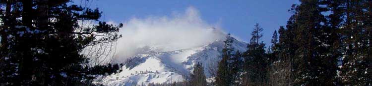
Spring and Summer in the Sierra Some Cool Pictures to get you excited
|
Snow Pack
and
Weather Information Resources
Snow Pack Info Regional Snow Analyses: Sierra Nevada All Snow Reporting Stations California Department of Water Resources (snow-navigate the map for more sensors) Sno Tel (Federal) Rivers |
Weather Links Current Winter Storm Warnings in Sierra Nevada Radar Satellite |
The Delayed Pacific Crest Trail Launch and Summer Backpacking Season
Pacific Crest Trail Notes The conditions and weather during Spring have determined that the few Pacific Crest Trail hikers who did not bypass the Sierra entered the Sierra very late this year. The approaches to the mountain passes are finally free of snow, but the high altitude passes and Northern flanks of the mountains are not. At this late date this year's "early" PCTers are already North of Tahoe, but the PCTers who bypassed the Sierra are going to be seen along the Sierra Crest all Summer long. That's rare. On "normal" years they are all long gone by early-to-mid July. |
Last Year: 2010 Last year the Sierra also saw an amazing amount of Spring Snow, though less than this year. This really screwed up Pacific Crest Trailers... Access to the mountains was delayed until mid July, when sufficient snow had melted off the high passes to allow the average-skilled backpacker to pass through. This Year: 2011 Record early season snow gave way to a series of late-Spring Storms. |
From Mid May until late June a series of late-season storms fed and preserved an already record snowpack. April has brought record high temps, but May and June brought unseasonable storms. Wow. These constant storms from March through the end of June determined that the PCTer entry into the High Sierra would again be significantly delayed as it was last year. It looks like we again dodged a bullet: We avoided a catastrophic thaw. It almost happened last year... This vast amount of moisture also promises a thick mosquito season. |
Lake Tahoe to Mount Whitney
Your guide to the Sierra Crest, including the Tahoe to Yosemite Trail, the Pacific Crest Trail and the John Muir Trail