LAST MONTH
NEXT WEEK
TOP
When Will the Sierra
"Open?"
Especially
for PCT-JMT Hikers
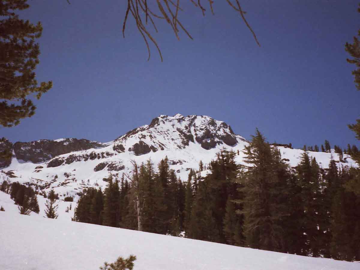
OBSERVE
The Winter and its Snowpack.
HEAVY? LIGHT?
Character and Sources of Storms?
Are Spring Conditions arriving with Spring?
Snowpack Status Sierra Reporting Stations
Timing
Our Winter-Spring-Summer?
Start Dates
for
PCT-JMT-TWT
Backpacking Trips
2019
March 2019 Trail News
Feb 25
LAST JMT START-DATE ASSESSMENT
The
"Spring-O-Meter"
2019 Status of Spring
Define Phenology
Why the National Phenology Network?
Home of NPN
Just how early is spring arriving in your neighborhood? Find out .. .
US GEOLOGICAL SURVEY, February 23, 2017.
WINTER of 2018
All
High Sierra Weather Info
2019 SITUATION
Feb-March
2019
Is looking like 2017, "lite."
(2017 was a record level snow year, with no early PCT starts for anyone not with expert snow skills)
FEB 25 2019 PROGRESS REPORT
FEB 13 2019 PROGRESS REPORT
Can We See
A
PREVIEW OF THIS YEAR IN 2017?
Danger-Danger!
2017
Backpacker
Alert through Spring into Summer!
2019 is working out very much like 2017.
Let's review the Status & Conditions
of
2017:
2017 BACKPACKER ALERT:
April 1 thru August 22, 2017. (coverage to 9-11)
The above was preceeded by the
MARCH 22, 2017 BACKPACKER ALERT
Note the parallels between the Winters of 2017 & 2019, and adjust the expectations of your PCT-JMT High Sierra Backpacking start date accordingly with the conditions...
These Old Alerts appear to apply as much today as they did in 2017.
2018
Feb 18, 2018
At this time l ast year, we were wondering if the snowpack would last until June. A cool Spring, with a couple of well-placed storms, barley stretched a thin snowpack into May.
2017
Feb 18, 2017
Two years, during 2017, at this point in time I was estimating the chances of a powerful, hot, tropical Spring storm triggering a potentially catastrophic Spring Thaw on a massive snow pack.
We had snow along the Sierra Crest through the whole Summer. Again, each year's thaw depends on the Winter snowpack against the profile of Spring temps and precip.
CURRENT SNOW
INFORMATION
Data
Latest Daily Snow Depth Summary
Daily Sierra Snowpack % of Normal pdf
Daily Snow-Water & Percent of Average
All Precipitation-Snow Data
All Snow Surveys
SWC & Snow Depth
Forecasting
All Snow Forecasts
WARMER
HIGH SIERRA
DAYS ARE AHEAD
Pick 'Em !
Summer of 2019 Backpacking Plans?
Yosemite-Hoover-Desolation
&
John Muir Trail Hikers:
Past Time to
Order This Year's Permits!
Reserved permits for the whole Summer of 2019 are now available from Yosemite, Hoover, and Desolation Wilderness Areas.
First shot at June reservations began in December.
In other words, Yosemite, Desolation, and Hoover Wilderness Areas all offer advanced reservations about six months ahead of your desired hiking dates, and now the remaining dates across the whole Summer are available.
This means now is the time to get your JMT permit application, along with other popular hikes, into the Man, and see what hiking windows are still open.
For When?
The Whole Summer!
All Permits
Yosemite Permits Desolation Wilderness
LAST MONTH
NEXT WEEK
TOP |
26 FEB
Light to Heavy
Precip
TTM out of SW
Forecast Tools
High Sierra
Avalanche Center
Tahoe Region
Central Sierra
East Sierra
THE
CURRENT SNOWPACK
GRAPHICS
Date-Adjustable Multi-Aspect High Sierra Snowpack Status
THE 24TH
NOAA-NOHRSC
SNOWPACK
The High Sierra
2-24-19
All
Snow Information
All
High Sierra
Reporting Stations
There is a vast storm off the North Coast of Australia, (in the Southern Hemisphere!) that's totally suppressing Westward movement of heat along the Equatorial Band far to the East of Indonesia, which is helping to clog-up, and feed vast amounts of tropical moisture splitting-off up to the Northwest, from Southwest of Hawaii.
This map, when viewed today, shows this vast storm:
Note the Vast Low, off the coast of Australia. That's blocking and feeding the storrm activity we see, the TTM, that's flowing North-West from the Equatorial region hitting us today...
If you look at this, today, you will see that it is nothing short of amazing that the low off Aus is feeding Tropical downpours here!
Fucking A !
2018
Snow Depths & Temps
LAST MONTH
NEXT WEEK
TOP |
27 FEB
Diminishing
Precip
Note N Sierra Focus
2019
Current Snowpack:
Percent of Average for
February 25.
N Sierra: 147%
+20% in 2 days
Cen. Sierra:154%
+0% in 2 days
S Sierra: 146%
+2% in 2 days
Ca State: 151%
+5% in 2 days
Last Reading
Feb 25
Compare with record year of 2017, Above
& ON THE 1ST-->,
and the 27th below
Statewide Summary of Snow Water Content PDF
2019
FEB 27
HIGH SIERRA
--Winter--
21st
Temp-Snow Check
Last Report:
Feb 24th, 2019
Next Report:
February ?, 2019
Let's check our reporting station snow & temp readings aftert the previous two days bringing a Tropical Transport Mechanism out of the Southwest. This is different than the last storms out of the Northwest, that preceeded this shift to the SW...
Click the stations below for the latest reports.
Below: Watershed Snow Water Content Charts followed by individual reporting station's Snow Depth and
24 hour high-low temps.
A NEW WATER YEAR:
LAST YEAR
Total Precipitation
58 % of Average
A NEW WATER YEAR: Reservoirs
N Sierra Reporting Stations On a Map
Scroll over stations for snow & temps. Click for
full report.
South Sierra Stations
"+/- & =" below are changes since last reading.
Tahoe Basin
Watershed
Southwest Tahoe
Trail Map with Stations
PCT-TYT
Rubicon
106" +15
7618 feet
Trail Map
(27.80 H2O) +0.4
36 & 30 +/+
PCT-TYT
Echo Peak
134" +11"
7652 feet
Stations Map
(49.50 H2O) +7.7 ??
35 & 29 +/+
American-Yuba Watersheds
PCT-TYT
Carson Pass 117" +15
(error??)
8388 feet
Trail Map
Stations Map
(27.50" H2O) +0.4
35 & 27 +/+
Carson-Walker
Watersheds
PCT-TYT
Ebbetts Pass
119" +1
8660 feet
Trail Map
(37.30" H2O) +0.3
33 & 26 =/+
EAST FLANK
Leavitt Lake
182" +9
9602 feet, East Flank
Trail Map
(49.2" H20) +4.6 ??
25
& 31 =/+
EAST FLANK
Marine Base
Cold Weather Training
6748 feet East Flank
Trail Map Above
FULL REPORT
VIS-CHIL-WEA-MB-
WIND
59 & 36 =/+
Mokelumne-Stanislaus Watersheds
PCT-TYT
Sonora Pass
Kennedy Meadows
RESUPPLY
Deadman Creek
45.47" -2.55
9250 feet,West Flank,
Trail Map
(20.66" H20) +0.66"
30
& 23 +/+
Tuolumne-Merced
Watersheds
Tenaya Lake
111.40 +4.8"
8163 feet, West Flank
Trail Map
(11.06") H20 +0.48
36
& 26 -/+
JMT-PCT-TYT
Tuolumne Meadows
90.3" +0.3 "
8600 feet, West Flank
Trail Map
(6.43") H20 + 0.01"
40
& 24 +/+
Tioga Pass/Dana
100" +5.9
9798 feet
Trail Map
10.19" H20 (=0.0)
35
& 22 +/+
Mammoth Mountain
Mono Lake-Owens Basin
East of PCT-JMT
Above Gem Lake
Gem Pass
152.40" +1.3
10750 feet
Trail Map
(31.32 H2O) +0.6
temps bad
JMT-PCT Junction
Devils Postpile
100.46" +2.82
8004 feet
Trail Map Above
(0.0) =
38 & 27 +/+
NE of JMT-PCT
Mammoth Pass
155.27" Snow +3.72
9500 feet
Trail Map
28.16" H2O =0.00
32 & 21 -/+
JMT-PCT
E of Bear Ridge
Volcanic Knob
97.10" +1
10100 feet
Trail Map
(0.00)
38 & 20 +/+
East Flank
South Lake Cabin
(Snow removed ")
9580 feet, East Flank
Trail Map
(24.50 H2O) +0.1
38 & 21 -/+
East Flank
Big Pine Sawmill
65.40" Snow −0.9"
10200 feet, East Flank
Trail Map Above
34 & 18 +/+
Kings River
Just East JMT-PCT
Bishop Pass
--.--
11972 feet
Trail Map Above
BAD- BAD
Just West JMT-PCT
Charlotte Lake
99.67" Snow +2.85
10398 feet, West Flank
Trail Map
41.65 H2O +0.75
32 & 19 +/+
(The coldest station)
Kern Watershed
JMT-PCT
Upr Tyndall Creek
96.95" +0.56"
11441 feet
Trail Map
(x.xx" H2O +x.xx")
32 & 20 =/+
JMT
Crabtree Meadow
45.31" Snow +0.09"
10,700 feet
Trail Map
(15.30 H2O) +0.61
35
& 19 +/+
All High Sierra
Reporting Stations
Diminishing Precip , after two days of various degrees of tropical intensity.
|
28 FEB
Broken
Clouds to Clear
More
Tropical Weather
Approaches
Winter Storm Warnings
All Sierra Forecast Zones
All Precip Forecasts
LAST MONTH
NEXT WEEK
TOP
LAST MONTH
NEXT WEEK
TOP
2018
Snow Depths & Temp
|
1
Thickening Clouds
PM Precip Expected
(Started AM 2nd)
2019
Current Snowpack:
Percent of Average for
March 1.
N Sierra: 152%
+5% in 2 days
Cen. Sierra:156%
+2% in 2 days
S Sierra: 147%
+1% in 2 days
Ca State: 153%
+2% in 2 days
Last Reading
Feb 27
Next Readion
March 4
Compare with record year of 2017 in Feb, Above
& March of Last Year, below.
Statewide Summary of Snow Water Content PDF
2018
Snow Depths & Temps
2018
Snowpack:
Percent of Average for
March 1.
(Change since Feb 24.)
N Sierra: 20%
(+3%)
Cen. Sierra: 27%
(+4%)
S Sierra: 22%
(+3%)
Ca State: 24%
(+5%)
Last
Feb 24, 2018
Statewide Summary of Snow Water Content PDF
2017
Snow Depths & Temps
2017
Current Snowpack:
Percent of Average for
March 1.
N Sierra: 159%
Cen. Sierra: 191%
S Sierra: 201%
Ca State: 185%
Statewide Summary of Snow Water Content PDF
Last 2017 Reading:
February 3
Next 2017 Readings
February 27
April 1
2016
Snotel Station Reports Current Snow Depth
Carson Pass
47 & 26 degrees, 64"
Ebbetts Pass
49 & 30 degrees, 58"
Sonora Pass
48 & 30 degrees, 50''
Tuolumne Meadows
23 & 53 degrees, 43
LAST MONTH
NEXT WEEK
TOP |
2
Light to Moderate
Precip
AM Start
PM Finish
Watch Low Hit Ca.
Sattelite View
HAZARDS
Roads
View the Roads
Watch It!
California Web Cams
Mammoth Lakes
Winter Warning
Calendar
Written Warning
Carson Pass
Winter Advisory
Calendar
Written Warning
All High Sierra
Reporting Stations
2019
MARCH 2
HIGH SIERRA
--Winter--
22st
Temp-Snow Check
Last Report:
Feb 27th, 2019
Next Report:
March 4, 2019
Let's check our reporting station snow & temp readings aftert the AM rains this moring bringing moisture out of the West & Southwest. This is different than the last storms out of the Northwest, that preceeded this shift to the SW...
Click the stations below for the latest reports.
Below: Watershed Snow Water Content Charts followed by individual reporting station's Snow Depth and
24 hour high-low temps.
A NEW WATER YEAR:
LAST YEAR
Total Precipitation
58 % of Average
A NEW WATER YEAR: Reservoirs
N Sierra Reporting Stations On a Map
Scroll over stations for snow & temps. Click for
full report.
South Sierra Stations
"+/- & =" below are changes since last reading.
Tahoe Basin
Watershed
Southwest Tahoe
Trail Map with Stations
PCT-TYT
Rubicon
106" =0
7618 feet
Trail Map
(36.60 H2O) +8.8 ??
37 & 31 +/+
PCT-TYT
Echo Peak
138" +4"
7652 feet
Stations Map
(50.90 H2O) +1.4
35 & 31 =/+
American-Yuba Watersheds
PCT-TYT
Carson Pass 122" +5
(error??)
8388 feet
Trail Map
Stations Map
(27.60" H2O) +0.1
38 & 28 +/+
Carson-Walker
Watersheds
PCT-TYT
Ebbetts Pass
130" +11
8660 feet
Trail Map
(38.4" H2O) +1.1
33 & 27 =/+
EAST FLANK
Leavitt Lake
193" +11
9602 feet, East Flank
Trail Map
(49.7 H20) +0.5
31
& 26 +/-
EAST FLANK
Marine Base
Cold Weather Training
6748 feet East Flank
Trail Map Above
FULL REPORT
VIS-CHIL-WEA-MB-
WIND
67 & 40 +/+
Mokelumne-Stanislaus Watersheds
PCT-TYT
Sonora Pass
Kennedy Meadows
RESUPPLY
Deadman Creek
58.00" +12.53
9250 feet,West Flank,
Trail Map
(20.66" H20) +0.66"
31 & 26 +/+
Tuolumne-Merced
Watersheds
Tenaya Lake
118.0 +6.6"
8163 feet, West Flank
Trail Map
(11.55") H20 +0.49
34
& 28 -/+
JMT-PCT-TYT
Tuolumne Meadows
99.0" +8.7 "
8600 feet, West Flank
Trail Map
(6.43") H20 = 0.00"
32
& 25 -/+
Tioga Pass/Dana
109.3" +9.3
9798 feet
Trail Map
10.20" H20 (+0.01)
24
& 27 -/+
Mammoth Mountain
Mono Lake-Owens Basin
East of PCT-JMT
Above Gem Lake
Gem Pass
153.30" +0.9
10750 feet
Trail Map
(32.57 H2O) +1.25
temps bad
JMT-PCT Junction
Devils Postpile
110.90" +10.44
8004 feet
Trail Map Above
(0.0) =
34 & 29 -/+
NE of JMT-PCT
Mammoth Pass
170.95" Snow +15.68
9500 feet
Trail Map
28.16" H2O =0.00
30 & 26 -/+
JMT-PCT
E of Bear Ridge
Volcanic Knob
108.90" +11.8
10100 feet
Trail Map
(0.00)
30 & 26 -/+
East Flank
South Lake Cabin
(Snow removed ")
9580 feet, East Flank
Trail Map
(24.80 H2O) +0.3
34 & 27 -/+
East Flank
Big Pine Sawmill
75.40" Snow +10.0"
10200 feet, East Flank
Trail Map Above
30 & 24 -/+
Kings River
Just East JMT-PCT
Bishop Pass
--.--
11972 feet
Trail Map Above
BAD- BAD
Just West JMT-PCT
Charlotte Lake
109.81" Snow +10.14
10398 feet, West Flank
Trail Map
43.38 H2O +1.73
29 & 24 -/+
(The coldest station)
Kern Watershed
JMT-PCT
Upr Tyndall Creek
106.02" +9.07"
11441 feet
Trail Map
(x.xx" H2O +x.xx")
26 & 21 -/+
JMT
Crabtree Meadow
57.46" Snow +12.15"
10,700 feet
Trail Map
(16.78 H2O) +1.48
28
& 21 -/+
All High Sierra
Reporting Stations
Diminishing Precip , after two days of various degrees of tropical intensity.
|
3
High Cloud Cover
Light Showers
Spring Potential Analysis
WINTER
STORM WATCHES
In the
North Sierra
Tahoe to Sonora Pass
N Sierra Forecast
In the
South Sierra
Sonora Pass to Whitney
S Sierra Forecast
Informative
"Normal" Vs. Now
Forcasts & Reality
vs.
Averages
|
4
High Cloud Cover
AM Showers
HAZARDS
Roads
All Forecasts
2019
Current Snowpack:
Percent of Average for
March 4.
N Sierra: 153%
+1% in 3 days
Cen. Sierra:159%
+3% in 3 days
S Sierra: 149%
+2% in 3 days
Ca State: 155%
+2% in 3 days
Last Reading
March 1
Compare this year against the record Year of 2017
to get some idea of when the trails will clear.
Statewide Summary of Snow Water Content PDF
View of Sierra on March 4 by the...
MODIS
SIERRA SATELLITE
2018
Snow Depths & Temps
2019
MARCH 4
HIGH SIERRA
--Winter--
23rd
Temp-Snow Check
Last Report:
March 2nd, 2019
Next Report:
March 6, 2019
Let's check our reporting station snow & temp readings after the AM rains this moring bringing moisture out of the West & Southwest. This is similar to the last storms out of the Southwest, that signaled this shift to the SW...
Click the stations below for the latest reports.
Below: Watershed Snow Water Content Charts followed by individual reporting station's Snow Depth and
24 hour high-low temps.
A NEW WATER YEAR:
LAST YEAR
Total Precipitation
58 % of Average
A NEW WATER YEAR: Reservoirs
N Sierra Reporting Stations On a Map
Scroll over stations for snow & temps. Click for
full report.
South Sierra Stations
"+/- & =" below are changes since last reading.
Tahoe Basin
Watershed
Southwest Tahoe
Trail Map with Stations
PCT-TYT
Rubicon
108" +2
7618 feet
Trail Map
(36.60 H2O) =0.0
35 & 27 -/-
PCT-TYT
Echo Peak
139" +1"
7652 feet
Stations Map
(50.90 H2O) +1.3 ??
36 & 28 +/-
American-Yuba Watersheds
PCT-TYT
Carson Pass 120" -2
(error??)
8388 feet
Trail Map
Stations Map
(27.70" H2O) +0.1
38 & 25 =/-
Carson-Walker
Watersheds
PCT-TYT
Ebbetts Pass
127" -3
8660 feet
Trail Map
(38.8" H2O) +0.4
33 & 26 =/-
EAST FLANK
Leavitt Lake
191" -2
9602 feet, East Flank
Trail Map
(49.5 H20) -0.2
33
& 24 +/-
EAST FLANK
Marine Base
Cold Weather Training
6748 feet East Flank
Trail Map Above
FULL REPORT
VIS-CHIL-WEA-MB-
WIND
71 & 38 +/-
Mokelumne-Stanislaus Watersheds
PCT-TYT
Sonora Pass
Kennedy Meadows
RESUPPLY
Deadman Creek
55.4" -2.6
9250 feet,West Flank,
Trail Map
(20.66" H20) +1.67"
32 & 16 +/-
Tuolumne-Merced
Watersheds
Tenaya Lake
113.2 -4.8"
8163 feet, West Flank
Trail Map
(11.33") H20 +0.33
40
& 22 +/-
JMT-PCT-TYT
Tuolumne Meadows
94.2" -4.8 "
8600 feet, West Flank
Trail Map
(6.44") H20 +0.01"
42
& 13 +/-
Tioga Pass/Dana
103" -6.3
9798 feet
Trail Map
10.20" H20 (=0.00)
35
& 13 +/-
Mammoth Mountain
Mono Lake-Owens Basin
East of PCT-JMT
Above Gem Lake
Gem Pass
149.7" -3.6
10750 feet
Trail Map
(32.58 H2O) +0.01
temps bad
JMT-PCT Junction
Devils Postpile
104.19" -6.71
8004 feet
Trail Map Above
(0.0) =
38 & 28 +/-
NE of JMT-PCT
Mammoth Pass
165.61" Snow -5.34
9500 feet
Trail Map
28.16" H2O =0.00
33 & 22 +/-
JMT-PCT
E of Bear Ridge
Volcanic Knob
103.50" −5.4
10100 feet
Trail Map
(0.00)
41 & 9 +/-
East Flank
South Lake Cabin
(Snow removed ")
9580 feet, East Flank
Trail Map
(24.80 H2O) =0.0
42 & 20 +/-
East Flank
Big Pine Sawmill
69.70" Snow −5.7"
10200 feet, East Flank
Trail Map Above
37 & 20 +/-
Kings River
Just East JMT-PCT
Bishop Pass
--.--
11972 feet
Trail Map Above
BAD- BAD
Just West JMT-PCT
Charlotte Lake
106.06" Snow -3.75
10398 feet, West Flank
Trail Map
43.38 H2O +0.17
29 & 6 =/-
(The coldest station)
Kern Watershed
JMT-PCT
Upr Tyndall Creek
104.32" -1.7"
11441 feet
Trail Map
(x.xx" H2O +x.xx")
33 & 15 +/-
JMT
Crabtree Meadow
53.26" Snow −4.2"
10,700 feet
Trail Map
(16.64 H2O) -0.14
33
& 5 +/-
All High Sierra
Reporting Stations
Diminishing Precip , after two days of various degrees of tropical intensity.
|
5
Showers
BEST
FORECASTS
Precipitation
Quantitative Precipitation Forecasts:
RAIN FORECASTS
&
MODELS
All High Sierra
ZONE
FORECASTS
Winds? Weather?
NorCal Graphics
SoCal & SW US
Temperatures
Model
Five Day Mean
Low Temps
Click Green "Latest" Model
NEW
Day 3-7 Forecast
Minimum Temps
Min & Max
Daily
Temperatures
All Temps
Let's look at the
Big Picture
The Pacific Ocean
Set this for 14 days
&
Display Loop Below
US Weather Map
All Maps
Tropical
Transport
Mechanisms
"Atmospheric Rivers"
About
TTMs
Tropical Transport Mechanisms
TTM
FORECASTS
Seven Day TTM Landfall
2018
Snowpack:
Percent of Average for
March 5.
(Change since Feb 1.)
N Sierra: 30%
(+10%)
Cen. Sierra: 43%
(+16%)
S Sierra: 37%
(+15%)
Ca State: 37%
(+13%)
Last
Feb 24, 2018
March 1, 2018
|
6
Variable Showers
Light to Heavy
Lower Highs,
Higher Lows
PCT-JMT-TYT
WARNING
Tropical
Transport
Mechanisms
"Atmospheric Rivers"
About
TTMs
Tropical Transport Mechanisms
TTM
FORECASTS
Seven Day TTM Landfal
HEAVY SNOWFALL
SOUTH SIERRA POUNDED
LAST WEEK
NEXT WEEK
TOP
2018
Snow Depths & Temps
2019
MARCH 6
HIGH SIERRA
--Winter--
24th
Temp-Snow Check
Last Report:
March 4nd, 2019
Next Report:
March 11, 2019
Let's check our reporting station snow & temp readings after the heavy AM rains this moring bringing moisture out of the West & Southwest. This is similar to the last storms out of the Southwest, that signaled this shift to the SW...
Click the stations below for the latest reports.
Below: Watershed Snow Water Content Charts followed by individual reporting station's Snow Depth and
24 hour high-low temps.
A NEW WATER YEAR:
LAST YEAR
Total Precipitation
58 % of Average
A NEW WATER YEAR: Reservoirs
N Sierra Reporting Stations On a Map
Scroll over stations for snow & temps. Click for
full report.
South Sierra Stations
"+/- & =" below are changes since last reading.
Tahoe Basin
Watershed
Southwest Tahoe
Trail Map with Stations
PCT-TYT-TRT
Rubicon
113" +5
7618 feet
Trail Map
(36.70 H2O) +0.1
35 & 31 =/+
PCT-TYT-TRT
Echo Peak
148" +9"
7652 feet
Stations Map
(52.90 H2O) +2.0 ??
36 & 31 =/+
American-Yuba Watersheds
PCT-TYT
Carson Pass 130" +10
(error??)
8388 feet
Trail Map
Stations Map
(28.00" H2O) +0.3
35 & 29 -/+
Carson-Walker
Watersheds
PCT-TYT
Ebbetts Pass
139" +12
8660 feet
Trail Map
(39.80 H2O) +0.2
33 & 26 =/-
EAST FLANK
Leavitt Lake
205" +14
9602 feet, East Flank
Trail Map
(49.9 H20) +0.4
31
& 26 -/+
EAST FLANK
Marine Base
Cold Weather Training
6748 feet East Flank
Trail Map Above
FULL REPORT
VIS-CHIL-WEA-MB-
WIND
57 & 29 -/-
Mokelumne-Stanislaus Watersheds
PCT-TYT
Sonora Pass
Kennedy Meadows
RESUPPLY
Deadman Creek
57.52" +2.12
9250 feet,West Flank,
Trail Map
(23.04" H20) +2.38" ??
28 & 24 -/+
Tuolumne-Merced
Watersheds
Tenaya Lake
123.60 +10.4"
8163 feet, West Flank
Trail Map
(12.37") H20 +1.04
33
& 29 -/+
JMT-PCT-TYT
Tuolumne Meadows
117.70" +23.5"
8600 feet, West Flank
Trail Map
(6.44") H20 = 0.00 ??
31
& 25 -/+
Tioga Pass/Dana
117.50" +14.5
9798 feet
Trail Map
10.23 H20 (=0.00) ??
27
& 21 =/=
Mammoth Mountain
Mono Lake-Owens Basin
East of PCT-JMT
Above Gem Lake
Gem Pass
152.80" +3.1
10750 feet
Trail Map
(34.59 H2O) +2.01 ??
temps bad
JMT-PCT Junction
Devils Postpile
114.78" +10.59
8004 feet
Trail Map Above
(0.0) =
33 & 31 -/+
NE of JMT-PCT
Mammoth Pass
176.67" Snow+11.06
9500 feet
Trail Map
28.16" H2O =0.00
28 & 24 -/+
JMT-PCT
E of Bear Ridge
Volcanic Knob
114.00" +10.5
10100 feet
Trail Map
(0.00)
31 & 22 -/+
East Flank
South Lake Cabin
(Snow removed ")
9580 feet, East Flank
Trail Map
(25.60 H2O) +0.8
27 & 23 -/+
East Flank
Big Pine Sawmill
92.60" Snow +22.9
10200 feet, East Flank
Trail Map Above
25 & 20 -/=
Kings River
Just East JMT-PCT
Bishop Pass
--.--
11972 feet
Trail Map Above
BAD- BAD
Just West JMT-PCT
Charlotte Lake
143.30" Snow+37.24
10398 feet, West Flank
Trail Map
47.03 H2O +3.65 !!
26 & 21 -/+
(The coldest station)
Kern Watershed
JMT-PCT
Upr Tyndall Creek
134.79" +30.47"
11441 feet
Trail Map
(x.xx" H2O +x.xx")
25 & 18 -/+
JMT
Crabtree Meadow
84.32" Snow+31.06"
10,700 feet
Trail Map
(20.43 H2O) +3.79
25
& 19 -/+
All High Sierra
Reporting Stations
Heavy AM showers, clarity building into range of PM showers from light to moderate
|
7
Diminishing
Showers
Updated !
Desolation Snow
2019
Current Snowpack:
Percent of Average for
March 7.
N Sierra: 158%
+5% in 3 days
Cen. Sierra:164%
+5% in 3 days
S Sierra: 161%
+12% in 3 days
Ca State: 161%
+6% in 3 days
Last Reading
March 4
Next Reading
March 10
Compare this Winter, first with Feb 3 during the record year of 2017, Above, the first of March, and
April 1st of 2017, below.
Statewide Summary of Snow Water Content PDF
2017
Snow & Temp Report
LAST WEEK
NEXT WEEK
TOP |
8
Clear & Cloudy
Clear Coast
Cloudy Sierra Nevada
Spitting Light Snow
Potential Clear Night
Brings
COLD
Hazard
THE
CURRENT SNOWPACK
All Snow Information
GRAPHICS
Date-Adjustable Multi-Aspect High Sierra Snowpack Status
THE 4TH
NOAA-NOHRSC
SNOWPACK
The High Sierra
3-4-19
All
High Sierra
Reporting Stations
REPORTING
STATIONS
NEW
Temp & Snow Tables
by Watershed and Highway Corridor
Also See
All High Sierra Snowpack Data
2018
Snow Depths & Temps
LAST WEEK
NEXT WEEK
TOP |
9
Broken Clouds
Showers
PCT-JMT-TYT
WARNING
All Sierra Forecast Zones
All Precip Forecasts
The Sierra
on
March 9
by...
MODIS
SIERRA SATELLITE
LAST WEEK
NEXT WEEK
TOP
LAST WEEK
NEXT WEEK
TOP |
10
Light Showers
&
Sun
Broken Clouds
(Random Downpours)
2019
Current Snowpack:
Percent of Average for
March 10.
N Sierra: 156%
-2% in 3 days
Cen. Sierra:165%
+1% in 3 days
S Sierra: 162%
+2% in 3 days
Ca State: 161%
=0% in 3 days
Last Reading
March 7
Next Reading
March 18
Compare the record year of 2017 on Feb 3, Above
and 2017's progression through the beginning of March, 2017, and into
April 1st of 2017, with this intense Winter of 2019.
Look Right --->
for 2018 Snow Pack Averages.
Statewide Summary of Snow Water Content PDF
2018
Snow Depths & Temps
Start of Daylight Savings
Spring Forward, Fall Back...
DAYLIGHT SAVINGS TIME
THE DST RULES
NIST
PDT
Information
Move clocks one hour Forward in time.
"Spring Forward,
Fall Back."
Why do we think we can manipulate Time & Nature, when the main thing we are changing, screwing-up, is ourselves?
Well, Nature too...
CRITICAL
Our
LOCAL
Measurement of Time
from
Greenwich Time, at.
"Longitute O,"
AKA,
"Zulu Time,"
or
"UTC,"
to the
West Coast & High Sierra
Shifts from
Z-8=PST
to
Z-7=PDT
PDT Ends
November 3
|
11
Clarity
Except E Sierra Flank
Sustained Clearing?
NE Pac High
Moving East to Coast.
Will it maintain a
"blocking" position
?
Clear Nights
Bring
COLD
Hazards
Crystal Clear
Sno-Covered Sierra
on
March 11
by...
MODIS
SIERRA SATELLITE
It's
A MONSTER
LAST WEEK
NEXT WEEK
TOP
2019
MARCH 11
HIGH SIERRA
--Winter--
25th
Temp-Snow Check
Last Report:
March 6th, 2019
Next Report:
March 17, 2019
Let's check our reporting station snow & temp readings after this day of incredible clarity preceeded by a couple of days of showers & gradual clearing...
Click the stations below for the latest reports.
Below: Watershed Snow Water Content Charts followed by individual reporting station's Snow Depth and
24 hour high-low temps.
A NEW WATER YEAR:
LAST YEAR
Total Precipitation
58 % of Average
A NEW WATER YEAR: Reservoirs
N Sierra Reporting Stations On a Map
Scroll over stations for snow & temps. Click for
full report.
South Sierra Stations
"+/- & =" below are changes since last reading.
Tahoe Basin
Watershed
Southwest Tahoe
Trail Map with Stations
PCT-TYT-TRT
Rubicon
112" -1
7618 feet
Trail Map
(36.80 H2O) +0.1
31 & 24 -/-
PCT-TYT-TRT
Echo Peak
145" -3"
7652 feet
Stations Map
(53.40 H2O) +0.5
33 & 24 -/-
American-Yuba Watersheds
PCT-TYT
Carson Pass 125" -5
(error??)
8388 feet
Trail Map
Stations Map
(28.10" H2O) +0.1
31 & 21 -/-
Carson-Walker
Watersheds
PCT-TYT
Ebbetts Pass
134" -4
8660 feet
Trail Map
(39.30 H2O) -0.5
33 & 19 =/-
EAST FLANK
Leavitt Lake
205" =0
9602 feet, East Flank
Trail Map
(49.9 H20) =0.0
27
& 16 -/-
EAST FLANK
Marine Base
Cold Weather Training
6748 feet East Flank
Trail Map Above
FULL REPORT
VIS-CHIL-WEA-MB-
WIND
64 & 13 +/-
Mokelumne-Stanislaus Watersheds
PCT-TYT
Sonora Pass
Kennedy Meadows
RESUPPLY
Deadman Creek
56.65" −0.87
9250 feet,West Flank,
Trail Map
(23.97" H20) +0.93"
24 & 14 -/-
Tuolumne-Merced
Watersheds
Tenaya Lake
119.50 −4.1"
8163 feet, West Flank
Trail Map
(13.22") H20 +0.85
36
& 9 +/-
JMT-PCT-TYT
Tuolumne Meadows
97.90" −19.8"
8600 feet, West Flank
Trail Map
(6.44") H20 = 0.00 ??
33
& 2 +/-
Tioga Pass/Dana
107.90" −9.6
9798 feet
Trail Map
10.31 H20 (+0.08) ??
27
& 3 =/-
Mammoth Mountain
Mono Lake-Owens Basin
East of PCT-JMT
Above Gem Lake
Gem Pass
155.50" +2.7
10750 feet
Trail Map
(34.33 H2O) −0.26 ??
temps bad
JMT-PCT Junction
Devils Postpile
110.09" −4.69
8004 feet
Trail Map Above
(0.0) =
36 & 17 +/-
NE of JMT-PCT
Mammoth Pass
173.51" Snow −3.16"
9500 feet
Trail Map
28.16" H2O =0.00
31 & 14 +/-
JMT-PCT
E of Bear Ridge
Volcanic Knob
111" -3.0"
10100 feet
Trail Map
(0.00)
33 & 7 +/-
East Flank
South Lake Cabin
(Snow removed ")
9580 feet, East Flank
Trail Map
(25.60 H2O) =0.0
39 & 8 +/-
East Flank
Big Pine Sawmill
81.60" Snow −11
10200 feet, East Flank
Trail Map Above
25 & 4 =/-
Kings River
Just East JMT-PCT
Bishop Pass
--.--
11972 feet
Trail Map Above
BAD- BAD
Just West JMT-PCT
Charlotte Lake
131.37" Snow−11.93
10398 feet, West Flank
Trail Map
47.72 H2O +0.69
22 & 5 -/-
(The coldest station)
Kern Watershed
JMT-PCT
Upr Tyndall Creek
125.54" −9.25"
11441 feet
Trail Map
(x.xx" H2O +x.xx")
19 & 5 -/-
JMT
Crabtree Meadow
71.95" Snow−12.37"
10,700 feet
Trail Map
(20.43 H2O) +0.34
26
& -1 +/-
All High Sierra
Reporting Stations
Heavy AM showers, clarity building into range of PM showers from light to moderate
|
12
Clarity
Afternoon Sierra Clouds
Clear Night Tonight
Brings
EXTREME
COLD
Hazard
This
High
is Moving
Frigid Northern Cold Air
SOUTH
2018
Snow Depths & Temps
BEST
FORECASTS
Precipitation
Quantitative Precipitation Forecasts:
RAIN FORECASTS
&
MODELS
All High Sierra
ZONE
FORECASTS
Forecast
Winds? Weather?
NorCal Graphics
SoCal & SW US
Forecast
Temperatures
Model
Five Day Mean
Low Temps
Click Green "Latest" Model,
observe using step button
NEW
Day 3-7 Forecast
Minimum Temps
Min & Max
Daily
Temperatures
All Temps
Let's look at the
Big Picture
The Pacific Ocean
Set this for 14 days
&
Display Loop Below
US Weather Map
All Maps
Tropical
Transport
Mechanisms
"Atmospheric Rivers"
About
TTMs
Tropical Transport Mechanisms
TTM
FORECASTS
Seven Day TTM Landfall |
13
Another Clear Day
Warming
Clear Night Tonight
Brings
EXTREME
COLD
Hazard
This
High
is Moving
Frigid Northern Cold Winds
SOUTH
2018
Snow Depths & Temps
2017
Snow & Temps
THE
CURRENT SNOWPACK
All Snow Information
GRAPHICS
Date-Adjustable Multi-Aspect
High Sierra
Snowpack Status
THE 10TH
NOAA-NOHRSC
SNOWPACK
The High Sierra
3-10-19
OBSERVATIONS
All
High Sierra
Reporting Stations
NEW
Temp & Snow Tables
by Watershed and Highway Corridor
Also See
All High Sierra Snowpack Data
|
14
Clear Day
Warming
LAST WEEK
NEXT WEEK
TOP
2018
Snow Depths & Temp
2018
Snowpack:
Percent of Average for
March 14
+/- change since
March 5
N Sierra: 32%
(+2%)
Cen. Sierra: 43%
(+0%)
S Sierra: 38%
(+1%)
Ca State: 38%
(+1%)
Last
March 5, 2018
March 1, 2018
Feb 24, 2018
Statewide Summary of Snow Water Content PDF
LAST WEEK
NEXT WEEK
TOP |
15
Clear Day
Warm
2017
Average Snowpack
2017 March 1
2017 March 27 & April 1 |
16
Clear Day
Warmer
2018
Snow Depths & Temp
2017
TTM setting up to begin Monday-Tuesday next?
(Tropical Transport Mechanism)
LAST WEEK
NEXT WEEK
TOP
LAST WEEK
NEXT WEEK
TOP
LAST WEEK
NEXT WEEK
TOP
|
17
Saint Pat's Day
Clear Day
Fog Bank off Whole
N Cal Coast
Persistant High
Covering Ca Coast &
Offshore Waters for a Week now.
Last Blocking Ridge we've seen off the West Coast was in the
last week of 2018.
Next
Precip Predicted
3-20, 1700
Our Last
PCT-JMT
Trail Opening Prospects
REPORT
March 6, 2019
2017
Snow Pack
2019
MARCH 17
HIGH SIERRA
--Winter--
26th
Temp-Snow Check
Last Report:
March 11th, 2019
Next Report:
March 20, 2019
Let's check our reporting station snow & temp readings after this last six days of incredible clarity, preceeded by a couple of days of showers & gradual clearing...
Click the stations below for their latest reports.
Below: Watershed Snow Water Content Charts followed by individual reporting station's Snow Depth and
24 hour high-low temps.
A NEW WATER YEAR:
LAST YEAR
Total Precipitation
58 % of Average
A NEW WATER YEAR: Reservoirs
N Sierra Reporting Stations On a Map
Scroll over stations for snow & temps. Click for
full report.
South Sierra Stations
"+/- & =" below are changes since last reading.
Tahoe Basin
Watershed
Southwest Tahoe
Trail Map with Stations
PCT-TYT-TRT
Rubicon
105" -7
7618 feet
Trail Map
(38.00 H2O) +1.2
38 & 33 +/+
PCT-TYT-TRT
Echo Peak
145" -12"
7652 feet
Stations Map
(55.60 H2O) +2.2
50 & 33 +/+
American-Yuba Watersheds
PCT-TYT
Carson Pass 116" -9
(error??)
8388 feet
Trail Map
Stations Map
(39.10" H2O) +11. ??
49 & 25 +/+
Carson-Walker
Watersheds
PCT-TYT
Ebbetts Pass
125" -9
8660 feet
Trail Map
(41.10 H2O) -1.8
49 & 29 +/+
EAST FLANK
Leavitt Lake
197" -8
9602 feet, East Flank
Trail Map
(57.30 H20) +7.4 ??
46
& 28 +/+
EAST FLANK
Marine Base
Cold Weather Training
6748 feet East Flank
Trail Map Above
FULL REPORT
VIS-CHIL-WEA-MB-
WIND
78 & 15 +/+
Mokelumne-Stanislaus Watersheds
PCT-TYT
Sonora Pass
Kennedy Meadows
RESUPPLY
Deadman Creek
51.85" −4.8
9250 feet,West Flank,
Trail Map
(23.86" H20) -0.11"
44 & 13 +/-
Tuolumne-Merced
Watersheds
Tenaya Lake
110.50 −9"
8163 feet, West Flank
Trail Map
(13.34") H20 +0.12
55
& 14 +/+
JMT-PCT-TYT
Tuolumne Meadows
91.00" −6.9"
8600 feet, West Flank
Trail Map
(6.44") H20 = 0.00 ??
53
& 10 +/+
Tioga Pass/Dana
100.90" −7
9798 feet
Trail Map
10.69 H20 (+0.38)
40
& 13 +/+
Mammoth Mountain
Mono Lake-Owens Basin
East of PCT-JMT
Above Gem Lake
Gem Pass
155.80" +0.3
10750 feet
Trail Map
(34.18 H2O) −0.15 ??
temps bad
JMT-PCT Junction
Devils Postpile
102.46" −7.63
8004 feet
Trail Map Above
(0.0) =
52 & 15 +/-
NE of JMT-PCT
Mammoth Pass
163.74" Snow −9.77"
9500 feet
Trail Map
28.16" H2O =0.00
46 & 17 +/+
JMT-PCT
E of Bear Ridge
Volcanic Knob
104.40" -6.6"
10100 feet
Trail Map
(0.00)
49 & 10 +/+
East Flank
South Lake Cabin
(Snow removed ")
9580 feet, East Flank
Trail Map
(25.70 H2O) +0.1
52 & 10 +/+
East Flank
Big Pine Sawmill
72.30" Snow −9.3
10200 feet, East Flank
Trail Map Above
41 & 7 +/+
Kings River
Just East JMT-PCT
Bishop Pass
--.--
11972 feet
Trail Map Above
BAD- BAD
Just West JMT-PCT
Charlotte Lake
120.82" Snow−10.55
10398 feet, West Flank
Trail Map
47.80 H2O +0.08
39 & 14 +/+
(Typically the coldest station)
Kern Watershed
JMT-PCT
Upr Tyndall Creek
118.92" −6.62"
11441 feet
Trail Map
(x.xx" H2O +x.xx")
36 & 13 +/+
JMT
Crabtree Meadow
63.17" Snow−8.78"
10,700 feet
Trail Map
(20.70 H2O) +0.27
38
& 11 +/+
All High Sierra
Reporting Stations
Fog off whole North Coast of CA, otherwise clear & warm.
|
18
Clear Day
Fog Bank off Whole
North & Central
California Coast
2019
Current Snowpack:
Percent of Average for
March 18.
N Sierra: 152%
-4% in 8 days
Cen. Sierra:165%
-6% in 8 days
S Sierra: 154%
-8% in 8 days
Ca State: 156%
-5% in 8 days
Last Reading
March 10
Compare the record year of 2017 on Feb 3, Above
and 2017's progression through the beginning of March, 2017, and into
April 1st of 2017, with this intense Winter of 2019.
Look Right --->
for 2018 Snow Pack Averages.
Statewide Summary of Snow Water Content PDF
BEWARE
Clear Nights Can Bring
EXTREME
COLD
Hazards
2018
Snow Depths & Temps
LAST WEEK
NEXT WEEK
TOP
|
19
Cloudy
Cooler
Next
Precip Predicted
3-20, 1700
Steady Precip from 11pm
BEST
FORECASTS
Precipitation
Quantitative Precipitation Forecasts:
RAIN FORECASTS
&
MODELS
All High Sierra
ZONE
FORECASTS
Forecast
Winds? Weather?
NorCal Graphics
SoCal & SW US
Forecast
Temperatures
Model
Five Day Mean
Low Temps
Click Green "Latest" Model,
observe using step button
NEW
Day 3-7 Forecast
Minimum Temps
Min & Max
Daily
Temperatures
All Temps
Let's look at the
Big Picture
The Pacific Ocean
Set this for 14 days
&
Display Loop Below
US Weather Map
All Maps
2017
Snow & Temps
|
20
Steady Precip
Moderate
Rain High up Sierra Flanks
Afternoon Clearing
Vernal
Equinox
First Day of Spring
Happens
Wednesday, March 20, 2019 at 21:58 Universal Time, So,
PDT = UT - 7
(PDT Shift)
2:58 PM, PDT.
The
Vernal Equinox
VIDEO
A Terrestrial Year from Space,
APOD, March 19, 2017.
Trail Guide
Seasonal Observer
Time References
2019
MARCH 20
HIGH SIERRA
--Spring--
1st
Temp-Snow Check
Last Report:
March 17th, 2019
Next Report:
March 25, 2019
Let's check our reporting station snow & temp readings after this last day of moderate precip, preceeded by a the last nine days of clarity...
Click the stations below for their latest reports.
Below: Watershed Snow Water Content Charts followed by individual reporting station's Snow Depth and
24 hour high-low temps.
A NEW WATER YEAR:
LAST YEAR
Total Precipitation
58 % of Average
A NEW WATER YEAR: Reservoirs
N Sierra Reporting Stations On a Map
Scroll over stations for snow & temps. Click for
full report.
South Sierra Stations
"+/- & =" below are changes since last reading.
Tahoe Basin
Watershed
Southwest Tahoe
Trail Map with Stations
PCT-TYT-TRT
Rubicon
102" -3
7618 feet
Trail Map
(39.40 H2O) +1.4
46 & 31 +/-
PCT-TYT-TRT
Echo Peak
129" -16"
7652 feet
Stations Map
(55.90 H2O) +0.3
47 & 31 -/-
American-Yuba Watersheds
PCT-TYT
Carson Pass 112" -4
(error??)
8388 feet
Trail Map
Stations Map
(40.2" H2O) +1.1
43 & 29 -/+
Carson-Walker
Watersheds
PCT-TYT
Ebbetts Pass
124" -2
8660 feet
Trail Map
(44.00 H2O) +2.9
42 & 27 -/-
EAST FLANK
Leavitt Lake
198"+1
9602 feet, East Flank
Trail Map
(58.90 H20) +1.6
40
& 24 -/-
EAST FLANK
Marine Base
Cold Weather Training
6748 feet East Flank
Trail Map Above
FULL REPORT
VIS-CHIL-WEA-MB-
WIND
69 & 27 -/+
Mokelumne-Stanislaus Watersheds
PCT-TYT
Sonora Pass
Kennedy Meadows
RESUPPLY
Deadman Creek
50.73" −1.12
9250 feet,West Flank,
Trail Map
(24.30" H20) +0.44"
32 & 24 -/+
Tuolumne-Merced
Watersheds
Tenaya Lake
110.70 +0.2"
8163 feet, West Flank
Trail Map
(13.75") H20 +0.14
38
& 26 -/+
JMT-PCT-TYT
Tuolumne Meadows
88.80" −2.2"
8600 feet, West Flank
Trail Map
(6.45") H20 - 0.01 ??
38
& 22 -/+
Tioga Pass/Dana
96.50" −4.4
9798 feet
Trail Map
11.15 H20 (+0.46)
33
& 20 -/+
Mammoth Mountain
Mono Lake-Owens Basin
East of PCT-JMT
Above Gem Lake
Gem Pass
156.10" +0.3
10750 feet
Trail Map
(34.58 H2O) +0.4 ??
temps bad
JMT-PCT Junction
Devils Postpile
99.26" −3.2
8004 feet
Trail Map Above
(0.0) =
37 & 29 -/+
NE of JMT-PCT
Mammoth Pass
167.47" Snow +3.73"
9500 feet
Trail Map
28.16" H2O =0.00
31 & 23 -/+
JMT-PCT
E of Bear Ridge
Volcanic Knob
104.40" =0.0"
10100 feet
Trail Map
(0.00)
41 & 19 -/+
East Flank
South Lake Cabin
(Snow removed ")
9580 feet, East Flank
Trail Map
(25.70 H2O) =0.0
46 & 23 -/+
East Flank
Big Pine Sawmill
73" Snow _+0.7
10200 feet, East Flank
Trail Map Above
34 & 21 -/+
Kings River
Just East JMT-PCT
Bishop Pass
--.--
11972 feet
Trail Map Above
BAD- BAD
Just West JMT-PCT
Charlotte Lake
121.76" Snow+0.94
10398 feet, West Flank
Trail Map
48.61 H2O +0.81
28 & 14 -/=
(Typically the coldest station)
Kern Watershed
JMT-PCT
Upr Tyndall Creek
115.66" −3.26"
11441 feet
Trail Map
(x.xx" H2O +x.xx")
27 & 11 -/-
JMT
Crabtree Meadow
63.90" Snow+0.73"
10,700 feet
Trail Map
(21.39 H2O) +0.69
33
& 8 -/-
All High Sierra
Reporting Stations
Fog off whole North Coast of CA, otherwise clear & warm.
2018
Snowpack:
Percent of Average for
March 20
+/- change since
March 14
N Sierra: 40%
(+8%)
Cen. Sierra: 55%
(+12%)
S Sierra: 43%
(+5%)
Ca State: 48%
(+10%)
Last
March 23
March 22
March 20
March 14, 2018 March 14, 2018
March 5, 2018
March 1, 2018
Feb 24, 2018
Statewide Summary of Snow Water Content PDF |
21
Sweet Day
DIMINISHING SHOWERS
Clouding Up, but Spring Like day, ducks & blooms
Rain High up Sierra Flanks
2019
Current Snowpack:
Percent of Average for
March 21.
N Sierra: 151%
-1% in 3 days
Cen. Sierra:160%
-5% in 3 days
S Sierra: 154%
=% in 3 days
Ca State: 156%
=% in 3 days
Last Reading
March 18
Statewide Summary of Snow Water Content PDF
LAST WEEK
NEXT WEEK
TOP
2018
Snow Depths & Temps
LAST WEEK
NEXT WEEK
TOP
2017
Average Snowpack
2017 March 1
2017 March 27 & April 1
LAST WEEK
NEXT WEEK
TOP |
22
Lite-Moderate
precip
Late AM through Overnight
THE
CURRENT SNOWPACK
All Snow Information
GRAPHICS
Date-Adjustable Multi-Aspect
High Sierra
Snowpack Status
THE 17TH
NOAA-NOHRSC
SNOWPACK
The High Sierra
3-17-19
OBSERVATIONS
All
High Sierra
Reporting Stations
NEW
Temp & Snow Tables
by Watershed and Highway Corridor
Also See
All High Sierra Snowpack Data
2018
Snowpack:
Percent of Average for
March 22
+/- change since
March 20
N Sierra: 43%
(+3%)
Cen. Sierra: 61%
(+6%)
S Sierra: 50%
(+7%)
Ca State: 52%
(+4%)
Last
March 23
March 22
March 20
March 14, 2018
March 5, 2018
March 1, 2018
Feb 24, 2018
Statewide Summary of Snow Water Content PDF
2017
Snow & Temps
|
23
Lite-Moderate
precip
Into Late AM, then a nice cloudy day.
LAST WEEK
NEXT WEEK
TOP
2018
Snow Depths & Temps
2018
Snowpack:
Percent of Average for
March 23
+/- change since
March 22
N Sierra: 44%
(+1%)
Cen. Sierra: 65%
(+4%)
S Sierra: 57%
(+7%)
Ca State: 56%
(+3%)
Last
March 23
March 22
March 20
March 14, 2018
March 5, 2018
March 1, 2018
Feb 24, 2018
Statewide Summary of Snow Water Content PDF
LAST WEEK
NEXT WEEK
TOP
LAST WEEK
NEXT WEEK
TOP
LAST WEEK
NEXT WEEK
TOP
|
24
Cloudy Overcast
Warm
LAST WEEK
NEXT WEEK
TOP
LAST WEEK
NEXT WEEK
TOP
LAST WEEK
NEXT WEEK
TOP
LAST WEEK
NEXT WEEK
TOP
|
25
Cloudy Overcast
Cool-Breezy AM
Moderate Precip Overnight
2019
MARCH 25
HIGH SIERRA
--Spring--
2nd
Temp-Snow Check
Last Report:
March 20th, 2019
Next Report:
March 26, 2019
Let's check our reporting station snow & temp readings after this last two days of warm & cool cloudiness, preceeded by a full day of showers....
Click the stations below for their latest reports.
Below: Watershed Snow Water Content Charts followed by individual reporting station's Snow Depth and
24 hour high-low temps.
A NEW WATER YEAR:
LAST YEAR
Total Precipitation
58 % of Average
A NEW WATER YEAR: Reservoirs
N Sierra Reporting Stations On a Map
Scroll over stations for snow & temps. Click for
full report.
South Sierra Stations
"+/- & =" below are changes since last reading.
Tahoe Basin
Watershed
Southwest Tahoe
Trail Map with Stations
PCT-TYT-TRT
Rubicon
101" -1
7618 feet
Trail Map
(40.20 H2O) +0.8
42 & 31 -/=
PCT-TYT-TRT
Echo Peak
130" +1"
7652 feet
Stations Map
(56.40 H2O) +0.5
42 & 23 -/-
American-Yuba Watersheds
PCT-TYT
Carson Pass 108" -4
(error??)
8388 feet
Trail Map
Stations Map
(40.30" H2O) +0.1
42 & 15 -/-
Carson-Walker
Watersheds
PCT-TYT
Ebbetts Pass
125" +1
8660 feet
Trail Map
(41.10 H2O) -2.9
40 & 29 -/+
EAST FLANK
Leavitt Lake
201" +3
9602 feet, East Flank
Trail Map
(58.90 H20) =0.0
36
& 30 -/+
EAST FLANK
Marine Base
Cold Weather Training
6748 feet East Flank
Trail Map Above
FULL REPORT
VIS-CHIL-WEA-MB-
WIND
77 & 17 +/-
Mokelumne-Stanislaus Watersheds
PCT-TYT
Sonora Pass
Kennedy Meadows
RESUPPLY
Deadman Creek
52.93" +2.2
9250 feet,West Flank,
Trail Map
(24.62" H20) +0.32"
36 & 21 +/-
Tuolumne-Merced
Watersheds
Tenaya Lake
111.30 +.6"
8163 feet, West Flank
Trail Map
(14.43") H20 +0.68
47
& 9 +/-
JMT-PCT-TYT
Tuolumne Meadows
87.60" −1.2"
8600 feet, West Flank
Trail Map
(6.46") H20 +0.01
45
& 8 +/-
Tioga Pass/Dana
98.20" +1.7
9798 feet
Trail Map
11.54 H20 (+0.39)
40
& 13 +/-
Mammoth Mountain
Mono Lake-Owens Basin
East of PCT-JMT
Above Gem Lake
Gem Pass
156.30" +0.2
10750 feet
Trail Map
(34.53 H2O) −0.05
temps bad
JMT-PCT Junction
Devils Postpile
99.63" +0.37
8004 feet
Trail Map Above
(0.0) =
44 & 11 =/-
NE of JMT-PCT
Mammoth Pass
163.98" Snow−3.49"
9500 feet
Trail Map
28.16" H2O =0.00
45 & 14 +/-
JMT-PCT
E of Bear Ridge
Volcanic Knob
107.80"+3.4"
10100 feet
Trail Map
(0.00)
45 & 12 +/-
East Flank
South Lake Cabin
(Snow removed ")
9580 feet, East Flank
Trail Map
(25.80 H2O) +x0.1
45 & 22 -/-
East Flank
Big Pine Sawmill
70.30" Snow +0.3
10200 feet, East Flank
Trail Map Above
37 & 18 +/-
Kings River
Just East JMT-PCT
Bishop Pass
--.--
11972 feet
Trail Map Above
BAD- BAD
Just West JMT-PCT
Charlotte Lake
119.69" Snow−2.07
10398 feet, West Flank
Trail Map
48.94 H2O +0.33
22 & 11 -/-
(Typically the coldest station)
Kern Watershed
JMT-PCT
Upr Tyndall Creek
112.51" −3.15"
11441 feet
Trail Map
(x.xx" H2O +x.xx")
35 & 14 +/+
JMT
Crabtree Meadow
59.82" Snow−4.08"
10,700 feet
Trail Map
(21.90 H2O) +0.51
39
& 14 +/+
All High Sierra
Reporting Stations
2018
Snow Depths & Temps
|
26
Cloudy Overcast
Clearing Middle AM
Spring Showers
2019
Current Snowpack:
Percent of Average for
March 26.
N Sierra: 155%
+4% in 5 days
Cen. Sierra:161%
-1% in 5 days
S Sierra: 154%
=% in 5 days
Ca State: 157%
+1% in 5 days
Last Reading
March 21
Statewide Summary of Snow Water Content PDF
2019
MARCH 26
HIGH SIERRA
--Spring--
3rd
Temp-Snow Check
Last Report:
March 25th, 2019
Next Report:
March 28, 2019
Let's check our reporting station snow & temp readings after this day of light to moderate precip, preceeded by a full day of showers, preceeded by a dry day....
Click the stations below for their latest reports.
Below: Watershed Snow Water Content Charts followed by individual reporting station's Snow Depth and
24 hour high-low temps.
A NEW WATER YEAR:
LAST YEAR
Total Precipitation
58 % of Average
A NEW WATER YEAR: Reservoirs
N Sierra Reporting Stations On a Map
Scroll over stations for snow & temps. Click for
full report.
South Sierra Stations
"+/- & =" below are changes since last reading.
Tahoe Basin
Watershed
Southwest Tahoe
Trail Map with Stations
PCT-TYT-TRT
Rubicon
100" -1
7618 feet
Trail Map
(40.30 H2O) +0.1
43 & 33 +/+
PCT-TYT-TRT
Echo Peak
128" -2"
7652 feet
Stations Map
(56.50 H2O) +0.1
42 & 33 =/+
American-Yuba Watersheds
PCT-TYT
Carson Pass 108" =0
8388 feet
Trail Map
Stations Map
(40.40" H2O) +0.1
43 & 31 +/+
Carson-Walker
Watersheds
PCT-TYT
Ebbetts Pass
123" -2
8660 feet
Trail Map
(41.30 H2O) +0.2
40 & 30 =/+
EAST FLANK
Leavitt Lake
200" -1
9602 feet, East Flank
Trail Map
(58.90 H20) =0.0
35
& 28 -/-
EAST FLANK
Marine Base
Cold Weather Training
6748 feet East Flank
Trail Map Above
FULL REPORT
VIS-CHIL-WEA-MB-
WIND
68 & 22 -/+
Mokelumne-Stanislaus Watersheds
PCT-TYT
Sonora Pass
Kennedy Meadows
RESUPPLY
Deadman Creek
52.90" −0.03
9250 feet,West Flank,
Trail Map
(24.62" H20) =0.0"
37 & 28 +/+
Tuolumne-Merced
Watersheds
Tenaya Lake
109.70 −1.6"
8163 feet, West Flank
Trail Map
(14.43") H20 =0.0"
45
& 24 -/+
JMT-PCT-TYT
Tuolumne Meadows
86.60" −1.0"
8600 feet, West Flank
Trail Map
(6.46") H20 =0.0"
42
& 20 -/+
Tioga Pass/Dana
96.20" −4.0
9798 feet
Trail Map
11.62 H20 (+0.08)
38
& 23 -/+
Mammoth Mountain
Mono Lake-Owens Basin
East of PCT-JMT
Above Gem Lake
Gem Pass
156.50" +0.2
10750 feet
Trail Map
(34.49 H2O) −0.04
temps bad
JMT-PCT Junction
Devils Postpile
97.78" −1.85
8004 feet
Trail Map Above
(0.0) =
45 & 29 +/+
NE of JMT-PCT
Mammoth Pass
162.00" Snow −1.98
9500 feet
Trail Map
28.16" H2O =0.00
42 & 23 -/+
JMT-PCT
E of Bear Ridge
Volcanic Knob
106.00" −1.8"
10100 feet
Trail Map
(0.00)
44 & 21 -/+
East Flank
South Lake Cabin
(Snow removed ")
9580 feet, East Flank
Trail Map
(25.80 H2O) =0.00
41 & 29 -/+
East Flank
Big Pine Sawmill
68.70" Snow −1.6
10200 feet, East Flank
Trail Map Above
37 & 27 =/+
Kings River
Just East JMT-PCT
Bishop Pass
--.--
11972 feet
Trail Map Above
BAD- BAD
Just West JMT-PCT
Charlotte Lake
117.71" Snow−1.98
10398 feet, West Flank
Trail Map
49.02 H2O +0.08
38 & 15 +/+
(Typically the coldest station)
Kern Watershed
JMT-PCT
Upr Tyndall Creek
111.20" −1.31"
11441 feet
Trail Map
(x.xx" H2O +x.xx")
37 & 17 +/+
JMT
Crabtree Meadow
58.25" Snow−1.57"
10,700 feet
Trail Map
(21.41 H2O) −0.49
40
& 16 +/+
All High Sierra
Reporting Stations
|
27
Cloudy Overcast
Showers
Spring Showers
2018
Snowpack:
Percent of Average for
March 27
+/- change since
March 23
N Sierra: 48%
(+4%)
Cen. Sierra: 65%
(=%)
S Sierra: 56%
(-1%)
Ca State: 58%
(+2%)
Last
March 23
March 22
March 20
March 14, 2018
March 5, 2018
March 1, 2018
Feb 24, 2018
Statewide Summary of Snow Water Content PDF
2017
Current Snowpack:
Percent of Average for
March 27.
N Sierra: 145%
Cen. Sierra: 174%
S Sierra: 166%
Ca State: 163%
Statewide Summary of Snow Water Content PDF
Last Reading:
March 1
|
28
Cloudy & Sunny
Broken Clouds
Spring Showers
2019
Current Snowpack:
Percent of Average for
March 28.
N Sierra: 162%
+7% in 2 days
Cen. Sierra:164%
+4% in 2 days
S Sierra: 154%
=% in 2 days
Ca State: 161%
+4% in 2 days
Last Reading
March 26
Statewide Summary of Snow Water Content PDF
What This Means
2019
MARCH 28
HIGH SIERRA
--Spring--
4th
Temp-Snow Check
Last Report:
March 26th, 2019
Next Report:
April 1 , 2019
Let's check our reporting station snow & temp readings after the last four days of light to moderate precip, & showers, preceeded by a dry day...
Click the stations below for their latest reports.
Below: Watershed Snow Water Content Charts followed by individual reporting station's Snow Depth and
24 hour high-low temps.
A NEW WATER YEAR:
LAST YEAR
Total Precipitation
58 % of Average
A NEW WATER YEAR: Reservoirs
N Sierra Reporting Stations On a Map
Scroll over stations for snow & temps. Click for
full report.
South Sierra Stations
"+/- & ="
below are changes since last reading.
Tahoe Basin
Watershed
Southwest Tahoe
Trail Map with Stations
PCT-TYT-TRT
Rubicon
109" +9
7618 feet
Trail Map
(42.20 H2O) +1.9 ?
35 & 24 -/-
PCT-TYT-TRT
Echo Peak
140" +12"
7652 feet
Stations Map
(58.70 H2O) +2.2
32 & 23 -/-
American-Yuba Watersheds
PCT-TYT
Carson Pass 117" +9
8388 feet
Trail Map
Stations Map
(42.50" H2O) +2.1
35 & 22 -/-
Carson-Walker
Watersheds
PCT-TYT
Ebbetts Pass
133" +10
8660 feet
Trail Map
(51.10 H2O) +9.8 ??
31 & 21 -/-
EAST FLANK
Leavitt Lake
206" +6
9602 feet, East Flank
Trail Map
(59.10 H20) +0.2
29
& 19 -/-
EAST FLANK
Marine Base
Cold Weather Training
6748 feet East Flank
Trail Map Above
FULL REPORT
VIS-CHIL-WEA-MB-
WIND
68 & 34 =/+
Mokelumne-Stanislaus Watersheds
PCT-TYT
Sonora Pass
Kennedy Meadows
RESUPPLY
Deadman Creek
56.42" +3.52
9250 feet,West Flank,
Trail Map
(25.44" H20) +0.82"
26 & 15 -/-
Tuolumne-Merced
Watersheds
Tenaya Lake
119.70 +10"
8163 feet, West Flank
Trail Map
(14.90") H20 =0.47"
36
& 24 -/=
JMT-PCT-TYT
Tuolumne Meadows
92.40" +5.8"
8600 feet, West Flank
Trail Map
(6.46") H20 =0.0"
41
& 21 -/+
Tioga Pass/Dana
104.10" +7.9
9798 feet
Trail Map
11.68 H20 (+0.06)
29
& 18 -/-
Mammoth Mountain
Mono Lake-Owens Basin
East of PCT-JMT
Above Gem Lake
Gem Pass
156.50" =0.0 ??
10750 feet
Trail Map
(35.62 H2O) +1.13
temps bad
JMT-PCT Junction
Devils Postpile
101.66" +3.88
8004 feet
Trail Map Above
(0.0) =
35 & 28 -/-
NE of JMT-PCT
Mammoth Pass
171.54" Snow +9.54
9500 feet
Trail Map
28.16" H2O =0.00
33 & 22 -/-
JMT-PCT
E of Bear Ridge
Volcanic Knob
107.50" +1.5"
10100 feet
Trail Map
(0.00)
36 & 20 -/-
East Flank
South Lake Cabin
(Snow removed ")
9580 feet, East Flank
Trail Map
(25.80 H2O) =0.00
36 & 23 -/-
East Flank
Big Pine Sawmill
71.00" Snow +2.3
10200 feet, East Flank
Trail Map Above
30 & 20 -/-
Kings River
Just East JMT-PCT
Bishop Pass
--.--
11972 feet
Trail Map Above
BAD- BAD
Just West JMT-PCT
Charlotte Lake
116.81" Snow−0.9
10398 feet, West Flank
Trail Map
49.17 H2O +0.15
29 & 11 -/-
(Typically the coldest station)
Kern Watershed
JMT-PCT
Upr Tyndall Creek
109.94" −1.26"
11441 feet
Trail Map
(x.xx" H2O +x.xx")
27 & 11 -/-
JMT
Crabtree Meadow
57.15" Snow−1.10"
10,700 feet
Trail Map
(21.48 H2O) +0.07
30
& 8 -/-
All High Sierra
Reporting Stations
2017
Snow & Temps
|
29
Clear & Sweet
Skeeter News & Thoughts
All Trail News
Clear Nights
Bring
COLD
Hazards
Modis Satellite
Views
(Compare 2017, 18, & 19)
THE
CURRENT SNOWPACK
All Snow Information
GRAPHICS
Date-Adjustable Multi-Aspect
High Sierra
Snowpack Status
THE 26TH
NOAA-NOHRSC
SNOWPACK
The High Sierra
3-26-19
OBSERVATIONS
All
High Sierra
Reporting Stations
Temp & Snow Tables
by Watershed and Highway Corridor
|
30
Clear & Sweet
Clear Nights
Bring
COLD
Hazards
SAFETY FIRST
Cayenne's First Aid Approach
BEST
FORECASTS
Precipitation
Quantitative Precipitation Forecasts:
RAIN FORECASTS
&
MODELS
All High Sierra
ZONE
FORECASTS
Zones & Points
Forecast
Winds? Weather?
NorCal Graphics
SoCal & SW US
Forecast
Temperatures
Model
Five Day Mean
Low Temps
Click Green "Latest" Model,
observe using step button
Graphical
Five Day
Low Temps
Map
Day 3-7 Forecast
Min & Max
Daily
Temperatures
All Temps
Let's look at the
Big Picture
Surface Map
The Pacific Ocean
US Weather Map
All Maps
LAST WEEK
NEXT WEEK
TOP
LAST WEEK
NEXT WEEK
TOP |
31
Clear & Sweet
Afternoon Haze
Which is warming...
Clear Nights
Bring
COLD
Hazards
2018
Snow Depths & Temps
LAST WEEK
NEXT MONTH
TOP |
1 APRIL
Cloudy Overcast
Weak, Lazy Front Offshore
Weak Showers
Warming
2019
Current Snowpack:
Percent of Average for
April 1.
N Sierra: ???%
-?% in 4 days
Cen. Sierra:???%
-?% in 4 days
S Sierra: ???%
-?% in 4 days
Ca State: ???%
-?% in 4 days
Last Reading
March 28
Statewide Summary of Snow Water Content PDF
This Date in 2017
2019
APRIL 1
HIGH SIERRA
--Spring--
5th
Temp-Snow Check
Last Report:
March 28th, 2019
Next Report:
March ?, 2018
Let's check our reporting station snow & temp readings after the last three days of clarity since the last precip...
Click the stations below for their latest reports.
Below: Watershed Snow Water Content Charts followed by individual reporting station's Snow Depth and
24 hour high-low temps.
A NEW WATER YEAR:
LAST YEAR
Total Precipitation
58 % of Average
A NEW WATER YEAR: Reservoirs
N Sierra Reporting Stations On a Map
Scroll over stations for snow & temps. Click for
full report.
South Sierra Stations
"+/- & ="
below are changes since last reading.
Tahoe Basin
Watershed
Southwest Tahoe
Trail Map with Stations
PCT-TYT-TRT
Rubicon
104" -5
7618 feet
Trail Map
(42.50 H2O) +0.5
47 & 37 +/+
PCT-TYT-TRT
Echo Peak
131" -9"
7652 feet
Stations Map
(59.60 H2O) +0.9
50 & 38 +/+
American-Yuba Watersheds
PCT-TYT
Carson Pass 109" -8
8388 feet
Trail Map
Stations Map
(42.60" H2O) +0.1
50 & 31 +/+
Carson-Walker
Watersheds
PCT-TYT
Ebbetts Pass
125" -8
8660 feet
Trail Map
(57.10 H2O) +6.0 ???
49 & 36 +/+
EAST FLANK
Leavitt Lake
200" -6
9602 feet, East Flank
Trail Map
(50.20 H20) +1.1
46
& 34 +/+
EAST FLANK
Marine Base
Cold Weather Training
6748 feet East Flank
Trail Map Above
FULL REPORT
VIS-CHIL-WEA-MB-
WIND
71 & 23 +/-
Mokelumne-Stanislaus Watersheds
PCT-TYT
Sonora Pass
Kennedy Meadows
RESUPPLY
Deadman Creek
52.58" −3.84
9250 feet,West Flank,
Trail Map
(25.55" H20) +0.11"
44 & 23 +/+
Tuolumne-Merced
Watersheds
Tenaya Lake
111.60 −8.1"
8163 feet, West Flank
Trail Map
(15.47") H20 +0.57 "
52
& 22 +/-
JMT-PCT-TYT
Tuolumne Meadows
86.30" −6.1"
8600 feet, West Flank
Trail Map
(6.46") H20 =0.0"
51
& 18 +/-
Tioga Pass/Dana
96.40" −7.7
9798 feet
Trail Map
12.19 H20 (+0.51)
46
& 22 +/+
Mammoth Mountain
Mono Lake-Owens Basin
East of PCT-JMT
Above Gem Lake
Gem Pass
156.50" =0.0 ?? ??
10750 feet
Trail Map
(35.58 H2O) −0.04
temps bad
JMT-PCT Junction
Devils Postpile
94.64" −7.02
8004 feet
Trail Map Above
(0.0) =
52 & 26 +/-
NE of JMT-PCT
Mammoth Pass
161.04" Snow −10.5
9500 feet
Trail Map
28.16" H2O =0.00 ??
50 & 28 +/+
JMT-PCT
E of Bear Ridge
Volcanic Knob
102.20" -5.3"
10100 feet
Trail Map
(0.00)
52 & 22 +/+
East Flank
South Lake Cabin
(Snow removed ")
9580 feet, East Flank
Trail Map
(25.80 H2O) =0.00
56 & 26 +/+
East Flank
Big Pine Sawmill
66.10" Snow −4.9
10200 feet, East Flank
Trail Map Above
47 & 22 +/+
Kings River
Just East JMT-PCT
Bishop Pass
--.--
11972 feet
Trail Map Above
BAD- BAD
Just West JMT-PCT
Charlotte Lake
110.14" Snow −6.67
10398 feet, West Flank
Trail Map
49.45 H2O +0.28
43 & 23 +/+
(Typically the coldest station)
Kern Watershed
JMT-PCT
Upr Tyndall Creek
105.74" −4.2"
11441 feet
Trail Map
(x.xx" H2O +x.xx")
43 & 22 +/+
JMT
Crabtree Meadow
53.14" Snow −4.01"
10,700 feet
Trail Map
(21.56H2O) +0.08
46
& 24 +/+
All High Sierra
Reporting Stations
2017
Current Snowpack:
Percent of Average for
April 1.
N Sierra: 147%
Cen. Sierra: 175%
S Sierra: 166%
Ca State: 164%
Statewide Summary of Snow Water Content PDF
Cal Coop Snow Survey
Last Readings:
March 27
March 1
|
2 APRIL
2017
Snow Depths & Temps |
3 APRIL
2018
Snow Depths & Temp
2018
Snowpack
Percent of Average for
April 3
+/- change since
March 27
N Sierra: 41%
(-7%)
Cen. Sierra: 59%
(-6%)
S Sierra: 49%
(-7%)
Ca State: 51%
(-7%)
Last
March 27
March 23
March 22
March 20
March 14, 2018
March 5, 2018
March 1, 2018
Feb 24, 2018
Statewide Summary of Snow Water Content PDF |
4 APRIL
LAST WEEK
NEXT MONTH
TOP
LAST WEEK
NEXT MONTH
TOP |
5 APRIL |
6 APRIL
LAST WEEK
NEXT MONTH
TOP
2018
Snow Depths & Temp
LAST WEEK
NEXT MONTH
TOP |