The Trails
Guide
Maps
Miles/Ele
Permits
Resupply
Forum
Current Weather Conditions
Weather Notes
Northern High Sierras
Central High Sierras
Southern High Sierras
Gear
Gear List
Gettin Started
Layering
Discussion
Testing yourself and your gear
Gear Reviews
Backpacking
Winnemucca Lake Trail Junction
to
Round Top Lake
Hiking the
Pacific Crest Trail from Carson Pass to the Tahoe to Yosemite Trail via Winnemucca Lake
Languages
Languages
Trail Arts
The art of walking
Physical Preperation
Trail Skills
The trail
Off the trail
Scrambling
Maps
Navigation
Camp skills
Food
Resupply
Food
Other
Photo Catagories
Trail Stories
Trail Culture
News and Science
Links
Groups
Books
Terms and Conditions of Use
| Trail Guide This Segment | NORTH PCT Carson Pass to Forestdale Divide |
SOUTH TYT Round Top Lake |
7.5 min Map Carson Pass Region |
30 min Map Mokelumne Wilderness |
TYT MILES AND ELEVATIONS |
ALL GUIDE PAGES | ALL SEGMENT MAPS | Carson Pass Management Area |
all maps index |
PAGE UNDER CONSTRUCTION
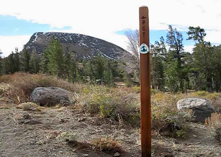
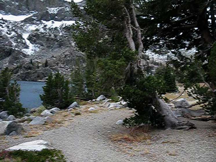
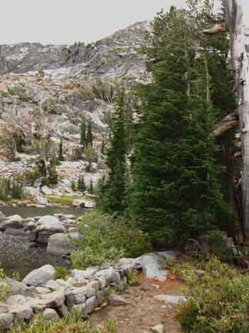
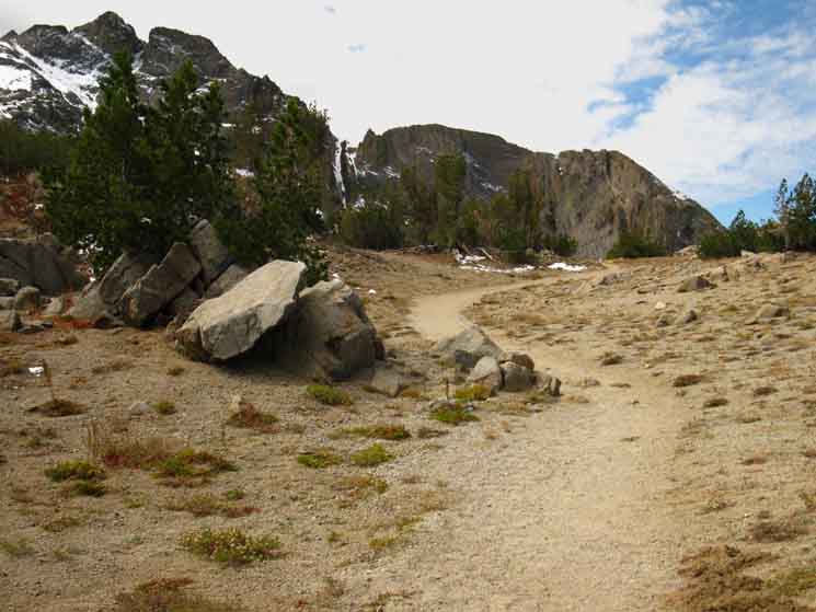
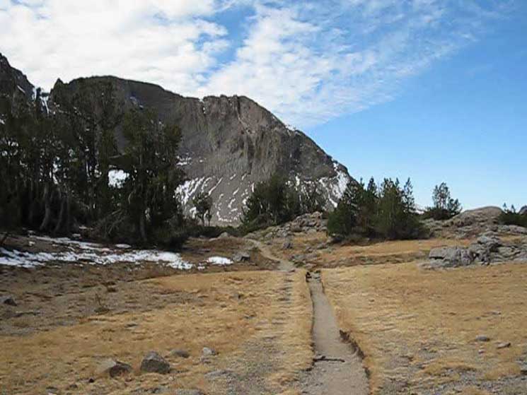
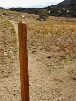
Winnemucca Lake trail junction
below
Elephant Back
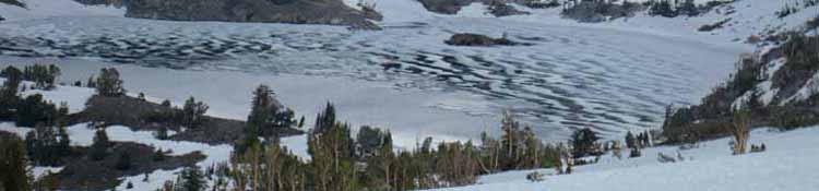
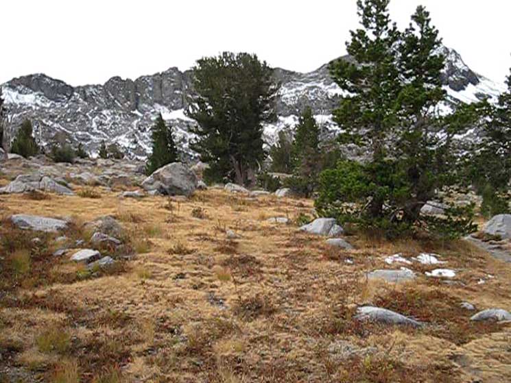
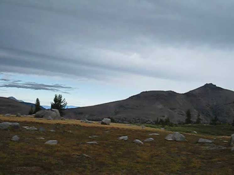
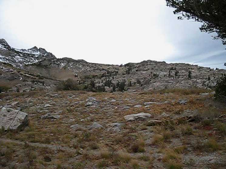
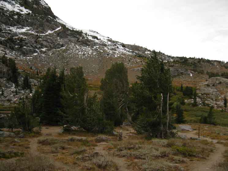
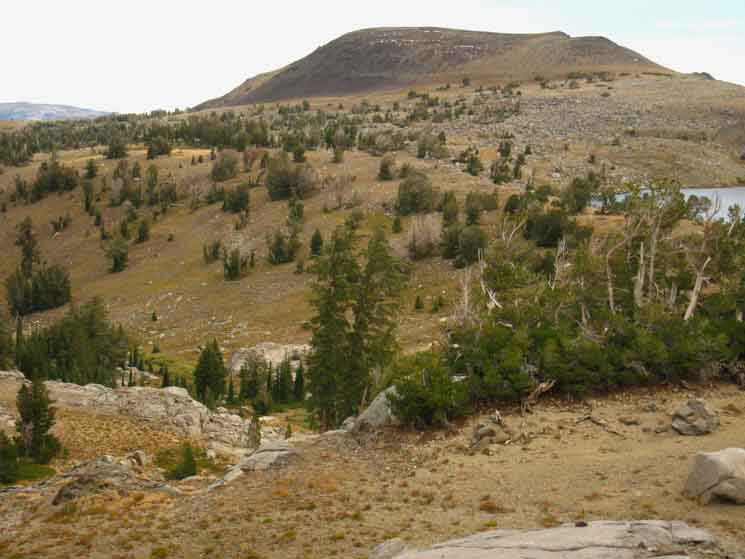
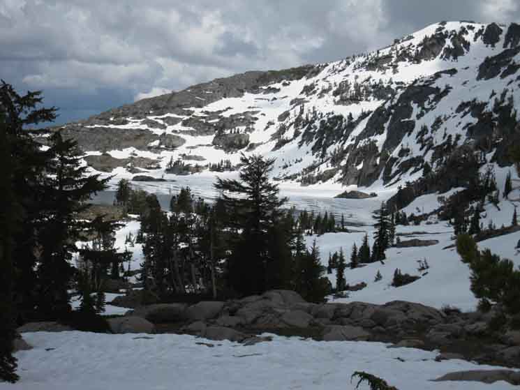
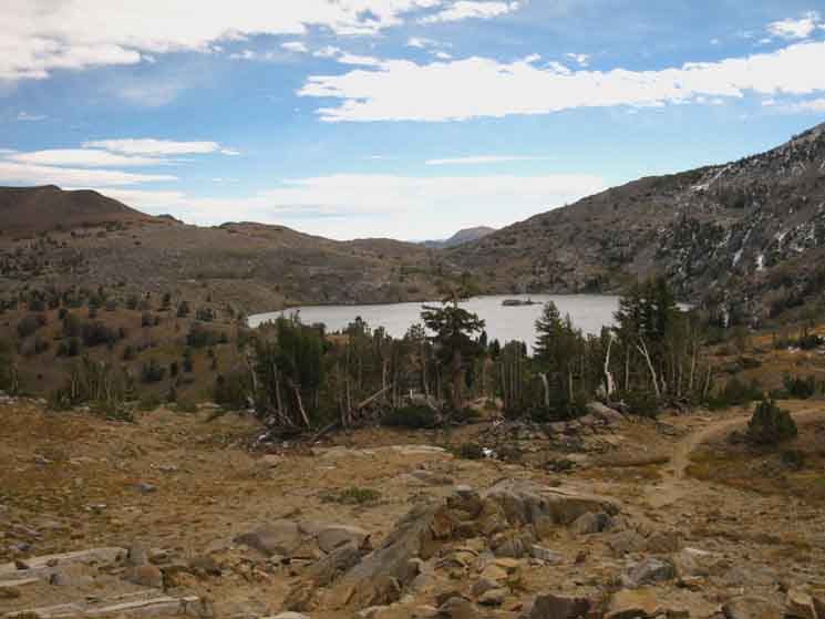
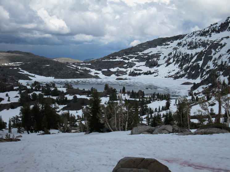
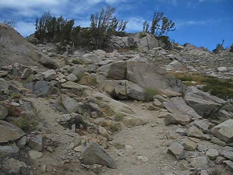
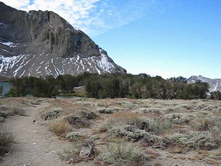
Turning South on the upcoming Winnemucca Lake Junction we will traverse along the base of the Northern flank of Elephant Back, pictured below, from Right to Left. Winnemucca Lake sits beyond the Southwest flank of Elephant Back, the Right side in the image below. |
||
 |
||
Golden colors of Fall on September 9, 2009. We will get bits of shade, but we'd have to stop to enjoy them. Miles& Trail Guide Pages
Carson Pass Region Winnemucca Lake Trail Junction |
 |
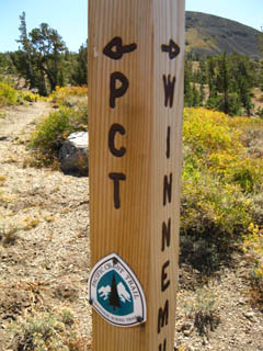
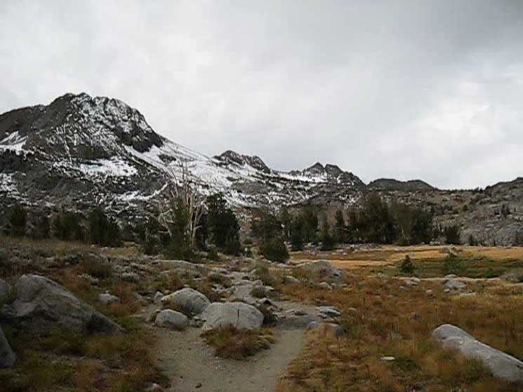
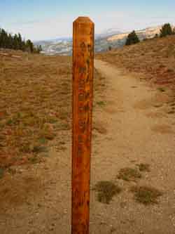
Post pointing the way for Southbound PCT hikers around the Northeast flank of Elephant Back. We can see our trail South towards Winnemucca Lake on the lower Right corner of the image. |
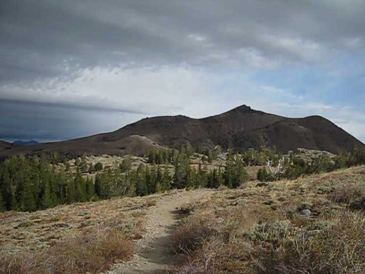
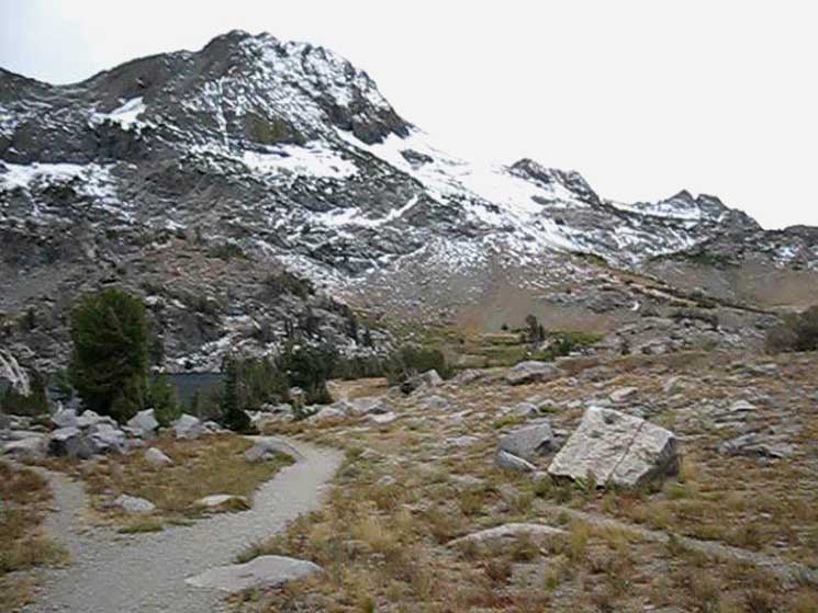
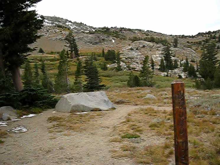
The Eastern Southbound backpackers on the Tahoe to Yosemite Trail had a choice between three different routes up to Round Top Lake passing South out of the Tahoe Basin through the Carson Gap. Now we have one. We've passed by the two trails breaking off the PCT leading South to Woods Lake, around which two of our potential routes up to Round Top Lake pass, being the Central footbridge and the Western Lost Cabin Mine routes. Those two trails broke off from the main PCT-TYT route just a tiny bit South of the Carson Gap. We've left those Western and Central route options behind.
The page below covers the trail and terrain turning South through the Winnemucca Lake trail junction off the PCT to Round Top Lake via Winnemucca Lake. This is our Easternmost and the Southbound Backpacker's last chance to cross over onto the Southbound Tahoe to Yosemite Trail. 1.26 miles South from this Winnemucca Lake trail junction we will find our next trail junction when we arrive at the West shore of Winnemucca Lake. The next and last stage of our hike up to Round Top Lake is the .88 of a mile West length of trail from Winnemucca Lake up the mountain flank to Round Top Lake. This last bit puts the total distance from Carson Gap to Round Top Lake at 4.57 miles, and also measures the distance the trail guide page below covers. Climbing West up to Round Top Lake from Winnemucca Lake we find the Western route, the Lost Cabin Mine trail route, coming South up to the Round Top Lake trail junction via its route climbing around and above the West shore of Woods Lake. That about covers the three routes up to Round Top Lake from the Carson Gap. Our present course on the Eastern route up to Round Top Lake via Carson Pass by Winnemucca Lake has swung us on a big circle route from the Carson Gap East to Carson Pass before we turn West for the final bit of hiking up to Round Top Lake. The Western and Central routes each take a much more direct route. The Carson Pass Region hiking map and the Carson Gap to Lake Alpine Miles and Elevations pages below lay out the various routes and the mileages of these three routes up to Round Top Lake from the Carson Gap, while the miles page measuring the distance between Carson Pass and Ebbetts Pass along the PCT lays out the miles to the Winnemucca Lake trail junction along its way South down to Ebbetts Pass.
Carson Pass to Ebbetts Pass Miles of the Three Routes Miles measured from our Carson Gap exit point out of the Lake Tahoe Basin The total distance of the Eastern Route from Carson Gap to Round Top Lake via Carson Pass and Winnemucca Lake is 4.57 miles, while the Center Route up from the footbridge is 3.90 miles. The total distance of the Western Route from Carson Gap to Round Top Lake via the Lost Cabin Trail is 3.40 miles. At the Round Top Lake trail junction all our possible routes up to there merge into a single Tahoe to Yosemite Trail route South down past Fourth of July Lake and into Summit City Canyon. In Summit City Canyon we begin the 9.52 mile unmaintained section of the Tahoe to Yosemite Trail down to Camp Irene.
|
| Video Three Ways to Round Top Lake from the Carson Gap |
Three ways from Carson Gap to Round Top Lake. Duration: 13:27 In the video above we hike the PCT route from the Carson Gap through Carson Pass. Turning Right, to the Southwest on the Tahoe to Yosemite Trail route at the Winnemucca Lake trail junction opens up views across the Carson Pass Management Area revealing the terrain our two other potential routes between Carson Gap and Round Top Lake cross. When we arrive at Winnemucca Lake we pass the trail junction where the "middle" route, the trail coming up from Woods Lake arrives at Winnemucca Lake. Arriving at Round Top Lake we take note of the third route up to Round Top Lake, the Lost Cabin Mine trail coming up from the campground near Woods Lake. This is the most Western of the three routes. This video covers the Eastern route from Carson Gap to Round Top Lake through Carson Pass and Winnemucca Lake. This is the most lengthy route between these two points. The Woods Lake trail guide page covers the other two routes, of which the Lost Cabin Mine Trail is the most direct and steepest route, while the "middle" route over the footbridge near Woods Lake up to Winnemucca Lake splits the difference in difficulty and distance between the "Eastern" and "Western" routes. Our next move is from Round Top Lake to Fourth of July Lake on our way down to enter the unmaintained section of Tahoe to Yosemite Trail along Summit City Creek. |
| INDEX On this page |
|||||||||||||||||
|
Winnemucca Lake
Two Routes South to Winnemucca Lake
Snow Route up to
Soft and Hard Frozen
Top of the Climb to
Flat section to Round Top Lake
|
Carson Pass Weather Information
All Weather |
||||||||||||||||
| > Forum < | |||||||||||||||||
All backpackers can post text comments about the following segment of trail through the comments links on all the trail guide pages. Registered Members can post up stand alone post about the trail with text, images, maps and videos in the Trails Forum that supplements this section of the Trail Guide. Check out All the Tahoe to Whitney .org |
|||||||||||||||||
South to Winnemucca Lake
 |
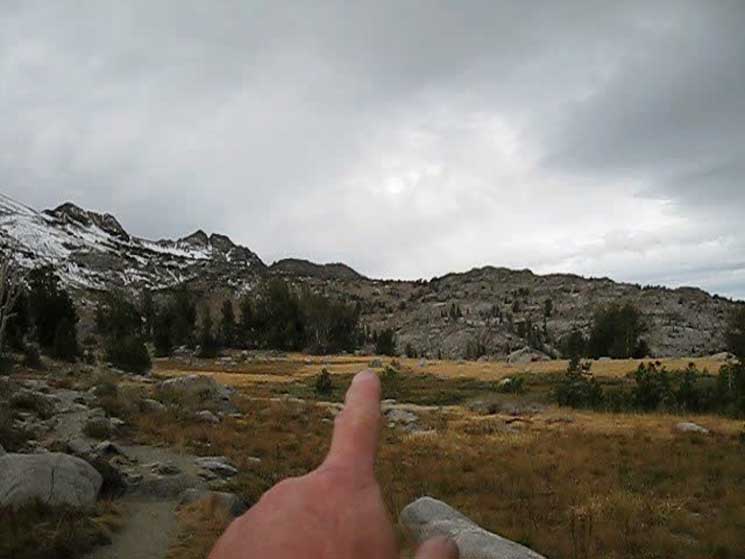
I'm pointing towards the location of Winnemucca Lake below Round Top from PCT junction. |
View North
Jacks and Dicks Peaks framed in the Carson Gap
 |
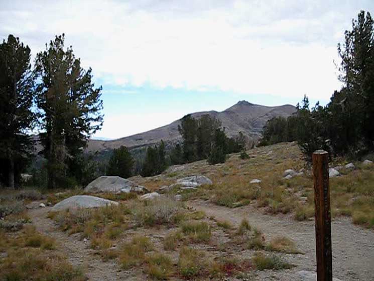
Lining up two distant gaps. I'm pointing through our Carson Gap exit from the Tahoe Basin at Dicks Pass far to the North. I'm convinced we're looking at 17.39 miles to the Northwest at the point along our Southbound Tahoe to Yosemite Trail route where we crossed between Jacks and Dicks Peaks through Dicks Pass while hiking South across the Center of Desolation Wilderness. |
The Carson Gap
 |
Looking through the Carson Gap and Jack and Dicks Peaks under a sweet crow of clouds far to our North in the Tahoe Basin. |
Carson Gap and Red Lake Peak
 |
Red Lake Peak rises to the North of Carson Pass, above the East side of our exit from the Tahoe Basin through the Carson Gap. |
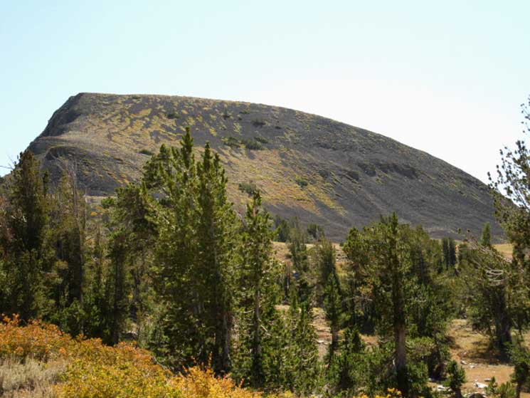
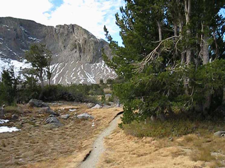
Elephant Back
 |
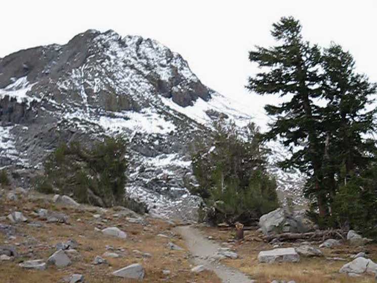
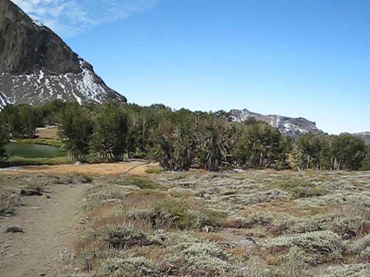
Looking back at Elephant Back to the Northeast while hiking South past its Western Flank. This view gives us a good ground-level perspective of the trail's route between its PCT junction and the West shore of Winnemucca Lake. |
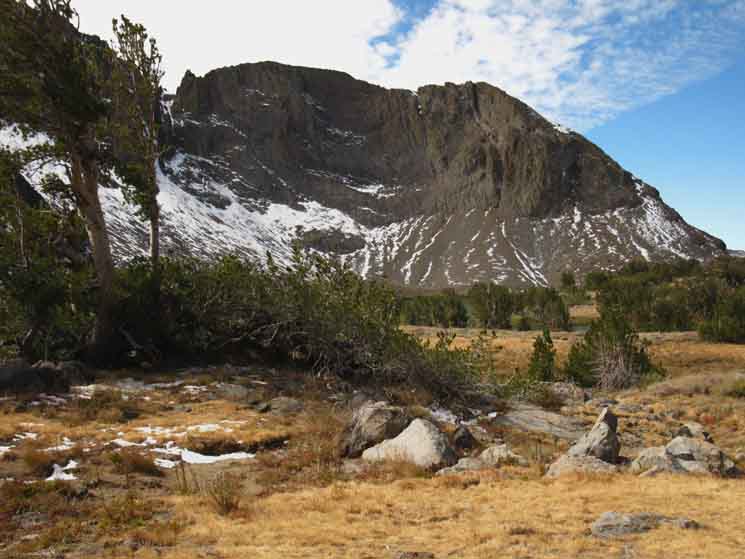
South Down the Trail to Winnemucca Lake
 |
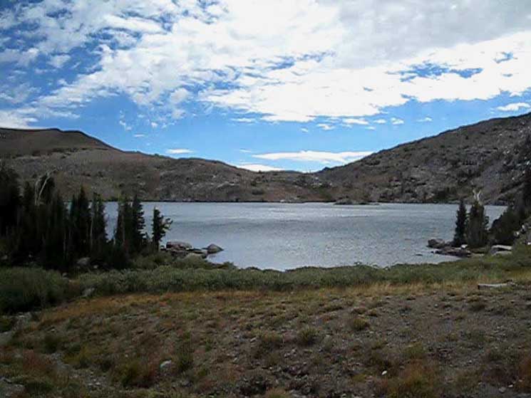
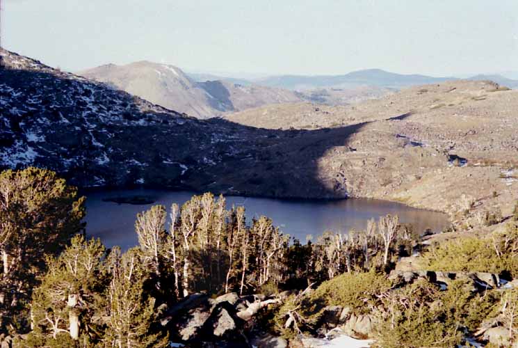
Round Top and its Eastern Ridge beyond, wrapping around the South shore of Winnemucca Lake. The face of the ridge running East from Round Top above Winnemucca Lake is majestic, a fine piece of rock. The Round Top Massif is striking. |
Beautiful Fall Colors
 |
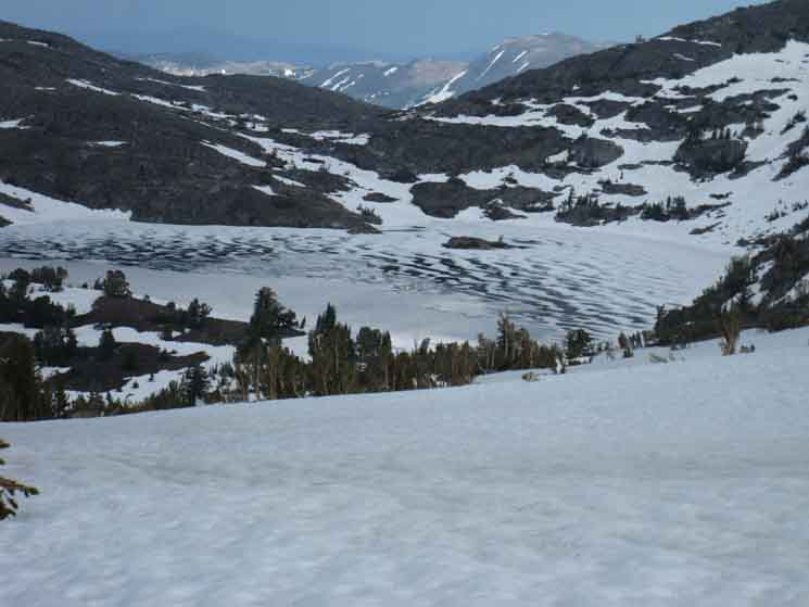
Winnemucca Lake is behind the descending ride our trail is paralleling down to its North and West shores. |
Round Top and The Sisters
to our
Southwest
 |
Terrain the trail from Winnemucca Lake follows West up to Round Top Lake. Note the golden-brown barren patch rising beyond the stand of whitebark pines in the terrain directly below the Westernmost Sister, the one with the split crest. Golden-brown colors are growing through the Fall day on September 23rd, 2013, when I last backpacked through, on my way to inspect the conditions along the unmaintained route of the Tahoe to Yosemite Trail through Summit City Canyon to Lake Alpine. |
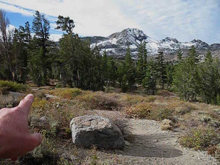
Pointing Out our Trail Location
up to
Round Top Lake
 |
Pointing out the route to Round Top Lake from Winnemucca Lake. To the Right of my finger the terrain rises into a lip bounding the flat flank I am pointing at where the trail up from Winnemucca Lake to Round Top Lake passes. The trail up from Winnemucca Lake crossed the barren patch before reaching the position I am pointing at. |
To the West Shore
of
Winnemucca Lake
 |
Trail gaps trees turning towards Winnemucca Lake. Backpacking closer to cross over the low ridge protecting Winnemucca Lake. |
View North
 |
View North hiking South to Winnemucca Lake from Carson Pass. Carson Gap and Red Lake Peak Behind us as we hike South on the Tahoe to Yosemite Trail towards Winnemucca Lake, we see to the North the route our trail followed out of the Lake Tahoe Basin through the Carson Gap, laying below the West flank of Red Lake peak in this new day's dark morning light, on a mildly stormy late Fall backpacking trip. |
Winnemucca Lake
Campsite Two
 |
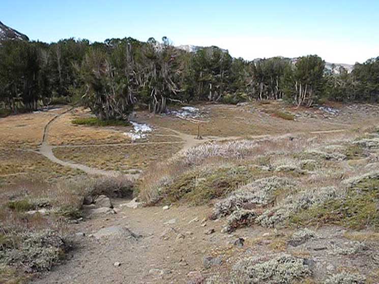
Trail Post designating campsite two branches off to the Southeast towards Winnemucca Lake. This is site two of three at Winnemucca Lake. There are six sites at Round Top Lake. The Carson Pass Management Area is a small, beautiful place. Thus the designated campsites, a la the heavily used area in Yosemite. This heavy use is a great reason to try to time our transit across the CPMA with weekdays. The Carson Pass Management Area is a Fee Area for everything. Day use, day hikers, and local backpackers all pay the price. Us long distance backpackers crossing the Carson Pass Management Area on the PCT and TYT are good to go if we named a location in the CPMA on our permit. |
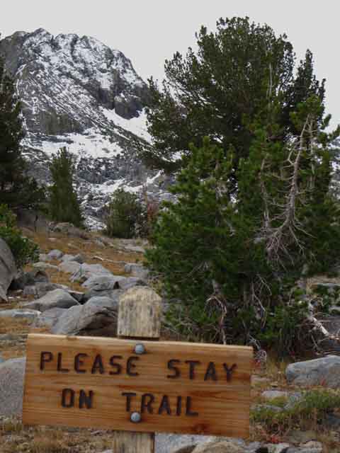
Stay on the Trail
 |
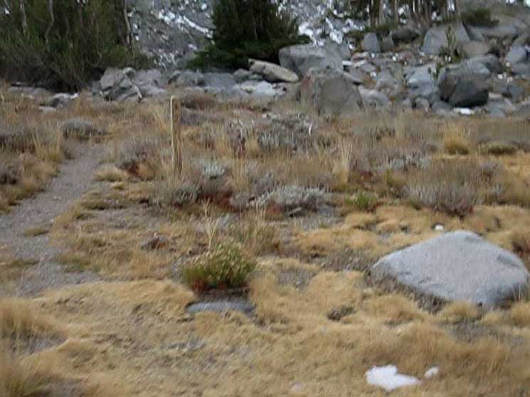
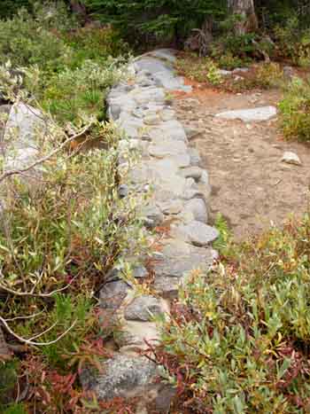
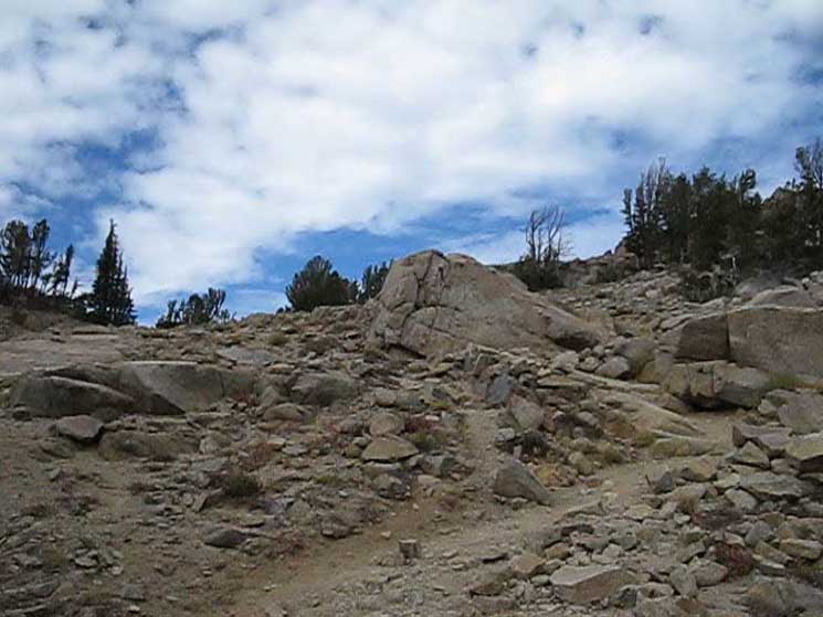
Unlike many sandy areas where multiple trails are formed as hikers attempt to stay on firm ground, the ground here is hard, meaning there is no real reason to hike out of the established trailbed. |
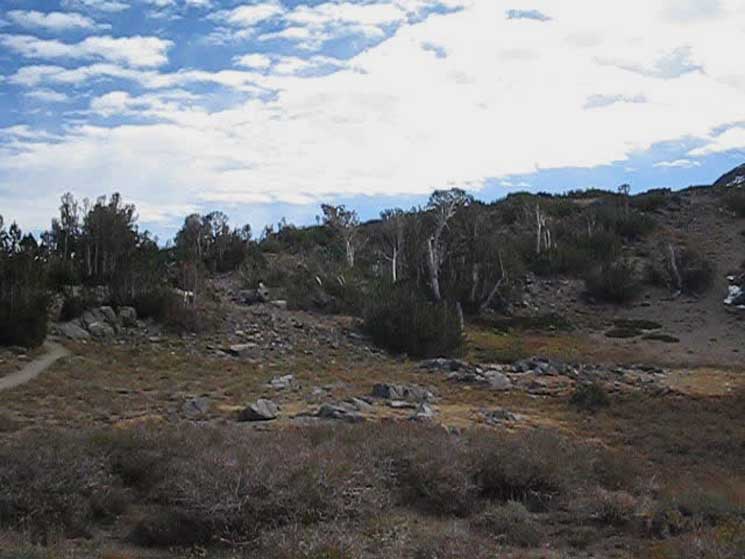
Whitebarks along the West Shore
of
Winnemucca Lake
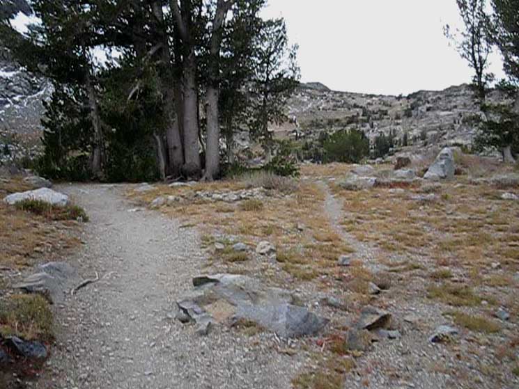 |
Ahead a useless parallel trail branches to our right around a stand of Whitebark Pines. To the Right to the stand of Whitebarks we can see the flank we've got to climb to get up to Round Top Lake. |
Route Up to Round Top Lake
 |
Our view West, looking at the terrain we are going to cross during our upcoming hike from Winnemucca Lake to Round Top Lake. On the far distant Right side of the image we can see a low rising mound of granite that begins descending on its furthest Right. That flank descends Northward to wrap around the South shore of Woods Lake. We can see the top of that mound of granite as the high point on the Right side of the ridge. The Left side of the ridge is back-dropped by The Sisters and her red-headed stepchild. Round Top is out of the frame to the Left of the Sisters. The ridgeline running down from Left to Right descends from Round Top. Our trail passes through the point in that ridgeline to the Left of the high point on the low granite mound on the furthers Right side of the ridgeline. Our trail crosses the point in that ridgeline where its descent from Left to Right off Round Top climb to the top of the low rise on the Right side of the image. Also notice that there's a valley between our position approaching the West shore of Winnemucca Lake and the climb up to Round Top Lake. The trail up from the footbridge over Woods Creek comes up that valley to intersect with our trail at the trail junction on the West shore of Winnemucca Lake. |
Winnemucca Lake
Round Top and The Sisters
 |
West end of Winnemucca Lake under Round Top as trail nears Winnemucca Lake. We're hiking down to the West shore of Winnemucca Lake, where its trail junction lay. Reintegration of the useless parallel trail on Right, trail to campsite on Left. |
Campsite 3
As our trail South approaches Winnemucca Lake we encounter the second trail branching off to the lake to the third of three campsites here. I can't explain why we hit campsite two before three, but we do. |
||||
 |
 |
|||
I did not find campsite one, but I am always passing by Winnemucca Lake on the way to more distant points, if not just up to Round Top Lake. I always assumed that campsite one was down by the trail junction and check dam, but I could be wrong. I recollect only one time camping here, and that was during a Winter trip in the late '90s that was not working out as expected. I've never intentionally set Winnemucca Lake as the destination of a backpacking trip. But, I do understand why they only have three campsites here: It's way too close to a busy trailhead in a busy Management Area. So, the CPMA has used camping restrictions to flip Winnemucca Lake from an over-used easy one-night "getaway" spot for locals into a quiet camping area. Restricting camp sites was the only way this transition was going to happen. I'm not sure when assigned-restricted camping began in the CPMA. I think is was the early 2000s. It was something like 2002 that I was camped at Round Top Lake, and another backpacker asked me what I was doing. I didn't understand the question. Camping, obviously. Then the other backpacker told me I was camping illegally, and that the CPMA had established regular campsites. Well, I always camp "rough," in that I don't make a fire or fire ring, and never make furniture. I use established campsites when available, but I don't establish campsites. Since that time backpacking through the Carson Pass Management Area on long-distance trips has been a bit more complex, but is not a problem with a bit of forethought. |
||||
Northwest Shore
of
Winnemucca Lake
 |
| The remainder of our hike to the trail junction is along the shore of Winnemucca Lake. |
Winnemucca Lake
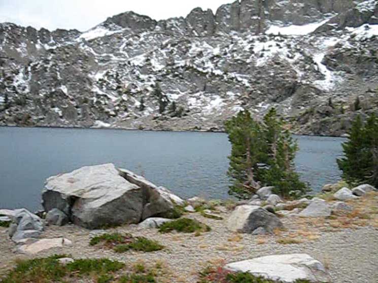 |
Winnemucca Lake. Looking across Winnemucca Lake from its Northwest shoreline. |
Stormy September Morning
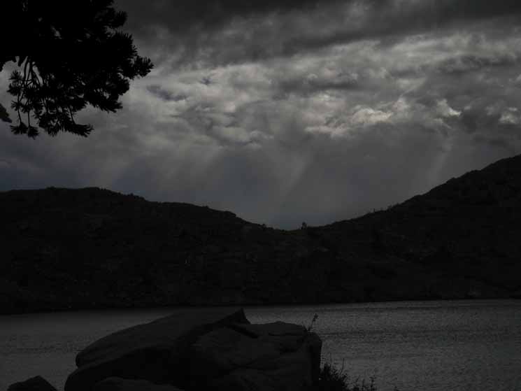 |
| Early morning light works its way through the tail end activities of a late Fall Storm, 2012. |
Northwest Shore
of
Winnemucca Lake
 |
Looking down the Northwest shore of Winnemucca at where the trail junction lays with Round Top towering above West end of Winnemucca Lake. |
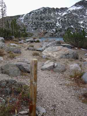
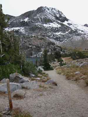
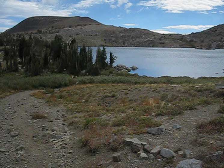
Approaching Winnemucca Lake Trail Junction
 |
Approaching the Winnemucca Lake trail junction. |
TRAIL JUNCTION
We encounter a trail junction at the West shore of Winnemucca Lake.
West: Southbound on the Tahoe to Yosemite Trail to Round Top Lake.
North: To Footbridge on Woods Creek below Woods Lake.
Northeast: Back the way we came from Carson Pass.
| PCT North & South Carson Pass to Forestdale Divide |
TYT North Footbridge Route to Winnemucca Lake |
TYT South Round Top Lake |
 |
Trail junction at West end of Winnemucca Lake with terrain West up to Round Top Lake in the background. Notice that we can still see the low point in the ridgeline off of Round Top where the terrain ascends on the far Right side of the image. |
| PCT North & South Carson Pass to Forestdale Divide |
TYT North Footbridge Route to Winnemucca Lake |
TYT South Round Top Lake |
We notice the trail North down the Valley past the East Shore of Woods Lake
 |
The trail North down to the Footbridge over Woods Creek Below Woods Lake View North down the trail to the footbridge over Woods Creek just North of Woods Lake. Red Lake Peak and the Carson Gap giving us some background context on our routes across the terrain. The Eastern Route to Round Top Lake crosses over to the Right side of the image above after passing through the Carson Gap, to bend a wide arc across the terrain to get to our position here at Winnemucca Lake. The central route proceeds a bit to the Left of the center of the Carson Gap on its way to split into two routes up to Round Top Lake. The central route crosses a footbridge a short distance North down Woods Creek from Woods Lake to climb up the valley pictured below to our position at Winnemucca Lake. The other route is the Western route, which climbs a ridge West of Woods Lake to take the most direct and steepest route up to the trail junction at Round Top Lake, where these three divergent routes converge. Woods Lake is located below us and the the Left, the West, while Carson Pass is located in the distant Right of the image, at the head of the forest running up the mountain from Left to Right that we can see below the Carson Gap. |
| PCT North & South Carson Pass to Forestdale Divide |
TYT North Footbridge Route to Winnemucca Lake |
TYT South Round Top Lake |
West Shore of Winnemucca Lake
The Check Dam
| Winnemucca Lake Check Dam | ||||
 |
 |
|||
Winnemucca Lake is another High Sierra Lake created by a historic check dam. It appears the check dam has over time been significantly backfilled. |
||||
Woods Creek
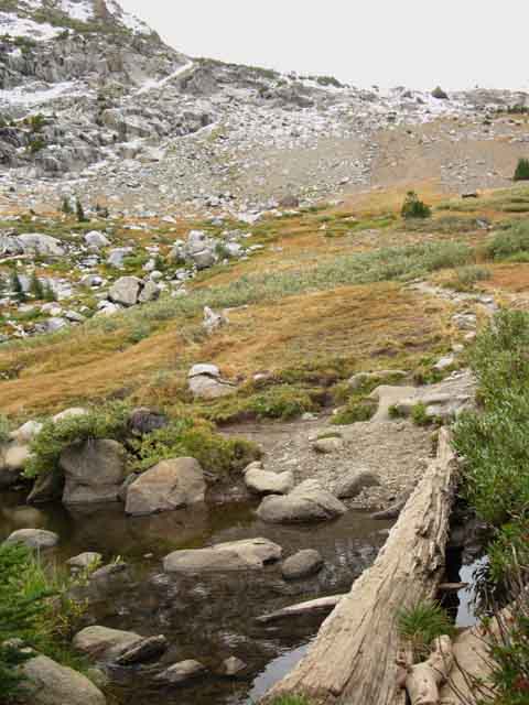 |
Log across Woods Creek at Winnemucca Lake. |
Woods Creek from Winnemucca Lake
 |
Woods Creek begins its flow. |
Let's hike a bit West of Winnemucca Lake's trail junction, a bit up in elevation towards Round Top Lake, to get longer and unimpeded views of the terrain around Winnemucca Lake
 |
Trail towards Round Top Lake from Winnemucca Lake. |
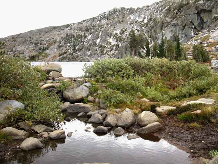
Winnemucca Lake
 |
Looking East-Southeast across Winnemucca from just a bit above its West shore. |
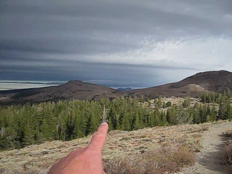
Pointing to Carson Pass
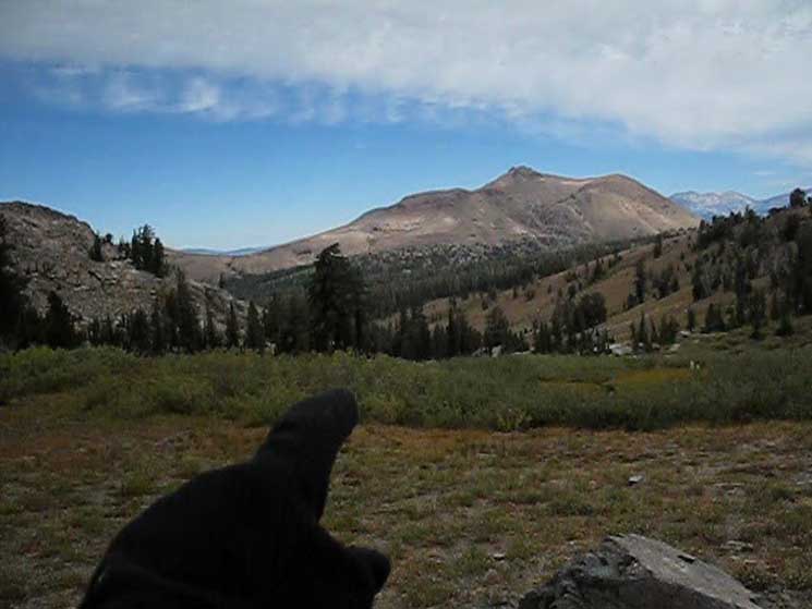 |
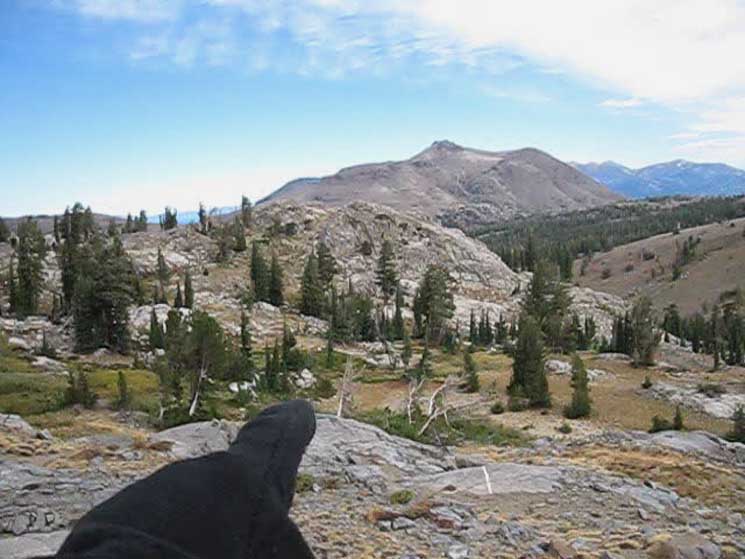
Looking North across the valley the trail up from Woods Lake follows up to Winnemucca Lake while pointing to the location of Carson Pass. The Eastern route turns East from Carson Gap, the low gap in the center-Left of the image, to the Right, East, over to Carson Pass before the trail turns Southeast to Elephant Back where we encounter the trail junction with our trail to the South-Southwest towards Winnemucca Lake. From Winnemucca Lake we turn almost directly West for the hike up to Round Top Lake. Note the route two TYT routes breaking off from the PCT at Carson Gap proceed almost straight South down from the Carson Gap. These Western and Central routes line up almost directly with the valley in front of us. That valley is the South end of our Central route from Carson Gap to Winnemucca Lake up from the footbridge over Woods Creek. The image above shows why the central route is much more direct and fails to bring us up unnecessary climbs, as does the Eastern route. These miles are not unnecessary if we started our trip out of the Carson Pass Trailhead, though they are unnecessary, if we've exited the Tahoe Basin along the TYT route. Well, no miles are unnecessary if they are miles on the trail we want to hike. I had hiked through here for years along the long trails North and South down the TYT on the Western and Central routes before I swung around through Carson Pass and Winnemucca Lake along the Eastern route. |
View East-Northeast
 |
View across Northwest shore of Winnemucca Lake at Elephant Back. We're taking a look back at the lake before we begin the short climb up to Round Top Lake. |
View North
 |
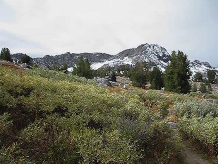
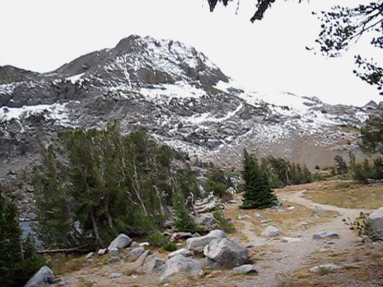
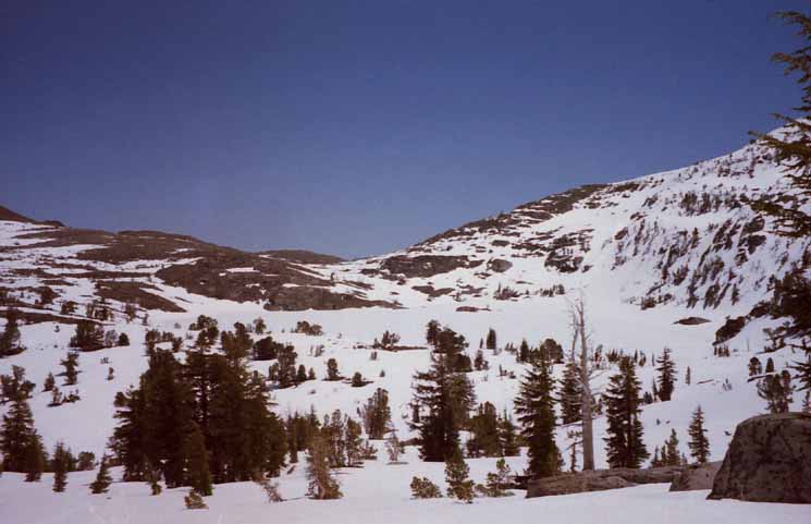
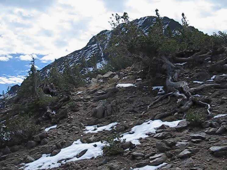
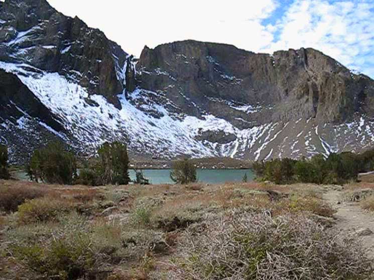
The Winter Route from the End of the Valley to Round Top Lake Looking North at the "lip" of granite rising on the North side of the flat up to Round Top Lake. Climbing the trail up the flank of the mountain towards Round Top Lake we can see a brush covered gully-like section to our North, over our Right shoulder. That brush-filled depression is the Winter route up to Round Top Lake. On the other side of the brush is a low rounded rise of granite before the granite terrain drops down to backdrop the South shore of Woods Lake, and wrap like rocky arms around its Eastern and Western shores. Note that the low gap in the far-distant Right is the Carson Gap. |
Two Routes to Winnemucca Lake
 |
Looking down and Northeast at two routes up to Winnemucca Lake. The first route is the one we've hiked to Winnemucca Lake on this page, the Eastern route. This Eastern route hikes through Carson Pass South to the Northwest corner of Elephant Back, then bends Southwest following along the Northwestern base of Elephant Back to the Northwest shore of Winnemucca Lake. We can see almost the entirety of its route from Elephant Back to Winnemucca Lake above. The second route is the Central route up to Winnemucca Lake from the footbridge over Woods Creek below Woods Lake. This trail comes up the canyon at our feet, up to the trail junction on the West shore of Winnemucca Lake. The Winter variant of this route up to Round Top Lake can cut up the channel at our feet. Behind us is the last bit of the trail West climbing up to Round Top Lake. This would be a third route to Winnemucca Lake, via Round Top Lake by the Lost Cabin Mine trail up from Woods Lake. |
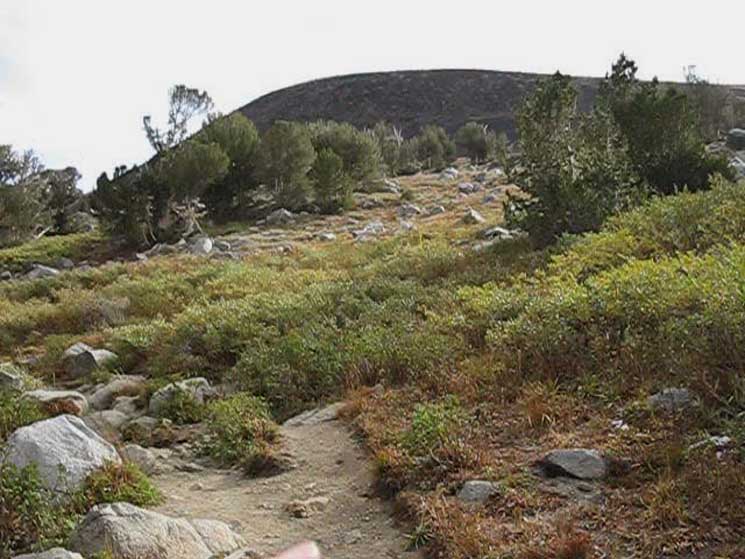
Across the Barren Patch
 |
Barren patch between Winnemucca Lake and Round Top Lake. We saw this barren patch on the ridgeline above and West of Winnemucca Lake when we were approaching Winnemucca Lake after turning off the PCT through the Winnemucca Lake trail junction. |
June 7 2010
 |
Winnemucca Lake in June slushy conditions. |
Early Season
hiking
Tahoe to Yosemite Trail Section
to
Lake Alpine
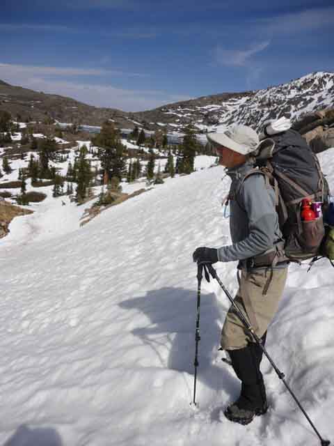 |
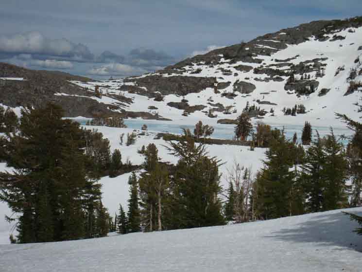
Scott overlooking Winnemucca Lake on a pause while climbing to Round Top Lake. Spring Backpacking All TYT Trail Reports and Forum Basic Where the snow line is, and how much sits above it determines a lot about the nature of our trip. The temps are important too. I say "typically" because over the past 40 years we have very clearly seen a gradual change in the characters of the seasons, their durations, and the timing of their transitions. The directions the winds blow from each season has slowly changed, and is today different from the Fall, Winter, and Spring Winds of yesteryear. Timing Spring Out During early Spring we will be on snow from end to end. Potential Late Spring Threats Potential Solutions 2> Ah, the snow lip below the top of Mount Reba. Not big enough to require crampons, but a real obstacle when in full length and glory. Man, you just gotta take your time and carefully kick good steps into it. High Sierra Trail Dogs |
Winnemucca Lake
Soft Frozen
during
JUNE 2009
 |
View of Winnemucca Lake from the trail to the West of Winnemucca Lake on our way up to Round Top Lake. |
The Winter Route
up to
Round Top Lake
 |
Pointing at Carson Pass. In the foreground is the Winter route up to Round Top Lake from Woods Lake via the valley below that's visible on the Right (East) edge of the image above, or skiing up from Carson Pass. I'm pointing towards Carson Pass in the distance, which is the low point in the Sierra Crestline under the South flank of Red Lake Peak and to the North of the terrain rising towards Elephant Back. |
Down to the Valley to Woods Lake
|
Snow route up from the valley via the Woods Creek Footbridge Route up to Round Top Lake. There's no need to swing by Winnemucca Lake when the best route swings West up the mountain towards Round Top Lake. |
Summer Trail Crosses Winter Route
 |
View East as we climb West and up higher towards Round Top Lake. We're where our trail route West and the Winter route's more direct line up the mountain hook up. Below the edge of the slope we can see the little valley turning North (Left) and down towards Woods Lake. In the distance across that valley we can see the Northwest flank of Elephant Back. In the middle-elevation far-Right of the image we can see Winnemucca Lake. |
Climbing West above Winnemucca Lake
 |
Valley, Winnemucca Lake, and South end of Elephant Back. |
View West up to the Top of the Ridge
 |
Looking West, up at the top of the ridge we are climbing towards Round Top lake. Climbing West to the top of the ridge between Winnemucca Lake and Round Top Lake. |
Elephant Back
 |
We can see how high up we are relative to the trail to Winnemucca Lake from the Northwest corner of Elephant Back. Northeast view of Elephant Back across the top of the valley down to Woods Creek footbridge. |
Soft Frozen East Shore
of
Winnemucca Lake
|
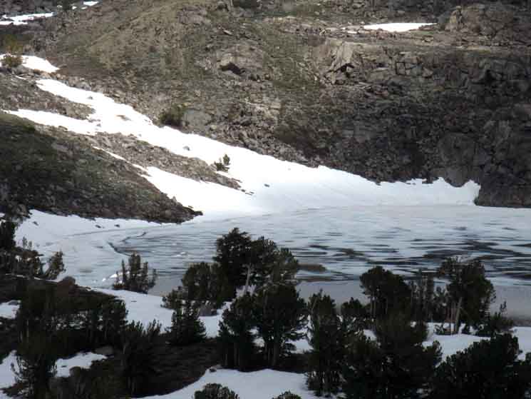
Soft Frozen Winnemucca Lake
 |
June 8, 2009. |
Hard Frozen
Winnemucca Lake
 |
May 2002. |
Late Fall
 |
November 9 2001. Cold and Clear on the way to Lake Alpine from Lake Tahoe for a late Fall backpacking trip. |
Soft Frozen
Winnemucca Lake
 |
The backlighting shows us the Forestdale Canyon through the low-V in the terrain to the East beyond Winnemucca Lake. June 8, 2009. |
Hiking West approaching the Top of the Ridge
between
Winnemucca Lake and Round Top Lake
 |
Hiking West approaching top of climb from Winnemucca Lake to Round Top Lake. Rocky terrain and islands of Whitebark Pines on our way up to Round Top Lake from Winnemucca Lake. |
A Relaxing Peace
of
Mental Terrain
 |
We're looking over to our North at the granite lip rising up out of the Spring snow on the North side of the flank we're climbing up to Round Top Lake. I pointed out this granite rise, or lip bounding the North end of the flank up to Round Top Lake when we were hiking South under the shadow of Elephant Back. |
A Relaxing Piece
of
Flat Terrain
 |
Small flat between Winnemucca and Round Top Lakes. Winnemucca Lake to East, Round Top Lake to the West. We're looking East at the top of Elephant Back to the Left of the image, and the low V-gap on the Right is the gap behind the East shore of Winnemucca Lake. Our View East is from a nice little flat above the climb West from Winnemucca Lake, and just a bit East of Round Top Lake. We'll have a short walk over a couple of gentle rises and flats to Round Top Lake and the Round Top Lake trail junction. |
Long View North
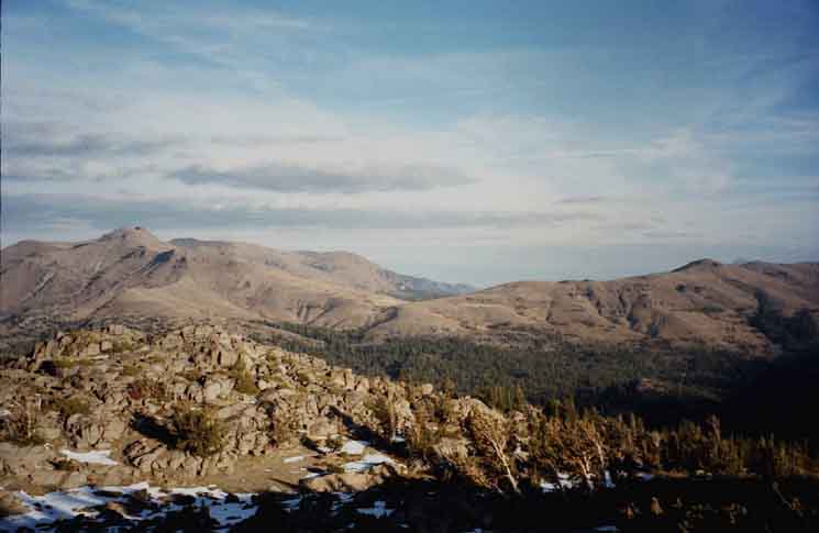 |
Little Round Top capping the Tahoe Rim Crestline to the North, Red Lake Peak on the South of the low point of the Carson Gap between them marking the Southern extent of the Tahoe Basin. |
West to Round Top Lake
 |
Gentle climb to next low rise Westward to Round Top Lake. |
Round Top Rises to Our Southeast
 |
Location of Round Top Peak to the East of Round Top Lake. |
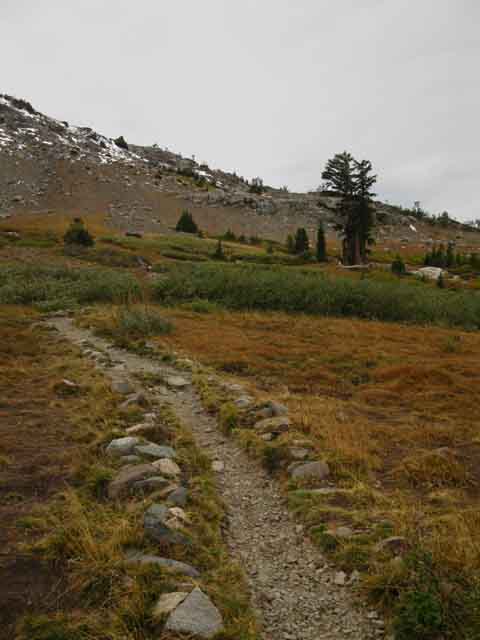
Low Rise Westward
to
Round Top Lake
 |
Low rise. |
Flat/Downward
to
Round Top Lake
 |
Short flat/downhill to next gap in terrain, this one above and East of Round Top Lake. Down to the final gap overlooking Round Top Lake. |
Last Gap in Terrain
West to
Round Top Lake
 |
West, down to Round Top Lake. Our Southbound Tahoe to Yosemite Trail passes around the base of the descending mountain flank after passing West by the compass through the upcoming Round Top Lake trail junction. |
| PCT North & South Carson Pass to Forestdale Divide |
TYT North Footbridge Route to Winnemucca Lake |
TYT South Round Top Lake |
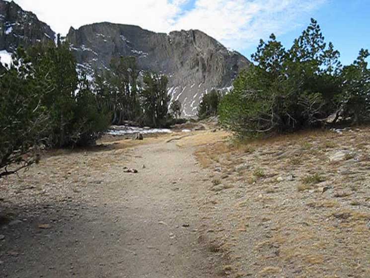
First View
of
Round Top Lake
 |
Our first glimpse of Round Top Lake. |
Round Top Lake
 |
It's down there behind the trees. We can just see a blue sliver of the lake through a break in the trees around it. I say "down there" because Round Top Lake sits in a depression ringed by the Sisters, and their Westernmost half-sister, which is the Western shoulder of the Westernmost Sister. |
 |
Round Top Lake lays nestled in under The Sisters. |
Campsites
 |
Beyond the West shore of Round Top Lake our Southbound Tahoe to Yosemite Trail bends around the base of the lowest and Northwestern end of the Round Top-Sisters Crestline. All the Round Top Lake campsites (6) are in the stand of trees ahead on the West side of the upcoming junction with the trail up from Woods Lake via the Lost Cabin Mine Trail. |
Last Glimpse
of our trail
East to Winnemucca Lake
 |
| A look to the East at the trail coming up from Winnemucca Lake. |
Tahoe to Yosemite Trail
 |
We can see the Southbound Tahoe to Yosemite Trail rising from the gully where the trail South up from Woods Lake via the Lost Cabin Mine Trail meets with our route West up from Winnemucca Lake meet at the Round Top Lake trail junction. |
Round Top Lake
Trail Junction
| PCT North & South Carson Pass to Forestdale Divide |
TYT North Footbridge Route to Winnemucca Lake |
TYT South Round Top Lake |
 |
Hiking West to the Round Top Lake trail junction. |
Trail Junction
| PCT North & South Carson Pass to Forestdale Divide |
TYT North Lost Cabin Mine Trail to Woods Lake |
TYT South Round Top Lake |
| Back the Way we Came Winnemucca Lake to Carson Pass. |
TYT North Woods Lake to Carson Gap. |
TYT South Summit City Creek to Lake Alpine |
 |
 |
 |
| Trail East to Winnemucca Lake. Trail North to Woods Lake. | TYT North. | TYT South. |
Carson Pass |
Carson Pass Management Area Backpacking Besides laying out the Eastern route from Carson Gap to Round Top Lake for hikers following the Tahoe to Yosemite Trail South across the Western Mokelumne Wilderness, this route also tracks across the South ends of the other two routes up to Round Top Lake, tying together the main trail routes across this tiny "special zone" of the Carson Pass Management Area. 7.5 Map 30 min Map South |
| PCT North & South Carson Pass to Forestdale Divide |
TYT North Footbridge Route to Winnemucca Lake |
TYT South Round Top Lake |
Backpacker ForumsHave a great Sierra Nevada route or trip through here to relate?Post it on
|
Trailhead
Contact
Alex Wierbinski

Backpacking Lake Tahoe to Mount Whitney
Your guide to the High Sierra Crest, including the Tahoe to Yosemite, Pacific Crest, and John Muir Trails
