The Trails
Guide
Maps
Miles/Ele
Permits
Resupply
Forum
Current Weather Conditions
Weather Notes
Northern High Sierras
Central High Sierras
Southern High Sierras
Gear
Gear List
Gettin Started
Layering
Discussion
Testing yourself and your gear
Gear Reviews
Backpacking
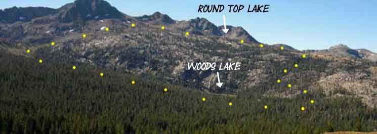
Woods Lake to Round Top Lake
via
Winnemucca Lake
Hiking the
Tahoe to Yosemite Trail route from Carson Gap to Round Top Lake via Footbridge Route
Languages
Languages
Trail Arts
The art of walking
Physical Preperation
Trail Skills
The trail
Off the trail
Scrambling
Maps
Navigation
Camp skills
Food
Resupply
Food
Other
Photo Catagories
Trail Stories
Trail Culture
News and Science
Links
Groups
Books
Terms and Conditions of Use
| Trail Guide This Section INDEX |
NORTH Carson Gap to Woods Lake |
SOUTH Winnemucca Lake to Round Top Lake |
SOUTH |
This 7.5 min Map Carson Pass Region |
This 30 min Map Mokelumne Wilderness |
MILES AND ELEVATIONS |
ALL GUIDE PAGES |
ALL SECTION MAPS |
Permits | all maps index |
The
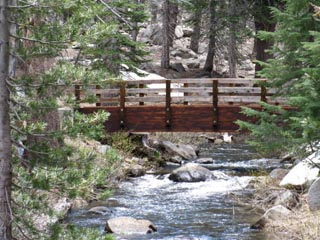
Footbridge Route
 |
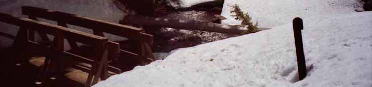
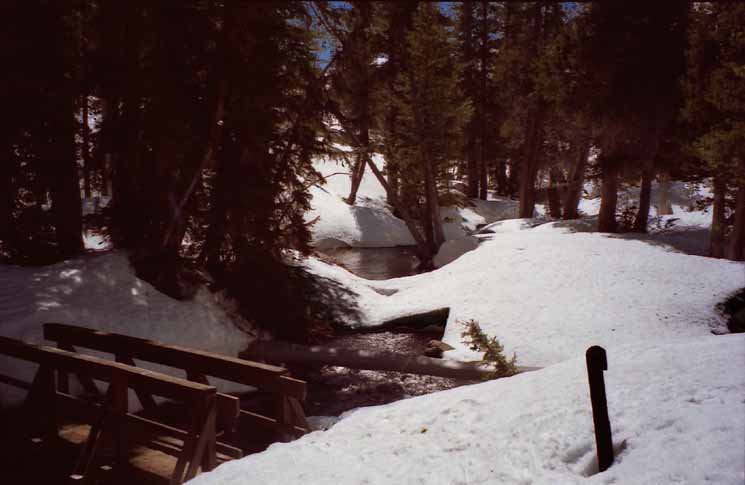
June snow does not block the bridge, but it makes getting onto it difficult. |
The
|
| Carson Pass Region Map CPMA 15 min Backpacking Map |
TYT Carson Gap to Lake Alpine Miles and Elevations |
| Mokelumne Wilderness Map 30 minute Backpacking Map |
TYT Echo Summit to Lake Alpine Map 30 minute Backpacking Map |
| El Dorado National Forest | Mokelumne Wilderness | Carson Pass Management Area |
The comments section is a good place to share tips and information about this segment of our route. The Forum and Comments allow the guide to grow with your updates.
The Sky
HIGH SIERRA BACKPACKER
|
||||||||||||||||||
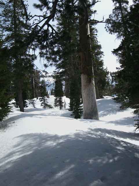
The Footbridge over Woods Creek
|
Footbridge over Woods Creek with remnants of Spring Snow, June. Less snow is more work! The best Winter conditions are when everything is covered with cold, hard snow. June 6 2010. |
Video
Woods Lake
to
Round Top Lake through Spring Snow
|
I often take the route from Woods Lake past Winnemucca Lake to Round Top Lake in the Winter and Spring. This video shows this route during Spring snow conditions. Video Playlist |
More Snow
 |
||
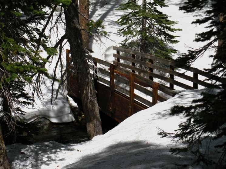
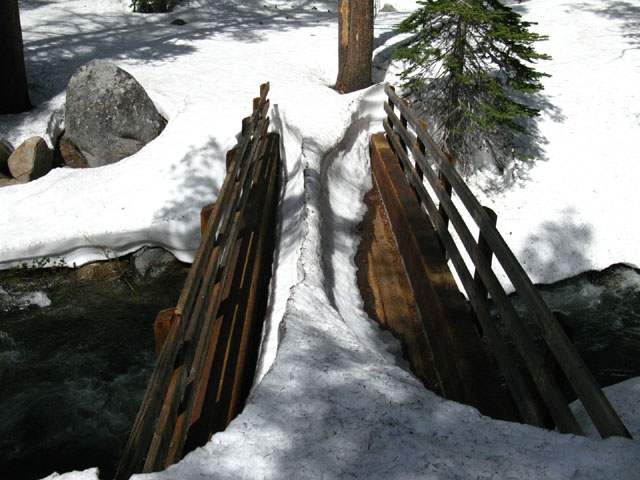
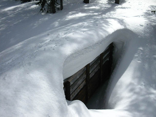
The Woods Creek Footbridge in March, 2010. More snow, and colder snow, the less work.
Above, the collected heat of the bridge has cleared it of snow long before the surrounding terrain, May 2002. Once the snow heats up and starts melting we sink deeper into it, making for much harder travel. Once the snow really starts melting it's warmth brings conditions to the edge of wet.
|
Past the Foodbridge over Woods Creek up to Round Top Lake via Winnemucca Lake
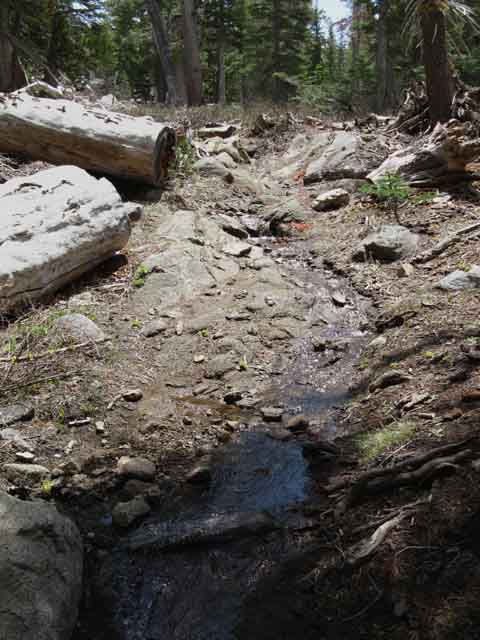 |
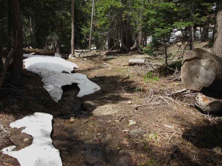
Trail flowing like creek below snowline. Runoff from the Spring Thaw flows down the already exposed trails. |
 |
||
The trail past the footbridge heading up to Winnemucca Lake is flowing as a little creek in early June. Note the shaded areas of the trail that are still decorated with snow tunnels protecting the little creeklet flowing down the trail. We can see the edge of the snow line ahead.
|
Into the Snow
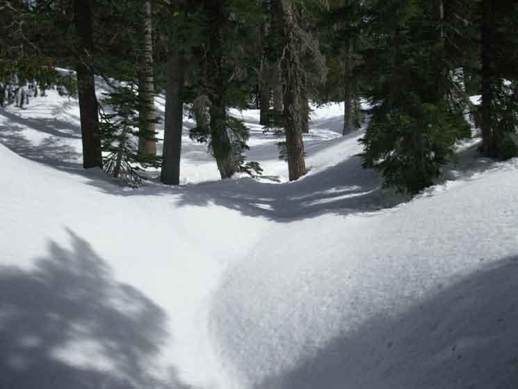 |
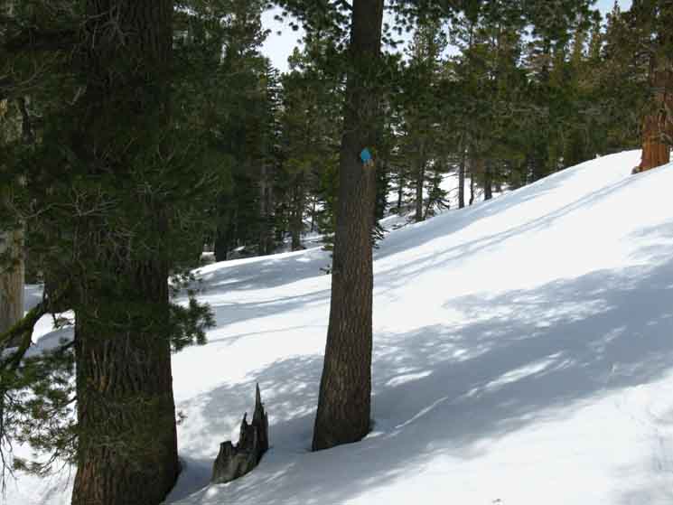
Sweet, beautiful snow. Route above footbridge crossing forest bending Southeast. It's not a problem following the blue diamond route towards Winnemucca Lake. The blue diamonds guide our route from where we cross Highway 88 at the shed, down to the paved road to Woods Lake and over the footbridge. The blue diamonds end at the edge of the forest below Winnemucca Lake. It's a straight shot to Winnemucca Lake from the edge of the forest. |
The Edge of the Forest Looking South
 |
||
Approaching the end of forest above Woods Lake. We can see Round Top-Sisters ridgeline in the distant.
|
 |
Into the valley North of Winnemucca Lake. |
Blue Diamond Winter Route Besides being a well maintained and heavily used Summer Trail, this trail also sports blue diamond snow markers from the footbridge to the end of the treeline just North of Winnemucca Lake. The end of the treeline marks the end of the blue diamond marked trail route up to Round Top Lake. But us Winter Travelers need not worry too much. It is very easy to figure out our way up to Round Top Lake from the end of the Blue Diamonds in Winter or Summer. Especially if we have the proper maps, have properly studied them, and pay attention. It's pretty obvious. And, I'd never do a Winter trip in an area I had not familiarized myself with during Summer... During Summertime we follow a heavily used trail from the footbridge to Winnemucca Lake trail junction, where we turn West for Round Top Lake. From the position pictured above, Winnemucca Lake is less than a mile further West up the mountain, and Round Top Lake .88 of a mile beyond. |
Looking North and South
from just above the
Treeline past the Footbridge
Round Top
 |
||
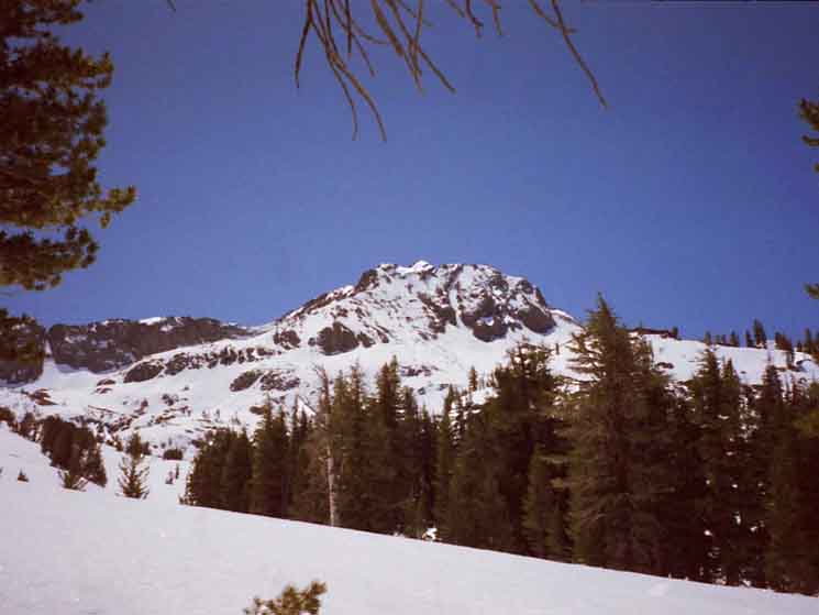
Looking South while hiking South out of the trees on the footbridge route. Directly ahead we see the sheer face of the hard rock ridge behind Winnemucca Lake. This ridge links up with Round Top, which is the mountain ascending to the center of the image.
|
South towards Round Top
South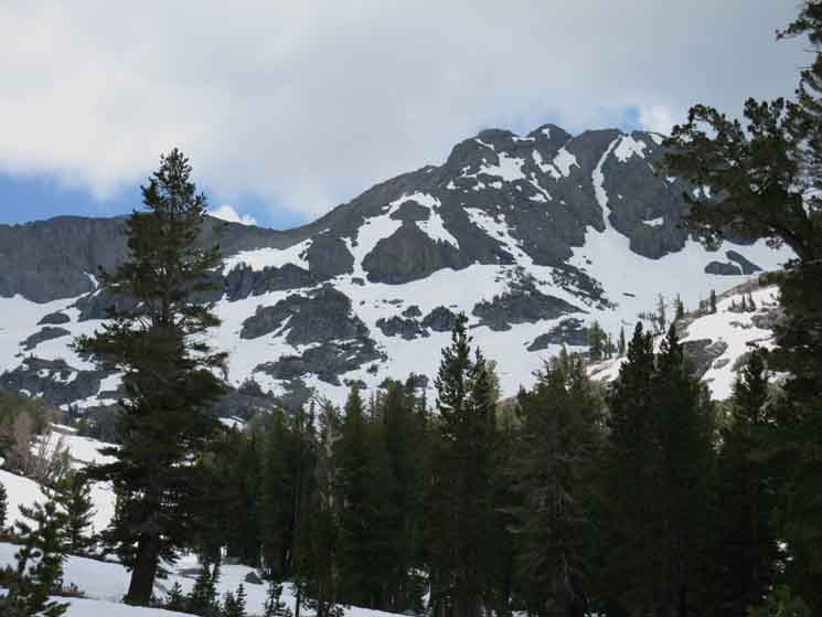 |
We can see a fairly flat climb across the open section of the valley up to Winnemucca Lake. |
Views
North and South
from the edge of the Forest
South
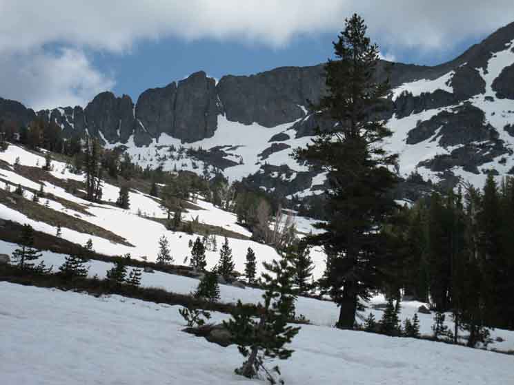 |
South towards Round Top Looking South while hiking South out of the trees on the footbridge route to Winnemucca Lake. Directly ahead we see the sheer face of the hard rock ridge wrapping around the South shore of Winnemucca Lake, its far shore. This ridge links up with Round Top, which is the mountain ascending to the right. Winnemucca Lake is sitting behind the ridge arm we can see descending from the Left down to the Right in the foreground. To get to Round Top Lake we continue through the treeless area directly ahead to the low point on the descending ridge in the foreground, then cut to the right, to the West, under the North side of Round Top for the hike up to Round Top Lake. |
North
Red Lake Peak
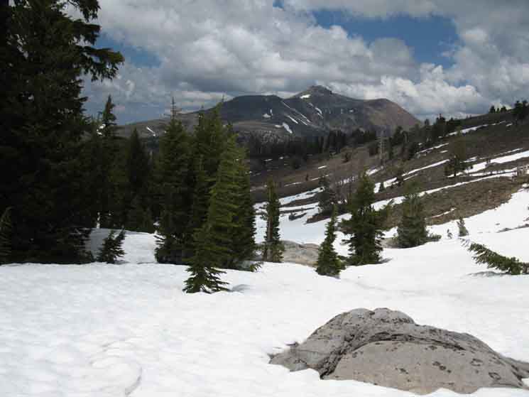 |
North towards Carson Pass Looking North towards Carson Pass from the same position as the picture above, while heading Southbound up to Round Top Lake via Winnemucca Lake. Red Lake Peak dominates the background. Ridge line extending leftward (West) off of the near side of Red Lake Peak leads West down to the Carson Gap. The Carson Pass is directly North of, and below the subordinate peak to the Left, the West of Red Lake Peak. Carson Pass is maybe just a bit less than two miles NE along our line of sight from this position. |
Winnemucca Lake Junction
to
Woods Creek Footbridge
Carson Gap and Red Lake Peak
 |
||
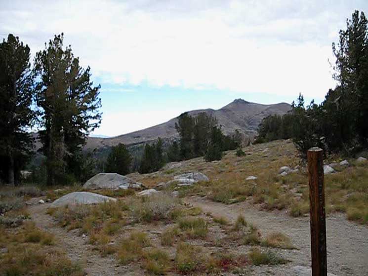
The Winnemucca Lake trail junction. We're looking at the trail North down to the Footbridge over Woods Creek near Woods Lake. That's the route we hiked up to here from Woods Lake. In the distance we see Red Lake Peak rising on the East side of the image and the low point of the Carson Gap to its West, its Left, which give us some context on our position in the terrain. We can see how the Central and Eastern routes differ across the terrain between the Carson Gap and Winnemucca Lake. The trail to Woods Lake drops almost directly down, while the Eastern trail climbs towards Elephant Back before dropping down to Carson Pass. The Eastern Route South to our position from the Carson Gap crosses over to the Right side of the image as it bends a wide arc across the terrain on its way to our position here at Winnemucca Lake. The central route proceeds a bit to the Left of the center of the Carson Gap on its way to split into two routes up to Round Top Lake. The central route the footbridge over Woods Creek a short distance North of Woods Lake. From there our trail climbed up the valley pictured above to this Winnemucca Lake trail junction. The third route is the Western route, which climbs atop a ridge West of Woods Lake to take the most direct and steepest of the three routes up to the trail junction at Round Top Lake, where all three of these divergent routes converge. Woods Lake is located below us and bit to the Left, the West, while Carson Pass is located in the distant Right of the image, at the head of the forest running up the mountain from Left to Right that we can see below the Carson Gap.
|
Backpacking Trail Guide TYT |
 |
Backpacking Trail Guide TYT |
North: Carson Gap to Woods Lake South TYT: Winnemucca Lake to Round Top Lake
| Woods Creek Footbridge to Winnemucca Lake |
Local or Long Distance Backpackers Both are doing fine at Winnemucca Lake. Hopefully local backpackers are on some type of loop route around the Round Top Massif, such as loops beginning and ending at Woods Lake or Carson Pass. Long distance backpackers on the Tahoe to Yosemite Trail are going to turn Right, and hike West from Winnemucca Lake up to Round Top Lake. Pacific Crest Trail hikers skirt the Eastern edge of the Carson Pass Management Area, rarely concerning themselves with exploring this local focus point of beauty. 7.5 Map 30 min Map Next page South |
Backpacker ForumsHave a great Sierra Nevada route or trip to relate?Post it on
|
Trailhead
Contact
Alex Wierbinski

Backpacking Lake Tahoe to Mount Whitney
Your guide to the High Sierra Crest, including the Tahoe to Yosemite, Pacific Crest, and John Muir Trails
