


Backpacker's
All Sky Constellation Star Chart
Star Chart
for
Study and Planning
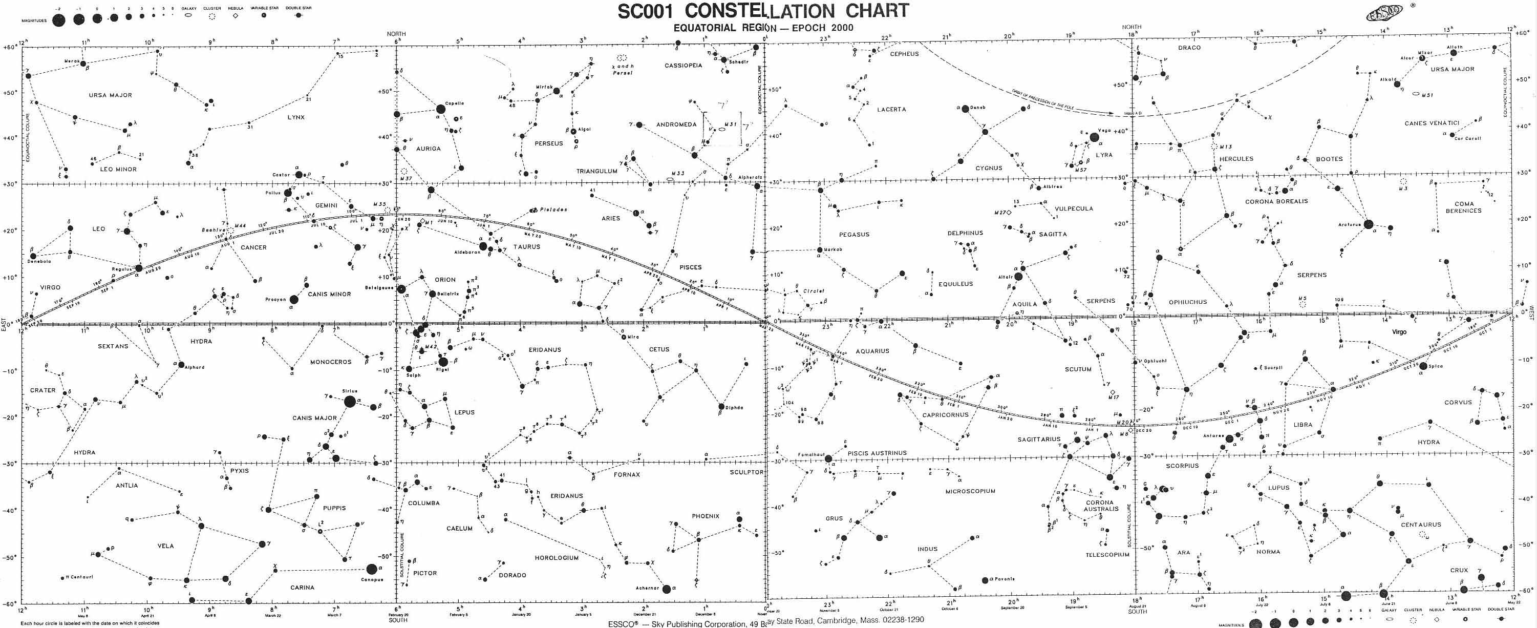
Test Constellation Chart - Equatorial Region
MAP CREDIT

Resources
| Astronomical Resources |
Astronomical Links |
Navigation Discussion |
Field Use Star Wheel/Chart |
Digital Star Wheel/chart |
Backpacking Astronomy
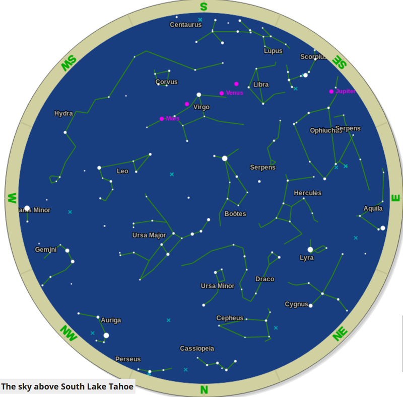
This This chart also tells us what's above every position on our planet every day of the year. This The Clock The Hands & Dial of Our Universal Clock Slices of the Biggest Pie So Close, Yet So Far The Invisible World These questions are practically and esthetically important. This page is hopeful it will answer those questions.
Our Favorite The That Classic star charts show us exactly what we cannot see in the sky during the day. That's why I've included the Digital Star Wheel below. It's adjustable to your current location, date, and time: This celestial information will be more important the further out into Nature that we hike, as the deepening darkness of wilderness opens up the depths of night skies to our experience. I want to know exactly what I am seeing, and why. See the More Information CGMD As I mentioned above, we can find exactly where we are pointed in the Universe THROUGH THE SUN at 12 Noon every Day on the Star Chart featured on this page below, and find the exact position our Earth is pointed at, in the Universe at Midnight, here on our Digital Star Wheel:
Personal Identify those positions on the whole year star chart below, and you will know what is passing overhead at Noon during the day, and be able to identify the seasonal constellations bracketing Midnight. Let's go to the next step, and figure out the main stars too. Big Context Yup, that's it, and all there is. Our whole Universe spins around us every day. Midnight and Noon define exactly what perspective we are going to have on the universe spinning around us every day and night of the year. Despite the fact that it takes a whole year's worth of nightly (and daily) observations to view the totallity of our surrounding universe (twice?), which, all together makes one (two?) full circle(s) around us each and every day. Factoid Center Point The Elipictic Can you see what I'm saying?
Our Favorite
Below Runs on FLASH |
Resources
Amazing REQUIRES FLASH
Representational, rather than Real:
|
History of Time with Standards & References Keeping Personal Time |
Time is 15 degrees is the width of every typical human hand!
A "hand" is not just an ancient Egyptian measure of horse heights (hands) , but a span of celestial Time, too.
These relationships between Time, Space, our physical position, and the width of our hand means that we can use the workings of Nature Itself as references in Time and Space along the length of our backpacking trip, making Nature itself our fundamental field clock and compass. We backpackers are the "crazy hands" on Nature's Clock, and the "spinning needle" in Nature's Compass. Using astronomical timings requires we look up and record some fundamental astronomical information to bring on our trip. |
Using the Sun and Stars as our Clock and Compass
Natural Timekeeping may sound complex now, but it quickly becomes "first Nature" with a little use and practice. It's the stupid watches and GPS that are unnatural. We were made to be Reflective of Reality. |
Backpacking Navigation Context and Goals
All Astro & Terrain Mapping Tools
Noon and Midnight |
Sidereal and Solar Time Simulator
OK
We will study the digital sky wheel linked to above. We will take note of, and become familiar with the key stars and constellations before we depart. We will print out a paper Sky Map for Field Use. We will note Sun rise, noon, and set times & bearings in our "Trail Journal & Land Alamanac" so that we can tell time and find directions using the fundamental workings of Nature. |
"Ground" Work
Our Science News Section |
Backpacker's
All Sky Constellation and Star Chart
 |
Location |
UP |
Sky Mapping |
|
Locate Various Features
Motion in the Sky Seasons of the Zodiac
|
Map Name Compass Offset
scale Contours
Backpacking permitting authority National Forest Wilderness Area Physical location |
Full Annular Eclipse
Banner Image
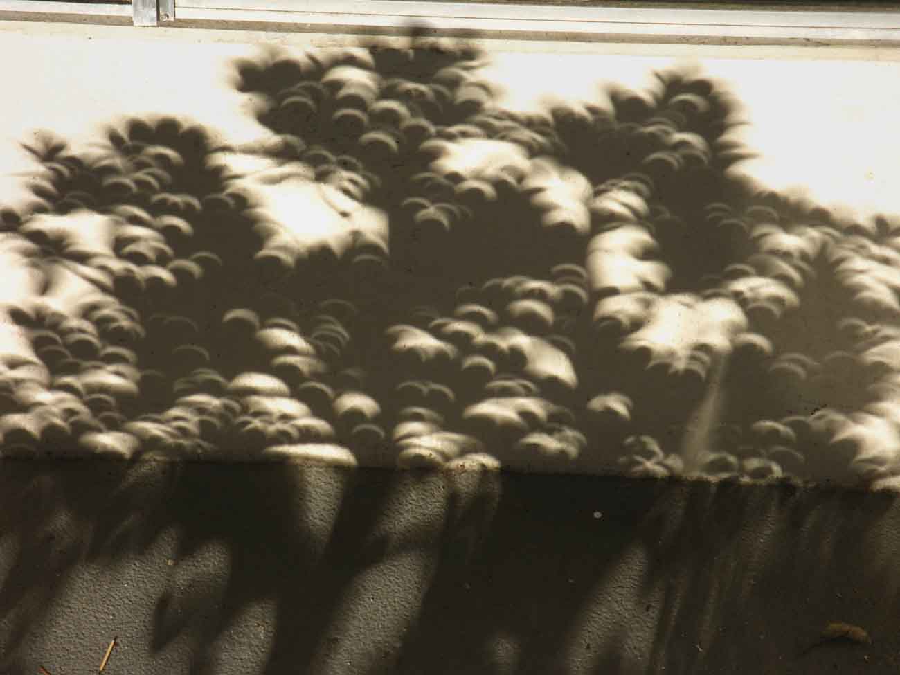 |
(Camera Reading)
Sun, 20 May 2012
06:47:57 PM
| Elevations | More Information | ||
Elevation? The current "Elevation," or "Size," of the Universe appears to be Aprox. 14 billion Light Years from "Top to Bottom" and "Edge to Edge:" Or, What I call, |
All
All
|
||
Map Credit |
|
Sky & Telescope Buy it Here Charts from the Classroom Resources of Earth & Sky This Constellation Chart is
|