
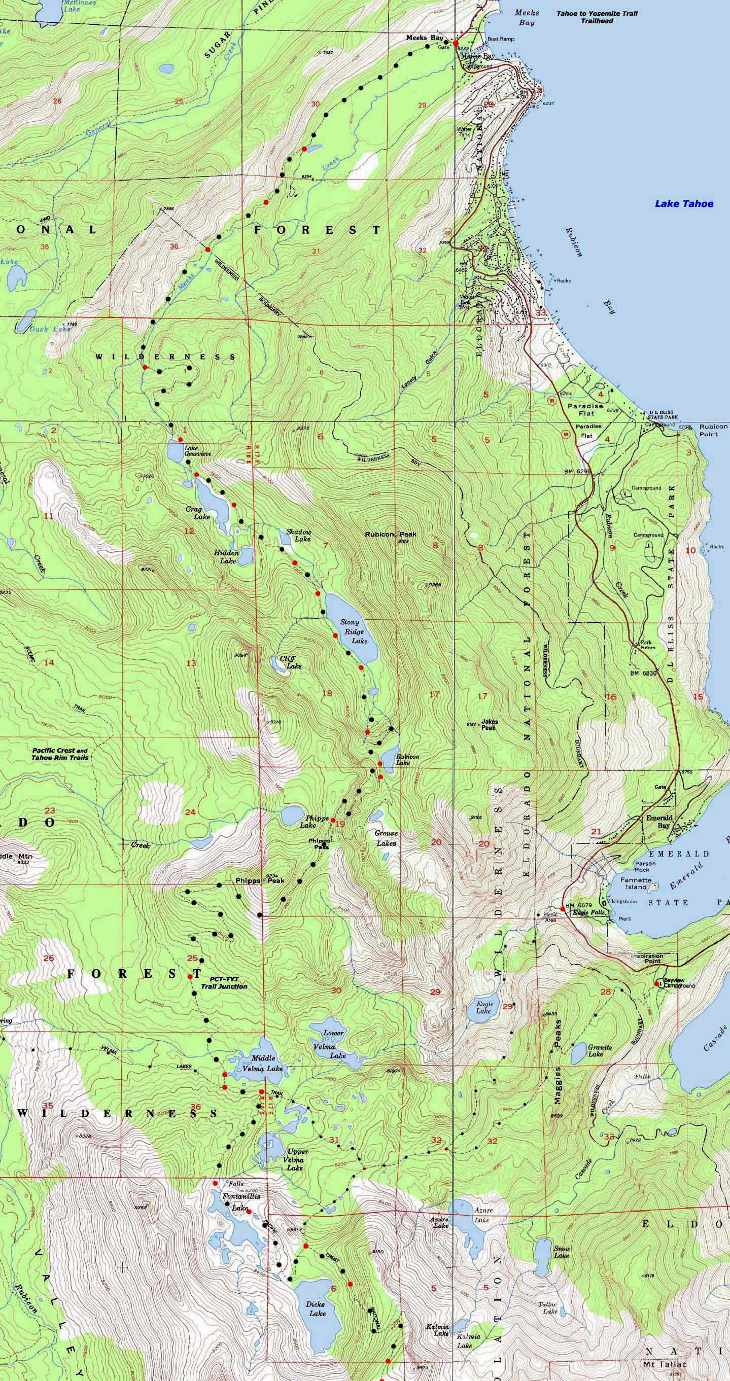
Backpacking Map
of
Meeks Bay Trail Head to Dicks Pass
Topo Hiking Map
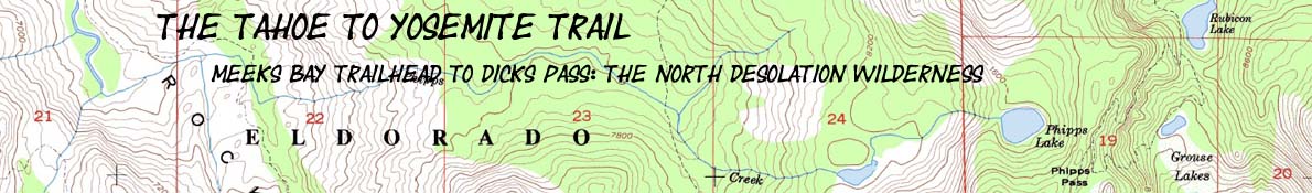
Starting The
Tahoe to Yosemite Trail
4 USGS 7.5 minute Topo Hiking Maps
The North Desolation Wilderness out of Meeks Bay
Maps |
7.5 min NONE Meeks |
7.5 min TYT-PCT |
Miles Meeks |
Miles |
Trail Guide |
30 minute |
Click |
WEATHER |
RESUPPLY |
PERMITS All |
|
North Desolation Wilderness Map
16.83 miles
Backpacking Map
of
Meeks Bay Trailhead to Dicks Pass along the Tahoe to Yosemite Trail
| North Desolation, Meeks Bay trail head and Sugar Pine State Park North Desolation and Sugar Pine |
7.5 Central Desolation Wilderness topo map Phipps Pass to Lake Aloha |
7.5 South Desolation Wilderness topo map South Desolation Wilderness to Echo Summit |
|
| The Northern Desolation Wilderness High Density 7.5 minute Topo Hiking Map: magnify for greater detail. |
| North Desolation, Meeks Bay trail head and Sugar Pine State Park North Desolation and Sugar Pine |
7.5 Central Desolation Wilderness topo map Phipps Pass to Lake Aloha |
7.5 South Desolation Wilderness topo map Dicks Pass to Echo Lake |
Meeks Bay trail head |
|||||
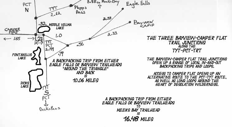
Main Features For trips shorter than hiking the whole TYT down to Yosemite we can backpack across the 28.71 mile length of the Desolation Wilderness itself down to the Southernmost Desolation Trailhead at Lower Echo Lake. This section can be part of our hike to a destination further South, a trip in itself, or an element in a nice 2 to 5 day backpacking loop around the Desolation Wilderness. What do you need? Desolation Wilderness has it, or can lead you there. Check out this whole Desolation Wilderness Map, and click the map, the trails, and the red dots for more map and guide information. In pursuit of trip flexibility this trail guide also measures the distances from access trails and trailheads to the main Pacific Crest and Tahoe to Yosemite Routes from Eagle Falls and Bayview Camp along the Western Shore of Lake Tahoe. Locate the red dot marking the junction on the topo map you are interested in, and click it to review the trail guide information for that location. Trailheads paralleling the Tahoe to Yosemite and Pacific Crest Trail routes all the way from Lake Tahoe to Mount Whitney allow us to craft nice trailhead-to-trailhead and loop trips along the High Sierra trails between Tahoe to Whitney. Using a section of the PCT-TYT-JMT to connect two trailheads or as part of a hiking loop is real rewarding, especially around the Northern Desolation Wilderness, which is crisscrossed by a web of trails. Meeks Bay is good for a lot more than just beginning your long trip down to Yosemite and on to the Whitney Portal. Backpacking Desolation Wilderness Desolation Wilderness is an excellent location to develop backpacking experience. It is nearby. It is beautiful. It has lots of people, which provides a feeling of security for many new backpackers. Though this guide describes the Pacific Crest and Tahoe to Yosemite Trail routes spanning Desolation Wilderness from Meeks Bay to the Whitney Portal, you can break off as big or little piece of trail as suits you. Trail Guide Pages Describing this Topo Map The topo map above depicts the
|
| Road and Trailhead access to West and South Shore Lake Tahoe Backpacking |
||||
| Three Excellent Representative Trailheads Highways 50 and 89 Meeks Bay, Echo Summit and South Upper Truckee Trailheads |
South Lake Tahoe Resources Highways 50 & 89 |
|||
More
|
||||
Desolation Wilderness |
|
Miles and Elevations Meeks Bay Trailhead to Phipps Pass 2561 feet, 8.88 miles Location Elevation Mileage Start: Meeks Bay 6239 0
Lake Genevieve 7400 4.39
Crag Lake 7440 4.77
Hidden Lake Jnct 7560 5.35
N. side, Stony Ridge Lake 7800 6.03
S. side, Stony Ridge Lake 7800 6.62
Rubicon Lake 8360 7.75
Grouse Lake Jnct 8400 7.89
Grouse Lake Jnct 2 8800 8.73
Phipps Pass 8800 8.88 All Miles/Elevations: Meeks Bay to Echo Summit
Backpacking Permitting Authority Lake Tahoe Basin Management Unit Lake Tahoe Basin Management Unit National Forest LTBMU Wilderness Area Desolation Wilderness Desolation Wilderness Physical Location Meeks Bay Trailhead and Highway 89 |
USGS Topo Map Information
Map Names NE: Meeks Bay (1992) NW: Homewood (1992) SW: Rockbound Valley (1992) SE: Emerald Bay (1992) Compass Offset
scale Contours
Tahoe to Alpine Trail Guide Index Meeks Bay trail head, Trail Guide
USGS MAP LOCATORDownload Free USGS Topo MapsINSTRUCTIONS 1>Locate the position you need a map for on the google map. 2>CLICK the MARK POINTS mode. 3>Select the size of MAP FOOTPRINTS you wish to see. 4>CLICK the Map Footprint you want to down load. This will leave a red marker on that map footprint. 5>CLICK the red marker, and the maps available for you to download will appear. 6>Select and download the map you need. NOTE: These are "GEO Maps" that load in Adobe Reader with many cool functions. If you want to manipulate and print custom sections, you must first load the map into MS Paint before it can be manipulated in PhotoShop.
|
| Top of Page | |
| North Desolation, Meeks Bay trail head and Sugar Pine State Park North Desolation and Sugar Pine |
7.5 Central Desolation Wilderness topo map Phipps Pass to Lake Aloha |
7.5 South Desolation Wilderness topo map Dicks Pass to Echo Lake |
| Elevations | More Information | ||
Lake Tahoe Phipps Pass elevation gain |
Trail Guide, Section Trail Guide Page Google Road Map |
||
| Map Credit |
U.S. Geological Survey, Department of the Interior: The Download this topo map free from the
|
The Trail Guide
Meeks Bay Trailhead