High Sierra
Backpacking
Main
Trail Guide
TRAILHEAD
High Sierra
MAGAZINE
ALL BLOG
The Trails
Guide
Maps
Miles/Ele
Permits
Resupply
Forum
Current Weather Conditions
Weather Notes
Northern High Sierras
Central High Sierras
Southern High Sierras
Gear
Gear List
Gettin Started
Layering
Discussion
Testing yourself and your gear
Gear Reviews
Backpacking
Lake Tahoe to Mount Whitney
Trail Guide Section
INDEX
Hiking
Reds Meadow Pack Station to Vermilion Valley Resort
Hiking
The John Muir Trail from Mammoth Lakes to Vermilion Valley
Languages
Translate
Trail Skills
The trail
Navigation
Camp skills
Paper Maps
Off the trail
Scrambling
Mountain
Safety
Safety Topics
Safety
Incidents
Mosquito Info
Skeeter News
Food
Resupply
FORUM
Food
Planning
40 Days to Whitney
Introduction Tahoe to Whitney
Introduction Tahoe-Yosemite
Trail Arts
Art of walking
Physical
Preperation
More
Information
Links
News
and
Science
Books
Trail Stories
Photo
Catagories
Social
Trail Culture
Groups
Terms and Conditions of Use
| North JMT & PCT Index Tuolumne Meadows to Reds Meadow Pack Station |
Alternative Route Fish Valley to VVR via Iva Bell Hot Springs |
South JMT & PCT Index Vermilion Valley Resort to Muir Ranch |
John Muir Wilderness
sorry... Only the North Guide from Tahoe to Tuolumne Meadows is complete in draft form. The South section is under construction as of COME BACK MAY 1 FOR MAPS AND MILES |
Reds Meadow to Vermilion ValleyTrail Guide Index
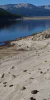
Edison Lake Ferry shutting down during drought. 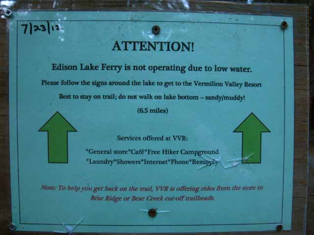
Post up your experiences, information, and your questions and comments about backpacking into and out of Yosemite Valley. |
Reds Meadow to Vermilion Valley Resort |
Trail Guide Pages
|
7.5 minute Maps
|
30 minute Maps
|
| N Lake's |
North: Tuolumne Meadows South: Vermilion Valley Resort
Reds Meadow Pack Station |
||
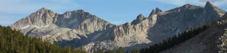
John Muir and Pacific Crest Trails This is the second of three short sections of trail between resupply points to the South of Tuolumne Meadows. The distances between Tuolumne Meadows to Reds Meadow, from Reds to Vermilion Valley, and from VVR to Muir Ranch are all short sections of trail. I have hiked each of these sections between resupply spots overnight. That is pretty darn short, especially when we consider my mimimum pack load is five days of food. So far my maximum has been about 14 days of food. The good thing is that each of these short trail sections is full of great scrambling/exploration/peak bagging opportunities. This means that we can easily hike each section with 2 days of food, then bring another 2 or 3 days of food to support some extensive scrambling and exploring. This is why I bring a light, small day pack stuffed into the bottom of my pack.
THIS PAGE IS UNDER CONSTRUCTION: STAY TUNED FOR MUCH MORE! COME ON BACK NOW, 'YA HEAR?
|
Backpacking Trail Guide JMT North Tuolumne Meadows |
 |
Backpacking Trail Guide JMT South |
Backpacker ForumsHave a great trip or story to relate about Yosemite or in the Sierra Nevada? Post it on Above we come to the Front Page of the High Backpacking Trails and Topics Forums. Below we break the forums down into categories:
The Trails Forum acts as your place to put up input, comments, relate your experiences, or ask questions about each segment and spot along the length of our combined TYT-PCT-JMT trails. The Forum is your place to supplement the trail guide. Anyone can post text comments in the existing forums, but only members can post up new topics, along with images, maps, and formatting. If you have experiences, comments, questions, or pictures and videos of the Pacific Crest and John Muir Trails from Reds Meadow to Vermilion Valley, post up here as an unknown hiker or as a member: Forum Section
|
Trailhead
Contact
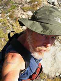
Alex Wierbinski

Backpacking Lake Tahoe to Mount Whitney
Your Guide to the High Sierra Crest, including the Tahoe to Yosemite, Pacific Crest, and John Muir Trails
