The Trails
Guide
Maps
Miles/Ele
Permits
Resupply
Forum
Current Weather Conditions
Weather Notes
Northern High Sierras
Central High Sierras
Southern High Sierras
Gear
Gear List
Gettin Started
Layering
Discussion
Testing yourself and your gear
Gear Reviews
Reds Meadow to Vermilion Valley
Miles and Elevations
Backpacking
The John Muir Trail
Backpacking Miles and Elevations on the John Muir Trail
Languages
Translate
Trail Arts
The art of walking
Physical Preperation
Trail Skills
The trail
Off the trail
Scrambling
Maps
Navigation
Camp skills
Food
Resupply
Food
Other
Photo Catagories
Trail Stories
Trail Culture
News and Science
Links
Groups
Books
MILES TYT-PCT |
MILES ALT ROUTE |
MILES ALT ROUTE |
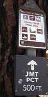
MILES JMT-PCT |
MILES JMT-PCT Reds
|
REGIONAL JMT & |
TRAIL JMT-PCT |
TRAIL ALT ROUTE |
MAPS |
MAPS |
TRAIL |
PERMITS
|
John Muir Wilderness
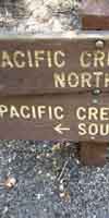
Miles & ElevationsJohn Muir and Pacific Crest Trails Reds Meadow to Vermilion Valley |
| Location | Elevation | Mileage | |
| Kennedy Canyon trail junction PCT | 9643 | 0 | |
| +xx | .23 | ||
| Shortcut Route | 9643 | .23 | |
| JMT NORTH Miles and Elevations |
JMT SOUTH Miles and Elevations |
| Miles and elevations index Lake Tahoe to Mount Whitney |
| top of page |
Miles North: Tuolumne Meadows to Reds Meadow Miles South: Vermilion Valley to Muir Ranch
Notes Setting up the outlines of the South Sierra section of Stay tuned for construction progress. |
Miles and Elevations |
ahoe on H |
Backpacker ForumsHave a great Sierra Nevada trip or story to relate? A fine piece of gear? Or gear that failed? Post it on Above we come to the Front Page of the High Backpacking Trails and Topics Forums. Below we break the forums down into categories:
The Trails Forum acts as your place to put up input, comments, relate your experiences, or ask questions about each segment and spot along the length of our combined TYT-PCT-JMT trails. The Forum is your place to supplement the trail guide. Anyone can post text comments in the existing forums, but only members can post up new topics, along with images, maps, and formatting. If you have experiences, comments, questions, or pictures and videos of the John Muir and Pacific Crest Trails Vermilion Valley to Muir Ranch, post up here as an unknown hiker or as a member: UNDER CONSTRUCTION Forum Section
|
Miles North: Tuolumne Meadows to Reds Meadow Miles South: Vermilion Valley to Muir Ranch