

High Sierra
Backpacking
Trail Guide
Forums
Sierra
Weather
WeatherNotes Northern
Sierra Weather
Gear
Hiking
The Tahoe to Yosemite Trail
Hiking to Rubicon Lake via Stony Ridge Lake
Backpacking out of Meeks Bay Trailhead, North Desolation Wilderness
Languages
Trail Skills
Mountain
Safety
Food
Planning
Trail Arts
More
Information
Social
| Trail Guide Section INDEX |
North |
South TYT Rubicon Lake |
Topo |
Miles & Elevations |
Miles & Elevations INDEX |
Lake Tahoe Basin Management Unit PEMITS |
All |
Hike the fine
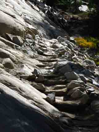
Rock and trail work above Stony Ridge Lake
 |
 |
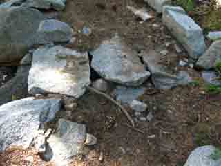
| Trail Work: Custom Rock Plates span the gap on a built-up length of trail. |
Side View |
Meeks Bay to Rubicon Lake
Rubicon Lake
Mileage Rubicon Lake is...
1.13 miles South of Stony Ridge Lake.
1.13 miles North of Phipps Pass Halfway between Stony Ridge Lake and Phipps Pass.
|
Details along the Trail
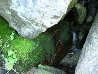
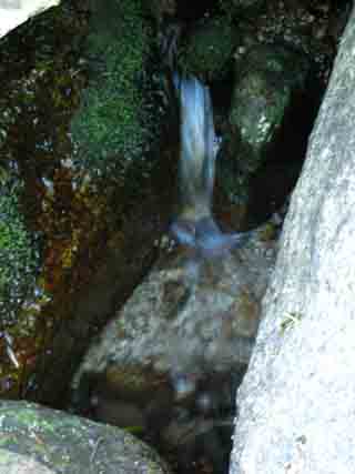
Tiny Rivulet
 |
 |
 |
|
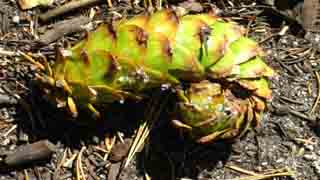
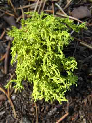
Above: Moss & trickle, and immature cone. A Bit of coolness. These delicate sounds, smells, and sights create tiny unique environments within the otherwise overwhelming grandure, inducing our senses to explore the smallest, as well as the largest, ranges of perception. |
A large cool draft was blowing down mountain along with the small cool flow of water. |
Views Climbing to Rubicon Lake
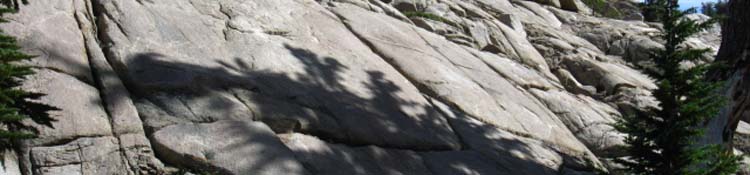
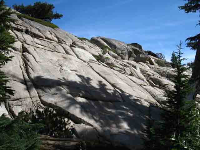
Great Granite Terrain Rises above Dense Forest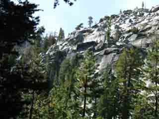 |
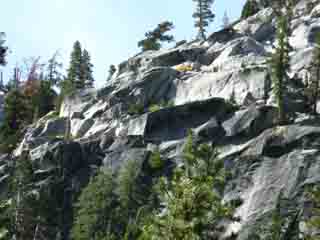 |
Above: Winding our way up towards Phipps Pass reveals lots of rock rising above dense forest cover surrounding us. Our trail to Phipps Pass runs through a forest-filled channel of granite cut by glacier into the mountainside between Phipps Peak and was likely the source of the two magnificant granite ridge arms running off its Southwest flank as well. Below: Magnificent Slab leads us into the channel. |
|
 |
|
 |
 |
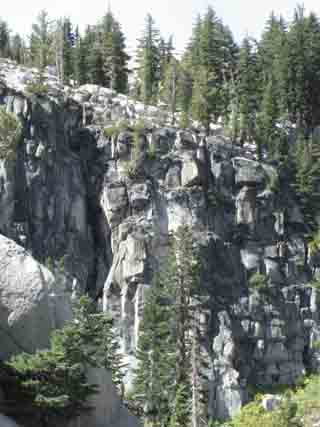
Above: Climbing upward into and through an amazing cut in the top of the rock rising above Stony Ridge Lake through beautiful forest and increasing-angle rock. Though Desolation is noted for its grand open basins of glacial cut granite surrounded by magnificent peaks, it also has some segments of trail into and through narrow, sheer canyons. Well, at least a couple! Mostly climbing out its West Shore Trailheads into The Crystal Range. |
|
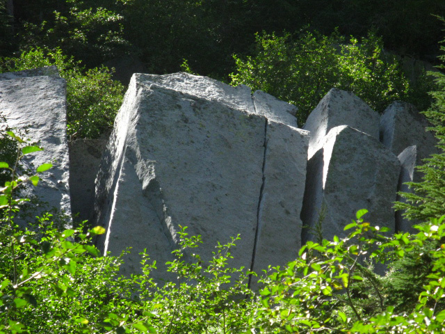 |
Above: Great split boulders. Not erratics left by receding glaciers, but shattered rock broken off and tumbled down from the surrounding cliffs. Another reason to keep our eyes on the skies, and the cliffs framing our skylines. And the forest filling these voids as well, for everything that presents beauty also contains elements of danger. |
The Hike up to Rubicon Lake Short, Steep, and Sweet. That pocket slips our trail East over onto Rubicon Lake's nifty little granite flat hemmed in by granite and forest, nestled in on the mountainside below Phipps Pass and Peak. |
 |
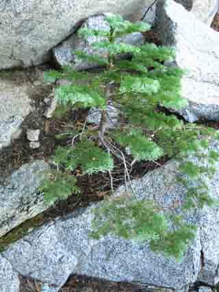 |
| Above: Flora, Wolf's Lichen and a tiny Fir growing within the constraints of the shattered rock | |
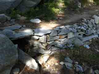
Fine Trail Work
| More trail work with wood. | |
 |
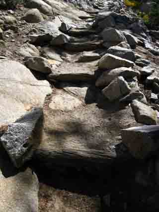 |
| All Hail the Desolation Wilderness Trail Crews | Fine Trail Work. More Wood... |
North TYT: Stony Ridge Lake South TYT: Rubicon Lake
Hiking to Rubicon Lake |
||||
The hike up the switchbacks to Rubicon Lake from Stony Ridge Lake is not too hard, a short but solid intermediate difficulty trail.
Surface and Exposure It's shaded with soft trail. That's compared to "exposed" terrain across hard rock terrain. The Sun is hard on the head, while Sun and heat make hiking harder. Hiking on hard surfaces takes its toll on the feet. Soft segments of the trail are really nice after extended lengths on hard granite.
Weather Information Local Temp and Snow Reporting Stations
Lake Tahoe Basin 7-Day Weather Forecast
This part of our hike begins offering some dramatic views of the stunning interface between Tahoe Forest and Sierra Granite at the moderate elevations of the Tahoe Rim. The Trails are mostly forest-soft, with hard-packed and rock sections. Note the fine trail work that keeps these heavily-trodden trails in top shape. Most of the trail work is repairing the damage from overuse, rather than Natural damage. 30 MIN Desolation Wilderness TRAIL MAP
Next page South |
Backpacking North Trail Guide |
 |
Backpacking South Trail Guide |
Backpacker ForumsDo you love trail crew too? Post your comments, pictures, and info about trail culture on the backpacker forumPost it on Welcome to Tahoe to Whitney
Add your experiences, comments, or pictures about this part of the Tahoe to Yosemite Trail here:Section
|
North: Stony Ridge Lake South: Rubicon Lake
Trailhead

Backpacking Lake Tahoe to Mount Whitney
Your guide to the High Sierra Crest, including the Tahoe to Yosemite, Pacific Crest, and John Muir Trails
