

High Sierra
Backpacking
Trail Guide
Forums
Sierra
Weather
WeatherNotes Northern
Sierra Weather
Gear
Backpacking
Upper Echo Lake
Hiking South through the Desolation Wilderness Boundary on The Tahoe to Yosemite Trail
Languages
Trail Skills
Mountain
Safety
Food
Planning
Trail Arts
More
Information
Social
Trail |
South Lower Echo Lake to Echo Summit |
Trail Miles & Elevations |
Trail Miles & Elevations INDEX |
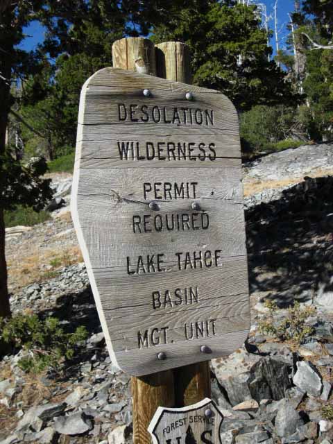
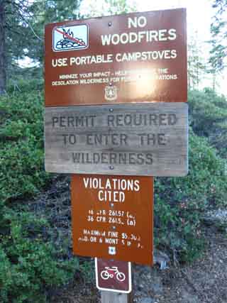
Lake Tahoe Basin PERMITS |
Local Weather All Sierra Weather |
All Wilderness PERMITS |
all pages |
 |
||
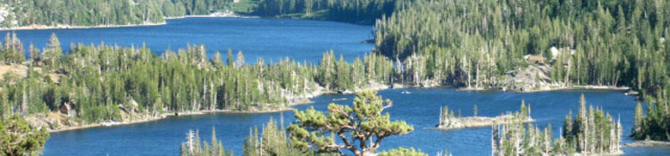
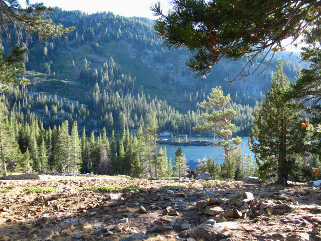
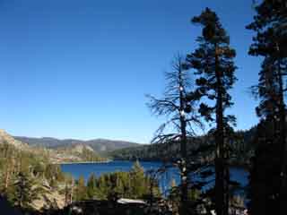
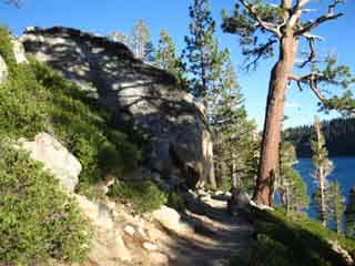
Final drop down to the Tamarack Lake trail junction before exiting Desolation Wilderness. Beyond the Wilderness Boundary we can see Upper and Lower Echo Lakes. Lower Echo Lake Marina just beyond the Lower Echo Lake trailhead is visible on far side of Lower Echo Lake. Development around Echo Lakes preclude the lakes from inclusion in the wilderness areas.
Meeks Bay to Echo Summit
|
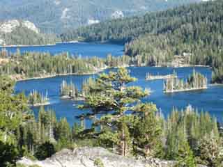
Upper and Lower Echo Lakes
 |
| Dropping down to a longer view across the Echo Lakes. |
Tamarack Lake trail junction
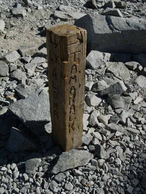 |
Tamarack Lake trail junction. We're .46 of a mile North of our exit Southbound straight through this junction to the Eastern Wilderness boundary on our way down to the West shore of Upper Echo Lake. Since passing South of Lake Aloha our Southbound route on the Tahoe to Yosemite Trail has pointed East-Southeast by the compass. The trail South by the Compass from this trail junction, or a Southbound backpacker's Right turn from this junction leads a tenth of a mile first to Tamarack Lake, then Ralston and Cagwin Lakes a third of a mile beyond. 25.2 miles South from the Meeks Bay Trailhead. |
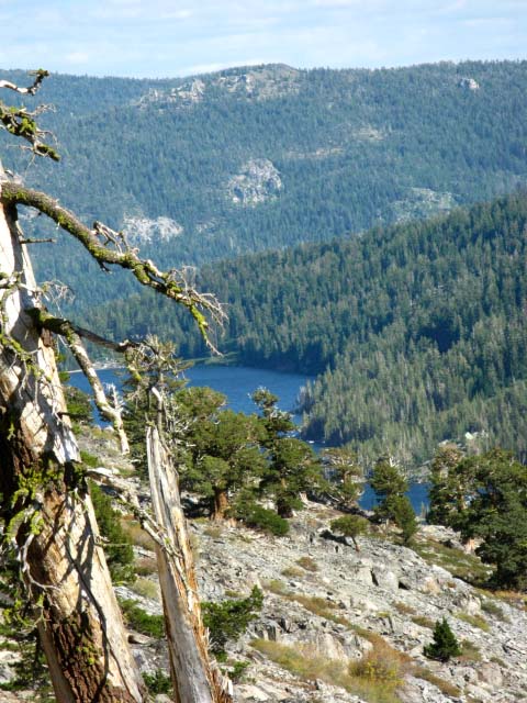
Desolation Wilderness Boundary
 |
Exiting the East end of Desolation Wilderness. Here we also find the trail junction leading Northwest to Triangle and Lost Lakes. Beyond Triangle Lake the trail climbs over to Lilly Lake and the trailhead off the Southwest shore of Fallen Leaf Lake. |
Exiting the Desolation Wilderness
Our downhill run from the North shore of Lake Aloha is coming to an end at Upper Echo Lake. When we reach a point just above lake level the trail will begin tracking along the gently rolling trail along the East shores of the Lakes. Crossing the Desolation Wilderness boundary signaled that "mixed use" has begun, here represented by the really expensive Summer homes ringing Lower Echo Lake. |
Video
The Length of Echo Lake, North to South, exiting the Desolation Wilderness
Video: Hiking from above the North side of Echo Lake to above Echo Lake on its South side. |
| North side of Echo Lake Desolation Wilderness |
The Video above spans the length of the Echo Lakes from the last (southbound) trail junction for Tamarack Lake to just past the Echo Chalet. The Pictures on this page just cover the North side of Echo Lake. The following pages follow the Tahoe to Yosemite Trail as it follows the Echo Lake's Eastern Shore South to the Echo Lake trailhead. Tamarack Lake trail junction Echo Lakes Elevation Mileage note: mileage sign at Echo Lake trailhead states: Aloha Lake 5 miles. This is incorrect according to my measurements and experience. Check the map and hike the trail to verify my observation: ALWAYS Double-Check your (and my) mileages. Trail distances are constantly changing as the trails are being regularly rerouted.
|
Upper and Lower Echo Lake
with
Christmas Valley
in the
background
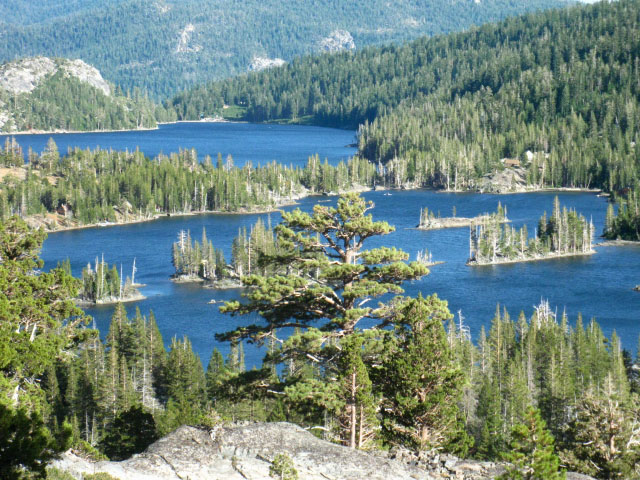 |
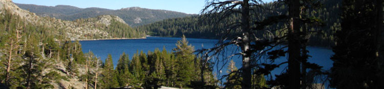
The two major rock formations sitting beyond the low ridge wrapping around the marina on the far shore of Lower Echo Lake are sitting above Southbound Highway 89 in Christmas Valley, which is also the valley where the South Upper Truckee runs out of the Meiss Country Roadless Area. Christmas Valley was once known as Long Valley. Our trail, once we reach the far South shore of Lower Echo Lake crosses along and over that low ridge to cross Highway 50 (on the other, furthest Right or South side of that ridge) just below the West flank of Echo Summit. We'll hike South through the Echo Summit Trailhead to follow along the top of that ridgeline as it represents the Sierra Crestline as the top of the Western wall of Christmas Valley, which also makes up the Southwestern perimeter of the Tahoe Basin as well. Once we hike along that ridge to the top of Christmas Valley we cross Meiss Meadow to climb out of the Tahoe Basin through the gap in the South end of the Tahoe Rim I call the Carson Gap (TYT Guide) where the South Upper Truckee begins (map) its run down into Lake Tahoe. The top of that valley we see way down there beyond Lower Echo Lake is the most Southwestern corner of the Tahoe Basin. We are looking into the bottom-third of Christmas Valley from here. Everything in Christmas Valley to the Left of the middle of the valley in the image above contains houses and is auto accessible, everything to the Right is accessible by trail only. |
Backpacking down to Lower Echo Lake from the North
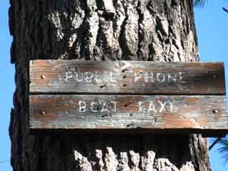
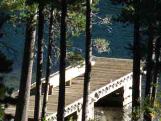
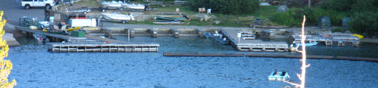
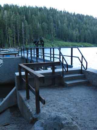
Lower Echo Lake Boat Taxi
View from North of the Echo Lakes
 |
 |
| Upper and Lower Echo Lake as we drop down towards lake level. | Echo Lake Boat Taxi sign |
 |
 |
Echo Lake Boat Taxi sign close up |
Echo Lake Boat Taxi Dock. |
Echo Chalet
|
Heading South around to the North side of Upper Echo Lake
 |
 |
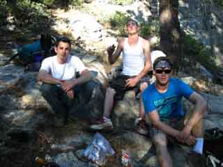
| Kicking it with Eric, John, and Will. You meet the BEST people on the trails, so stop and kick it with the boys when the opportunity arises. | Down to Upper Echo Lake. View Southwest. |
 |
|
Scenes hiking past Upper Echo Lake |
 |
 |
|
Running to beat the lengthening shadows, Echo Lake. |
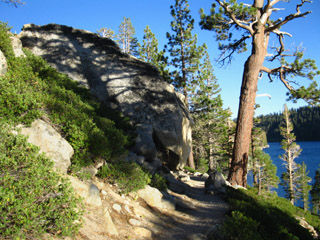
The well-worn trail around the North side of Echo Lake. |
North: Trail Junctions S of Aloha South: Echo Lake to Echo Summit
Upper Echo Lake |
We have come to the end of the Desolation Wilderness Section of the Tahoe to Yosemite Trail the second full day out of Meeks Bay. The end of the Desolation Wilderness is evident from the buildings and boat taxi dock, and the luxury "cabins" we see ringing the Echo Lakes. If you are on a Meeks Bay to Echo Lake backpacking trip, the end of your trip is near. Camping Options Continuing South through the Lower Echo Lake trailhead, offers few premium campsite opportunities between the end of the Desolation Wilderness Area and Frog Pond. Frog Pond is roughly a mile and a quarter South of the Echo Summit Trailhead. Our best campsite option to the South sits about 6.73 miles past the Echo Summit Trailhead at Showers Lake in the Meiss Country Roadless Area. In any case, through hikers should consider the time of day when hiking through the Echo Lake and Echo Summit area. This is because there are around 13 miles between excellent campsites at Lake Aloha to the North of Echo Lake, and Showers Lake to the South of Echo Summit Trailhead. There are plenty of good campsites just off the Tahoe to Yosemite Trail between the South shore of Lake Aloha and the Desolation Wilderness boundary. We plan our hike through this section so we can easily get from campsite to campsite across the stretch of civilization from Echo Lakes to Echo Summit. Hiking Plan Check out my Hiking Plan for properly timing my visits to the Echo Lake Chalet to Resupply. As you will see on the pages ahead, the last time through here I continued my mad rush for mileage until utter darkness forced me to "emergency" camp in a sparse little throw-down area just after crossing to the South side of Highway 50 . Topo Trail Map
|
North: Trail Junctions S of Aloha South: Echo Lake to Echo Summit
Nearing
the
Lower Echo Lake Trailhead
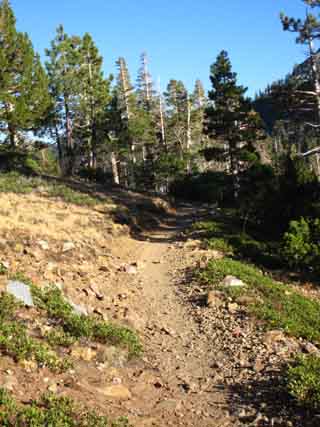
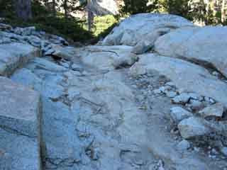
Hiking South for 2.69 miles from the trail down to the Boat Dock on the trail around the North side of the Echo Lakes on the far North side of Echo Lake brings us to the Echo Lake Trailhead. Or we can call the Echo Lake Chalet from the Boat Dock for a ride on their Boat Taxi to the Echo Lake Marina between Memorial Day to Labor Day. I'd rather walk. From solid rock to soft forest floor trail beds, we cross a variety of excellent trail surfaces between the Tamarack Lake trail junction to the Echo Lake trail head. I'm just happy to get off of constant pounding of downhill hiking on hard rock surfaces!
Meeks Bay to Echo Summit
|
 |
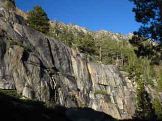 |
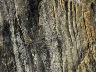
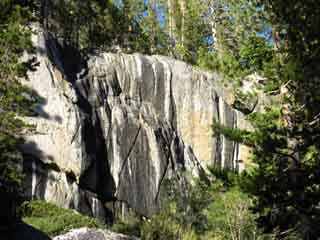
| Trail, Echo Lake | fine rock formations, Echo Lake |
 |
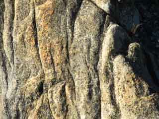 |
fine rock formations, details, Echo Lake |
|
| Approaching the Lower Echo Lake Trail Head |
We're just one mile North of the Echo Lake trailhead. Rock Faces descend off of Flagpole Peak sit to our immediate NE, above us, with the crystal blue waters of Lower Echo Lake to our SW. It is a beautiful location, despite the vacation houses. Our fine level trail winding through rock and forest splits the distance between steep rock and deep blue water. It's really pretty along this section of trail. Our generally downhill run from the North side of Lake Aloha ends at Echo Lake. South from there we have a two mile climb to the Echo Lake trail head on Highway 50. Elevation Mileage
note
|
Hiking along Lower Echo Lake nearing the trail head
 |
 |
|||
| The trail South along Lower Echo Lake. | ||||
| top of page | ||||
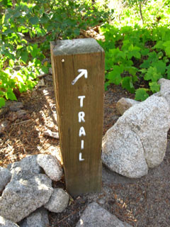
| Sign posts on the East side of Echo Lake keep you on the trail to the trailhead, rather than down to cabins. | ||||
Houses accompany the rock and lake hiking South to the Echo Lake trailhead
 |
|
| Lots of fine rock lines the trail along Echo Lake. The reddening of the setting Sun highlighted the rock colors | |
 |
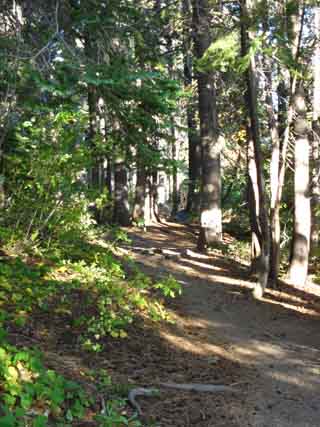 |
| Frodo lives here, Echo Lake | Nice wooded trail section along Echo Lake |
 |
|
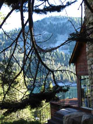
Not my patio, but my view was the same while passing by. |
|
Mid-Point: Echo Lake |
I was racing against sunset as I flew South by the luxury houses lining the East shore of Echo Summit. This section of trail has been unfairly disparaged. The trail snakes along between a beautiful rock and forest ridge and and the crystalline blue waters of Echo Lake. But I am running low on energy. Since I'm not resupplying between Meeks Bay and Tuolumne Meadows, the pack is very,very heavy, which is very tiring.. The short length of Desolation Wilderness requires I pass it quickly, which is always challenging at the start of a trip. Despite my dedication to observation and enjoyment of every inch of trail I cover, I was determined to push until darkness terminated my day. In any case, I would not take the boat taxi through this section of trail, even if it was still running.
Echo Chalet Boat Taxi information.
Hiking Topo Trail Map
|
Echo Lake Trail Head and Echo Lake Chalet
Resupply options
|
| Dicks Pass to Echo Lakes 15 minute backpacking Trail MAP |
South Desolation Wilderness 30 minute backpacking Trail MAP |
Meeks Bay to Echo Summit
Backpacking Trail Miles and Elevations
Approaching the Lower Echo Lake trailhead and Marina
 |
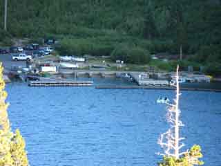 |
| Trail nearing the South end of Lower Echo Lake. | Lower Echo Lake Marina. |
 |
 |
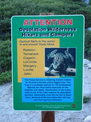
Yellow Legged Frog rescue plan. |
Be good! |
| Echo Lake Trailhead |
Lower Echo Lake Trailhead Resupply information Elevation Mileage note |
Echo Lake Location on a Road Map
| a |
| See the Lake Tahoe Backpacker Resources Page |
Echo Lake Trailhead
 |
 |
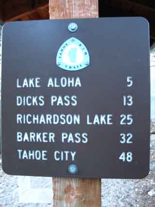
| I have Lake Aloha at 6.13 miles to the trail junction at the South end, and Dicks Pass at 11.88. | Pacific Crest-Tahoe to Yosemite Trails cross the Echo Lake Dam. |
 |
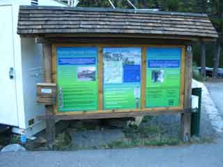 |
Information board at the Echo Lake trailhead. |
|
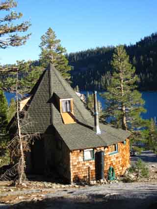
Echo Lake Chalet
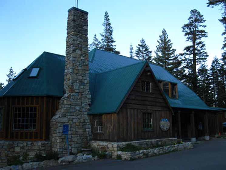 |
The end of our Meeks Bay to Echo Lake trail segment is marked by our arrival at Echo Chalet. Arriving late in Fall, it was closed for the season. |
North: Trail Junctions S of Aloha South: Echo Lake to Echo Summit
Lower Echo Lake |
|||
A very busy trailhead during SummertimeOn my last trip across the length of Desolation Wilderness I emerged from Desolation Wilderness through the Lower Echo Lake trailhead on September 17, 2009. The Echo Lake Chalet was closed (Echo Lake Chalet operates from Memorial Day to Labor Day), and the area was as quiet as I've ever seen it, and the upper parking lot had only a few cars. The last time I was here was over 10 years ago. A friend drove me into the upper parking lot, which was packed with cars. There were hundreds of people milling about, and running around. 90% were wearing brand new backpacking clothes, and had the latest gear, all virtually unused. At that point in my life I was not taking pictures, films, or writing a trail guide. I looked at the beauty of the rock, water, and trail, and lamented the ocean of people who covered them. I turned to my buddy, and said, "the same way out as in," and he drove me over to the South Upper Truckee, where I quickly hiked to Summit City Creek, and the isolation of the Western Flank of the Sierras between Round Top and Lake Alpine. I had spent many nights in Desolation, so leaving it to the crowds was not a problem. Fall Conditions Experiencing the quiet of Fall in the Desolation Wilderness has changed my mind about Desolation. I miss it. Not that you will see me there in mid-Summer, but I'm going to start visiting Desolation again, but only during Fall and Spring before the big crowds form up. Hey, I think it is good that backpacking is stylish, and valued by a significant segment of consumers. Remember when wearing North Face mountain jackets in the city was "cool?" But I fear that many hikers are as motivated by using their experience as an emblem of "wilderness validity" within their urban consumer lives, as they are motivated by the backpacking experience itself. I found it amusing when North Face jackets became "cool." Nature, backpacking, and life are ultimately what we make out of it. The real message I see in the busy Summers crowds at Lower Echo Lake is a good one. The crowds show that a significant group of our massive populations have made wilderness experience a term of social validity. That's an excellent trend. After that nightmare of crowds (Lining up for the trail like a lining up for a ride at Disneyland? Never!), I never went back to Desolation until 2009. When I returned, it was in mid-September, when the massive crowds had diminished to a trickle of backpackers. It was nice. I could enjoy the company of other backpackers and hikers, rather than be swept away by them. This is a great place for beginning backpackers worried about not having folks around.
Echo Lake Chalet The Echo Lake Chalet runs a Post Office, so Pacific Crest Trailers can send a well-timed resupply to themselves during the Summer. The Echo Lake Chalet also has a store and deli. Hit the link below for complete information on resupplying at Echo Lake Chalet, and a discussion about making your resupply plans work for you through this section of our Tahoe to Whitney Trail: To Resupply, or not to Resupply at Echo Chalet?
Lower Echo Lake Trailhead
Resupply information
You can also easily hitch hike down to South Lake Tahoe for rest and resupply
Backpacking Topo Trail Map
Backpacking Topo Trail Map
Southbound |
Backpacking Trail Guide
North
Trail Junctions South
|
 |
Backpacking Trail Guide
South
|
Backpacker Forum
|
| High Sierra Trails | High Sierra Topics |
It was nice to see Echo Lake almost deserted in September!
Add your experiences, comments, or pictures about the what's up at Upper Echo Lake:
Section
Meeks to Echo Summit
Segment
Echo Lake
North: Trail Junctions S of Aloha South: Echo Lake to Echo Summit
Trailhead
Contact
Alex Wierbinski

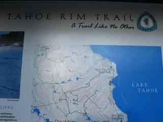
Backpacking Lake Tahoe to Mount Whitney
Your guide to the High Sierra Crest, including the Tahoe to Yosemite, Pacific Crest, and John Muir Trails
