The Trails
Guide
Maps
Miles/Ele
Permits
Resupply
Forum
Current Weather Conditions
Weather Notes
Northern High Sierras
Central High Sierras
Southern High Sierras
Gear
Gear List
Gettin Started
Layering
Discussion
Testing yourself and your gear
Gear Reviews
Trail Segment
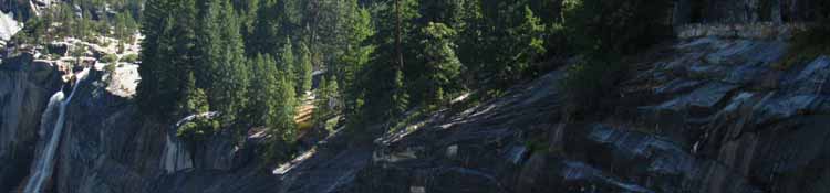
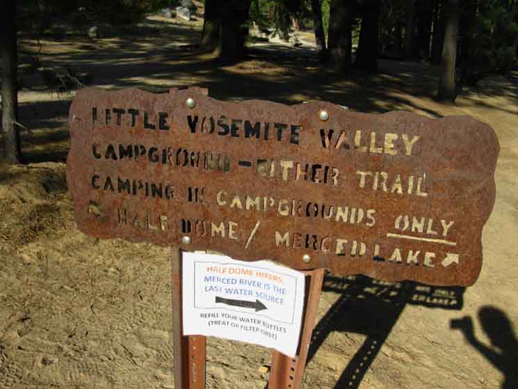
Little Yosemite Valley
down into
Big Yosemite Valley
Section
Tuolumne Meadows to Yosemite Valley
BACKPACKING
YOSEMITE NATIONAL PARK
Section Hiking
The John Muir Trail
South
to
Happy Isle
Languages
Languages
Trail Arts
The art of walking
Physical Preperation
Trail Skills
The trail
Off the trail
Scrambling
Maps
Navigation
Camp skills
Food
Resupply
Food
Other
Photo Catagories
Trail Stories
Trail Culture
News and Science
Links
Groups
Books
Terms and Conditions of Use
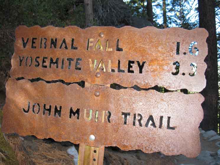
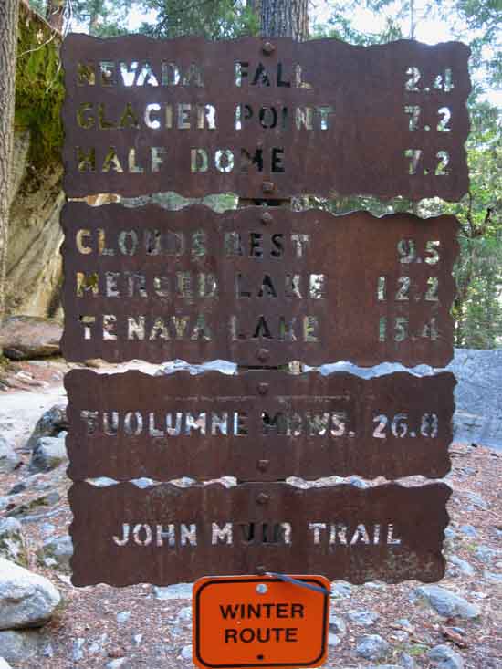
| Trail Guide INDEX Tuolumne Meadows to Yosemite Valley |
Trail Guide |
Trail Guide EAST to SOUTH JMT Little Yosemite Valley to Merced Lake |
7.5 Topo |
30 min |
MILES Tuolumne Meadows to Yosemite Valley MILES and ELEVATIONS |
TOPO MAP INDEX Central Yosemite |
Resupply South |
PERMITS National Forests & Parks Toiyabe & Stanislaus & Yosemite |
|
Little Yosemite Valley
to
YOSEMITE
VALLEY
UNDER CONSTRUCTION To the The Little Yosemite Valley backpackers camp is located along the trail veering Left from the point where the John Muir Trail lands in the corner of Little Yosemite Valley. This trail to our Left, to the South is the first link to the trail coming down along the Merced River from Merced Lake. Veering Right when dropping into Little Yosemite Valley along the JMT brings us directly to their second junction on the West end of Little Yosemite Valley. That would be our route directly towards the Happy Isles Trailhead if we are not spending the night in Little Yosemite Valley backpackers camp. We are, so we will veer Left dropping into Little Yosemite Valley along the John Muir Trail. Tomorrow morning we will turn West, Right through the junction along the Merced River linking the trail coming down from Merced Lake with the JMT. We'll hike it down to the West end of Little Yosemite Valley, where we find the trail along the North edge of Little Yosemite Valley from Half Dome merges with our trail that swung around the backpackers camp and touched the Merced River. Viewmaster Do stay off the slippery rock surfaces along the shoreline above the falls unless you want the ride of your life. The last ride of your life. Please don't provide any extra intensity to an already dramatic scene. Don't become a Yosemite "statistic." Final Segment It's a quick hike down if the knees are sound. Though short and at low elevation, the steepness of the climb up over the short distance from Happy Isles to Nevada Falls establishes this segment of trail as the middle degree of the most difficult level of backpacking difficulty, an H-2 trail.
Map and Miles
Miles Tuolumne Meadows to Yosemite Valley
Backpacker Resources
Lakg the Tahoe to Yosemite Trail. |
||||||||||||||||||||||||||||||||||||||||
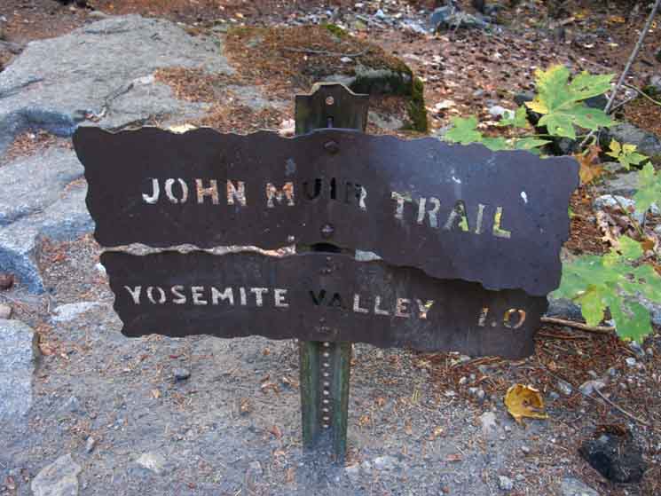
| Little Yosemite Valley Trail "Delta" Junction CONNECTOR TRAIL SOUTH JMT Trail to Little Yosemite Backpacker Camp & Merced River Trail Junction Final Plunge We are confronted with a Y-junction in our trail when we first step onto the flat terrain of Little Yosemite Valley descending along the John Muir Trail below the Half Dome junction. One arm of the Y points West, to our Right along the North edge of Little Yosemite Valley, down to where it rejoins with the other arm of the Y at the trail junction on the West End of Little Yosemite Valley. The other trail branching to our Left from the Y is the official JMT trail swinging past the Little Yosemite Backpackers Camp before turning West at the Merced River to follow it down to where that branch of our trail rejoins its Northern counterpart on the West End of Little Yosemite Valley. Check out the map for clarity on this delta-box trail configuration across the Western end of Little Yosemite Valley: Cathedral Pass to Yosemite Valley On the previous page we explored the short route along the North edge of Little Yosemite Valley down to the trail junction on the West end of Little Yosemite Valley. This page below follows the John Muir Trail route South across the valley to the Little Yosemite Backpackers Camp before turning Right at the Merced River to follow the JMT West parallel to the river down to the West end of Little Yosemite Valley. From the West end of Little Yosemite Valley we continue hiking down the John Muir Trail to the Happy Isles Trailhead in Yosemite Valley. We will start looking for food, shelter and resupply resources once we get into The Valley. I find it more trying to find accommodation in civilization than Nature. |
Little Yosemite Valley Descending Hiking Out Back In We will continue upriver along the Merced River from Little Yosemite Valley to eventually rejoin the Southbound John Muir Trail in Lyell Canyon after hiking over Vogelsang Pass. Below we hike the four miles from Little Yosemite Backpackers Camp to Happy Isles Trailhead.
|
Video
9:13 video of John Muir Trail from Little Yosemite Valley backpackers camp to its
|
Little Yosemite Valley
 |
||
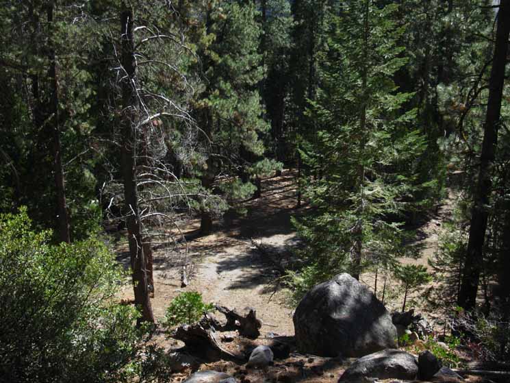
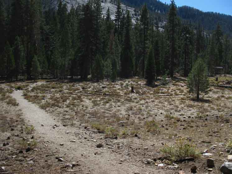
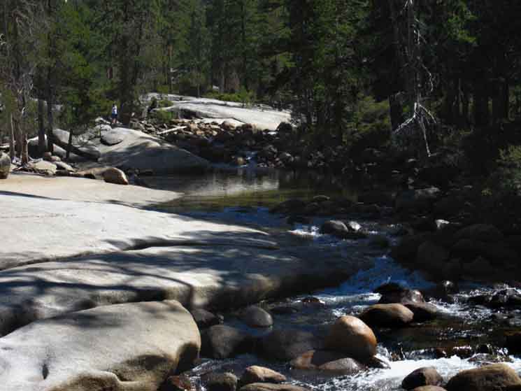
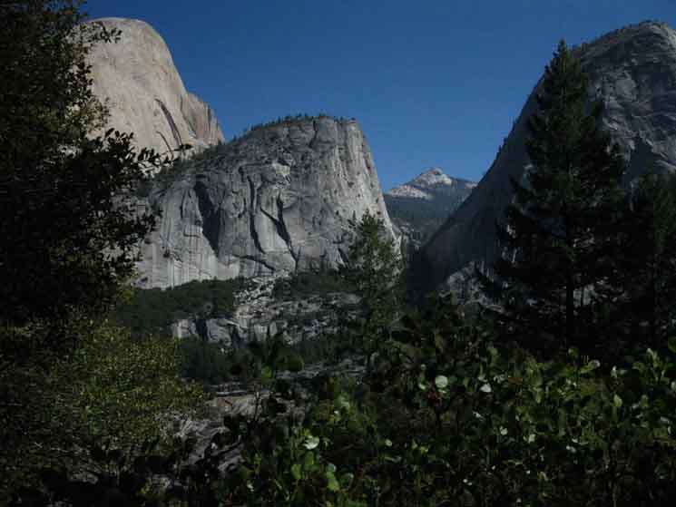
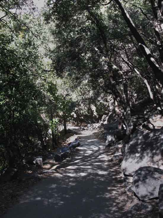
We get a look into the forest on the floor of North edge of Little Yosemite Valley as we descend South on the John Muir Trail to our entrance into Little Yosemite Valley.
|
Onto the Floor
of
Little Yosemite Valley
 |
||
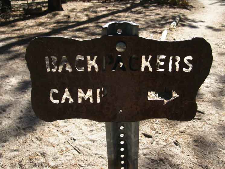
Dropping into Little Yosemite Valley below Half Dome. We are confronted with a Y trail junction dropping into this corner of Little Yosemite Valley. The actual John Muir Trail veers to our Left, to pass by the Little Yosemite Valley Backpackers Camp and associated solar toilets hiking South across this width of this narrow valley to where it tees-out into the trail running East and West along the Merced River. Here our JMT route turns Right towards the West end of Little Yosemite Valley and Nevada Falls beyond. A Right-turn West from here at this trail Y pictured above when we first drop into Little Yosemite Valley brings us along a slightly more direct route to the West end of the valley along its Northern edge. We can see the solar toilet building in the distant upper-Right of the image above. The Little Yosemite Backpackers Camp is stashed in the forest to the Left, just East of that solar toilet building. We walk there, and we are at the backpackers camp. The Plan
|
Turning Left, South, arriving in Little Yosemite Valley
 |
At the bottom of our descent into Little Yosemite Valley from the Half Dome trail junction we are veering to our Left, to the South to the Backpackers Camp and the Merced River just beyond. First we approach the composting bathroom. |
Solar Composting
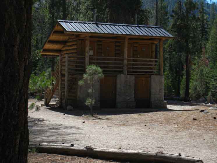 |
||
The solar outhouse is the main human feature of note as we hike South towards the Little Yosemite Backpackers Camp. Once a wilderness area reaches a certain level of human use is also reaches its saturation point of just how much human waste it can naturally absorb. Reaching this level of use demands limitation on human access or building an infrastructure to maintain high levels of use and high environmental standards. The higher the levels of use, the more infrastructure required. Infrastructure is antithetical to the essence of wilderness. Houston, we have a problem... Limitation or restrictions on human use are also employed, but the numbers allowed access against the numbers desiring access speaks to the core dysfunction driving all the problems: profound overpopulation. There are way more of us than Nature can handle or accommodate. That translates into too much shit in Little Yosemite Valley. I figure the solar part of the process provides electricity to dry the "product" more rapidly and thoroughly for easier handling and rapid transportation out of the wilderness. This process indicates one of the problems of attempting to have "wilderness" and mass culture coexist. They don't. It's as simple as that. Shithouse Symbol Think of Owens Valley, and of the whole watershed of the Colorado River, just for starters... Irresponsible growth has had the inverse effect on protected wilderness areas. The growth of vast populations has put incredible internal strains on protected wilderness areas through perpetually above-maximum capacity crowds in the parks and on the trails. We are in the late stages of failure as individuals and as a society, both to physically protect the last bits of our original natural environment, and any remnants of the character and values necessary for such a task. I would say we are stupid for doing this, for throwing away our fundamental principals, which is true. But, stupidity is not the driving force behind our destructive behavior. It is greed that drives us to destroy the very environment that created and sustains us. Greed only pays off on the "front end," meaning in the short term, and only then for the greedy. Long term pain is the ultimate harvest of allowing greed to condition short term behavior. The vast short term profits made by a few from destroying our ecosystem will be dearly paid by all for a long, long time. Societies built on greed and fueled by corruption always end badly for man and Nature. The consequences of this tragicomedy of self-created "karma" are exactly what we are currently experiencing. Consequences that are being played out in the changing skies, along crowded trails through dying-burning forests, in corrupted markets, and on our desperate, dirty streets full of alternatingly fearful, then greedy, "consumers." Man destroys Nature until enough of us figure out we are destroying ourselves. This generally happens around the time that Nature begins to play that fun game, "Stop Hitting Yourself," with mankind. Nature takes the hand of man in its own, smiles sweetly, balls our hand up into a fist, and guides the fist of man repeatedly into his own face until we stop, while quietly saying, "stop hitting yourself." My advice is, We are far past that point. That's it. The Scoop on the Poop The bottom line is that all heavy use areas have to have the poop hauled out. This first involved, and still involves vault facilities, which have to be pumped out in a conventional method, but from an operation on horse and mule. The solar aspect is to apply an air-drying factor to dessicate and reduce the weight and volumne of waste removal. Physical Layout
|
Backpackers Camp
Notices
 |
||
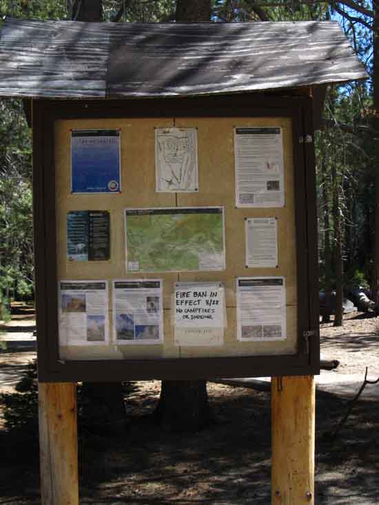
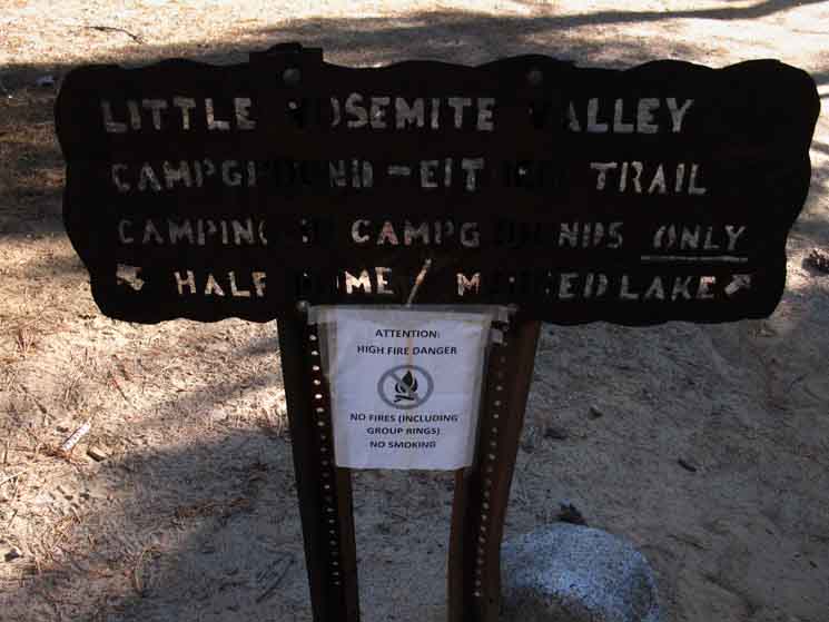
The Little Yosemite Backpackers Camp is located across the trail to the East of the solar outhouse, behind this notice board.
|
Little Yosemite Valley
Backpackers Camp
Rules
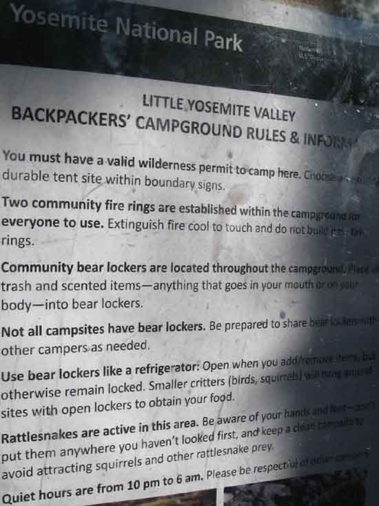 |
||
A closer look at the rules and recommendations for camping in the Little Yosemite Valley backpackers camp.
|
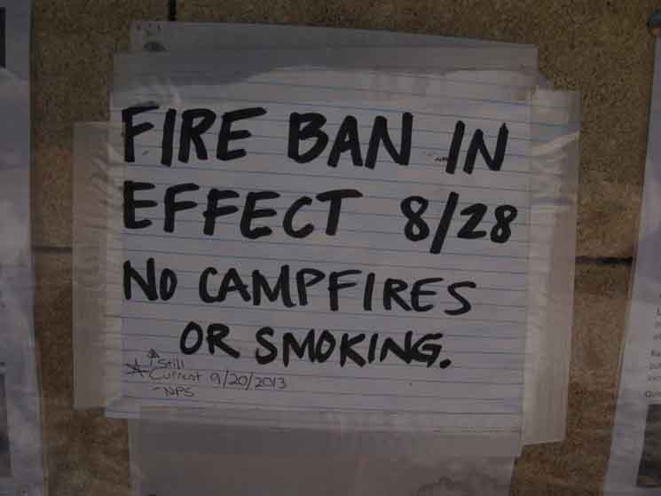
Fire Restrictions
 |
||
Low water all year(s) and early season fire threats come with drought conditions bringing fire bans.
|
Kicking it in Camp
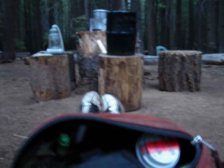 |
||
Relaxing in Little Yosemite Valley backpackers camp.
|
Little Yosemite Backpacker Camp
Communal Fire Ring
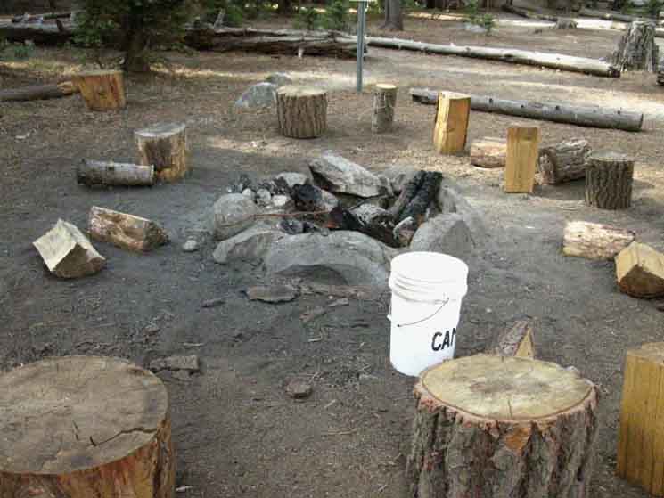 |
||
Group campfire ring in Little Yosemite Valley backpackers camp. I have a firm solo hiking fire policy: none unless it's an emergency. Or a social situation.
|
Exploring
 |
||
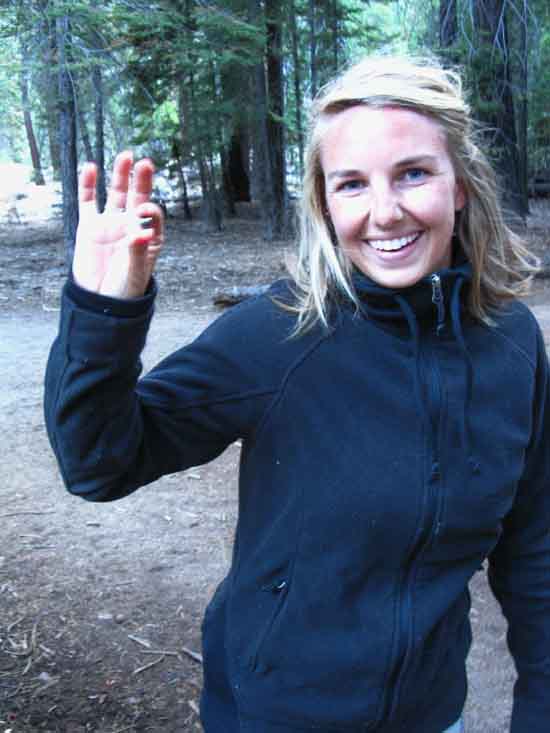
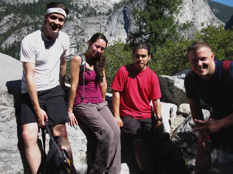
Taylor Bacci finds a steel ball in Little Yosemite Valley backpackers camp. She was observing carefully to find that!
|
Little Yosemite Valley
Descending Little Yosemite Valley
6140 feet 17.76 miles South of Tuolumne Meadows 4.64 miles North of Yosemite Valley
to
Maps and Miles Map
Miles Tuolumne Meadows to Yosemite Valley
Continuing South past the backpackers camp for a very short distance brings us to our water supply, the location of our next trail junction, and a nice beach and swimming spot all wrapped up in one at our first access point to the Merced River. First we encounter the trail T, and continue straight South through it to continue onto the beach to the river.
|
JMT Junction
from
Little Yosemite Junction
at
The Merced River
to
Tuolumne Meadows
Tuolumne Meadows
 |
| The Numbers Up the JMT to Tuolumne Meadows. |
Sign Pointing East
Tuolumne Meadows via Merced Lake
(Arrow Points North)
 |
||
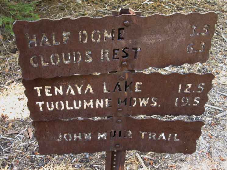
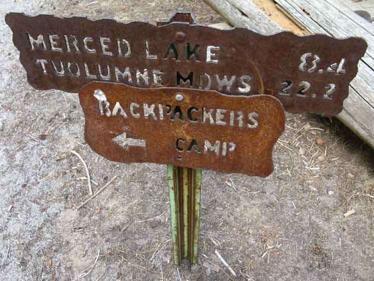
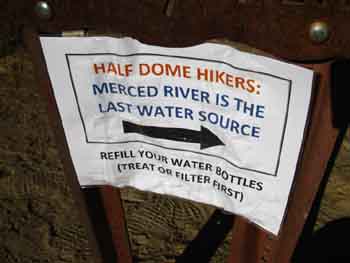
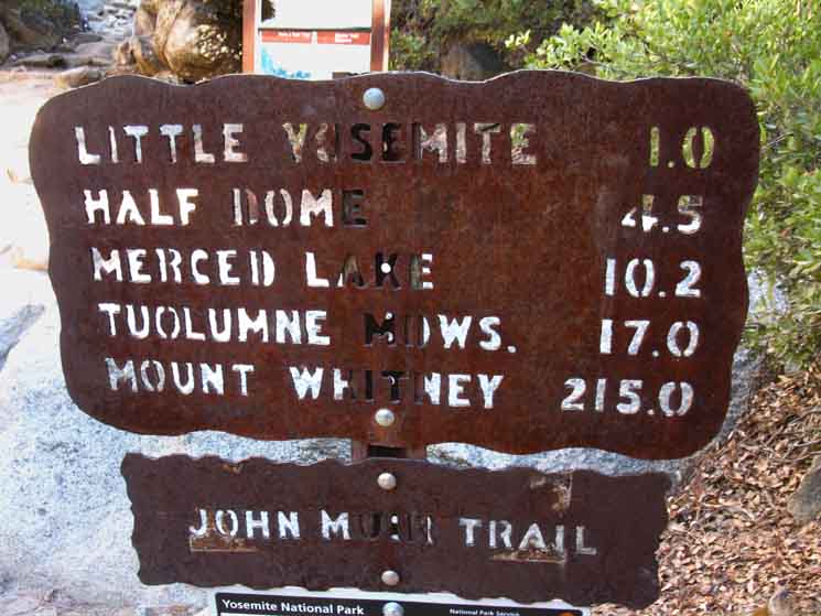
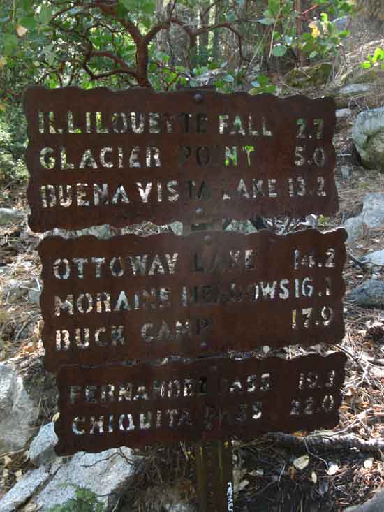
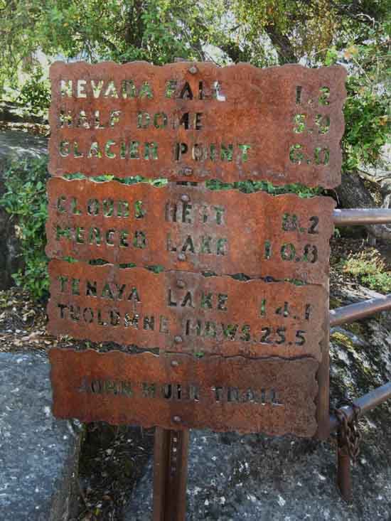
John Muir Trail junction with the Merced River in Little Yosemite Valley. This sign notes the miles East up along the Merced River, and I suspect the miles to Tuolumne Meadows via Vogelsang Pass to Tuolumne Pass to Tuolumne Meadows. Little This will be our route returning to the Southbound John Muir Trail for the rest of our hike down to Mount Whitney after visiting Yosemite Valley. We will not hike all the way back to Tuolumne Meadows, but turn East into Lyell Canyon just a bit North of Vogelsang High Sierra Camp to intercept the JMT about 5.6 miles South of Tuolumne Meadows. The arrow pointing at the backpackers camp is directed to the North along the trail running between the composter building and the backpackers camp to the John Muir Trail route climbing to Tuolumne Meadows via Half Dome and Clouds Rest. The trail up the Merced River can also bring us to Tuolumne Meadows, though through Tuolumne Pass by continuing North from Vogelsang High Sierra Camp, rather than our route into Lyell Canyon. So, this junction clues us in to the fact that we have two distinct routes to Tuolumne Meadows. The over-popular route of the John Muir Trail, and the less-traveled route via Merced Lake and Vogelsang. Well, maybe not much less traveled, but less than the JMT as reflected by my experiences.
|
Miles Down
from
Little Yosemite Junction
at
The Merced River
to
Nevada Falls and Yosemite Valley
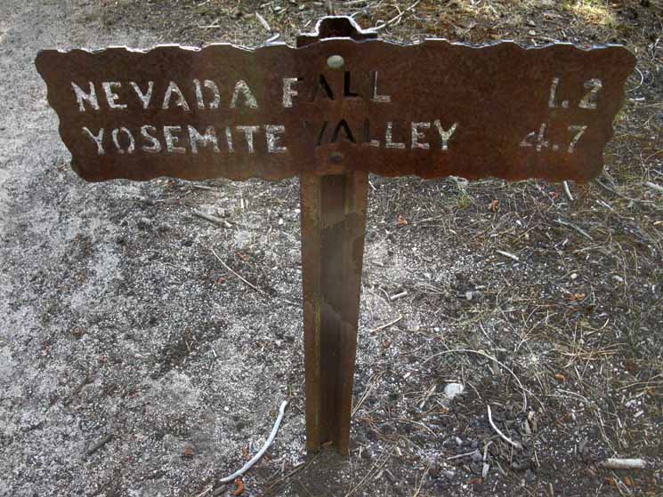 |
The Numbers Down Mountain. 1.2 miles to Nevada Falls,
|
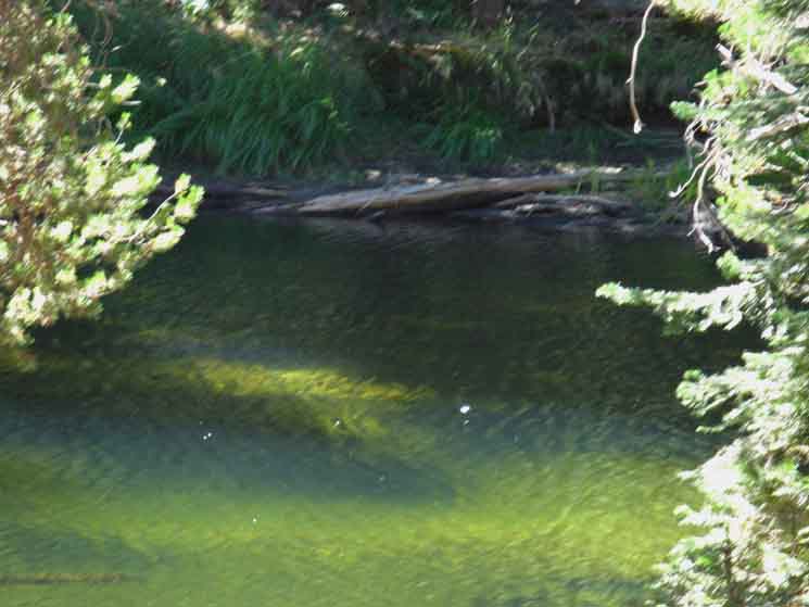
Merced River Continuing South on the obvious sandy extension of trail we find an expansive beach on the bank of the North Shore of the Merced Rive, with an languid length of river offering a nice cool soak. Cold most of the year, but the drought years have brought temps up. |
Little Yosemite Valley
LAUNDRY
 |
||
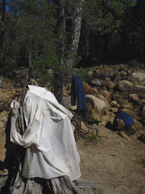
On the Beach of the Merced River. Little Yosemite Valley Laundry. I was getting pretty grubby, so decided to wash the clothes before descending into the population density of The Valley. I rinse the clothes away from the water first, then in the water. Though not perfectly clean, everything is much fresher. I don't care if the animals smell me coming, but the people never should! I rinse out my clothes every three days or so, on the trail. Sock washes happen every three to five days, depending on how sunny the days are.
|
Pool along Merced River
 |
||
Slow flow of the Merced River past Little Yosemite backpackers camp.
|
West .43 of a mile West to trail convergence. Our route following the John Muir Trail from the Little Yosemite Valley backpackers camp continuing West down to Yosemite Valley necessitates taking a Right turn at the junction by our beach to parallel the Merced downriver to the West end of Little Yosemite Valley. We reach the convergence point of our two possible routes across Little Yosemite Valley on the West End of the Valley. The more direct trail across the North fringe of the meadow and the JMT route past the backpackers camp and down along the river come together on the West end of Little Yosemite Valley. |
 |
||
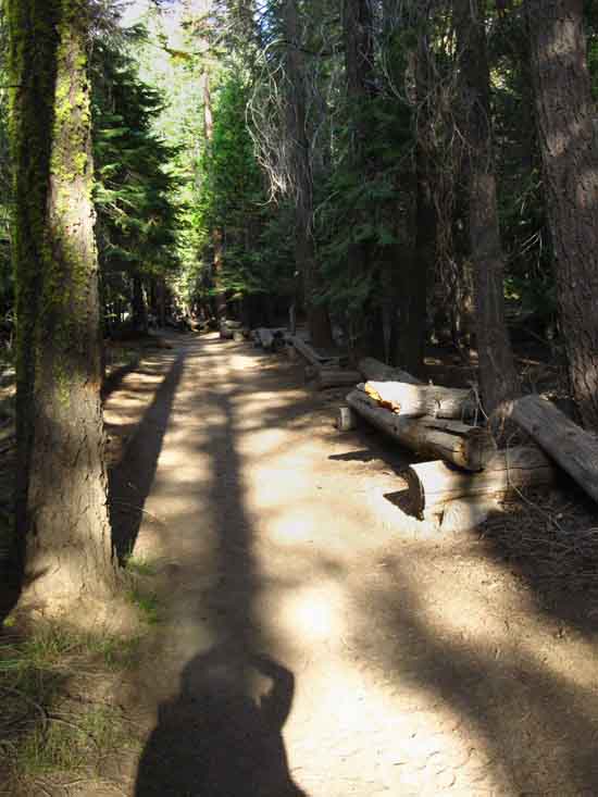
The trail running parallel to the Merced River East and West along the South edge of Little Yosemite Valley is flat.
|
Dense Dry Forests
 |
||
John Muir Trail through Little Yosemite Valley.
|
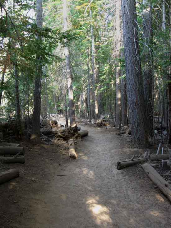
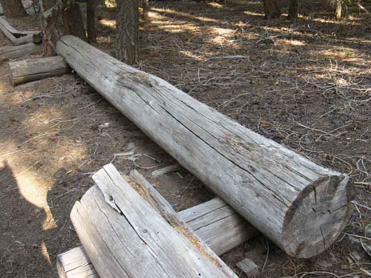
Unique Trail Border
 |
||
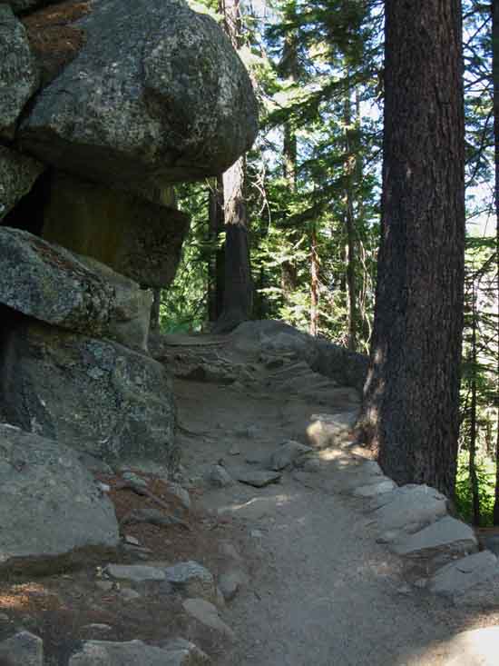
Cut and notched logs bracket the John Muir Trail through Little Yosemite Valley. We will see evidence of every different approach that the National Park Service has utilized for trail construction over its long history if we look carefully at Yosemite's infrastructure. Yosemite has tried everything at one time or another.
|
Trail Junction .58 of a mile West to Mist Trail Junction
Descending Little Yosemite Valley
5970 feet 17.76 miles South of Tuolumne Meadows 3.43 miles North of Yosemite Valley
to
Maps and Miles Map
Miles Tuolumne Meadows to Yosemite Valley
Our two trails coming West into this lowest Western end of Little Yosemite Valley converge here. The "shortcut" trail along the Northern Edge of Little Yosemite Valley from the trail up to Half Dome converges with the trail coming down along the Merced River.
From here it is .58 of a mile West to the Mist Trail Junction |
Trail Y
Western Edge of Little Yosemite Valley
 |
||||||
For the Eastbound hiker the John Muir and Merced River trails diverge on West end of Little Yosemite Valley. The trails converge for Westbound backpackers. The sign above faces Eastbound hikers on their way up from Yosemite Valley via Nevada Falls. TwoBackpacker-Hiker WARNINGS
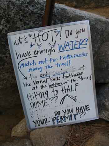
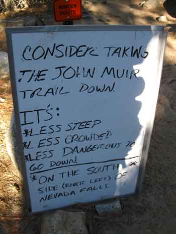
Posted on the Little Yosemite Valley Sign Warning-Warning The Rangers also have a couple of white boards at the cluster of signs at the upper Mist Trail junction where they post warnings, reminders, and suggestions. The subtext of all their warnings is generally along the lines of, "don't kill or injure yourself, or trash Yosemite."
Tuolumne Meadows to Yosemite Valley
|
Little Yosemite Valley
 |
|||||
Little Yosemite Valley trail sign. Eastbound Backpackers View Left to the JMT Up. Two ways
|
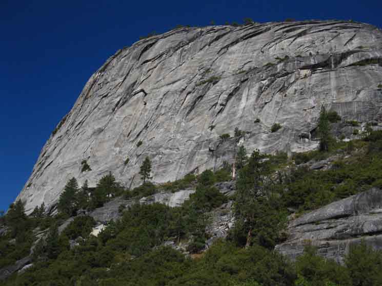
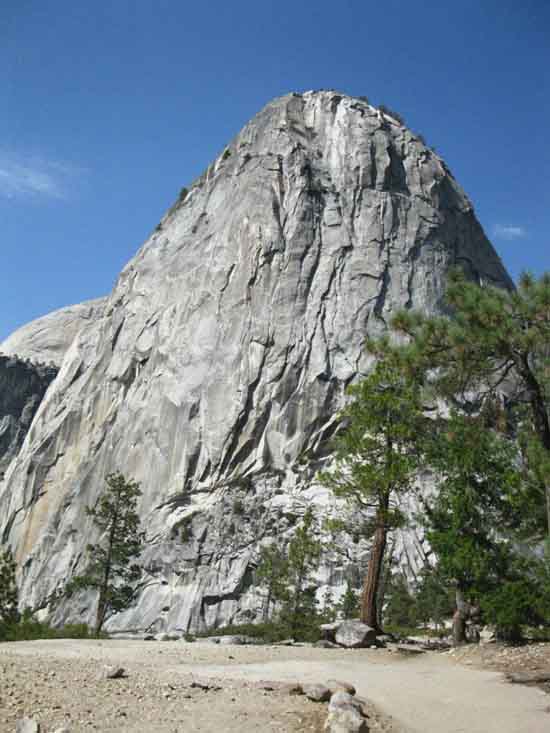
Liberty Cap
 |
||
Exiting Little Yosemite Valley under the watchful presence of Liberty Cap.
|
End of Liberty Cap
 |
||
Looking past the sheer Southeast flank of Liberty Cap out the Western end of Little Yosemite Valley.
|
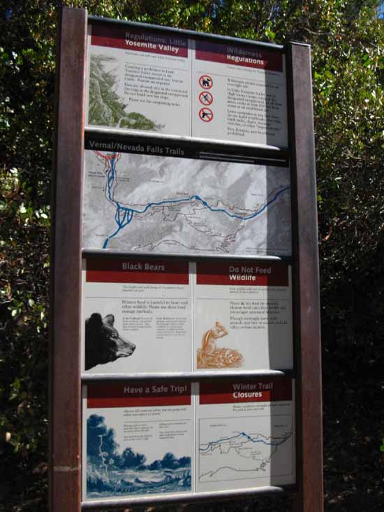
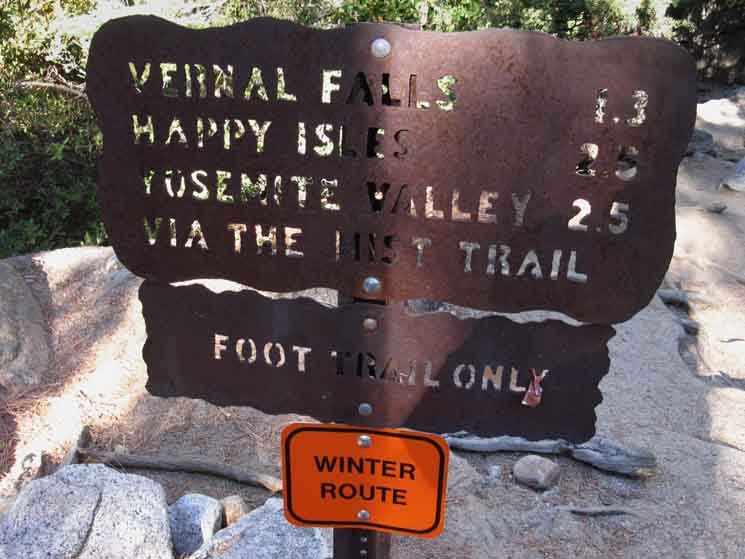
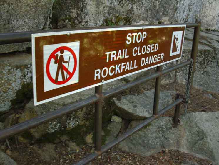
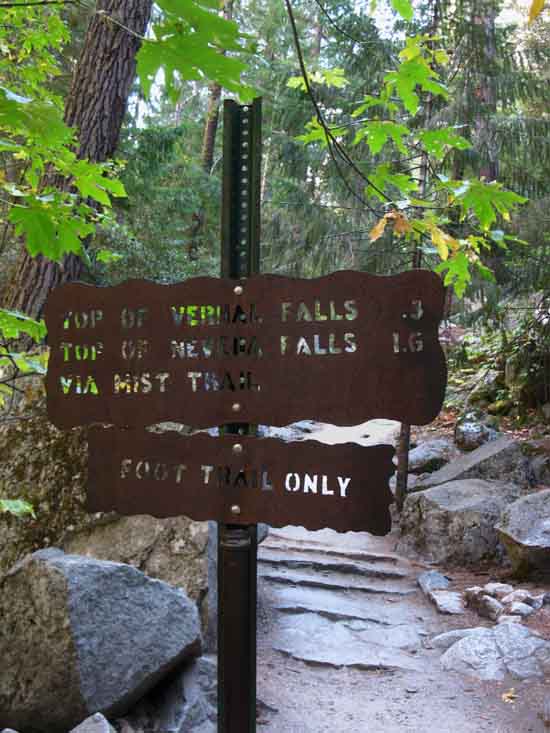
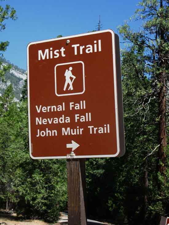
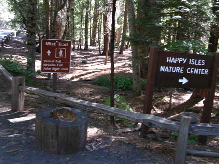
Mist Trail Junction We have a bunch of stuff at this upper Mist Trail Junction. It appears to be the formally designated wilderness boundary, though the maps define that line as crossing the Merced River with the bridge over the falls, a bit to our West. The type of signs Yosemite decorates its wilderness boundaries are located here. There are also our classic steel cut trail signs from the 1950s. There are bathroom facilities. And finally, the point of all this, the junction onto the John Muir Trail off the top of the Mist Trail.
5970 feet 17.76 miles South of Tuolumne Meadows 3.43 miles North of Yosemite Valley
to
Maps and Miles Map
Miles Tuolumne Meadows to Yosemite Valley
|
Yosemite Signs
 |
||
Yosemite Sign Post
|
JMT
Up the River
 |
||
John Muir Trail to Little Yosemite Valley and beyond through the Mist Trail Junction.
Tuolumne Meadows to Yosemite Valley
|
Upriver Rules
 |
||
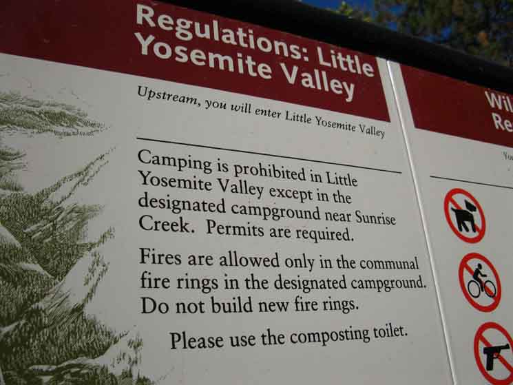
Little Yosemite Valley camping rules posted at the uppermost Mist Trail junction.
|
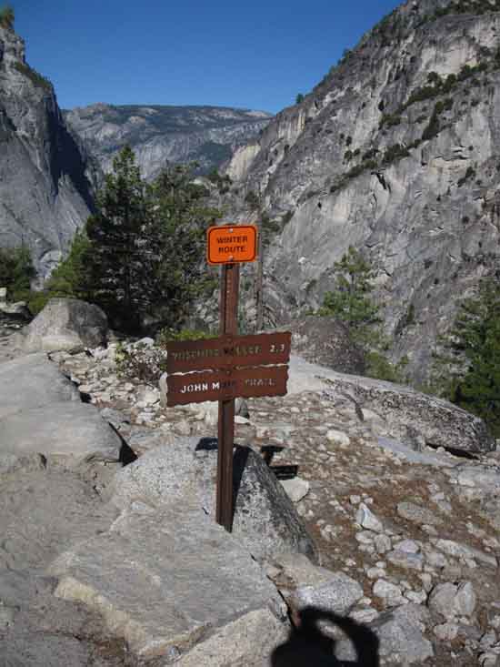
More Destinations
JMT
Up the River
 |
||
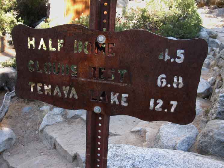
Miles to Clouds Rest, and Tenaya Lake from the upper Mist Trail Junction via the John Muir Trail.
|
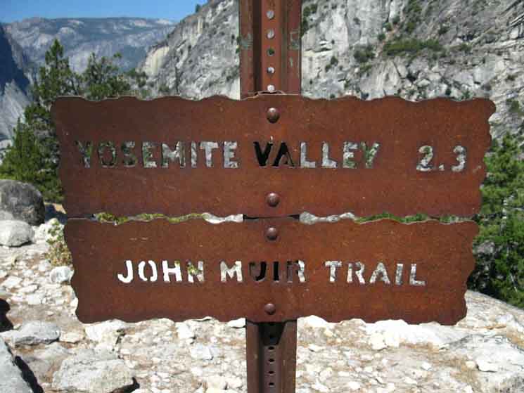
Down the River
John Muir Trail
to
Nevada Falls
 |
||
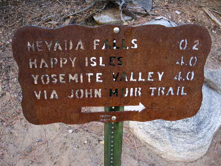
John Muir Trail to Nevada Falls from upper Mist Trail junction.
|
Down the River
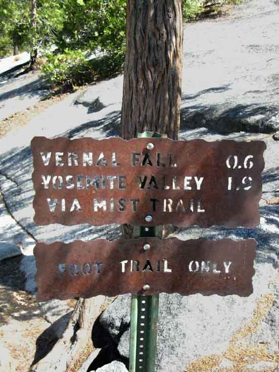
Mist Trail to Vernal Falls
 |
||
The uppermost Mist Trail junction with the John Muir Trail above Nevada Falls at the West End of Little Yosemite Valley.
|
Public Facilities
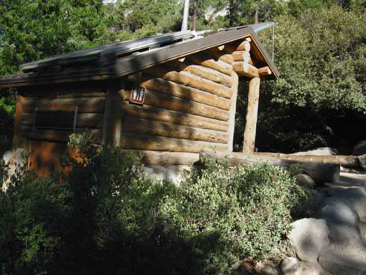 |
||
Lots of people means lots of poop and pee, requiring sufficient infrastructure.
|
Ranger
Safety Warnings
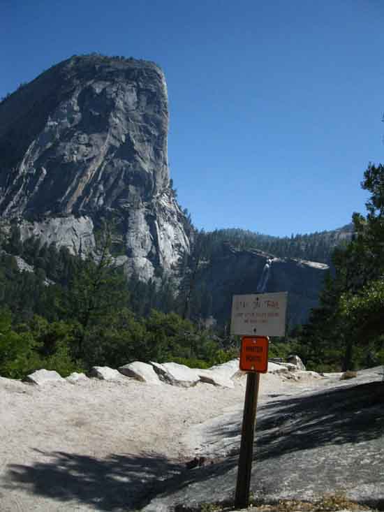
| Heat | Terrain | ||
 |
 |
||
Messages.
|
|||
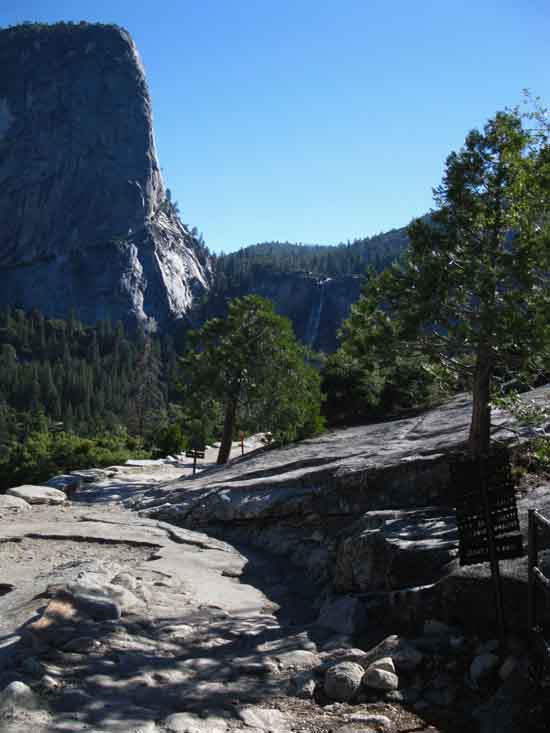
West .14 Only a short hike separates us from Nevada Falls, but one that gives us a look down the final run of the Merced River below Nevada Falls to where it takes a placid course across the Yosemite Valley floor. Unless it's one of those Springs...
|
 |
||
Trail to Nevada Falls from Mist Trail Junction.
|
The Top of the Bottom of the Merced Canyon
 |
||
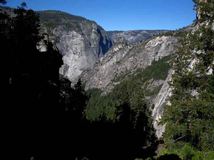
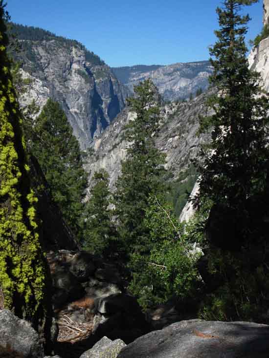
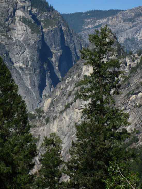
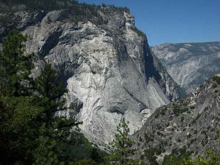
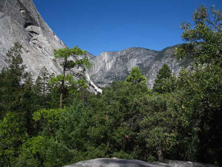
Getting a glimpse down the lowest length of the Merced Canyon below Nevada Falls and the rim of Yosemite Valley beyond. Not that we can see into the bottoms of these sheer canyons. Glacier Point beyond Grizzly Peak from above Nevada Falls on the John Muir Trail.
|
Glacier Point
 |
||
Looking into top of Yosemite Valley across Glacier Point from just above Nevada Falls.
|
Glacier Point Cliffs
 |
||
Cliff faces below Glacier Point. There is a hole down there, a great granite hole. The top of this great granite hole before us reaches for the Sierra Crest, for the Stars, and deep into the spirit of Man. The views through Yosemite's Granites frame eternity. The bottom of this great granite hole has its foundations festooned with the accoutrements reflecting our contemporary status as a society and our understanding of the use and role of Nature.
|
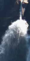
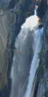
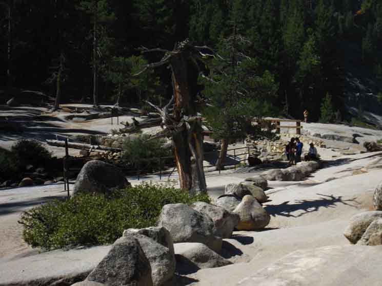
Nevada Falls
5930 feet 19.09 miles South of Tuolumne Meadows 2.71 miles North of Yosemite Valley
to
Maps and Miles Map
Miles Tuolumne Meadows to Yosemite Valley
|
 |
||
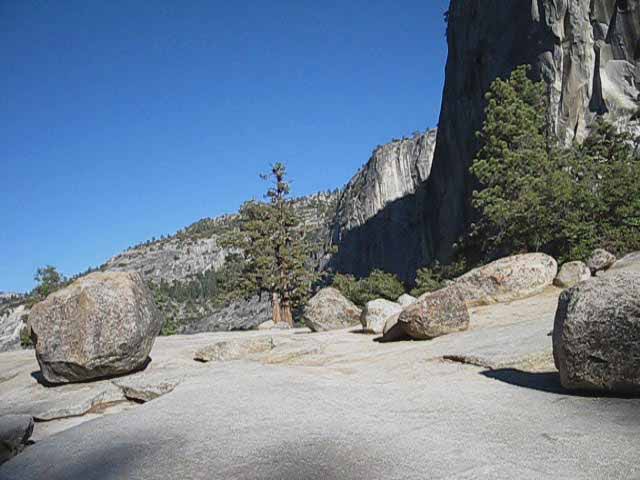
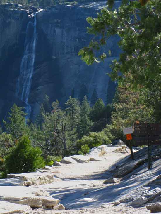
Across the great granite flat where Merced River becomes Nevada Falls.
|
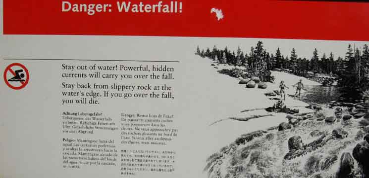 |
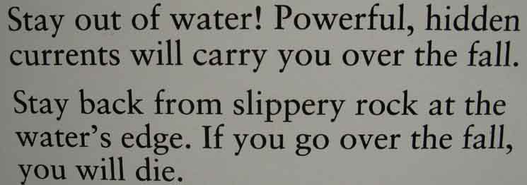
||
Water safety warning sign at Nevada Falls.
|
Text
 |
||
You will die if you go over Nevada Falls, says the sign. Sounds correct. Let's do the graphical representation, just to be sure.
|
Graphical Representation
"Dad takes the Big Dive"
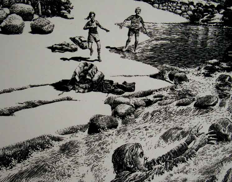 |
||
Just in case you did not get the message, in five languages on the sign above, Yosemite provides us with a gripping graphic called, Don't try this at home, at Yosemite, or at your local watering hole. OK, is it just me, or is the little boy laughing? Was dad pushed?
|
Black and Blue
Bird Life
Black
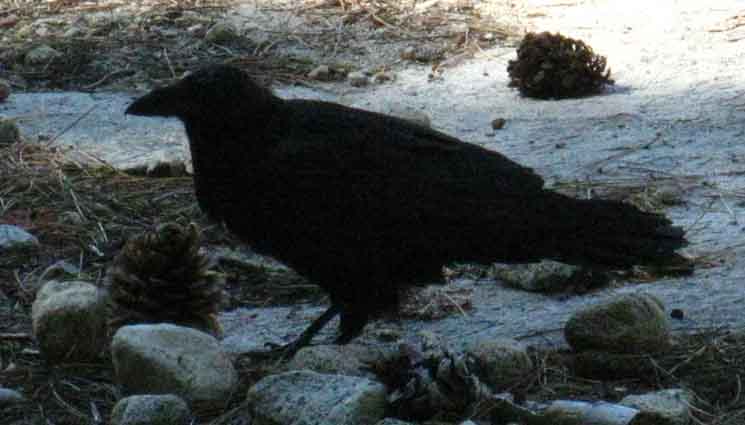 |
||||
Crow.
|
Blue
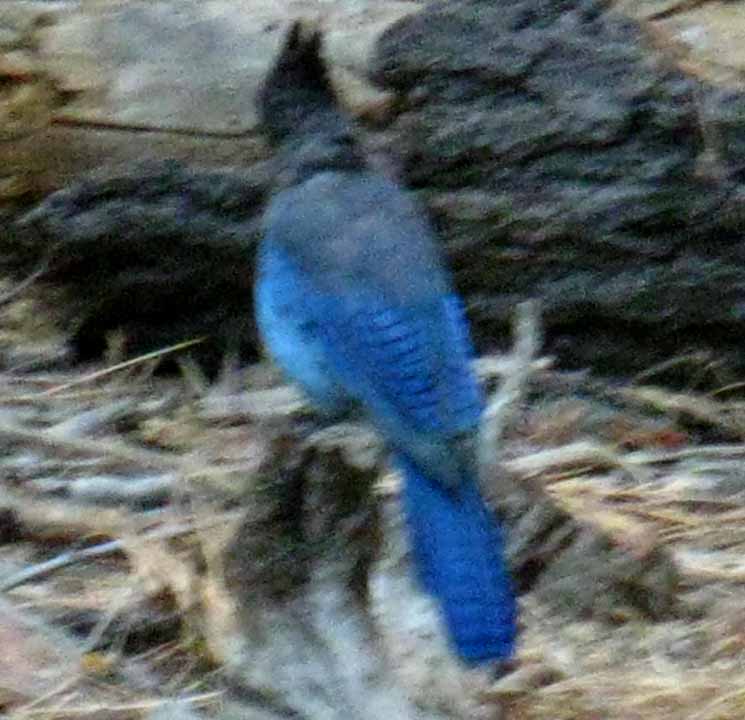 |
||
I enjoy watching the black and blue birds in the Sierra. They are always into something, doing something, after something. Food, fun, and ..., well, they are both curious birds. The crows seem to have more "gravity" than the jays, in that the crows seem to have a broader perspective on the activities surrounding them, while the jays are more one-dimensional.
|
Nevada Falls Bridge
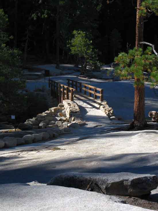 |
||
Nevada Falls Bridge.
|
Profile
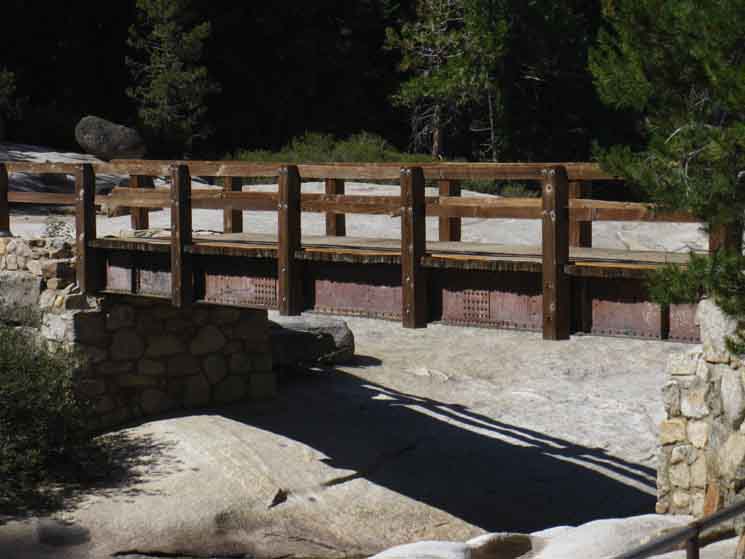 |
||
Length of the bridge across the Merced River above Nevada Falls.
|
Upriver
 |
||
Placid pool upstream from the bridge over Nevada Falls.
|
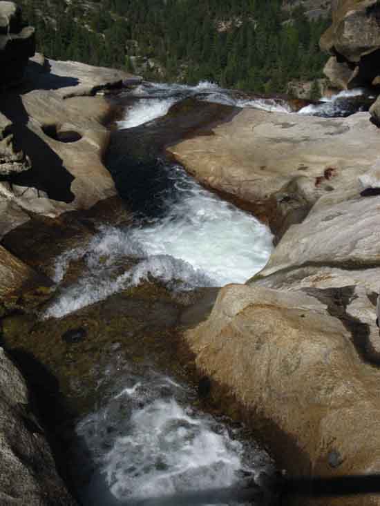
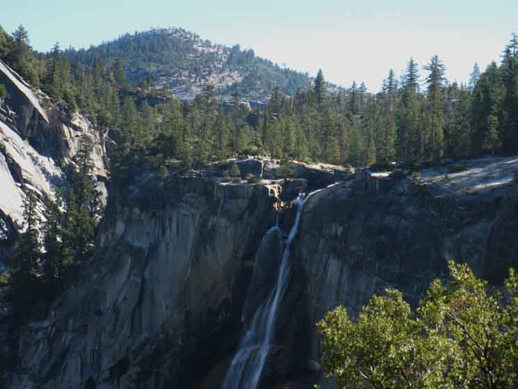
Nevada Falls
Flies Into Being
 |
||
Merced River making its final transformation into Nevada Falls.
|
Western Faces of Broderick and the Lib Cap
 |
||
Liberty Cap and Mount Broderick from Nevada Falls. There's a great granite flat where the river approaches the edge of the precipice, perfect for fine views of the surrounding landmarks, such as to our North, looking across the West faces of these two distinctive peaks.
|
Liberty Cap
 |
||
Liberty Cap rising above North bank of Merced River at Nevada Falls.
|
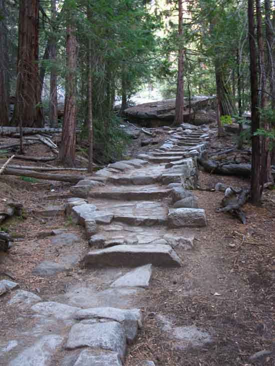
South We climb a finely crafted staircase.
|
Up Up and Away
 |
||
Armored trail rises South from the Nevada Falls Bridge.
|
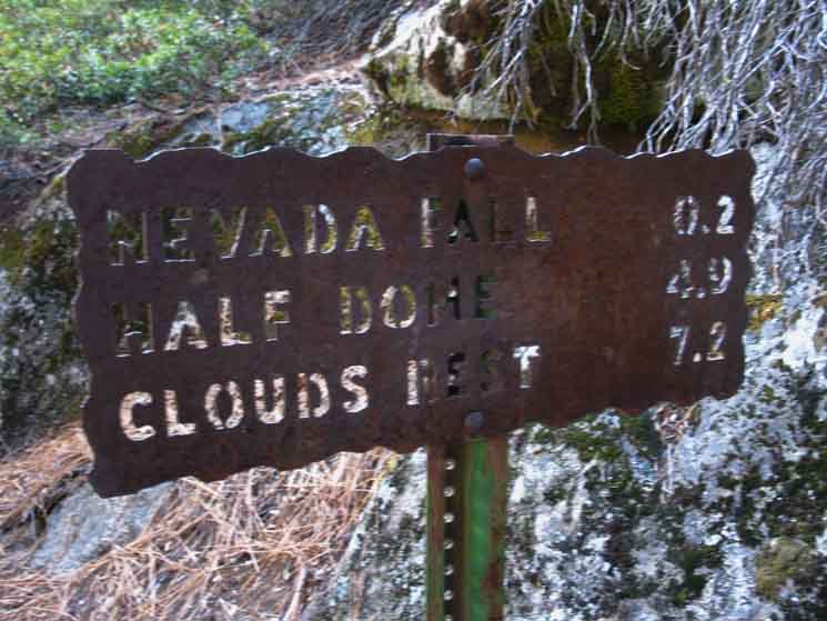
Illilouette Fall Trail Junction
6000 feet 19.29 miles South of Tuolumne Meadows 2.51 miles North of Yosemite Valley
to
Maps and Miles Map
& Guide Page Resources
Miles Tuolumne Meadows to Yosemite Valley
|
 |
||
Illilouette Fall and Glacier Point trail junction Two tenths of a mile South of Nevada Falls.
|
Trail to the Top
of the
Yosemite Valley Rim
 |
||
Trail turning South of the John Muir Trail up to the top of the rim of the canyon to get access to Glacier Point and Illilouette Fall .2 of a mile South of Nevada Falls along the John Muir Trail.
|
Illilouette Fall & Glacier Point
Junction Miles
 |
||
Illilouette Fall and Glacier Point trail junction Illilouette Fall and Glacier Point are destinations on or above the rim of Yosemite Valley, while the other destinations reference on the sign above are accessing the South and Southeast Yosemite Wilderness.
Central & South Yosemite Hiking Map
|
 |
||
Illilouette and Glacier Point trail up to the rim of Yosemite Valley from our position on the John Muir Trail. We are just a bit to the South of Nevada Falls below Nevada Falls, as indicated by the sign above. Well, maybe not actually from below Nevada Falls, as our first steps of our final segment of the John Muir Trail into Yosemite Valley are a brief, low climb to the elevation of the rocky cleft cut into the cliff side serving as the first place we get views of the whole length of Nevada Fall and a true view of the scale of the formations leading up to, and surrounding the waterfall.
|
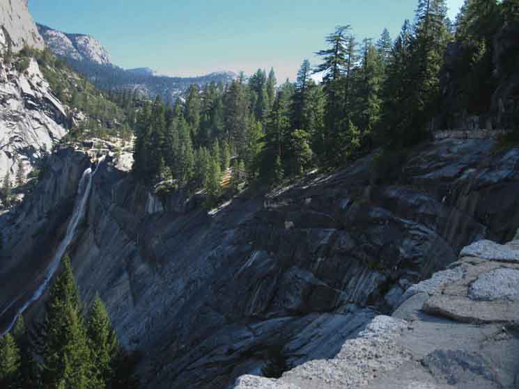
Classic Route Trail Junction After climbing over the shoulder to the South of Nevada Falls past the Glacier Point trail junction we now hike out onto the first and highest of two long traverses along the edge of the upper canyon down to Clarks Point. This first long traverse offers grand views up and down the Merced's Canyon from Nevada Falls to Yosemite Valley, and sweeping views of the surrounding terrain and landmarks. That would be the difference between the Mist Trail and the John Muir Trail. The Mist Trail is in the terrain, submerged in the jumble, grandeur, and misting sprays of the Mist Trail while the John Muir Trail floats above both the chaotic and the grand, taking it all in from above. Well, I'm floating as long as I'm descending. Descend the John Muir Trail like a butterfly, climb it like a bee, to paraphrase old Ali.
|
Sweet JMT
 |
||
Sweet bit of the John Muir Trail as we get onto the cliff side.
|
Upper Gate
 |
|||||
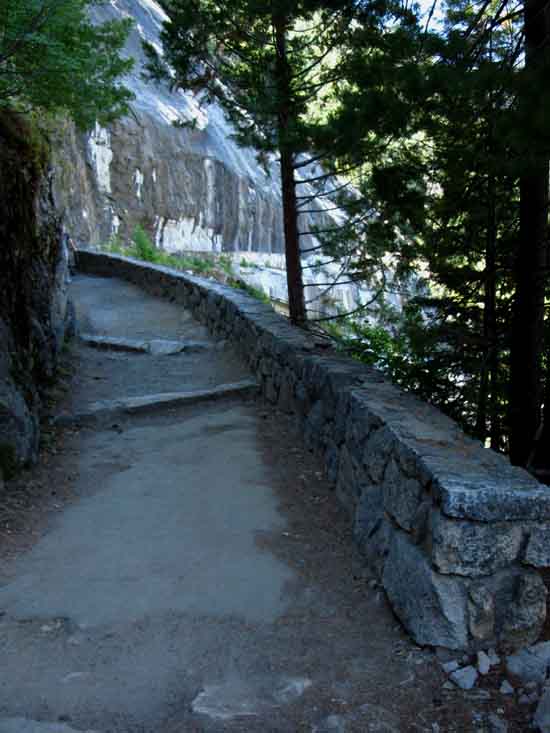
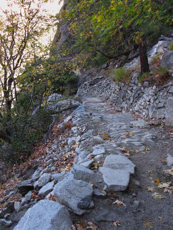
Note the broken lip of the old asphalt path. We have seen a trail bed sufficient to support an asphalt path all the way up to the Half Dome trail junction along the John Muir Trail. We noted the change in the character of trail when we dropped into the Half Dome junction on our way down the JMT. The trail became big, wide, flat, and well-compressed. Miles and Elevations We find the gate a short distance beyond Illilouette and Glacier Point trail We can see ahead a fantastic length of trail cut into the face of the cliff bending South-Southwest from Nevada Falls.
|
Upper Gate
 |
||
Highest gate along the John Muir Trail in Yosemite National Park.
|
Walk in the Park
 |
||
I call this the "Walk in the Park" segment of trail because we step onto an old asphalt surface along a fine wall that gives the feeling of a tamed, cultivated environment. We soon see that an environment made accessible is far from tamed. Though enmeshed within great tentacles of resource extraction around the world, and by chains of trails across the Sierra, the power of Nature is by no means or manner tamed, constrained, or controlled. Far from it. What we have with our trails are "at your own risk" lines of observation and travel subject to disruptions of route and access by the constant movements of Nature.
|
The Dominant Dome
 |
||
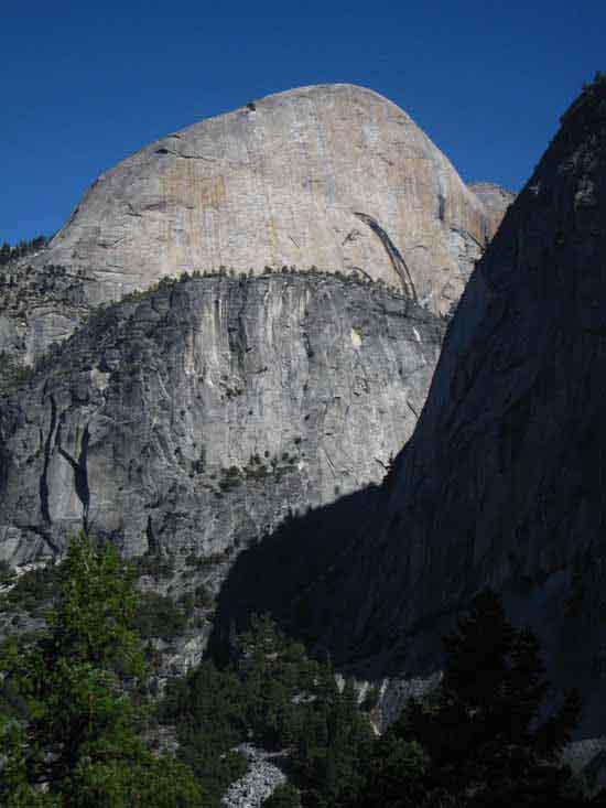
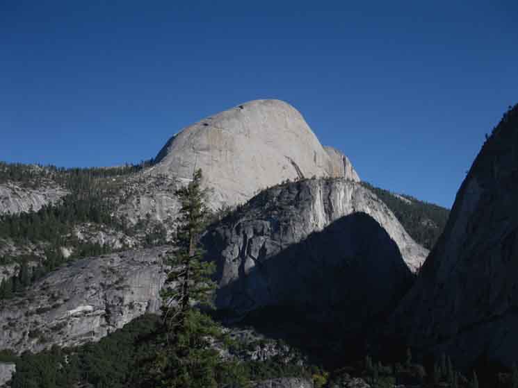
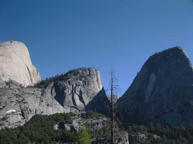
Liberty Cap in shadow with Half Dome towering over the other flank of Mount Broderick.
|
Guardian of Great Terrain
 |
||
Nevada Falls under Liberty Cap and Rising Sun.
|
Hard Rock
Guardians of Great Terrain
 |
||
Shifting perspective of alignment of Half Dome, Mount Broderick, and Liberty Cap.
|
The Big W
 |
||
Half Dome, Mount Broderick, and Liberty Cap from the John Muir Trail. Once buried treasures accessible for investigation. We can see the Southeastern shoulder of Clouds Rest granite in the distance through the space between Mount Broderick and Liberty Cap. We can see it better in the image below, and then the Southern horn of the Clouds Rest Crestline further below.
|
Looking Back
 |
||
Nevada Falls from the South. Viewpoint The great bulging shoulder of granite we see in the distance beyond the flank of Liberty Cap must be the Southeastern bulk of the great Southern Spur of the Clouds Rest Massif. In the distance beyond the Southeastern Spur of Clouds Rest we see the Sunrise Mountains descending off the Northeastern heights of Clouds Rest. Our route following the John Muir Trail down from Tuolumne Meadows came across the Southeast flank of Sunrise Mountains (their Right side from the perspective above) and around the base of that bad-boy block of granite in the middle-distance composing the South-Southeast flank of Clouds Rest. Our route on the JMT came around the base of that. Alternative Route
|
Nevada Fall
 |
||
Nevada Falls in morning shadows and light.
|
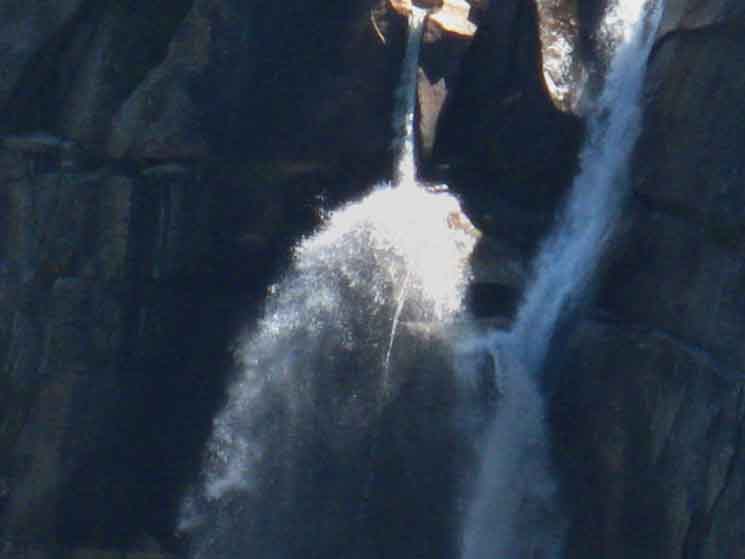
Top of Nevada Falls
 |
||
Detail of upper Nevada Falls.
|
Clouds Rest Massif
Beyond the
Triplets
 |
||
The South end of the upper ridge composing Clouds Rest visible between Mount Broderick and Liberty Cap, with Half Dome towering above. That's the Southern end of the Clouds Rest Massif visible in the distance, where the trail climbs up to Clouds Rest from the junction above the Half Dome trail junction.
|
Group of Cool Kids
 |
||
Met this cool group of kids on an aggressive day hike up to Nevada Falls from Yosemite Valley. They were real good folks, having a blast working themselves up higher and higher into Yosemite's beauties. They were well-prepped for the work, and really enjoying the pleasures of hiking.
|
Clarks Point Grand Vista
5490 feet 20.22 miles South of Tuolumne Meadows .88 miles North of Yosemite Valley
to
Maps and Miles Map
Miles Tuolumne Meadows to Yosemite Valley
|
View from Clark Point
 |
||
Dropping down onto the great exposed flat composing Clark Point, well, really a great set of tilted slabs offering unencumbered views up and down this lowest segment of the Merced Canyon just above Yosemite Valley. We also find the middle link to Mist Trail here, down to intersect with the middle of the Mist Trail above Emerald Pool. We are about halfway from the start point of the Mist Trail just above the Merced Bridge and its end point above Nevada Falls. The image above is of us stepping past the sign for the mile sign for hikers up the John Muir Trail. We can see the trail North down to the Mist Trail ahead to our Right, which is East by the compass. Beyond the trail junction we can see the wavering white line of Nevada Falls snaking its way down the cliff face, with Liberty Cap rising above. Our John Muir Trail continuing down to Happy Isles bends Left, West, here. But first we are going to walk down and check out the miles to the Mist Trail reported on the Clark Point miles sign.
|
To the Mist Trail
 |
||
Nevada Falls behind Clark Point trail to Emerald Pool along Mist Trail.
|
Mist Trail from Clark Point
Yosemite Trail Miles Sign
 |
||
Miles to Mist Trail from Clark Point.
|
Down
Mist Trail Connection
 |
||
Ample trail down to Mist Trail from Clark Point.
|
Down
JMT
 |
||
Clarks Point down John Muir Trail to Happy Isles Trailhead.
|
JMT Miles
 |
||
Clark Point to Happy Isles miles sign.
|
JMT to
Nevada Falls
 |
||||||
Clark Point miles North on John Muir Trail. Steel SignMiles
Miles and Elevations
|
Japanese Climbing Machines
 |
|||||
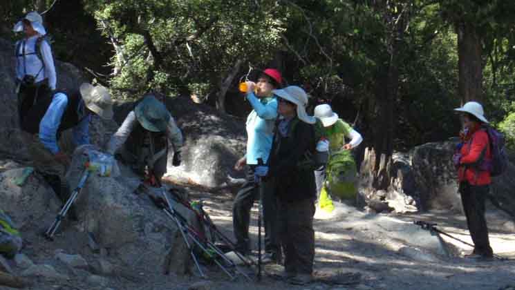
Old Jap women climbing to Nevada Falls with military precision and discipline. I could relate with these tough old birds and their very determined approach to loving Nature through direct engagement. I felt I was watching something very fundamental about the Jap character. It was a group assault, they were equipped with walki-talkies, and seemed to be divided into fitness levels, and monitoring individual and group progress. Everyone had every possible square inch (mm?) of their skin covered. The ladies were very stern, but nice as I encountered them as I was going down mountain, and they up. The majority were observing as they climbed, tending towards good mountain practices while working hard. It was clear most were long time hikers who took their big-climbing hikes very seriously, and were in fact expressing specific values as they were working their way up the canyon. I figure I moved thorough a tour-bull full, or two... Some of them were not much bigger than my pack, and not much heavier. I know size, sex, and age does not measure grit. These girls had some grit. They all look like they outlived their old men. I can see why. Go, Girls, Go!
|
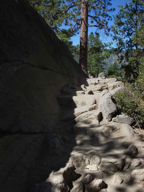
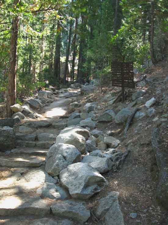
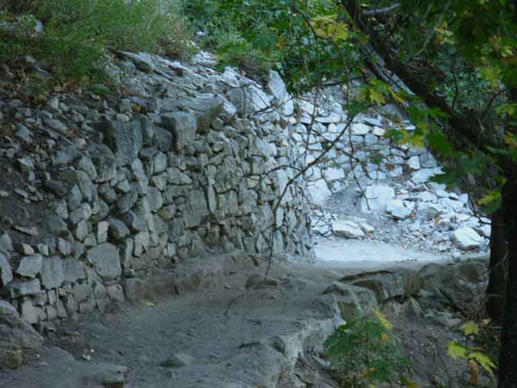
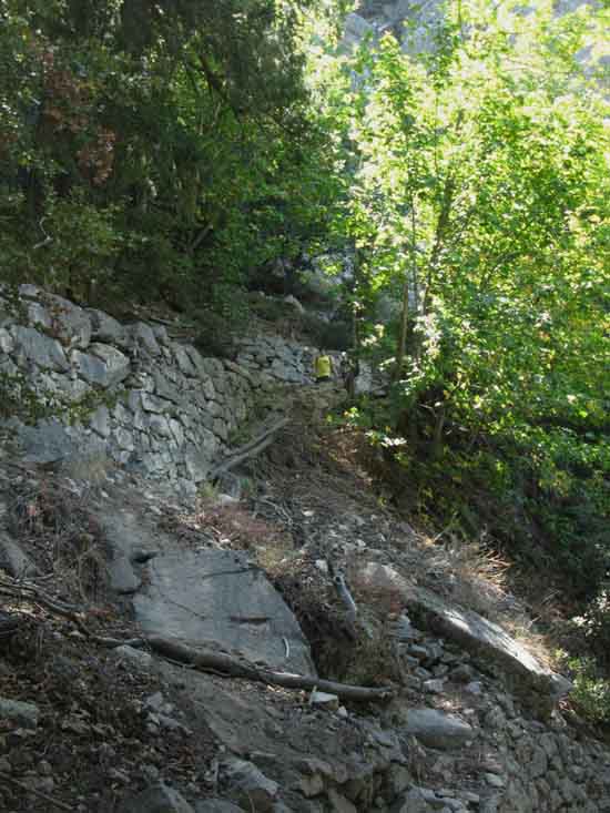
Clarks Point We now descend into an amazing example of trail engineering and construction where the John Muir Trail descends below solid high elevation trails on hard granite rock. We are descending into a steep, densely forested transition zone of thin soils and broken rock below the hard granite. This precipitous transition zone blocks easy access from the high hard rock trail along the upper valley wall to the soft flat trails on the floor of Yosemite Valley. The builders of the John Muir Trail solved this problem by stacking up a huge tower of granite blocks up along the mountainside, where they could not cut them into the mountainside itself, creating their own self-stacked switchbacking trail climbing through the steep unstable zone above our lowest bridge over the Merced River up to the hard rock approaching Clark Point. This is a fine example of physical ingenuity, masonry, and decades of hard working trail crews. This bit of trail is comparable with the Golden Staircase on Palisade Creek to our South. Except for their elevations and degrees of isolation. GC is higher and a much more isolated location.
History of Muir and the John Muir Trail
|
Long View above Forest and Terrain
 |
||
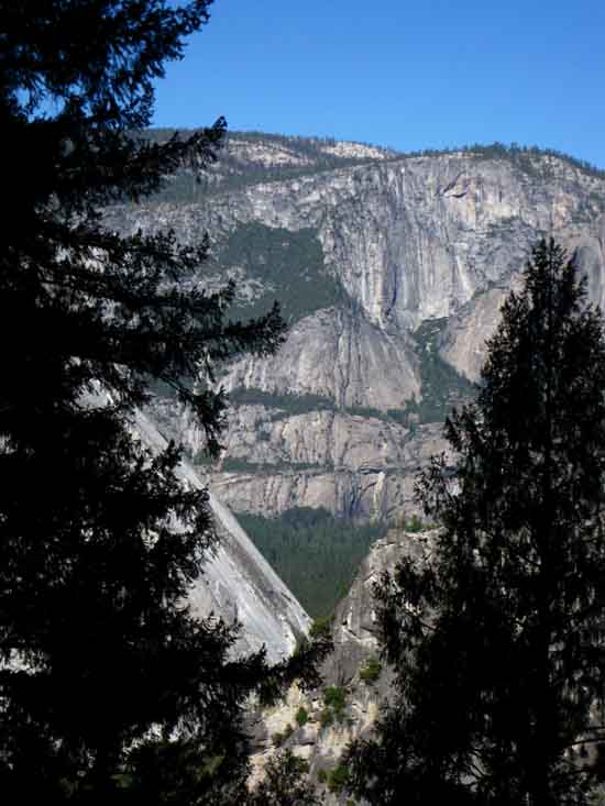
Last long view as we drop under terrain and forest cover for a while. Colombia Rock beyond Glacier Point, with the terrain in the distant background running up the West Valley Wall towards Yosemite Falls.
|
View West Opens
 |
||
Looking across Yosemite Valley at Yosemite Falls Trail from Clark Point on the John Muir Trail. I figure that Yosemite Falls are just out of the Right edge of the image, where we can see a bit of the Falls Trail climbing to get above it.
|
Entering the Switchbacks
below
Clark Point
 |
||
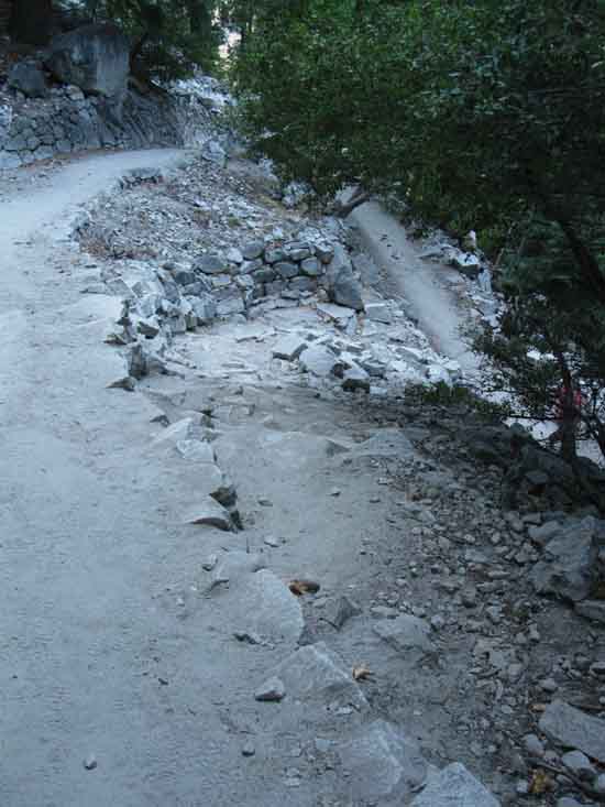
Entering the top of the switchbacks below Clark Point.
|
Built Up Switchbacks
 |
||
Switchbacks below Clark Point to the lowest Mist Trail junction.
|
Down We Go
 |
||
Switchbacks down to Happy Isles Trailhead from Clark Point.
|
Layers, or Levels of Switchbacks
 |
||
Extensive switchbacks from the middle Mist Trail junction to the lowest Mist Trail junction. Though extensive, unrelenting, and moderately steep, these switchbacks are well shaded by dense aspens.
|
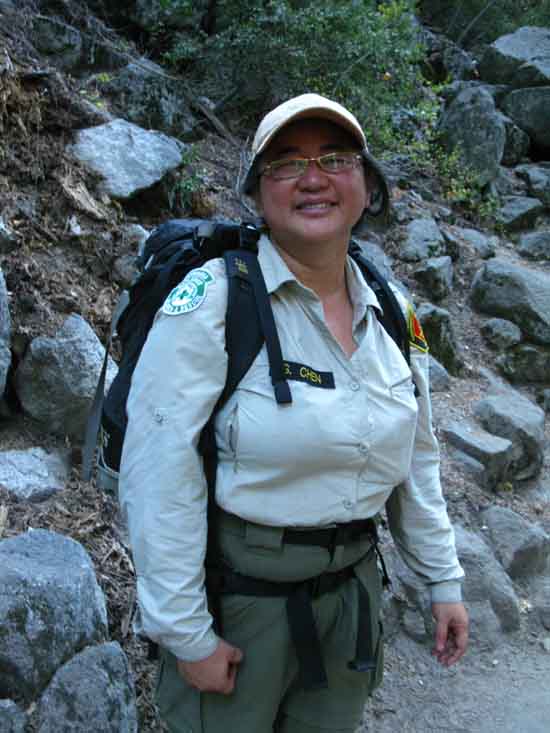
Yos Vol
 |
||
G. Chen, Yosemite Search and Rescue Volunteer. She was out looking querying backpackers about a mom and son hiking team out of Tuolumne Meadows who had not finished on time. Having just walked down from Tuolumne Meadows made Gloria question me about seeing the missing team. I had not.
|
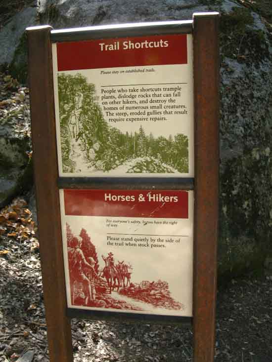
Rules and Practices
 |
||
Shortcut trails and horse traffic.
|
Top of the Horse Trail
 |
||
Horse Trail junction. Junction of the Horse Trail with the John Muir Trail.
|
Up the JMT
 |
||
Horse Trail junction miles.
|
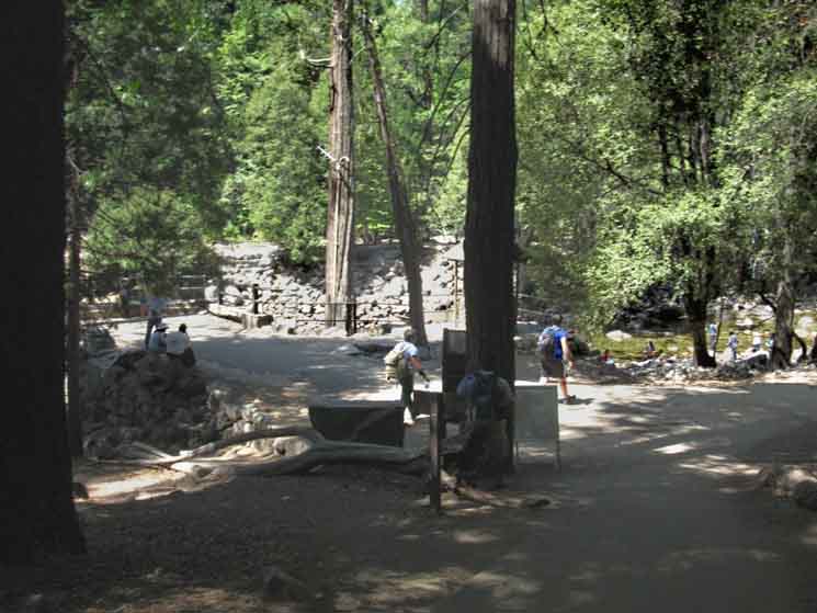
Lowest Mist Trail Junction Merced River Bridge The lowest junction leading onto the Mist Trail sits a very short distance to the East above the Merced River Bridge. Here much of the day hiking tourist crowd relieves overcrowding on the John Muir Trail by shifting it onto Mist Trail. This is good for hikers on the John Muir Trail, but not so good for the Mist Trail. In our direction, hiking West to and out of the Happy Isles Trailhead, we experience a "wash." The number of oncoming tourists turning off the JMT onto the Mist Trail is roughly equal to the number returning to the JMT from the Mist Trail. Such are the balances of life. We will experience the full level of traffic for the day of the week and the time of the year once we hit the lowest junction of the Mist Trail with the John Muir Trail. For example, the day-hiker-tourist foot traffic from Happy Isles to the Mist Trail junction is crazy during Summer Weekends in July. Day hikers are literally bouncing off fully-loaded backpackers like drunk blackbirds bouncing off my front window in Spring.
4590 feet 20.95 miles South of Tuolumne Meadows .85 miles North of Yosemite Valley
to
Maps and Miles Map
Miles Tuolumne Meadows to Yosemite Valley
|
Up the John Muir Trail
 |
||
John Muir Trail miles from the Lowest Mist Trail junction.
|
Up Mist Trail
 |
||
Start of the Mist Trail at the bottom of the John Muir Trail.
|
Down the JMT
 |
||
Distance from trailhead to start of Mist Trail.
|
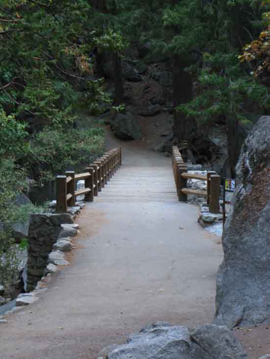
Merced River Bridge
 |
||
Merced River Bridge on the John Muir Trail.
|
Full Fresh Water
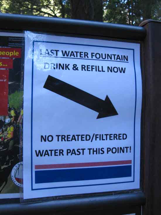 |
||
Last Tourist Water.
|
Last Tourist Water
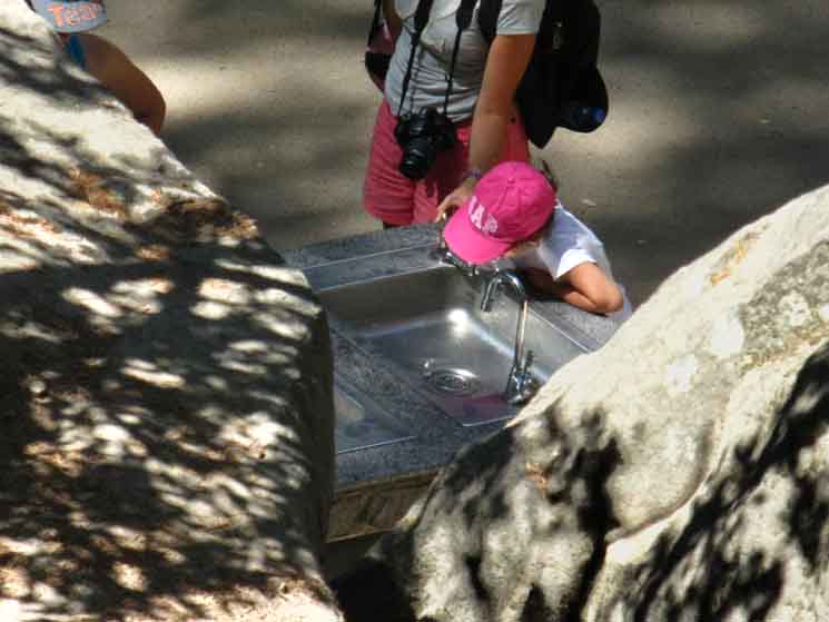 |
||
Last Tourist Water. From here up the trail we must treat water.
|
View East
 |
||
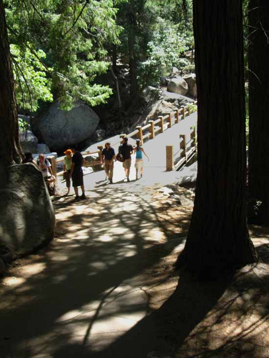
Hiking over the bridge we make one last little climb before arriving at Happy Isles Trailhead.
|
John Muir Supertrail
 |
||
We have a little climb after crossing the bridge towards Happy Isles.
|
Wide and Paved
 |
||
Wide paved trail.
|
Last Long View
from
The John Muir Trail
 |
||
At the top of our little climb from the Merced River Bridge to Happy Isles we got one last long view before formally walking through the John Muir Trailhead at Happy Isles into Yosemite Valley. Royal Arches on far Right, Indian Canyon receding in the middle of the wall, then Yosemite Point descending towards the slot Yosemite Falls falls through. To the Left we see the bottom of the sheer wall below Glacier Point.
|
John Muir Trailhead Happy Isles Trailhead 4590 feet 21.8 miles South of Tuolumne Meadows 0.0 miles North of Yosemite Valley
to
Maps and Miles Map
Miles Tuolumne Meadows to Yosemite Valley
|
 |
||
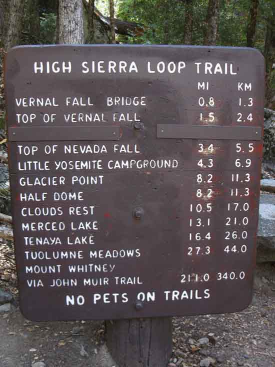
High Sierra Loop Trail miles sign at Happy Isles Trailhead.
|
Happy Isles
 |
||
Happy Isles along the Merced River, Yosemite.
|
To Surface Transportation Happy Isles
|
 |
||
To John Muir Trailhead, and shuttle bus.
|
To the Happy Isles Yosemite Shuttle Stop
 |
||
Across Happy Isles Bridge to Shuttle Bus stop.
|
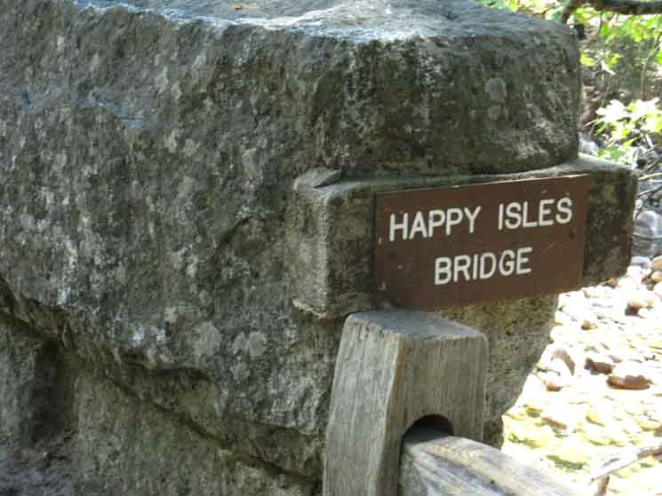
Across the Happy Isles Bridge
 |
||
Crossing the Happy Isles Bridge. Green, "...the Happy Isles Bridge built in 1929,..."
|
At the Happy Isles
Shuttle Stop
 |
||
Happy Isles Nature Center by the Shuttle Stop.
|
Happy Isles
Yosemite Valley Shuttle Stop
 |
||
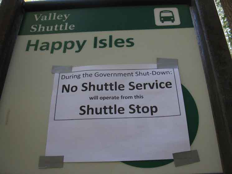
Happy Isles Yosemite Valley Shuttle Stop. Yes, I hiked through Yosemite approaching and into the government shutdown of 2013. This resulted in the backcountry, Tuolumne Meadows, the trails, and The Valley all being virtually devoid of people, let alone crowds. The flip side was I found little in resources to nourish me once I exited the John Muir Trail through the Happy Isles Trailhead into The Valley. No shuttles, no hot food, and I got to one of the stores for some food just before the shutdown forced their closure. It was surreal to see Yosemite Valley naked and natural, without its typical dense human population. I found it interesting that the quiet made me think that the "true" biggest feature in the Valley were the humans surging through it. But that fact was not readily apparent until the humans were absent, and Nature could reassert itself.
|
| Next
Re-Crossing UP UP, and Away, But before climbing out of the Valley back to the JMT via Merced Lake,
On the next guide page we hike back through the Happy Isles Trailhead to continue our hike South to Mount Whitney, but we are taking a different route back to the Sierra Crest than the John Muir Trail route we followed down here from Tuolumne Meadows. We will trace out our route back up to Little Yosemite Valley along the John Muir Trail route, but from there we will follow the Merced River East up to Merced Lake. From Merced Lake we will hike up to Vogelsang High Sierra Camp on our way to rejoining the Southbound Muir Trail in Lyell Canyon. Tuolumne Meadows may be the destination for those of us hiking a local backpacking loop around the Central Yosemite Wilderness.
|
North: Sunrise High Sierra Camp South: Yosemite Valley
Backpacking |
The Golden Triangle Yosemite is a large National Park that I break down into North, Central, and South regions for the convenience of the Long Distance Backpacker. We hike into the most Northwestern region of Yosemite through Bond or Dorothy Lake Passes on the Tahoe to Yosemite and Pacific Crest Trails, respectively. To our East-Southeast are the Hoover Wilderness Trailheads, to our South lays the Grand Canyon of the Tuolumne River. Hiking through the North Yosemite Backcountry we arrive at roughly the center of the Sierra Nevada Mountain Range hiking into Tuolumne Meadows. Here the end of our hike along the Tahoe to Yosemite Trail is supplanted by the John Muir Trail heading South along the Sierra Crest from Tuolumne Meadows. Since I consider everything South of Tuolumne Meadow to be the South Sierra, our explorations of the center of Yosemite will be quite limited. Unless we take an alternative route that will run us down to Yosemite Valley along the John Muir Trail and then back up to the JMT 5.6 miles South of Tuolumne Meadows in Lyell Canyon via a different return route.
THIS PAGE IS UNDER CONSTRUCTION: STAY TUNED FOR MUCH MORE!
7.5 Map:
30 min Map
|
Backpacking Trail Guide PCT-TYT North
Sunrise High Sierra Camp
|
 |
Backpacking Trail Guide JMT Little
|
Backpacker ForumsHave a great trip or story to relate about Yosemite or in the Sierra Nevada? Post it on Above we come to the Front Page of the High Backpacking Trails and Topics Forums. Below we break the forums down into categories:
The Trails Forum acts as your place to put up input, comments, relate your experiences, or ask questions about each segment and spot along the length of our combined TYT-PCT-JMT trails. The Forum is your place to supplement the trail guide. Anyone can post text comments in the existing forums, but only members can post up new topics, along with images, maps, and formatting. If you have experiences, comments, questions, or pictures and videos of the Pacific Crest Trail between Sonora Pass and Tuolumne Meadows, post up here as an unknown hiker or as a member: Forum Section
|
Trailhead
Contact
Alex Wierbinski

Backpacking Lake Tahoe to Mount Whitney
Your Guide to the High Sierra Crest, including the Tahoe to Yosemite, Pacific Crest, and John Muir Trails
