The Trails
Guide
Maps
Miles/Ele
Permits
Resupply
Forum
Current Weather Conditions
Weather Notes
Northern High Sierras
Central High Sierras
Southern High Sierras
Gear
Gear List
Gettin Started
Layering
Discussion
Testing yourself and your gear
Gear Reviews
Trail Segment
Little Yosemite Valley
to
Merced Lake
Section
Yosemite Valley to John Muir Trail in Lyell Canyon via Vogelsang
BACKPACKING
YOSEMITE NATIONAL PARK
Section Hiking
Yosemite Valley
to
Lyell Canyon
via
Vogelsang
Languages
Languages
Trail Arts
The art of walking
Physical Preperation
Trail Skills
The trail
Off the trail
Scrambling
Maps
Navigation
Camp skills
Food
Resupply
Food
Other
Photo Catagories
Trail Stories
Trail Culture
News and Science
Links
Groups
Books
Terms and Conditions of Use
| Trail Guide INDEX Yosemite Valley to Lyell Canyon |
Trail Guide JMT WEST LITTLE Yosemite Valley to BIG Yosemite Valley |
Trail Guide |
Trail Guide NORTHEAST Merced Lake to Lyell Canyon |
7.5 Topo Map Central Yosemite Wilderness |
30 min |
MILES Yosemite Valley to Lyell Canyon MILES and ELEVATIONS |
TOPO MAP INDEX Central Yosemite |
Resupply South |
PERMITS National Forests & Parks Toiyabe & Stanislaus & Yosemite |
|
Little Yosemite Valley
to
Merced Lake
High Sierra Camp
Crux Move
South, Eventually Simply stated, I want to miss as few miles along the Sierra Crest as possible, while getting in as many miles along our way down into Yosemite Valley and on our way back to the Sierra Crestline.
Alternative Route back to the John Muir Trail
Back to the
A Good
Always More Trails
Find All Possible Routes
Central & South Yosemite Hiking Map
From our Current Position at
EAST-WEST EAST-WEST
NORTH JMT on the STANDARD ROUTE
YOSEMITE VALLEY to REDS MEADOW
Section Tip
Maps and Miles
Miles Yosemite Valley to Lyell Canyon
Up and Down
1090 foot elevation gain over 8.4 miles
East and North
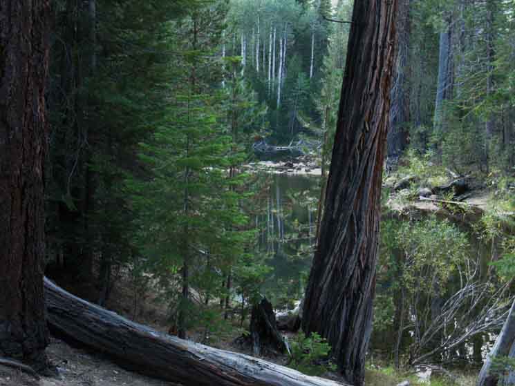
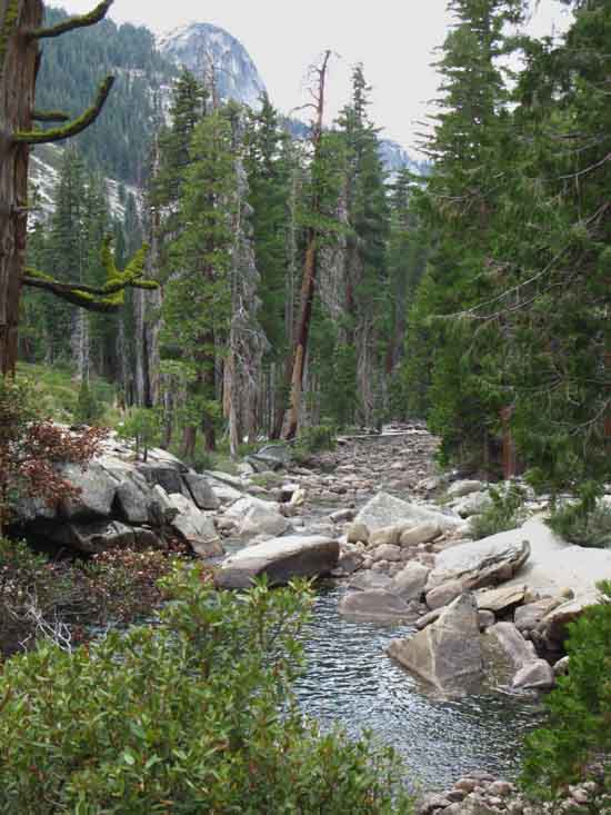
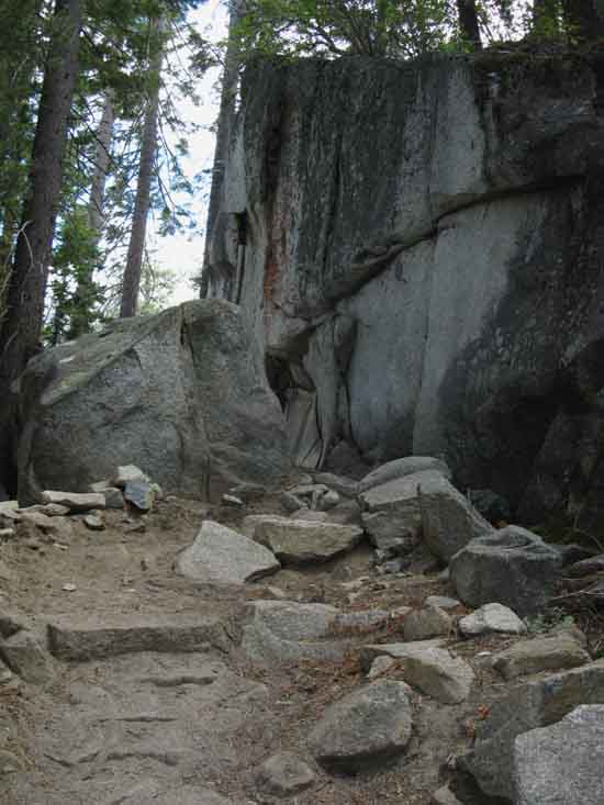
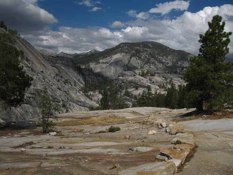
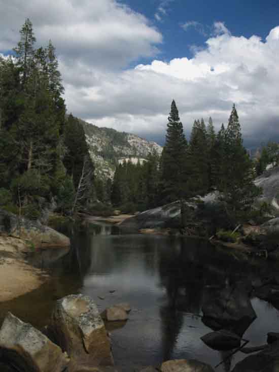
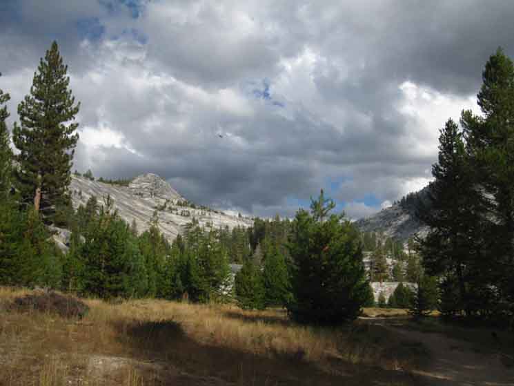
Little Yosemite Valley was one of the early High Sierra Camps.
and Hiker Information
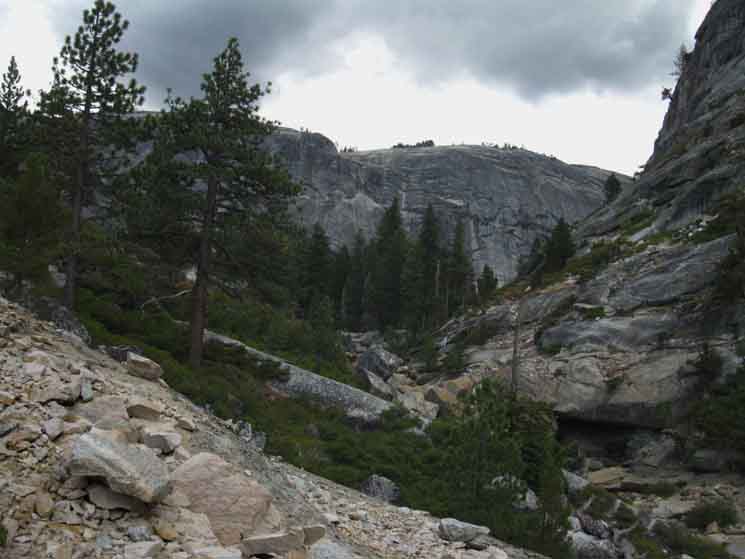
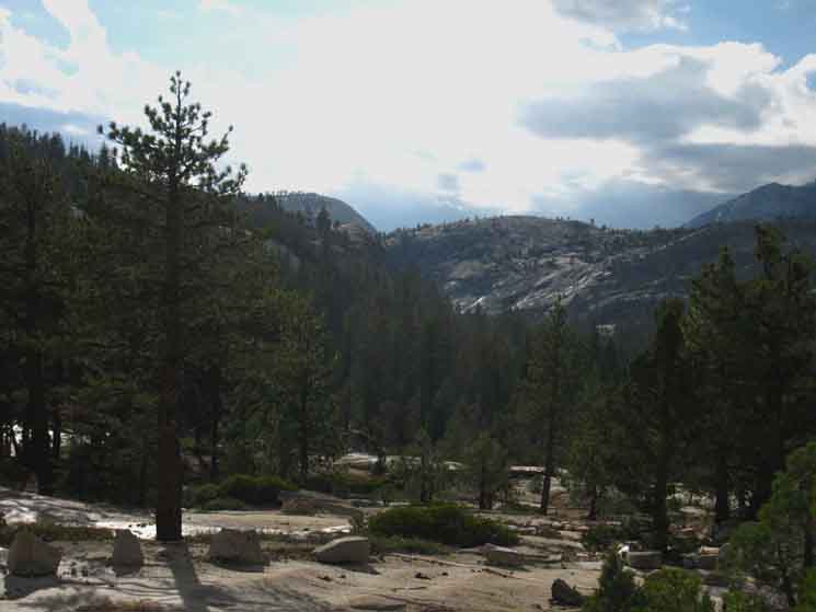
Here at Little Yosemite Valley begins a wide selection of hiking option for local hikers remaining in Yosemite National Park. Our options split off North and East. To the North is one of the busiest, most regulated, and hardest to get hiking permits in the United States, being the route of the John Muir Trail. But, it does not get a whole lot easier to get permits continuing East up the Merced River to our destination in Lyell Canyon. Nor to connect these lines of trail together into local loops. Hiking in Yosemite requires permit planning as much as logistical and physical preparation. Hikers must remember that permits become available for reservations six months in advance of desired dates, and all the reservations for the most desired dates on Yosemite's popular trails are rapidly snapped up. Inspect the Yosemite Permits Page for more information. The High Sierra Backpacking Calendar notes each year's opening of reservations Regardless of permit issues and the popularity of the "named" trails, all of the routes through the Central Yosemite Wilderness have a classic appeal and draw substantial public and backpacker attention, which requires study and sustained attention to obtain desired permit dates. How do I deal with the popularity of Yosemite? I became a four-season backpackers so I would have three seasons of the Sierra to myself. |
|||||||||||||||||||||||||||||||||||||||||||||||||||||||||||||
VIDEO
Little Yosemite Valley
to
Merced Lake
Little Yosemite Valley 8.4 miles in 12:50 minutes. This trail winds its way up the base of the Merced Canyon along the Merced River It's a necklace by and for the Spirit of Life. Backpacking Vidiot
|
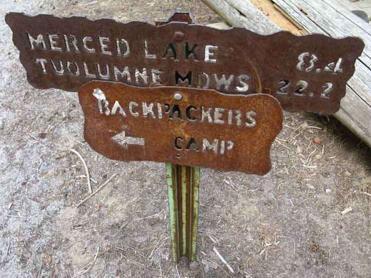
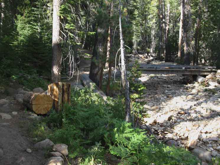
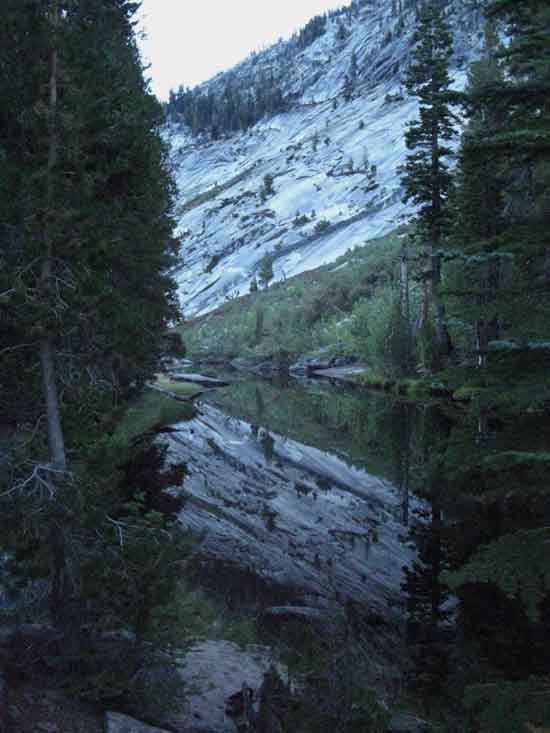
Transitions Up and Down The last time we were at this junction in Little Yosemite Valley was when we were turning down to Yosemite Valley at the end of our hike down the John Muir Trail from Tuolumne Meadows. This time we are continuing up the Merced River hiking out of The Valley, out of the Little Yosemite Valley, out of the Central Yosemite Wilderness, and we will shortly be hiking out of Yosemite National Park as well. We are going to do this using two great canyons divided by the Cathedral Range. On this side of the mountain we are following the Merced River through its fantastic upper granite canyon up between the Southwest flank of the Cathedral Range and the Northeast Flank of the Clarks Range. I make the distinction between the upper section of the canyon Once we get up to Merced Lake we will have the Vogelsang Massif of the Cathedral Range separating us from Lyell Canyon draining the Northeastern flank of the Cathedral Range. Our long gradual ascent East up the Merced River turns steep where we turn North climb out the canyon to get over Vogelsang. Our serious climbing begins from the trail junction at the substantial Merced Lake Ranger Station-cabin. This page below looks at the trail from Little Yosemite Backpackers camp up to the Steele Yosemite Trail Miles Signs at the Merced Lake High Sierra and backpackers camps. |
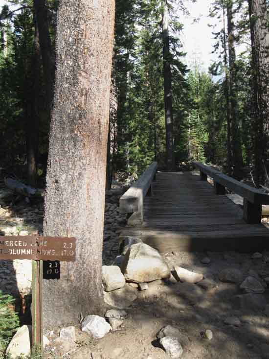
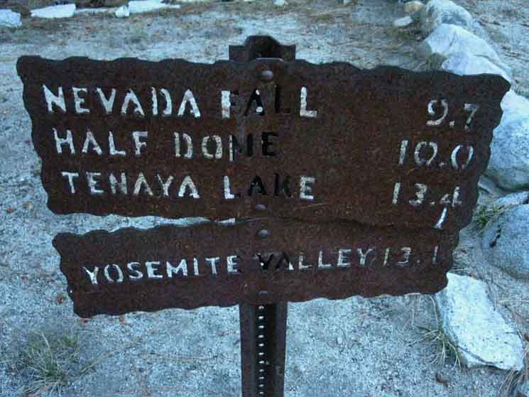
Little Yosemite Valley
Trail Junction
NORTH
|
Sign Below: JMT |
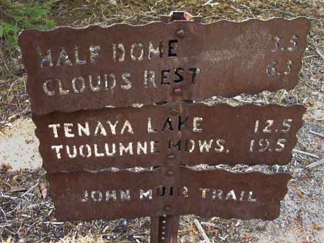 |
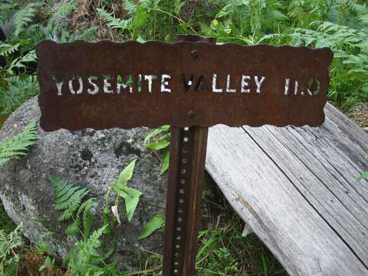
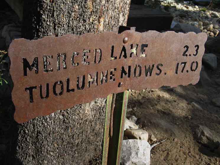
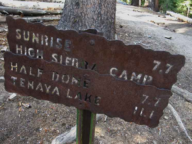
Sign pointing North to the steep climb up the John Muir Trail to Tuolumne Meadows from junction along the Merced River a few steps South of the backpackers camp in Little Yosemite Valley. Little Yosemite Valley is a brief interlude between the steep climb up from Yosemite Valley that led there, and the steep climb up to Sunrise High Sierra Camp laying below the West end of the Cathedral Range.
Standard JMT Miles
|
Our Route
EAST
(Straight through)
The Trail up to Merced Lake
East
Climbing the Main Line
Trail Junction at the Beach
6140 feet 3.92 miles East of Yosemite Valley 22.02 miles West of John Muir Trail in Lyell Canyon
to Maps and Miles
Miles Yosemite Valley to Lyell Canyon
|
 |
||||
This Is We are facing East looking at the arrow pointing to Left, North to the Little Yosemite Backpackers Camp and the JMT climbing North out of Little Yosemite Valley to Half Dome & on to Tuolumne Meadows. WE, & THE PAGE BELOW
Following the arrow pointing North, Left, brings us to and past the Little Yosemite Backpackers Camp along the route of the John Muir Trail for the hike covered by the trail guide page from The second sign above specifics the John Muir Trail miles to Tuolumne Meadows. The guide page below covers our hike continuing East, straight through this junction above, upriver along the Merced River to Merced Lake. Let's explore our local hiking options hiking up the Merced River from here. Central Yosemite Wilderness Both these routes to Tuolumne Meadows radiate from their shared start point in Yosemite Valley like two sides of a great triangle reaching up to two different points along the John Muir Trail in high altitude Yosemite. The JMT climbs to Tuolumne Meadows while our route up the Merced River brings us to a point in Lyell Canyon 5.6 miles South of Tuolumne Meadows. This complete circut would be the full extent of the Golden Triangle. Another trail from Vogelsang also offers us the option of hiking directly to Tuolumne Meadows through Tuolumne Pass. We choose the trail South into Lyell Canyon as it suites our route continuing South out of Yosemite along the John Muir Trail, but we do have shorter backpacking route options remaining within Yosemite National Park to explore, so let's explore them. Shorter Loops A second and longer loop also turns up, North from Echo Valley, but hikes further up the Cathedral branch of Echo Creek all the way up to Sunrise High Sierra Camp before follwing the JMT back to Yosemite Valley. Our third and longest loop option continues up the Merced River and over Vogelsang into Lyell Canyon before following the John Muir Trail route back to Tuolumne Meadows and eventually down to The Valley. These loops are all shorter versions of The Golden Triangle, which we Tahoe to Yosemite backpackers hike to where it intersects with the route of the John Muir Trail in Lyell Canyon 5.6 miles South of Tuolumne Meadows, to better position ourselves to exit the South end of Yosemite National Park, as our ultimate goal is the Whitney Portal. Hiker's Choice The Longest Trail It makes me shout, jump up and down, spin all around, and go "whooo-hooo!" That's a trail dance of mine. I dance Moons, Animals, Trails, or any Cool Spirits that catch my fancy. Nonetheless, the trail is life's ultimate dance floor.
Hokey-Pokey or Time Warp?
Kalidascopic The full-version hike through the length and width of Yosemite offers an impressive range of experience. North Yosemite Backcountry Central Yosemite Wilderness Out the South End But we are still in "the hot zone," the Central Yosemite Wilderness, and climbing back over the Cathedral Range into Lyell Canyon will only marginally mitigate the density of humans in the environment. Back to the Crest Sustained Use OK, that's the approach we are going to take, the outlines of the environment, and the plan to make it happen. Now we just need to get this thunder rolling.
|
East through Little Yosemite Valley
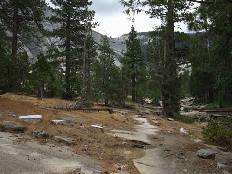
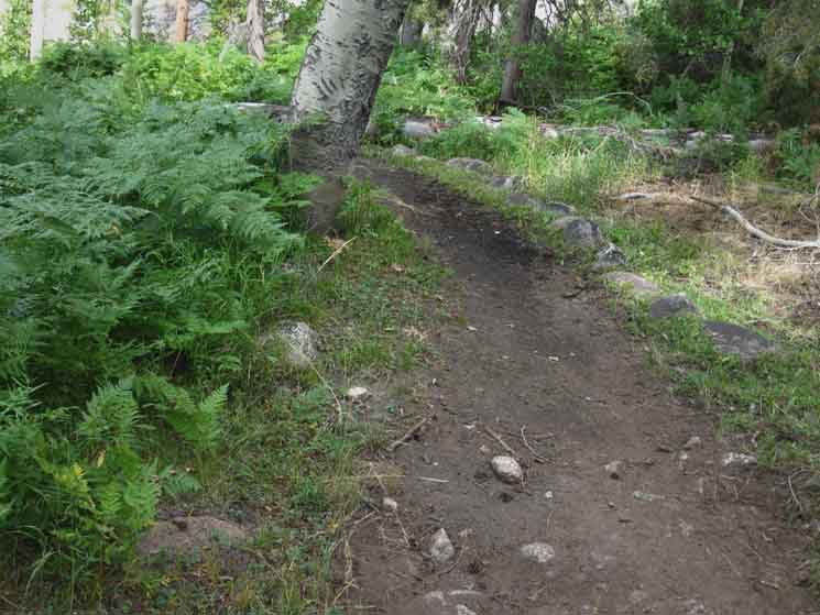
Hiking East, upriver from the trail junction at the Little Yosemite beach next to the Backpacker's Camp runs us up the length of the dense forest filling Little Yosemite Valley.
Maps and Miles
Miles Yosemite Valley to Lyell Canyon
|
National Hikers
 |
||
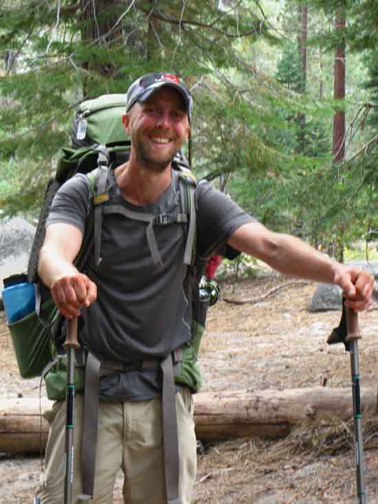
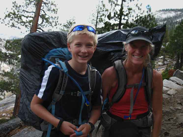
Cotton Joe Norman from Tennessee.
|
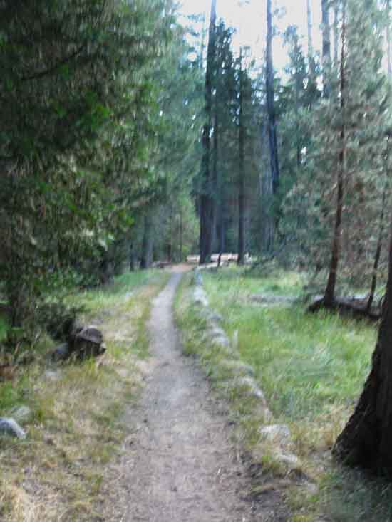
Little Yosemite Valley
Floor
 |
||
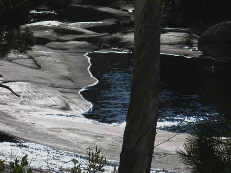
Trail East towards Merced Lake through Little Yosemite Valley. An extended flat associated with Little Yosemite Valley stretches into what looks like it was once meadow.
|
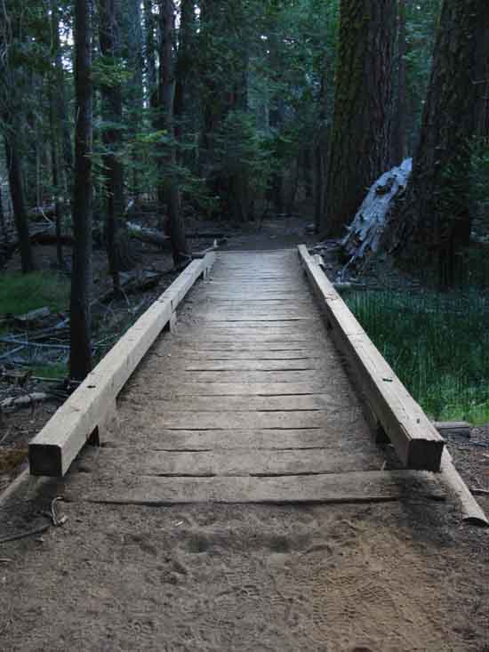
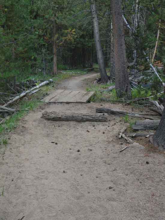
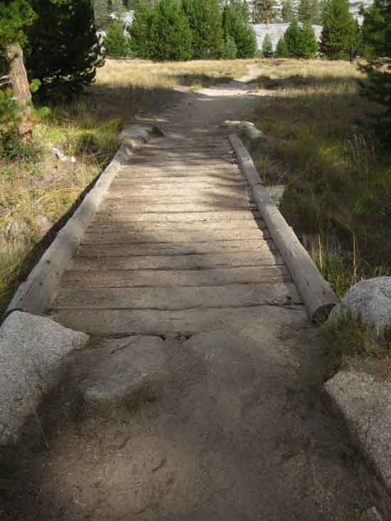
First Land Bridge
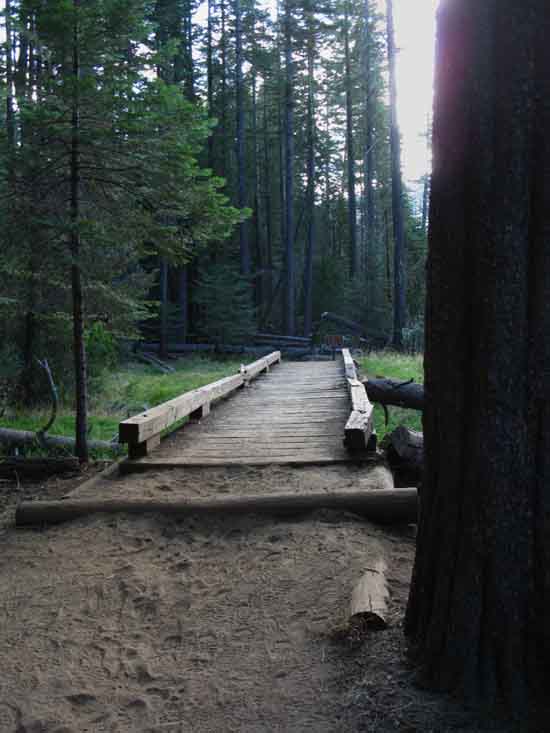 |
||
Land bridge protects vunerable terrain in Little Yosemite Valley.
|
Restricted!
 |
||
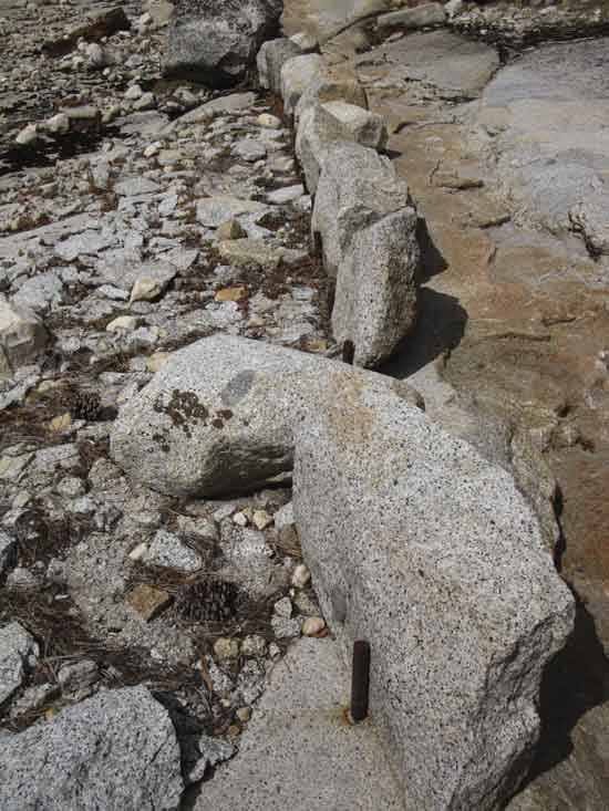
We find extensive restrictions and prohibitions along Yosemite Trails. This sign is posted just East of the trail junction at the Little Yosemite Valley backpackers campground beach and access to the Merced River.
|
Second Land Bridge
 |
||
Second ramp over fragile terrain East of Little Yosemite Valley backpackers camp.
|
Katie-Kate
 |
||
Katie-Kate jogging to Merced Lake from Yosemite Valley. Katie is one of the fantastic group of kids working for DNC in Yosemite so they can access the Natural beauty and experiences Yosemite offers. Katie's pals working at Merced Lake High Sierra Camp were going to put her up for the evening, and she was jogging back down to The Valley the next day. Katie turned out to be friends with the DNC dudes who put me up in The Valley. The DNC crew evolves some really interesting social sub-groups.
DNC DNC has been replaced by Aramark.
|
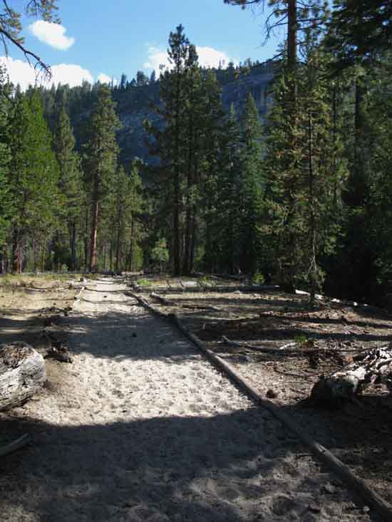
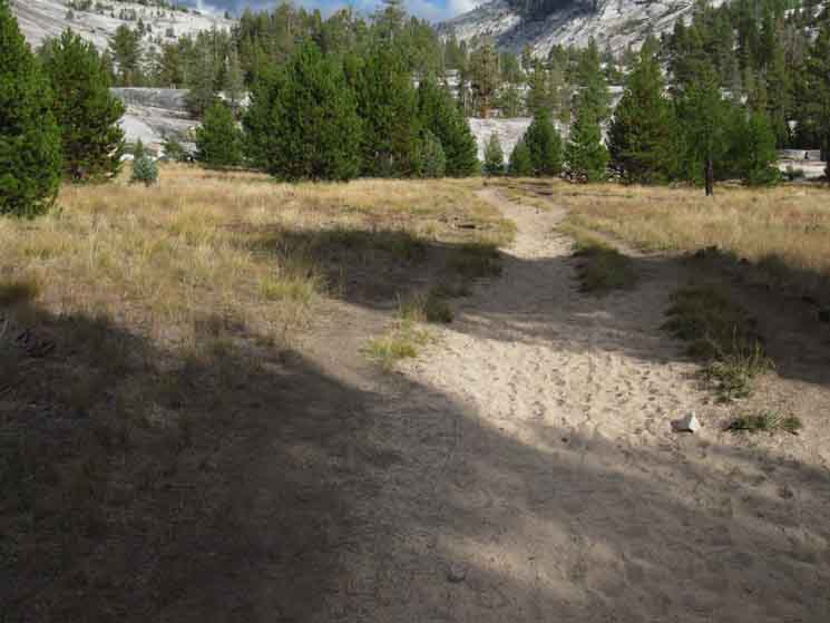
Yosemite Sandbox
 |
||
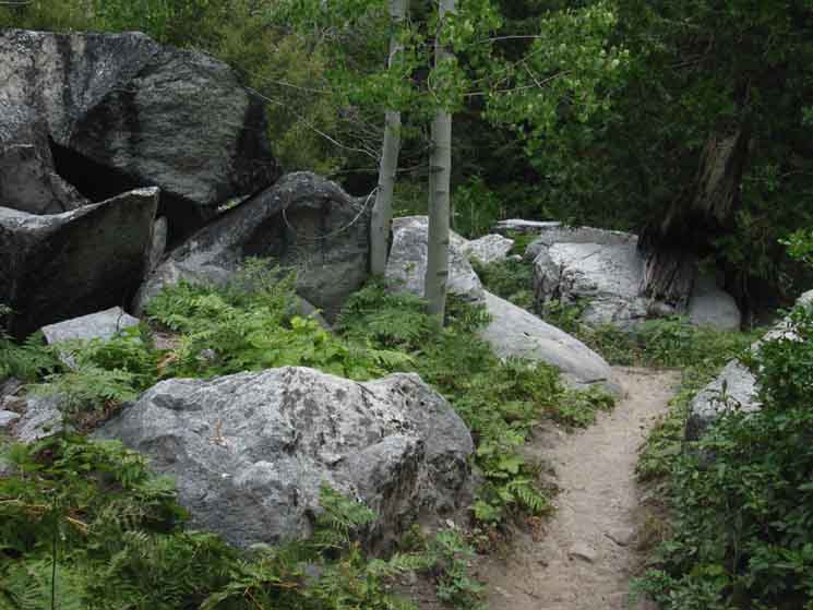
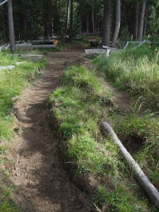
Sandbox trail across East Little Yosemite Valley. The thin soils of the forested floor of Little Yosemite Valley break down into sandy trails. Sandy trails sap backpacker's energy. I forstall this by modifying gait. We stay more "on top" of our steps by shortening them and reducing ankle rotation, thereby reducing slippage across each stage of foot contact. Our steps don't reach as far down the trail, we pull the foot earlier at the end of the step, and we reduce push-off to stay within the limited traction. I might even cant the foot angles out and start "waddling" a bit, if the trail is wide enough. Sand-Stepping.
|
Forested Riverine Beauty
 |
||
Bend in Merced River in Little Yosemite Valley. We are still at a low elevation where the aspens grow thickly with hemlock and it's even hot enough for Jeffery Pines here. Lots of fir and western white pine looking at the bottom of their range, too.
|
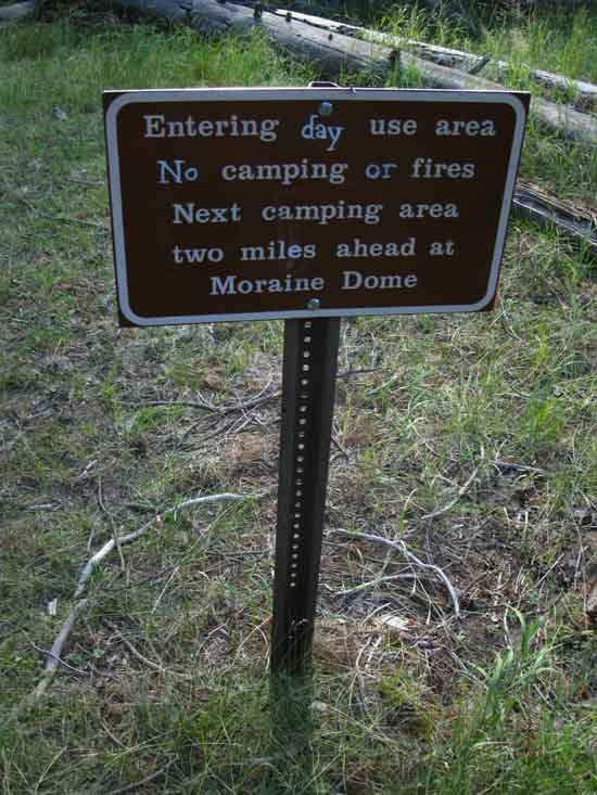
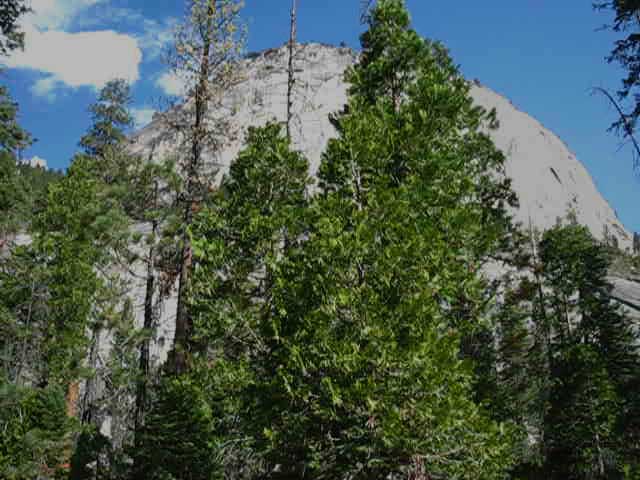
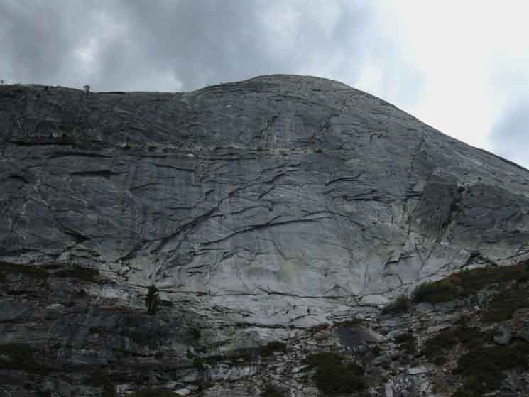
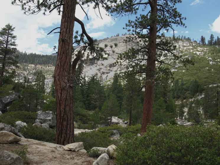
Moraine Dome
 |
||
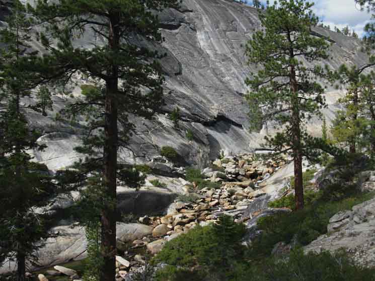
Moraine Dome towering above Little Yosemite Valley becomes visible as we approach East end of the valley.
|
Canyon Land
 |
||
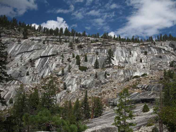
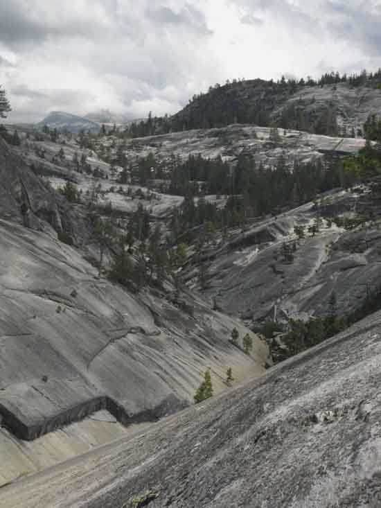
The canyon narrows as we climb above Little Yosemite Valley. This brings the sheer granite walls closer, but also shortens the segements where the shape of the terrain on the canyon floor can capture soils and build little valleys along the canyon floor. This canyon's steep walls above the carved granite canyon floor make it hard for eroding material to remain in place and consolidate. This makes the series little green valleys strung out along the floor of the Merced Canyon special. They are stashed between vast sheets of granite. They sit below the sheer walls of verticle granite. Hiking through here is like looking through a fantastic kalidascope of amazing views constantly juxtiposing themselves as our perspective shifts. These valleys along our route to Vogelsang along the Merced would be Yosemite Valley, Little Yosemite Valley, Lost Valley, Echo Valley, and Merced Lake sitting below its forested mirror-valley.
|
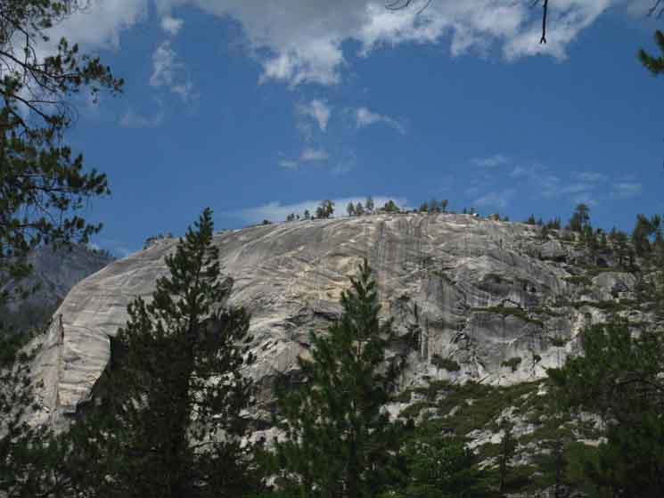
Peak 7683
 |
||
To our East we can see the great dome extending off the North wall of the Merced Canyon. We will rotate around the base of that dome where it pinches the canyon and the Merced River between it and the base of Bunnell Point into the falls and cascade above the East end of Little Yosemite Valley.
|
Chill Lizard
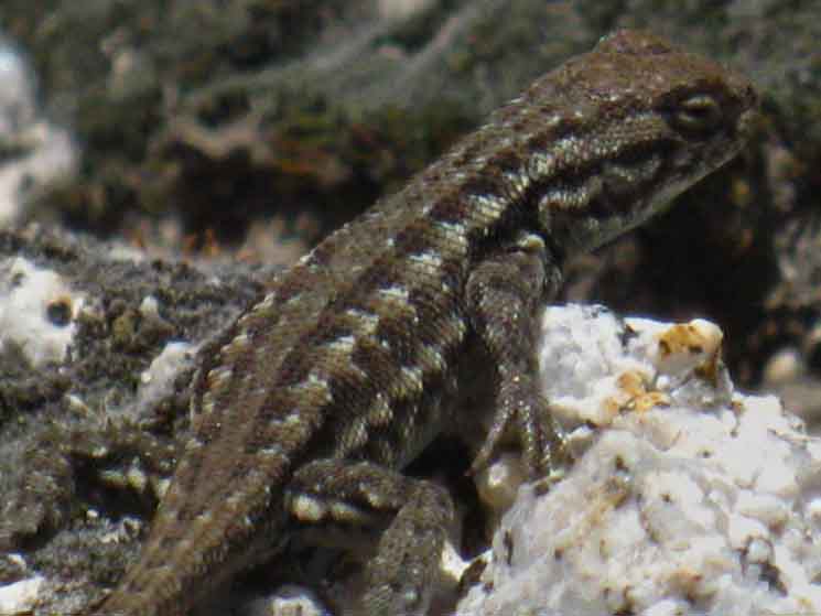 |
||||
Little Yosemite Valley Lizard. The terrain here is dry. Rattlesnakes, lizards, and lots of Sierra Foothill life are perfectly adapted for the crazy range of weather here. Snowpacked Winters, wet and wild Spring Thaws followed by long dry Summers puncuated with random local and regional storms favor the ability to survive long and lengthening Summers with little water, and be able to swim through the regular happenings of Winter and Spring floods. I'd say the range of the lizards in the Sierra Nevada is expanding with expanding heat.
|
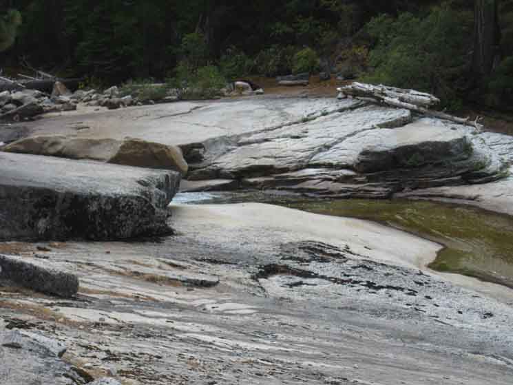
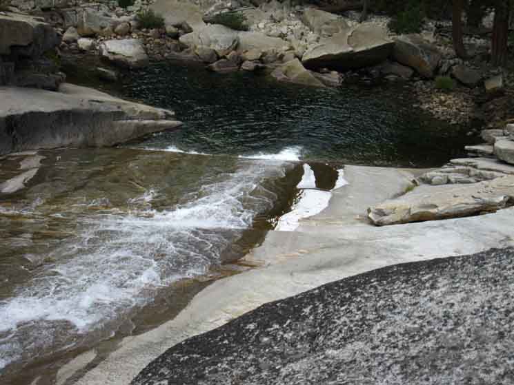
Merced River Narrows
East End
Little Yosemite Valley
 |
||
The Merced River narrows significantly on the East End of Little Yosemite Valley.
|
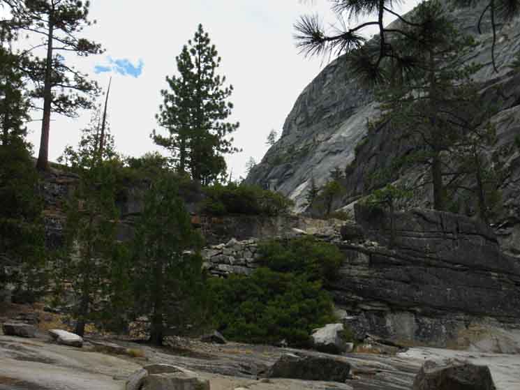
East End of Little Yosemite Valley Into Lost Valley Climbing Ch-Ch-Changes Continuing East from Little Yosemite Valley brings a step down in the level of trail traffic we experience by leaving the majority of day hikers behind on the trails to Nevada Falls and Half Dome. Each segment of trail through the sheer, narrow runs of the canyon serves to bring us from one tiny little green pearl of a valley to the next, until we arrive at Merced Lake. The series of little forested valleys opening up along this otherwise narrow granite canyon up to Merced Lake are Lost Valley, a unnamed little valley, and Echo Valley. The main granite features, the epic pieces of rock pinching the course of the Merced River & Canyon are the Great Blocks of Granite labeled Peaks 7683, Bunnell Point, the unnamed dome under the JMT across from Bunnell Point, and Peak 7673. The layout of just how these granite features were glacially carved determined where the river runs, where our route was laid, the shape of our skyline, and it is only between these massive features that our little green valleys along the greater Merced River Canyon could form and grow. The Bottom Line |
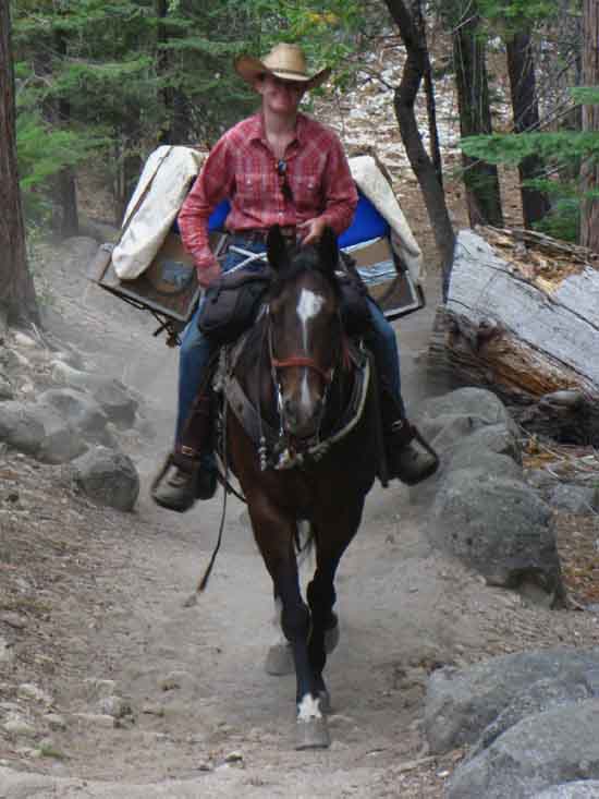
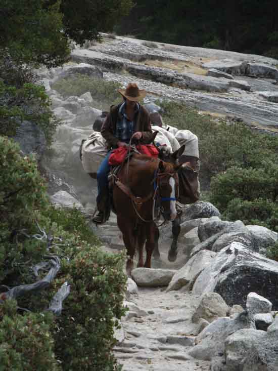
Horsepackers Ho!
 |
||
A short climb brings us past Merced Falls under the base of Peak/Dome/Point 7683 into our short green passage through Lost Valley. Above we see a horsepacker exiting the East end of Little Yosemite Valley.
|
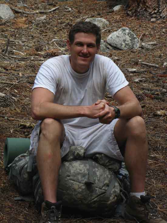
America's Finest
 |
||
Sitting and kicking it with Greg Clover. Greg was shipping out to Iraq, and was soaking in as much of the Natural beauty, peace, and engagement with American Beauty before dealing with the ugly side of the coin. Great guy, and I hope he did well and came back in one piece.
|
Horsepacker Ho!
 |
||
Horsepacker coming down through what we are climbing between the East End of Little Yosemite Valley and little Lost Valley just above. Note how that trail horse is very carefully inspecting the errant boulder on the trail, while keeping an ear cocked on the backpackers ahead. That is a sensitive horse. Those backpackers would be me and Greg sitting beside the trail talking about observing everything as the mule train approached.
|
Crossing
|
Bottom of Falls into
Top
of
Little Yosemite Valley
 |
||
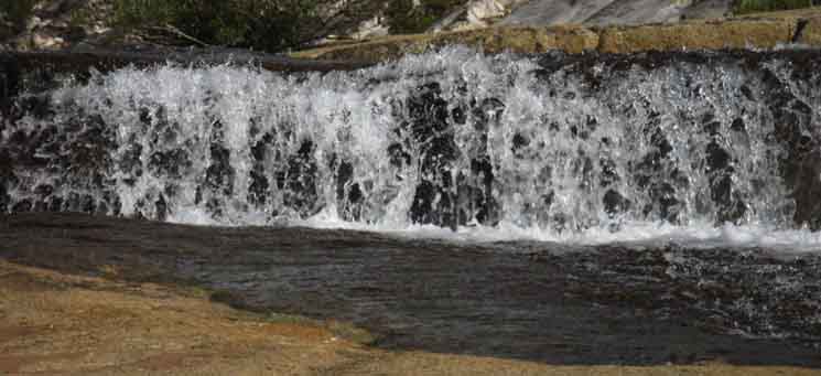
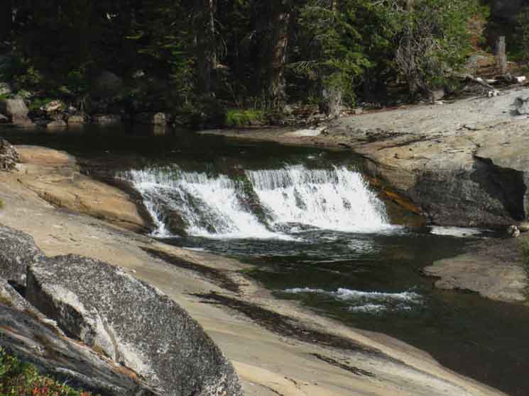
Pool below Merced Fall.
|
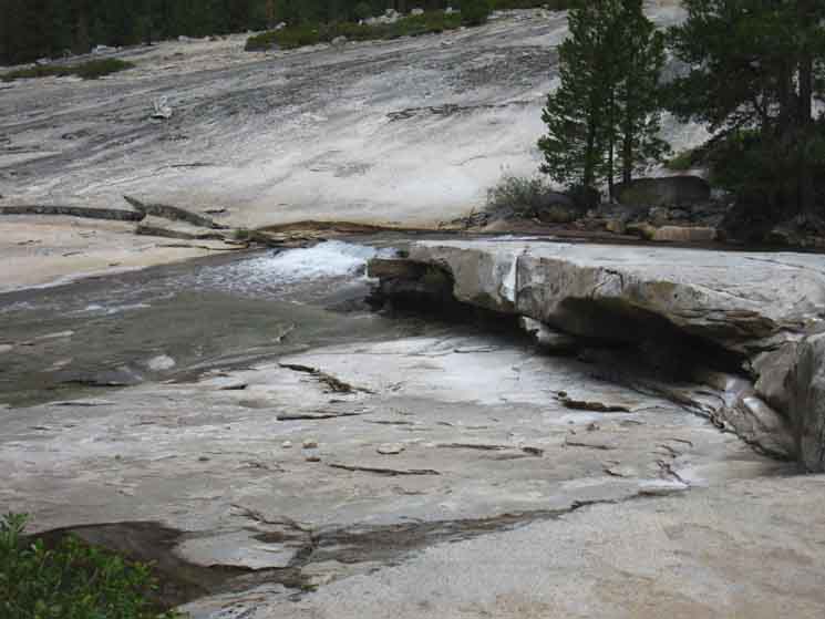
Top of the Falls
 |
||
Top of Merced Fall.
|
Off the Edge
 |
||
Merced River sliding off Merced Fall.
|
Maps and Miles
Miles Yosemite Valley to Lyell Canyon
|
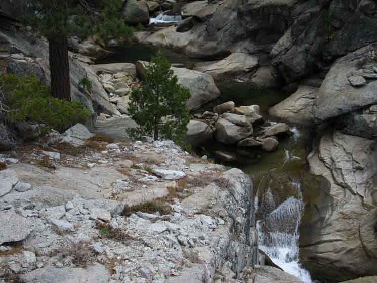
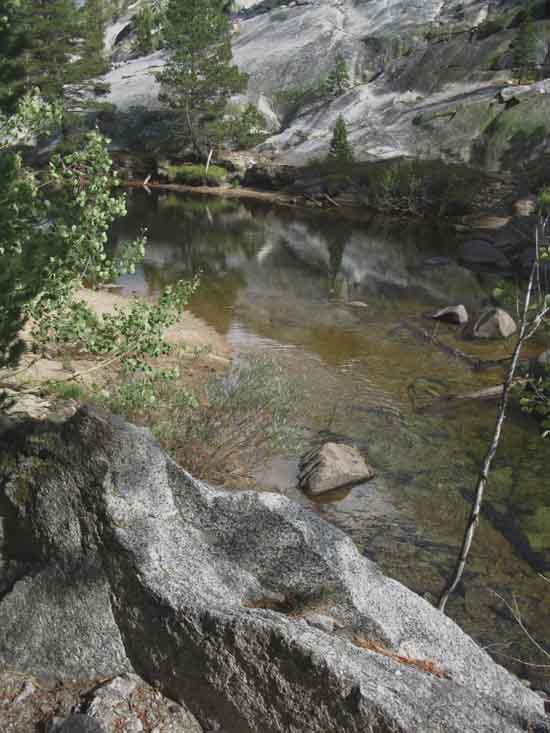
Lost Valley
 |
||
Looking downriver from the Northeast end of Lost Valley we can see the distinctive shape of the rounded top of the nearest and highest of Cascade Cliff's domes. Our view is looking to the Southwest lengthwise down across this little green valley along the steel grey granites of this Merced River Canyon.
|
Climbing into
Bunnell Cascade
Crossing This position is marked by the distinctive ramp leading up into the throat of a narrow riverside granite channel known as the Bunnell Cascade.
6360 feet 7.08 miles East of Yosemite Valley 18.86 miles West of John Muir Trail in Lyell Canyon
to Maps and Miles
Miles Yosemite Valley to Lyell Canyon
|
 |
||
Upriver we enter the narrow channel of Bunnell Cascade as it runs through the narrow channel carved between the base of Bunnell and the great point projecting from the North Wall of the Canyon.
|
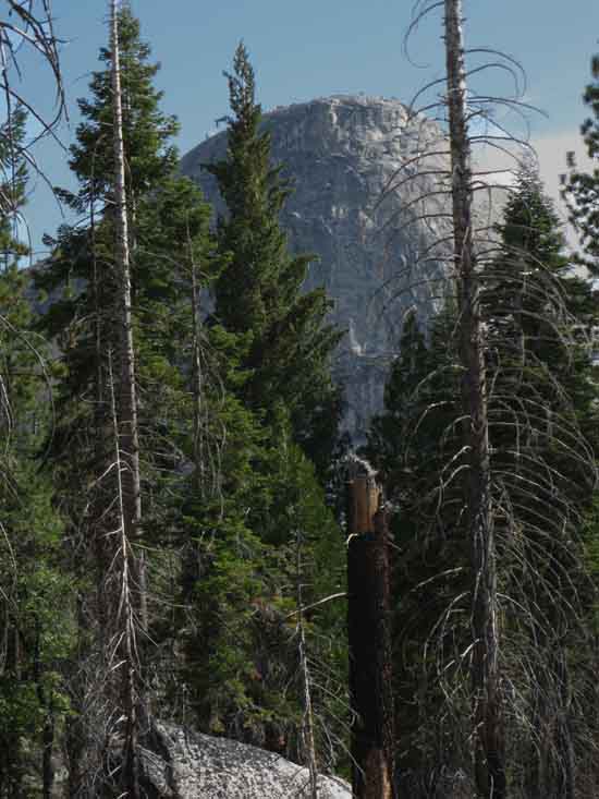
Cascade Cliffs & Mount Star King
Above Lost Valley
above
The Very Bottom of Bunnell Cascade
 |
||||
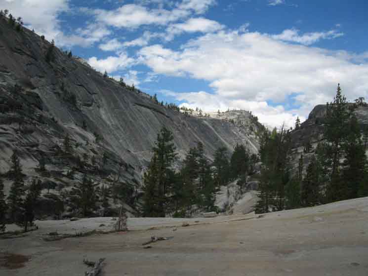
The Cascade Cliffs and Starr King from the top of Lost Valley. As we are climbing into Bunnell Cascade we turn to our Southwest, our Left, to notice the Merced River taking a ninety degree turn out of the base of Bunnell Cascade into the top of Lost Valley. The beauty of this little valley view grows as we take note of the distinctive beauty imparted to the scene by the rounded crown of Peak 8070's highest dome of Cascade Cliffs rounding out our view. The situation at our feet is we are climbing, switchbacking up this rustic turn of trail running us into what is essentially a slot alongside the Bunnell Cascade carved into the base of thousand foot granite walls rising on either side. We will not see the Cascade Cliffs again on this trip once we enter Bunnell Cascade..
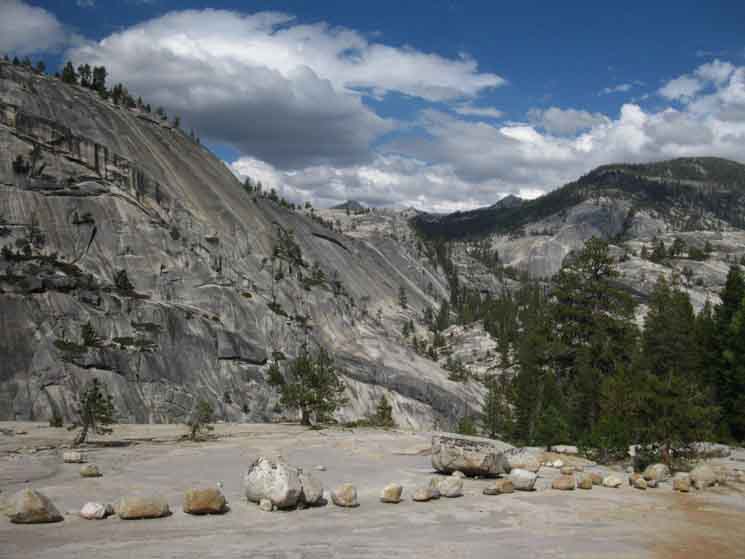
Central & South Yosemite Hiking Map
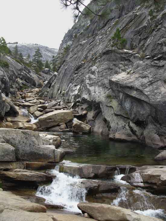
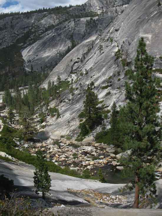
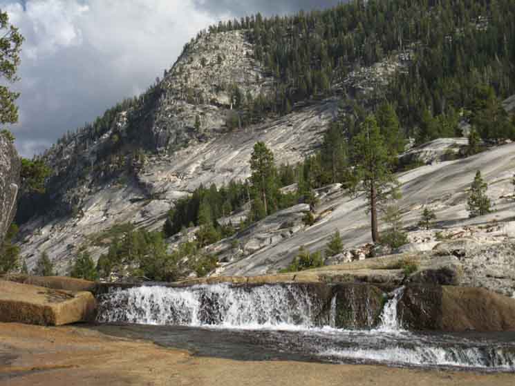
Bunnell Cascade is interesting. We are passing between the bases of massive thousand foot tall vertical & near vert granite cliff faces. Bunnell Point rises 1600 feet above our position, while the massive dome projecting off the North face of the canyon wall only reaches up a thousand feet. This small planet-sized chunk of granite called Bunnell Point arcing into space above us has more different aspects than the moon. Just like the moon's appearance shifts under its changing lighting so too does the look of Bunnell Point change with our changing position, and its shifting lighting daily and seasonal lighting. Traversing along Bunnell Cascade is the key segment of our rotation around this massive multi-faceted feature. Bonus Views That's Mount Starr King! Much lower down in elevation and closer to us is the great granite wall rising on the near-Right edge of the photo. See that great rising dome? That's the base of the massive Dome 7683. We rotated around the base of 7683 climbing out the East end of Little Yosemite Valley, as we are rotating around the base of Bunnell out the East and Uppermost end of Lost Valley.
Yosemite Valley to Merced Lake
We are getting good perspectives on the features as we hike through them. We also got some good looks from above as we descending the John Muir Trail towards Yosemite Valley. Different Views of our Position at the base of Bunnell Point
|
Bunnell Cascade
 |
||
Bunnell Cascade under Bunnell Point.
|
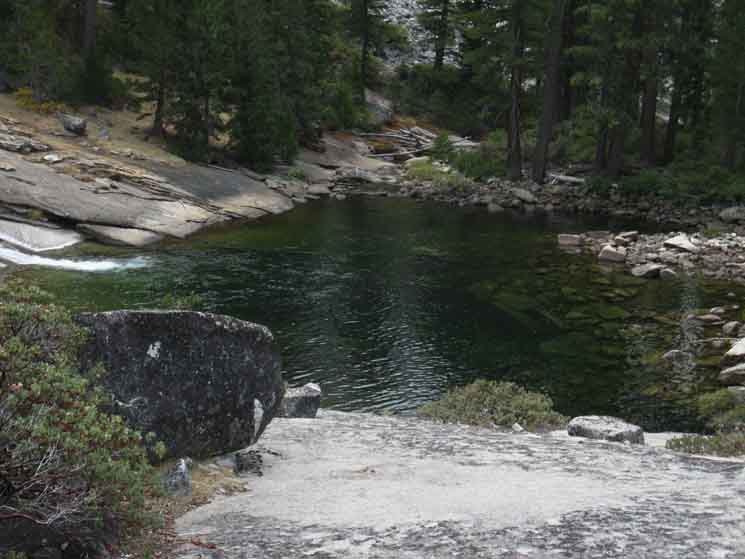
Pool along Bunnell Cascade
 |
||
Pool along the Bunnell Cascade.
|
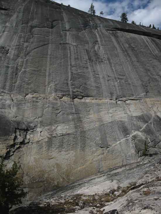
North Wall
 |
||
Zebra-stained granite North wall of Merced Canyon. The Merced Lake trail crosses the top of the well-decorated wall above, running East-West along its edge. Our route hiking East up the bottom of the Merced River Canyon intersects with the trail up there at the upcoming trail junction in Echo Valley. The trail on the North rim of the canyon Tees-out with the trail running North from Echo Valley. That trail climbs North out of Echo Valley along the Cathedral Branch of Echo Creek, up intersect with the John Muir Trail in the middle of Long Meadow a short distance North of, and above Sunrise High Sierra Camp.
|
Trail above Bunnell Cascade
 |
||
Trail carved in granite along Bunnell Cascade of the Merced River. The cascade is running in its granite channel to our Right.
|
Sweetness along Bunnell Cascade
 |
||
Placid scene along low flowing Bunnell Cascade. Nice cool spots to sit, watch the light play off the rippling surfaces, feel the cool air running down the rocky channel, and listen to water music.
|
Grove Below Bunnell Point
 |
||
Approaching small grove in unnamed valley under Bunnell Point. We're looking almost directly East at the significant West flank of the vast granite outcropping topped by Peak 7673. Echo Valley is on the other side of that block. Our last two dramatic turns following the course of the Merced up-river to this point followed the course of the river as we traversed around the bases of the vast granite features guiding the course of the river. That's not the case with the upcoming block of granite we see in the picture above. This next section of trail climbs up out of the bottom of the canyon up some nice switchbacks once we hike through the unnamed little valley in the foreground. That grand block of granite we see ahead is going to force up to climb its opposite flank to get around its effects on the course of the river. We'll actually descend down river level to cross the next footbridge marking the point we find a short gentle climb into Echo Valley.
|
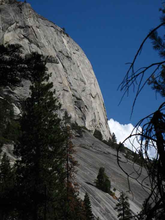
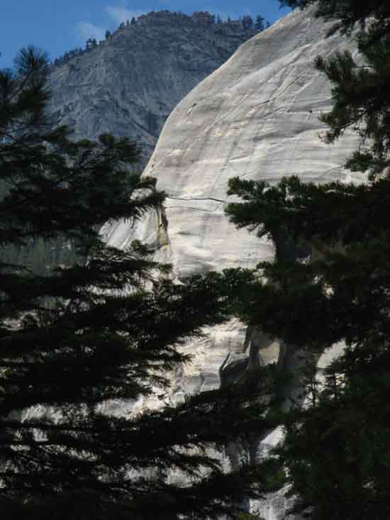
Bunnell Point
Looking Up
 |
||
Looking up at the North face of Bunnell Point from the grove in the tiny unnamed valley under the North face of Bunnell Point.
|
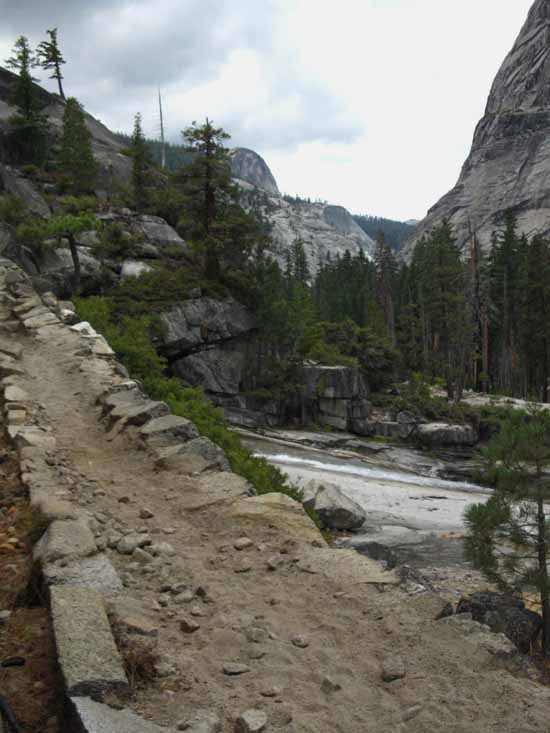
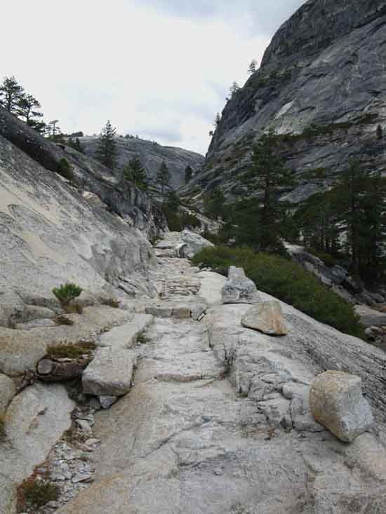
Two Crossing The Canyon begins to briefly open up a bit above Bunnell Cascade's narrow channel between the precipitous walls of the canyon. The configuration of our trail here is interesting in many ways, one of which is the sequencing of its physical construction. The sequence: Lost Valley-Narrow Canyon-Unnamed Valley-Narrow Canyon- Echo Valley. Exiting the open space of Lost Canyon we make our way around the base of Bunnell Point in narrow canyon conditions to the open spaces of the tiny unnamed valley. From there we make our way around the base of the equally massive, but more "squat" feature of Block 7673 to Echo Valley. Rather than hiking along in the base of the narrow canyon as we have climbing up here so far, our trail now climbs switchbacks cut, carved, and stacked into the South wall of the Merced Canyon to get us over and around this narrow segment of the river's canyon. The alternating pattern of narrow canyon followed by little valley followed by narrow canyon continues here, even though the narrow nature of this particular segment of the canyon is driving us out of the canyon. This is good, as our climb up the switchbacks and onto the South wall gives us a much better overview than we have had in either the narrow canyons or the tiny valleys as we climbed up here. Our descent off the high point of this excursion up the South wall brings us down to the bridge marking the short hike up into Echo Valley.
6560 feet 7.74 miles East of Yosemite Valley 18.2 miles West of John Muir Trail in Lyell Canyon
to Maps and Miles
Miles Yosemite Valley to Lyell Canyon
|
 |
||
Temperate grove and growth in small valley above Bunnell Cascade.
|
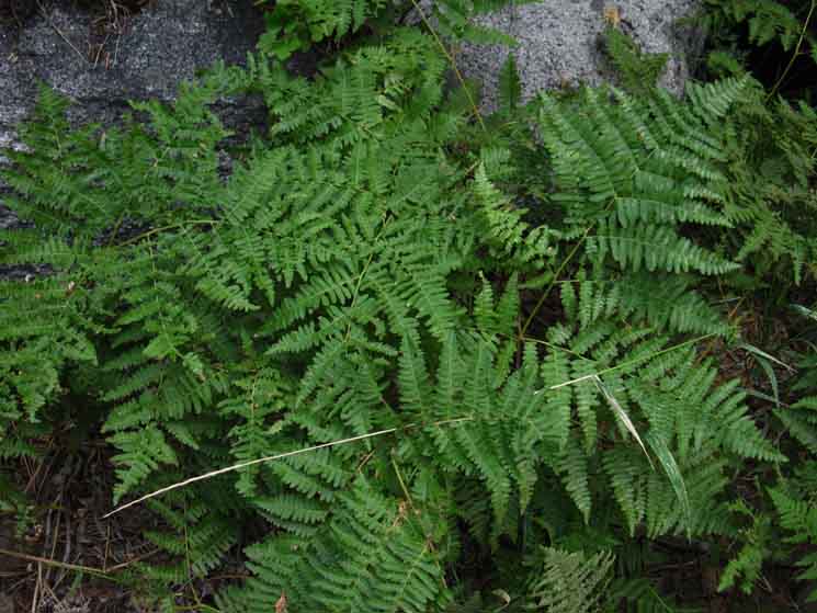
Sweetness
 |
||
Ladyfinger ferns growing in tiny grove in the small valley in the shadow under the North face of Bunnell Point.
|
Approaching
The First Bridge
 |
||
We find the first of two bridges in quick succession in this tiny bulge, this brief lapse in climbing just big enough to allow a small clump and scatter of extra shade to gather along this intense course of reflective river rock. The sheer granite walls concentrate vast amounts of extra refected light at any time of the year, but especially during Summer. Though the refleced light is noteworthy, our position in the bottom of this steep, deep, and narrow canyon gives degrees of protection unavailable exposed among a sea of granite High Sierra Peaks. I see the real physical threats here to be a combination of high Summertime temperatures, combined with powerfull direct and reflected sunlight. When these combinations line up I expect the most trouble to be focused on those backpackers not quite properly trained or prepared for the trip. Those will be the folks testing their own mettle, when the trip they never quite properly prepared themselves for turns even harder than expected or anticipated. Then begins the suffering.
|
The First Bridge
 |
||
The first bridge hiking up the Merced River under Bunnell Point. The first bridge is over the main body of the river, necissitating a center pier.
|
The Second Bridge
 |
||
Just a few feet upriver from the first, we come to the second bridge hiking up the Merced River in this tiny unnamed valley under the North End of Bunnell Point. "Tiny Two bridge Valley?" This is a shorter bridge over the smaller of the two channels splitting around the central area of our little grove of forest, essentially creating an "island." "Island Valley?" I am not saying this configuration is durable. It may or may not be. Rivers do crazy things with their courses. Or not. But right now the Merced splits around a tiny island. Bookends
|
Second Bridge
 |
||
Northeastern of two bridges above Bunnell Cascade. I have it at .38 of a mile from the center of this bridge hiking upriver along the length of the traverse to the bottom of the first switchback. The length of the switchbacks from bottom to top is coincidenally another .38 of a mile, putting this next segment of trail from this upstream bridge under Bunnell Point to the top of the switchbacks at .76 of a mile. From the top of those switchbacks we have a very rare thing for the next .95 of a mile: Downhill Trail! The .95 of a mile from the top of the switchbacks to the bridge just below Echo Valley is a downhill run.
|
Granite Sheet below our Climbing Traverse
 |
||
Crossing the second bridge brings us out the top of the little grove in this tiny valley, now putting us on the South Bank of the Merced. Looking upriver we can see that our trail is funneling up into a narrowing great granite V-gorge of titanic porportions as we hike upstream out of this tiny wide spot beneath Bunnell Point. Let's take a look around this tiny valley before we hike upriver out of it.
|
VIEW
NORTHWEST
North Canyon Wall Dome
 |
||
Looking at the low dome on the North Wall of the Merced Canyon opposite Bunnell Point. The image above is our view to the Northwest turning back to look across the tiny little unnamed valley we are departing. The John Muir Trail is located about a half-mile further up the mountain beyond the top of that dome on the wall of the canyon. The high trail to Merced Lake from Little Yosemite Valley is also up there, located below and running parallel with part of the route of the JMT. Lets take a better look at the dome: VIEW From the top of that dome the slope of the mountain runs first up to the Merced Lake Trail up there running East-West. To the East the Merced Lake Trail either descends to Echo Valley or climbs to Long Meadow/Sunrise High Sierra Camp. Hiking West on the Merced Lake Trail leads to the John Muir Trail running down to Little Yosemite Valley. A short ways above the line of the Merced Lake trail up there on the South Rim of the Merced Canyon the John Muir Trail is descending towards the Clouds Rest and Half Dome junctions from Sunrise High Sierra Camp.
Consult this map to figure out the trail configuration above the North Rim of the Merced Canyon: Yosemite Valley to Merced Lake
VIEW Lets take a look at this part of the Merced River Canyon and Bunnell Point from above, from up on the John Muir Trail descending towards the North Rim of the Merced Canyon as we were descending towards Little Yosemite Valley: Bunnell Point and Dome 7683 from the John Muir Trail. We can't really see the top of the low dome in the images links above. Those pictures I took along the John Muir Trail did not really highlight that dome, which is my fault. But these views of the Merced Canyon from the JMT do give us a somewhat broader context on the relationships between the trails and terrain along the bottom of the canyon, and our various changing positions on these trails and in the terrain. Context is a critical Key to Understanding Terrain.
|
VIEW
SOUTHEAST
"UP"
Bunnell Point
 |
||
UP It is much more an impressive view than this image indicates.
|
Upriver
 |
||
Crossing the second bridge in the little valley under the North Face of Bunnell Point brings us onto what is essentially a very long built-up gradually climbing traverse along the South wall of the canyon until we are under the switchbacks. I put the distance from the bridge to the bottom of the switchbacks at .38 of a mile.
|
Betsy and Cody
 |
||
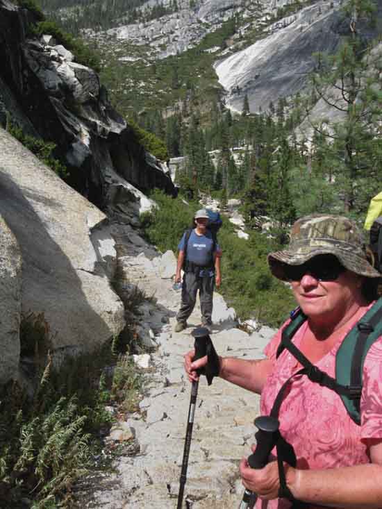
Betsy and Cody hiking from Tuolumne Meadows to the Valley via Clouds Rest.
|
The Traverse
 |
||
Yosemite Trails. Wow.
|
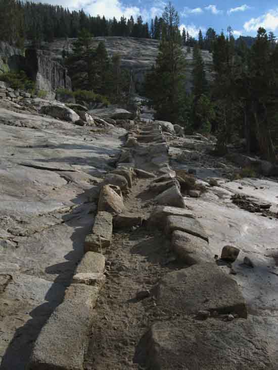
Extensive
Built-Up Segment
 |
||
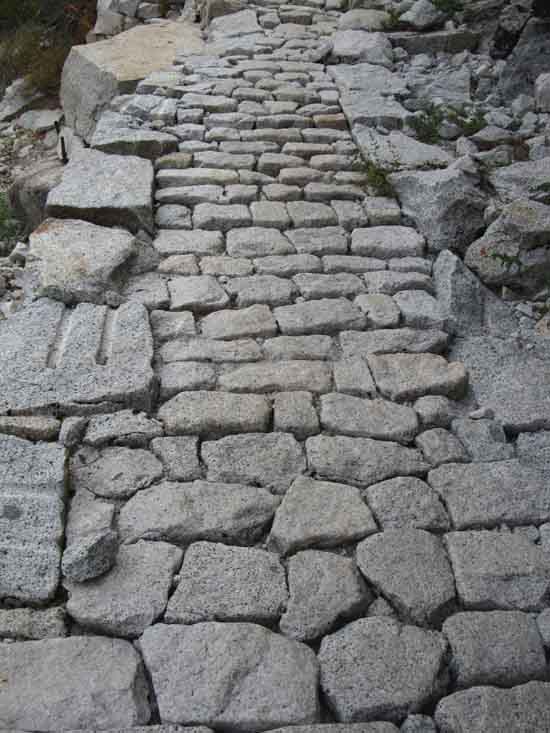
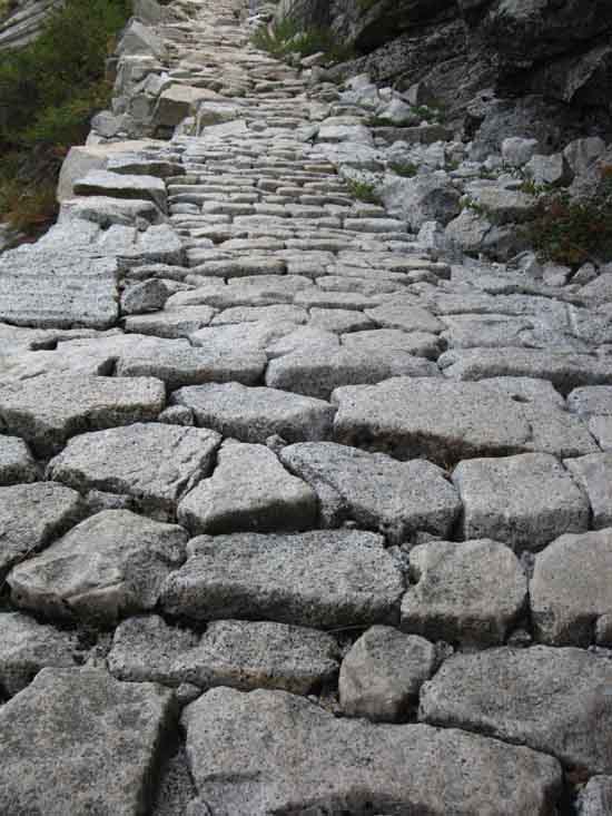
Extensive, stable build up. A very long section of remarkable trail. A lot of rock was hauled, processed (hammered), chipped, formed, and finally interlocked into this amazing structure. This thing is designed to become stronger as greater pressures are applied to it.
|
A Fine Hike
Downriver View
 |
||
Laurel and George backpacking Tuolumne Meadows to Yosemite Valley via the Merced River. We are looking West down the length of the traverse up from the Eastern bridge under Bunnell Point. We can see the slab of granite where we began the traverse above George's head.
|
Another Look
Downriver
 |
||
Downriver view approaching switchbacks at end of the traverse.
|
Upriver
 |
||
View upriver from under the switchbacks. We'll climb the .38 of a mile zig-zagging up the switchbacks to get up on a flat, then descending segment of trail taking our trail around this segment of the Merced River. Here the Merced runs through a segment of sheer unbroken granite canyon walls composing a formidible chute along its course From the high point of our traverse once we reach the top of the switchbacks we begin a long descent (in the upriver direction) back down to river level, finally reaching water at the bridge below Echo Valley. This bridge marks the point we again begin climbing, rather than descending up-river, over the short distance to our entrance into the Western end of Echo Valley.
|
High Point on South Rim
 |
||
Trail passage atop switchbacks.
|
Family Hiking Team
 |
||
Chris and Terry Nilsen hiking down the Merced River Canyon.
|
The Creek
 |
||
The location of this creek precisely locates us on our maps.
|
Red Zone
 |
||
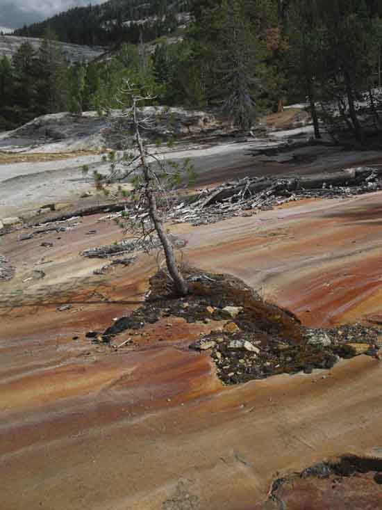
Rust streaked granite marks creek overflow, Spring runoff patterns.
|
The Next Bend in the Merced River
 |
||
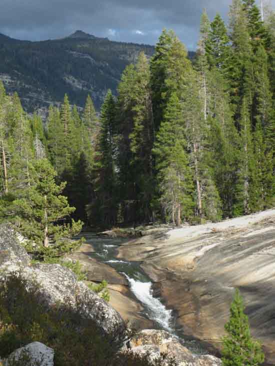
Our view opens up to the Northeast of Peak 9890. Echo Creek runs down to Echo Valley along the edge of the great granite cliff making up its Southwestern base. We are working our way down into the granite channel to the edge of the South Bank of the Merced to follow the river up into Echo Valley under the Southwestern flank of Peak 9890. Entering Echo Valley draws us close to Merced Lake. Merced Lake sits under the Southeastern flank of Peak 9890. We close this gap along a short moderate difficulty climb continuing upriver along the Merced.
|
Echo Valley Ahead
 |
||
Dropping down into a bit of forest as we run down to river level again. Ahead we see the narrow channel under the great wall our trail will follow up to the bridge marking our the Southwestern entrance into Echo Valley. First we pass through a dot of forest and green, an outpost of life that grabbed hold of a crack in the granite, filled it with soil crafted by captured erosion and generations of failed seedlings and dead insects as each healthy root pried each crack a little wider, capturing a bit more soil, until...
|
Grove in a Granite Wasteland
 |
||
Little grove in granite desert along the Merced River. The trees have a long strategy in play with colonizing big stretches of granite desert.
|
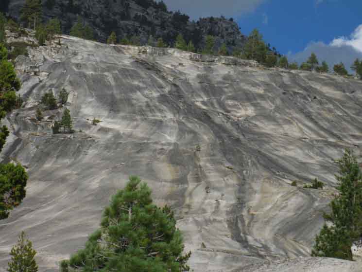
Great Black Stripe
 |
||
The great black stripe zone approaching the bridge on the Southwest end of Echo Valley. We crossed the red stripe zone at the creek marking the end of the flat after climbing up the switchbacks. Now this black zone marks our return back towards river level.
|
Temperate Zone
 |
||
Soft trails are a relief after the hard impacts of so much unmigitated hard granite terrain. The relief on the feet and rest of the body from the reduction in shock is noticable. The Winds and fierce power of the Sun are known and protected against. But many folks neglect to anticipate the shock from the harshness, the hardness of the terrain itself, on the whole structure of our body. We notice when the stress is reduced, when crossing onto soft soils reduces the intensity of our experience.
|
Great Granite Wall
 |
||
The scale of the wall along the North Bank of the Merced become apparent as we get closer and drop down into the South side of the channel under it.
|
 |
||
A couple of hundred feet of rock.
|
Hey Spike
 |
||
The end result of a not well thought-out old style of trail construction. Removal would be preferable. I would bet that is on Trails schedule.
|
The Rustic Fool
 |
||
The goal of those spikes is what I call, "The Rustic Fool" style of trail marking. "Rustic," because of its appearance. "Fool," because of the level of defacement and unnecessary work to stand up rocks that could just as easily be anchored by gravity.
|
Down to the Merced River
 |
||
Approacing Merced River as we descend to it and the bridge below Echo Valley below this fantastic granite wall.
|
Jeffery Pine
 |
||
Jeffery Pine.
|
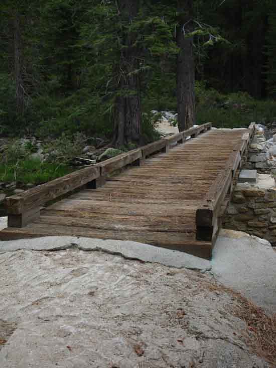
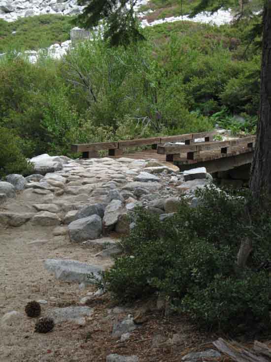
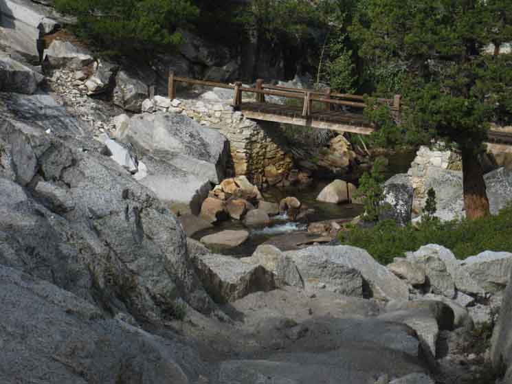
Bridge Crossing The bridge marking the short hike up into Echo Valley.
6960 feet 9.4 miles East of Yosemite Valley 16.54 miles West of John Muir Trail in Lyell Canyon
to Maps and Miles
Miles Yosemite Valley to Lyell Canyon
|
Bridge
South of Echo Valley
 |
||||
Our climb around the course of the Merced River on the South Bank passing around the sheer South flank of Peak 7673 and the deep granite channel the Merced flows around it is coming to a close. We are again approaching river level and the bridge over it a short distance below Echo Valley.
|
View Downriver
 |
||
View down the Merced River from bridge South of Echo Valley.
|
Placid Pooling
 |
||
Entering Echo Valley hiking up Merced River.
|
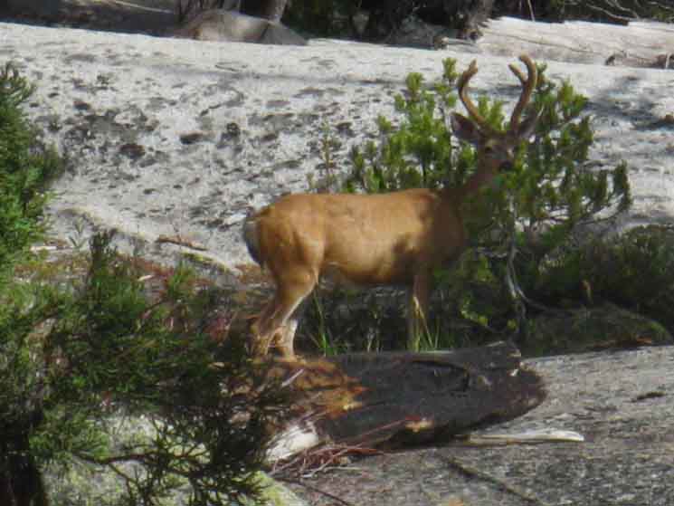
Buck in Echo Valley
 |
||
Buck hiding behind bush in Echo Valley. It did not work. A buck was grazing as I entered the South end of Echo Valley. Rather than startle him, I clicked to reveal my postion. I detected that Buck was a bit unhappy that a creature had approached so close without his knowledge. He was hoping that his little shrubby fir was offering as good cover for his back end as his front, but it offered little cover for either. I defused the situation by continuing hiking into the heart of Echo Valley, leaving Buck to relax back into his grazing after my momentary disturbance of his day.
|
Upriver
 |
||
Looking upriver from Echo Valley. Merced Lake is close. Looking up the base of the valley we can see an arm of granite angling from Left to Right. Merced Lake is on the near side of that low arm, Washburn Lake on the far. The Mount Florence Massif is rising on the furthest Left side of the image.
|
Echo Creek Bridge
7000 feet 10.15 miles East of Yosemite Valley 15.79 miles West of John Muir Trail in Lyell Canyon
to
Maps and Miles
Miles Yosemite Valley to Lyell Canyon
|
Bridge over Echo Creek
 |
||
Approaching the bridge over Echo Creek.
|
Echo Valley Miles Signs
Downriver
 |
||
Eleven miles to Yosemite Valley from the bridge in Echo Valley.
|
Upriver
 |
||
Miles to Merced Lake and on to Tuolumne Meadows.
|
Up
Echo Creek
 |
||
Miles up Echo Creek from Echo Valley.
|
Crossing the bridge hiking to Merced Lake
 |
||
Echo Creek bridge towards Merced Lake.
|
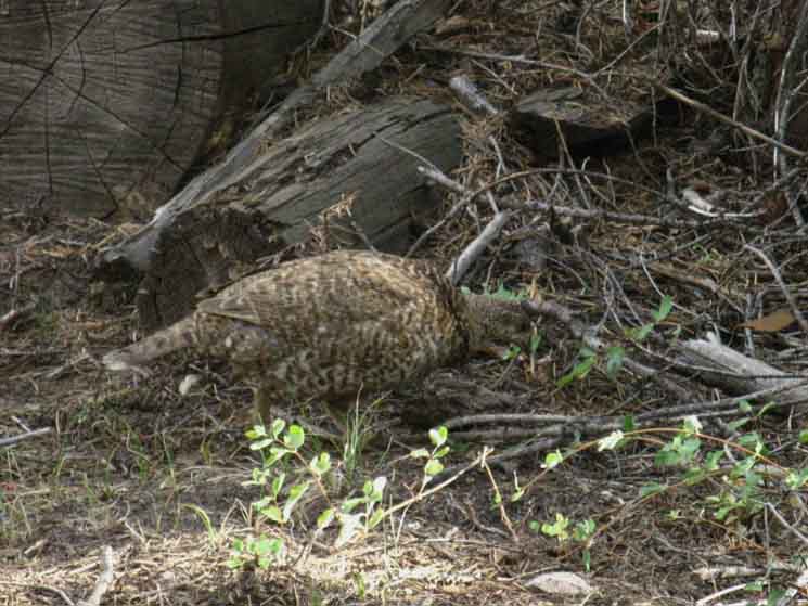
Grouse
 |
||
Between the bridges.
|
Middle Bridge in Echo Valley
 |
||
Middle of three bridges in Echo Valley along the Merced River. The second bridge is about 150 yards upriver from the first bridge.
|
Iron Bridge
 |
||
The third most substantial and last of Echo Valley's standard footbridges lays a couple of hundred yards East, upriver from the middle bridge.
|
Ouch
 |
||
Observations The only difference between constant environmental stresses and the periods of concentrated destruction are the scales of energy involved. The former describes engergy applied consistently over time, while the latter applies it all at once. An analogy would be the difference in the intensity of the experience of a life lived over fifty years being experienced in a second. Though the same life would be lived in a second as over fifty years, the difference in intensity between the experiences makes them very different ways of doing the same thing. But Nature is not bound by human rules, nor our conceptions or perceptions of time and space. Nature can age gradually for fifty years, then age fifty years in a "second." So too are flood events a speed-up of the slow, but already operating processes of soil production and distribution. Every tree that grows will fall, every river that flows will flood. Floods and fallen trees move together. Everything that is flexible to these forces, or can regrow after being crushed and swept away, survives. Everything in Nature that is not flexible facing Nature's overwhelming power is either broken quickly or worn away over time. The plants are the ultimate in flexible. The product of their individual deaths produces the very soil for, and fertilizes their next generation. The ultimate in flexibility is their ability to turn failure, the very death of plants, into the basis of their success, soil, as the plant world has achieved. Plants understand that life and death are interdependent factors feeding each other. The granite is the ultimate in inflexible. It stood against the ice, it drowned under lava and lahars. It stubbornly resists thousands of years of generations of plants leverging cracks on its flanks and splitting its sheets into slowly expanding groves, forests, and meadows while at the same time gradually eroding off the sands necessary for its destruction, or slow conversion into soil. What we see depends on how, and how long, we look at it. The interaction of the flexible and inflexible is moderated by the water cycle. The rains, snows, and thaw all work to time the cycle of life in the Sierra, to set the interelated paces of plant growth and erosion all fueled by rain and runoff feeding life. Looking at the Sierra in my mind's eye as a time-lapse movie of the last thousand years over five minutes of running time presents an amazing spectacle as the annual cycle of weather poweres the life, growth, and death of generations of High Sierra plants and trees, drawing all elements of its vast web of life up the rock. As the rain feeds the water necessary for the plant world to grow into, leverage, and crack out the granite this same rain and runoff also drives the other side of the equation, the erosion that supplies the plants their even more fundamental need: minerals to mediate into soils. We would start our "mental-movie" by watching a thousand seasons of rain scouring sands and rocks off the barren Sierra Crest. Infinite seedlings would sprout and die in this sand and rocks, until their very deaths transformed sand into soil, their prying roots cracked a beachead, and a self-perpetuating soil-plant community rises from the enduring fertility of their own ashes. Life out of death, baby! The same weather driving erosion and plant growth is the same mechanism driving soil creation. Weather provides the energy for the plants to invade the hard rock as it simultanously wears granite mountain peaks into sand. The effeciency of Nature is profound. All of this vortex of life, this engine of life is moving. We can see this motion in the layout of the series of little valleys laid-out along the course of the Merced River. All of these valleys are composed of rich soils eroded as sand off the surrounding mountians thousands of years ago, mediated by thousands of generations of plant growth, animal and insect death, all slowly transformed into soil and washed downstream to be deposited as a series of fertile little pearls of green valleys strung out along, and linked to each other by the granite-bound course of this magical Merced. Art of the Highest Degree. Thus the mountains, forests, and our trails through them are all moving imperceptibly every season, moving perceptably over decades, and it all moves a bit faster during wetter seasons, and slower during the dry. Everything up here is in fact being swept down mountain to the sea in slow motion as soil and forest climb to engulf a slowly eroding High Sierra Crestline. Slow motion until the forces of Nature line up, and things begin to move very quickly. These mountains are vast engines of soil creation and distribution, a vortex of life itself. Every now and again Nature gets things moving very rapidly. Spring Thaws during tropical-affected seasons can quickly transform Spring rains on the Spring snowpack into Spring flooding. These events move vast loads of soil and topple lots of live trees along the riverbanks, dropping them into their engorged rivers to join the many dead trees already caught-up and being swept down-mountain by flood conditions. Unless the changes in weather starve the Sierra of the water necessary to fulfill its tasks. In that case the timing of life, the very pace of time and rate of change in the Sierra will slow down into a very different ecology. Changing the timing of life changes its distribution, timing, and the very character the face of Nature shows. We trifle with forces beyond our understanding capable of bringing our destruction. Kicking the Life Production Machine, this Vortex of Life That is Evil
|
Meadow and Forest
 |
||
We make our way across the East end of Echo Valley through alternating forest and meadow after crossing the iron bridge.
|
Protected Trail
 |
||
Trail protection in East Echo Valley. We've noted that the density of trail traffic in Yosemite requires attention to identify and protect the even the smallest areas of terrain "weakness." That this level of protection is necessary is apparent from the common degraded state of triple-trails and deeply grooved trails etched into the mountains. These common degraded trail conditions characterize the heavy damages the heavy use of Yosemite brings, even within the considerable restrictions imposed. WE are apparently too big for Nature, our own britches, or to even concieve of the failure of all our policies, programs, or our most fundamental error: That Nature is a bottomless pit of natural resources to be converted into consumer products by an ever-expanding population of consumers. We apparently have little collective conception of what Nature is, or of any enduring role for humans in it, judging by the commonly accepted definitions of Nature mediated by our greedy motiviations and material goals.
|
East End of Echo Valley
 |
||
Facing East hiking out the East end of Echo Valley looking at our final little low climb up to Merced Lake.
|
Lay of the Land
 |
||
East end of Echo Valley up Merced River to Merced Lake. Check the bird.
|
Last Bridge
 |
||
Looking beyond our last bridge in Echo Valley at our moderate climb East out of Echo Valley.
|
East End of Echo Valley
 |
||
Climb to Merced Lake from East end of Echo Valley.
|
The Line
 |
||
Onto the sheets of granite rising towards Merced Lake.
|
Back to the Merced River
 |
||
To the edge of the Merced River hiking East out of Echo Valley.
|
Landmark Rock
 |
||
We see the cliff above the South Shore of Merced Lake before we see the lake.
|
Liquid Sweetness
 |
||
Detail of small waterfall below Merced Lake.
|
Solid Sweetness
 |
||
Fine granite slab rising on South shore of Merced Lake, but just a bit West of Merced Lake, part of the great slab rising from the South Bank of the Merced just below, West of the lake.
|
Downriver View
 |
||||
This image gives us context on the course of the Merced River below Merced Lake despite the glare from shooting into a late afternoon Sun. The map is a good reference for the image above.
Yosemite Valley to Merced Lake
In the image above we are looking West down the canyon of the Merced River as we climb very last segment of trail to Merced Lake. Let's identify the landmarks we can pick out along our route up here, which gives us some context on our route so far. In the furthest distant Left of center we see massive top of Bunnell Point projecting over the tops of the subsequent bends in the serpentine canyon of the Merced River up to our position. Our trail up here wrapped around its base. In the center of the image we have the visible upper elements of the East-face of the vast block of granite called Peak 7673 facing us, shining in the reflected Sun as the bright face in the middle of the image. Its rounded top is descending to the South, to the Left in the image above to the point it cuts off our view of Bunnell Point beyond it, and is cut off by our next feature in front of it. That feature is the face of the pointy-topped dome and face cutting off the Left end of Peak 7673 from our view. That pointy dome and its North-facing face is eclipsing both of our views of Peak 7673 and Bunnell Point behind it. That feature is faint, you may have to squint and search to see it... Its most noticable feature is the top of its rounded dome sitting in front of the far lower-Right ecge of Bunnell Point. Our Route Bonus View What If ? Yosemite Valley to Merced Lake Echo Valley-John Muir Trail We can hike up to the top of Echo Creek and access the John Muir Trail just a short ways above Sunrise High Sierra Camp in Long Meadow. Or we can hike just a short ways above Echo Valley and turn West to intersect with the JMT at its Merced-Washburn junction above its Clouds Rest trail junction. Or we can hike downriver to connect with the JMT in Little Yosemite Valley. If we want to hike a longer loop, say Yosemite Valley to Yosemite Valley, or TM to TM, we are better served using the trail to Merce Lake in one direction to access Tuolumne Meadows over Tuolumne Pass. Our return leg to the Valley would use the classic route of the John Muir Trail. Or visa-versa. Reservations Required
|
Upriver View
 |
||
Though not too steep, our trail up to the West Shore of Merced Lake kicks out a leg a long way away from the river to the North, as we can see from our chaning perspective with the wall of granite rising off the South Shore of Merced Lake.
|
Gentle Terrain approaching West Shore of Merced Lake
 |
||
Our trail brings us back to the course of the Merced River by turning a 45 degree line back towards the Merced River after it ran us away on a 45 degree angle. I figure Yosemite Trails are alternating the line of the trail through here over long periods of time, resulting in unique routes as they give overused segments of terrain some rest and rehab. I don't mind walking the long way to preserve terrain.
|
Merced River out of Merced Lake
 |
||
The Merced River begins to descend after coming through the forested channel along the Western Shore of Merced Lake.
|
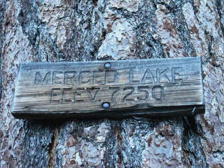
West Shore of Merced Lake
7230 feet 11.41 miles East of Yosemite Valley 16.54 miles West of John Muir Trail in Lyell Canyon
to Maps and Miles
Miles Yosemite Valley to Lyell Canyon
|
Merced Lake
to
Merced River
 |
||
Is it a tongue or is it a tail? In either case Merced Lake has a unique granite channel through which it drains West. The Merced River exits the West end of Merced Lake through the narrow finger or channel above we see bending around the small triangular flat of forested terrain on the very Western end of the lake. This little forested shelf gives the West end of the lake a little spot of breathing room between the surrounding cliffs and the shoreline. The remainder of the trail East to the Merced Backpacker and High Sierra Camps is along a narrow track between cliff wall and shoreline.
|
Merced Lake
 |
||
Merced Lake sign.
|
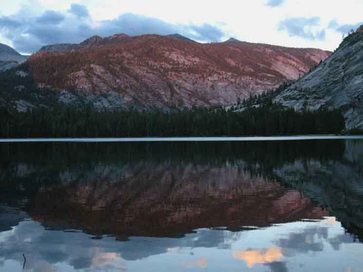
Merced Lake Sunset
 |
||
Merced Lake Sunset.
|
Mergansers on Merced Lake.
 |
||||
Mergansers on Merced Lake.
|
The
7320 feet 12.1 miles East of Yosemite Valley 16.54 miles West of John Muir Trail in Lyell Canyon
to
to
Maps and Miles
Tuolumne Meadows Area Map
Miles Yosemite Valley to Lyell Canyon
Current Access, History, and Perspective on
|
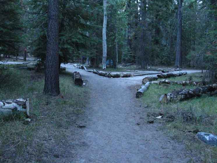
Merced Lake Camps
Backpacker & High Sierra
 |
||
Trail splits between Merced Lake Backpackers and High Sierra Camps. Left to backpackers camp, Right to the High Sierra Camp
|
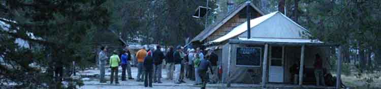
Merced High Sierra Camp
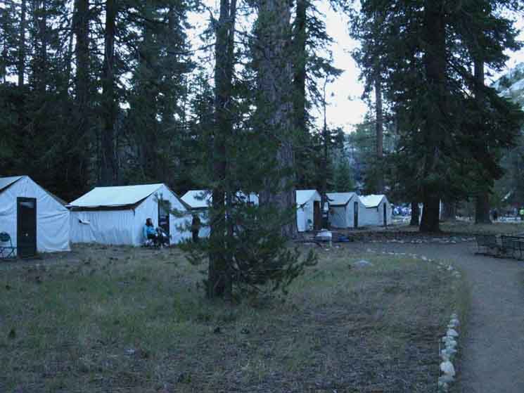 |
||
One row of Merced Lake High Sierra Camp tents.
|
More Cabins
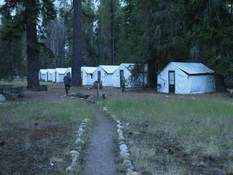 |
||
The other row of Merced Lake High Sierra Camp tents.
|
Merced High Sierra Camp Kitchen
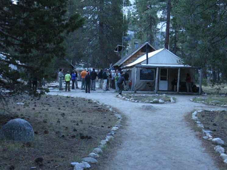 |
||
Merced Lake High Sierra Camp mealtime.
|
Merced Lake
Backpackers Camp
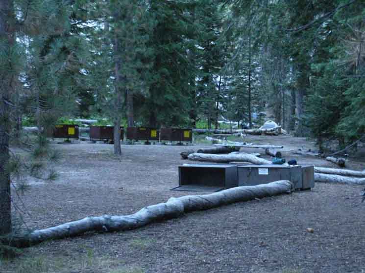 |
||
Merced Lake Backpackers Camp.
|
Merced Lake Trail Miles Signs
7320 feet 12.1 miles East of Yosemite Valley 16.54 miles West of John Muir Trail in Lyell Canyon
to
to
Merced Lake to Lyell Canyon
|
West
Downriver
 |
||
Yosemite Trail Sign miles from Merced Lake to Yosemite Valley.
|
East & North
Upriver
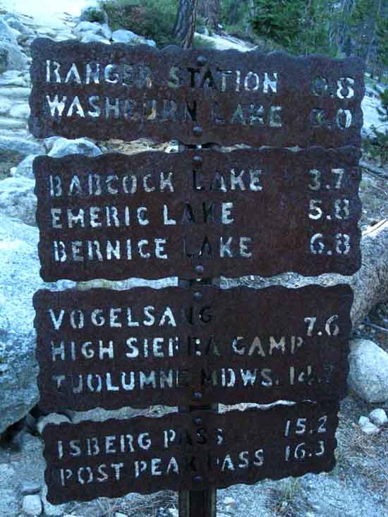 |
||||
Yosemite miles sign East and North from Merced Lake. Ranger Station .8 Washburn Lake 3. Babcock Lake 3.7 Emerick Lake 5.8 Bernice Lake 6.8 Vogelsang HSC 7.6 Tuolumne Meadows 14.7
|
| Next
Climbing Up!
Next Segment of Our Trail Crossing the berm to our East and observing the terrain and studying the map indicates this larger upriver oval valley along the Merced Canyon once held an even larger lake than Merced Lake. It is clear that thousands of years of sedimentation and associated meadow and forest incursions eventually filled in the upper lake, converting the wide spot in the canyon above Merced Lake into a sweet treasure of forest and meadow filled valley along the Merced River's Canyon. We can see this is the same fate that will eventually befall Merced Lake in its turn. We find our way around the Northwestern edge of this upper bowl to find the impressive Merced Lake Ranger Station sitting at our trail junction below the substantial climb up to Vogelsang High Sierra Camp. Our next page brings us from the Miles Posts at Merced Lake to Vogelsang High Sierra Camp, then down to the John Muir Trail in Lyell Canyon 5.6 miles South of Tuolumne Meadows to resume our Southbound hike along the Sierra Crest to Mount Whitney.
|
East-West: LITTLE Yosemite Valley to BIG Yosemite Valley Northeast: Merced Lake to Lyell Canyon
Backpacking |
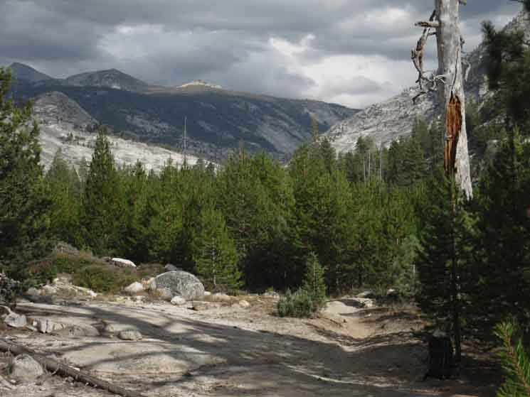
The Golden Triangle Yosemite is a large National Park that I break down into North, Central, and South regions for the convience of the Long Distance Backpacker. We hike into the most Northwestern region of Yosemite through Bond or Dorothy Lake Passes on the Tahoe to Yosemite and Pacific Crest Trails, respectively. To our East-Northeast are the Hoover Wilderness Trailheads, to our South-Southwest lays the Grand Canyon of the Tuolumne River. We arrive at roughly the center of the Sierra Nevada arriving at Tuolumne Meadows. Here the end of the Tahoe to Yosemite Trail is supplanted by the John Muir Trail heading South along the Sierra Crest from Tuolumne Meadows. Since I consider everything South of Tuolumne Meadow to be the South Sierra, our explorations of the center of Yosemite will be quite limited. Unless we take an alternative route that will run us down to Yosemite Valley and back up to the JMT 5.6 miles South of Tuolumne Meadows in Lyell Canyon.
THIS PAGE IS UNDER CONSTRUCTION: STAY TUNED FOR MUCH MORE! COME ON BACK NOW, 'YA HEAR?
7.5 Map:
30 min Map
|
Backpacking Trail Guide JMT Little Yosemite Valley |
 |
Backpacking Trail Guide to |
Backpacker Forums Have a great trip or story to relate about Yosemite or in the Sierra Nevada? Post it on Above we come to the Front Page of the High Backpacking Trails and Topics Forums. Below we break the forums down into categories:
The Trails Forum acts as your place to put up input, comments, relate your experiences, or ask questions about each segment and spot along the length of our combined TYT-PCT-JMT trails. The Forum is your place to supplement the trail guide. Anyone can post text comments in the existing forums, but only members can post up new topics, along with images, maps, and formatting. If you have experiences, comments, questions, or pictures and videos of the Pacific Crest Trail between Sonora Pass and Tuolumne Meadows, post up here as an unknown hiker or as a member: Forum Section
|
Trailhead
Contact
Alex Wierbinski

Backpacking Lake Tahoe to Mount Whitney
Your Guide to the High Sierra Crest, including the Tahoe to Yosemite, Pacific Crest, and John Muir Trails
