

The Trails
Guide
Maps
Miles/Ele
Permits
Resupply
Forum
Current Weather Conditions
Weather Notes
Northern High Sierras
Central High Sierras
Southern High Sierras
Gear
Gear List
Gettin Started
Layering
Discussion
Testing yourself and your gear
Gear Reviews
Hiking
to the
Overlook with Great Views
East & South
of
Christmas Valley & Round Top
Backpacking Meiss Country Roadless Area on the Tahoe to Yosemite Trail. A break with Pete, Jason, Pat and Jan.
Languages
Languages
Trail Arts
The art of walking
Physical Preperation
Trail Skills
The trail
Off the trail
Scrambling
Maps
Navigation
Camp skills
Food
Resupply
Food
Other
Photo Catagories
Trail Stories
Trail Culture
News and Science
Links
Groups
Books
Terms and Conditions of Use
| Trail Guide INDEX |
NORTH Meiss Roadless Area to Echo Summit |
SOUTH Meiss Roadless Area to Showers Lake |
Topo Map Echo Summit to Carson Pass |
Maps Index |
MILES and ELEVATIONS |
Miles and Elevations INDEX |
Tahoe to Whitney on YouTube |
Grand View
South
across the
Meiss Country Roadless Area
From
The Gap Break spot
 |
|||||||
Outside the Tahoe Basin Our two potential trails South split going around Round Top and the Sisters. The Tahoe to Yosemite Trail crosses Round Top to the Southwest, the Right side of image, while the Pacific Crest Trail winds around the East flank of the Round Top and the Sisters massif, not too far out of the Left edge of the image. Round Top and the Sisters marks the real divergence point of the TYT and PCT. The map and miles information below covers hiking us to the bottom of the Tahoe Basin, where we face our Southbound route options, which begin with how we pass South of Round Top.
This map below shows our route options across and around Round Top and The Sisters in the Carson Pass Management Area after we exit the South end of the Tahoe Basin. Carson Pass Region Backpacking Map
Our Break-Overlook Spot
We've been climbing with few views overlooking Christmas Valley and the terrain and topography to our East. This gap gives us great view and its comfortable break-spot provides us with a very timely place to study it for a while. I have been needing both a break and a good, sustained long view since hiking South from Echo Summit Trailhead! We get some fine views from up here on our little perch on the edge of the Tahoe Basin! I think I'll make some coffee with hot chocolate with powered cream to Bearings and Beverage Forced Focus It's all good. Forking Y to our West The first two junctions as we encounter them hiking South are the Bryan Meadow and Sayles Canyon trail junctions separated by .85 of a mile. The routes of these trails join further down the Western Flank to end together at Camp Sacramento on Highway 50. Bryan and Sayles Trail Junctions West to Highway 50 Aggressive day hikers and short distance backpackers can begin or end short backpacking trips into the Meiss Country Roadless Area through the Sayles Canyon Trailhead above Camp Sacramento. Schneiders Camp Trail Junction Southbound hikers on the TYT-PCT-TRT continue Straight through this junction, keeping a Southeastern line by the compass. The trail to Schnieders Camp tees-off the main line of the TYT-PCT to the Southwest, the Southbound backpacker's Right. South to Highway 88 Carson Pass Region Backpacking Map To Showers Lake To our Right, our Southwest, rises the low line of the Tahoe Rim itself, the Sierra Crest wrapping around the South end of the Tahoe Basin. In front of us, to our Southeast, we can make out the line a flat shelf of terrain running just under the crestline. To our Left, our Northeast, we see the descending watershed of the South Upper Truckee draining into Lake Tahoe beyond. Backdropping this whole scene is the Carson Range running North from beyond Meiss Meadow. This narrow shelf wrapping around the Southwest end of the Tahoe Basin begins with Showers Lake, and extends Southeast all the way down to the East end of Meiss Meadow. Our route South follows this narrow, undulating flat to Meiss Meadow, where we turn to exit the Tahoe Basin through the Carson Gap. The Grand View I am chomping at the bit by now for unrestricted views in all possible directions! We are nestled in under the Southernmost part of the Tahoe Rim, so the views possible to our South are terribly short, but at this point our views North and East really open up. We finally get the grand view North down the length of Christmas Valley. Our view extends beyond the valley and out across the South end of Lake Tahoe, finally settling on the massive but stark Northern elements of the Carson Range wrapping around Tahoe's East Shore. This is the view laid out for our inspection as we hike around the North Flank of Little Round Top. We have been looking East across Christmas Valley at the East Flank of the Southern Carson Range every chance we've gotten while hiking South from Echo Summit. Now, we are finally getting some expansive views North and East of the extent of the Carson Range from a real nice perspective as we are making our final approach to the very Southern End of the Tahoe Rim. Three Trails These trails offer short routes we can put together into fine little backpacking trips into the Meiss Country Roadless Area starting from and finishing exclusively on Highway 50 or Highway 88 trailheads. The relationship between the Echo Summit and Carson Pass Trailheads to these trails makes short trips of intermediate difficulty across different short segments of Meiss Country possible. We can use these trails to execute long day hikes and short backpacking trips between trailheads along Highway 50 or between trailheads on Highway 88, respectively. The easiest directions to hike would always be "top to bottom." That means starting our trips through the higher elevation trailheads of Echo Summit or Carson Pass, then hiking to the Schneider, Sayles, or Bryan Meadow junction (whichever is most suitable for our particular trip), to descend to our selected ending trailhead.
|
North: Meiss Roadless Area to Echo Summit South: Meiss Roadless Area to Showers Lake
A Great Rest Spot
with a
View of
Meiss Roadless Area
and
Good Company
 |
Round Top and the Eastern Sister in the distance. |
 |
|
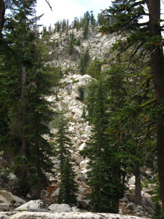
Past the Break Spot But you will make no mistake about the nature of this hike being upward, compounded by short descents. We move out of the drainage feeding Benwood Meadow below as we climb towards the Eastern-facing gap in the Western flank of Christmas Valley that will give us long views. |
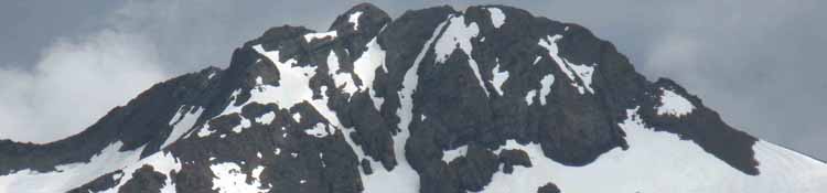
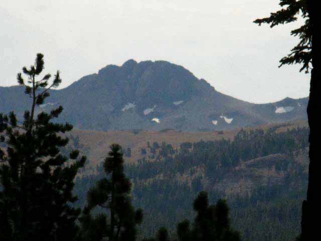
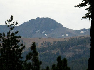
As we approach our break spot, about 2.14 miles South of Echo Summit, fine views of Round Top, about 11 miles South, open up through the trees. Round Top (guide) sits just Southwest of Carson Pass, outside of the Lake Tahoe Basin. One of the two Sisters, the pointy peak to the right of Round Top, is also visible. When we exit the Tahoe Basin at the Carson Gap, (guide) we must choose which trail we follow South, the PCT or the TYT. The PCT runs to the left, Southeast of Round Top's massif while the Tahoe-Yosemite trail passes to its right, to its Southwest. |
Remember
Click the Red Dots on the MAP for the Related Trail Page.
The maps act as an index for that area's trail guide pages.
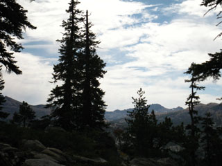
Long Views
South to Round Top, and East to the South Upper Truckee River in Christmas Valley
 |
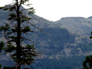 |
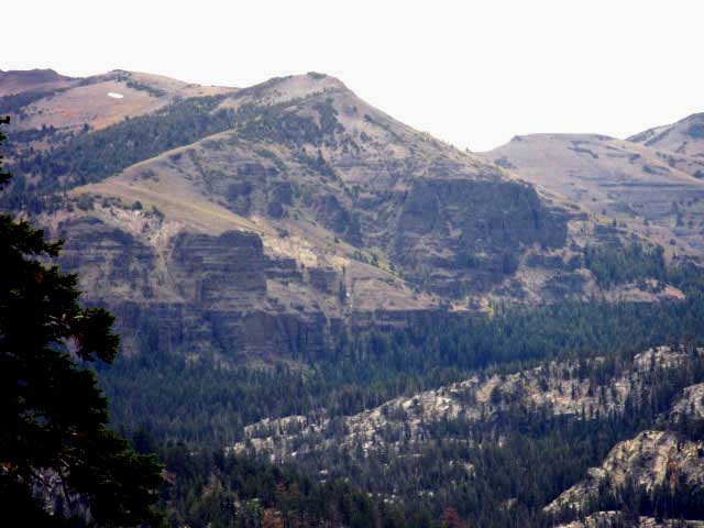
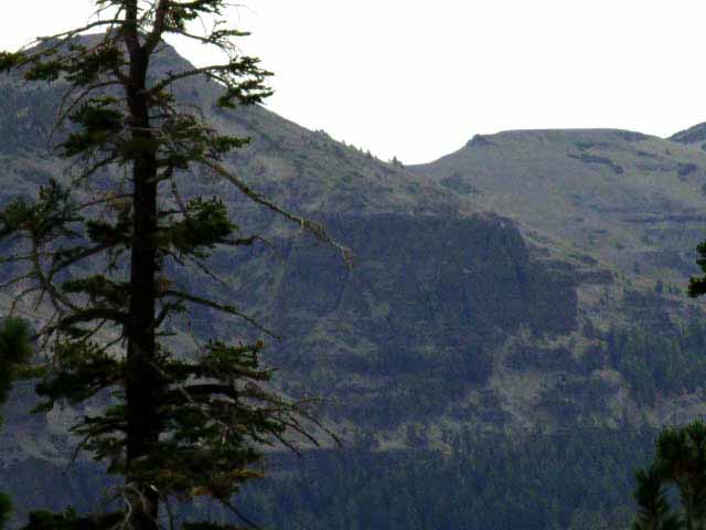
For just a small section along the trail Round Top comes fully into view. Highway 88 runs East and West at the base of the far flank of the foreground ridge, which is the South Rim of the Tahoe Basin, with Round Top sitting beyond Highway 88. The Tahoe to Yosemite Trail (map) passes under the Crest of Round Top, just out of sight, obscured by the Tahoe Rim in the image above. |
Looking East across Christmas Valley. Here the valley splits whole mountain ranges. The Eastern Wall of Christmas Valley is the West Flank of the Carson Range, while the West Flank of the Valley is the East Flank of the Sierra Crest. The South Upper Truckee Trail (guide) from Meyers tracks South (Right) towards the Pacific Crest Trail junction through Christmas Valley below this formation. This rock formation sits above, and just a bit South of Round Lake (guide). |
massif 1. a geologically distinct mass of rock or a series of connected masses forming the peaks of a mountain range. |
View
East-Southeast
The South Upper Truckee
through
Christmas Valley
South End of the Carson Range Eastern Flank of Christmas Valley
 |
Looking to the Southeast at where the South Upper Truckee River drains Christmas Valley between the Carson and Sierra Nevada Ranges. Round Lake and Dardanelles Lake sit within Christmas Valley. Round Lake sits in the forest below the volcanic formation Left of center. Notice that the terrain is volcanic on the Carson Range's Eastern flank of Christmas Valley, while the Sierra's Western flank is granite. Cool. This same type of bold yet impossibly intricate interface also splits Brown Bear Pass, down South in the Emigrant Wilderness. And, this granite-volcanic interface runs all the way down the Sierra Crestline, sometimes spilling over to the West, though most times running along the crest and covering the Eastern flank. It's like the volcanic material coats the East flank of the Sierra and runs over and down the Western flank in a random "overflow" patterns. Eruptions appear to have been centered on the crest and Eastern flank. As we hike South along the rim of the Tahoe Basin on this combined Pacific Crest, Tahoe Rim, & Tahoe to Yosemite Trails route, we will exit this granite zone passing Showers Lake and be hiking across volcanic terrain until we are well past Ebbetts Pass, except for small islands of granite, in this vast sea of high altitude volcanic debris. Well, at least on the Pacific Crest Trail. All's I have to say about that is, "Woooo-Hoooo." Views Here and There Hiking South on the TYT-PCT-TRT from our point here we will intersect with the Round Lake/Meyers trail runs up through Christmas Valley about 7 miles further South along the Tahoe Rim near Meiss Cabin in Meiss Meadow. |
Detail to Our East
 |
Detail of volcanic rock to the East above Round Lake in Christmas Valley making up the crumbling volcanic spire East flank of Christmas Valley. |
North: Meiss Roadless Area to Echo Summit South: Meiss Roadless Area to Showers Lake
Nice Rest StopBackpacking the Meiss Country Roadless Area, South of Echo SummitElevation Miles 4.66 South to the first Showers Lake trail marker (+.4 more to the lake itself). 9.86 miles South to the Carson Pass. Hiking Map South |
Trail Friends
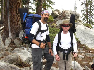
Pete, Jason, and Dog
Break Time The new trail route now goes around the mountain top to the North of the marked "overlook" position on the USGS 15 minute map. This vista is complimented with an expansive flat littered with boulders and rocks providing excellent seating. Well, this flat is expansive compared to the "close-in" dense forest and rock terrain we hiked up through to get here. Excellent seating and expansive views make this flat location a natural break and meeting spot for hikers between Echo Summit and Showers Lake. |
 |
 |
Pete and Jason. Cool Dudes. Had a nice break with these guys. I had plenty of food, and therefore plenty of time to get to Showers Lake. We had a smoke and they left their pouch with me. |
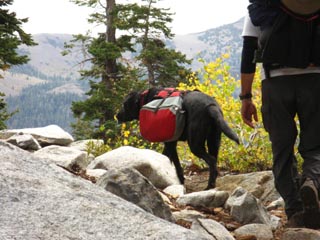
Pete and Jason's Trail Dog Cole packed for action, heading back to Echo Summit from an overnight at Showers Lake. |
Also See
Peter and Jason Showers Lake Images
Backpacker's tip from the Trail
|
||
 |
||
Jason and Peter's
Alex More Information Ask Yourself if You Are Tahoe to Whitney Member Material. I think it is likely So... |
Trail Friends Pat is an astute observer of man and nature, and I enjoyed a lively chat with Pat and Jan. Jan and Pat demonstrate the value of this section of Tahoe to Yosemite Trail for day hiking. You meet lots of good folks on the High Sierra trails. |
| Jan and Pat |
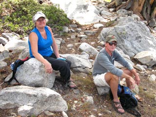 |
Jan and Pat taking a break during what appeared to be an 8 to 10 mile aggressive day hike. I believe they were training and hiking themselves into condition to start backpacking sections of the Tahoe Rim Trail. There are a lot of cool day hikers in the Meiss Country Roadless Area. We had an excellent conversation. If you want to restore your faith in humanity, spend a few weeks on the Sierra trails meeting great people from California, the United States, and around the world. |
North: Meiss Roadless Area to Echo Summit South: Meiss Roadless Area to Showers Lake
Great Conversations |
||
Trail Note A little over 2.14 miles South of the Echo Summit trail head, according to the map, (though it appears to me that the trail was re-routed through part of this section, is a bit different, and a bit longer than as depicted on the USGS 15 min map. So, the actual distance figure may differ a bit from what I measured off the map, the real distance likely being a bit longer, maybe a couple of hundred feet, than the route depicted on the 15 and 30 minute USGS maps.) This is what I consider the top of the first half, the bottom half of the big climb South of Echo Summit. Keep your eyes open. Having a good view, and there being a nice place to sit and take a break while enjoying this view are only the #2 and #3 reasons to stop here for a break. Reason #1 by, by far, are the cool hikers I meet here. This is a natural stopping place for hikers on this trail. Especially on Summer Weekends. The last time hiking through the first backpackers in after I arrived were Pete and Jason, two cool dudes out of the El Dorado Hills. They joined us for a break on their way South to their car at Echo Summit after camping at Showers Lake. They had a pouch of Bugler, which was gold to me at that point. I generally stop smoking on the trail, but when they saw my face when I saw their tobacco pouch, they quickly consulted, determined their needs over the length of their remaining hike to the trailhead and back home, and presented me the rest of their trail tobacco pouch. I really enjoyed my after-hiking hot chocolate and smoke that evening! Thanks Dudes! I tarried a bit after they departed, and shortly Pat and Jan came around the corner, also hiking back towards Echo Summit. They were also ready for a break, so I kicked it longer and enjoyed their company. Being able to stop and enjoy the company of other backpackers and hikers is an important reason to pack the proper amount of food. Nice Gear Pat had a real nice insulation/shell layer that combined the attributes of both an insulation layer and a shell. It was quite costly. But the finest, lightest, most effective gear always is. That's one reason why I'm packing heavy more often than light. Social Activities Quite a social day on the trail. No worries. We've got plenty of high mileage days ahead on the way South to Tuolumne Meadows, and on to Mount Whitney. And, I'm not going to miss meeting the fine people along the way populating the long trails between Tahoe and Whitney, as long as the food holds out.
Next page South |
Backpacking Trail Guide North |
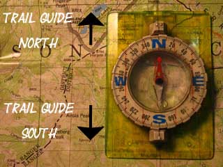 |
Backpacking Trail Guide South |
Backpacker ForumsGeneral Sierra Nevada hiking thoughts to relate? Post it on
On the Forums you can browse locations along the trail and add your experiences, comments, questions (or pictures and videos) about hiking South out of the Echo Summit Trail Head. General comments about the Echo Summit to Carson Pass section of the High Sierra trails, as well as and specific descriptions of the specific segments of trail, terrain, and experiences can be shared here: Section
|
North: Meiss Roadless Area to Echo Summit South: Meiss Roadless Area to Showers Lake
Trailhead
Contact
Alex Wierbinski

Backpacking Lake Tahoe to Mount Whitney
Your guide to the High Sierra Crest, including the Tahoe to Yosemite, Pacific Crest, and John Muir Trails
