The Trails
Guide
Maps
Miles/Ele
Permits
Resupply
Forum
Current Weather Conditions
Weather Notes
Northern High Sierras
Central High Sierras
Southern High Sierras
Gear
Gear List
Gettin Started
Layering
Discussion
Testing yourself and your gear
Gear Reviews
Backpacking
Up
Christmas Valley
to the
Burnt Flat
Meiss Country Roadless Area into Rock and Burnt Forest
Languages
Languages
Trail Arts
The art of walking
Physical Preperation
Trail Skills
The trail
Off the trail
Scrambling
Maps
Navigation
Camp skills
Food
Resupply
Food
Other
Photo Catagories
Trail Stories
Trail Culture
News and Science
Links
Groups
Books
Terms and Conditions of Use
Hiking
up to the
Burnt Flat
 |
||
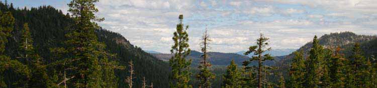
View North down Christmas Valley from the edge of the burnt flat. The tributary we followed up here is off to our Left (West) at the base of the rise this flat is situated on. To our Right (East) is the shortcut Wintertime route up to Big Meadow. Behind us to the South is our next destination, Round Lake.
Echo Summit to Round Top Lake In the distant Left we can see where Highway 50 comes through Echo Summit into the Tahoe Basin. That point is a good landmark to measure how far South we have come. That's because Highway 50 enters the Tahoe Basin just a bit to the Northwest and about a thousand feet above the South Upper Truckee Trailhead. The next feature we will continue to use as a landmark to monitor our progress is the gap in the Tahoe Rim about 2.15 miles South of Echo Summit along the combined Pacific Crest, Tahoe Yosemite, and Tahoe Rim Trails. It's a good idea to identify local landmarks and track our relationship to them as we pass through during Summertime so we can recognize our position during Winter. |
| On this page | ||||||||||||||||||
Information below
Terrain
Entering
Four Season Views
Video
Echo Summit and Gap Landmarks
USGS Topo Hiking Map
All Weather |
Lake Tahoe-Meyers
Local Resources |
|||||||||||||||||
| > Forum < | ||||||||||||||||||
All backpackers can post text comments about the following segment of the trail from the Trailhead to the Burnt Flat through the comments links on the trail guide page below. This guide is designed to present and absorb information. Check out all the Tahoe to Whitney .org Tell us what you see on the trails. |
||||||||||||||||||
| Rocky Trail above South Upper Truckee Tributary. Granite decorates the lower segment of the trail. |
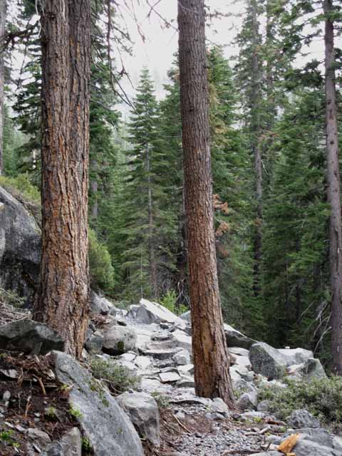 |
The trail stays above the steep and narrow drainage. |
| The flat after the trailhead gives way to an intermediate difficulty climb, which steepens as you continue South towards Round Lake. | ||
 |
||
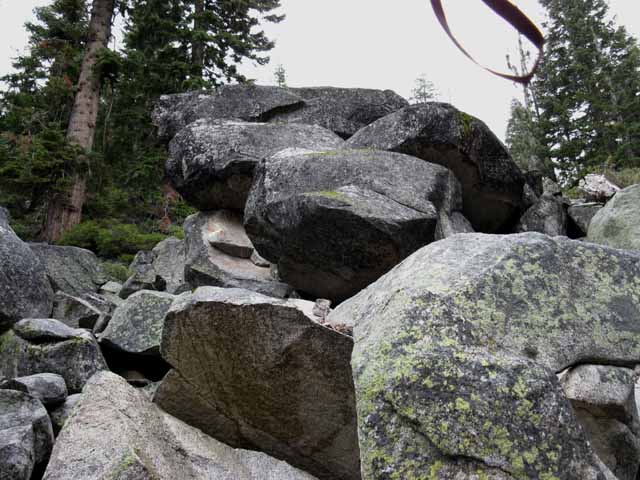
Great rockfall of granite boulders.
|
Information
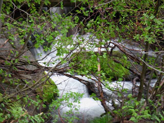
South Upper TruckeeMeiss Country Roadless AreaUp to The burnt Area & A View of the LakeElevation Mileage We are hiking South up the Valley that sits below the cliff where Highway 50 comes through the Tahoe Rim. Currently called Christmas Valley, it was previously known as Lake Valley. Hiking South out of the South Upper Truckee Trailhead we soon begin to follow the stream feeding the South Upper Truckee from the East. This stream runs up under Big Meadow within a narrow canyon up to Round Lake. Though the map shows Round Lake draining directly into the South Upper Truckee River, it does not. The upper section of this tributairy runs through a steep gorge twisting around to the Round Lake Check Dam. We'll follow this tributairy, sometimes having to follow the trail as it bends around obstacles and too-steep sections the tributairy throws at us, such as this segment of the route where we hike up and over the Burned Flat where the tributairy flows through a narrow channel to the West of the Burned Flat. We're roughly following this tributairy up to Round Lake. |
Terrain
Great Granite Features below the burnt flat
We're looking to our Right, to our Southwest, as we hike South, to our Left in the image below. This rock formation we are looking at divides the drainage our tributary follows, which is running between us and that rock formation, from the South Upper Truckee, which sits to the West, on the other side of this formation. We are now moving to our Left from the perspective of the image below, up into a narrowing valley. |
||
 |
||
We are following the Eastern tributary of the South Upper Truckee up to Round Lake.
|
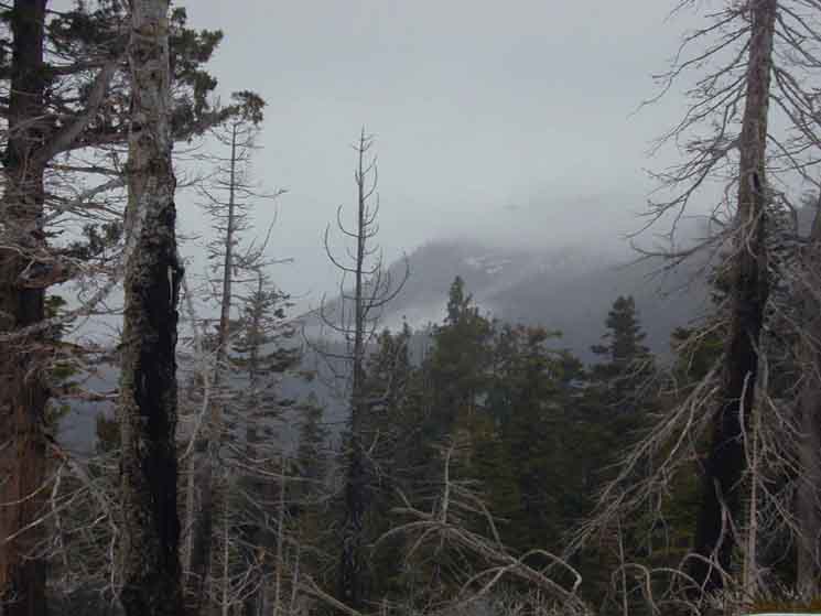
Misty Mountains Rise out of the Dense Forests
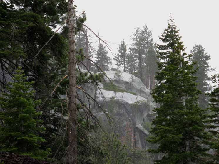
Faint mists and light rains were painting the rocks and the trees. Rock surfaces became slick. This is a beautiful piece of granite, considering the volcanic terrain beginning to tower above us to the East... |
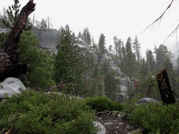 |
The moisture darkened the rocks and deepened the color of the forest, thickening the already rich scent of the forest and adding another dimension of dampening, smell, to the already hushed terrain. |
 |
Note the beautiful terrain below the forest that giving us great pleasure during the short bit of route-finding up to this point. Just pure joy. This is really really fun. Scary fun with a real element of danger woven in, but safe with the proper tools, skills, and experience that you can develop. |
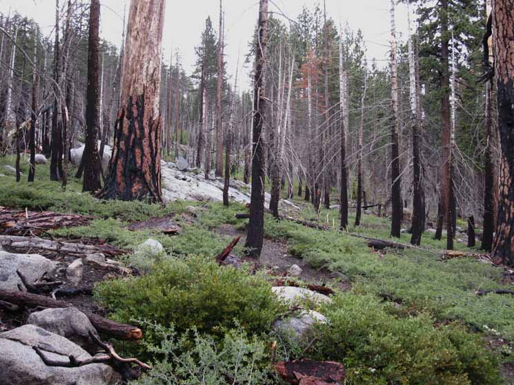
Below After hiking less than a mile South of the trail head we will begin encountering partially burnt trees climbing up towards what turns out to be a small flat spot, maybe a hundred yards by 50 yards in size. This was once a sweet little camping spot, before the fire. There is a campsite in the rocks on its North edge, overlooking Christmas Valley. |
| Spring View North from Northern edge of the burnt flat looking down Christmas Valley. | ||
 |
||
Looking down Christmas Valley into the Lake Tahoe Basin.
|
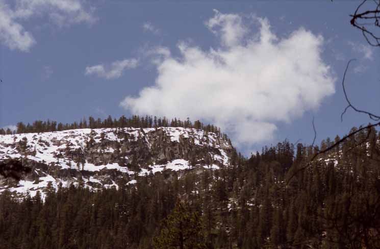
Carson Range
A longer Look Snow-capped Carson Range visible along East shore of Lake Tahoe in the far distance. |
||
 |
||
Snow-covered peaks of the Eastern Tahoe Rim, the Carson Range, faintly visible in far distance across Lake Tahoe.
|
Amazing Mists and Fogs
| Amazing mists veil Christmas Valley as air tempertures and moisture levels subtly change and intertwine during cold days. |
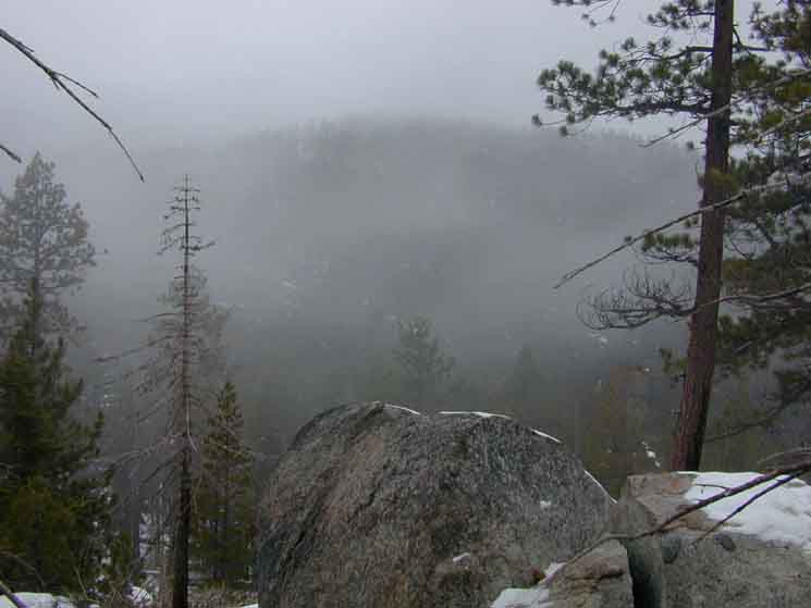 |
The mists here sometimes move as if alive. |
Christmas Valley Mists
| Looking down Christmas Valley at dancing mists. |
 |
A finger of Mist flows like water between upper and lower elevation fog banks down the flank of the lower ridge making the East side of Christmas Valley. |
East:
Up to Big Meadow
 |
||
Snow route to Big Meadow from South Upper Truckee. Approaching the Burned Flat we can see the ridge to the East offering a way East over to Big Meadow. Yup, Big Meadow is up there. Big Meadow is on the other side of that ridgeline. We will continue up to the Burnt Flat, South, to our Right from the perspective of the image above, where we can get much more direct access to that flank up to Big Meadow. We won't have to drop down into the little gully full of trees before climbing the ridge to Big Meadow. A few more feet hiking South will put us above the top of that little gully. We have the option of hiking up to Big Meadow to check it out, then we can veer South along the now snow-covered route of the trail from Big Meadow to Round Lake. Well, we can during Winter and when Snow conditions have covered the grueling forest floor litter and brush obstacles. This is not a viable shortcut during Summer. Or we can continue as planned Southbound up this tributary (to our Right) of the South Upper Truckee through the Burnt Flat on our way up to Round Lake.
30 min Hiking Map Big Meadow and Scotts Lake to Hope Valley As I mentioned, we have the Winter option to hike East up to and across Big Meadow. This could be part of a backpacking trip on our way over a gap in the Waterhouse Massif to Scotts Lake. It was a nifty Winter exploration. I just decided to go explore new terrain over there, and did. This 30 minute map lays out the terrain from Big Meadow to Scotts Lake and Hope Valley. |
View North down the Valley
 |
Our tracks coming up the valley, animal tracks off to the Right. The cold darkness under the forest is growing as the sunlight diminishes with sunset's approach. |
Looking North
across the
Burnt Flat
| The burnt area running up to a flat spot where we can turn around and get our first uninpeded view of the Tahoe Basin. The fire must have been 8 or 9 years ago. (2002 or 2003?) | ||
 |
||
Looking North across the Burnt Area. The fire burned hot in here.
|
Toasty Summers
Summer View North down Christmas Valley from the North edge of the Burnt Area. This position is about 1.13 miles South of the trailhead. The Carson Range is visible in the far distance rising above the unseen East shore of Lake Tahoe. |
||
 |
||
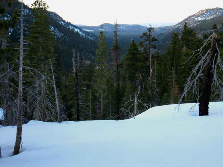
Note the scorched trees in the foreground. This marks the Northern edge of the Burnt Area. This view is looking North from the North end of the Burnt Flat. In Winter I generally camp near here on the way in, and the way out. Drifting snow forms some nice flats suitable for camping. Note the FAINT cutaway on the descending ridge on far-distant left side of image. That is where Highway 50 cuts through the Tahoe Rim at Echo Summit. The Echo Summit trailhead is less than a half-mile West of there. See the image below for a close-up of Highway 50 coming through Echo Summit into the Lake Tahoe Basin.
|
Frosty Winters
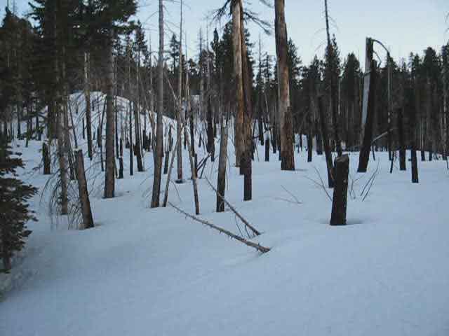
|
||
Christmas Valley and Lake Tahoe beyond from the North edge of the Burnt Flat in Meiss Country. Note the exact same three trees in the center of the image above and the second image above. I am in almost exactly the same place in different seasons of different years.
|
Looking South across the Burnt Flat
 |
| Looking South across the Burnt Flat from its North edge. |
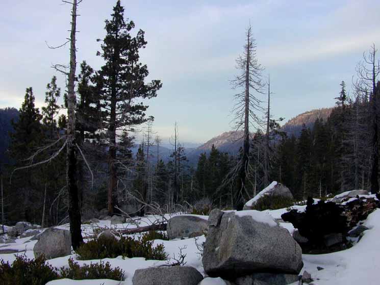
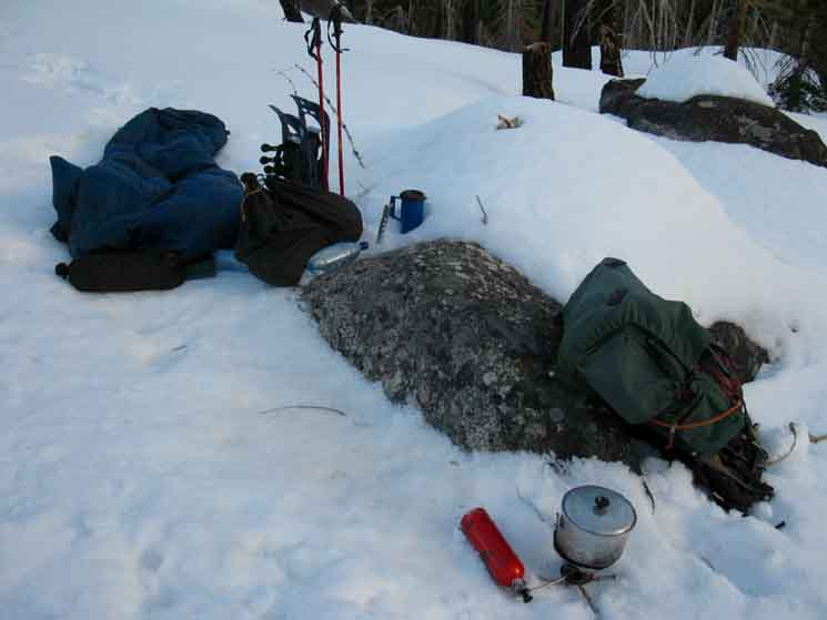
Two Camps
Camp
1
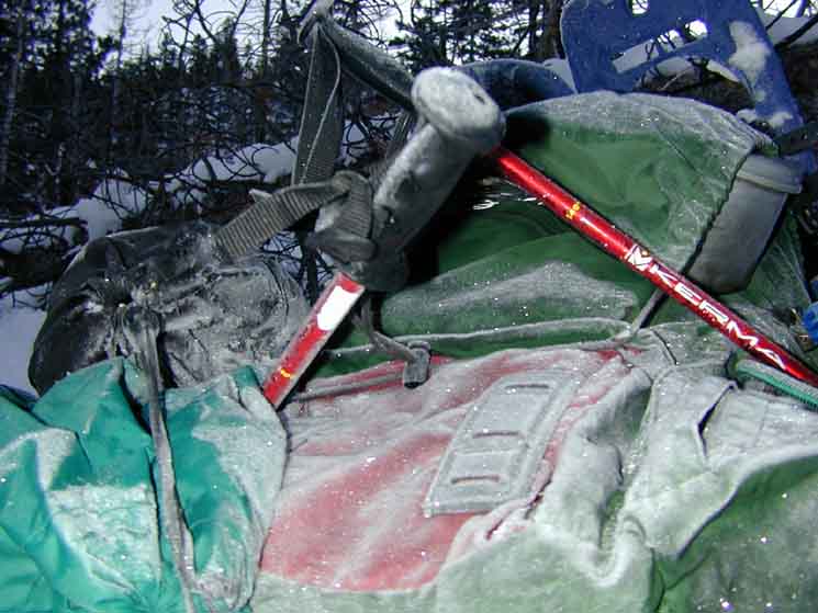
Snack Break, Burnt Area. Note my snack sack on the rock above my pack. I always hang a sack with the day's food and snacks within easy reach. It goes like this: Pack off, food and water instantly in hand. |
 |
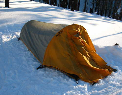
Winter, hiking up through Christmas Valley to Round Top Lake, near Carson Pass. |
Just throw down the pack and crash out
Camp 2
Another Burned Flat Camp
 |
||
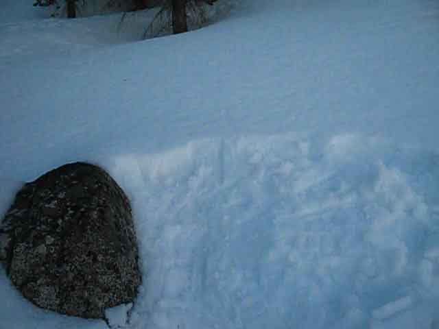
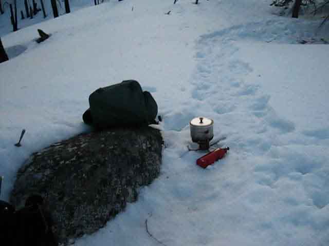
Another Burnt Flat Winter campsite. Solar heating had cleared this rock of enough snow to provide a great seat and seatback. I just had to stamp out a nice compressed flat for sleeping and camp activity.
This place is a good target for the first day's hike in, as it is not too far from the trailhead. It is a good place for the last night of a trip for the same reason. Below I've stamped out the trail to the toilet and tree I'll hang the food from.
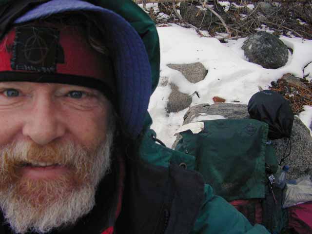
Since I use my thumb and public transportation on the way in and out of trailheads I've got to stage up my beginnings and ends of trips to accommodate the extra transportation time. I don't know how long it will take to get to the trailhead, so the first day's trail miles are dependent on transportation time. The same applies to the way out, especially during Winter. It may take a couple of hours to walk out of the trailhead to Highway 89 and down to 50, so staging up here for an early morning return to civilization on the way out seems to me as good a plan as staying here on the first night in after an extended trip to the trailhead. We need to have plans for the easiest transition onto and off of the trail as possible. Transitions are important. Another
|
Video
Burnt Flat, March 18, 2010
| Setting up the Winter to Spring trip first Campsite on the Burnt Flat. | ||
Morning at the Burnt Flat, proceeding up to Round Lake along our tributary. Video of Winter terrain.
See the full list of Videos from this |
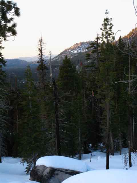
Winter Sunset
| Sunset from the North side of the Burnt Area. |
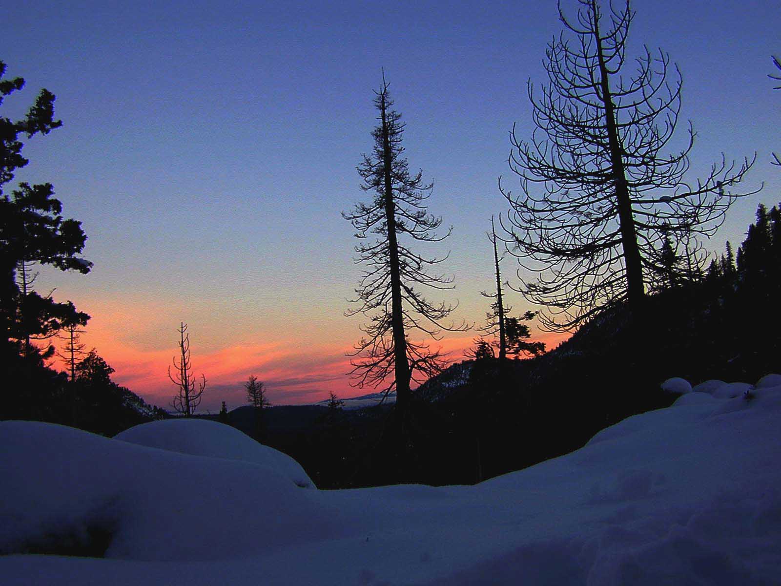 |
| Winter Sunset over Lake Tahoe Basin from from the sleeping bag in the Burn Area. |
Echo Summit and Tahoe Rim
viewed from
Christmas Valley
Check out the view into Christmas Valley from the Tahoe Rim South of Echo Summit
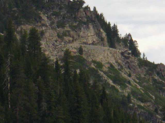
Highway 50 entering the Tahoe Basin. That's the cutaway we've been looking at on the side of the distant wall of the Tahoe Rim. |
||
 |
||
Looking Northwest from Christmas Valley at Highway 50 coming onto the East flank of the Tahoe Rim via Echo Summit into the Lake Tahoe Basin.
|
The Tahoe Rim
to our
West
To our Southbound Right (West) the edge of the Tahoe Rim parallels our route hiking South up the canyon. I use this gap in the Tahoe Rim as a Winter Landmark. |
||
 |
||
Looking West up at the gap in the Tahoe Rim from our position on the burnt Flat in Christmas Valley. This is the gap in the terrain 2.15 miles South from Echo Summit Trailhead along the Pacific Crest and Tahoe to Yosemite Trails that makes a great overlook into Christmas Valley and our position here on the Burnt Flat. This gap is also an excellent landmark for a long as we can see it. Soon the close-in nature of the terrain we are following up to Round Lake will obscure long views.
|
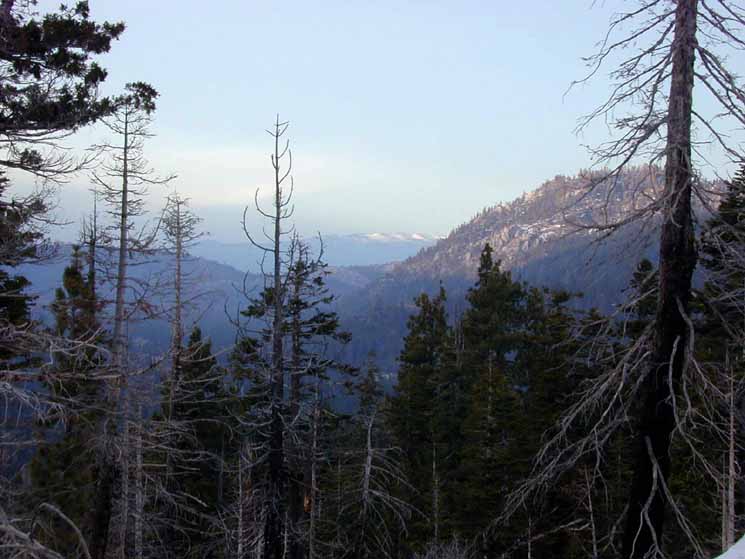
| Most of the forest floor litter was burned away, and virtually all the trees killed. |
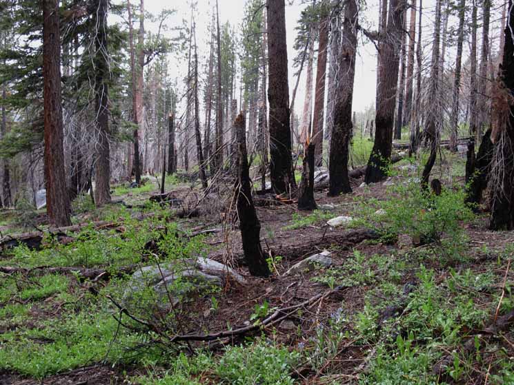 |
The View North passing South through the Burnt Area. We're just about to descend off the South end of the Burnt Flat. |
Turning our back on this great view we again turn upstream and hike to the end and off the Southwest side of the burnt flat. On the Southwest end of the burned flat we find the trail bends to the Southwest off the backside of the Burned Flat through a short switchback, back down to the tributairy we've more or less followed up to this point. From here we are going to get up on the steep side of the mountain below the West side of Big Meadow to where the trail begins traversing a narrow passage following above the countours of the creek all the way up to the Dardanelles Lake trail junction. |
The Tributary on the Southwest Side of the Burnt Flat
We are hiking up along the Eastern tributary of the South Upper Truckee. We do not ford it. Dropping Southbound over to the South side of the burnt area flat brings us back down to this creek. |
||||
 |
||||
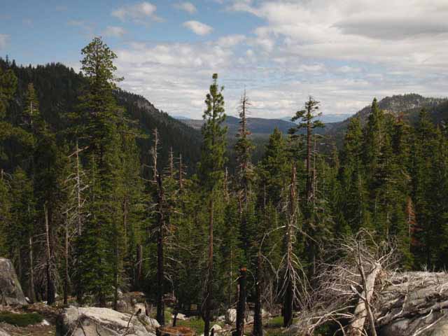
We are now past the Southern limit of The Burned Area. South of the burnt area we will again be encased in deep forest within this steep narrow valley along the tributary, until things open up a bit past the Dardanelles Lake trail junction. We'll continue traversing the mountain flank Southbound as the creek drops down deeper into its ravine off to our Right side. We'll mostly stay in this closed-in terrain above the creek up to where the trail cuts in from Dardanelles Lake from the West, our Southboud Right. There are two all-season locations where we can access the creek between the Burned Flat and the Dardanelles Lake trail junction. The first is pictured above, where we rejoin the creek on the South side of the Burned Flat. This is where we get water for Burnt Flat Summer campsites. The second place to get water is where the trail makes a sharp bend Left near the creek about a half-mile to the North of the Dardanelles trail junction. Typically we'll see a couple of flat spots sufficient for emergency campsites as we hike past this mid-way watering point. As the total distance between the South Upper Truckee Trailhead and Round Lake is four miles, I really don't see any water issues on this part of the trail.
Likewise for the short distance from Round Lake to our Southbound exit from the Tahoe Basin through the Carson Gap. Plenty of water here in the Meiss Country Roadless Area. But we've got to consider water for the next section of the trail South when we exit the Lake Tahoe Basin, especially if we are hiking South on the Pacific Crest Trail. The PCT may have some water issues during dry years. We'll consider these issues as we get ready to hike out of the Tahoe Basin from Meiss Meadow tomorrow. The Tahoe to Yosemite Trail South of the Tahoe Basin has plenty of water sources. |
South: Just Past South Upper Truckee Trailhead top of page North: Dardanelles Lake Junction
Where to Camp |
The Hiking PlanOur 1st day's backpacking plan must consider the situation created by the time we arrive at the trailhead, combined with the load that elevation, pack weight, and the stiff climb right out of the trailhead are going to put on the body. The video on this page considers these issues for Winter travel. I generally plan to spend the first night of Summer backpacking trips out of the South Upper Truckee trailhead at Round Lake. Round Lake is about four miles and 1560 of vertical elevation up Christmas Valley. Round Lake sits at 8032 feet of elevation. I say "about" four miles because the route has been significantly altered by recent trail reroutings. The map does not reflect the current route between the trailhead and the Dardanelles trail junction accurately, and subsequently the distance between the trailhead and Round Lake. I did place the lower part of the new trail from the new traihead in the correct location on the USGS map. The new trail route is located higher up on the mountain to the East than the old trailhead and trail indicated on the map. There are also a couple of switchbacks that have been added to the trail between the trailhead and the Burnt Area that are not depicted correctly on the USGS maps, or on my modified maps, yet. Though Round Lake is only four miles up the trail, I generally camp there my first night out. This is because my arrival time at the trailhead is very rarely earlier than 3 pm, and that's if everything goes right, on my way to the trailhead from Berkeley. During Wintertime my 3 pm arrival time at the trailhead makes it impossible to get to Round Lake before dark, so I shoot for the Tahoe Basin overlook in the Burnt Area Flat to spend my first night.
During Summer the sun sets as late as 8:30, giving us plenty of time to hike to Round Lake for our first night on the trail. There are good reasons to camp at Round Lake. Round Lake First, Round Lake is beautiful, and has many nice campsites overlooking the lake. It's the nicest place to camp from the South Upper Truckee trailhead to Round Top Lake. Second, it sits at 8080 feet, and a night here helps us adjust to altitude. And finally, an easy first day at altitude and under load is the proper way to warm up without provoking blisters, exhaustion, injury, or altitude adjustment problems. Depending on my state of fitness going into the High Sierras, I generally do 5 to 7 miles on the first day, 10 to 12 on the second, then hold 15 mile days as long as required, and more miles per day as necessary. This means that we will be departing the Lake Tahoe Basin sometime during the second day hiking South. During Summer or Winter our likely destination on day two will be at Round Top Lake. Round Top Lake Round Top Lake is our second campsite out of the South Upper Truckee because I prefer the Tahoe to Yosemite Trail route over the Pacific Crest Trail Route between Carson Pass and Ebbetts Pass. Round Top Lake is on the Tahoe to Yosemite Trail route pointing Southwest after the Pacific Crest Trail route has broken off to the Southeast. Round Top Lake is not a long distance away from Round Lake, about 7 miles, but it is such a pretty Lake, and the views spanning the Northern horizon from West to East are so profound, that I will sacrifice a few miles on the trail to enjoy the view and spectacular sunset at one of Round Lake's fine campsites. That's why we are here... For more on permitting requirements at Round Top Lake for local and long distance backpacking, see the Carson Pass Management Area information. Down the Tahoe to Yosemite Trail Our next two camping options hiking the Tahoe to Yosemite Trail South are at Fourth of July Lake at 9.3 miles South of Round Lake, and the wrecked camp I call "The Boyscout Camp," (pretty much wiped out by fallen snags ((2013))which sits approximately 11.5 miles South of Round Lake. Pacific Crest Trail If I am heading South on the Pacific Crest Trail my destination will be one of the lakes in the chain of lakes located South of the paved Blue Lakes Road. Of course I can do more or less miles, as required by the situation and determined by analysis of food, miles, social and esthetic issues, and physical conditions. My priority list is clear: I do what I want to first, followed by what I need to do second, and ultimately devolve to doing what I have to. The key is to be clear on how these priorites are flexibly interconnected, about how following each priority induces changes in the others. In other words, how you walk today determines how you will walk tomorrow. For more on the daily calculation.
TRAILS FORUMS
7.5 Hiking Topo Map 30 min Hiking Topo Map
Next page South |
Backpacking Trail Guide North South |
 |
Backpacking Trail Guide South |
Backpacker ForumsGeneral Sierra Nevada hiking thoughts to relate?Post 'em on
On the Forum you can browse trail locations and add your experiences, comments, questions (& pictures and videos if you Register...) about hiking South out of the South Upper Truckee Trail Head. Become a Member!General comments about the South Upper Truckee to Carson Gap section of the High Sierra trails, or this particular location: Section
|
North: Just Past South Upper Truckee Road Trailhead South: Dardanelles Lake Junction
Trailhead
Contact
Alex Wierbinski

Backpacking Lake Tahoe to Mount Whitney
Your guide to the High Sierra Crest, including the Tahoe to Yosemite, Pacific Crest, and John Muir Trails
