

High Sierra
Backpacking
Trail Guide
Forums
Sierra
Weather
WeatherNotes Northern
Sierra Weather
Gear
Backpacking
South Lake Aloha
Hiking through South Desolation Wilderness on the Tahoe to Yosemite Trail & the Pacific Crest Trail
Languages
Trail Skills
Mountain
Safety
Food
Planning
Trail Arts
More
Information
Social
Video
Backpacking past Central and Southern Lake Aloha
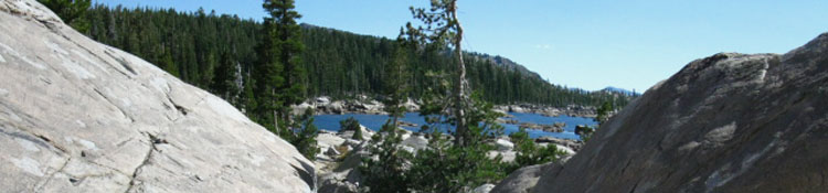
South Lake AlohaOnce we reach the North side of Lake Aloha we get clear views down our Southbound route through the wide open expanse of Desolation Valley for the next couple of miles. We'll be hiking between the Northeast shore of Lake Aloha and the Southwest flank of Cracked Craig.
Meeks Bay to Echo Summit The open granite terrain and the shattered spattering of Lake Aloha's Fall configuration of lake-lets scattered over the terrain are visible down to the point where the our Southbound trail climbs a low rise to enter the forest, visible in the far distance, for our drop down to Upper Echo Lake. This segment of trail finishes our hike South along Lake Aloha through Desolation Valley. |
| Winding through the maze of great granite slabs, boulders, and rocks along the Southern Lake Aloha shore. |
The Numbers
| South Shore of Aloha Lake in Desolation Wilderness |
Desolation WildernessSouthern Shore of Lake AlohaLake of the Woods trail junctionElevation Mileage 22.58 miles South from the Meeks Bay Trailhead. 6.13 miles to the Echo Lake Trailhead. note: Mileage sign at Echo Lake trailhead states: Aloha Lake 5 miles. This is incorrect according to my measurements and experience. |
South Shore of Lake Aloha
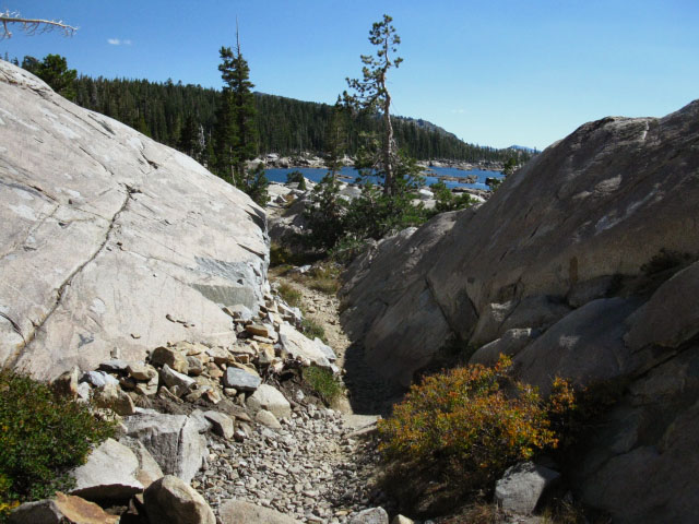 |
The trail winds through a beautiful granite landscape on the East side of Lake Aloha. The peak in the distance is one of the mountains on the South side of the Echo Lakes. Either Ralston Peak or Talking Mountain. |
The Central and Southern Shores of Lake Aloha
| The trail winds through, around, and by some beautiful, strange, and intriguing granite formations as we pass South along the East shore of Lake Aloha. |
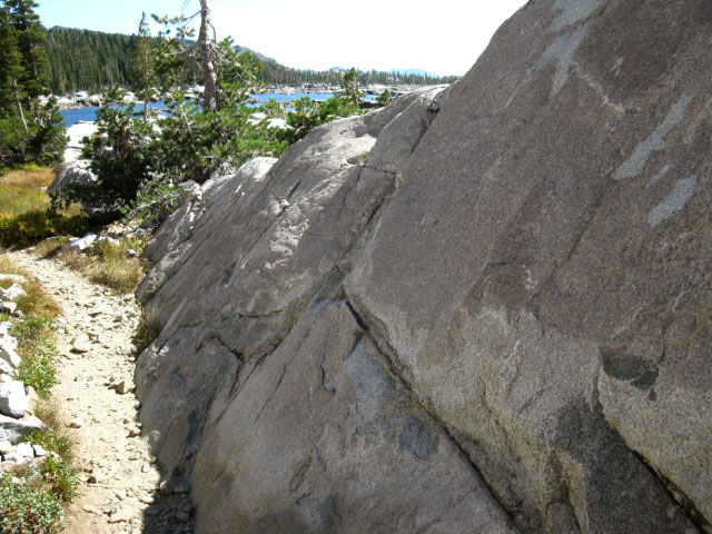 |
Tahoe to Yosemite Trail along great granite formation, Lake Aloha, Desolation Wilderness. |
Cracked Craig
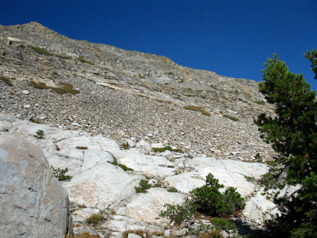 |
| Shattered surface of Cracked Crag. |
Continuing SouthAs we proceed South through Desolation Valley we can see the granite terrain reach far to the Southwest, further than we can actually see. Beyond our vision Pyramid Creek and the granite terrain create some fine falls where they run together all the way down to Twin Bridges on Highway 50. But our trail does not go so far. Our trail keeps a Southeast line to enter the forest when we first encounter the forest fringe, bending gently Southeast and downward towards the Echo Lakes. |
North: Aloha Lake 1 South: Trail Junctions S of Aloha
South Side of Lake Aloha |
||
At the South end of Lake Aloha an expansive view to the Southwest opens up, flanked to the North by Pyramid Peak and its massive granite slab. The first trail junction on the South Side of Lake Aloha, the trail to Lake of the Woods, breaks off to our right. The Echo Lake trail head is 6.13 miles straight past this junction. From here the elevation drop puts us into forest, which means shade and softer trail surfaces,, which will accompany us all the way to Echo Lake trailhead on the trail along the Norh shores of the Echo Lakes. Passing Echo Lakes the forests deepen approaching and into the Meiss Roadless Area through the Echo Summit trailhead. Meeks Bay to Echo Summit Forum Maps
30 min Map South Trail Guide |
Backpacking Trail Guide North |
 |
Backpacking Trail Guide South |
Backpacker ForumGeneral Thoughts about backpacking:TahoetoWhitney.OrgAdd your experiences, comments, or pictures about Lake Aloha:Section
|
North: North Lake Aloha South: Trail Junctions S of Aloha
Trailhead
Contact
Alex Wierbinski

Backpacking Lake Tahoe to Mount Whitney
Your guide to the High Sierra Crest, including the Tahoe to Yosemite, Pacific Crest, and John Muir Trails
