


Lake Aloha, Desolation Wilderness
hiking map
The Tahoe to Yosemite and Pacific Crest Trails
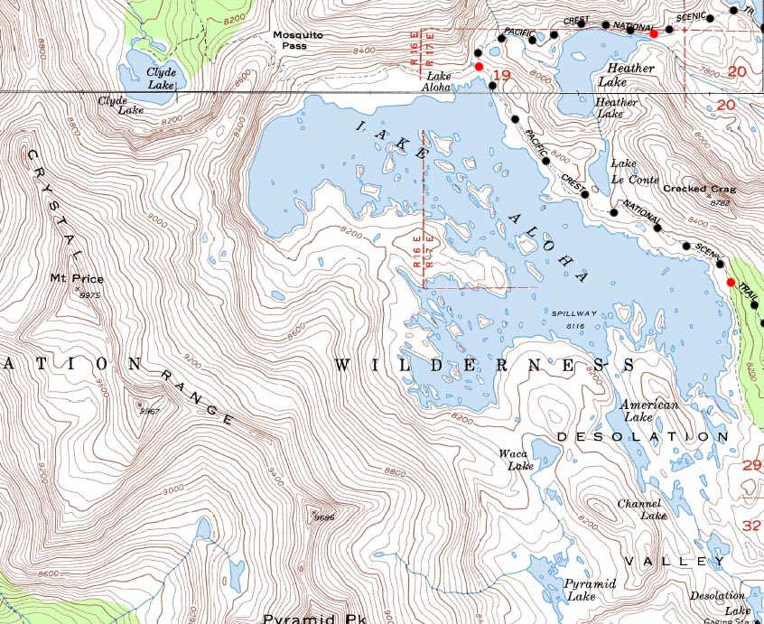
7.5 minute USGS Backpacking Topo Map of Lake Aloha in the Desolation Wilderness

| Topo Maps Index Meeks Bay to Echo Summit |
Central |
South |
South |
30 min REGION TOPO MAP Phipps Pass to Echo Summit Trailhead |
Full Desolation Wilderness Topo Map |
Trail Guide |
all maps |
all pages |
Miles and Elevations |
map info |
Backpacking Map, 2.82 miles from the Northwest Shore of Susie Lake to Lake of the Lake of the Woods Trail Junction on the South end of Lake Aloha
North 7.5 min map: Central Desolation Wilderness Click Red Dots Mileage and Elevations South 7.5 map: South Desolation Wilderness
|
North 7.5 min map: Central Desolation Wilderness South 7.5 map: South Desolation Wilderness
|
North Echo Lake South Echo Lake
Mapology |
||||
MAP NOTE What's important for our general reference purpose is that each side of a square is 1000 meters, or a Kilometer. From my point of view that is 1093.6 yards or .62 of a mile. Diagonal: 1414.22 meters, if my trig is correct. That converts the diagonal distance into 4,639.8 feet or .88 of a mile.
|
Lake Aloha |
|
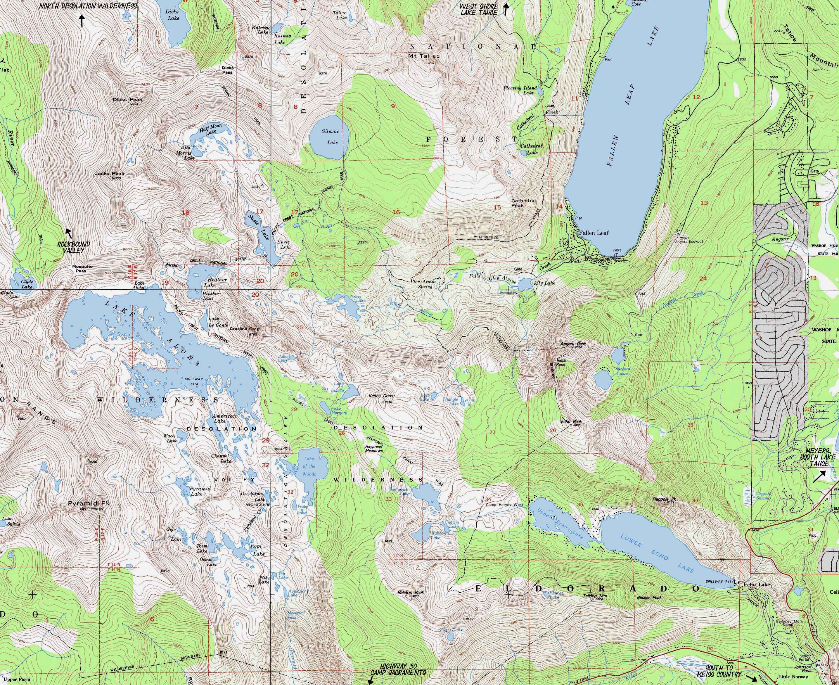
MileagesNorth side of Lake Aloha to Echo Lake trailhead: 7.55 miles Also see Lake Aloha 30 min Map I am particularly impressed by the depiction of Lake Aloha full during Spring above, agasinst how it looks during Fall on the 30 min Map. Meeks Bay to Echo Summit Meeks Bay trail head to Lake Genevieve: 4.39 miles Lake Genevieve to Middle Velma Lake: 7.93 miles Middle Velma to N. side, Lake Aloha: 8.84 miles North side of Lake Aloha to Echo Lake trail head: 7.55 miles Echo Lake trail head to Echo Summit Trail head: 2 miles Totals Meeks Bay trail head to Echo Lake trailhead: 28.71 miles Meeks Bay trail head to Echo Summit trailhead: 30.71 miles
Physical location Desolation Wilderness Region Map Tahoe to Alpine Trail Guide Meeks Bay Between Highway 89 and Highway 50 in the Desolation Wilderness |
USGS Map InformationMap Name: Pyramid Peak, Ca., 1992, USGS 7.5 minute Topographic Northwest Map Northeast Map Southeast Map Southwest Map Compass Offset scale Contours Backpacking Permitting Authority TahoeWhitney Feds National Forest LTBMU Wilderness Area: Desolation Wilderness Desolation Wilderness |
North 7.5 min map: North Desolation Wilderness South 7.5 min map: Echo Lake 1
| Elevations | More Information | ||
Dicks Pass : 9390 feet Susie Lake: 7800 feet Lake Aloha: 8120 feet Echo Lake: 7414 feet Echo Summit: 7377 feet Dicks Pass to Echo Summit: 14.33 miles |
Trail Guide, Section Trail Guide, Segment Google Map |
||
Map Credit |
U.S. Geological Survey, Department of the Interior The USGS Get this topo from the:USGS Topographic |
The Tahoe to Yosemite Trail begins at