The Trails
Guide
Maps
Miles/Ele
Permits
Resupply
Forum
Current Weather Conditions
Weather Notes
Northern High Sierras
Central High Sierras
Southern High Sierras
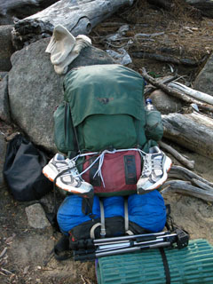
Gear
Gear List
Gettin Started
Layering
Discussion
Testing yourself and your gear
Gear Reviews
Backpacking
Granite Flat Campsite
to the
Lower Ford of Summit City Creek
Hiking the Tahoe to Yosemite Trail in the Mokelumne Wilderness
Languages
Languages
Trail Arts
The art of walking
Physical Preperation
Trail Skills
The trail
Off the trail
Scrambling
Maps
Navigation
Camp skills
Food
Resupply
Food
Other
Photo Catagories
Trail Stories
Trail Culture
News and Science
Links
Groups
Books
Terms and Conditions of Use
| Trail Guide INDEX Carson Gap to Lake Alpine |
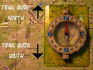
TYT Guide North Telephone Gulch to Camp Site |
TYT Guide South Camp Irene |
7.5 Topo TYT Map Telephone Gulch to the Lower Ford |
Big 7.5 min TYT Topo Map Summit City Creek to Mount Reba |
30 min TYT Topo Hiking Map Echo Summit to Lake Alpine |
TYT Carson Gap to Lake Alpine MILES AND ELEVATIONS |
TYT |
EL Dorado National Forest |
Tahoe to Whitney on You Tube |
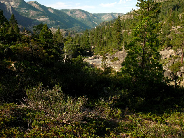
View out the End of Summit City Canyon from a Sweet Campsite
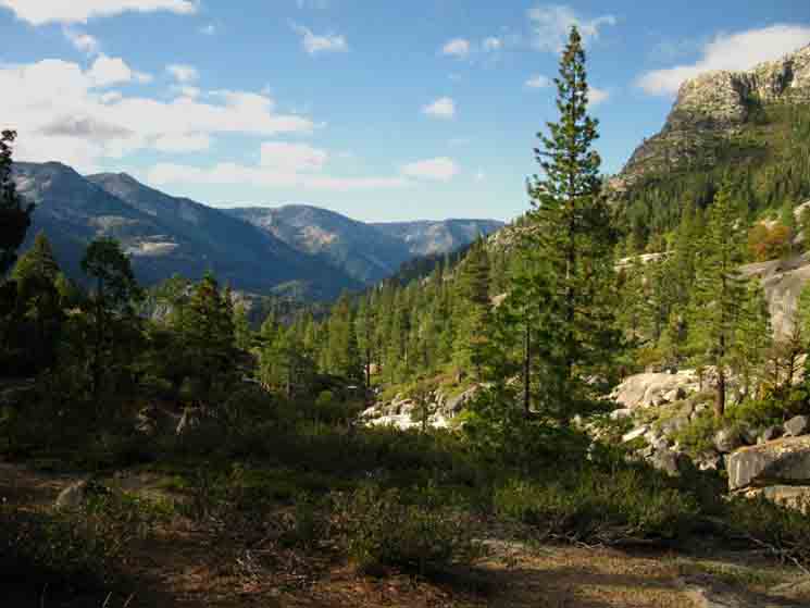 |
Mount Reba is the second peak sticking out from the Left, with the little barb on its peak. Well, that is one of the two Mount Reba Peaks listed on the USGS maps. That's the Western Mount Reba pictured above. That ridgeline has two almost equal peaks, so I guess the USGS decided to share the "Mount Reba" designation between 'em. The peak to the Left of Mount Reba in the image above is Peak 7632. Between 7632 and Reba sits Lake Valley. Behind Mount Reba we can see the much larger Horse Canyon. Horse Canyon runs up to the Bear Valley Ski Resort. On the West flank of the peak to the Left of Mount Reba, Peak 7632, the great granite ledge that we cross over the top of on our way into Underwood Valley is very brightly lit up, rising out of the sea of shadow blanketing the surrounding mountain flank. Yes, we are going to climb up from Camp Irene to cross the flat top of the upper granite formation on the Western flank of Peak 7632. We then bend around the Southwest corner of Peak 7632 into Lake Valley for the rest of the hike up to Mount Reba. Check out the map for details. Our Location at the Campsite at the End of Summit City Canyon Latitude 38.580626° Longitude -120.038911° |
The Campsite at the End of Summit City Canyon to the Lower Summit City Creek Ford
Distance: .97 of a mile. Descending 540 feet of elevation.
We hike South out of the End of Summit City Canyon from the fine campsite looking out over the vast canyon of the North fork of the Molkelumne River. As with the previous sections of the trail coming down Summit City Canyon this short .97 of a mile section mixes followable trail with untrailed lengths. Ducks can be in short supply early in the hiking season after heavy snows and runoff. |
Backpacking Information
Miles-Elevations-Maps-Terrain
At the campsite overlooking the end of Summit City Canyon we are looking into what is subsequently called the canyon of the North fork of the Mokelumne River. Campsite Location Latitude 38.580626° Longitude -120.038911°
POST UP! All backpackers can post text comments about the following section of trail through the comments links on all the trail guide pages. Registered Members can post up stand alone post about the trail with text, images, maps and videos in the Trails Forum that supplements this section of the Trail Guide. Hiked this section of the Tahoe to Yosemite Trail lately? Check out the Tahoe to Whitney .org Backpacking Trails and Topics forums |
||||||||||||||||||||||||
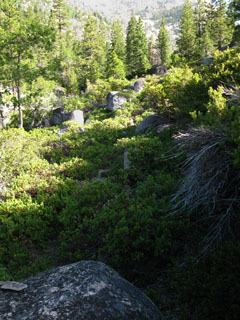
Campsite at the End of Summit City Canyon
Hiking South
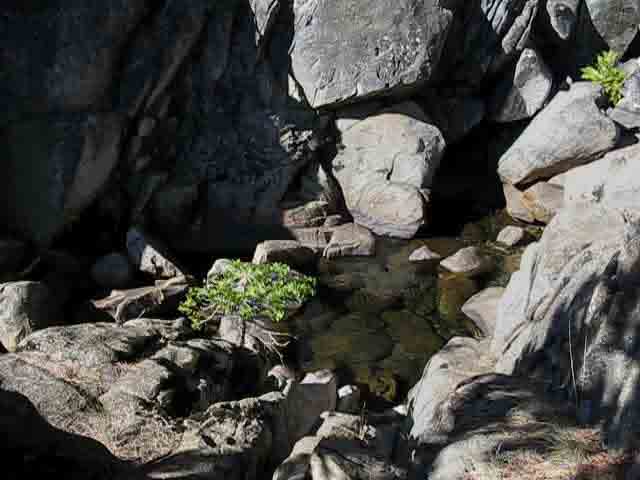
| Fine terrain with access to the creek continues a ways past the improved campsite on the granite flat. | A deep cold water pool with a fine sparkling green water. These are great places to sneak up on fish, and take their pictures. If they hear your heavy footsteps approaching, they will flee or hide, so tread softly when you approach fish. |
|||||
 |
 |
|||||
This section features a nice cascade surrounded by granite plates and boulders. |
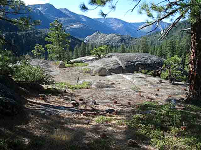
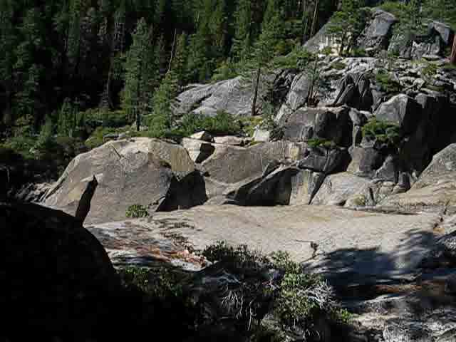
Next year I will spend a full day here. There's a lot of fine terrain details to explore in this flat. |
The View of the upcoming North Mokelumne River Valley, crowned by Mount Reba, opens up before us at the end of the Granite Flat
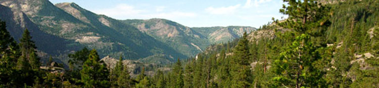
Heading South, down to the end of the narrowing Granite Flat. We can see out the end of Summit City Canyon into the vast canyon of the North Mokelumne River heading Southwest towards its grand bend to the West. The lower ford of Summit City Creek, far below us, precedes the confluence of Summit City Creek with the North Mokelumne River. The flank of the massive ridge line in the distance, Bloods Ridge, bounds the Southern Shore of the North Fork of the Mokelumne River where Horse Canyon drops into the drainage. We won't see the North Mokelumne River at all until we arrive at Camp Irene, unless we seek it out while crossing the Enchanted Forest. See the subsequent trail guide pages for details on amazingly secluded places to camp on the North Mokelumne that are rarely visited, let alone camped in... |
||
 |
||
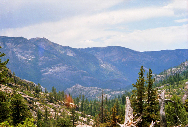
The picture above reveals much detail about our upcoming climb to the top of Mount Reba. The top of the first peak visible on the very upper-Left of the image above is Mount Reba. Lake Valley sits to the Left of Mount Reba, and Underwood Valley is the next valley to its Left. From the upper-Left of the image above looking from Left-to-Right the valleys we see are Underwood Valley, Lake Valley, and Horse Canyon. Horse Canyon is a huge valley on the far side, the South side of Mount Reba. Camp Irene is out of view behind and below the pointed granite feature located just a bit to the upper-Left from the exact center of the image. Can you see that pointed granite feature? That is the top of the huge granite feature dividing the Enchanted Forest on its North side from Camp Irene on its South. Above and to the Left of the pointed granite feature we can see the great granite slabs under the mouth of Underwood Valley lit up by the brilliance of the rising Sun shining through Underwood Valley. We will climb up and over these grand granite features along a serpentine route passing under the mouth of Underwood Valley and into Lake Valley. This is very complex terrain with very faint "trails." As the Southeastern base of the pointed granite feature between Camp Irene and the Enchanted Forest gets its roots wet in the waters of the North Mokelumne River, and that it flows past both the Enchanted Forest and Camp Irene we can see that this image gives us a pretty good general overview of the lay of the land, but not much in the way of granular detail. Well, keep reading. We have figured out the relationships between the Enchanted Forest, Camp Irene, the granite features we climb under Underwood Valley, Lake Valley and Mount Reba... now we will hike them!
|
The North Mokelumne River Valley from the end of the Granite flat
This is the same view as the image above, but from 15 years ago, and from a position nearer the end of the granite flat, just a short distance from where our route will begin to head down mountain, into the exposed manzanita. Note how we are climbing up and away from the flat to our Left before the creek drops off the mountain side. As you can see from this MAP, our "trail" route here is climbing away from where Summit City Creek begins its steep descent down a ravine down to the lower ford. |
||
 |
||
Again, Mount Reba is the barbed peak on the center-Left of the image, the second peak from the Left edge of the image. Peak 7632 is the peak to its Left. Camp Irene sits far below the Northwestern flank of 8353, which is on the far side of the granite feature rising out of the bottom-middle of the image above. The South end of the Enchanted Forest is established by the North flank of this granite feature, Camp Irene lays on its Southern base just a bit downriver along the North Mokelumne, and our trail route passes around the backside, the Western end of the granite feature where it is buried by the rising Western flank of this huge canyon. This image is looking almost directly South as we hike up and away from Summit City Creek coming out the mouth of Summit City Creek's awesome hanging canyon. The angle of this image above better illustrates the distinction between Mount Reba and Peak 7632 than the second image above, which depicts the same section of crestline. A slight change of perspective is the only difference between these images. Mount Reba's 8720 feet is actually much higher than Peak 7632, which gives us an idea of how much closer Peak 7632 is to our position than Mount Reba. To be perfectly clear, we are hiking up to and then across a flat granite ledge high up on the West flank of Peak 7632, then up into Lake Valley between the two peaks on the Left of the image on our way up to the top of Mount Reba. Camp Irene, at the Northwestern base of Peak 8353 (check the map above: Peak 8358 is out of view on the Left of the image above, though we can "see" where Camp Irene is located behind the massive rock in the lower-Center of the image above) is five and a quarter miles from the top of Mount Reba, while the high point of our trail across Peak 8353 is 2 and a quarter miles closer to our position. Check the miles and elevations page for more details. From our current position and perspective we can make out the mouths of Horse Canyon and Lake Valley, the faint line of their mouths defined by the outlines of their surrounding mountain ridges. The perspective of the image above also gives us some feeling for the impending descent we are dropping into. Let's take a look at where we are on the Summit City Creek drainage from a completely different perspective, from the South. This IMAGE gives us a view of our current position here along Summit City Creek from Mount Reba. To find our position on the view from Mount Reba linked to above, look at the bare patch below the forested section just below the point marked "upper ford." This bare section drops down to the lower ford of Summit City Creek, and is where we are about to encounter the manzanita maze divided up by a few arms of dense forest. Between the map, images, and trail guide you should be getting a good idea about the nature of the unique terrains through this section, and the advanced skills and fitness required to pass it without excessive danger. But it's not over yet. The next very short section between the lower ford and the Munson Meadow trail junction is the most challenging segment of this section of trail between Carson Pass and Lake Alpine. Trail and Route dissappear, and you are left on your own ass-ass-assets...haha... No big deal. We've developed the skills to deal with this. If you have any further questions or comments, don't hesitate to post them through which ever trail guide page that concerns you most, or shoot me an email. |
| Dropping off the Southern edge of the Granite Flat feels like we have fallen into a big Manzanita bush. | Pushing through the interface between Manzanita and Rock. | |||||
 |
 |
|||||
| A multitude of paths radiate through the Manzanita. | You may scramble atop a boulder to view your options. |
| If the boulder is not capped with manzanita. | ||
 |
||
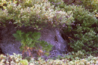
A typical scene of manzanita, rock, and bird. |
Yeah, a Bird
 |
| The bird was shocked to see me. Rather than fly off it just sat there in disbelief. I kept going. |
 |
||
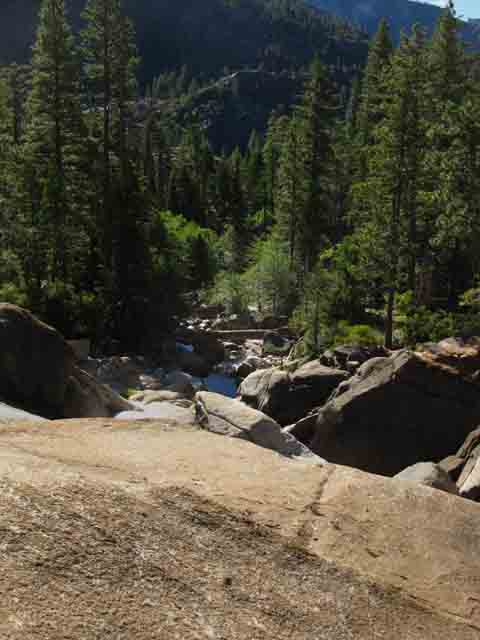
As we drop down the mountainside to rejoin Summit City Creek we clearly see the granite features marking the route of the North Molkelumne River. The North Molkelumne River flows along the base of the shaded formation on the upper-middle Left of the image. The Enchanted Forest lays between that shaded formation and the bright naked formation in the upper-middle of the image. Camp Irene lays on the far side of the bright naked formation in the upper-middle of the image above. The North Molkelumne River flows around the Left side of the base of the bright naked formation in the upper-middle of the image above. We can suss out that the North Molkelumne River makes a nifty S-Turn snaking its way around these granite features. Mount Reba is the second visible mountain peak on the upper Left of the image. We can see that we are almost down to the elevation of the North Molkelumne River.
comments or questions? |
About a Third of a Mile South of the End of Canyon Campsite
 |
Above: Looking Right (West) towards Summit City Creek as we hike South. Off to our Right we see an inviting flat and mysterious granite features. Though the trail continues down mountain this flat draws us to our Right, towards the channel of Summit City Creek off the faint line of route we've been following. |
 |
||
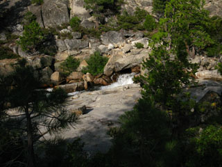
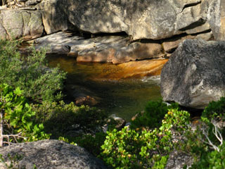
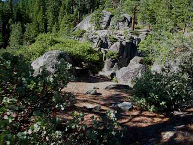
As we approach this inviting flat we hear the sound of falling water and see a granite slab projecting out over Summit City Creek.
|
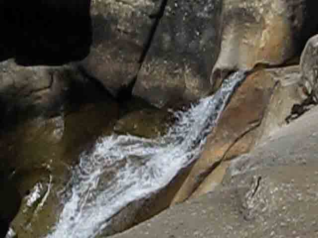 |
At the end of this fantastic granite flat we overlook the late-season flow of the waterfall. |
 |
A Jeffery Pine and Junniper shade a small circle of soft soil cupped in the end of this granite overlook. We are sitting in their thin shade looking down at the pool feeding the waterfall. It's a little scramble to get down to the pool below for water, but this small flat can hold a camper, while the nice flat off the slab can hold a few. |
Looking Downstream
 |
The granite slab is very slick when wet. After exploring this nifty granite shelf above the cascading waterfall, we will retrace our way back to the last bit of the trail route bringing us down to the lower ford. |
North: Telephone Gulch to Camp Site top of page South: Camp Irene
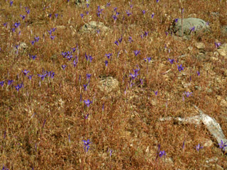
Brittle rock, Brittle Dried Grasses, with beautiful purple flowers
| There are open sections on the way down. Here we see a slab of granite where this fine polished surface is transforming into expanding patches of roughness. | Unknown purple flowers blooming in bone-dry exposed meadow, Mid-July. Open sections of exposed mountainside alternate with deep sections of manzanita. Neither offer much cover from the scorching Sun. |
|||
 |
 |
|||
This surface of this rock is slowly changing, transforming into a finish of grainy weathered brittleness from its fine glacial polish. |
The bright golds of the brittle dry burnt grasses were a fine backdrop for these vibrant, glowing purple beauties. |
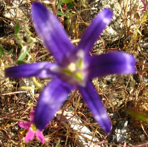
BrodiaeaAttempting to identify this striking flower led me to a fine site, Sierra Nevada Wildflowers, by Mr. Jay Sullivan. This site has a collection of striking photographs of Sierra flora. If you have the scientific or common name of a Sierra Flower, It is likely that Mr. Sullivan has an excellent photograph of that flower. I say flora, rather than flowers, because Mr. Sullivan also includes fine photographs of Sierra Trees as well as Sierra Flowers. If you have a guide, such as the Sierra Club's The Sierra Nevada, which cites many flowers but only presents line drawings, Mr. Sullivan's site is a boon. Mr. Sullivan states that this purple flower is of the Brodiaea genus, though he could not identify this particular species. This is not surprising to me, as I could not even identify it as a brodiaea. The Pacific Bulb Society cites sixteen species restricted to Western North America, noting the regional specializations. Comments, questions, or more information about this fine flower? |
| I was having a hard time getting a clear picture bending over with the heavy pack on. I was shaking with the weight as the flower was shaking in the light breeze. | ||
 |
||
| Sierra flowers are a constant delight. The range of sizes, shapes, and colors are constantly surprising. |
87 degrees at 10:30 am on the exposed descent
| ,, | Outlines of shoulder straps, sternum strap, and hip belt all visible. And it is getting hotter as we head down mountain! | |
 |
||
It was a little warm. Stay Hydrated! |
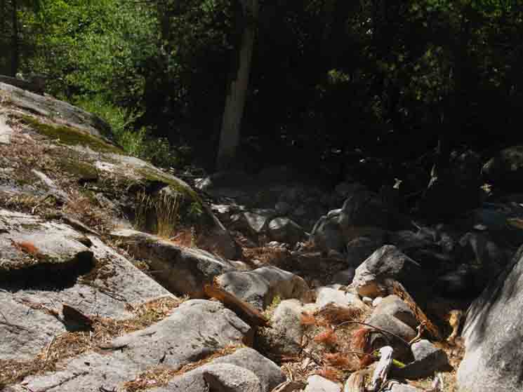
Drawing close to Summit City Creek's Lower Ford
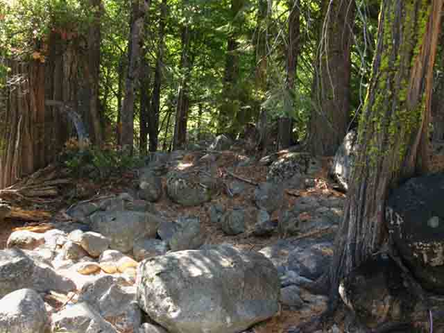
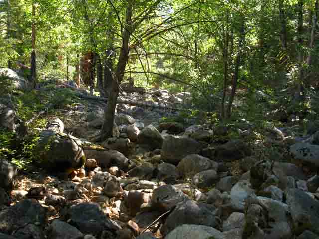
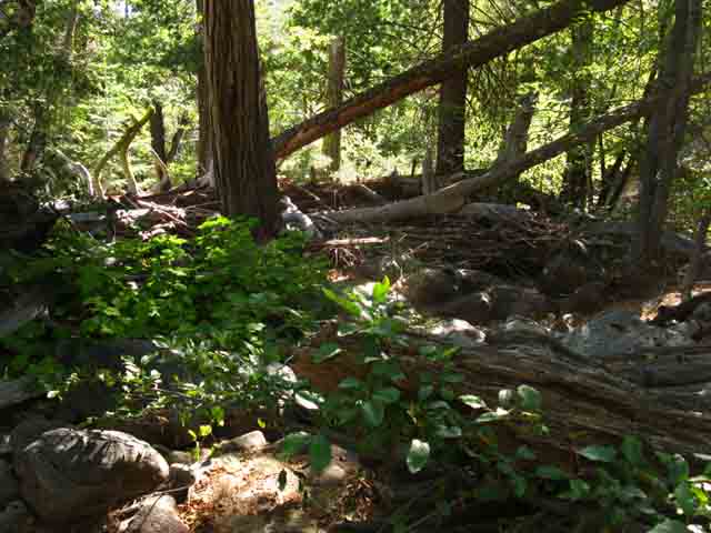
As we reach the bottom of this descent down the manzanita covered mountainside from the granite flat we note that Summit City Creek and our route are again drawing closer together. Summit City Creek was unapproachable for the majority of its steep fall down from the granite flat. We will soon be able to safely approach Summit City Creek, which we can see is converging with our route from the Right. This point of convergence between the trail route and the creek happens as Summit City Creek and our route run together into a flat section preceding Summit City Creek's intersection with the North Fork of the Mokelumne River. As our trail route approaches a parallel track with the creek we will again be able to hear and see bits of the creek. As the terrain ahead begins to flatten out we will see a channel of trail carved by trail crew through hard rock off to our right, which leads us down a short section of perfect trail down to the creek side jumble of debris just as the terrain flattens out. This little bit of hard rock trail will bring us down to the creek side flat and into a strange space, a small narrow channel where the timber carried down the mountain by previous flash thaws along Summit City Creek jams up into a slot of dark forest growing in the flat alongside the creek. You will notice that there is a tremendous amount of old rotting shattered tree debris packed between and around the big trees within this creekside slash of forest. All of this debris is a product of the disastrous early Spring rains that caused a catastrophic melt of the snow cover during the Spring of 1998, if I remember correctly. I entered the Canyon a couple of months after the flood. This massive early Spring rain in 1998 sparked snow-melt floods that swept a huge amount of timber down Summit City Creek, smashing it into bits as the flood waters cascaded down the mountainside ravine. At the lower elevation of our ford the cascading debris coming down Summit City Creek joined the great grinding pool of debris that backed up behind a log jam that blocked the North Mokelumne River between the flat where "The Enchanted Forest" sits and Camp Irene. The flood down Summit City Creek was nothing compared to the wall of water that traveled down the North Fork of the Mokelumne when this logjam broke. We will observe the remnants of the flood damage as we progress down the trail along the North Mokelumne River. From this point approaching the lower ford until we climb across the high water mark of the flood climbing South out of Camp Irene we will observe remnants and clues in the terrain this powerful event left behind. We will be able to see both the signs of the power of nature to destroy as well as the equally tremendous power of nature to heal. Observe carefully through this upcoming section, between the lower ford and just South of Camp Irene, as the current character of the terrain has been deeply affected by this event. This flood is what swept away all indications of the trail through here, leaving a deep mat of shattered tree debris that has since been filled in by runoff carried sand and soil. Here, where we enter the creekside flat, we will begin to see a series of small ducks, pictured below. These ducks lead us about 40 yards downstream through this jumble of wrecked trees within this deep stand of timber to the lower ford. As we head downstream we keep our eyes peeled on the opposite shore, where a channel through the rock wall along the opposite shore will lead us up to a short length of well-defined trail. Then it's on. The lower ford has been well and multiply ducked on the opposite shore every time I've been through here. But it may not be so in the future. |
 |
||
Hiking below the waterfall we plainly see the finger of green growing up along the course of Summit City Creek, up to where the creek comes out of its naked granite ravine. Our route and the terrain coming down the mountain are moving us towards the upper end of this finger of green where it meets and covers the naked creek. It is a passage into darkness, an abrupt transition of light to dark, hot to cool, open terrain to closed. Any semblence of a trail disappears. This is a nifty transition. We exit the bright light of our hike down the exposed mountainside entering what is a short scramble along Summit City Creek down to its lower fording point. I measure it at around 220 yards. It's dark. It's surface and terrain are composed of boulders and downed trees and snags making up a three dimensional jumble. We've got to watch our footing carefully, manuver around all the downed timber stuffed in here, and keep an eye on the other side of the creek for the ducks marking the location of the lower ford of Summit City Creek. The lower ford is about 220 yards downstream.
|
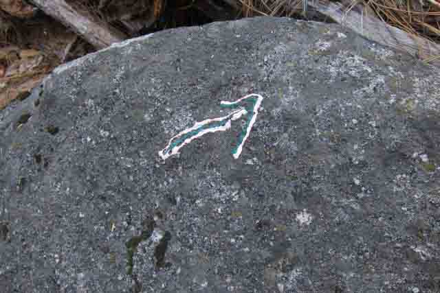
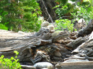
A Fool, Finger Polish Lady, Defaces the Lower Ford of Summit City Creek
 |
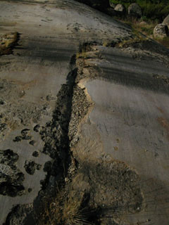
Defacement of boulders approaching Lower Ford of Summit City Creek. Photo by Hobbitbook. |
Arrrg!!
 |
||
This is the mark of ignorance defacing the boulders approaching Lower Ford of Summit City Creek. Self Portrait of the fool who committed these crimes against nature and other hikers. Photo by Last Observed Defacement by Finger Polish Lady First Observed Defacement by Finger Polish Lady Johnny removed the markings in 2015.
|
Forested Slot along Northeast Bank of Summit City Creek
 |
| Jumbled chaos hiking the final distance down to the lower Summit City Creek ford point. |
 |
Rock, forest, and huge debris blocks our way. Keep your eyes on the ground for footing, ahead for a route and wild ducks, and all around for the critters in here. |
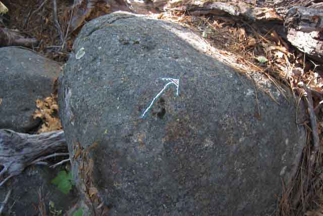
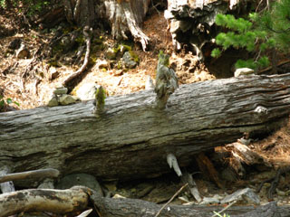
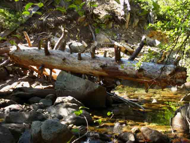
Some Ducks
| A big duck on an old smashed tree fragment. | A very small duck. Look carefully, it's on the Left side of the rotting tree fragment. | |||||
 |
 |
|||||
| After you exit the Manzanita covered mountainside you enter a section of timber holding a thicket of of the remnants of ancient shattered trees in a small, tightly packed forest section along side Summit City Creek. | You will parallel the creek for about 40 yards, then look carefully to your right for the fording spot. |
 |
||
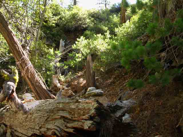
No trail hiking down to the lower ford along Summit City Creek. Your route is where you put your feet...
|
 |
Mixed debris and chaotic terrain. This series of images of the jumble along the creek are in the order hiked (as are all materials on this site) and well represent the variety of terrain along this short span of our route. But not to worry too much. The total length of this finger of jumbled chaos from entry to ford is about 220 yards. |
Early Season Fording Conditions
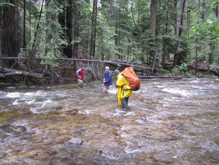 |
Mokelumne Wilderness Volunteers crossing Summit City across the lower ford. They are moving North across the creek. Thanks to Ranger Reed for the image. |
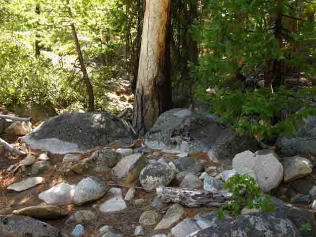
Ducks on the South Bank
 |
||
Duck on the South side of the lower ford of Summit City Creek.
|
The Tahoe to Yosemite Trail continuing South
 |
Ducks on the South shore of Summit City Creek. The Southbound Tahoe to Yosemite Trail climbs the riverbank on the far side of the fallen snag. |
North: Telephone Gulch to Camp Site top of page South: Camp Irene
The Lower Ford of Summit City Creek |
From the position pictured above you have a convoluted 40 yard hike alongside Summit City Creek down to the ford. Unfortunately, I deleted, misplaced, or never shot key images of the terrain between the lower ford and the Munson Meadow trail junction. Repeated searches of my old film and new digital record has not turned up these key pictures. Though I have many images of the upcoming section, they are not the key shots that I would prefer to present. Sorry. I will carefully and accurately describe the conditions you will encounter between the lower ford and the Munson Meadow junction, though I'm still peeved that I can't find all the pictures. Well, this is an excellent excuse to head through this section next Summer.
7.5 Hiking Topo Map: Lower ford, Summit City Creek over Mount Reba to Bee Gulch 30 min Hiking Topo Map: Carson Gap to Lake Alpine
South: Camp Irene |
Backpacking Trail Guide North |
 |
Backpacking Trail Guide South |
Backpacker ForumsHave Information about Long-Distance Backpacking, Gear, or the Sierras to relate?Post it on: TahoetoWhitney.OrgYour comments and questions posted from this page appear on the Lower Summit City Creek Ford Forum Page.Register to post your own stand-alone pages about your trips and the trails around the Lower Summit City ford on the Carson Gap to Lake Alpine Forum.Section: Carson Gap to Lake AlpineLocation: Granite Flat to the Lower Ford |
North: Telephone Gulch to Camp Site South: Camp Irene
Home Page
Contact Alex Wierbinski

Backpacking Lake Tahoe to Mount Whitney
Your guide to the High Sierra Crest, including the Tahoe to Yosemite, Pacific Crest, and John Muir Trails
