
The Trails
Guide
Maps
Miles/Ele
Permits
Resupply
Forum
Current Weather Conditions
Weather Notes
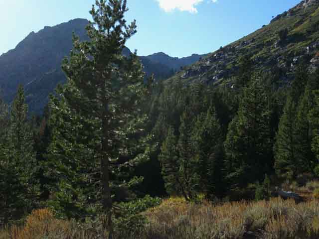
Northern High Sierras
Central High Sierras
Southern High Sierras
Gear
Gear List
Gettin Started
Layering
Discussion
Testing yourself and your gear
Gear Reviews
Backpacking
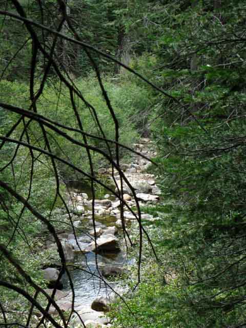
Summit City Creek
to
Telephone Gulch
Hiking the Tahoe to Yosemite Trail through the Mokelumne Wilderness
Languages
Languages
Trail Arts
The art of walking
Physical Preperation
Trail Skills
The trail
Off the trail
Scrambling
Maps
Navigation
Camp skills
Food
Resupply
Food
Other
Photo Catagories
Trail Stories
Trail Culture
News and Science
Links
Groups
Books
Terms and Conditions of Use
| Trail Guide INDEX Carson Gap to Lake Alpine |
North Fourth of July Lake |
South Telephone Gulch to Camp Sites |
Map North Carson Pass Region |
Map South Summit City Creek to Mount Reba |
30 min Topo Hiking Map Echo Summit to Lake Alpine |
Map INDEX Carson Gap to Lake Alpine |
Carson Gap |
EL Dorado National Forest PERMITS |
All |
Tahoe to Whitney on YouTube |
Down
Summit City Creek
from
Fourth of July Lake
DANGER
The Summit City Creek trail is unmaintained South from the Summit City Creek trail junction to Camp Irene. Camp Irene is located 9.52 miles South on the North Fork of the Mokelumne River.
See the guide below and the unmaintained trail Updates.
Summit City Creek
|
||||||||||||||||||||||||||||||||||
| Inside this Section: Carson Gap to Lake Alpine Miles TYT Miles and Elevations |
Local
Trail Segments
South TYT
| 1 Fourth of July Lake to the Summit City Creek trail junction 1.31 miles |
2 Summit City Creek trail junction to the Upper Ford of Summit City Creek 4.94 miles |
| 3 Summit City Creek trail junction to the Campsite at the end of Summit City Canyon 6.48 miles |
4 Summit City Creek trail junction to Camp Irene 9.52 miles |
Vital
Hiker Input
| High Sierra Backpacker's Trails and Topics Forums
|
South on the Tahoe to Yosemite Trail Summit City Creek INDEX On this page |
||||||||||||||||||
Summit City Creek
Video
Looking Down
East and West views of Summit City Creek
Almost Down to the Floor of Summit City Canyon
Summit City Canyon
Left and Right from Summit City Canyon trail junction
Hard Trail Ahead
Local Backpacking
Summit City Trail Junction 2009
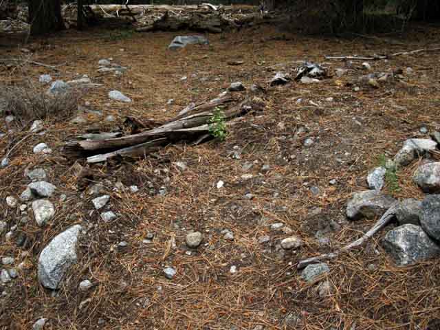
Campsite
|
Weather
Below find the closest Ground Stations, Point and Regional Forecasts near Summit City Creek. Satellite and Radar Imagery provides Long Range and Regional overviews. High Sierra Weather
All Weather |
Landmark
Views Up and Down canyon
Campsite
Campsite
Clear and Faint Trail
Campsite
Horse Canyon trail junction
Video
Campsite
|
||||||||||||||||
| > Forum < | ||||||||||||||||||
All backpackers can post text comments about the following section of trail through the comments links on all the trail guide pages. Registered Members can post up stand alone posts about the trail with words, images, maps and videos in the Trails Forum that supplements this section of the Trail Guide.
This section has a special forum for updates on the status of the un maintained trail section between Summit City Creek and Camp Irene. Post up your updates and information on this challenging route here.
Check out the Tahoe to Whitney .org Backpacking Trails and Topics forums
Summit City Creek Trail JunctionMiles and Elevations Elevation
Detailed Maps
South TYT
Big Maps
|
| VIDEO Fourth of July Lake to Horse Canyon |
||
Upper Summit City Canyon This films starts with a brief recap of our hike down to Fourth of July Lake from Round Top Lake before passing into Summit City Creek's magnificent canyon. At the base of Summit City Canyon we encounter the trail junction running North and South along Summit City Creek. Downstream into Summit City Canyon is South along the Tahoe to Yosemite Trail. The trail deteriorates a bit as we hike South from the Summit City trail junction down to the Horse Canyon trail junction. Then it gets worse below Horse Canyon. This film ends shortly South of Horse Canyon after checking out the two campsites South of the Horse Canyon trail junction. Trail difficulty continues to increase as we hike South of Horse Canyon. South of the Upper Ford the manzanita can be quite challenging on our way down to the lower ford, where we begin my favorite part of this unmaintained section: The hike into and through the "Enchanted Forest." Big old growth forest and white sand beaches fronting steep cliffs with the North Mokelumne River slipping between the sheer cliffs and old forests on its way down to Camp Irene. We bipeds have to find the way out of the Enchanted Forest to take the long way around the steep cliffs and massive granite through which the river slips on its short route between the Enchanted Forest and Camp Irene. Our route around these obstacles is much longer... This exciting semi-un maintained section begins with the hike from the Summit City junction down to the Horse Canyon trail junction.
It's a beautiful and challenging hike. Compare it with the PCT route across the East Mokelumne Wilderness: Duration: 20:40
Video Playlist |
Summit City Creek South
Bird's Eye Views
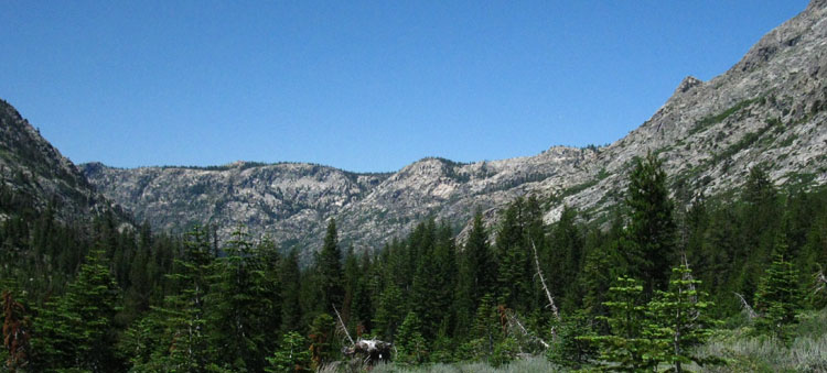
Looking Down Summit City Canyon Let's review the character of the terrain North and South up and down the trail from our position above the upcoming Summit City Canyon trail junction, before we lose our view and perspective under forest cover. Below we have the view South down the Tahoe Yosemite Trail through Summit City Canyon. We are looking down-canyon from our position traverse down into the canyon from Fourth of July Lake. We are turning to look behind us as we hike the long upstream traverse down to the canyon floor, where we will turn downstream to hike down canyon. Between the upcoming Summit City Creek trail junction in the canyon below South to the Upper Ford our route swings away and then back to Summit City Creek five times by my count. The only significant uphill exceptions to our long descent to the Lower Ford are the series of small bluffs we navigate South of the Upper Ford. |
||
 |
||
Above: The view South from below Fourth of July Lake hiking down the great traverse into Summit City Canyon to the Summit City trail junction. We can see Summit City Canyon making a hard turn to the Southwest. Character of the Tahoe to Yosemite Trail Dropping into Summit City Canyon marks the beginning of the first of our two great swings far down the Western Flank of the Sierra Nevada along the Tahoe to Yosemite Trail route. These great swings down onto the Western Flank are what distinguish the TYT from the PCT. The Pacific Crest Trail stays high up on the Sierra Crest or close to the crestline along its Eastern flank, while the Tahoe to Yosemite Trail twice swings far down onto the Western flank through deep granite canyons. After crossing Mount Reba (8720) South of Camp Irene we drop down to Lake Alpine (7360) and continue South along the Tahoe to Yosemite Trail towards Saint Marys Pass across ridges about 15 miles West of the Sierra Crestline. The highpoint of of hiking up to Saint Marys Pass is instantly followed by the Tahoe to Yosemite Trail's next great swing down the Western flank of the High Sierra. We've got to hitch hike down to Kennedy Meadows from the Saint Marys Pass Trailhead to begin the next section of our Tahoe to Yosemite Trail hike South, from Kennedy Meadows Pack Station (6400) ) up to Brown Bear Pass (9760) on our way across the High Emigrant Wilderness. Character of this Section of Trail Three things characterize this next segment of our 9.52 mile hike from the Summit City Canyon trail junction South to Camp Irene. First and foremost is the un maintained character of the upcoming trail section. Observing and maintaining our course along the optimal route through the terrain will now be our first priority, rather than speed. Observing, analyzing and making excellent route-following decisions is now our paramount concern. The second characteristic is our precipitous loss of elevation. From Round Top Lake (ele 9360) to Fourth of July Lake (ele 8164) to Summit City Canyon trail junction (ele 7440) to the Lower Ford (ele 5540) to Camp Irene (ele 5280) we lose a total of 4080 feet of elevation over the 13.13 miles separating the high point of this section of trail at Round Top Lake from our low point at Camp Irene. The third characteristic is the rise in temps associated with this loss of elevation. It's going to get hot as we lose elevation. The Lapse Rate indicates that temp differences between 9360 feet and 5540 feet work out to around 11 degrees F. I use the wet Lapse Rate figure of 2.7 degrees per 1000 feet of elevation. I have found very high temps greeting me descending this section of trail, depending upon the season. Spring and Summer offer very hot hikes through the lower parts of this section. Temps in the low 90s are typical of Spring and Summer hikes through here.The elevation and temp changes also change the foliage. We will drop out of whitebarks at Round Top Lake to Lodgepoles below Fourth of July Lake into the manzanita zone between the Upper and Lower Fords of Summit City Creek, finally entering an optimal zone and elevation for massive Cedars, Jeffery and Sugar Pines in the Enchanted Forest along the North shore of the Mokelumne River as well as Spruce and Juniper trees appearing to grow as big as their species can support. Second Sweep Down onto the Western Flank Our second great swing down the West Flank of the Sierra Nevada begins when we exit the Saint Marys Pass trailhead onto Highway 108. Our trail resumes its Southern route about 8 miles West down Highway 108 through Kennedy Meadows Pack Station and Resort. I don't suggest hiking down to Kennedy Meadows Pack Station from Saint Marys Pass along the twisting narrow track of Highway 108. Rather than the dangerous walk along Highway 108 down to Kennedy Meadows I suggest hitch hiking. It's a lot safer than walking Highway 108... It's dangerous for hiker and driver. Give yourself a break and hitch-hike down. The Tahoe to Yosemite Trail begins its climb back to the Sierra Crest from Kennedy Meadows Pack Station (ele 6400) which ends 10.92 miles further South at Brown Bear Pass (ele 9760) where the Tahoe to Yosemite Trail again regains the Sierra Crest. There are ways to hike into Kennedy Meadows Southbound along the Tahoe to Yosemite Trail, but they differ significantly from the route of the classic TYT route. |
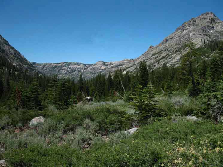
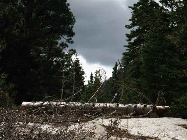
 From the trail post on the Southeast corner of Fourth of July Lake we face an 8.76 mile descent to the Lower Ford of Summit City Creek. This is where our hike along Summit City Creek ends after we cross its Lower Ford and make our way over to the shore of the North Fork of the Mokelumne River.
 Long views
|
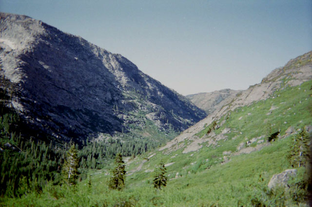
EAST The View East. The PCT crosses the bald peak, which is Forestdale Divide's Eastern flank, being where both the PCT and the Forestdale Road cross Forestdale Divide. Check the Carson Pass Topo Map. |
WEST The View Southwest of the physical outline of the Tahoe to Yosemite Trail route down Summit City Creek's big granite canyon, bending South in the distance. |
|||||
 |
||||||
 |
||||||
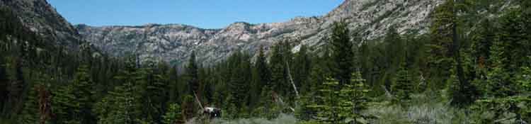
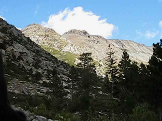
Summit City Creek bends Southward with its canyon down on its way to empty into the North Fork of the Mokelumne River. Look at the massive granite walls of that canyon! Carson Pass Region
Summit City Creek to Bee Gulch
|
||||||
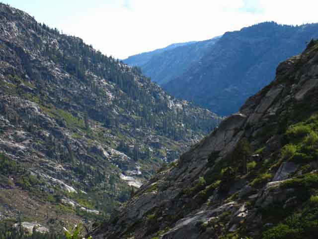
The Summit City Creek trail runs East up to both Upper Blue Lake, sitting behind the ridge arm descending from the middle-Right of the image, or up to Forestdale Divide, not visible just a bit to the Left of the barren patch on the most distant-Left pointy peak. In fact, the PCT route crosses that barren patch on the South side of Forestdale Divide. |
Almost down to Forest Level, Summit City Canyon |
| View South just above the Summit City Creek trail junction, hiking down from Fourth of July Lake. | ||
 |
||
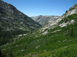
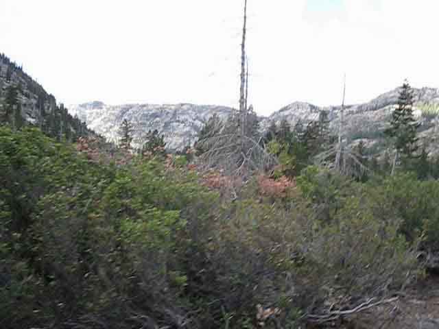
We can see where we will be bending South with the canyon following Summit City Creek as it turns towards the North Fork of the Mokelumne River. At this point we have departed the heavily-used Carson Pass Management Area and are entering the most isolated section of a "known" trail in the Sierra, the Tahoe to Yosemite Trail through Summit City Canyon. Though well known as the route of the Tahoe to Yosemite Trail, there is no actual maintained trail for 9.52 miles between the upcoming Summit City Creek trail junction to Camp Irene. These trail conditions tend to dissuade most backpackers from this difficult section of trail, and this section is far out of the range of all but the strongest day hikers from Fourth of July and Blue Lakes. Chances are that you will not encounter other hikers between Summit City Creek to the Bee Gulch trail head on the East Side of Lake Alpine. I've only run into a handful of hikers here over the last two decades. All this boils down to one thing: be real careful through this section, as you will not have the normal support that hiker traffic on a heavily-used trail provides. Looking at the TYT Route down Summit City Canyon
Summit City Creek to Bee Gulch > Forum < |
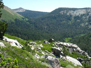
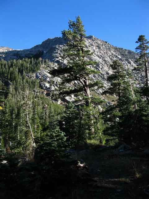
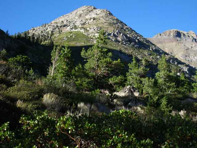
 Above: Peak 9607 on Right side of the image above towers above West side of Fourth of July Lake. Observing this peak and Horse Canyon will keep us informed as to our position as we hike down Summit City Canyon.
 Summit City Creek Trail Junction
last Steps to the Trail Junction
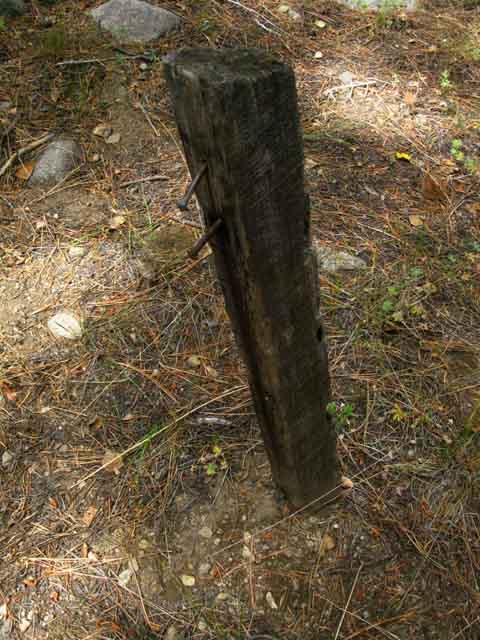
Summit City Trail Junction
Elevation 7440
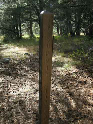
"New" trail junction post, late 2013.
Left or Right
The Tahoe to Yosemite Trail As we are following the Tahoe to Yosemite Trail route 17.54 miles South from this trail junction to our next resupply stop at Lake Alpine, we will turn right, downstream and Southbound along Summit City Creek. For us hiking the Tahoe to Yosemite Trail South the next 9.52 miles from this Summit City Canyon trail junction South to Camp Irene are not maintained. 2014 update In the long term it will be the changes in the Winter snow pack and resulting dimunation of the Spring thaw, and the rise of fire that will control the fates of all High Sierra trails. Nonetheless, this section has segments along the route from this trail junction to Camp Irene that have no trail, that have faint trail, that have good trail, and everything in-between. Though recently improved, this section still has segments that qualify as route. Continue South down this trail guide page and the subsequent pages for details of this most fun, entertaining, and challenging TYT route South to Camp Irene. This route challenges us physically as it simultanously tests our observation, analysis, and basic route finding skills. It even keeps us guessing a bit as we hike South of Camp Irene climbing Mount Reba. HIKING OPTION East, or Left Off A Local Loop, or the long way to Ebbetts Pass via the PCT If we are running a short loop around Round Top Lake out of and back to Carson Pass via Forestdale Divide or to Blue Lakes this Summit City Canyon trail junction is where we will turn East, to our Left, rather than West down Summit City Canyon. Summit City Canyon Trail JunctionEAST to
EAST Local Loops As I metioned, the end of the Blue Lakes paved road connects us up with the end of the dirt Forestdale Divide Road coming out from Red Lake just East of Carson Pass. Summit City to Forestdale Divide and Blue Lake Both Blue Lakes and Forestdale Divide Roads and our trail up Summit City Canyon all intersect at the Upper Blue Lake Campground (pdf). The best nearby backpacker camping is reached by hiking up the Forestdale Divide Road and out to Lost Lakes.
Lower Blue Lake to the PCT From the Upper Blue Lake Campground we can follow the paved Blue Lakes Road South past both of the Blue Lakes to where it climbs up and out of the basin holding the Blue Lakes up to the PCT just below where it crosses the Blue Lakes Road, cutting up and South through the Tamarack Trailhead. From there we can either hike South to Ebbetts Pass or North to Carson Pass. For long distance hikers planning on continuing South along the Pacific Crest Trail route, we will find that the PCT crosses the paved Blue Lakes Road a mile up the paved road once we begin climbing up from Lower Blue Lake. From the intersection of the PCT and Blue Lakes Road we turn Right to continue our hike South on the PCT to Ebbetts Pass. Where we turn back to our original trailhead determines the length of our loop. The quickest way between two points may not be the best route... PCT Section Hiking South to Ebbetts Pass via Summit City Creek was a bit of an unusual route, a different way than normal to mix up the Tahoe to Yosemite and Pacific Crest Trail routes, but it was required by the seasonal conditions, and very rewarding. Our views of the Devils Corral are the best when we hike past it, and I had never looked at it from the bottom-up. Nice!. During the peak of the Summer Car Camping Season we might well see some day hikers coming down trail into Summit City Canyon from the full PGE car campgrounds at Blue Lakes. At Blue Lakes we will encounter the PGE car camping crowd. Lots of nice retired folks, kids and families. PGE Upper Blue Lake Car Campground Here's a fun thought: Either way we hike from the Summit City Canyon trail junction takes us South. The trail upstream, East up Summit City Creek to and past Blue Lakes follows Blue Creek Southeast to Highway 4 (granted that's after it bends a bit to the North-Northeast...). The Carson Pass Management Area Map shows details of the Summit City Creek trail linking to Forestdale Divide and South to Blue Lakes out of the top of Summit City Canyon. This map shows us the rest, to the East, of the PCT South from Carson Pass: Summit City to Forestdale Divide and Blue Lake The Mokelumne Wilderness Area Map shows the whole thing, including both the Tahoe to Yosemite and Pacific Crest Trail routes from Highway 88 to Highway 4. We can see that this clumsly link through the top of Summit City Canyon to the PCT running past Blue Lakes is the only way the PCT and TYT are connected across the Mokelumne Wilderness.
|
Hard Trail Ahead
The Tahoe to Yosemite Trail
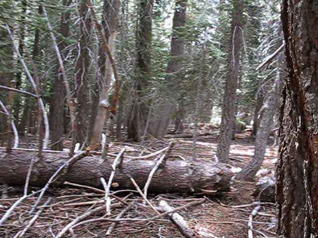
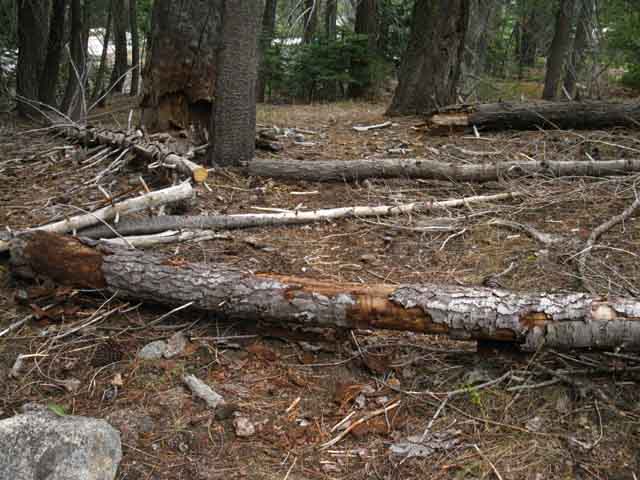
South Down Summit City Canyon Warning If unable to maintain the route, the distance may be considerably longer. This section can have large stretches with no trail, no blazes, no ducks, nor any indication of a route or trail through the terrain. Most likely during early Spring after a heavy Spring Thaw. Hikers will typically open up the route as season progresses. If we don't pay very close attention to finding and staying on the trail route, if we wander too far off of the actual route that gets us through this terrain with minimum difficulty, our hike through this section may be much harder and will be, and take much longer in both time and distance than we expected or planned for. If we are able to stay on the best route, the old trail route, we will experience the least physical challenge. Though Summit City Canyon is fairly narrow, which constrains just how lost we can get, in the upper section of Summit City Canyon at least, the lower section of Summit City Creek merging into the North Mokelumne River Canyon offers expansive opportunities to wander off-route and get seriously lost. Backpacking Recent Route History Setting the Stage Summit City Creek running down the upper canyon was an active participant and contributor to this massive catastrophic thaw, which swept down to join the surging North Mokelumne River. Just below where they converge a vast pool of timber-filled water built up behind a log-jam of huge trees wedged in the narrow granite canyon between the bottom of the Enchanted Forest and the top of Camp Irene. Above the log-jam the assembled trees that had been swept down-mountain were shredded and torn up in this brutal surging pool that I estimate at 75 feet deep, which backed water all the way up above the lower ford of Summit City Creek, as indicated by the scope of the debris field, which we still see fading indications of today. Trail through this lower section where the flood waters collected was lost. I walked across the top of a thirteen foot thick (as far as I could tell) mat of smashed timer that was left behind across Camp Irene, the Enchanted Forest, and the debris field reaching up Summit City Creek after the mess dried out a bit. As this damage happened along an already unmaintained segment of the Tahoe to Yosemite Trail, it was not addressed by trail crew, and resulted in effectively closing this segment of trail to all but skilled backpackers. Over the subsequent years the terrrain was remarkably healed by the powers of nature, and the old route re-emerged under the feet of intrepred backpackers. To this day the flooded section retains an unusual atmosphere that are both physical and perception remnants of that powerful catastrophy. Things also changed on the North end of this unmaintained Segment Between 2002 and 2009 the trail from Summit City Canyon trail junction below Fourth of July Lake downstream to Horse Canyon was not maintained and subsequently deteriorated into route. The result was that the actual length of this segment of unmaintained route could, and still does, vary by quite a few miles. The New Era Though segments of the trail are still faint or missing the condition of this unmaintained segment of trail from Summit City Creek through Camp Irene are in as as "good" a condition as it has been since 1998, and in much better overall condition than it has been since 2002. As I mentioned above, this does not sit well with all backpackers.
I would say opinion is roughly split between those who bitch about trail conditions, and those who bitch about having a trail. I fall on the side of favoring less trail and more engagement. But I am not for banning all work. I figure that Nature is going to win in the long run, and a little bit of trail work will shortly dissappear. The most important thing for us as backpackers is to have as much good information about this trail and its current status. The link below describes the basic environment on this route. The link in the black box below leads to hiker reports on the status of the route and their experiences along it. You are invited to contribute your experiences and perspective. Route Description & Warnings
Warning
Continue South down the Trail Guide to explore the unmaintained route to Camp Irene. |
What You Say?
Hiker Experiences and Comments Check out this recent note by Jim about this route on the Here we also have Eric and Hobbitbooks thoughtful experiences and observations. Johnny Add your update about the route, tell us how it went and what you saw here. |
Staging Local Hikes
Blue Lakes Blue Lakes Car Camping Add a shovel, come-along, some rope, and plenty of water to your car camping gear and take that car down some of these dirt mountain roads. Check out the Also check out this Google Road Map of the Carson Pass Area which marks the locations of both the unpaved Forestdale Road to Blue Lakes, as well as the paved Blue Lakes Road. This map also describes our car camping options West of Carson Pass near Woods Lake. The Blue Lakes Road, At the Blue Lakes we can car camp at the PGE Car Campground, or you can explore some of the surrounding dirt roads in National Forest Lands. At Tamarack Lake we can set up our backcountry car camping campsite. Just make sure we clean up your site, and it would be real nice if we hauled out any crap that our fellow car campers always leave behind. Though permits are not required for car camping, the National Forests generally require fire permits, even for self-contained stoves. Check out the Car Camping Notes, and Car Camping near Carson Pass Also see the Car Camping in the Sierra Nevada section of the Forum. |
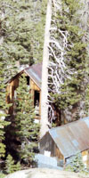
Historical Summit City
At the base of the great traverse down from Fourth of July Lake the trail tees out at the Summit City Trail Junction running up and down Summit City Creek. Historical Note We are likely standing at Lower Summit City at this Summit City Canyon trail junction. According to Mr. Acker the location of the Summit City site is 2 miles East, or upstream, from this trail junction. Both of Mr Acker's locations make sense to me. Mokelumne Wilderness The location last marked as Lower Summit City is just a nice remote spot in a remote High Sierra canyon. Check out the Historical Summit City Forum Page. |
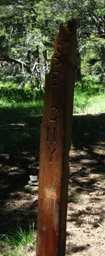
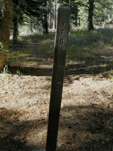
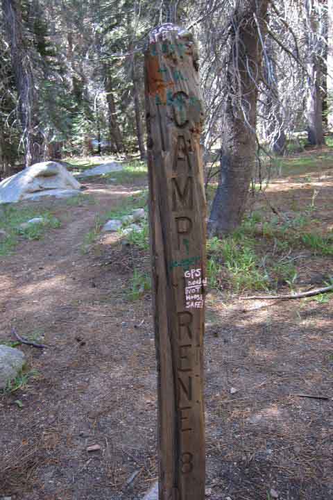
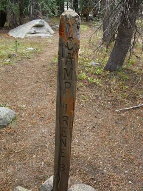
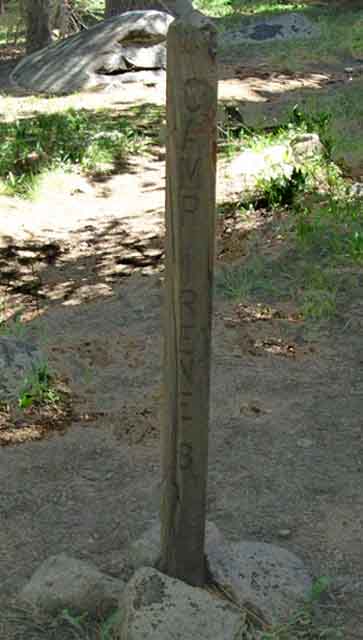
Trail Junction Post at Summit City Creek
Ouch! Old Post 2009 |
THE UNMAINTAINED TRAIL BEGINS | |||||
 |
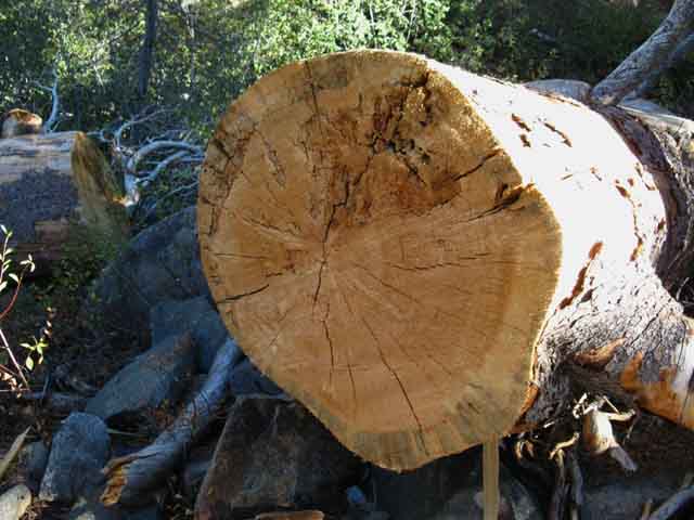
Basic Details about the Unmaintained Section between Summit City Creek and Horse Canyon (As of July 2009) The trail deteriorates moderately immediately South of the Summit City Creek trail Junction with the trail down from Fourth of July Lake. Seven years ago this section of trail was maintained down to Telephone Gulch. Not so as of July '09. The trail is unmaintained, and it has deteriorated sufficiently to make finding the route moderately rough South of this trail junction. (Opened Up 2012) South of this junction there are occasional followable remnants of trail bed you can piece together, though very faint in segments. Moderately overgrown and obscured segments of the trail bed are complimented by no shortage of downed trees, many of which require some climbing. This is why you do sit-ups. Climbing over downed trees with a heavy pack tests abdominal muscles. Don't lean backwards. I was able to stitch together identifiable sections of the trail bed from the Summit City Creek trail junction to bring me to Horse Canyon with little difficulty during July of 2009. UPDATE Conditions are not the same at this later date. More trees have fallen. More overgrowth has grown up, covered, and grown through the trail bed. Or the El Dorado National Forest has cleared the trail. (I doubt it) If I was your, I'd hope for the best, and prepare for the worse. 2013 UPDATE: The Amador Ranger District of the El Dorado National Forest manages this area.
For the Trail Guide Updated |
|||||
The post points the way South to Horse Canyon, the only trail junction along the Tahoe to Yosemite Trail between here and the Munson Meadow trail junction, which I have not seen for years. Living Things Forum |
||||||
|
Johnny Rates it a "Five of Ten" on the Difficulty Scale in 2015.
Trails Forum
|
||||||
1998
The conditions described on the trail guide below for the unmaintained trail section between the trail junction in Upper Summit City Canyon to Camp Irene have changed considerable between 2009 and 2013.
Between 1998 and 2009 trail conditions had deteriorated considerably, most notably the short section of trail between the Summit City Canyon junction downstream to Horse Canyon. This once-maintained trail segment had degraded into unmaintained status.
The remaining segments of trail below Horse Canyon down to Camp Irene perpetuated and deepened their unmaintained status between 1998 and 2009.
A trip through at the end of the 2013 hiking season revealed much improved conditions. Still challenging, but much improved. |
2009 to 2013 Status Trail conditions have improved considerably between 2009 and 2013. The segment of trail between the Summit City Canyon trail junction pictured below down to Horse Canyon has been significantly opened up. A pair of dedicated hikers, the Mokelumne Wilderness Volunteers, and the Trails Ranger of the Amador Ranger District of the El Dorado National Forest have all turned their attention to the Summit City Creek section of this classic trail, The Tahoe to Yosemite Trail. Early in the Summer of 2013 the Mokelumne Wilderness Volunteers "brushed out" a big section of the trail, followed up by the work of a pair of hard working backpackers who spent a couple of backpacking trips clearing and repairing sections of the trail during mid Summer of 2013. Both groups have done very constructive work. Much of the undergrowth and small to medium fallen snags have been removed or cut along the upper section of the trail from the Summit City Canyon trail junction down to the Horse Canyon trail junction. This is still listed on the maps as "maintained" trail, and it is once again in maintained status as of 2013. Approaching Horse Canyon Southbound the trail becomes lighter and fainter. This trend continues and deepens below Horse Canyon. Yet some degree of work has been done during the past few years along the whole route, meaning signs of trail are not too far apart when the trail itself disappears. A duck, a blaze, or some short stretch of trail bed is scattered along the correct route through the terrain. If you are not picking up clear signs of trail every 30 to 50 yards you are not staying on route, which means you need to keep your eyes a bit further open. If you look carefully you will see... Yet conditions change every year. What we experience one year may not be applicable the next, and I would anticipate the trend direction of conditions is always pointed down. |
Future Status Each year's trail conditions emerge out of the chaos of the Spring Thaw. Runoff flows and rising meadows eat trail: great thickets of trees are swept down by runoff, while the same runoff energizes the bush, grass and flower all pushing their way up to the Sun through our trail. Trail definitions used on this guide Challenges found early in the backpacking season moderate with the wear brought on the footsteps of the annually increasing Summertime backpacker traffic, or not. I'm personally betting trail conditions from Summit City trail junction to Camp Irene will improve between 2013 and 2020. As of 2013 conditions are already improved, and I expect them to improve further during the next few years. But, I could be wrong... Another factor working to slow trail degradation is the long term trend of weakening and shortening Winters. I base my prediction on, first, the attention this site has created. We've drawn together lots of potential Tahoe to Yosemite Trail hikers and informed many curious backpackers about this uniquely challenging route. Traffic is increasing. Then there's the Amador Ranger District Trails Ranger, Cecilia Reed. I believe she's going to bring the upper section (Summit City to Horse Canyon) into fully maintained status with regular trail crew and has already seriously worked on bringing the unmaintained section up to the status of a more easily followable route. Third, there are at least a couple of backpacking dudes who have put a lot of hard work into opening up the trail. Trail Slug and his pal Joe have put in a lot of work and appear to be dedicated to opening a clear route, if not a clear trail between the Summit City junction and Camp Irene. Fourth, the Mokelumne Volunteers and Ranger Reed have been directing some serious efforts into fixing up this route. Trail Slug reported finding serious work already done when he and Joe made it out in 2013. I figure that work was done by the Mokelumne Wilderness Volunteers and Ranger Reed. I can't really figure out who has done exactly what work, but a lot of work has been done as of the end of the 2013 season. It appears that there have been two groups working on the route during 2013, Trail Slug and the Mokelumne Wilderness Volunteers. Ranger Reed of the Amador Ranger District is directing trail crew out there to do some work between the Summit City Canyon trail junction down to Horse Canyon and back out to Silver Lake on Highway 88 in 2014. Ranger Reed's efforts opening up the 2.43 miles of trail between Summit City Creek trail junction South down to Horse Canyon will shorten the length of unmaintained trail down to 7.09 miles from the current 9.52 miles. The status of the majority of this length of trail is holding the status of a faint trail at the end of 2013. That would bring trail conditions is line with with the specifications for maintained trails above Horse Canyon and unmaintained trails below, to Camp Irene. Questions of Status and Purpose As I mentioned above, this does not sit well with all backpackers:
The whole extended section of unmaintained trail from the Summit City trail junction to Camp Irene is a unique backpacking treasure that should remain unmaintained. This status does not preclude some degree of trail work, but limits trail work to the subtle. Opening this route too far subtracts from the unique nature of backpacking experience enjoyed while hiking this section. I believe the nature of the terrain here assures that the long-term future of this section of the Tahoe to Yosemite Trail will always holds some substantial stretches of unmaintianed route requiring some degree of route finding. I mentioned the destructive and constructive powers of nature at the start of this discussion. The effects of these forces on the route are currently being observed by lots of humans. We humans have the power to properly balance our constructive forces against the destructive forces of Nature, or not. Though this route is presently getting a lot of attention compared to the last couple of decades, that attention will fade as the years pass into the next couple of decades. What to Expect A reasonable route exists as of 2013. This was a rough and tough route between 2002 to 2009. Though we may have more open conditions at present, trail conditions are cyclic across the long and short terms. I would classify 2013 as a high point in the status of this segment of trail, and that it will subsequently degrade. Read and Post Updates in the Forum. The upper trail, the trail down to Horse Canyon will be in improved conditions for a few years or a decade, then conditions will change. If it stays on the list of maintained trails it will actually improve over the upcoming years as its present long-unmaintained status is improved. I predict the "trail" below the Horse Canyon junction to Camp Irene will degrade post-2013 at a rate directly linked to the ferocity of Winter Storm and Spring Thaw activity, divided by the number of backpackers who travel over it, as it is not on the list of maintained trails. This segment will degrade steadily. Post up your trail reports to keep us current, or review those of the past few years to get yourself up to speed.
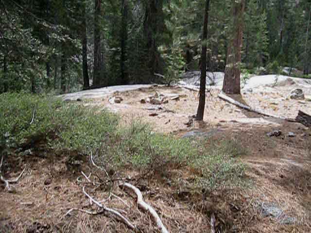
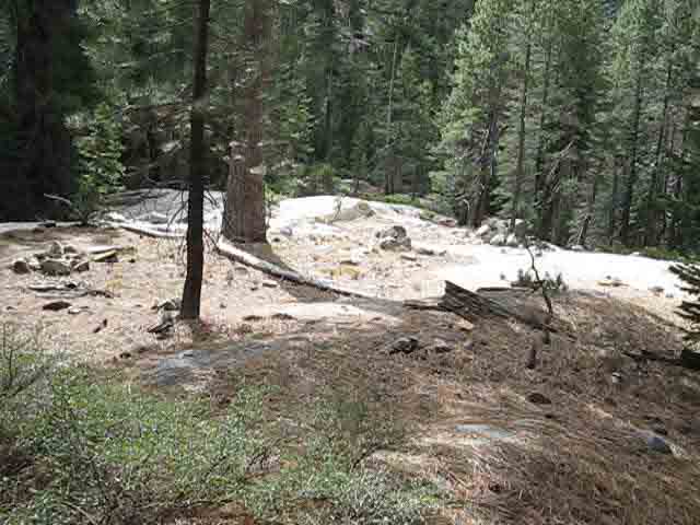
NOTE A Route Trail definitions used on this guide. Trail conditions between the Upper Ford to the Lower Ford merit its rating as a route rather than a trail. Though we find many good section of trail bed and a solid line of ducks there is no continuous trail bed between these points. A few downed ducks and a small bit of manzanita growth will make this section very challenging. Thus I suggest you read the variety of experiences folks have had through here. A reasonable trail leads from the Lower Ford to the Dead Pond entrance to the Enchanted Forest. There is no trail across the Enchanted Forest, but someone has begun to build trail North into this forest section, up from the Southern exit out of this unique forest basin. There is reasonable if faint trail from the Enchanted Forest to Camp Irene. Faint conditions persist a bit South from Camp Irene, but solid trail begins where we begin climbing above the top of the forest, away from the North Mokelumne River towards Mount Reba a short ways South out of Camp Irene. Growth of manzanita may leave the trail pushing through seams of the underbrush. Despite a few dense sections of manzanita and a couple of raggedy steep switchbacks on the very upper section of the North flank of Mount Reba, the trail between Camp Irene to Lake Alpine is traditionally reasonably maintained. That's why the trail descriptions on the trail guide pages following below cover this trail as it was between 2002 and 2009 when conditions had deteriorated into route-finding and the post-2009 trail conditions improvements, when we've had improved trail conditions. As it was, is, and can be. We will encounter both hard and easy situations hiking this route. Where we encounter them may change from year to year. There are always many places where we will have to observe carefully to find the next length of trail. Other lengths of trail are carved into the granite terrain itself, and will remain to the next ice age. My point here is although there is currently (2014) reasonable route between the Summit City trail junction to the Upper Ford and a good train of ducks from the Upper Ford to the Lower Ford, these advantages can instantly disappear. A heavy Spring Thaw will sweep away great lengths of trail. A blight will sweep down great swaths of forest over trail. Ducks get swept away. Brush grows, trees fall, and things constantly change. Things will happen every year to degrade parts of the trail. People may have repaired others. BE READY for the UNEXPECTED. These degradations will be somewhat counter-balanced by the efforts of the Mokelumne Volunteers, backpacking diehards like Trail Slug and his buddy Joe, National Forest Trail Crews, and the hundreds of hikers who's feet kick route into the terrain. I never bet against Nature. Report what you see and experience: Tahoe to Yosemite Trail Unmaintained Section Updates |
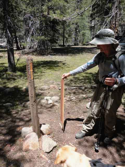
New Trail Junction Post
| South | The broken post has been replaced with a very old weather worn replacement | Northwest |
|
 |
||||||
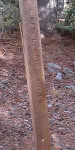
SOUTH
2.43 miles to Horse Canyon 3.23 miles to Telephone Gulch 4.94 miles to Upper Ford 7.45 miles to Lower Ford 9.52 miles to Camp Irene |
NORTHWEST
1.31 miles to Fourth of July Lake 3.61 miles to Round Top Lake
|
||||||
Upstream
TYT Maps and Miles |
|||||||
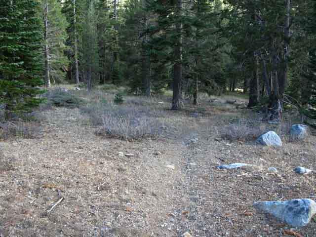
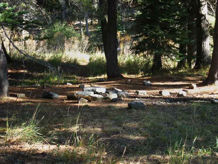
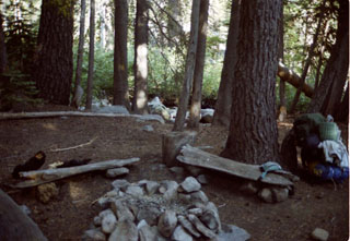
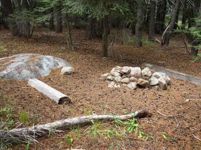
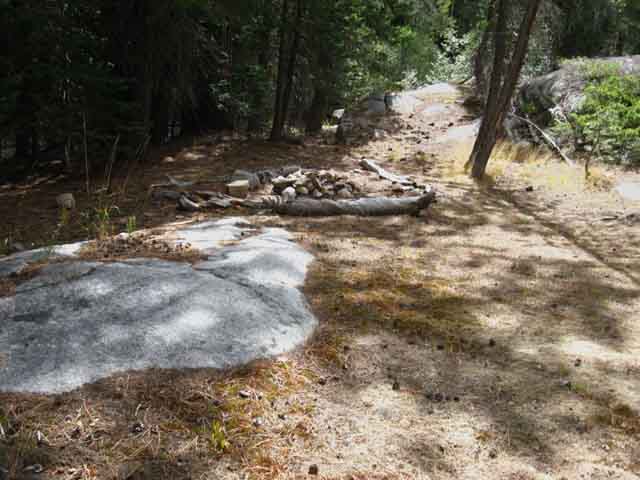
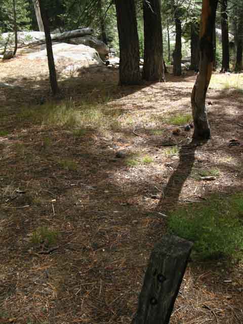
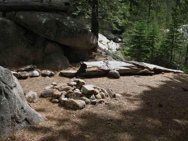
Before the trail East splits, a few feet upstream from the Summit City trail junction we find a nice campsite. |
|||||||
| Summit City Canyon Trail Junction CAMPSITE |
||
 |
||
A few feet upstream from the Summit City Canyon trail junction there's this nice campsite with good sleeping flats, easy water access, some granite boulder seating, nice shade, and a fire ring. This site might suit you if your hiking day is ending here near the top of Summit City Canyon along the Tahoe to Yosemite Trail. But I'd rather stay at Fourth of July Lake if I hiked here on the TYT, or Lost Lakes, if I came in via the PCT.
|
South
|
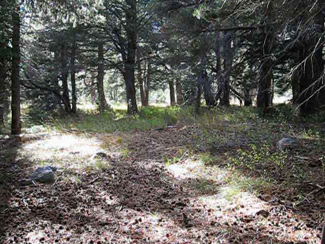 |
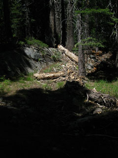
First Steps South down Summit City Canyon from the Trail Junction. The route tracks Right through thin forest into a great open space. The image above is from 2009, and we can see the degree the trail bed has filled in with forest floor debris. This was all swept out in 2013. This gives us a marker to judge the timing of subsequent degradation and between maintenance. FORUM REPORT We can see bright light in the open meadow beyond the trees. |
Peak 9607
 |
||
As soon as we hit open space we see Peak 9607. Our position relative to Peak 9607 (The peak towering above Fourth of July Lake) will mark where we are along our route down the upper segment of Summit City Canyon. We will run into the first campsite above Horse Canyon about a half-mile past Peak 9607. By then we will be getting glimpses of Horse Canyon through the trees, which will help us determine where we are along the trail. Observing Peak 9607, then Horse Canyon, and finally Telephone Gulch will be our reference points as we hike down Summit City Canyon. This is a section of trail I now hike with map in one hand, camera in the other.
RATTLE SNAKE ALERT |
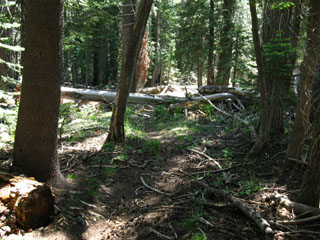
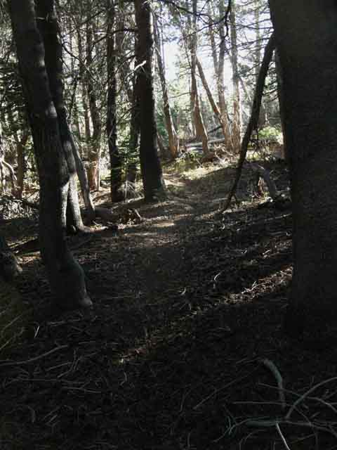
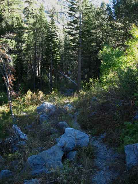
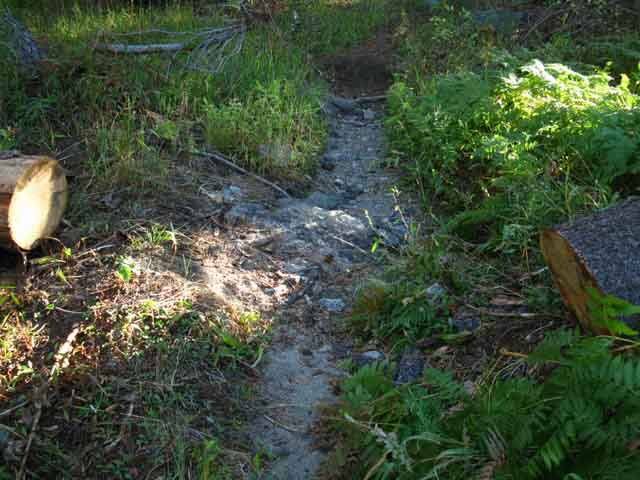
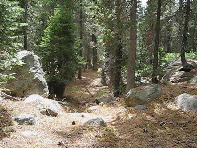
Faint Trail
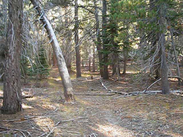 |
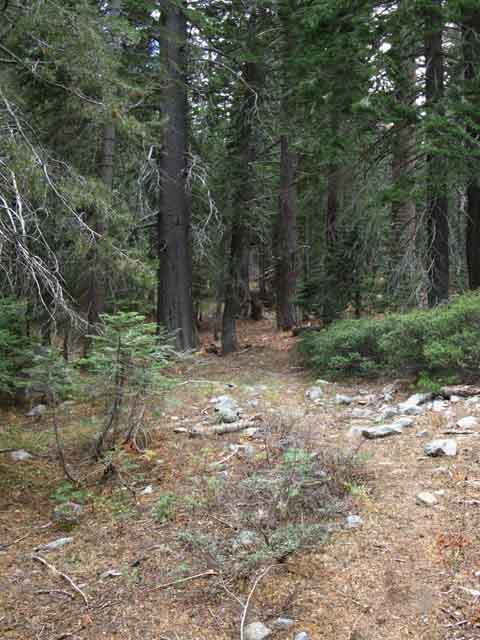
Faint, quiet but easily follow-able trail leads us through forest path recently cut clear of small and medium obstructions. Though still faint this recent work has opened up the route. |
Recently Cleared Obstacles
Big and Small
 |
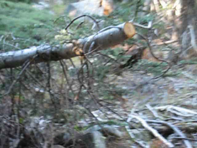
Examples of recent big and small trail work. Both likely cut during the Spring and Summer of 2013. These fresh cuts will help keep the trail open for a long time. In places where the trail bed disappears old cut trees point our way to the route. This section was cleared by the Mokelumne Volunteers under Ranger Ceclia Reed. Keep an eye out for saw cut trees when the trail gets faint or lost. Human cut trees are a sure sign of where the trail used to be. When we see a cut branch like the ones here we know we are on or near the route. The bright color of the recently cut branches sings out the location of the trail. Tahoe to Yosemite Trail Updates |
 |
| Faint trail bed remnant running through forest floor debris along low granite outcroppings. | Shadow and Light, trail and cross-country. | |||
 |
 |
|||
2009: Good sections of the trail are the sections that you can see. There were no freshly cut trail obstacles. 2013: Trail almost continuous down to Horse Canyon, with many freshly cut trees, brush, and fallen snags. |
||||
2009: Very bad footing around the granite boulder. Forest floor debris have filled the trail bed. But hey, at least there's a trail bed to follow! 2013: Debris removed from trailbed, fallen trees and brush again cut. |
||||
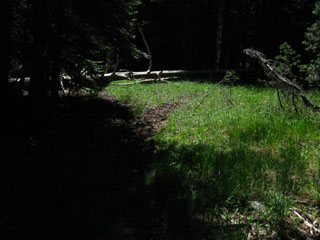
Hiking South
|
| Faint trails - Deep shadows - Profound quiet |
| Unmaintained trail reverting to an animal track. | ||
 |
||
Look ! Trail ! 2013: A regular track is open. > Forum < |
The trail bends around to Summit City Creek
 |
||
The trail bends around to Summit City Creek again as we come under the ledge in the mountain containing Fourth of July Lake. We're about .57 mile South of the trail junction. We got water through the campsite just above the Summit City Canyon junction if we needed it, so we should be good to go.
|
Trail leads back into Forest
 |
||
Recent Trail Work The trail touches Summit City Creek then bends back into forest five times between the Summit City Canyon trail junction down to the Horse Canyon trail junction. |
||
 |
||
Though this is marked as a four-season creek on the map it is a seasonal wash. Note the informal trail work as signified by the new blaze. The folks who did this work did a good job repairing this confused segment of the route. This once confusing stretch is now tied to trail bed on both sides of the wash. We're about .76 of a mile South of the trail junction.
|
Our Route again bends towards Summit City Creek
 |
Above: After crossing the wash and a complex section of trail we find a faint seam of trail dimpling the terrain again leads us back down towards Summit City Creek between fallen snap and live tree. Below: .95 of a mile South of the Summit City Creek trail junction we again encounter Summit City Creek, but now larger and displaying beautifully sculpted granite boulders. |
 |
In a broader context we are passing by the shelf Fourth of July Lake sits on above us wedged into the canyon wall to our Northwest, and directly under Peak 9607. Guess what we do now? After passing by Boy Scout Camp we have an extended hike through forest over rocky and flat terrain away from Summit City Creek down to the first of three campsites above Horse Canyon. |
"Boy Scout Camp," Then and NowSummit City CreekAbout a mile South of the Summit City trail junction we come to a rather large campsite on our left hand side, if you can recognize it. As of 2013 you may not see this camp. The picture below at left below shows the camp in the late 1990's, when it's organization and clean appearance led be to believe it was established and maintained by a Boy Scout Troop. Not even the best horse-packing operations set up a primitive camp like that! Boy Scouts do. Alas, a big snag fell right across the center of the camp a few years ago, as shown by the picture on the Left. I believe it was during 2002. The snag fell right across the elevated fire ring, making the fireside benches unusable, effectively splitting this big, fine camp into two smaller fine camps divided by the now unusable fire ring. It's ironic that a big piece of prime firewood, a massive old snag, fell "into," actually across the fire ring. A clear case of too much firewood, rather than too little. Then a snag fell across the main sleeping flat. Then a whole forest of snags fell across the whole area. The long cycle of life and death in the forest determined the end of Boy Scout Camp. As of 2013 this once fine camp is virtually unrecognizable. It is now buried under a sea of fallen snags. There are still a few of nice flat spots around this campsite where you can sleep, and Summit City Creek is beautiful where it passes by, though the nice benches and fire ring are unusable. Unless you want a damn big fire... As of 2013 Boy Scout Camp is virtually unusable. The best campsite between the Summit City Creek trail junction and Horse Canyon are now the site just North of the Summit City trail junction, the three sites to the North of the Horse Canyon trail junction, the campsite at Horse Canyon, and the two sites just to the South of the Horse Canyon trail junction. The best sites are the second camp above and the second camp below Horse Canyon trail junction. The second campsite above Horse Canyon trail junction is an eight mile North of Horse Canyon, which is located down a short side trail off the main TYT route. Mountain Safety Mountain Safety |
| Boy Scout Camp, 1999. | Boy Scout Camp, 2009. | |||||
 |
 |
|||||
This camp had considerable work put into maintaining it during the 90's. Note the pack leaned up against the tree. I'm still using the same pack and frame in 2013 as I was using in 1999... |
The snag (standing dead tree) fell across the fire ring, and landed to the right of the tree pictured at left. The picture above is taken from the same angle as the one at left, but from further back. As of 2013 this space is filled with fallen snags and timber. |
Hiking South
 |
||
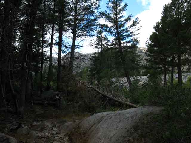
South from Boy Scout Camp the trail submerges itself into forest as our route moves up and stays high up near the North wall of the canyon while Summit City Creek falls towards the South through jumbled terrain The logic of the trail here appears to attempt to keep the trail up high, away from Summit City Creek, only to be bend back to Summit City Creek where forced by the terrain.
|
View to the South
 |
||
Telephone Gulch 's outline in the distant canyon wall is revealed where our trail emerges from forest cover after the trail moved Right, to the North towards the canyon wall. We get a good look around from here. Horse Canyon is located to the Right of Telephone Gulch out of our line of sight behind the ridge arm descending in the middle Right of the image above. We are approaching Summit City Canyon's bend to our Left, to the South.
|
View East
 |
Looking East across Summit City Creek we get a unique view of the massive rock wave on the East-Southeast wall of Summit City Canyon. On the map the crest of this great rock wave is named Peak 9434. Deadwood Peak, the highest point on this massif, is rising to its peak out of the distant far Left of this image. Check out this view of Peak 9434 from Fourth of July Lake, and this view from above Fourth of July Lake while hiking down between the Western flank of Round Top and the Sisters and Fourth of July Peak. We can see here that we are pretty high above Summit City Creek, which we locate running through the dense thicket of trees between us and the other side of Summit City Canyon. |
Round Top Behind Us
 |
||
Turning around to look Northeast over our Right shoulder at Peak 9607 and the backside of Round Top further up Summit City Canyon. Fourth of July Lake is located between Peak 9607 and Round Top, wedged up under the Northeast flank of Peak 9607. Our trail down from Round Top Lake came through the second, the most distant gap in the canyon. Referencing these landmark peaks in the images above will keep us aware of our location as we hike down Summit City Canyon.
|
Back Down into Forest towards Summit City Creek
 |
We pick up bits of fine trailbed as we turn back down towards Summit City Creek. |
Recent Trail Work 2013
 |
Welcome trail improvements easing the way back down towards Summit City Creek. |
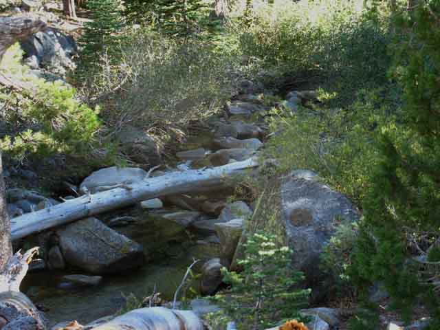
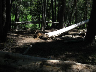
River of Smashed Timber
 |
||
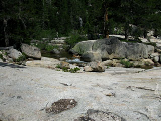
The trail returns to a stretch of Summit City Creek formed by the power of the Spring Thaw. Note the collection of smashed trees wedged on the upstream side, the Left side of the great boulder. This deposit has becoming part of the terrain, turning the creek around it. This wedge of trees redirected the course of the creek, and is now back-filling with sand rooted by vegetation. Note the proliferation of large fallen trees scattered about. Looking carefully at the collection of trees wedged into the boulder reveals a huge tree wedged up against the boulder. This monster tree is the key of this debris-raft, its flood-tide deposition here responsible for redirecting the creek. A little bit of new terrain has been born. This configuration and the process that created it are indicative of the catastrophic thaws and subsequent floods that sweep down Summit City Creek on an unknown frequency. I know of one in 1925 and another flood during the Spring of 1997. What I do know is that catastrophic floods smash down Summit City Creek every now and again. I feel very lucky to have seen the immediate and medium-term aftermath of one of these events. This whole section of the creek is filled up with old smashed timber, especially past the upcoming campsite where the creek's fall increases.
|
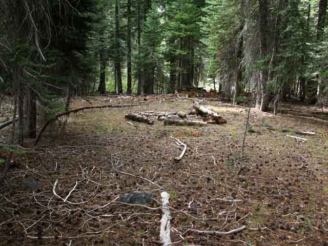
Approaching Campsite
 |
Continuing down along Summit City Creek we come to the first of three campsites above Horse Canyon trail junction. It's off to the Left in the distant sunny area. We are about 1.57 miles South of the Summit City Canyon/Creek trail junction. |
| 3rd site North of Horse Canyon CAMPSITE |
||
 |
||
The campsite furthest North of Horse Canyon trail junction. About 1.57 miles South of the Summit City Canyon/Creek trail junction. We are about .86 of a mile North of the Horse Canyon trail junction. The next campsite South of here on our way down to Horse Canyon is about .37 of a mile further South along the TYT.
|
 |
| Camp Kitchen with nice rock seat. |
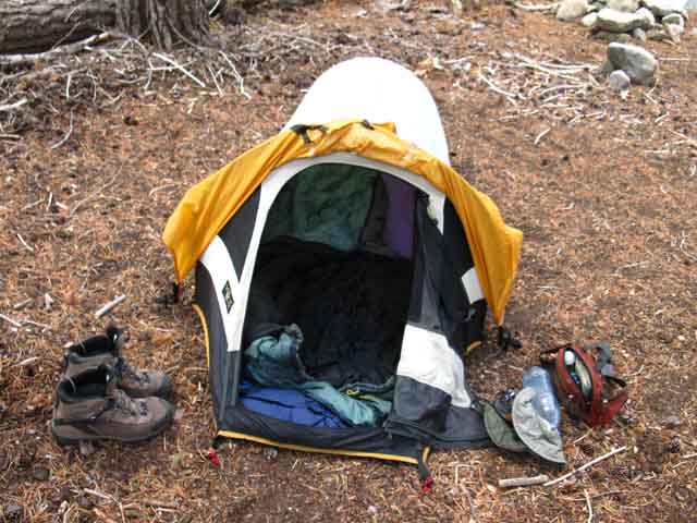 |
Cold weather, strong winds, and the threat of snow prompted me to put up the tent in late September. |
View South
 |
South from the uppermost campsite North of Horse Canyon we climb a gentle rise out of forest onto a rocky meadowed open space where we can see Telephone Gulch directly ahead and the great cut of Horse Canyon into the side of Summit City Canyon off to our Right. The next campsite, the second of three on our way South to Horse Canyon trail junction is about .37 of a mile South of the first campsite. But here's the deal: We can camp wherever we want. We certainly do not have to rely on improved campsites. We have seen lots of fantastic potential campsites, and there is absolutely no reason why we cannot find a beautiful location, scout about a bit until we find a fantastic spot to camp in, and throw down our gear. I prefer locations with great views, easy access to water, good sitting and wind protection rocks, and a flat big enough for sleeping pad and bag. That's all it takes. Between the Summit City Canyon trail junction and Camp Irene we will find lots of locations that are not formal campsites that fill these requirements. |
View South
 |
||
Crossing the low rise above and just a bit North of the Horse Canyon trail junction. The cut in the canyon wall directly ahead is Telephone Gulch while we can make out the wide and deep cut of Horse Canyon rising out of Summit City Canyon on the far Right side of the image. In the image below we see the day's first light brighten up the West wall of Horse Canyon. And, we've again climbed away from Summit City Creek.
|
View South
 |
||
We can better see the grand cut Horse Canyon makes into Summit City Canyon in the image above. The upper West wall of Horse Canyon is being lit up by the rising sun. Check out the view up Summit City and at Horse Canyon as we climb towards Mount Reba.
|
Summit City Canyon Bends South
 |
Looking further down Summit City Canyon at Telephone Gulch and beyond we see that we begin making a turn South, Left, with Summit City Canyon when we arrive at Horse Canyon. The peak composing the Southwest end of Horse Canyon is visible on the far Right of the Canyon wall behind the interceding tree. By the time we pass under Telephone Gulch we will be completing our turn South within the canyon. On the Left side of the image we can see the descending flank of the Deadwood Peak Massif making up the inside corner of our turn South down Summit City Creek Canyon. |
View Upstream
 |
||
Peak 9607 on Left-center and Round Top beyond in the center of this image looking upstream, to the Northeast, from our current position just above Horse Canyon. This is the last place we get clear views of the upper canyon and its main landmarks we've used to chart our progress down to here. We're leaving Peak 9607 and the backside of the Round Top and Sisters Massif behind when we make the turn into the lower section of Summit City Canyon. As we turn the corner South along our hike down Summit City Canyon these peaks above, and this part of the upper canyon will pass out of sight. As we pass Horse Canyon and Telephone Gulch turning South with the bend in the canyon Horse Canyon and Telephone Gulch will become our next set of landmarks referencing our changing position through the middle section of Summit City Canyon. As we approach the far end of Summit City Canyon the end of the canyon itself will be our Southern landmark while Telephone Gulch and Horse Canyon will be our Northern landmarks. Once we turn into the middle portion of the canyon we will also be able to get long views Southeast into the massive canyon of the N Mokelumne River from high points along our route as we hike down Summit City Canyon. At the far South end of Summit City Canyon we emerge from within the sheer walls of this magnificent canyon high above the North Fork of the Mokelumne River. From the end of the Summit City Canyon we get grand views of the epic canyon holding the North Fork of the Mokelumne River. We see that Summit City Canyon is essentially a hanging canyon disgorging Summit City Creek high above the North Fork of the Mokelumne River. The final couple of miles of Summit City Creek past the Summit City Canyon flows down to the North Mokelumne River via a deep rocky channel/gorge on the Northwest wall of the North Mokelumne River's Canyon. We get pretty good overviews of this terrain we are now hiking through from high points further down the trail. The overview linked to above puts our current position, buried in the terrain in Summit City Canyon, into a broader context. It is as important to me to turn around and look back as it is to look forward. Looking back from where we are climbing from Camp Irene to the Top of Mount Reba is particularly informative. Our trail-route down from the end of Summit City Canyon to the Lower Ford of Summit City Creek roughly parallels the rough channel Summit City Creek is falling through, but our route moves away from the chaotic rocky channel of Summit City Creek to find its way down to the lower ford following distantly spaced ducks through a maze of dense manzanita into and out of dark folds of forest wedged into steep granite gorges. That's if the ducks are there. It was well ducked in late 2013. They may well be gone or diminished after that date. Here and Near From our current position there's one campsite a short distance upstream and two campsites downstream along our remaining short hike down to the Horse Canyon trail junction. There's also a nice campsite at the Horse Canyon trail junction and two more campsites within a quarter mile South of the Horse Canyon trail junction. We've got regular access to water and really sweet break spots scattered up and down the trail between the Summit City Canyon and Horse Canyon trail junctions.
|
Forest Trail
 |
Dropping off the rise we begin moving towards Summit City Creek as we descend towards Horse Canyon trail junction. We note a noticeable decrease in the depth of the trail bed increasing the faintness of the trail, and more fallen snags and brush as we get closer to Horse Canyon. The general rule of thumb is that the route deteriorates the further South we go. |
Beaver Dam
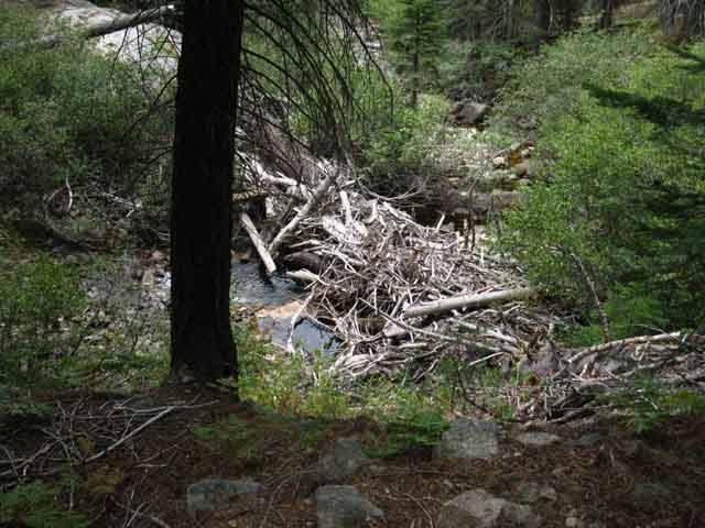 |
It looks like the beavers rearranged debris swept downstream into a nice little dam. |
 |
Looking downstream. |
Faint Trail to 2nd site North of Horse Canyon |
||
 |
||
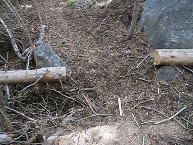
This unmarked trail junction branching off to our Left towards Summit City Creek is blocked off by old branches. Our Tahoe to Yosemite Trail route bends Right. This cutoff is about 1.94 miles below the Summit City Canyon trail junction below Fourth of July Lake. About 50 yards to the Left down a faint route we find the nice campsite below.
|
2nd site North of Horse Canyon |
 |
This is a nice place for a camp. It's offset from the trail sufficiently to afford privacy from hikers All around us are nifty places to explore. The next, and last campsite between us and Horse Canyon trail junction is |
Improved Route
 |
A recently outlined length of very faint trail. The trail is following Summit City Creek down canyon by bobbing in and out of the forest along its West shore. |
Faint Trail
 |
Very faint trail hiking South down Summit City Canyon between the first and second campsites North of Horse Canyon. |
| 1st site North of Horse Canyon CAMPSITE |
||
 |
||
The first campsite North of Horse Canyon. About 2.54 miles South of the Summit City trail junction below Fourth of July Lake. We've about .2 of a mile South to the Horse Canyon trail junction.
|
Around the Obstacles
 |
As we draw nearer to Horse Canyon the number of fallen trees and snags increases, and the trail gets fainter. Above the trailbed bends around a tree long ago fallen across. |
Around the Obstacles
 |
Recent work opening up path around fallen snag. The trail section from the Summit City Canyon trail junction South down to Horse Canyon was only unmaintained for a few years. Maybe eight years. During this time lots of snags fell across the trail, especially lower down the trail approaching the Horse Canyon trail junction. Most of the trail was absorbed by the terrain across the areas of soft soil, and the route detoured around the fallen obstacles. In 2013 Trail Slug and his pal did a lot of work to reveal the old route. They marked and opened up the historical route and took the time and spent the effort, as demonstrated by the work above, to mostly subtly open or mark the route. The cut branches on the fallen snag above inform hikers as to the route's location. The route South of Horse Canyon has been unmaintained for decades, resulting in the build up of more large fallen trees across the original route than above Horse Canyon. |
Around the Obstacles
 |
The short and long ways around a fallen tree. |
Trail Junction
Horse Canyon
 |
||||
Horse Canyon Trail Junction along Tahoe to Yosemite Trail in Summit City Canyon. The trail through Horse Canyon to Highway 50 at Silver Lake splits to the Right, the Northwest. Our trip South on the Tahoe to Yosemite Trail veers Left through this junction. Note the location of my bedroll on the back of my pack. Whenever I fall down I aim to hit that first. I am mostly successful, resulting in minimal damage to body and gear over the years. I rack gear on my pack to minimize damage and assure my gear stays attached to my pack in emergency situations while maximizing efficient and safe carry of heavy loads through all situations and conditions. Tip: never lash anything to your pack or person that bounces while stepping your gait.
Camp Irene is the noteworthy destination to our South on our hike on the Tahoe to Yosemite Trail down Summit City Canyon. That's because maintained trail resumes just South of Camp Irene. We've been hiking across harder than normal conditions, even for the High and Hard conditions hiking any part of the High Sierra entails, ever since we hiked South of the Summit City Canyon trail junction. The difficulty increases South of the Horse Canyon trail junction. |
| VIDEO HORSE CANYON TO UPPER FORD OF SUMMIT CITY CREEK |
Duration: 19:30 |
Horse Canyon Trail JunctionElevation: 6880 feet |
|
Physical Location The Horse Canyon trail junction marks where a trail climbs Northwest through Horse Canyon to Highway 88. Horse Canyon is the lowest and largest gap in the granite walls of Summit City Canyon. Check out an image of Horse Canyon as part of the Sierra Crestline. Hiking Northwest The two trailheads leading to this Horse Canyon coming from the West are located along Highway 88. The shortest route begins from just North of the Oyster Creek trailhead on the North side of Silver Lake. The long way in is from West shore of Silver Lake at the end of the paved road to Camp Minkalo. Silver Lake itself sits about 10.3 miles West of Carson Pass on Highway 88. Silver Lake also offers Federal car campgrounds and day use areas. Both are really nice. Compass Points Hiking down Summit City Creek arriving at Horse Canyon marks where the East-West direction of our trail down the Upper section of Summit City Canyon begins bending into a North-South alignment. Jut a bit ahead of us arriving at Telephone Gulch will mark the end of our turn South. But it's hard for us to see this, as we are in the bottom of this forested granite canyon. Nonetheless, we are now in the middle section of this great granite canyon making a turn South. After crossing the Upper Ford lower down the canyon we will hike the lower end of Summit City's great hanging granite canyon down to where it's cavernous mouth terminates high up on the Northwestern wall of the vast canyon containing the North Mokelumne River below. It is a profound location. We are going to see that Summit City's massive canyon is a hanging canyon feeding the North Fork of the Mokelumne River far below. Or is it? I'd argue that the North Mokelumne River actually joins the drainage of Summit City, rather than visa-versa. But who am I to say? If you checked out the view of Summit City Canyon from the climb up Mount Reba, you might agree. Summit City is the dominant canyon and creek. At least in geological terms of ice and water movement, if not on our maps... From the end of the Summit City Canyon we hike down a great exposed hot mountain flank around huge rocks rising out of the sea of manzanita we are plunging through, trimmed by dense forests to our Northeast. |
Miles & Elevations
Carson Gap to Lake Alpine Mileage Northwest It's 7.44 miles Northwest from this Horse Canyon trail junction to the trailhead on Highway 50 North of Silver Lake at the Oyster Creek Day use area. It is 9 miles to Camp Minkalo on the East Shore of Silver Lake from this Horse Canyon trail junction.
Heading South on the Tahoe to Yosemite Trail Telephone Gulch is .8 of a mile South of Horse Canyon. The trail gets rougher South of Horse Canyon. Camp Irene is 7.09 miles South of Horse Canyon. (where maintained trails begin.) We have many points of challenging route finding between Horse Canyon and Camp Irene. Bee Gulch Trailhead on the Northeast Shore of Lake Alpine along Highway Four is 15.11 miles South of Horse Canyon.
Heading North on the Tahoe to Yosemite Trail The Summit City Canyon Trail Junction below Fourth of July Lake is 2.43 miles North of the Horse Canyon trail junction. Carson Pass via the Winnemucca Lake junction route and the Pacific Crest Trail is 9.05 miles South of the Horse Canyon trail junction.
Backpacking Maps
Summit City Creek to Bee Gulch
TYT Echo Summit to Lake Alpine Mokelumne Wilderness
|
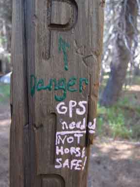
Horse Canyon Trail JunctionElevation: 6880 feet. 2013 Defacement |
|
2009
|
2013
|
A well meaning but destructive vandal has struck our beloved unmaintained route down the jumbled granite gorge along Summit City Creek. This one did not get the memo about Wilderness Areas not being good places to paint graffiti all over the trail posts, campsites, and boulders. This errant hiker apparently wandered off the Pacific Crest Trail, or had inadvertently bitten off much more than digestible for the level of skill, sensitivity, and intelligence brought to the table. This would not normally be a problem for an individual smart enough to study the terrain they plan on hiking, which goes a long way towards building the capacity to get ourselves out of what we got ourselves into, but this particular hiker decided to consolidate and record their ignorance by leaving a physical record of their ignorance for all of us to enjoy later... Thanks for that. Fingerpolish Lady is the worse trail name I've recently christened a hiker with, and I've cast more than a few. Well, it's the worse one I will tell you about... Rest assured that their are lots of backpackers who have the trail names, "Jackass," "Dumbass," and just plain old "Fool." Take heart in the fact that J-asses, D-asses, and Fools are the rare minority in the backpacking bag of diversity. But we constantly see their handiwork carved on trees and in campsites. Don't be that person. Be nice. Be helpful. Be informative. Haul your trash out. Help the injured, feed the hungry, guide the lost, and curb the asses and fools who deface themselves by defacing nature. Be quiet and don't write stupid shit on the face of nature. Living good in nature is not rocket science, though it's a rare quality in this world... Image on Right above from HobbitBook, an intrepid cross-country hiker. Next Defacement |
|
Horse Canyon Trail JunctionElevation: 6880 feet. 2013 Defacement |
|
 |
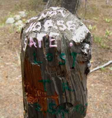 |
No, GPS is not needed. Observation, analysis and route finding skills are required. Even if you bring a GPS. GPS will not show you what nature demands. Only you can see that. Self-Portrait of A Fool
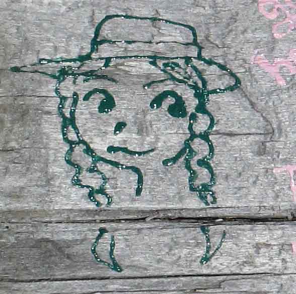
This is "Finger Polish Lady's" self portrait, left at the campsite at the South end of the granite flat. The phrase "Fools Names and Fools Faces Appear in Public Places" never fit better... This misguided hiker left a criminal record of their misadventure written in nail polish (fabric paint?) all the way down our beloved Summit City Creek Canyon from the Horse Canyon trail junction down to the lower ford of Summit City Creek. Wow. What a self-centered fool. This person thought that their experience was more important than our environment. NOT. Do Not Be This Person. We have way too many of them as it is... Better yet, if you know who this person is, report them to Trails, at the Amador Ranger Station of the El Dorado National Forest for criminally defacing the Mokelumne Wilderness. She must pay for her crime against mother nature and against our Wilderness Area. I'd make her clear trail for a year of weekends. Learning that defacing our environment is bad behavior would be sufficient. Image from Eric, The TYT Hiker Dude. |
|
2013 Trail Post Repair
Using a very sharp Swiss Army Knife allowed me to gently whittle off only the thinnest layers of paint and wood necessary to remove the fabric paint, or whatever the hell fingerpolish lady used to mark up the post. The wood should age to uniform color quickly. I collected up all the scrapings that I could. Hiker Input My thanks to all of you hikers who have both contacted me for and with information about this trail route. Y'all are always welcome to email me or post up comment & question through the trails forums. As you can see, comments, questions and trail conditions updates can be put through the forums covering the specific segments of this unmaintained section of trail, or you can post up general reports about this un maintained section can to the |
Horse Canyon |
||
 |
||
Campsite to the East of the Horse Canyon trail junction. A hike requires planning. Where we start from and how many miles a day we plan on hiking determines where we will likely camp each evening. The availability of great campsites along the length of the route and especially the locations of the most beautiful spots along our route is going to affect our campsite decisions. This is true at the Horse Canyon trail junction. We have three campsites stretching from just North of the trail junction and two sites located just a bit to the South. At the Horse Canyon trail junction we also have a campsite, making a total of six sites situated North and South of the Horse Canyon trail junction. All of these sites except one, maybe two are along and visible from the trail. One is offset from, but close to the trail. The two best campsites along this section of trail are above and below Horse Canyon, depending on your particular tastes. The second campsite to the North of Horse Canyon and the second campsite to the South are the best campsites along this stretch of trail by mine. Well, they are as of 2013... All's we really need for a campsite is access to water and a flat sufficient for our sleeping bag. By that standard there are campsites at every point the trail route nears Summit City Creek. Independent of this fact, the best campsites are still the second camps located both above and below the Horse Canyon trail junction.
|
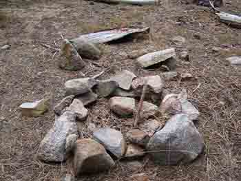
Horse Canyon Ritual Circle
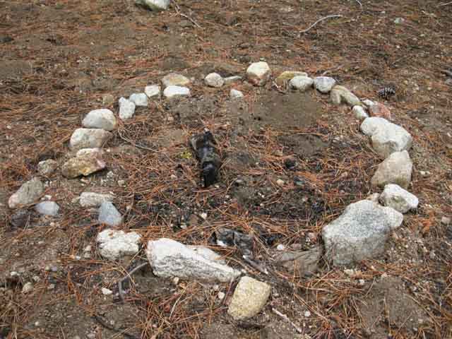 |
Though we see some remnants of fire inside, this is not a fire ring. I've found examples of what I call "ritual circles," of rock circles up and down the Sierra Crest. Apparently folks like to make circles of rock in the mountains. There are some old ones up there. |
| Missing in Action
Lower Summit City |
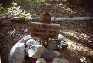 |
I understand that Lower Summit City was both a location of Silver exploration during the Comstock Silver Strike, as well as a failed speculation on the route of the Transcontinental Railroad. I also understand that it was not located here, as it was previously signed as seen above, but that Lower Summit City was actually located at the current position of the Summit City Canyon trail junction below Fourth of July Lake. This sign pictured above is no longer at the Horse Canyon trail junction. Rather than the original mining settlement of Summit City itself being located at the Summit City trail junction, as tradition had suggested, the hamlet of Summit City was likely located in the meadow at the mouth of Devils Corral. We can see the location as we descend into Summit City Canyon from Fourth of July Lake. That's the opinion of Mr. Roy M. Acker, who's ancestors operated the sawmill at Blue Lakes and resided at Summit City. His investigations of life in Summit City Canyon are documented in, Historical Summit City. An 1860'S Mining Center in Alpine County California, self-published in 1999. Independent of the rise and fall of the Gold and Silver Booms across the Sierra the advent of Civil War pushed the South out of Congress, meaning the Transcontinental RR was going to be built. Long delays building a Transcon RR had been generated by the same North-South split in Congress that fueled the Civil War: Each group fought for its own geographic financial and social "interests." With the South out of Congress the Transcontinental RR would be built across the North. The only question was where. Summit City Creek was claimed by speculators hoping to cash in if the Transcontinental RR route passed over the Sierras through the Summit City Creek route. Scouting out the terrain of the major East-West passes over the Sierra Nevada today certainly reveals that the Summit City Canyon route would have been quite a long shot bet. |
Continuing South
on the
Tahoe to Yosemite Trail
| Horse Canyon post states Camp Irene is 8 miles South. |
 |
|
Hiking South from the Horse Canyon trail junction I put the distance to Camp Irene at 7.09 miles, though the sign says 8.
> Forum < |
South from Horse Canyon We noticed the trail becoming fainter as we hiked South down from the Summit City Canyon trail junction approaching Horse Canyon trail junction. The trail route below the Summit City Canyon trail junction had stopped cutting through great fallen trees to find its way around them. These unmaintained trail conditions intensify South of Horse Canyon. The forest appears to darken South of Horse Canyon, thickening and darkening as we lose altitude. |
 |
| This is our route through dense forests of both standing and fallen trees through Summit City Canyon South of the Horse Canyon junction. |
 |
Despite the fainter trail conditions and increasing obstacles we see many indications of recent work during late 2013. These freshly cut obstacles keep hikers on route. When we cannot see or follow trail we find the old and new cuts that keep us on route even if there is no trail. |
| 1st Campsite South of Horse Canyon CAMPSITE |
||
 |
||
Hiking through a dense dark forest for about an eight mile South of Horse Canyon brings us to this campsite on a flat just off, and visible from our Tahoe to Yosemite Trail route.
|
View South Down Canyon
 |
Dark cold clouds pushing across Summit City Canyon. Light snow on strong cold gusts of wind in late September keep hikers cool. Remember: weather can always surprise us in the Sierra, and quickly! |
Faint Trail through Dense Forest around fine Rock
 |
Section of faint but easily followable trail through Summit City Canyon below Horse Canyon junction. |
Unsigned Trail Post
 |
About an eight-mile past the first campsite South of Horse Canyon and about a quarter mile South of the Horse Canyon trail junction we encounter this trail post without a message. I'm thinking that this sign once held one of the locations of the Lower Summit City trail sign, but I'm not certain. I remember the Lower Summit City Creek sign was shifted around a bit before it was removed. |
Second Campsite South of Horse Canyon
 |
Looking towards Summit City Creek from the trail post reveals a fine campsite wedged within a nifty granite formation. Note that the fallen tree across the rock in the upper Left of the image above is the same tree faintly visible in the upper Left of the image below. |
| 2nd Campsite South of Horse Canyon CAMPSITE |
||
 |
||
Hiking through a dense dark forest for about an eight mile South of the first site South of Horse Canyon brings us to this second sweet campsite wedged in a sweet flat under fantastic granite boulders just off, and visible from our Tahoe to Yosemite Trail route. Beyond the site on the Right we can see a section of Summit City Creek featuring granite sculpted by thousands of years of flowing water. This is a very nice campsite. Good seats. Soft flats. Shelter from wind and flowing cold air. SWEET.
|
Trail along Creek through Forest
 |
Reasonable faint trail decorated with some debris. When you can't find plain trail look about for new and old cut timber or fallen trees with bark damaged by passing travelers to rediscover the route. Cut wood and bark damaged by hikers and animals are hiking hints visible along the faint trail above. Many times it comes down to recognizing the faint cues laid out by man and nature to keep ourselves on route. |
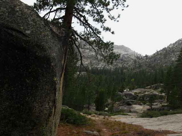
Into a Zone of Rock Terrain
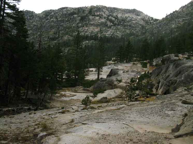 |
Entering the first short but significant rock section between Horse Canyon and Telephone Gulch. Telephone Gulch is the cut in the ridge on the upper Right, while our trail turns Left following Summit City Canyon's bend to the South. |
Fine Rock Terrain
 |
| Ancient trail work. |
Summit City Canyon and Creek turn South
 |
||
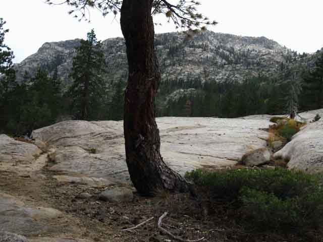
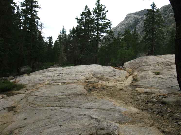
Crossing this granite flat high point reveals the whole length of the Western Wall of Summit City Canyon between Telephone Gulch, the cut in the ridge on the Right, from the cut in the canyon to the South, the Left in the image above. Our route South on the Tahoe to Yosemite Trail bends Left, down the canyon. Though there is no trail through Telephone Gulch to Silver Lake to our West-Northwest (through the gap on the Right of the image), as there is a trail to Silver Lake through Horse Canyon behind us, the great face ahead of us is also part of the Eastern face of the same great granite ridge dividing our position in Summit City Canyon from Silver Lake and the Silver Fork of the American River to our West-Northwest.
|
A bit of Rock and Open Terrain South of Horse Canyon
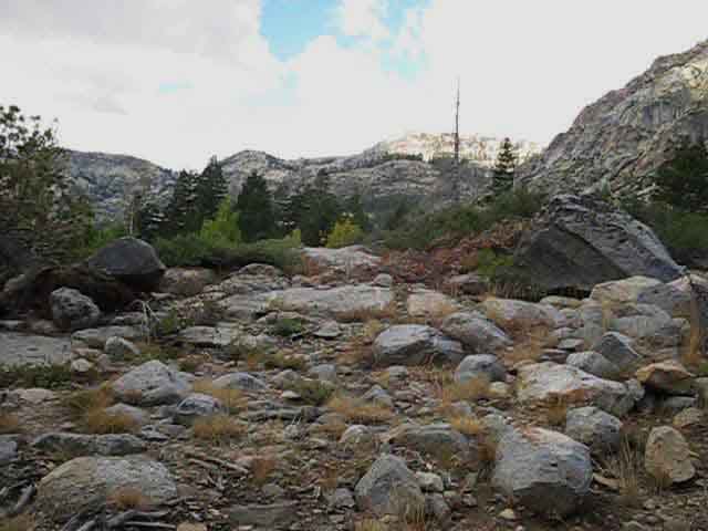
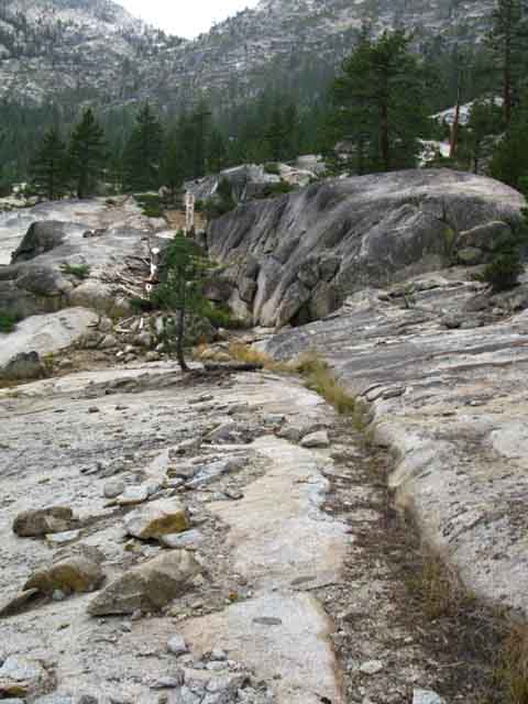
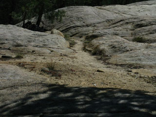
South of Horse Canyon we are relieved to find easily discernable trail bed through and across a too-small section of rock. Rock terrain is much easier to navigate than the dense forest and meadow leading South to the Horse Canyon trail junction. Rock terrain is relaxing. |
||
 |
||
| Smooth, flat trail: Easy to follow, easy on the body. |
Turning South in Summit City Canyon
 |
Turning South with Summit City Canyon approaching Telephone Gulch. The perspective above is looking down-canyon to the South in our direction of travel. |
More of the Rock and Open Terrain South of Horse Canyon
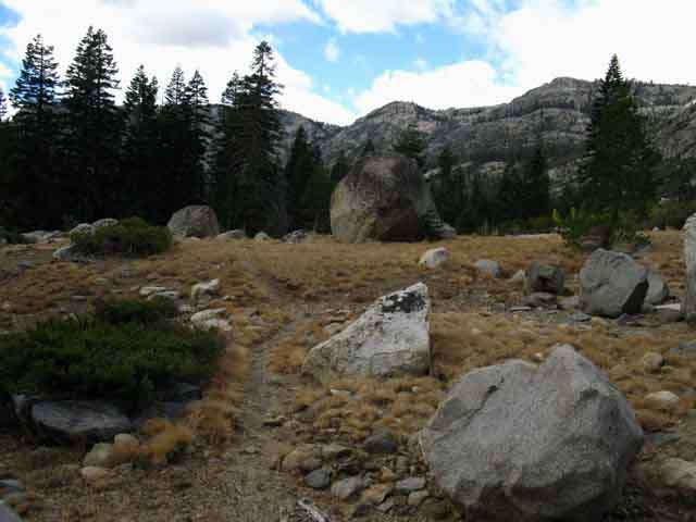
| Massive once-polished granite plates with "erratics," boulders dropped by melting glaciers. | ||
 |
||
Crossing this rocky terrain was like taking a break compared with crossing through dense forest. How much of a break it is will depend on how bad the route through the forest is. And how bad your feet and knees hurt. Soft forest soils cushion impact better than hard surfaces. Hard surfaces offer easier hiking, but much more foot, knee, and hip impact. > Forum < |
A Fantastic Boulder
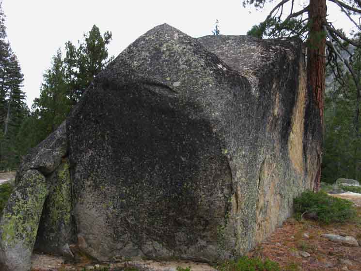 |
Great Boulder. It either rolled down here or was dropped by the glacier. |
Trail Beyond Great Boulder and Telephone Gulch
 |
||
View of trail South across rock and through forest at Telephone Gulch.
|
Segments through Dense Forest
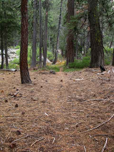 |
| Very faint trail approaching Telephone Gulch. |
Easy Hiking over Rock Trail
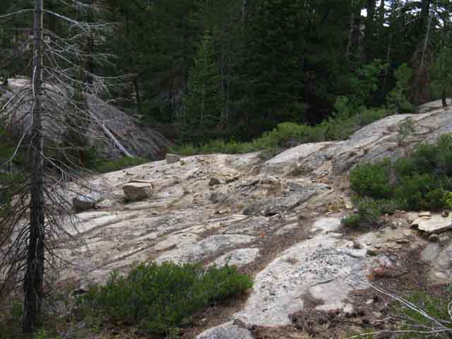 |
Off the last bit of rock down into forest. These sections of trail carved into rock are welcome interludes to faint trail through dense forest and no trail across meadow. Many backpackers don't carry a mental load on maintained trail. We can let our minds wander, relying on generations of work by trail crew to keep us on trail and route, without a thought. When the trail disappears and the faintness of the route melts into the terrain we begin to feel the weight of the mental load. Soon we begin to notice that this mental load is burning calories and increasing, if not magnifying our physical load. Whoa! That's Incredible! We soon understand that stretches of identifiable trail and/or route lighten our mental load, while navigating the chaos of the forest increases it. Each piece of the puzzle of route-finding we figure out lightens our mental load while sections of easy to follow trail cut across rock ease both our mental and physical challenges. Out here across unmaintained trail we can find the true weight of our pack. |
Into Dense Forest, Again
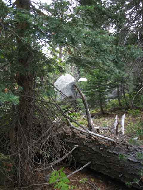 |
Dense forest at the base of Telephone Gulch in Summit City Canyon. |
Telephone Gulch
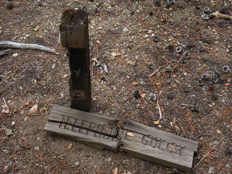 |
||
Telephone Gulch trail sign and post together but not joined.
The campsite here is a bit South down the trail from Telephone Gulch. |
Telephone Gulch is strange. There is no trail junction here, only the remnants of a trail sign. The two pieces were widely separated before I found and reunited them in 2009. It looks and feels old here, like a place that was used by people long enough ago that their only remaining traces are an uneasy feeling. The uneasiness may be a product of the end of the trail traces that had so far led us down to Telephone Gulch from the Summit City Creek trail junction below Fourth of July Lake. It's so quiet here it's disquieting. As the noise of civilization recedes from body and mind the silence of nature roars in both. The silence roars here, both physically and psychologically. Traces of "trail" South of Telephone Gulch were hard to find in July 2009. 2013 update: Faint trail conditions persist. Greater distances between observable trail/route sections below Telephone Gulch than above, but recent trail work has opened up a faint observable route down to the great open expanse of granite sitting above, and leading us down to the Upper Ford, though our upcoming route down to the granite is punctuated with short sections without easily observable signs of trail or route. Route finding skills are becoming more important the further South we hike. Telephone Gulch Elevation: 6720 feet. .8 of a mile South of Horse Canyon. 3.23 miles South of the Summit City Junction. 1.71 miles North of the Upper Ford of Summit City Creek. 6.26 miles North of Camp Irene.
|
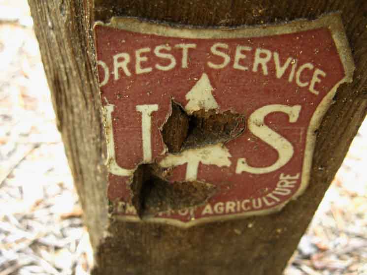 |
| Support the Forest Service, but insist that all of their "multiple uses" do no long term damage to the forests. |
| I found, collected, and put together the sign pieces for this 2009 picture. | ||
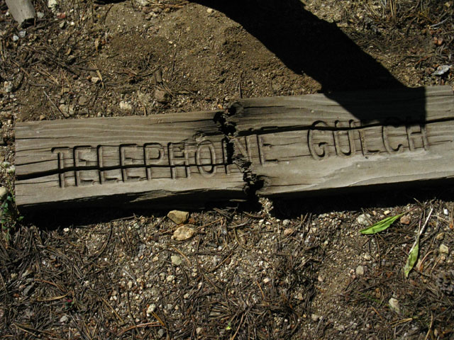 |
||
Telephone Gulch. |
Culvert a few feet South of Telephone Gulch Trail Sign
 |
Summit City Creek runs to our Left. This is a great piece of old work because culverts wash away. The longevity of this setup is a testament to the trail crew that laid it, how long ago? Longer than I've been hiking through here. Twenty years? Thirty? Forty? Tell me: comments. Note the recent addition of three boulders to hold the culvert down and in... |
Runoff water polished amazing contours onto Summit City Creek rock
| Summit City Creek drops through narrow granite slot. | Sea of granite waves. | |||||
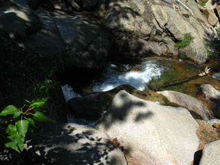 |
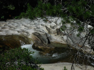 |
|||||
| top of page |
Telephone GulchShortly past Telephone Gulch we cross a creek feeding Summit City Creek. No problem in July, but the two drainages around Telephone Gulch that feed Summit City Creek will present real problems to cross when the Spring Thaw is pushing high levels of runoff through them. Be Careful! After crossing the tributaries we come to a strange piece of water-carved granite alongside Summit City Creek. |
A sea of Granite Waves
| I must admit that I have seen this neat feature many times from a distance, but I have never checked it out up close. | ||
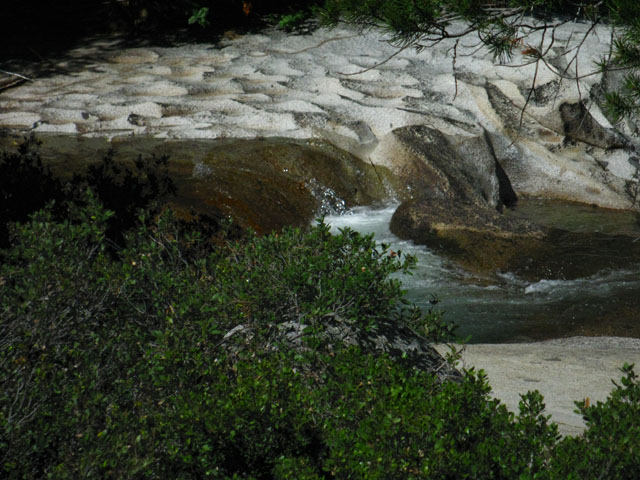 |
||
The reason is my simple laziness. Close inspection of this unique feature requires work, and carrying the damn tripod, cameras, batteries, charger and taking all the damn pictures and notes is already working me good. So I've deferred stopping, pulling off the old boots, and wading across Summit City Creek to screw around with the granite waves. But I will next time through here, (I did not) which should be sometime during the Summer of 2012, (passed it again in 2013) if things go well, and I get the opportunity to hike my 5th Tahoe to Whitney. (I did a 2012 TW hike and things did not go real well... oh well. Here's a piece of wisdom for you: If you spend long enough on the trail everything will happen to you on the trail. Everything good, and everything bad. That is why you should always pack all the proper safety equipment, first aid, and proper gear for the range of dangers, including weather and injury.) (Note: TW in 2012 was via PCT through Mokelumne Wilderness, but 2013 finally brought another hike down Summit City Creek, but my attentions were on other elements of the infinite terrain we find within even the small spaces...) I'd like to get some shots and input about this feature from hikers, so post up through the second link below, or email me with shots and info and I'll include 'em in the guide and forum. > Forum < |
Summit City Creek South of Telephone Gulch
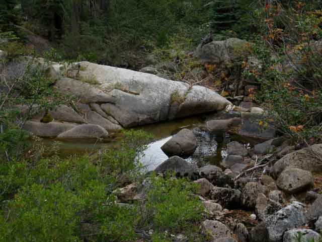 |
||
Great rock along Summit City Creek just above the Telephone Gulch Campsite.
|
Telephone Gulch CampsiteElevation: 6720 feet. .8 of a mile South of Horse Canyon. 3.23 miles South of the Summit City Junction |
Old Campsite just beyond Telephone Gulch Sign
Campsite South of Telephone Gulch |
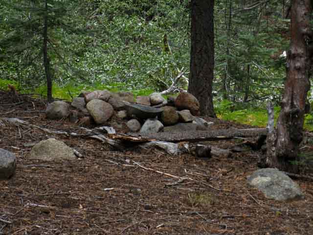 |
Campsite South of Telephone Gulch 2013. This built-up fire ring is the physical representation of the increased attention and traffic this section of the Tahoe to Yosemite Trail, this special length of primitive trail down Summit City Canyon has been attracting during the last few years. But what does that mean? It means that the trail route and campsites are showing signs of use and work. This is good and bad. The question is how much trail work is too much? I invite increased backpacker traffic and the natural opening up of the trail this wear brings. But, this traffic is also drawing the attention of well-intentioned volunteers and the El Dorado National Forest who are working to open up this route into marked trail. This makes me wonder how much work it will take to remove the challenge and mystery that have traditionally characterized a hike through this section. Exactly the same issues that have made this section of trail physically and mentally demanding, the deterioration of trail into route, are being reduced in length and difficulty all along this section. Much of the beauty and pleasure of hiking the trail route down Summit City Canyon is tied to the exercise of route-finding skills. Personally, I always have seen this section of trail as a test of a hikers fundamental observation, analysis, and decision making skills. There are at least a thousand miles of maintained trail in the Sierra Nevada. There are less than a hundred miles of unmaintained trail, making these miles an endangered specie. If a hiker easily cruises through here they are generally ready to bring it up to the next level: Developing into a Spring then a Winter snow traveler, along with expanding your cross-country hiking menu. If you can run this section without too many problems you are good to go for most of what the Sierra Nevada can throw at you, if you plan and gear up properly. You are also good to go up to your next level of backpacking skills. If you executed and enjoyed this section of trail I strongly suggest you check out the 9 mile unmaintained trail up the East Carson River from Carson Falls connecting to the PCT about 8 miles North of Sonora Pass. Unmaintained sections of High Sierra Route like Summit City Creek and the East Fork of the Carson River where we follow ancient trail through very rough terrain are getting rarer and rarer. Places like these are vital places for evolving backpacking skills within the backpacking community, but it's most important to maintain places like these where the feelings, experiences, as well as the skills created by route-finding are preserved. The degree of opening this route into a trail will be the degree it is closed down as a route-finding challenge. But how much work is too much? Or too little? I see things differently, and I don't think there is one "answer" or solution to this problem. I see these changes as part of the trail cycle. Talking with Ranger Cecilia Reed, the Trails Ranger of the Amador Ranger District of the El Dorado National Forest, gives me confidence. Ranger Reed is going to open up the 2.43 mile long section of trail from the Summit City Canyon trail junction down to Horse Canyon and out to Silver Lake with regular trail crew. It sounds like that is going to happen, and that this section will be returned to regular maintenance. It was always maintained up until around 2002, when it seems the El Dorado forgot about it. No problem for me, but curious. That section will now be maintained, with a trail crew going in during the Summer of 2014, if I understood Ranger Reed correctly. Ranger Reed and the Mokelumne Wilderness Volunteers have also directed their efforts to brushing out and ducking the route from Horse Canyon to Camp Irene. They hit the trail early in the 2013 backpacking season, fixing up the traditional length of non-maintained trail between Camp Irene and Horse Canyon. This work was very apparent to me during my hike through in September of 2013. In addition, Trail Slug and his pal Joe have been doing lots of trail work spanning from the Summit City Canyon trail junction South all the way through The Enchanted Forest. These guys have connected up sections of trail bed that were very disconnected, considerably improving the overall distance of continuous trail that hikers can observe. All of these efforts have brought the unmaintained trail route up to the high level of quality it held prior to 1997, before the catastrophic thaw of 1997 destroyed the lower section of trail, and greatly degraded the whole route. This section of trail from Horse Canyon to Camp Irene is in the best shape it's been in for the last 15 years, and looks to improve further over the next few years. This is the upward part of the trail cycle. By 2020 all of this attention and work will fade away, a blight will bring down many trees across one section, and a thaw with flooding will degrade other parts, and the trail will again fall into an obscure route. The trail cycle will rise and fall. We are currently on the improving part of this cycle as of 2013. Cool. But let's not push it too far. |
| Closer look at Campsite South of Telephone Gulch. | ||
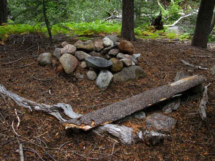 |
||
Primitive bench and fire ring.
|
NEXT The Big Picture At Telephone Gulch we are a bit less than half-way between the Summit City Canyon trail junction 3.23 miles to our North and where we leave Summit City Creek behind crossing its Lower Ford 4.22 miles to our South. Here at Telephone Gulch we have finished our turn South within the South-bending course of Summit City Canyon. We are now pointed South by the compass, poised for our final 3.03 miles hiking in this great granite canyon down to the campsite overlooking a profound view of the canyon of the North Mokelumne. This campsite marks the Southern end of Summit City Canyon. The walls of Summit City Canyon open out to become part of the upper walls of the great canyon holding the North Mokelumne River. The final 1.19 miles between this campsite at the end of the Summit City Canyon down to the Lower Ford of Summit City Creek drops down through an exposed flank of the Canyon holding the N Mokelumne far below us through an ocean of dense manzanita surrounding glacially carved granite islands rising out of this hot green sea. Summit City Creek runs through a deep and mostly inaccessible rock channel to our West, our Right from the end of Summit City Canyon down to the Lower Ford. Let's Do It The next page of our trail guide South on the Tahoe to Yosemite Trail continues South down the faint and degraded route from the campsite South of Telephone Gulch pictured above, to find our way to and then across the great section of open granite laying to the North, above the Upper Ford of Summit City Creek. After fording Summit City Creek we continue South over the first two of four granite hills or rises, beautiful sculpted granite formations separating the Upper Ford from the South end of Summit City Canyon. At the Southern base of the fourth hill South of the Upper Ford we look West, to our Right, at where Summit City Creek flows out of the rough section South of the Upper Ford onto and through an unusual massive expanse of flat, smooth granite. This will be the second amazing granite flat we encounter South of the Upper Ford. Hiking West over to Summit City Creek from here reveals this stunning granite flat has been penetrated and covered by dense forest, and is also decorated by a garden of massive granite boulders, while Summit City Creek flows peacefully past. Another frkn amazing place hidden along our route. Check it out. Its level of peace depends on the season; during wet Springs the creek surges through here. But if you managed to get across the Upper Ford your attention will be focused on worrying about getting across the Lower Ford. These fords are crossable before the Spring snows begin to melt, and after the majority of the thaw has passed by. But they are not passable during the height of the Spring Thaw. This granite flat with forest and creek is a stunningly beautiful, quiet, and peaceful place. The second granite flat South of the Upper Summit City Ford reveals an amazing section of creek, rock, and nice spots to throw down a relaxing campsite and soak up some nature. It's a hard place to see and find, but it is worth the observation and efforts to find and see it. Just when we though we had seen the most amazing things, more amazing things pops into view. Whew! |
North: Fourth of July Lake South:Telephone Gulch to Granite Flat South of upper ford
Summit City Creek to Telephone Gulch |
The Unmaintained SectionAs of July 2009. Post your reports and experiences along this route. On this segment of the Tahoe to Yosemite Trail between the Summit City Creek trail junction to Telephone Gulch there is occasionally a followable faint trail bed, though the trail was very faint or non existent in some sections during 2009. This section of trail from Summit City Creek junction to Telephone Gulch was maintained just a few years ago, but this is no longer the case. (2013 update: Summit City trail junction to Telephone Gulch has received much work and has almost continuous trail or trail signs between these points.) There are many downed trees that require some climbing to follow the identifiable sections of the trail bed. If you lose the route along the faded trail bed, you will have a rough hike down to Horse Canyon. (2013 update: It is much harder to lose the trail route, most trees cut or detoured around.) Basic Details of the Un maintained SectionTo cross this unmaintained section of the Tahoe to Yosemite Trail between Summit City Creek to Camp Irene, you should be prepared to find your way without trail or trail signs through 9.52 +/- miles of forest, rock, and manzanita. That is the worst-case scenario. Remains of the trail can ease your passage though this section, if they are still there, and you can find and stay on the old trail route. (2013 update: The 2.43 miles between the Summit City trail junction South to Horse Canyon is not quite a maintained trail, but it is in much better condition than unmaintained route.) If you lose the old trail route the whole way through this section, which is theoretically possible, you will face a tremendously difficult 9.52 mile hike. (2013 update: Trail work makes losing the trail route across the whole length of this section is much less likely during 2013 than 2009.) If you are reasonably skilled at wilderness observation, you will note that the traces of an old trail bed can be discerned at various points throughout this section, while ducks mark some of the route across open granite. Other parts of this unmaintained section have no reliable trail markers at all. Independent of the observable trail markers, the majority of the trail through here is obscured to one degree or another. This means that you really have to keep your eyes open and watch the near terrain, where you put your feet, while simultaneously scanning the upcoming features for the best route through, all while trying to piece together what bits of the old trail you can find. (2013 update: This is still true. Even where marked and ducked the faintness of the trail bed requires we pay close attention to our route through the terrain.) This route requires careful walking, careful observation of your hiking surface, careful observation of your potential upcoming route options, while carefully observing for old faded blazes and the remaining bits of the old trail bed all at once. In the meantime, you will be forced to climb over downed trees, push through dense underbrush, and cross unexpected runoff gorges blocking the route. (2013 update: Not nearly as many obstacles to climb.) Rest assured that the old trail marked a route through this section that still exists, even though the trail itself has faded away in places. If you lose the trail through here, think! The first thing I do is carefully observe my forward options. If none prove fruitful, I backtrack to my last know position. This is generally a piece of old trail, but may not be. From my last known position I observe and explore the other forward options that I declined my last time venturing forward from this point. I jokingly call this "exploring unknown territory." That sounds a lot better than being lost. But this is not being lost, as I have a "known position" that I can trace back to the same way I entered. That would be a real drag, but objective hazards such as impassable fords or unavoidable avalanche zones sometimes require a healthy retreat and rerouting. (2013 update: Having and using skills is always good practice...) I once pointed myself West from the Sierra Crest at Grizzly Peak Lake in the Emigrant Wilderness, and worked my way West down the Sierra flank by a self-selected route to Pinecrest Lake, and Highway 108 at the Pinecrest Ranger station. As I worked my way down the ridges descending off the Sierra Crest, I quickly found that many of the options down mountain I explored led into complex dead-end gorges. I quickly decided that I had to have a fool-proof way to work my way back up to a solid known position. So I decided to duck my explorations. If the route down failed, I kicked the ducks down as I climbed back up to my last known position. If that route successfully brought be down a section of the mountain, I left the ducks behind. I have never needed to use this method while hiking the unmaintained trail along Summit City Creek. In the long run, I have found that if I observe and follow what is the best route through the terrain along Summit City Creek I will refind pieces of the old trail, only to lose them yet again, to stumble upon it yet again. Another reassuring fact: The distance from the bank of Summit City Creek to the rock of the canyon wall is pretty short. The trail, or the best route through any particular section along Summit City Creek do not have much space to hide in. Expert cross-country hikers skilled at route finding should find this a fun hike. Rookie backpackers may want to develop some experience and skills before attempting this section, while experienced hikers may want to get in shape before running this route. Everyone needs something, and this route will find your weakness. The conditions you may encounter through here demand that you have the physical fitness, backpacking experience, and navigational skill to find your way through difficult terrain without trails. If you don't have these skills you will suffer and be endangered in proportion to your lack of skills and fitness. Psychological Difference: Much more IsolatedThe Tahoe to Yosemite Trail route is much more remote and less traveled than the Pacific Crest Trail route. It is not uncommon to pass through the whole section between Summit City Creek to Lake Alpine without meeting another backpacker. The lack of Summertime traffic through this section marks it as somewhat unique. I've only run into three hiking parties over the decades I've hiked this section. The steepness of the canyon walls, the lack of human traffic, and the signs of disuse expressed by the deteriorating trails and unused camps impart a deep feeling of isolation. This is a good feeling, unless you get into trouble. Solo Backpackers should note that the lack of backpacker traffic through here, and the possibility of hikers taking different routes through the same sections, combine together to make extra caution prudent. The lack of trail, the remoteness of the terrain, and the history of this location combine to give you a small psychological window into the isolated experiences of early Western hikers in the Sierras. Unmaintained Trail Section on the Tahoe to Yosemite TrailThe reason for the low backpacker traffic on the Tahoe to Yosemite Trail route between the Carson Pass and Lake Alpine is the roughness of the terrain and difficult navigation demanded by the 9.52 miles of unmaintained trail between the Summit City Creek trail junction below Fourth of July Lake, to the North Fork of the Mokelumne River at Camp Irene. Basic Conditions on Unmaintained SectionsOn an unmaintained section of trail you should expect, and be able to navigate through, terrain where all signs of trail, trail bed, blazes, and ducks will be absent for extended lengths. If you cannot stay on the old trail route through this section you may not see any route indications whatsoever. You should expect fallen trees, heavy overgrowths of brush, runoff gorges, and boulders to block your way. A wide variety of obstacles can be depended on to block your route, and to obscure all traces of the trail you are following. This type of terrain demands physical conditioning and skills necessary to prevent injury while carrying a heavy pack across difficult and unstable terrain. Crossing this type of terrain with a backpack is very hard work. This terrain also demands the ability to find the best route through a particular section of terrain while maintaining your proper direction without trail, trail markers, blazes, or ducks while working yourself hard. Projected or predicted times to make mileage on maintained trails are significantly altered by encountering unmaintained trail sections. It can easily take twice as long to cross a mile of unmaintained trail than a mile of maintained trail. Backpacking is DangerousBackpacking is dangerous, and can generate significant amounts of physical and psychological stress. Injury and death are regular outcomes for backpackers. Every year backpackers get lost, injured, struck by lightening, eaten by bears, drown while crossing rivers, shot by hunters, or frozen in unexpected blizzards. These are the things that can happen to well-prepared, smart backpackers. I have not even begun to mention the things that unprepared stupid backpackers do to themselves through bad decision making. Nothing in this trail guide will protect you against yourself or the occasional Fury of Nature. Backpacking unmaintained trails multiplies all of these dangers, puts you further from help and/or rescue, and generally multiplies all of the physical and psychological stresses and dangers of normal backpacking on maintained trails across steep high altitude mountains. I don't mean to scare you, but backpacking, for all of its joys, can put you into some very dangerous situations. And it is during these hard engagements with nature that I have my best and worse experiences. Though most of us attempt to mitigate these dangers, there is always a reasonable chance that you will get lost, get injured, or get dead. Thus I offer these cautions, suggest precautions, and have the Trails Disclaimer. The best way to minimize the ever-present chances of injury and death is to build your backpacking and backcountry skills and fitness in conjunction with increasing the difficulty of your backpacking trips in a logical and safe progression. This is the best way you can reduce the chances of putting yourself in situations you are not prepared for. Don't attempt the unmaintained section of the Tahoe to Yosemite trail unless you are an accomplished, experienced backpacker, in good physical shape, capable of reading maps, and properly equipped with enough food to accommodate a longer crossing of this section than you anticipated. Shit happens. Your pace, carrying capacity, state of physical conditioning, and the particular route you choose may extend or shorten the duration of your trip through this section of the trail, and any of the trails described on this web site. Plan accordingly. Discretion is often the better part of valor.
30 min Tahoe to Yosemite Topo Hiking Map: Echo Summit to Lake Alpine 7.5 Topo Hiking Map: South on the Tahoe to Yosemite Trail Note: Click the Red Dots on the Maps! |
Backpacking Trail Guide North |
 |
Backpacking Trail Guide South |
Backpacker ForumsHave a great Sierra Nevada route or trip to relate?Post it on
|
North: Fourth of July Lake South:Telephone Gulch to Granite Flat South of upper ford
Trailhead
Contact
Alex Wierbinski

Backpacking Lake Tahoe to Mount Whitney
Your guide to the High Sierra Crest, including the Tahoe to Yosemite, Pacific Crest, and John Muir Trails
