

The Trails
Guide
Maps
Miles/Ele
Permits
Resupply
Forum
Weather Conditions
Weather Notes
Northern High Sierras
Central High Sierras
Southern High Sierras
Gear
Gear List
Gear Forum
Gettin Started
Layering
Testing yourself and your gear
Gear Reviews
Backpacking
South to Dicks Pass on the Tahoe Yosemite Trail through Desolation Wilderness
Hiking the High Sierra from Lake Tahoe to Mount Whitney
Translate
Languages
Trail Prep
The art of walking
Physical Preperation
Planning
Trail Skills
The trail
Off the trail
Scrambling
Maps
Navigation
Camp skills
Food
Resupply
Food
Other
Photo Catagories
Trail Stories
Trail Culture
News and Science
Links
Groups
Books
Terms and Conditions of Use
Passing South by the Southernmost Bayview Trail junction puts us on this long arcing climb up the densely forested Eastern wall of the basin holding Dicks Lake.
Meeks Bay to Echo Summit Our climb higher passes above the North to the South end of the lake reveals a shifting range of pleasing views as our perspective on Dicks Lake rotates and rises. |
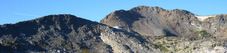
Dicks Peak
| Looking Southwest from above the Northwest side of Dicks Lake. |
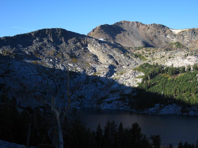 |
The morning is the best time to climb. I'm hiking South to Dicks Pass in the cool morning shade! Here we can see the gap between the low rise in the dark ridgeline and Dicks Peak in the back-Right. That gap holds a lake draining down to Fontanillis Lake. Dicks Pass is out of frame to the Left of the low dark rise in the middle-Left of the image. |
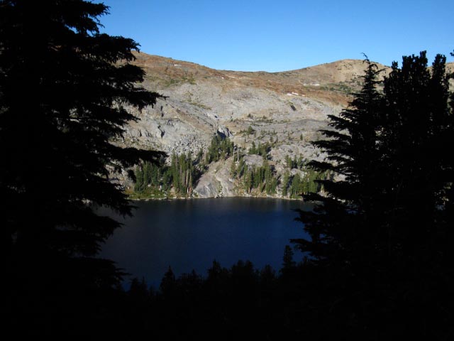
| Climbing higher we get stunning glimpses of Dicks Lake's Western shore through the dark dense forest. Note the coves with associated campsites. |
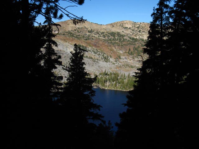 |
| Sunrise lighting up the West side of Dicks Lake with the Eastern side under shadow. |
Campsite on West Shore of Dicks Lake
| Next to the cove above Dicks Lake's Western shore I could make out a fine campsite. |
 |
| The Cannon hand-held camera's little telephoto works pretty well. |
Climbing Higher through dense forest on East side of Dick Lake
| Climbing higher and further South. |
 |
| I'm trying to beat the sun to Dicks Pass. |
| The South end of Rockbound Valley sits West beyond Dicks Peak. |
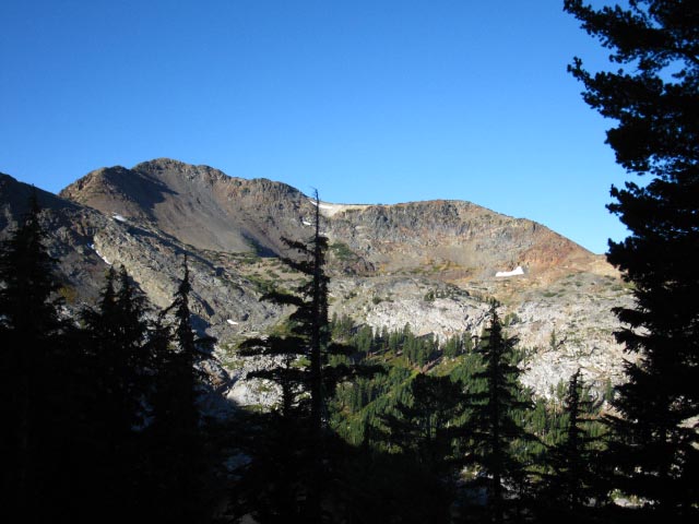 |
The massif holding Dicks and Jacks Peaks makes up the Eastern wall of Rockbound Valley, the Crystal Range the Western wall of Rockbound Valley. |
video
Dicks Pass #2
Approaching Dicks Pass from the North
| Dicks and Fontanillis Lakes from final approach to Dicks Pass |
The Southbound backpacker's climb up to Dicks Pass is mostly a long, gradual traverse under nice forest cover. The traverse ends where the trail doubles back in a "button hook" move, then another gentle traverse brings us into the open terrain that crosses Dicks Pass. The actual the North-South gap in the mountains is West of, and below the marked position of Dicks Pass on the maps. I mention this because most mountain passes are at the low point in a gap in a range of mountains. The trail to Dicks Pass from the North crosses the pass as marked on the maps, then drops down to the lowest point of the gap in the crestline to drop off the West side of Dicks Pass. We do pass through the actual low spot of the gap between Dicks Peak and Dicks Pass, but this feature is unnamed on the USGS maps. The route of the trail through Dicks Pass is logical, I'm just curious about why the named location of Dicks Pass on the maps is above the gap on the mountain, and not at the low point in the gap. |
| Past Bayview Trail Junctions South to Dicks Pass |
||
Desolation WildernessNorth side of Dicks Passmileage on this piece of trail The distance from the Bayview Junction South to Dicks Pass is 1.65 miles while rising 910' in Elevation.
A longer perspective North North
South
Notes on local, and local long distance backpacking trips On the trail guide pages to the North we just passed two trail junctions sporting trails leading East to the Bayview Camp and Eagle Falls Trailheads on the West shore of Lake Tahoe, and one trail West to Camper Flat in Rockbound Valley. These Bayview and Eagle Falls Trailheads on the West shore of Lake Tahoe can be used to begin backpacking loops South on this Tahoe to Yosemite Trail that turn North for the return leg of the trip through Rockbound Valley to Camper Flat, via Mosquito Pass on the North Shore of Lake Aloha. On the South side of Dicks Pass we encounter the next series of three trail junctions in quick succession. This next series of junctions also offers two routes East out to West shore Lake Tahoe Trailheads, and one trail West, but the trail West dead-ends at Half Moon and Alta Morris Lakes. The trails East bring us out of Desolation Wilderness either over Mount Tallac or hiking down to Glen Alpine. We can begin our local or looping backpacking trips in the Desolation Wilderness from any of these four trailheads along the Western shore of Lake Tahoe.
|
Amazing view
from just
North of Dicks Pass
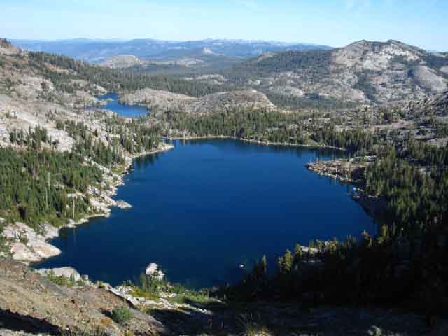 |
| Northwest View: Dicks Lake in foreground, the pinched form of Fontanillis lake behind, |
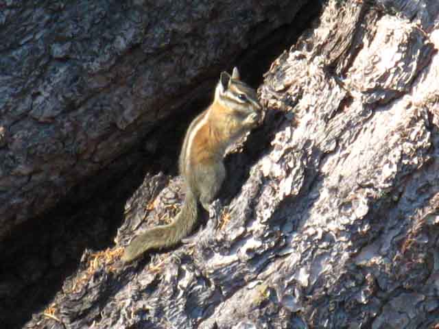
Two Squirrels and a Chipmunk
on the
North Side of Dicks Pass
 |
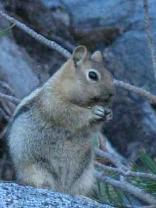 |
| Squirrel | Squirrel |
 |
|
| Chipmunk | |
North: Fontanillis to Dicks Pass 1 South: Dicks Pass
Approaching Dicks Pass on The Tahoe to Yosemite Trail |
|
You begin your climb towards Dicks Pass from Middle Velma Lake when traveling Southbound through the Desolation Wilderness on the Pacific Crest, Tahoe to Yosemite and Tahoe Rim Trails. Middle Velma Lake is the low point between Phipps Pass and Dicks Pass. Heading South from the Third, the Southern Bayview Junction to Dicks Pass Passing the Bayview trail junction puts us a bit past the half-way point up to Dicks Pass from Middle Velma Lake. 1.65 miles climbing 910' feet of vertical elevation separate the Bayview Junction from Dicks Pass. Obscured views of Dicks and Fontanillis Lakes clear as the forest lining the trail up to Dicks Pass thins out as our elevation increases.
Topo Hiking Map North Topo Hiking Map Topo Hiking Map South Next page: Dicks Pass |
Backpacking North Trail Guide |
 |
Backpacking South Trail Guide |
Backpacker ForumsTahoetoWhitney.OrgFrom Bayview Trail junction South to Dicks Pass, #2Add your experiences, comments, or pictures about the North side of Dicks Pass overlooking Dicks and Fontanillis Lakes:Section: Meeks Bay to Echo SummitSegment: Fontanillis to Dicks Pass |
North: Fontanillis to Dicks Pass 1 South: Dicks Pass
Home Page
Contact
Alex Wierbinski

Backpacking Lake Tahoe to Mount Whitney
Your guide to the High Sierra Crest, including the Tahoe to Yosemite, Pacific Crest, and John Muir Trails
