

The Trails
Guide
Maps
Miles/Ele
Permits
Resupply
Forum
Weather Conditions
Weather Notes
Northern High Sierras
Central High Sierras
Southern High Sierras
Gear
Gear List
Gear Forum
Gettin Started
Layering
Testing yourself and your gear
Gear Reviews
The Tahoe to Yosemite Trail
Backpacking
The South End of Stony Ridge Lake
Meeks Bay Trailhead Access to the North Desolation Wilderness
Translate
Languages
Trail Prep
The art of walking
Physical Preperation
Planning
Trail Skills
The trail
Off the trail
Scrambling
Maps
Navigation
Camp skills
Food
Resupply
Food
Other
Photo Catagories
Trail Stories
Trail Culture
News and Science
Links
Groups
Books
Terms and Conditions of Use
Stony Ridge Lake
The chain of lakes we hiked past coming South up from Lake Genevieve terminates sloppily but beautifully in the boggy area South of the South shore of Stony Ridge Lake.
Meeks Bay to Echo Summit |
A Marshy Meadow
at the
Head of the Valley
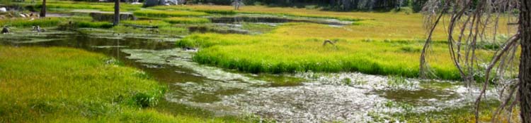
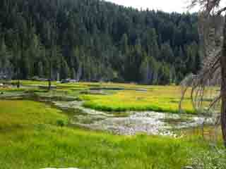
| Delightful meadow-quagmire at the South end of Stony Ridge Lake. The low rolling granite formations appear to check and hold water above Stony Ridge Lake creating a nice marsh-meadow. |
 |
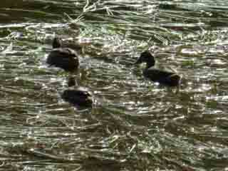
You and I want to stay the hell out of this beautiful muck and mosquito factory, but it's beautiful to look at, and Heaven for migrating Ducks. Above we are looking North-Northeast, to our Left across the valley just South of Stony Ridge Lake. We are hiking South, to the Right from the perspective above. |
Marshy Meadow Verdant Greens light up the wet marsh and grassy meadow on the South Side of Stony Ridge Lake running up to the head of this narrow wedge of a valley. Movement in the water draws my eye, causing a pause in the pace. It's Ducks feeding in the Marsh. They too notice me, and take my measure. The Ducks decide to measure out a bit more distance between us, and move leisurely but deliberately further away from my position. This wet mess on the South Side of Stony Ridge Lake precludes it as a location for good campsites. Find camping along the drier North and Northwest sides of the lake. |
 |
 |
| Verdant green marshy meadow fills up the head of the valley North of Stony Ridge Lake. | Hiking past, I noticed movements in the marshy flow, it's Ducks! |
 |
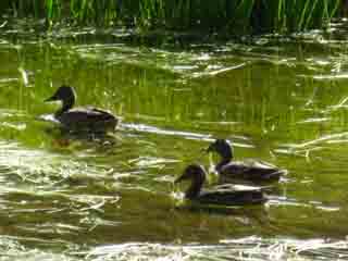 |
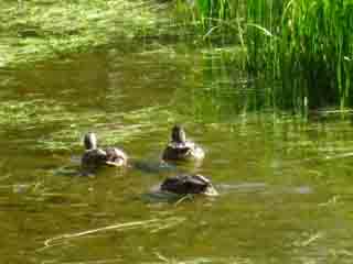
| Ducks chilling, but moving away from Al. | I always stop and watch when the ducks are out. Hell, I try to observe everything. |
 |
 |
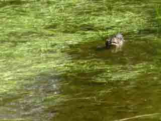
Always plan extra time for each day's backpacking so we can stop and watch the Ducks, and everything else that crosses our path. |
|
Desolation Wilderness
Meeks Bay to Stony Ridge LakeNice hiking on Lake Tahoe's Western Shore. Stony Ridge Lake Elevation Mileage 2.26 miles South to Phipps Pass |
Into the Heart of the Desolation Wilderness Our easy hike out of Meeks Bay terminates at the South Side of Stony Ridge Lake. The hike up to Phipps Pass is a brief easy-grade intermediate difficulty hike. Climbing up to Phipps Pass will open up broad vistas of the Southwestern Shore of Lake Tahoe, and dropping down off the pass brings us into the Heart of the Desolation Wilderness. Middle Velma Lake is another 3.44 miles beyond Phipps Pass, which is a total of 5.7 miles from the South side of Stony Ridge Lake. This means that we've 2.26 miles of climbing followed by 3.44 miles of descending before we begin the climb up to Dicks Pass. |
Nice Trail Work
| Nice use of granite slabs to cover busy creek across the trail. |
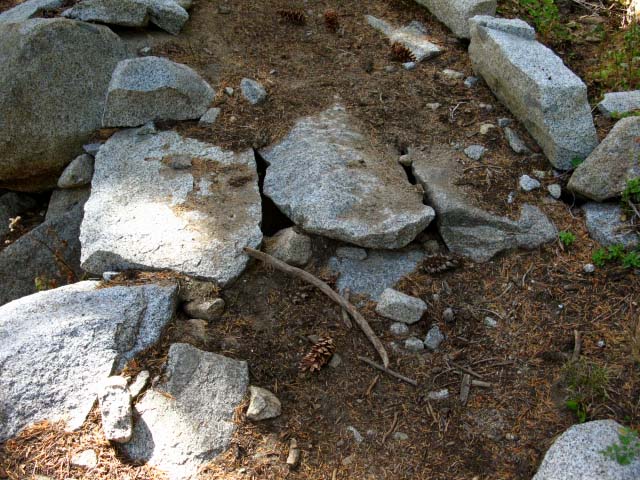 |
Granite Flake Bridge I could see that it took a lot of work to get to the point where these large granite "flakes" would cover the gap over the creeklet below. Note the extensive build up and backfill of the ramp up to the actual "bridge." |
| This trail crew feature made me go off trail to get a better look at this pro bit of trail work. |
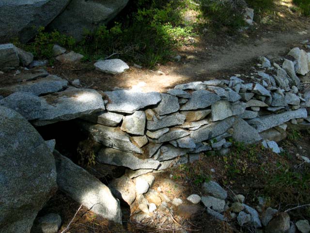 |
Side view of the build-up and cap-stoned section on the South side of Stony Ridge Lake. |
Video
Climbing from Stony Ridge Lake to Phipps Pass
Up the switch backs above Stony Ridge Lake through dense forest littered with great granite boulders. Though not a great piece of film making, we can see and get an idea of the nature of the terrain. |
Views of Stony Ridge Lake Climbing South towards Rubicon Lake
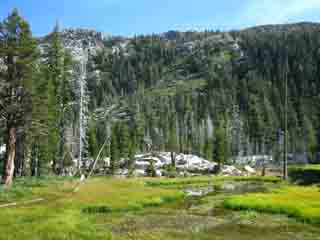
| Climbing South from Stony Ridge Lake. |
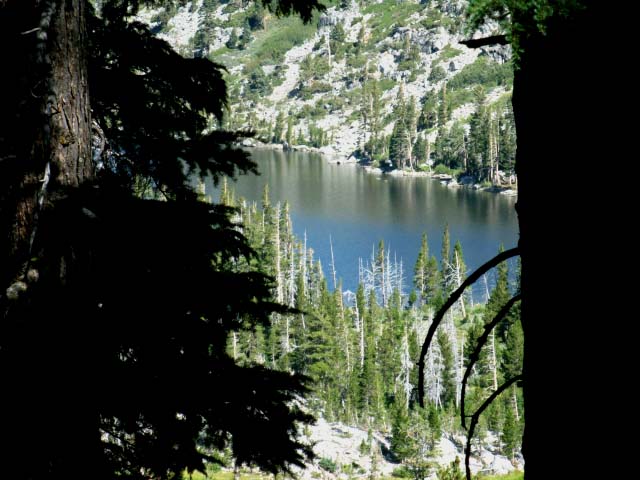 |
We can see how the switchbacks rapidly gain elevation above Stony Ridge Lake. The heavily forested hillside gives good cover from the Sun. |
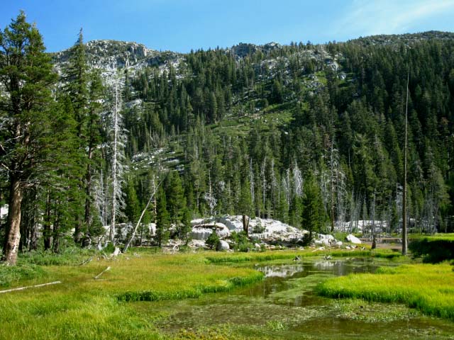
Stony Ridge Lake
| Climbing South from Stony Ridge Lake we can see the marsh at its South end. |
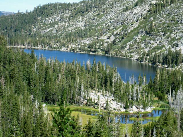 |
Climbing South from Stony Ridge Lake towards Rubicon Lake and on to Phipps Pass. Our trail up to here followed along the Western, or left side of the lake from this perspective. We can see the marshy area South of Stony Ridge Lake filling up the head of the valley. Rubicon Lake is behind us, wedged into a shelf in the mountain ridge we're climbing. |
Backpacking North: Stony Ridge Lake 2 Backpacking South: Stony Ridge to Rubicon Lake
Stony Ridge Lake |
Departing the Southern Side of Stony Ridge Lake Southward presents us with a 2.26 mile hike up 1000 feet to Phipps Pass. Hard3 or and Intermediate1 The trail is nicely switch backed at a gentle grade. But it presents a stiff climb, even being well graded. The hike between Stony Ridge Lake and Phipps Pass is an intermediate1 level hike. The fine forest trails we have traveled on so far will now be decorated with the Great Granite Formations first rising out of dense forest, which characterize the lower part of the climb up to Phipps Pass. The higher up we go the greater the exposed granite features. Hiking Topo Map: Meeks to Phipps Pass Hiking Topo Map: Genevieve to Phipps Pass |
Backpacking North Trail Guide |
 |
Backpacking South Trail Guide |
Backpacker ForumsGeneral Backpacking Topics:TahoetoWhitney.OrgAdd your experiences, comments, or pictures about your Hiking Trips around Stony Ridge Lake:Section: Tahoe to Echo SummitSegment: Stony Ridge Lake |
North: Stony Ridge Lake 2 South: Stony Ridge to Rubicon Lake
Home Page

Backpacking Lake Tahoe to Mount Whitney
Your guide to the High Sierra Crest, including the Tahoe to Yosemite, Pacific Crest, and John Muir Trails
