

The Trails
Guide
Maps
Miles/Ele
Permits
Resupply
Forum
Weather Conditions
Weather Notes
Northern High Sierras
Central High Sierras
Southern High Sierras
Gear
Gear List
Gear Forum
Gettin Started
Layering
Testing yourself and your gear
Gear Reviews
The Tahoe to Yosemite Trail
Backpacking past Stony Ridge Lake
Hiking Meeks Bay through North Desolation Wilderness, The Tahoe to Yosemite Trail
Translate
Languages
Trail Prep
The art of walking
Physical Preperation
Planning
Trail Skills
The trail
Off the trail
Scrambling
Maps
Navigation
Camp skills
Food
Resupply
Food
Other
Photo Catagories
Trail Stories
Trail Culture
News and Science
Links
Groups
Books
Terms and Conditions of Use
| Trail guide section index | North |
South Stony Ridge Lake |
Topo map | miles & elevations | Miles & Elevations Index | Lake Tahoe Basin Management Unit | All forest-wilderness Permits | all pages |
Video
View from the Middle-South Side of Stony Ridge Lake, Desolation Wilderness
| Rock, forest, and Water. | ||
| Hiking to the South side of Stony Ridge Lake. Duration 1:07.
Meeks Bay to Echo Summit |
Desolation WildernessMeeks Bay to Stony Ridge Lake
Backpacking to Stony Ridge Lake Elevation Mileage 2.26 miles South to Phipps Pass |
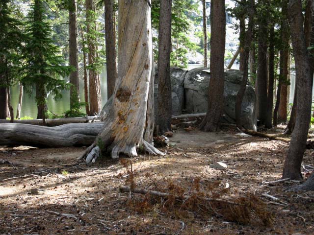
| Stony Ridge Lake campsite. | ||
 |
||
About half way between the North and South sides of Stony Ridge Lake we find this very well used campsite area between the trail and the lake.
|
Backpacking on the South Side of Stony Ridge Lake, Desolation Wilderness
| Looking North along West shore of Stony Ridge Lake. |
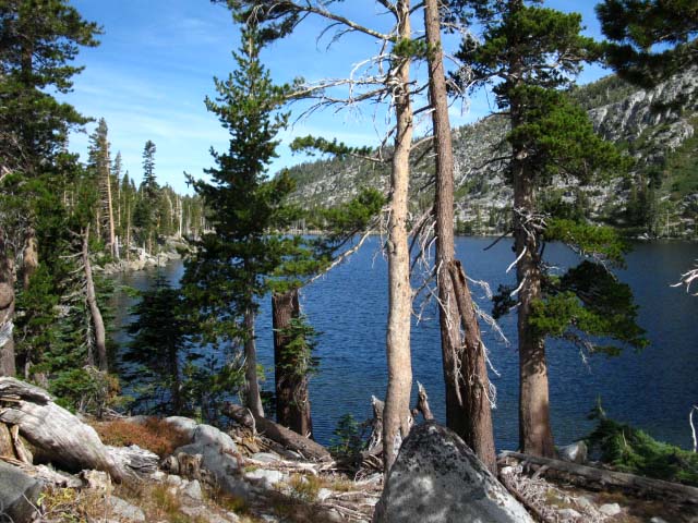 |
| Rocky forested terrain. |
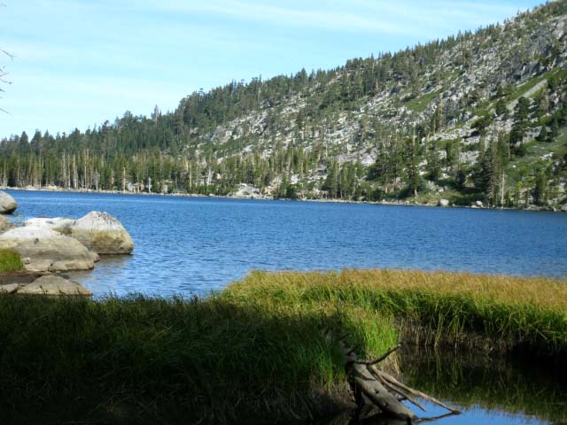
| Heading South to the South end of Stony Ridge Lake. | ||
 |
||
Looking almost directly North across Stony Ridge Lake. Bits of marsh grasses begin to indicate the boggy conditions on the Southern side of Stony Ridge Lake we find as we hike up to the head of this narrow valley. The drainage off the mountains around the head of this valley appear to drain too quickly for a lake to form, and too slowly to form a well defined creek. Thus the terrain above Stony Ridge Lake is boggy. The next page South on the guide explores the marshy South side of Stony Ridge Lake.
|
Hike North: Center Stony Ridge Hike South: South Stony Ridge Lake
Desolation Trail |
After Passing the marshy zone on the South side of Stony Ridge Lake we begin the 2.26 mile 1000' ascent of intermediate difficulty up to Phipps Pass on a series of well graded switchbacks on firm trails with a soft surface. If we are going the distance to Yosemite or Mount Whitney, we can make good time through this moderate difficulty section. If we are doing a Meeks to Echo Lake backpacking trip, at say 10 miles a day, we can stop and enjoy all of these beautiful views during a three day, 30 mile traverse of the Desolation Wilderness. In late September of 2009 it took me six nights to get from Meeks Bay to Ebbetts Pass, taking the Pacific Crest Trail route South from the Carson Gap. Here on our first significant climb out of Meeks Bay is where we first feel pressure from our hiking plan. Every mile not hiked today will add to the daily total down the trail. Every mile that strains us now will slow us down later. A balance must be struck. Topo Hiking Map: Meeks to Dicks Pass Topo Hiking Map: Genevieve to Phipps Pass Next page: Stony Ridge Lake 3 |
Backpacking North Trail Guide |
 |
Backpacking South Trail Guide |
Backpacker ForumsTahoetoWhitney.OrgStony Ridge Lake, Desolation Trail, Desolation WildernessHave any experiences, comments, questions, or pictures about backpacking Stony Ridge Lake? Share 'em!Section: Tahoe to Echo SummitSegment: Stony Ridge Lake |
North: Center Stony Ridge South: South Stony Ridge Lake
Home Page
Contact
Alex Wierbinski

Backpacking Lake Tahoe to Mount Whitney
Your guide to the High Sierra Crest, including the Tahoe to Yosemite, Pacific Crest, and John Muir Trails
