

High Sierra
Backpacking
Trail Guide
Forums
Sierra
Weather
WeatherNotes Northern
Sierra Weather
Gear
The Tahoe to Yosemite Trail
Backpacking & Hiking to
Crag Lake out of Meeks Bay
Meeks Bay Trailhead, North Desolation Wilderness, The Tahoe to Yosemite Trail
Languages
Trail Skills
Mountain
Safety
Food
Planning
Trail Arts
More
Information
Social
| Trail guide section index | North |
South Stony Ridge Lake |
Topo map | Miles & Elevations |
Miles & Elevations INDEX |
Lake Tahoe Basin Management Unit | All forest-wilderness Permits |
all pages |
Interesting sights on the South Side of Crag Lake, Desolation Wilderness
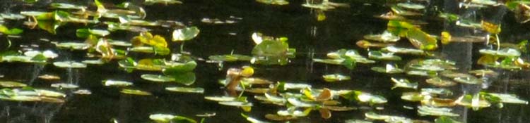
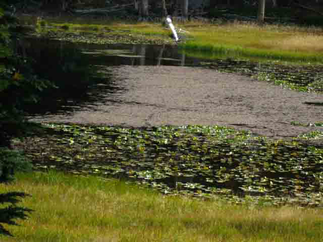
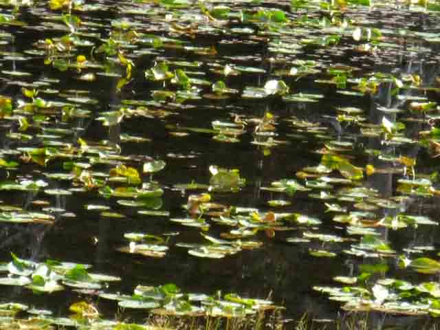
South Shore of Crag LakeHidden Lake Trail Junction From a distance it appeared the South side of Crag Lake had a rumpled green cover over part of the lake. Hiking past showed the green to be a layer of Water Lilies. Very pretty. Very relaxing. A gentle upgrade brings us across soft trails through this chain of lakes. |
 |
 |
| Above: lilies on Crag Lake? | Above: Yes, Water Lilies on Crag Lake |
 |
|
| Above and Below: There's something hypnotic about Lilies, and Desolation Wilderness is full of entrancing Surprises. | |
 |
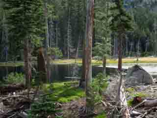
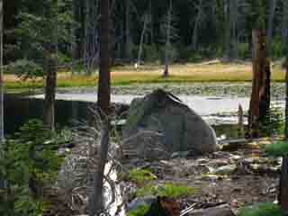
| Every step brings another relaxing scene in the Desolation Wilderness |
A fine Series of Terrains Along a dry sandy meadow-side trail to the ridge, through dry forest into a little temperate zone, and now into this narrow valley containing a chain of lakes. The series of sights, sounds, smells and feelings along these first miles on the trail are a fine sensory transition from "civilized" to natural environment. |
Desolation WildernessMeeks Bay to Crag Lake to Phipps PassCrag Lake +1201 Meeks Bay to Dicks Pass Mileage 4.77 miles from Meeks Bay trail head 4.11 miles to Phipps Pass |
North: Crag Lake South: South Shore Stony Ridge Lake
Desolation Wilderness |
From Meeks Bay trail head to Phipps Pass we will be climbing a total of 2561 feet of vertical elevation over 8.88 miles of distance. Crag Lake is the second in the series of lakes along the TYT to Phipps Pass. As the area between Lake Genevieve to Stony Ridge Lake represents the last relatively flat places before we begin climbing towards Phipps Pass at the South end of Stony Ridge Lake, we may want to stop at this scenic location for a snack or a bit of lunch, depending on our plans. Crag Lake is 4.77 miles South from Meeks Bay Topo Hiking Map: Meeks to Dicks Pass Topo Hiking Map: Genevieve to Phipps Pass Next page South |
Hiking North |
 |
Hiking South |
Backpacker ForumsTahoetoWhitney.OrgWant to Give or Get more information about Crag Lake?Add your experiences, comments, questions, or pictures about this...Section
|
North: Crag Lake South: North Shore Stony Ridge Lake
Trailhead
Contact
Alex Wierbinski

Backpacking Lake Tahoe to Mount Whitney
Your guide to the High Sierra Crest, including the Tahoe to Yosemite, Pacific Crest, and John Muir Trails
