

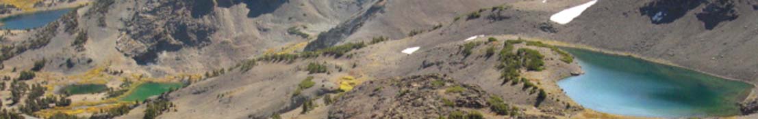
Dicks Lake

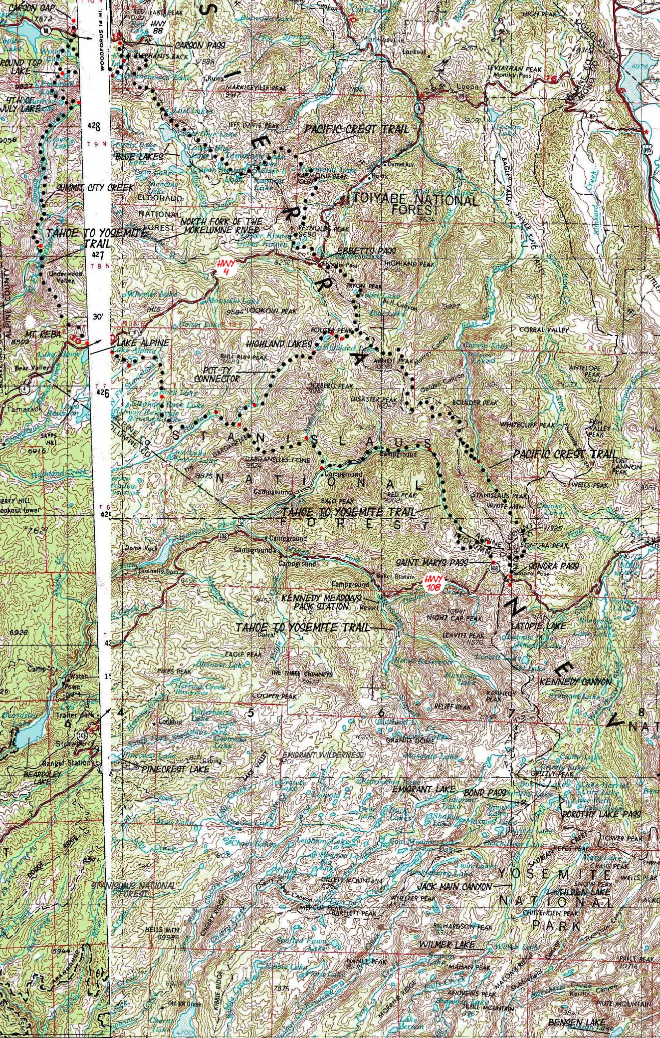
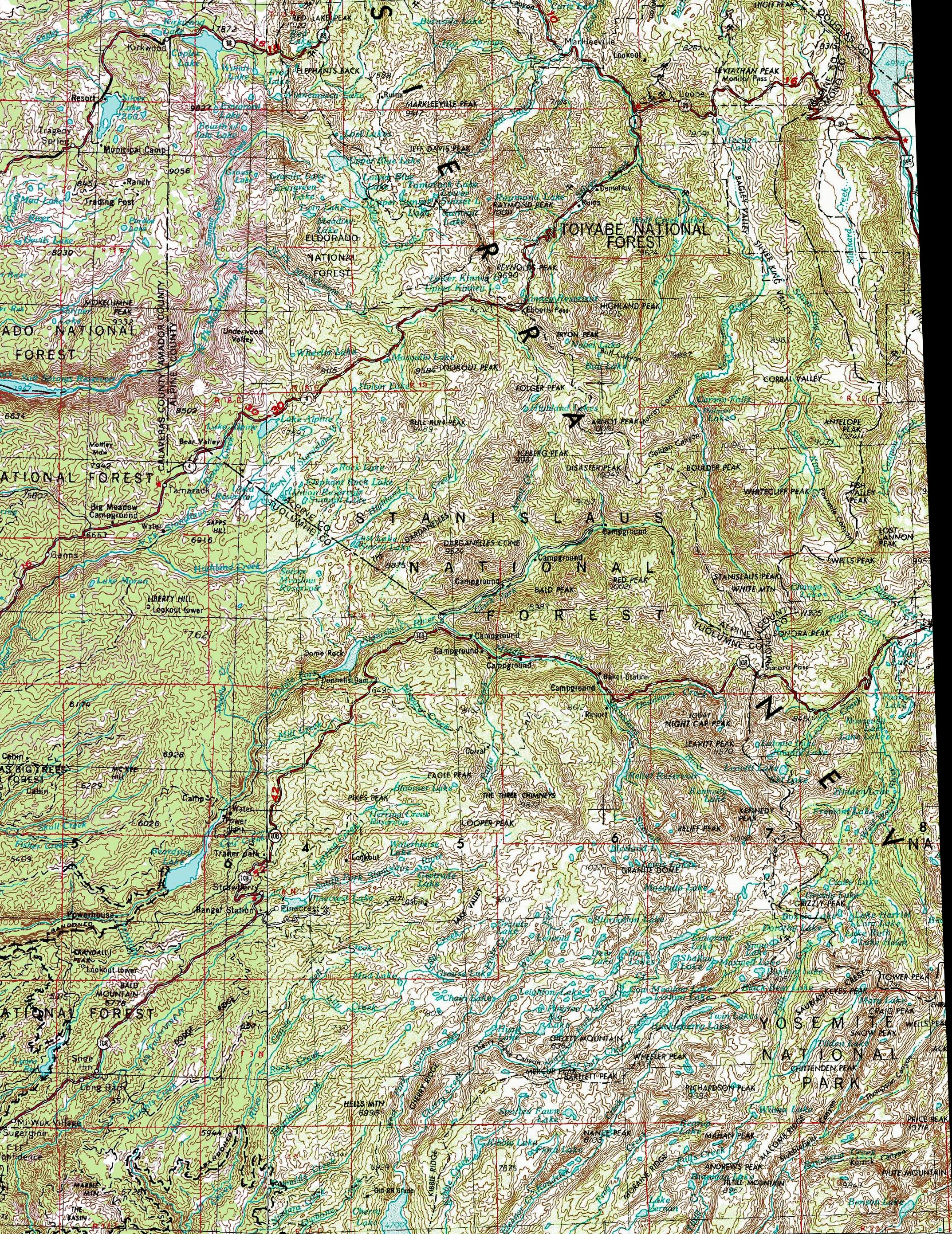
The Big View: Carson Pass to Bensen Lake Backpacking Map
The Northern High Sierras along the Pacific Crest and Tahoe to Yosemite Trails
Two 1x2 degree USGS Backpacking Maps

| Tahoe to Yosemite Maps and Mileages, and Trail Guide | Trail Guide | Map Indexes | TY Miles and Elevations | PCT Miles and Elevations | Weather, Map Data | ||||||||||||||||||
| North Side: Carson Pass Region Map | Continuing South: Bensen Lake to Virginia Canyon |
All Maps: All Tahoe to Whitney | All Miles and Elevations: All Tahoe to Whitney | The Trail Guide Index: Tahoe to Whitney | Section: Lake Alpine | Page: Lake Alpine | Lake Tahoe to Highway 4 | Highway 4 to Sonora Pass | Sonora Pass to Tuolumne Meadows | Carson Gap to Lake Alpine | Lake Alpine to Saint Marys Pass | Saint Marys Pass to Tuolumne Meadows | Carson Pass to Ebbetts Pass | Ebbetts Pass to Sonora Pass | Sonora Pass to Tuolumne Meadows | map info | |||||||
The Big Picture: The Tahoe to Yosemite and Pacific Crest Trails from the Carson Gap to Bensen Lake
Click Colored points on map for more information: Red Points are trail junctions, blue points are images, and green points represent Videos. Large Red and Blue points represent real time weather stations
 |
next MAP page: Le
 |
Location |
Main Features: This map covers the majority of the Tahoe to Yosemite and Pacific Crest Trails from the Carson Gap to Bensen Lake in the Yosemite Backcountry. The Carson Gap marks the Southbound backpacker's exit from the Lake Tahoe Basin. At the Carson Gap, pictured at the top of the map above, the Southbound Tahoe to Yosemite and Pacific Crest Trail part company. These trails again intersect at Jack Main Canyon, below their respective entries into Yosemite. The Tahoe to Yosemite Trail departs the Emigrant Wilderness Bond Pass. This map depicts the |
Mapping Information |
|
Mileages and Elevations Trail head to road/trail junction (the first red dot): 1.35 miles Road/trail junction to end of map: 3.04 Total Trail Mileage: 4.39
back to Tahoe to Alpine Trail Guide Index back to Meeks Bay trail head |
Map Name: Walker Lake, Nevada, Calif, 1957, 1x2 degree Topographic Map Name: Sacramento, Calif, 1957, 1x2 degree Topographic Compass Offset: Not Stated on Map
scale: 1:250 000 Contours: 200 feet
Backpacking permitting authority: Lake Tahoe Basin Management UnitNational Forest: LTBMU Wilderness Area: Desolation WildernessPhysical location: Meeks Bay Trailhead and Highway 89 |
next map: last map:
| Elevations | More Information | ||
Lake Tahoe: 6226 feet Meeks Bay Trail head: 6239 feet elevation rise: 400 meters, or 1312 feet |
Trail Guide, Section: Meeks Bay to The Carson Gap Trail Guide, Segment: Meeks Bay Trail head Google Map: All Lake Tahoe trailheads |
||
Map Credit |
U.S. Geological Survey, Department of the Interior: The USGS Move the Map to the Sierras. Select size of Maps you wish to locate. Click "Mark Point" on map to see the USGS map grid of the selected map scale. USGS Topographic Map Information |