

High Sierra
Backpacking
Trail Guide
Forums
Sierra
Weather
WeatherNotes Northern
Sierra Weather
Gear
Backpacking
South up to Dicks Pass
Hiking The Tahoe to Yosemite and Pacific Crest Trails through the High Sierras
Languages
Trail Skills
Mountain
Safety
Food
Planning
Trail Arts
More
Information
Social
| Trail Guide Section INDEX |
North |
South TYT-PCT Dicks Pass |
Miles & Elevations |
Miles & Elevations INDEX |
Lake Tahoe Basin Management Unit PERMITS |
All forest-wilderness PERMITS |
|
Video
South
of the
Southernmost Bayview Trail Junction,
on the
TYT-PCT-TRT
in
Desolation Wilderness
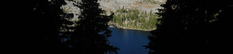
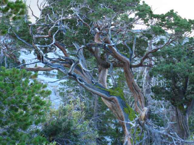
Stark, yet Graceful lines of Dead tree above Dicks Lake
| South Past the Southern Bayview Trail Junction to Dicks Pass |
||
Desolation Wilderness
Mileage Miles East to Eagle Falls and Bayview Trailheads: Previous Guide Page
Elevations
This and the next page covers this 1.65 mile span of trail between the Bayview Trail junction up to Dicks Pass.
Meeks Bay to Echo Summit
Comments, Questions, Advice?
|
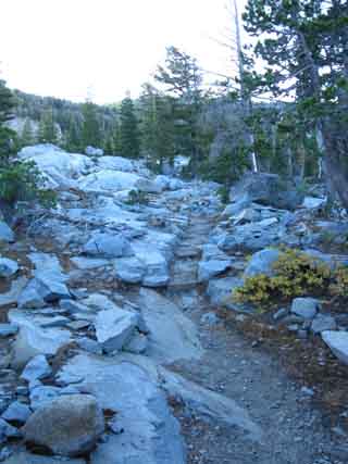
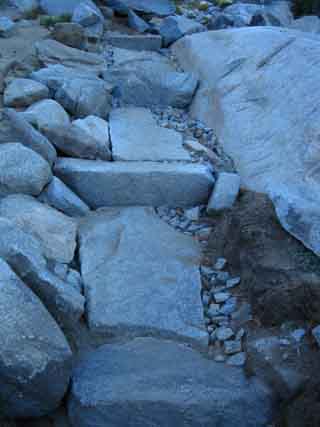
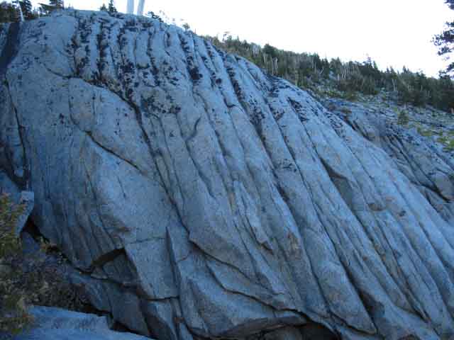
Killer Trail Work up to Dicks Pass
typical of the
High Quality Trails in Desolation Wilderness
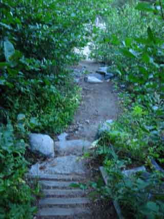
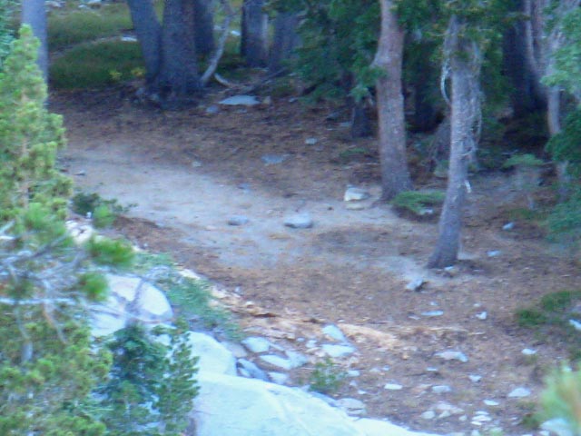
The TrailsThis trail guide pays special attention to the trail itself. From our perspective the trail is not a means, it is an end in itself. It is part of the art, it is the first surface of engagement. The trail is not just a "surface," it is an important way of measuring of the nature and character of the terrain. It's location, design, and maintenance are all important parts of the "story" and logic of the local terrain we are passing through. May you observe and read it well. When your observations of the local wind, weather, temps, and humidity are contrasted with the conditions of the trail surface and the tracks on it, much information becomes available. We seek to understand the logic of the terrain. |
 |
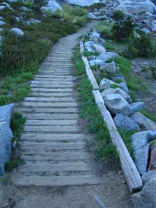 |
Armored Trail Heavy backpacker traffic will damage wet meadow and trail sections moistened by springs unless properly protected. Most National Forest trail crews utilize "rock hops" by placing stepping stones across wet trail sections they cannot route the trail around. The incredibly heavy backpacker traffic in Desolation Wilderness requires a more hearty response. This induced Trails to armor-up wet sections of trail with some pretty serious planking. Desolation Wilderness Crews build "Land Bridges," meaning they construct wooden causeways over extended lengths of meadow or other vulnerable terrain. |
|
 |
 |
Nice stone work on the Left. Examples of fine trail crew work between Fontanillis Lake and Dicks Pass in Desolation Wilderness demonstrate Art and Science well balanced. |
|
North TYT-PCT: Bayview Junction South TYT-PCT: Dicks Pass
More fine terrain and beautiful views up to Dicks Pass
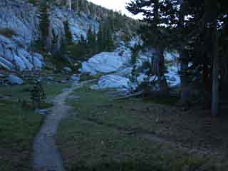
Hiking PlanA good daily hiking plan starts with a big climb. The cool morning temps help minimize the stress and strains of hiking over the Sierra mountains. Take advantage of this fact. Getting up before the asscrack of dawn can provide significant advantages for properly-situated long distance High Sierra backpackers. Therefore my long term hiking plan tries to put each campsite at the base of a big climb. I hope to do as many of the big climbs between Lake Tahoe and Mount Whitney in cool morning air as possible. There is a real difference between how we will feel after climbing a thousand feet during a cool morning, and how we feel after climbing the same thousand feet in afternoon heat and sun. A wise hiking plan will try to cover as many miles and feet of elevation in cool morning conditions as possible. This tactic will preserve a heck of a lot of energy over the length of our backpacking trip from Lake Tahoe to Mount Whitney.
|
 |
 |
| Above: First Light on Dicks Peak and Pass | Upper unmarked Junction down to Dicks Lake hiking South past the third Bayview Trail junction. |
 |
 |
| Fine crisp September morning in Desolation Wilderness passing South around Dicks Lake. | Rocky cove on far side of Dicks Lake. We can see campsites over there. |
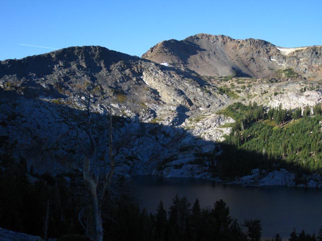
Rock and Forest hiking South to Dicks Pass
North TYT-PCT: Bayview Junction South TYT-PCT: Dicks Pass
Approaching |
We begin our climb towards Dicks Pass when we departed the Northernmost of the Bayview trail junctions on the Southwestern corner of Middle Velma Lake. We climbed the ramp up into the lower bowl holding Fontanillis Lake by turning Right, South through the middle Bayview junction above the South Shore of Middle Velma Lake, and now we've climbed up to the Southernmost and third of the Bayview trail junctions, the one that's located on the North edge of the upper bowl, the uppermost of these stepped-bowls holding Fontanillis and Dicks Lake in the valley running North under the North Flank of Dicks Pass. Our hike South past Fontanillis and bending around under the North shore of Dicks Lake brings us up to this third and Southernmost Bayview Trail junction. It also marks the beginning of the final leg of our climb to Dicks Pass. Arriving at this Southern Bayview trail junction 2.86 miles South of Middle Velma Lake puts us a bit past the half-way point of the 4.51 miles up to Dicks Pass from Middle Velma Lake. But we've only climbed 560, a bit more than a third of the 1470 feet between Middle Velma and Dicks Pass. Our trail South from the Bayview junction now begins climbing into a long traverse up and around a rising perimeter carved into the Northeastern forested wall of this upper bowl, wrapping around the wall above Northeastern Shore of Dicks Lake in a long arc climbing to Dicks Pass. 1.65 miles climbing 910' feet of vertical elevation separate our position at this third Bayview Junction from Dicks Pass. Just below Dicks Pass pur trail takes more of a "jag," than a switchback, to set itself up to cross Dicks Pass.
Phipps Pass to Heather Lake
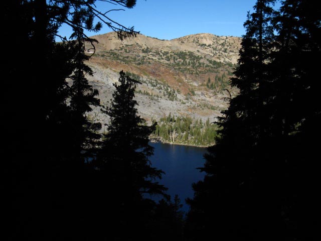
Obscured views of Dicks and Fontanillis Lakes filter through the forest lining our trail up to Dicks Pass, opening up stunning views of both Dicks and Fontanillis Lakes in this narrow valley from sweet perspectives, every now and then.
Topo Hiking Maps
South Dicks Pass to Echo Lake Trailhead
Desolation Wilderness
Next page |
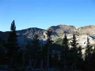
Top of the World in Desolation Wilderness
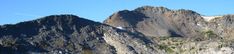
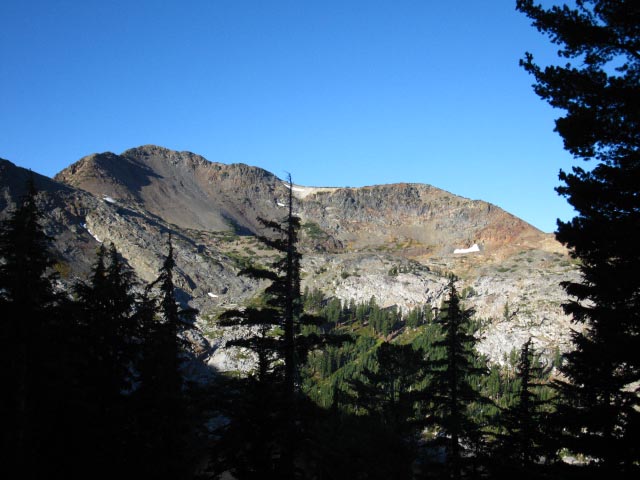
Dicks Pass is out of the Left edge of the image, Dicks Peak sits on the Right side.
Passing South by the Southernmost Bayview Trail junction puts us on this long arcing climb up the densely forested Eastern wall of the basin holding Dicks Lake.
Meeks Bay to Echo Summit
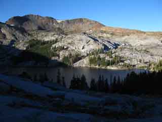
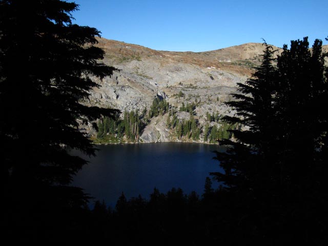
Our climb higher passes above the North to the South end of Dicks Lake revealing to the observant hiker a shifting range of pleasing views as our perspective on Dicks Lake rotates and rises.
|
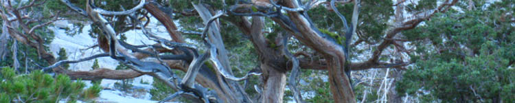
Dicks Peak
| Looking Southwest from above the Northeast Shore of Dicks Lake. |
 |
The morning is the best time to climb. I'm hiking South to Dicks Pass in the cool morning air and its attendant shade! Here comes the Sun! But I'm on the run to hit Dicks Pass while its still cool. Here we can see the gap between the low rise in the dark ridgeline and Dicks Peak in the back-Right. That gap holds a lake draining down to Fontanillis Lake. Dicks Pass is out of frame on the Left side of the semi-shadowed, low-peaked ridgeline in the middle-Left of the image. Dicks Pass is part of, on the line of that ridge running off down to our Left to Dicks Pass. |
| Climbing higher we get stunning glimpses of Dicks Lake's Western shore through the dark dense forest. Note the coves with associated campsites. |
 |
| Sunrise lighting up the West shore of Dicks Lake with the Eastern shore still under shadow. We passed a series of trails leading up to those campsites as we were climbing away from the South end of Fontanillis Lake up to and even South of the Southern Bayview trail junction. |
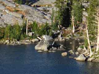
Campsite on West Shore of Dicks Lake
| Around the coves along Dicks Lake's Western shore we can make out fine campsites. |
 |
The Cannon hand-held camera's little telephoto works pretty well. |
Climbing Higher through dense forest on East side of Dick Lake
| Climbing higher and further South. |
 |
I'm trying to beat the sun to Dicks Pass. The Western shore of Dicks Lake is already heating up. Not going to happen. |
| The South end of Rockbound Valley sits West beyond Dicks Peak. |
 |
The massif holding Dicks and Jacks Peaks makes up the Eastern wall of Rockbound Valley, a Northern Spur off the Crystal Range, running North from Dicks Peak, pictured above, composing the massive ridgeline making up the Western wall dividing Rockbound Valley on its Western flank from that of our route up from Middle Velma to Dicks Pass. |
Video
Dicks Pass #2
Approaching Dicks Pass from the North
Dicks and Fontanillis Lakes from final approach to Dicks Pass |
The Southbound backpacker's climb up to Dicks Pass is mostly a long, gradual traverse under nice forest cover. The traverse ends where the trail doubles back in a "button hook" move, then begins another gentle, shorter, traverse bringing us into the open terrain that crosses Dicks Pass. The actual the North-South gap in the mountains is West of, and below the marked position of Dicks Pass on the maps. I mention this because most mountain passes are at the low point in a gap in a range of mountains. The trail to Dicks Pass from the North crosses the pass as marked on the maps, then drops down to the lowest point of the gap in the crestline as we drop off the West side of Dicks Pass. We do pass through the actual low spot of the gap between Dicks Peak and Dicks Pass, but this feature is unnamed on the USGS maps. The route of the trail through Dicks Pass is logical, I'm just curious about why the named location of Dicks Pass on the maps is above the gap on the mountain, and not at the low point in the gap, as is typical. |
| Past Bayview Trail Junctions South to Dicks Pass |
||||
Desolation WildernessNorth Flank of Dicks Passmileage on this piece of trail The distance from the Bayview Junction South to Dicks Pass is 1.65 miles while rising 910' in Elevation.
A longer perspective
North
North
South
Notes on local, and local long distance backpacking trips On the trail guide pages to the North we just passed two trail junctions sporting trails leading East to the Bayview Camp and Eagle Falls Trailheads on the West shore of Lake Tahoe, and West to Camper Flat in Rockbound Valley. These Bayview and Eagle Falls Trailheads on the West shore of Lake Tahoe can be used to begin backpacking loops South on this Tahoe to Yosemite Trail that turn North for the return leg of the trip through Rockbound Valley to Camper Flat, via Mosquito Pass on the North Shore of Lake Aloha. On the South flank of Dicks Pass we are going to encounter the next series of three trail junctions in quick succession. This next series of junctions also offers two routes East out to West shore Lake Tahoe Trailheads, and one trail West, but the trail West dead-ends at Half Moon and Alta Morris Lakes. The trails East bring us out of Desolation Wilderness either over Mount Tallac or hiking down to Glen Alpine. We can begin our local or looping backpacking trips in the Desolation Wilderness from any of these five trailheads along the Western shore of Lake Tahoe. We started out of Meeks Bay Trailhead and have so far passed the trails East out to Eagle Falls and Bayview Camp Trailheads, and West into Rockbound Valley. Next, we find the trails East out to the Tallac and Glen Alpine Trailheads along the West Shore of Tahoe, and a bit further South we find the trail West into the South end of Rockbound Valley. This series of trail junctions opens up a wide variety of local backpacking loops around the North Desolation Wilderness.
Check the Maps and Mileages to Plot your Own
Meeks Bay to Echo Summit
High Sierra Weather Information Local Temp and Snow Reporting Stations
Lake Tahoe Basin 7-Day Weather Forecast
|
Amazing view
from just
North of Dicks Pass
View North 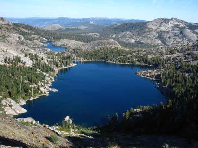 |
Northwest View: Dicks Lake in foreground, the pinched form of Fontanillis lake behind. |
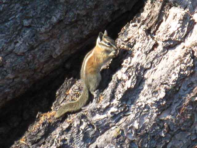
Two Squirrels and a Chipmunk
on the
North Side of Dicks Pass
 |
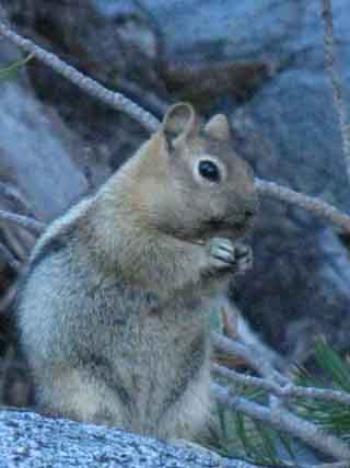 |
| Squirrel | Squirrel |
 |
|
Chipmunk |
|
Approaching Dicks Pass |
|
You begin your climb towards Dicks Pass from Middle Velma Lake when traveling Southbound through the Desolation Wilderness on the Pacific Crest, Tahoe to Yosemite and Tahoe Rim Trails. Middle Velma Lake is the low point between Phipps Pass and Dicks Pass. Heading South from the Third, the Southern Bayview Junction to Dicks Pass Passing the Bayview trail junction puts us a bit past the half-way point up to Dicks Pass from Middle Velma Lake. 1.65 miles climbing 910' feet of vertical elevation separate the Bayview Junction from Dicks Pass. Obscured views of Dicks and Fontanillis Lakes clear as the forest lining the trail up to Dicks Pass thins out as our elevation increases.
Topo Hiking Map North Topo Hiking Map Topo Hiking Map South
Next page |
Backpacking North Trail Guide |
 |
Backpacking South Trail Guide |
Backpacker Forums Post it on Welcome to Tahoe to Whitney
Anyone can post text comments in the existing forums, but only members can post up new topics, along with images, maps, and formatting. As we addressed some gear issues on the page above,
If you have experiences, comments, questions, trip reports, trail conditions updates or pictures and/or videos of the Tahoe to Yosemite Trail from Meeks Bay to Lake Genevieve, and camping around Lake Genevieve and up the valley, post up your images, experiences, notes, and advice here as an unknown hiker or as a member: Section
|
North TYT-PCT: Bayview Junction South TYT-PCT: Dicks Pass
Trailhead
Contact
Alex Wierbinski

Backpacking Lake Tahoe to Mount Whitney
Your guide to the High Sierra Crest, including the Tahoe to Yosemite, Pacific Crest, and John Muir Trails
