|
Part IV
The Backpacking Trip, Trails, and Culture
REPORT
Into the
North Yosemite Backcountry
The Backpacking Trip & Trail Culture
REPORT
The North Yosemite Backcountry
Report
After hiking 16.04 miles from Kennedy Meadows and passing through Bond Pass our route on the Tahoe to Yosemite Trail reconnects with the PCT when we hit the floor of Jack Main Canyon.
The TYT and PCT last parted company where we exited the Lake Tahoe Basin. They come back together here in the top of Jack Main Canyon for the remaining fifty-four and a half miles of our potential hike down to Tuolumne Meadows. Excepting the TYT's five mile swing around Tilden Lake where the PCT loops around Wilmer Lake.
Our trip described below turns South, dropping off the route of the TYT-PCT from Tilden Lake for a long descent down the West Flank of the Sierra into the Grand Canyon of the Tuolumne River.
North Yosemite Wilderness
Backpacking Maps, Miles, & Trail Guide Information
The Tahoe to Whitney Trail Guide covers the TYT-PCT continuing South to Tuolumne Meadows, for those who decide to extend this trip.
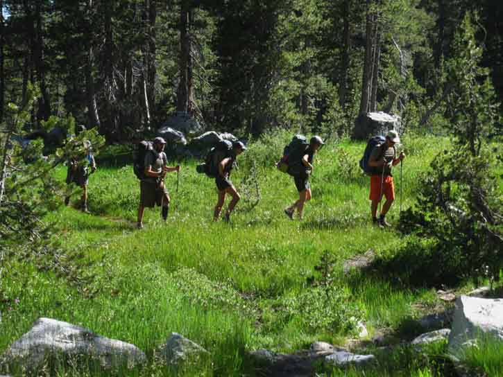
2016 PCT HIKERS
at the
TOP of JACK MAIN CANYON
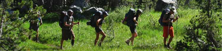
Entering Jack Main Canyon not only changes our Wilderness Area from Emigrant to Yosemite, it also changes the character and nature of our contacts with other hikers. We are entering the heavy flow of Northbound PCT hikers when we hike South into the top of Jack Main Canyon.
Now that we've hit the Southbound Pacific Crest Trail we are going to get another random sample of this year's huge crop of Northbound PCT hikers. These folks in Jack Main Canyon are approaching the thousand mile mark along their hike North from the Mexican border. The point one thousand miles North of the Mexican border is located about two-thirds of the way down to Harriet Lake after passing through Dorothy Lake Pass at the top of Jack Main Canyon.
The PCT hikers pictured below had hiked between 990 to 995 miles North from the Mexican border.
Degree of Difficulty
This section of trail from Sonora Pass to Tuolumne Meadows is also the second-most difficult section, if not the most difficult section of the TYT-PCT-JMT along the whole length of the Sierra Crest between Lake Tahoe and Mount Whitney.
I personally consider this 54 mile section of the PCT-TYT across the North Yosemite Backcountry to be the most difficult section of trail along the Sierra Crest.
The Main Body
of
PCT Hikers
Dropping into Jack Main Canyon hiking South in early July assures that we are going to meet a whole lot of Northbound PCT hikers who've covered a whole lot of miles. At this point in time, during this year's particular timing of the thaw and seasonal opening date of trails, entering the PCT here in Northwestern Yosemite in early July puts us through the tail end of the "main body" of this year's PCT hikers.
The mid-point of the main body of the PCT pack passed through maybe ten days earlier, with a whole lot of PCT hikers passing through since then and now.
Statistical Distribution
Every year the body of PCT hikers distribute themselves up and down the trail based on their average daily miles. There are a number of snow-capable PCT hikers who can safely enter the South Sierra while covered by thick snow, but the vast majority of hikers must wait until the point in time that most of snow melts out of the mountains. At that point in time the great flow of PCT hikers surges into the South Sierra.
How precisely a PCT hiker's arrival at the South end of the Sierra Nevada matches its opening date for snow-free trails measures the accuracy of their weather prediction and trip planning.
PCT PACK
The "pack" of PCT hikers is led by the "rabbits," composed of fast, strong and durable hikers.
Following these speedy folks will be increasing numbers of strong hikers doing decreasing numbers of daily miles, until the, "main body" comes through. I've found that the average "main body" hiker averages 20 miles a day across the South Sierra. That changes when they hit the North Yosemite Backcountry between Tuolumne Meadows and Sonora Pass. The difficulty of the terrain across the North Yosemite Backcountry decreases the daily average of strong "main body" PCT hikers by 5 miles per day to 15 miles per day.
The Pack is Thick
In recent years I have seen the main body of PCT hikers so thick that PCT hikers are distributed from five to fifteen minutes apart along the trail for dozens of miles.
And that's up here in the North Sierra, after the pack has had a thousand miles to spread and thin itself out. We find a powerful statistical distribution expressed in the main body of each year's hikers. Each year's specific Spring Thaw trajectory determines the exact timing of when the main body of PCT hikers moves into and across the Sierra, then they themselves distribute themselves under the bell curve of strength, endurance, and perception as they move North.
It is a very interesting laboratory of human experience, this phenomena of pop-culture PCT popularity drawing so many civilians into the mountains.
The Long Trail
There are lots of PCT hikers in "the main body." After the main body of PCT hikers passes North of our position, the number of PCT hikers diminishes with each passing day.
Late in the Summer season we will still encounter a good number of PCT hikers, but most of those folks will be the much more relaxed Pacific Crest Trail, "section hikers." Section Hikers are generally doing as many miles as they can each Summer until they finish the whole PCT.
These folks are much less stressed & strained than the early season PCT hikers.
The PCT section hikers are typically not yet on the trails during July. Too many mosquitoes.
Route
We will only be dealing with PCT hikers across a short span of our hike, and at our Kennedy Meadows and Tuolumne Meadows resupply spots.
It's about six miles from our TYT entrance into Jack Main Canyon to the trail junction where we climb out of the canyon to Tilden Lake following the route of the TYT.
Beyond Tilden Lake we will only cross the Pacific Crest Trail one more brief moment on our way off the Sierra Crest down to Tilltill Valley and Rancheria Falls on our hike down to Hetch Hetchy.
Once we get off the Pacific Crest Trail we will not see anyone at all, nor many signs of any humans, until we get down to Tilltill Valley and encounter local hikers coming out of the Hetch Hetchy Trailhead.
|
The Location
Backpacking
Into
North Yosemite Backcountry
Orientation
Our
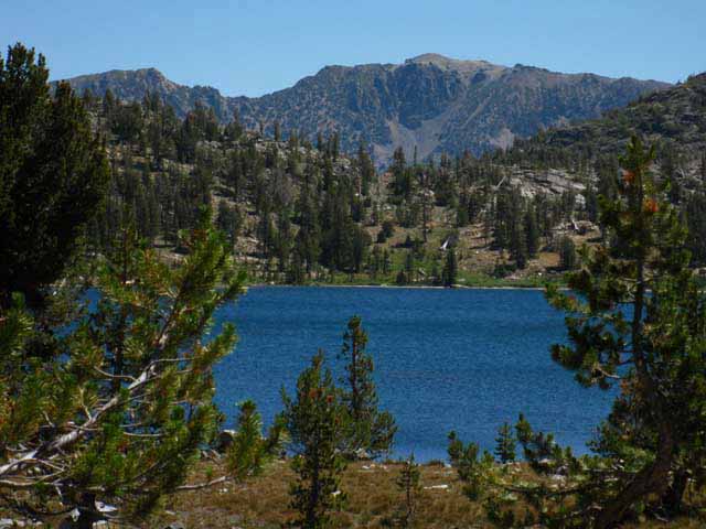
View North at the Top of Jack Main Canyon.
Looking at our Two Northbound PCT-TYT Hiking Options
in
The
Northwest Corner of Yosemite National Park:
the
Top of Jack Main Canyon
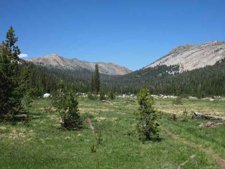
Above we are looking North at the point where our currently unified routes of the Pacific Crest and Tahoe to Yosemite Trails separate into their very different routes climbing out of the Northwestern Corner of Yosemite National Park.
The TYT and PCT either break apart or join together up there, depending on your direction of travel.
(See a View looking down Jack Main Canyon from the TYT.)
The route of the combined Tahoe to Yosemite and Pacific Crest Trail (visible in the lower Right corner) continues up the canyon and out of our current location in Grace Meadow to climb the forested ramp visible beyond the distant edge of the meadow.
PCT
The Pacific Crest Trail continues up to the top of that ramp to find Dorothy Lake located in a rectangular flat between the top ends of the white granite crestline to our Right and the reddish volcanic crestline to our Left. The point where they cross in the furthest distance roughly marks the location of Dorothy Lake Pass at very top of Jack Main Canyon.
Before climbing to the Pass we find a nice flat up there with Dorothy Lake wedged-into it between those red and white ridges at the very top of the West Flank of the Sierra Crestline.
The most distant end of the red ridgeline in the furthest distant center of the image above makes up the "line" of the Sierra Crestline descending to Dorothy Lake Pass from the North. The white ridge in the foreground obscures our view of Dorothy Lake Pass itself.
Dorothy Lake
and
Dorothy Lake Pass
The Northbound PCT hiker makes the very short climb pictured below to Dorothy Lake Pass after hiking past Dorothy Lake. The low gap in the middle distance is Dorothy Lake Pass.
Dorothy Lake
and
Dorothy Lake Pass
at
The Top of Jack Main Canyon
Looking Northeast across Dorothy Lake at the route of the Pacific Crest Trail running
through Dorothy Lake Pass at the top of Jack Main Canyon.
Dorothy Lake Pass Trail Guide Entry.
top of page
PCT North
out of
Yosemite
The Hoover Wilderness boundary runs along the crest of the distant ridge, marking the line between the Hoover on the far side of the ridge and the Toiyabe National Forest on this side.
We'll exit Yosemite through Dorothy Lake Pass to hike North in a tab of the Toiyabe National Forest wedged on the East Flank of the Sierra between the Emigrant, Yosemite, and Hoover Wilderness Areas. This map shows the lines of both the PCT and TYT around the Northwestern corner of Yosemite National Park:
The PCT,
Leavitt Meadow Pack Station,
Sonora Pass
&
The
East Sierra Flank
BACKPACKING MAP
TYT
The route of the Tahoe to Yosemite Trail takes a different route out of the top of Jack Main Canyon.
The route of the Tahoe to Yosemite Trail proceeds about halfway up the forested ramp (top image above) along with the PCT before reaching the Southern of its two junctions. These junctions mark the TYT breaking off from the PCT to the Northwest, to our Northbound Left.
The TYT climbs Northwest out of Jack Main Canyon crossing the low point in the ridgeline that we can see along the furthest Left-edge of the top top image above. That's the gap in the ridgeline where the Tahoe to Yosemite Trail crosses the boundary between Yosemite and Emigrant Wilderness through Bond Pass.
Bond Pass Trail Guide Entry.
Upper Jack Main Canyon
Trail Junctions
There are two trail junctions to Bond Pass along the route of the PCT in Jack Main Canyon. We are concerned with the Southern of the two, as we are hiking Southbound along the route of the Tahoe to Yosemite Trail. We would hike to and through the Northern junction if our destination was Northbound.
Below we show the Southern of the two Bond Pass trail junctions:
Tahoe to Yosemite Trail
Intersecting
Pacific Crest Trail
in the
Northwest Corner
of
Yosemite Wilderness:
at the
SOUTH
Bond Pass Trail Junction
EAST
to
BOND PASS
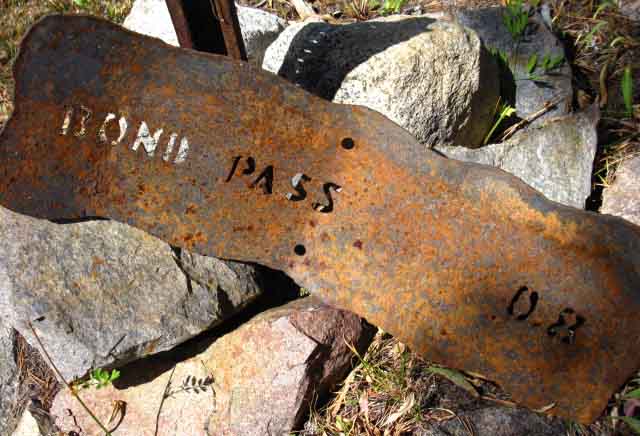
The Southernmost of the two trail junctions of the Tahoe to Yosemite Trail breaking off to the Northwest into Emigrant Wilderness. This Southern junction is marked by these signs, the North junction is not marked.
Into
the
Top of Jack Main Canyon
Trail Guide Page.
South
Bond Pass Trail Junction
SOUTHBOUND
Down Jack Main Canyon
on the
NOW UNIFIED
PCT & TYT
ROUTES
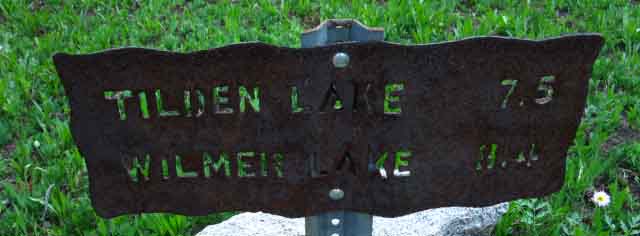
Distance to Tilden Lake down Jack Main Canyon from the Southern Bond Pass trail junction.
7.5 miles to Tilden Lake.
8.4 miles to Wilmer Lake.
South
Bond Pass Trail Junction
NORTHBOUND PCT
to
Dorothy Lake
Up Jack Main Canyon
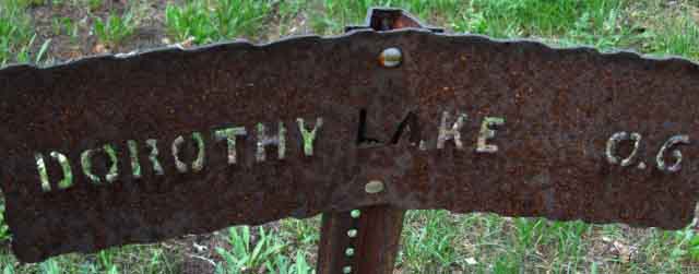
PCT North to Dorothy Lake and Dorothy Lake Pass at the top of Jack Main Canyon from the Southern of the two trail junctions marking where the Tahoe to Yosemite Trail breaks off to the Northwest from the PCT
through Bond Pass.
Triple Divide
on the
Sierra Crest
The boundary line dividing this Northeastern corner of Emigrant Wilderness from the Northwestern-most corner of Yosemite runs down from the Sierra Crestline along the crest of that reddish ridge.
In the uppermost image above this boundary runs atop the ridge running from the Left edge of the image up to the Sierra Crestline in the center of the image, where it terminates on the main wilderness boundary running Northwest & Southeast along the Sierra Crestline.
Emigrant is on the other side, Yosemite on this.
The line of the Sierra Crest across the top of Jack Main Canyon divides Yosemite on the West Flank of the Sierra from the Toiyabe National Forest administering the East Flank. The map below illustrates this triple divide between Emigrant, Yosemite, and the Toiyabe on the Sierra Crestline.
Check out these boundaries on this map:
This map above and trail guide page below show that we have a lot of Northbound
hiking options through Dorothy Lake Pass when we hike the Southbound TYT into the top of
Jack Main Canyon.
PCT
Trail Guide Page
Through Dorothy Lake Pass
West West Walker to Dorothy Lake Pass
Trail Guide Page
Top of Page |
Into the PCT ZONE
July 14 2016
SOUTHBOUND
into
THE PCT PACK
Entering Jack Main Canyon Southbound our Tahoe to Yosemite route joins the Pacific Crest Trail, where the vast majority of PCT hikers are hiking North. This means we are going to begin measuring the density, character, and condition of Pacific Crest Trail hikers during the duration of our brief hike South into the flow of PCT hikers.
As I mentioned above, the density of PCT hikers we encounter is a measure of the current date against the previous profile of the Spring Thaw along the Sierra Crest. The greatest density of hikers happens when PCT hikers are forced to congregate as they wait at the base of the South Sierra for the trail to open.
Every
Unique Season
The different dates when the snow melts into "clear trails" on the crest every year means that every hiker's plans are dependent on the specific trajectory of the transition of each year's weather from Spring to Summer conditions, and the mountain trails from snow-covered to clear.
Independent of their plans and expectations,
the average PCT hiker will enter the South Sierra when Nature lets them in. That date of access has been getting earlier and earlier during the past couple of decades, and has rapidly retreated after six drought years. Our recent drought has accelerated the long-term trend of earlier and earlier starts for the Spring Thaw.
These long-term warming trends have already encouraged folks to expect and plan earlier High Sierra opening dates than may be reasonable, or even wise, without proper gear for snow travel and a deep understanding of the increased potential for rapid reversions to very cold conditions that are very possible each Spring.
This
Specific Season
The "seasonal" situation in the top of Jack Main Canyon on July 14, 2016 worked out this year to put us roughly into the back of the "Main Body" of the "lead pack" of PCT hikers crossing the Sierra.
PCT Hiker Distribution
Over the years I've noted that PCT hikers distribute themselves very much the same from year to year. The faces and folks on the trail change from year to year, but the overall pattern of the distribution of hikers remains very much the same every year. What changes are the individuals hiking the PCT and the differing dates that the main body of each year's PCT hikers can access the Sierra Crest trails.
Changing Dates of Access
The dates of the Spring Thaw and access to High Sierra Trails have been getting gradually earlier and earlier over the past 30 years. This trend has radically accelerated over the past five years of unprecedented drought conditions.
This year, 2016, the opening date of clear trails along the Sierra Crest moved much closer to its long term average opening date than those early-opening conditions we've experienced during the last years of serious drought. The more typical opening date this year caused lots of PCT hikers to delay their early start times that were based on the last few year's early trail opening dates. Either pospone the start date from Mexico, or wait at the base of the South Sierra for the trails to clear of snow.
The Classic Distribution
Independent of the date of each season's opening of Sierra trails, the "Main Body" of the "lead pack" always forms up with the initial surge of PCT hikers into the South Sierra. First we get the front-runners, the rabbits. Many of the lead hikers have Winter and snow skills allowing them to enter the Sierra earlier than most PCT hikers are capable.
Next we get the front edge of the lead pack, followed each day by increasing numbers of hikers, until we reach the highest density of hikers at center of the lead pack. I find the group of hikers making up the middle of the lead pack averaging twenty miles a day.
After hiking South and passing through the middle of the main body of PCT hikers the numbers of daily PCT hikers declines steadily through July, until we find a gap between this year's PCT hikers, those who hope to finish it in one season, and those who are hiking the PCT in "sections" over a number of seasons.
This "gap" between annual and perennial PCT hikers generally coincides with the decline and end of generalized mosquito conditions. This date, like the opening of the Sierra trails, shifts from year to year with changing moisture conditions.
I figure the center of the main body of PCT hikers was no more than 10 days further North when I joined the Southbound PCT in the top of Jack Main Canyon on July 14 of 2016.
High Sierra Backpacker Weather Resources
This makes understanding the trajectory of each year's weather important. The Tahoe to Whitney Weather Page is set up for the capacity to track the Winter snow pack into the Spring Thaw for all backpackers, and especially for PCT and Long Distance High Sierra Backpackers to best estimate and finally determine when in the transition from Spring Thaw to Summer conditions the Sierra Crest trails are substantially clear of snow.
The estimated date of open Sierra Trails is extrapolated to determine the best date to begin moving North from the Mexican border. Those dates shift with the changing character of each year's seasons.
Here Comes the Section Hikers
As August ends we again find the numbers of PCT hikers increasing, but this time it's a steady increase in the number of "section" hikers rising with the improved hiking conditions of Fall.
Top of Page |
First PCT Hiker on the Trail
Though we met and talked to lots of PCT hikers who were resupplying at Kennedy Meadows, we are now encountering PCT hikers in their natural habitat, which is the Pacific Crest Trail itself.
Our position at the top of Jack Main Canyon marks where PCT hikers are making their final climb to exit the "Five Canyons of the North Yosemite Backcountry." These Five Canyons are a very difficult section of trail for the first fifty miles hiking North out of Tuolumne Meadows.
Encountering PCT hikes here is very revealing of their overall status. The difficulty of this fifty mile section running North of Tuolumne Meadows combined with the total length of the PCT from Mexico to Sonora Pass reaching a thousand miles of hiking tends to reveal the true status of every hiker we encounter.
Most were looking well, though there were many showing various signs of stress.
The Scene
Very HOT
Brutal FIERCE Sun
CLOUDS of Mosquitoes
Last, long BRUTAL Climb of the
Brutal
Five Canyons |
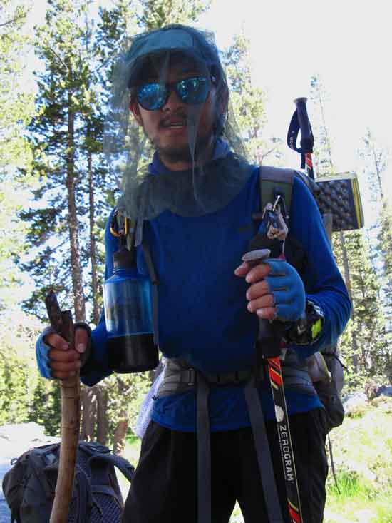
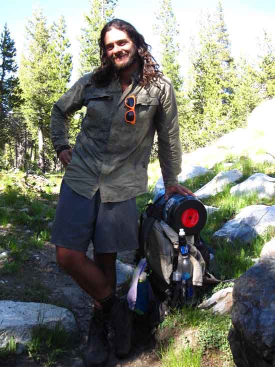
PCT hikers
Approaching the Thousand Mile Mark
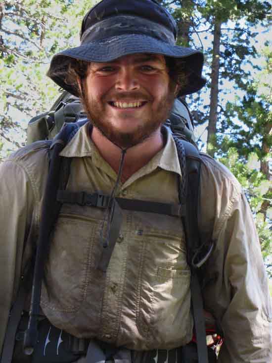
Perch
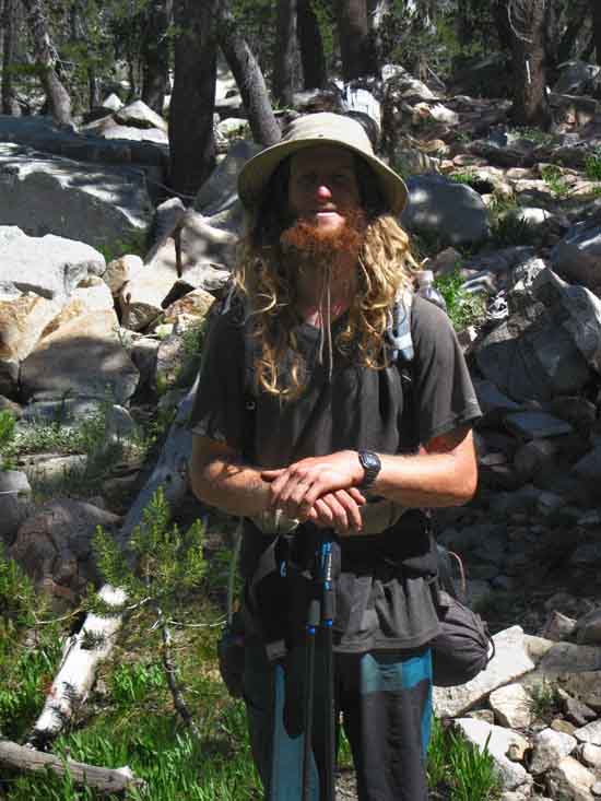
PCT hiker Perch at the top of Jack Main Canyon in 2016
Out of Riverside California, looking good-feeling good.
top of page
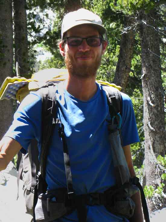
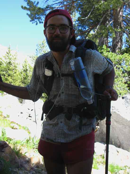
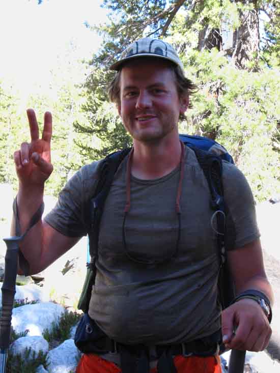
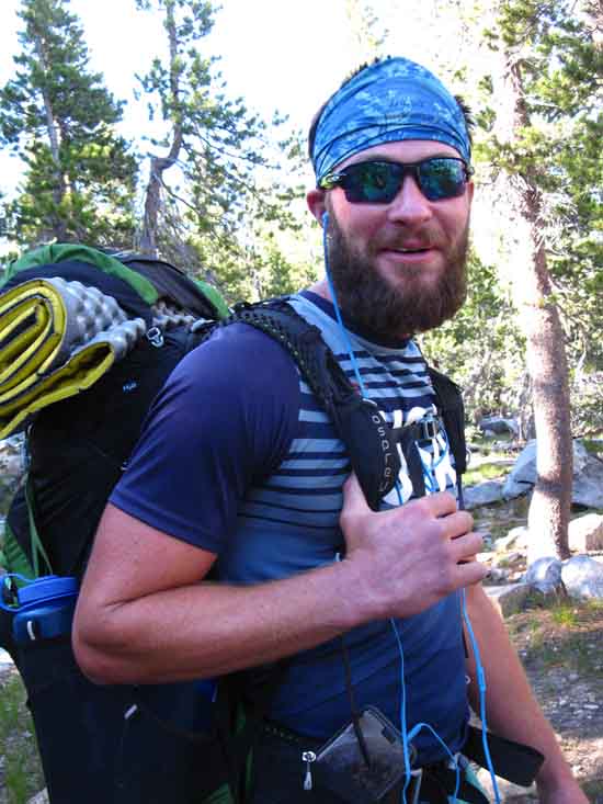
Hale
&
Well met Big Fellow
Out of Virginia
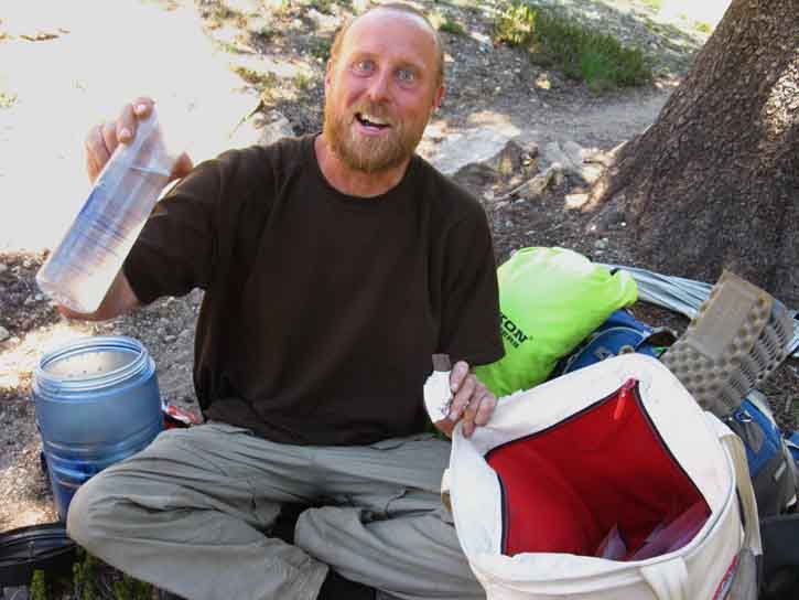
"Small Steps-Big Thoughts"
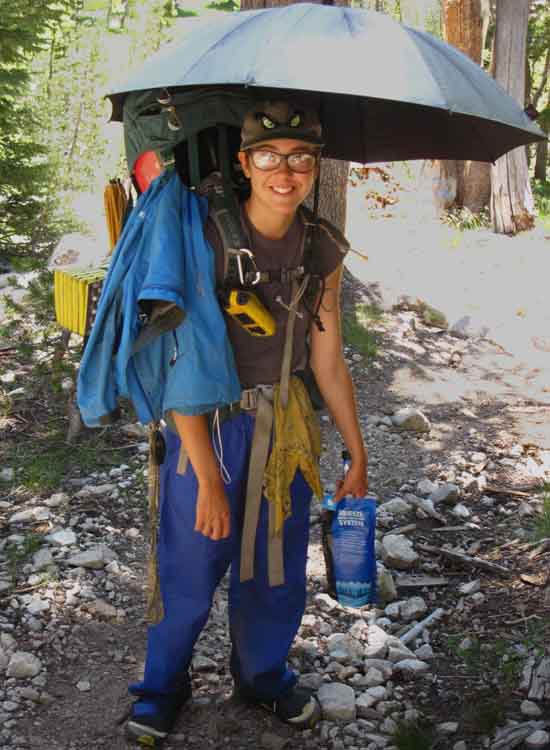
PCT hiker Andrew (trail name Hale) had problems getting the proper pack, which caused problems fitting his resupply into the pack he could get, which required him packing that big tote-sack.
Andrew was carrying a lot of stuff, a lot of weight, and had his hands full as he hiked.
This was taking a tremendous amount of energy, which he was dealing with very well.
Loves his umbrella.
top of page
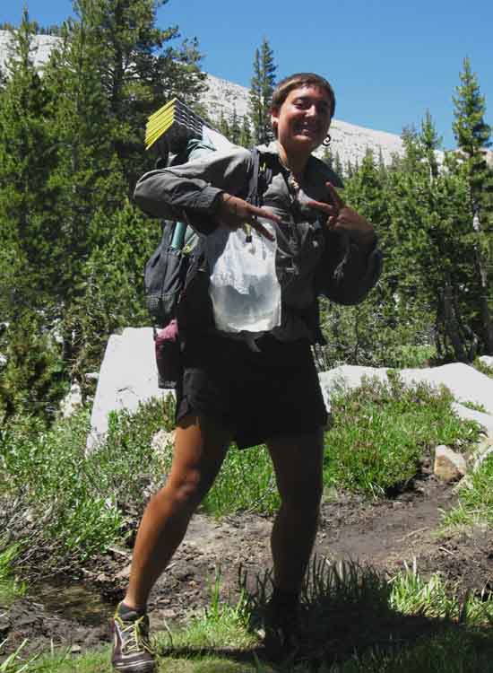
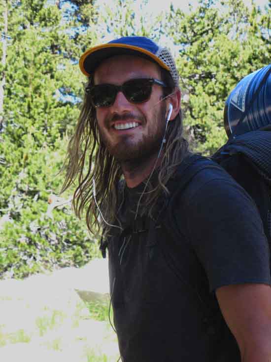
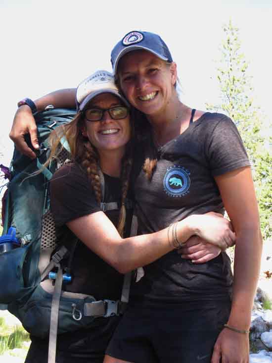
Fish Nugget
PCT hiker Fish Nugget leading her two teammates by forty minutes or so.
The PCT,
"Tunes you up."
"The PCT was a crazy culture until it spead out down the trail."
Out of Truckee, hiking
with Square Pants and Pokey Mom, who are a bit further
down the canyon.
PCT hikers
Mark and Leo
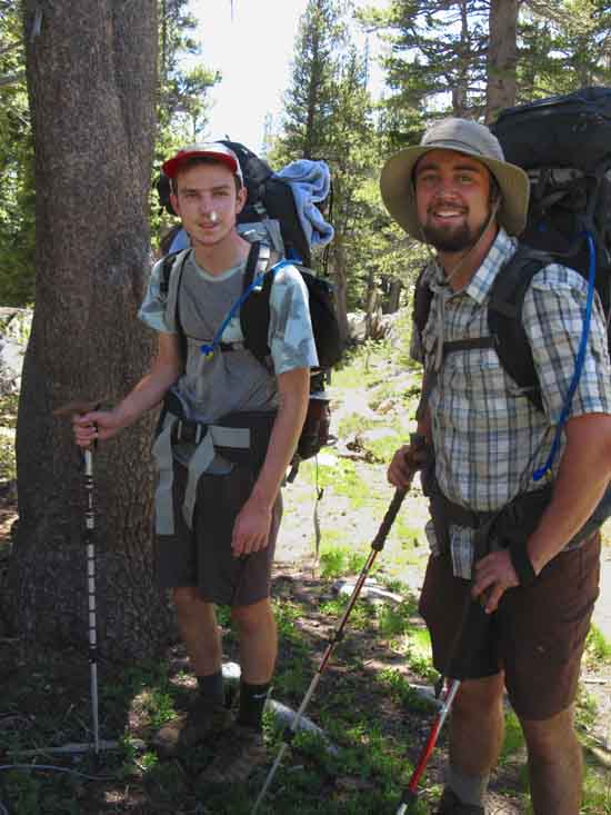
Dudes out of Chicago.
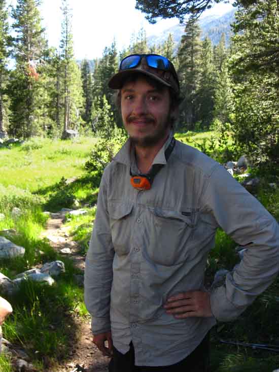
JP
PCT hiker JP out of Quebec hiking the PCT in Jack Main Canyon.
top of page
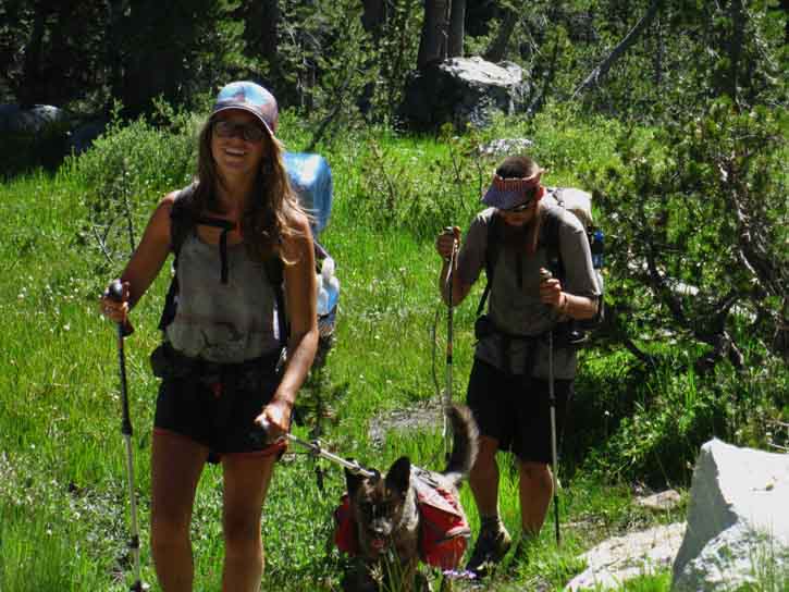
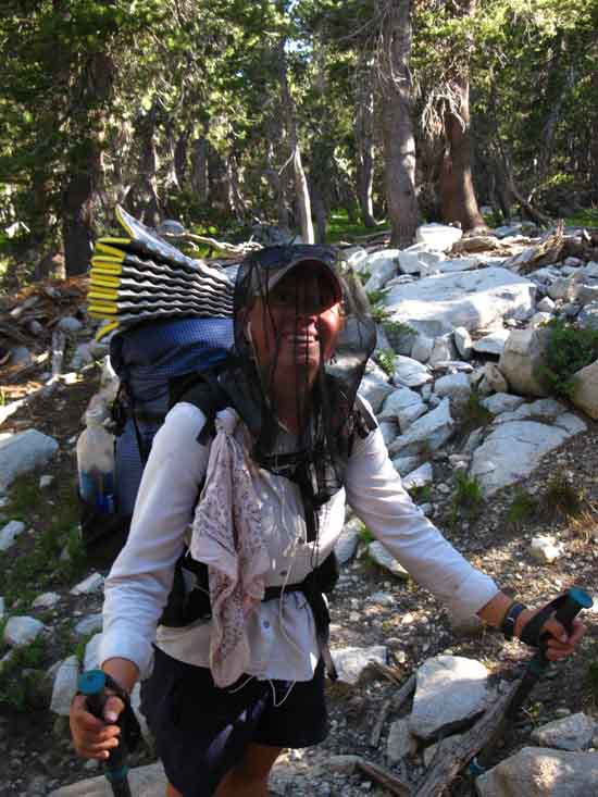
Square Pants & Pokey Mom
PCT hiker Square Pants.
Pokey Mom
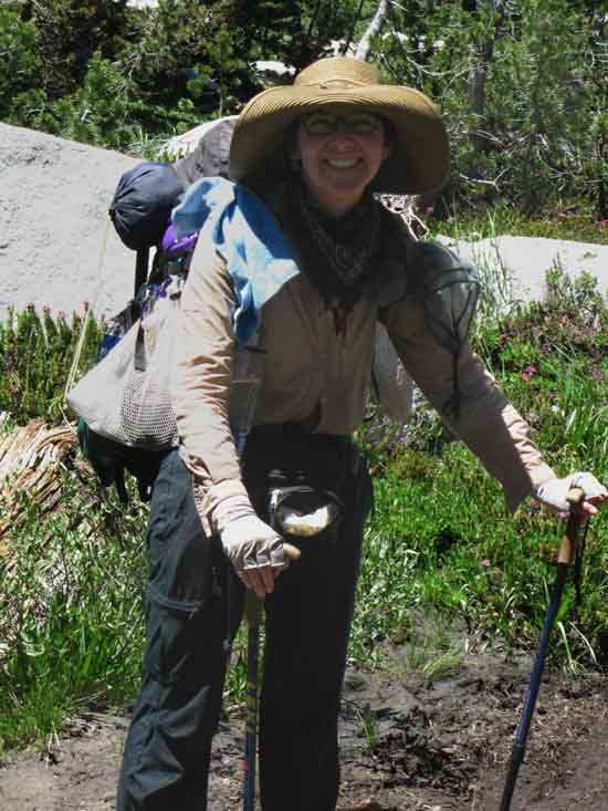
PCT hiker Square Pants was about a half hour behind Fish Nugget, with Pokey Mom a bit behind her.
All three were hiking as a group, though their differing paces would pull them apart during the day.
-Brutal Choices-
Brutal Tradeoffs
Very HOT
vs.
CLOUDS of Mosquitoes
WORKING VERY HARD
under
Brutal FIERCE Sun
Work load demands light clothes for cooling, yet mosquitoes and Sun demand full clothing protection.
Too much clothes threatens hiker with overheating, too little clothes threatens mosquitoes with overeating!
Top of Page
|
I found a nice shaded spot, a place I could query passing PCT hikers.
Koba
PCT hiker Koba from Iowa & Colorado hiking the Pacific Crest Trail in 2016.
top of page
Firefly
PCT hiker Firefly out of the Central Valley of California.
Firefly had relatives driving up to Sonora Pass for Rest, Resupply, & Recovery.
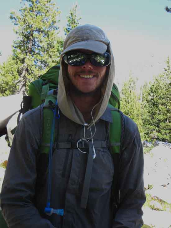
Stirling
PCT hiker Stirling hiking past quickly.
Starburst
PCT hiker out of London England.
Top of Page |
AT this point in time things got a bit crazy.
Crazy-Good.
The steady flow of PCT hikers seemed to speed up.
An up tick in Northbound PCT hiker traffic was hiking up the trail.
Lots of PCT hikers joined the loose crowd that had been previously taking on and bleeding members at the same time, creating a big circle of PCT hikers discussing the trail, the location of other hikers, weather, food, and the nature of life on the long trails.
That rush of activity, along with my compromised position, allowed my note-taking to get more than a bit sloppy, which detached the flow of my notes from that of the images.
The circle of paused PCT hikers expanded up to nine hikers kicking back before centrifugal force of the daily demands for trail miles towards Canada drew the PCT hikers North, and me South, all to our next campsites.
Top of Page |
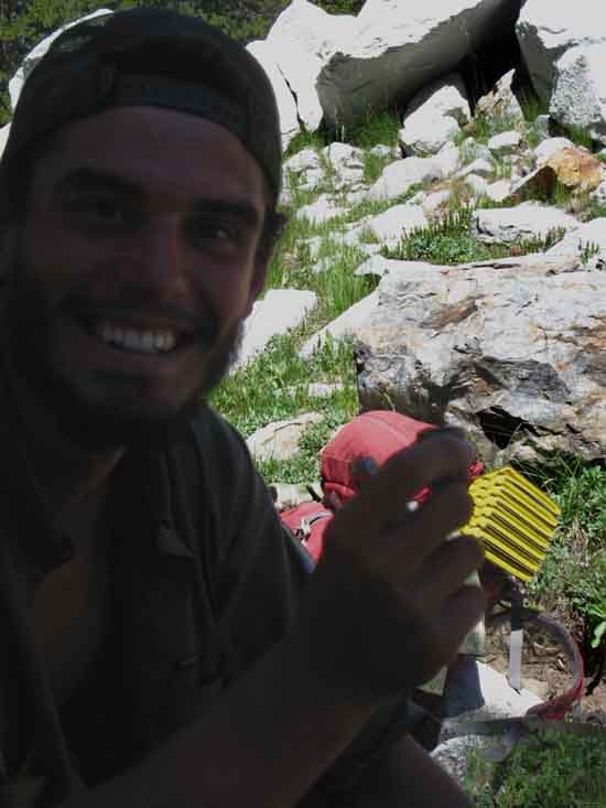
Moonshine, Dojo Dog, and Handsome Devil
"What has Eight Legs and Three Hikers?"
Eight PCT hiker legs: Moonshine and Handsome Devil with Dojo Dog moving up Jack Main Canyon hiking the PCT in 2016. Hailing from Ohio, Virginia, and Arizona.
top of page
Jun from South Korea
Jun, a PCT hiker from Korea, moving up Jack Main Canyon in 2016.
He is a grad student of "American Culture" at a prestigious Korean University.
He asked his professor, "How do I learn about, and understand the US?"
His professor told him, "Hike the Pacific Crest Trail."
Here he is.
Golden Girl
Golden Girl hiking the Pacific Crest Trail in Jack Main Canyon during 2016.
From, "Brooklyn, not NYT, that's for Sure!"
top of page
Sierra Santos
Hiking North to South, rather than the typical South to North of the majority
of Pacific Crest Trail hikers.
He really likes Matt Bloom's Kennedy Meadows Pack Station, and reports that
cell phone coverage is picked up out of Markleyville while crossing Raymond and
Reynolds Peaks to the North of Ebbetts Pass.
Swigski!
Siwgski hiking the Pacific Crest Trail in 2016.
Roots in Michigan and Oklahoma.
OU fan.
Pack of PCT Hikers
A conglomeration of PCT hikers approaches.
top of page
OK, the Naming Fails or is weak on the next two hikers.
Duck Man
"This Guy," on the PCT in Jack Main Canyon, 2016.
He was as relaxed approaching the thousand mile mark on the PCT as walking
across the street for a quart of milk. Very Relaxed. Chill, even.
Duck Man out of Houma, Lousiana. (wiki)
Duck Man hiked the AT last year, or recently.
Black Widow and MirCat ?
I may have their trail names incorrect, but these ladies are good friends from
OZ who are walking the Pacific Crest Trail. Very nice folks...
Note how Black Widow did not even take off her pack as we all conversed and hung out
in Jack Main Canyon.
42
This is 42, he is from the East Bay and LA and is hiking the PCT during 2016.
top of page
Uncertain Identity
JAZZUS ?
Not certain, but I believe this is Jazzus out of San Diego.
Canary
Canary climbing the PCT out of Jack Main Canyon in 2016.
Caveman
Caveman hiking the Pacific Crest Trail in Jack Main Canyon, 2016.
AT this point in time
The sun was rapidly approaching the ridge to our West dividing Yosemite from Emigrant Wilderness. PCT hikers' minds were turning towards their next optimal campsite locations at Dorothy Lake wedged into the top of Jack Main Canyon, or at the series of lakes on the East side of Dorothy Lake Pass.
The thousand mile mark from the Mexican border is less than a mile beyond Dorothy Lake Pass approaching Heather Lake.
I was thinking about the rocky zone below Grace Meadow and above the trail junction to Tilden Lake. Being rocky this area would have many less mosquitoes than Grace Meadow, and offer nice vistas of Falls Creek and the beauties of sunset playing out on the surrounding canyon walls.
Hiking down to the rocky zone I found the trail lined with camping PCT hikers!
As I entered the rocky zone I realized that finding a spot would be a little harder than I had anticipated as I simultaneously realized just how many PCT hikers were on the trail this year.
Rocky Campsite for High Mosquito Times
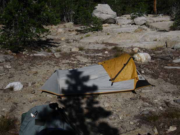
Rocky campsite above Tilden Lake junction in Jack Main Canyon.
Hiking the last couple of miles down to the Tilden Lake trail junction revealed that PCT hikers had camped in every available spot along the canyon. I have never seen so many folks in Jack Main Canyon at any time over the last 22 years.
|
Top of Page |
This
series of images above is only our second (Kennedy Meadows being the first), small sample of the many, many PCT hikers we passed along this short six-mile run down Jack Main Canyon, of the thousands who obtained PCT Corridor permits this year.
There were a huge number of PCT hikers on the trail this year,
many of whom did not even look up as they passed. Sad.
Sigh. At least say hi.
Most had an animated look in their eyes, decent spring in their steps, and reasonable awareness of their surroundings. Others; not so much.
Therefore these contacts with groups of PCT hikers in the Sierra are only a set of "samples" of the eclectic and unique configuration of this year's PCT hikers.
Add to it.
Post up your PCT hiker sightings, reports on their condition and activity, and how you helped them get down the trail. PCT hikers are invited to post up your perspective and experiences.
Top of Page |
Next
Away from the Pacific Crest Trail
The route of the Tahoe to Yosemite Trails
Our route OFF the TYT
down Tilden Canyon:
Lower
Jack Main Canyon & Tilden Canyon
Dropping Off
the
TYT & PCT
to
Hetch Hetchy
Backpacking Map
Tilden Lake Trail Junction
SOUTHBOUND
TYT splits off PCT
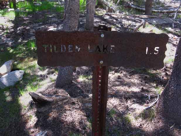
The Northern of the two Tilden Lake trail junctions, the one located in Jack Main Canyon.
Southbound TYT hikers ford Falls Creek and climb out of Jack Main Canyon here.
top of page
Falls Creek Ford
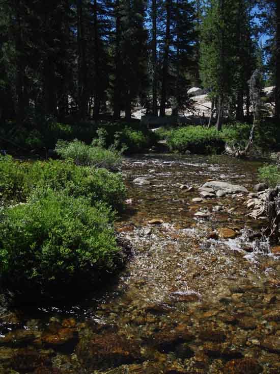
Looking across Falls Creek at our Southbound fording point to Tilden Lake.
Stairs into Switchbacks climbing to Tilden Lake
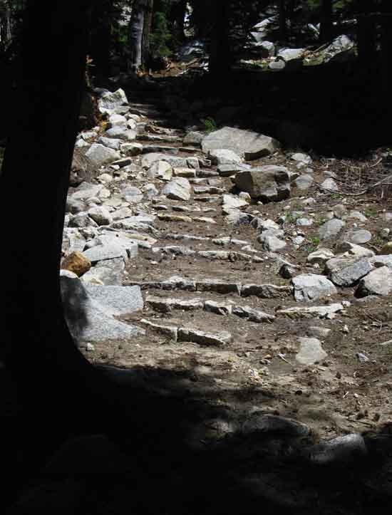
Stepping up into switchbacks climbing to Tilden Lake.
Tilden Creek and Chittenden Peak are just to our North, so the North end of each
switchback overlooks the
creek under the peak.
North End of a Switchback
Overlooking Tilden Creek
under
Chittenden Peak
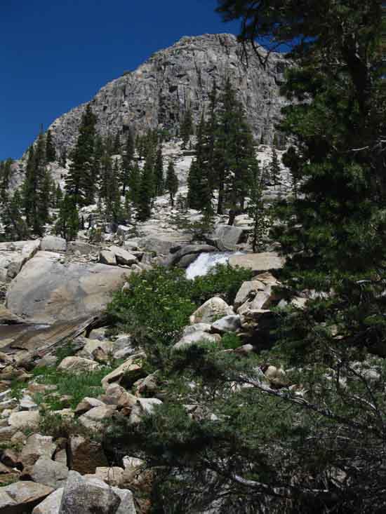
The source of Tilden Creek flowing out of Southwestern end of Tilden Lake lays
just a short distance above us under
the shadow of Chittenden Peak.
The surface level of Tilden Lake actually lays roughly at the line between the dark granite of Chittenden and the
lighter granite surrounding it.
top of page
NEXT
SUMMER OF 2016
TRAIL REPORT
Around
Tilden Lake
and
Down
through
Tilltill Valley
and
Rancheria Falls
to
Hetch Hetchy
Into Yosemite
and down
Jack Main Canyon
to
Tilden Lake
| Trail Guide |
Backpacking Map |
MAP
Continuing South from
Tilden Lake
OFF the TYT:
Lower
Jack Main Canyon & Tilden Canyon
Dropping Off
the
TYT & PCT
to
Hetch Hetchy
Backpacking Map
Next PCT HIKER SAMPLE:
Tuolumne Meadows Backpacker Resupply Spot
Top of Page |
Last page: Emigrant &
Yosemite Trail and Culture Report Next page: Tilden
Lake
to
Hetch Hetchy
2016
High Sierra
Trail Report & Trail Culture
Brave New Backpacking World |
Out
of
Jack Main Canyon
We've departed the PCT fording Falls Creek, worked our way upriver to put ourselves in postion to make the easy climb to the base of the switchbacks up to Tilden Lake.
As we reach the North end of each switchback we come out of the edge of the forest cover overlooking Tilden Creek under Chittenden Peak's distinctive shape.
Next page
Tilden
Lake
to Hetch Hetchy |
Backpacker Forums
Have a great Sierra Nevada trip or story to relate? A fine piece of gear? Or gear that failed?
Post it on
TahoetoWhitney.Org
If you have experiences, comments, questions, or pictures and videos about the trail between Lake Tahoe to Mount Whitney, post up here.
All backpackers can comment.
Members can post their own pages with images, videos and text.
North Yosemite Backcountry Forum
|
top of page
|