LAST MONTH
NEXT WEEK
TOP
April 2020
"Open"
Spring Conditions?
Typically,
Access Depends on Conditions.
Conditions on the ground, NOT a date on the calendar determines our gear and skills requirements.
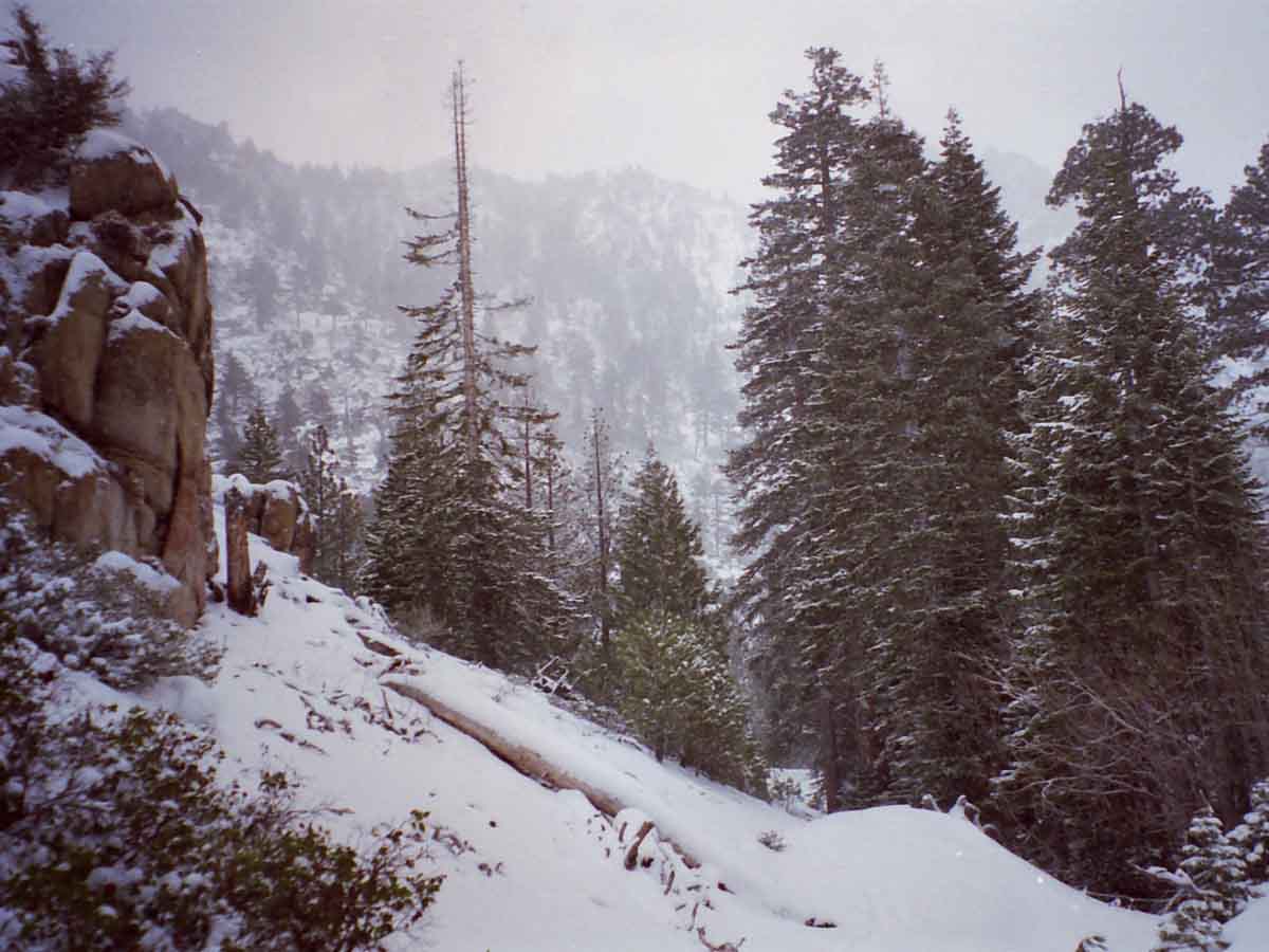
Spring has been clearing mountain trails earlier and earlier over the the last twenty-five years, and especially the previous seven years, before the Massive 2017 Snowpack.
Short Winters & Early Thaws, such as 2015, 16, and 18, have been offset by the massive snow years of '17 & '19 .
"Open"
Spring Conditions?
in
2020
?
2019
Not a Chance.
Spring Conditions are, & will be, Epic.
NOT 2019
HUGE PACK ON THE CREST
We're going to use our 2017 readings to give us some context & insight as to how this year's snow, similar to the levels of 2017, could melt-out:
March 27
April 20
May 2
Tracking
SPRING THAW 2019
2018
A Weak Snow Pack as of April 1
Spring of 2018
Danger
We've seen a long trend of earlier and earlier Spring Openings of Sierra Crest Trails, creating expectations of early openings. This year was following trend until our wet March, bringing a quarter of normal snowpack up to half.
Though this still bodes well for early starts on the PCT & JMT, the die is not yet cast.
Warm Torrential Tropical Rains could yet scour the snow from the Sierra Crest, while a cold version of Tropical Rains could still deposit many more feet along the Sierra Crest and Flanks.
Both would be "tail" events, with the most likely outcome being a quick Spring Thaw under warm conditions, and an earlier than "average" opening of Sierra Crest Trails.
2017
"Open"
Spring Conditions?
NOT 2017:
HUGE PACK ON THE CREST
The 2017 Spring Thaw was Under
WINTER SNOW CONDITIONS
2016
A slightly below average snowpack
More
High Sierra
Backpacker
Information
Guide Trailhead
Guide Index
High Sierra Magazine
HIGH SIERRA TRAILS FORUMS
HIGH SIERRA TOPICS FORUMS
GEAR FORUMS
GEAR LIST
|
31
Clouds Clearing
Warming Nicely
2020
Snowpack:
Percent of Average for
March 31
N Sierra: 56%
+3% in 6 days
Cen. Sierra: 56%
+1% in 6 days
S Sierra: 45%
+3% in 6 days
Ca State: 53%
+2% in 6 days
Last Reading
Mar 25
Statewide Summary of Snow Water Content PDF
Snow Depth
at
Carson Pass
2020, Today
Carson Pass 61"
2019, the 28th
Carson Pass 117 "
2018, Today
Carson Pass 67"
2017, the 24th
Carson Pass 124"
2016, the 14th
Carson Pass 93"
2015, the 25th
Carson Pass
21 inches of snow
Station Reports
The
SECOND
--SPRING--
Temp-Snow
Check
March 31
2020
Early Afternoon
Below: Watershed Snow Water Content Charts followed by individual reporting station's Snow Depth and 24 hour high-low temps.
Last Report:
March 25
Next Report:
April 6, 2020
Tahoe Basin
Watershed
Southwest Tahoe
Trail Map with Stations
PCT-TYT-TRT
Rubicon 53.0 −10.00
(20.30) + 2.1 !!
7618 feet
Trail Map
40 & 35 +/+
PCT-TYT-TRT
Echo Peak 61.0 −10
(30.00) +0.90
7652 feet
Stations Map
40 & 34 −/+
American-Yuba Watersheds
PCT-TYT
Carson Pass
61.0 −6.0
(22.80) +0.30
8388 feet
Trail Map
Stations Map
38 & 33 +/+
Carson-Walker
Watersheds
PCT-TYT
Ebbetts Pass
57.0 −11
(29.20) +0.60
8660 feet
Trail Map
39 & 31 +/+
West of PCT
Highlands Meadow
20.20 −0.21
(25.32) +0.82
8360 feet
Trail Map
36 & 28 +/+
Top of List
EAST FLANK
Leavitt Lake
93.0 −6
(23.90) +1.3
9602 feet, East Flank
Trail Map
38 & 31 +/+
EAST FLANK
Marine Base
Cold Weather Training
6748 feet East Flank
Trail Map Above
FULL REPORT
VIS-CHIL-WEA-MB-
WIND
52 & 25 +/−
Mokelumne-Stanislaus Watersheds
PCT-TYT
Sonora Pass
Kennedy Meadows
RESUPPLY
Deadman Creek
32.26 −10.97
(--.--)
9250 feet,West Flank,
Trail Map
42 & 23 +/+
Tuolumne-Merced
Watersheds
SW of TYT
Horse Meadow
Error =0.4 ???
8602 feet
Trail Map
40 & 30 +/+
Top of List
Tenaya Lake
46.91 −5.22
(7.27) +1.98
8163 feet, West Flank
Trail Map
47 & 26 +/+
JMT-PCT-TYT (10PM)
Tuolumne Meadows
14.03 −1.92
(5.99) +0.25
8600 feet, West Flank
Trail Map
47 & 26 +/+
Tioga Pass/Dana
ERROR +ERROR
(2.09) =0.01 ??
9798 feet
Trail Map
40 & 26 +/+
Mammoth Mountain
Mono Lake-Owens Basin
East of PCT-JMT
Above Gem Lake
Gem Pass
(error)
10750 feet
Trail Map
temps bad
JMT-PCT Junction
Devils Postpile
11.73 −6.78
(12.05) +0.74
8004 feet
Trail Map Above
51 & 20 +/−
NE of JMT-PCT
Mammoth Pass
74.29 −4.44
(9.08) = +2.36
9500 feet
Trail Map
21 & 17 −/+
Top of List
JMT-PCT
E of Bear Ridge
Volcanic Knob
46.60 +2.0
(0.00) = ??
10100 feet
Trail Map
50 & 21 +/+
East Flank
South Lake Cabin
no snow sensor
(29.50) =0.0
9580 feet, East Flank
Trail Map
53 & 25 +/+
East Flank
Big Pine Sawmill
14.50 −1.8
10200 feet, East Flank
Trail Map Above
47 & 22 +/+
Kings River
Just East JMT-PCT
Bishop Pass (bad)
(0.0) =
11972 feet
Trail Map Above
-- & -- −/− (earlier)
Just West JMT-PCT
Charlotte Lake
4.21 +0.15
(75.09) +0.64
10398 feet, West Flank
Trail Map
44 & 20 +/+
(Typically the coldest station)
Kern Watershed
JMT-PCT
Upr Tyndall Creek
35.64 +1.14
11441 feet
Trail Map
44 & 25 +/+
JMT
Crabtree Meadow
3.32 ERROR −X.XX
(35.58) +0.29
10,700 feet
Trail Map
44 & 22 +/+
? = questionable data
All High Sierra
Reporting Stations
More Stations, by Watersheds
Top of List
|
1
FOOL'S DAY
Clouds Clearing
Nice
April 2015
Driest Year in History
April 2016
An Average-Dry Year
April 2017
Wettest Year in History
April 2018
Dry Year
April 2019
Wet Year
2017
Current Snowpack:
Percent of Average for
April 1.
N Sierra: 147%
Cen. Sierra: 175%
S Sierra: 166%
Ca State: 164% 2017
Snow Depths & Temps
2016 Snow Depth
Carson Pass
49 & 23 degrees, 75"
Ebbetts Pass
48 & 23 degrees, 75"
Sonora Pass
33 & 28 degrees, 69"
Tuolumne Meadows
17 & 50 degrees, 34.5"
2016 April
Snow Depths & Temps
2015
JB declares Water Emergency
25% State-Wide cutback.
Carson Pass Hwy 88
11 inch Snow Depth
Tuolumne Meadows
1.3 inch Snow Depth
Deadman Creek Hwy 108
9 inch Snow Depth
2015 April
Snow Depths & Temps |
2
Clouding Up
Nice
LAST MONTH
NEXT WEEK
TOP
2019
Current Snowpack:
Percent of Average for
April 2.
N Sierra: 165%
+3 % in 5 days
Cen. Sierra: 165%
+1 % in 5 days
S Sierra: 153%
-1 % in 5 days
Ca State: 162%
+1 % in 5 days
2019
This Week
TOP |
3
Moderate Storm
Approaching
2018
Snowpack
Percent of Average for
April 3
+/- change since
March 27
N Sierra: 41%
(-7%)
Cen. Sierra: 59%
(-6%)
S Sierra: 49%
(-7%)
Ca State: 51%
(-7%)
2018
Snow Depths & Temps
This Week
TOP
|
4
Moderate Storm
AM Showers
Hiking the PCT
in
2020?
From the Trail Guide
The
Earliest, Latest, and Average Start Dates
How Will This Year Stack-Up?
ON THE CALENDAR
Earliest
Start Date
Winter of 2015
Driest in History
Average
Start Date
Winter of 2016
An Average-Dry Year
Latest
Start Date
Winter of 2017
Wettest in History
When are the trails along the Sierra Crest going to be passable this year?
Upcoming
Weather
Probabilities
These three years highlighted above offer the potential range of Weather Conditions within which this year's PCTer,
"Start Date," the date you can reasonably expect to encounter fairly snow-free trails with post-deadly fording conditions, will be determined within. These are the historic limits of wet and dry, with a perfectly average year thrown in-between, for good measure.
This date, of course, depends upon your ability to navigate snow at high altitude, along with your ability to cross the various stages of the dangerous thaw waters draining off it.
And your fitness, of course. You are training, are you not?
You can get through before and after the period of high-flow runoff, but not during this phase.
How the conditions of the Winter to Spring
Transition we track this year measures-up to the classic trajectories of these three years cited above will inform potential PCT hikers about the snow/trail conditions along the High Sierra Crest they may reasonably expect to encounter during May, June, and July of this year measure-up against those of the Driest year in history against an Average Year, against the wettest Year in History...
This year of 2020 will fit somewhere between these historic parameters of the record Wettest and record Driest years that happened between
2015 and 2017.
As our seasonal start date for open access to trails along the High Sierra Crest will be adjusted according to the character and trajectory of this year's Winter to Spring Transition, we will watch it carefully.
Advice for
Rookie Hikers wishing to hike the
TYT-JMT-PCT
2018
Weather Notes
TWISTED SEASONS
Hottest & Driest, then Wettest Year Ever, over Three Years
Compare Years
LAST MONTH
NEXT WEEK
TOP |
5
Moderate Storm
Diminishing Showers
LAST WEEK
NEXT WEEK
TOP |
6
Moderate Storm
Continuing
over
South & East
Sierra
Warnings
NWS HANFORD
Winter Storm Warning
"Southern Sierra"
Thru Monday Evening
NWS VEGAS
E. FLANK WINTER WRNG
Thru Wednesday Afternoon
NWS RENO
NWS SACTO
COLD
Nights
2020
Snowpack:
Percent of Average for
April 6
N Sierra: 66%
+10% in 6 days
Cen. Sierra: 64%
+8% in 6 days
S Sierra: 49%
+4% in 6 days
Ca State: 61%
+8% in 6 days
Last Reading
Mar 31
Statewide Summary of Snow Water Content PDF
Station Reports
The
THIRD
--SPRING--
Temp-Snow
Check
April 6
2020
Late Morning
Below: Watershed Snow Water Content Charts followed by individual reporting station's Snow Depth and 24 hour high-low temps.
Last Report:
March 31
Next Report:
April 14
Tahoe Basin
Watershed
Southwest Tahoe
Trail Map with Stations
PCT-TYT-TRT
Rubicon 58.0 +5.00
(21.60) +1.3
7618 feet
Trail Map
31 & 21 −/−
PCT-TYT-TRT
Echo Peak 75.0 +14
(32.30) +2.30 !!
7652 feet
Stations Map
32 & 21 −/−
American-Yuba Watersheds
PCT-TYT
Carson Pass
83.0 +22.0
(25.50) +2.70 !!
8388 feet
Trail Map
Stations Map
29 & 18 −/−
Carson-Walker
Watersheds
PCT-TYT
Ebbetts Pass
73.00 +16
(32.20) +3.00 !!
8660 feet
Trail Map
29 & 20 −/−
West of PCT
Highlands Meadow
32.92 +3.00
(26.54) +1.22
8360 feet
Trail Map
25 & 19 −/−
Top of List
EAST FLANK
Leavitt Lake
120.00 +27
(24.70) +0.8
9602 feet, East Flank
Trail Map
26 & 18 −/−
EAST FLANK
Marine Base
Cold Weather Training
6748 feet East Flank
Trail Map Above
FULL REPORT
VIS-CHIL-WEA-MB-
WIND
31 & 27 −/−
Mokelumne-Stanislaus Watersheds
PCT-TYT
Sonora Pass
Kennedy Meadows
RESUPPLY
Deadman Creek
33.98 +1.72
(Yesterday's snow)
9250 feet,West Flank,
Trail Map
26 & 18 −/−
Tuolumne-Merced
Watersheds
SW of TYT
Horse Meadow
Error =0.4 ???
8602 feet
Trail Map
26 & 19 −/−
Top of List
Tenaya Lake
83.90 +36.99 !!
(7.27) = 0.00
8163 feet, West Flank
Trail Map
28 & 19 −/−
JMT-PCT-TYT (10PM)
Tuolumne Meadows
32.34 +18.31
(6.04) +0.05
8600 feet, West Flank
Trail Map
26 & 18 −/−
Tioga Pass/Dana
ERROR +ERROR
(2.09) =0.01 ??
9798 feet
Trail Map
24 & 14 −/−
Mammoth Mountain
Mono Lake-Owens Basin
East of PCT-JMT
Above Gem Lake
Gem Pass
(error)
10750 feet
Trail Map
temps bad
JMT-PCT Junction
Devils Postpile
50.13 +38.4
(15.57) +3.52
8004 feet
Trail Map Above
29 & 22 −/−
NE of JMT-PCT
Mammoth Pass
97.19 +22.9
(9.08) = +2.36
9500 feet
Trail Map
24 & 17 +/=
Top of List
JMT-PCT
E of Bear Ridge
Volcanic Knob
67.10 +20.50
(0.00) = ??
10100 feet
Trail Map
25 &17 −/−
East Flank
South Lake Cabin
no snow sensor
(29.80) +0.3
9580 feet, East Flank
Trail Map
27 & 19 −/−
East Flank
Big Pine Sawmill
28.30 +13.8
10200 feet, East Flank
Trail Map Above
23 & 16 −/−
Kings River
Just East JMT-PCT
Bishop Pass (bad)
(0.0) =
11972 feet
Trail Map Above
-- & -- −/− (earlier)
Just West JMT-PCT
Charlotte Lake
22.98 +18.77
(76.36) +1.27
10398 feet, West Flank
Trail Map
28 & 17 −/−
(Typically the coldest station)
Kern Watershed
JMT-PCT
Upr Tyndall Creek
38.97 +3.33
11441 feet
Trail Map
26 & 15 −/−
JMT
Crabtree Meadow
14.78 +?.??
(36.35) +0.77
10,700 feet
Trail Map
29 & 18 −/−
? = questionable data
All High Sierra
Reporting Stations
More Stations, by Watersheds
Top of List
|
7
Sweet Day
North Sierra
Moderate Storm
Continuing
over
South & East
Sierra
Informative
"Normal" Vs. Now
Forcasts & Reality
vs.
Averages
TRENDS
Week-Month- 3 Months
2016
Heat Wave Records
See 2015 Report
2015: KM to Open last weekend of this month.
24 hr High-Low & Snow Dp.
2016 Station REPORTS
Carson Pass
54 & 31 degrees, 69"
Ebbetts Pass
53 & 31 degrees, 67"
Sonora Pass
54 & 28 degrees, 55"
Tuolumne Meadows
63 & 25 degrees, 25"
2016
Our Selected
REALTIME
High Sierra Crestline
Reporting Stations
REPORTING
The
SPRING
of
2020
Compare Today
with
Snow
&
Temperatures
on
April 6
March 31
March 25
WINTER
March 17
March 8 & 13
March 2
Feb 27
Feb 20
Feb 10
Feb 3
Jan 28
Jan 23
Jan 13 & 17
Jan 8
Jan 2
Dec 30
Dec 24
Setting the Table
for
WINTER
Fall to Winter
2019
Reports |
8
Overcast-Cloudy
North Sierra
Moderate Storm
Continuing
over
South & East
Sierra
2019
Current Snowpack:
Percent of Average for
April 8.
N Sierra: 166%
+1 % in 6 days
Cen. Sierra: 165%
= % in 6 days
S Sierra: 152%
-1 % in 6 days
Ca State: 162%
= % in 6 days
2019
2015
KM to Open
last weekend
of this month.
Carson Pass
15 inch Snow Depth
Tuolumne Meadows
5.6 inch Snow Depth
2015
This Week
TOP
This Week
TOP
This Week
TOP
This Week
TOP |
9
Unsettled
Cooler Up North,
S & E Sierra
Diminishing Showers
Warnings
NWS HANFORD
Winter Storm Warning
"Southern Sierra"
Thru Thurs Evening
NWS RENO
NWS SACTO
NWS VEGAS
2020
Snowpack:
Percent of Average for
April 9
N Sierra: 69%
+3% in 3 days
Cen. Sierra: 68%
+4% in 3 days
S Sierra: 58%
+9% in 3 days
Ca State: 66%
+5% in 3 days
Last Reading
<<-- April 6 <<--
Next Reading
April 14
Statewide Summary of Snow Water Content PDF
2017
Snow & Temps
BEST
FORECASTS
HAZARDS
Precipitation
General
Quantitative Precipitation Forecasts:
ALL
RAIN FORECASTS
&
MODELS
Direct to
Seven Day Precip
Animation
Precipitation
Geographic
All High Sierra
ZONE & POINT
FORECASTS
All High Sierra
ZONE
FORECASTS
Now
RADAR
SATELLITES
Direct
to
GRAPHICAL INTERFACE
Forecast
Winds? Weather?
NorCal Graphics
Region, SW US
Forecast
Temperatures
Model
Five Day Mean
Low Temps
Click Green "Latest" Model,
observe using step button
All Temps
Let's look at the
Big Picture
Surface Map
The Pacific Ocean
US Weather Map
All Maps
|
10
Sweet Day
Increasing Sun & Warmth
Point
Forecasts
Lake Tahoe Forecast
Walker Forecast
Sonora Pass Forecast
Bishop Forecast
Cherry Lake Forecast
Lee Vining Forecast
Tuolumne Meadows
Mammoth Pass
Lake Thomas Edison
Mount Whitney-Lone Pine
Lake Isabella Forecast
Move the Map Dot
to
Customize Forecast Point
Trail Maps
2018
Snow Depths & Temp
2018
Snowpack
Percent of Average for
April 10
+/- change since
April 3
N Sierra: 36%
(-5%)
Cen. Sierra: 51%
(-8%)
S Sierra: 39%
(-10%)
Ca State: 43%
(-8%)
2018 |
11
Overcast-Cloudy
AM Precip Clearing
LAST WEEK
NEXT WEEK
TOP
--2016--
24 hr High-Low & Snow Dp.
2016 Station
REPORTS
Carson Pass
54 & 31 degrees, 68"
Ebbetts Pass
43 & 32 degrees, 63"
Sonora Pass
47 & 32 degrees, 53"
Tuolumne Meadows
48 & 27 degrees, 18"
2016
LAST WEEK
NEXT WEEK
TOP
LAST WEEK
NEXT WEEK
TOP
LAST WEEK
NEXT WEEK
TOP
LAST WEEK
NEXT WEEK
TOP
|
12
EASTER
Sweet Day
Increasing Sun & Warmth
LAST WEEK
NEXT WEEK
TOP
2018
Snowpack
Percent of Average for
April 12
+/- change since
April 10
N Sierra: 35%
(-1%)
Cen. Sierra: 47%
(-4%)
S Sierra: 36%
(-3%)
Ca State: 41%
(-2%)
2018
Snow Depths & Temp
A Year Comparable
to
2019?
2017
NEXT
2017
SNOW READINGS
April 20, 2017
May 2, 2017
PREVIOUS
April 1 |
13
Sweet Day
Increasing Sun & Warmth
Our Selected
REALTIME
High Sierra Crestline
Reporting Stations
REPORTING
The
SPRING
of
2020
Compare Today
with
Snow
&
Temperatures
on
April 6
March 31
March 25
WINTER
March 17
March 8 & 13
March 2
Feb 27
Feb 20
Feb 10
Feb 3
Jan 28
Jan 23
Jan 13 & 17
Jan 8
Jan 2
Dec 30
Dec 24
Setting the Table
for
WINTER
Fall to Winter
2019
Reports
|
14
Sweet Day
Increasing Sun & Warmth
2020
Snowpack:
Percent of Average for
April 14
N Sierra: 62%
−7% in 5 days
Cen. Sierra: 65%
−3% in 5 days
S Sierra: 59%
+1% in 5 days
Ca State: 63%
−3% in 5 days
Last Reading
April 9
Next Reading
April 22
Statewide Summary of Snow Water Content PDF
Station Reports
The
FOURTH
--SPRING--
Temp-Snow
Check
April 14
2020
Early Afternoon
Below: Watershed Snow Water Content Charts followed by individual reporting station's Snow Depth and 24 hour high-low temps.
Last Report:
April 6
Next Report:
April 22
Tahoe Basin
Watershed
Southwest Tahoe
Trail Map with Stations
PCT-TYT-TRT
Rubicon 58.0 −9.00
(22.20) −0.6
7618 feet
Trail Map
48 & 30 +/+
PCT-TYT-TRT
Echo Peak 54.0 −21
(33.30) +1.0
Echo Lake Resupply
Lake Tahoe Resupply
7652 feet
Stations Map
48 & 27 +/+
American-Yuba Watersheds
PCT-TYT
Carson Pass
60.0 −23.0
(25.50) +1.40
8388 feet
Trail Map
Stations Map
47 & 22 +/+
Carson-Walker
Watersheds
PCT-TYT
Ebbetts Pass
56.00 −17
(33.50) +1.30
Lake Alpine Resupply
8660 feet
Trail Map
46 & 21 +/+
West of PCT
Highlands Meadow
16.85 −16.07
(28.26) +1.72 !!
8360 feet
Trail Map
45 & 16 +/−
Top of List
EAST FLANK
Leavitt Lake
106.00 −14
(29.10) +4.40
9602 feet, East Flank
Trail Map
44 & 18 +/=
EAST FLANK
Marine Base
Cold Weather Training
6748 feet East Flank
Trail Map Above
FULL REPORT
VIS-CHIL-WEA-MB-
WIND
40 & 20 +/−
Mokelumne-Stanislaus Watersheds
PCT-TYT
Sonora Pass
Kennedy Meadows
RESUPPLY
Deadman Creek
40.21 +6.23
9250 feet,West Flank,
Trail Map
46 & 18 +/=
Tuolumne-Merced
Watersheds
SW of TYT
Horse Meadow
Error =0.4 ???
8602 feet
Trail Map
49 & 23 +/+
Bensen Lake Loop
Slide Canyon
63 −15
(26.12) +2.19
9200 feet, NW Yos
Trail Map--Location
40 & 11
(Typically one of the coldest stations)
Top of List
Tenaya Lake
48.95 −34.95 !!
(8.69) + 1.42
8163 feet, West Flank
Trail Map
49 & 19 +/=
JMT-PCT-TYT
Tuolumne Meadows
14.49 −17.85
(7.37) +1.33
8600 feet, West Flank
Trail Map
49 & 16 +/−
Tioga Pass/Dana
ERROR +ERROR
(3.90) +1.81 ??
9798 feet
Trail Map
42 & 12 +/−
Mammoth Mountain
Mono Lake-Owens Basin
East of PCT-JMT
Above Gem Lake
Gem Pass
(error)
10750 feet
Trail Map
temps bad
JMT-PCT Junction
Devils Postpile
9.48 −40.65
(15.57) +0.35
8004 feet
Trail Map Above
51 & 23 +/+
NE of JMT-PCT
Mammoth Pass
85.66 −11.53
(16.20) = +7.12
9500 feet
Trail Map
48 & 16 +/−
Top of List
JMT-PCT
E of Bear Ridge
Volcanic Knob
58.60 −8.5
(0.00) = ??
10100 feet
Trail Map
46 &18 +/+
East Flank
South Lake Cabin
no snow sensor
(30.50) +0.7
9580 feet, East Flank
Trail Map
51 & 10 +/−
East Flank
Big Pine Sawmill
29.20 +0.9
10200 feet, East Flank
Trail Map Above
39 & 6 +/−
Kings River
Just East JMT-PCT
Bishop Pass (bad)
(0.0) =
11972 feet
Trail Map Above
-- & -- −/− (earlier)
Just West JMT-PCT
Charlotte Lake
14.64 −8.34
(79.74) +3.38
10398 feet, West Flank
Trail Map
38 & 13 +/−
(Typically the coldest station)
Kern Watershed
JMT-PCT
Upr Tyndall Creek
57.35 +18.38
11441 feet
Trail Map
39 & 7 +/−
JMT
Crabtree Meadow
17.02 +2.24
(39.13) +2.78
10,700 feet
Trail Map
39 & 10 +/−
? = questionable data
All High Sierra
Reporting Stations
More Stations, by Watersheds
Top of List
|
15
Clouding
Cooling
2019
Current Snowpack:
Percent of Average for
April 15.
N Sierra: 167%
+1% in 7 days
Cen. Sierra: 162%
-3% in 7 days
S Sierra: 151%
-1 % in 7 days
Ca State: 161%
-1% in 7 days
2019
This Week
TOP
2016
Snotel Station Reports 2016:
Carson Pass
44 & 31 degrees, 64"
Ebbetts Pass
41 & 29 degrees, 59"
Sonora Pass
44 & 33 degrees, 50"
Tuolumne Meadows
44 & 25 degrees, 14"
2016
This Week
TOP
This Week
TOP
|
16
Point
Forecasts
Lake Tahoe Forecast
Walker Forecast
Sonora Pass Forecast
Cherry Lake Forecast
Lee Vining Forecast
Tuolumne Meadows
Mammoth Pass
Lake Thomas Edison
Mount Whitney-Lone Pine
Lake Isabella Forecast
Move the Map Dot
to
Customize Forecast Point
Trail Maps
2016
TRANS-SIERRA HIGHWAYS
REPORT
Opened
Mid-April 2015!
Not in 2016!
2016
2015
TRANS-SIERRA HIGHWAYS
Hot Day
Ebbetts Pass Opened
Sonora Pass Opened
2015 |
17
Cloudy
Cool
BEST
FORECASTS
HAZARDS
Precipitation
General
Quantitative Precipitation Forecasts:
ALL
RAIN FORECASTS
&
MODELS
Direct to
Seven Day Precip
Animation
Precipitation
Geographic
All High Sierra
ZONE & POINT
FORECASTS
All High Sierra
ZONE
FORECASTS
Now
RADAR
SATELLITES
Direct
to
GRAPHICAL INTERFACE
Forecast
Winds? Weather?
NorCal Graphics
Region, SW US
Forecast
Temperatures
Model
Five Day Mean
Low Temps
Click Green "Latest" Model,
observe using step button
All Temps
Let's look at the
Big Picture
Surface Map
The Pacific Ocean
US Weather Map
All Maps
|
18
Cloudy
Cool
HIGH SIERRA
SNOW INFO
All Snow Info
SNOW STATUS
&
FORECASTS
THE SNOWPACK
GRAPHICS
Date-Adjustable
High Sierra Snowpack Status
APRIL 14
NOAA-NOHRSC
The High Sierra
4-14-20
Tracking
SPRING THAW 2019
LAST WEEK
NEXT WEEK
TOP
2018
Snowpack
Percent of Average for
April 18
+/- change since
April 16
N Sierra: 37%
(-%)
Cen. Sierra: 51%
(+4%)
S Sierra: 37%
(-2%)
Ca State: 44%
(+3%) 2018
Snow Depths & Temp
LAST WEEK
NEXT WEEK
TOP
LAST WEEK
NEXT WEEK
TOP
LAST WEEK
NEXT WEEK
TOP
|
19
Cloudy
Warming
LAST WEEK
NEXT WEEK
TOP
2015
Snotel Station Reports
Pre-Storm Snow Depth
Carson Pass 2 inches
Road Open
Ebbetts Pass 0 inches
Road Open
Sonora Pass 2 inches
Road Open 2015 |
20
Cloudy to Clearing
Cloudy
Point
Forecasts
Lake Tahoe Forecast
Walker Forecast
Sonora Pass Forecast
Cherry Lake Forecast
Lee Vining Forecast
Tuolumne Meadows
Mammoth Pass
Lake Thomas Edison
Mount Whitney-Lone Pine
Lake Isabella Forecast
Move the Map Dot
to
Customize Forecast Point
Trail Maps
2017
COLD WARNING
Weak Front through last night, clear, High building.
2017
Current Snowpack
VAST
Percent of Average for
April 20.
N Sierra: 182%
Cen. Sierra: 197%
S Sierra: 182%
Ca State: 189%
Next
May 2, 2017
Statewide Summary of Snow Water Content PDF
2016:
Hot
THE BLOB RETURNS
NW US
The Blob
|
21
Beautiful Day
Cloudy to Clearing
&
Warming
2019
Snow & Temps
2018
Snow & Temps
2017
Snow & Temps
2016 April
Snow & Temps
2015 April
Snow & Temps
--2016--
Snotel Station Reports Carson Pass
55 & 39 degrees, 56"
Ebbetts Pass
53 & 39 degrees, 50"
Sonora Pass
53 & 35 degrees, 43"
Tuolumne Meadows
57 & 24 degrees, 1"
Unsettled but gentle
instability. Not yet the breakout of Spring Instability...
|
22
Beautiful Day
Increasing Sun & Warmth
WARMER
Overnight Temps
Warming...
Approaching
Transition
to
Spring Gear
2020
Snowpack:
Percent of Average for
April 22
N Sierra: 51%
−11% in 8 days
Cen. Sierra: 63%
−3% in 8 days
S Sierra: 59%
+/− 0% in 8 days
Ca State: 58%
−5% in 8 days
Last Reading
April 14
Next Reading
May 1
Statewide Summary of Snow Water Content PDF
2019
Current Snowpack:
Percent of Average for
April 22.
N Sierra: 162%
-5% in 7 days
Cen. Sierra: 162%
=% in 7 days
S Sierra: 152%
+1 % in 7 days
Ca State: 159%
-2% in 7 days
2019
Station Reports
The
FIFTH
--SPRING--
Temp-Snow
Check
April 22
2020
Late Afternoon
Evening
Below: Watershed Snow Water Content Charts followed by individual reporting station's Snow Depth and 24 hour high-low temps.
Last Report:
April 14
Next Report:
May 1
Red Snow = Near Clear
Tahoe Basin
Watershed
Southwest Tahoe
Trail Map with Stations
PCT-TYT-TRT
Rubicon
40.0 −18.00
(22.50) + 0.3
7618 feet
Trail Map
52 & 38 +/+
PCT-TYT-TRT
Echo Peak
44.0 −10
(33.70) +0.4
Echo Lake Resupply
Lake Tahoe Resupply
7652 feet
Stations Map
53 & 38 +/+
American-Yuba Watersheds
PCT-TYT
Carson Pass
53.0 −7.0
(27.40) +1.90
8388 feet
Trail Map
Stations Map
53 & 31 +/+
Carson-Walker
Watersheds
PCT-TYT
Ebbetts Pass
49.00 −7
(33.80) +0.30
Lake Alpine Resupply
8660 feet
Trail Map
54 & 36 +/+
West of PCT
Highlands Meadow
10.65 −6.20
(28.26) +0.65
8360 feet
Trail Map
53 & 28 +/+
Top of List
EAST FLANK
Leavitt Lake
104.00 −12
(29.50) +0.40
9602 feet, East Flank
Trail Map
49 & 35 +/+
EAST FLANK
Marine Base
Cold Weather Training
6748 feet East Flank
Trail Map Above
FULL REPORT
VIS-CHIL-WEA-MB-
WIND
62 & 24 +/+
Mokelumne-Stanislaus Watersheds
PCT-TYT
Sonora Pass
Kennedy Meadows
RESUPPLY
Deadman Creek
33.67 −6.54
9250 feet,West Flank,
Trail Map
51 & 7 +/− ??
Tuolumne-Merced
Watersheds
SW of TYT
Horse Meadow
Error =0.4 ???
8602 feet
Trail Map
56 & 24 +/+
Bensen Lake Loop
Slide Canyon
55 −10
(25.14) −0.98
9200 feet, NW Yos
Trail Map--Location
46 & 23
Report
(Typically one of the coldest stations)
Top of List
Tenaya Lake
42.75 −6.2
(10.05) +1.36
8163 feet, West Flank
Trail Map
57 & 25 +/+
JMT-PCT-TYT
Tuolumne Meadows
8.86 −5.63
(8.32) +0.95
8600 feet, West Flank
Trail Map
55 & 24 +/+
Tioga Pass/Dana
ERROR +ERROR
(4.59) +0.69 ??
9798 feet
Trail Map
51 &23 +/+
Mammoth Mountain
Mono Lake-Owens Basin
East of PCT-JMT
Above Gem Lake
Gem Pass (New)
(error)
Report
10750 feet
Trail Map
temps bad
Old
JMT-PCT Junction
Devils Postpile
0.22 −9.26
(15.57) +0.35
8004 feet
Trail Map Above
51 & 23 +/+
NE of JMT-PCT
Mammoth Pass
74.19 −11.47
(17.32) +1.12
9500 feet
Trail Map
57 & 28 +/+
Top of List
JMT-PCT
E of Bear Ridge
Volcanic Knob
53.70 −4.9
(0.00) = ??
10100 feet
Trail Map
56 & 24 +/+
East Flank
South Lake Cabin
no snow sensor
(30.60) +0.1
9580 feet, East Flank
Trail Map
62 & 26 +/+
East Flank
Big Pine Sawmill
24.40 −4.8
10200 feet, East Flank
Trail Map Above
52 & 23 +/+
Kings River
Just East JMT-PCT
Bishop Pass (bad)
(0.0) =
11972 feet
Trail Map Above
-- & -- −/− (earlier)
Just West JMT-PCT
Charlotte Lake
8.34 −6.3
(80.92) +1.18
10398 feet, West Flank
Trail Map
48 & 22 +/+
(Typically the coldest station)
Kern Watershed
JMT-PCT
Upr Tyndall Creek
50.46 −6.89
11441 feet
Trail Map
45 & 29 +/+
JMT
Crabtree Meadow
39.80 +22.78
(39.80) +0.67
10,700 feet
Trail Map
50 & 23 +/+
? = questionable data
All High Sierra
Reporting Stations
More Stations, by Watersheds
Top of List
2015
ADZPCTKO.org
TWO EVENTS
April 22-24
April 24-26
Annual PCT kickoff event.
|
23
Beautiful Day
Increasing Sun & Warmth
WARMER
BEST
FORECASTS
HAZARDS
Precipitation
General
Quantitative Precipitation Forecasts:
ALL
RAIN FORECASTS
&
MODELS
Direct to
Seven Day Precip
Animation
Precipitation
Geographic
All High Sierra
ZONE & POINT
FORECASTS
All High Sierra
ZONE
FORECASTS
Now
RADAR
SATELLITES
Direct
to
GRAPHICAL INTERFACE
Forecast
Winds? Weather?
NorCal Graphics
Region, SW US
Forecast
Temperatures
Model
Five Day Mean
Low Temps
Click Green "Latest" Model,
observe using step button
All Temps
Let's look at the
Big Picture
Surface Map
The Pacific Ocean
US Weather Map
All Maps
This Week
TOP
This Week
TOP
This Week
TOP |
24
Beautiful Day
Increasing Sun & Warmth
HOT
Hiking the
PCT-JMT-TYT?
How is this year Stacking-Up?
LAST WEEK
NEXT WEEK
TOP
2018
Snow Depths & Temp
2018
Snowpack
Percent of Average for
April 25
+/- change since
April 18
N Sierra: 22%
(-15%)
Cen. Sierra: 46%
(-5%)
S Sierra: 28%
(-9%)
Ca State: 37%
(+7%)
2018
2017
Snow & Temps
2016
Post Stormlet
Snotel Station Reports
Carson Pass
44 & 21 degrees, 56"
Ebbetts Pass
46 & 21 degrees, 49"
Sonora Pass
45 & 21 degrees, 47"
Tuolumne Meadows
47 & 23 degrees, 0" 2016 |
25
Beautiful Day
Sun & Warmth
HOT
Overnight Temps
Warming...
Approaching
Transition
to
Spring Gear
SPRING THAW
---DANGERS---
--WARNINGS--
BEGIN
NWS RENO
E. SIERRA RISING WATER
Thru Next Week
NWS VEGAS
DESERT HEAT
Tuesday Thru Thurs
Informative
"Normal" Vs. Now
Forcasts & Reality
vs.
Averages
TRENDS
Week-Month- 3 Months
An
EARLY SIERRA
TRAIL OPENING
in
2020?
DROUGHT
CONSIDERATIONS
FEB 22
DROUGHT CONSIDERATIONS
MAR 5
MARCH 14
E SIERRA FIRE WATCH
Weather Monitoring
DROUGHT REPORTING
&
THAW-
RIVERS
2015
EPIC DROUGHT
Snotel Station Reports Post Storm Snow Depth
Carson Pass 3 inches
Ebbetts Pass 11 inches
Sonora Pass 10 inches
Tuolumne Meadows 6.1
LAST WEEK
NEXT WEEK
TOP
LAST WEEK
NEXT WEEK
TOP
LAST WEEK
NEXT WEEK
TOP
|
26
Beautiful Day
Sun & Warmth
HOT
Overnight Temps
Warming...
Approaching
Transition
to
Spring Gear
SPRING THAW
---DANGERS---
--WARNINGS--
BEGIN
LAST WEEK
NEXT MONTH
TOP
2019
Current Snowpack:
Percent of Average for
April 26.
N Sierra: 151%
-11% in 4 days
Cen. Sierra: 155%
-7% in 4 days
S Sierra: 149%
-3 % in 4 days
Ca State: 152%
-7% in 4 days
2017
Snow & Temps
2016 April
Snow & Temps
2015 April
Snow & Temps |
27
Beautiful Day
Sun & Warmth
HOTTER
|
28
Beautiful Day
Sun & Warmth
HOT
|
29
Beautiful Day
Sun & Warmth
HOT
2019
Current Snowpack:
Percent of Average for
April 29.
N Sierra: 144%
-18% in 7 days
-7% in 3 days
Cen. Sierra: 145%
-17% in 7 days
-10% in 3 days
S Sierra: 140%
-12% in 7 days
-9% in 3 days
Ca State: 143%
-16% in 7 days
-9% in 3 days
2018
Snowpack
Percent of Average for
April 29
+/- change since
April 25
N Sierra: 30%
(+8%)
Cen. Sierra: 44%
(-2%)
S Sierra: 31%
(+3%)
Ca State: 37%
(=%)
2018
2015
Bloom & Weather announce:
Kennedy Meadows Pack Station,
Highway 108,
OPENS |
30
Beautiful Day
Sun & Warmth
HOT
2016
Post Stormlet
Snotel Station Reports
Carson Pass
42 & 9 degrees, 58"
Ebbetts Pass
42 & 28 degrees, 50"
Sonora Pass
40 & 28 degrees, 45"
Tuolumne Meadows
47 & 21 degrees, 0"
2015
KM Actual OPENING
See 2015 Report
2016
This Week
TOP
This Week
TOP |
1 MAY 2020
Beautiful Day
Sun & Warmth
Cooler
LAST WEEK
NEXT MONTH
Top
2020
May1
Ca Snow
37%
Of May 1 Average
Last Reading
April 22
Next Reading
May 7
2019
Current Snowpack:
Percent of Average for
May 1.
N Sierra: 144%
=0% in 2 days
Cen. Sierra: 147%
+2% in 2 days
S Sierra: 139%
-1% in 2 days
Ca State: 143%
=0% in 2 days 2019
2017
Snow & Temps
Station Reports
The
SIXTH
--SPRING--
Temp-Snow
Check
May 1
2020
8 pm
Evening
Below: Watershed Snow Water Content Charts followed by individual reporting station's Snow Depth and 24 hour high-low temps.
Last Report:
April 22
Next Report:
May 7
Red Snow = Near Clear
Tahoe Basin
Watershed
Southwest Tahoe
Trail Map with Stations
PCT-TYT-TRT
Rubicon
27.0 −13.00
(22.60) + 0.1
7618 feet
Trail Map
54 & 38 +/=
PCT-TYT-TRT
Echo Peak
18.0 −26
(33.50) −0.2
Echo Lake Resupply
Lake Tahoe Resupply
7652 feet
Stations Map
53 & 39 =/+
American-Yuba Watersheds
PCT-TYT
Carson Pass
36.0 −17.0
(27.40) =0.00
8388 feet
Trail Map
Stations Map
52 & 31 −/=
Carson-Walker
Watersheds
PCT-TYT
Ebbetts Pass
26.00 −23
(33.90) +0.10
Lake Alpine Resupply
8660 feet
Trail Map
52 & 37 −/+
West of PCT
Highlands Meadow
00.00 −10.65
(28.95) +0.69
8360 feet
Trail Map
49 & 27 −/−
Top of List
EAST FLANK
Leavitt Lake
75.00 −29
(29.40) −0.10
9602 feet, East Flank
Trail Map
48 & 36 −/+
EAST FLANK
Marine Base
Cold Weather Training
6748 feet East Flank
Trail Map Above
FULL REPORT
VIS-CHIL-WEA-MB-
WIND
69 &48 +/+
Mokelumne-Stanislaus Watersheds
PCT-TYT
Sonora Pass
Kennedy Meadows
RESUPPLY
Deadman Creek
18.46 −15.21
9250 feet,West Flank,
Trail Map
57 & -19 +/− ??
Tuolumne-Merced
Watersheds
SW of TYT
Horse Meadow
5.40 x0.0
8602 feet
Trail Map
52 & 26 −/+
Bensen Lake Loop
Slide Canyon
38 −17
(25.14) −0.98
9200 feet, NW Yos
Trail Map--Location
49 & 26 +/+
Report
(Typically one of the coldest stations)
Top of List
Tenaya Lake
19.11 −23.64
(10.05) +0.00
8163 feet, West Flank
Trail Map
53 & 26 −/+
JMT-PCT-TYT
Tuolumne Meadows
0.43 −8.43
(8.32) =0.00
8600 feet, West Flank
Trail Map
55 & 26 =/+
Tioga Pass/Dana
ERROR +ERROR
(4.59) =0.00 ??
9798 feet
Trail Map
48 & 26 −/+
Mammoth Mountain
Mono Lake-Owens Basin
East of PCT-JMT
Above Gem Lake
Gem Pass (New)
(error)
Report
10750 feet
Trail Map
temps bad
Old
JMT-PCT Junction
Devils Postpile
0.26 +0.04
(16.55) +0.98
8004 feet
Trail Map Above
57 & 30 +/+
NE of JMT-PCT
Mammoth Pass
48.80 −25.39
(17.44) +0.12
9500 feet
Trail Map
53 & 31 −/+
Top of List
JMT-PCT
E of Bear Ridge
Volcanic Knob
34.30 −19.4
(0.00) = ??
10100 feet
Trail Map
54 & 28 −/+
East Flank
South Lake Cabin
no snow sensor
(30.60) =0.0
9580 feet, East Flank
Trail Map
56 & 36 −/+
East Flank
Big Pine Sawmill
11.10 −13.3
10200 feet, East Flank
Trail Map Above
46 & 35 −/+
Kings River
Just East JMT-PCT
Bishop Pass (bad)
(0.0) =
11972 feet
Trail Map Above
-- & -- −/− (earlier)
Just West JMT-PCT
Charlotte Lake
PREVIOUS READING
(no current data)
8.34 −6.3
(80.92) +1.18
10398 feet, West Flank
Trail Map
48 & 22 +/+
(Typically the coldest station)
Kern Watershed
JMT-PCT
Upr Tyndall Creek
38.07 −12.39
11441 feet
Trail Map
51 & 32 +/+
JMT
Crabtree Meadow
1.76 −38.04
(40.02) +0.22
10,700 feet
Trail Map
53 & 28 +/+
? = questionable data
All High Sierra
Reporting Stations
More Stations, by Watersheds
Top of List
|
2 MAY 2020
Beautiful Day
Sun & Warmth
Cooler-Warm
2017
Current Snowpack
VAST
Percent of Average for
May 2.
N Sierra: 198%
Cen. Sierra: 201%
S Sierra: 178%
Ca State: 194%
2017
LAST WEEK
NEXT MONTH
Top
LAST WEEK
NEXT MONTH
Top
LAST WEEK
NEXT MONTH
Top |