Killer Sunset at The Sisters near Carson Pass
Lake Tahoe to Mount Whitney: Crown Jewel of the Pacific Crest Trail
Need a Map? Lost Al near Lost Keys Lake
Emigrant Wilderness under Tropical Thunderstorm, September.
Round Top Lake
Whitebarks and Grizzly Peak in Emigrant Wilderness under Tropical Clouds during September 2013
Lost Keys Lake
 

Lake Tahoe to Mount Whitney
Trail Guide, Magazine, & High Sierra Backpacker's Trails and Topics Forums

2020
HIGH SIERRA BACKPACKER'S

Calendar


JUNE


Important Seasonal Happenings, Transitions, Events & Dates
for
High Sierra Backpackers


Road Conditions, Resupply, Seasonal Transition Concerns, Permit Dates, Weather, Water, and Mosquitoes


Previous Years
2019

2018

2017


ANNUAL
News, Views, & Issues
2020
High Sierra
News
Spring
of
2020
2020
Natural Meltdown


2019
News, Views, & Issues
2019
High Sierra
News
Spring
of
2019
2019
Natural Meltdown


2018
News, Views, & Issues
JUNE
2018
High Sierra
News
JUNE
2018
Backpacker
Alerts
Spring
of
2018


2017
News, Views, & Issues
JUNE
2017
High Sierra
News
JUNE
2017
Backpacker
Alerts
2017
Natural Meltdown


EVERY YEAR
High Sierra
Backpacking
TOPICS
High Sierra
Backpacking
TRAILS
High Sierra
Backpacking
FITNESS
High Sierra
Backpacking
SKILLS


High Sierra
RESUPPLY
High Sierra
PERMITS
High Sierra
WEATHER
High Sierra
Trail
GUIDE
INDEX
High Sierra
Trail
MAPS
INDEX
High Sierra
Trail
MILES
INDEX
Download
FONT


2020
High Sierra
Backpacking Calendar

2020 INDEX

January         February         March         April         May         June

July         August         September         October         November         December


June
2020

Week 1

Week 2

Week 3

Week 4

Week 5

TRAILHEAD

Last Year

2017

June
2020

Magical pond on the South end of Seavy Pass
Summit City Canyon from Mount Reba.
Seavy Pass is the high point in a wide bowl filled with beautiful ponds atop the ridge separating Bensen Lake from Kerrick Canyon along the combined TYT-PCT routes through the North Yosemite Backcountry. Above we are passing around the Southernmost pond before beginning the great descent to Bensen Lake.

Trail Guide           Map           Miles and Elevations


JUNE 2020

January       February     March       April       May       June     July     August     September       October       November       December

2020 Monday Tuesday Wednesday Thursday Friday Saturday


LAST MONTH

NEXT WEEK

TOP


JUNE 2020
JUNE
Transitional Month

Not at all during May of 2019
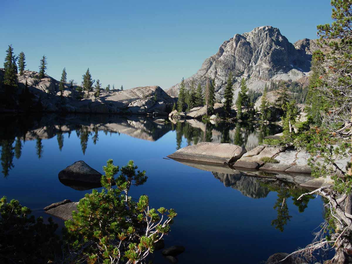
The Sierra Crest still has between four feet on it in the North Sierra to 8 in the South.

CLEARING QUICKLY DURING 2018

Not so much during 2017
The Sierra Crest still has between four feet on it in the North Sierra to 10 in the South.


More
High Sierra
Backpacker Information

High Sierra
News of Nature & Science for Backpackers


LET'S GO BACKPACKING

Guide Trailhead

Guide Index

High Sierra Magazine

Blog-Forums


MORE

Navigation Information
Time & Space


High Sierra Backpacker
Trail Skills


1


June 2015
Driest Year in History
Snow Long Gone

June 2016
A Average-Dry Year

Clearing of Snow

June 2017
Wettest Year in Histor
y


2016
Carson Pass
8353 ft
Clear of Snow today
49 & 30°, 0"

Ebbetts Pass
51 & 31°, 7"

Sonora Pass E Flank
67 & 41°, 0"

Deadman Creek
Upper meadow West flank just below Sonora Pass
72 & 34°, 16"

Tioga Pass DM
xx & xx°, 17"?

2


3


2019
Current Snowpack:
Percent of Average for
June 3.

N Sierra: 215%
+3% in 4 days

Cen. Sierra: 216%
+5% in 4 days

S Sierra: 188%
+10% in 4 days

Ca State: 201%
+5% in 4 days

2019


2018
Snowpack, June 2


2017
Snowpack


2016
Early Season Heat wave STRONG
VALLEY TEMPS TO 100s

2016
Carson Pass
8353 ft
Clear of Snow today
49 & 30°, 0"

Ebbetts Pass
51 & 31°, 7"

Sonora Pass E Flank
67 & 41°, 0"

Deadman Creek
Upper meadow West flank just below Sonora Pass
72 & 34°, 16"

Tioga Pass DM
xx & xx°, 17"?

2016


This Week
TOP

4


5


6


LAST MONTH

NEXT WEEK

TOP


LAST MONTH

NEXT WEEK

TOP


Sunday Monday Tuesday Wednesday Thursday Friday Saturday

7


LAST WEEK

NEXT WEEK

TOP


2019
RED FLAG
ADVISORY,
EXCESSIVE HEAT,

&
FORDING
HAZARDS

Start Now, with the fording Hazard persisting through July 25th, when the flow moderated a bit.

2019


2015
T-storms and Rain from
TS BLANCA (2015)
Raining on the Sierra Crest

1.1 inches of precip predicted over Sierra next 7 days.

8


9


2018
Snowpack, June 9

2017
Snowpack


10


2019
Current Snowpack:
Percent of Average for
June 10.

N Sierra: 176%
−5% in 4 days

Cen. Sierra: 178%
−27% in 4 days

S Sierra: 175%
−13% in 4 days

Ca State: 175%
−15% in 4 days


11


2019
RED FLAG
ADVISORY,
EXCESSIVE HEAT,

&
FORDING
HAZARDS


12


This Week
TOP

13


2019
Current Snowpack:
Percent of Average for
June 13.

N Sierra: 156%
−20% in 3 days

Cen. Sierra: 154%
−24% in 3 days

S Sierra: 156%
−19% in 3 days

Ca State: 153%
−22% in 3 days

2019


LAST WEEK

NEXT WEEK

TOP

Sunday Monday Tuesday Wednesday Thursday Friday Saturday

14


LAST WEEK

NEXT WEEK

TOP


2015
REPORTS
HEAT WAVE BUILDING,
LAST BITS of the
Sierra Snowpack

Our past
Sets the Table
for the
FUTURE

15


2017
Current Snowpack

VAST
Percent of Average for
June 1.

Ca State: 226%

(% ofApril 1: 68%)

Compare against previous years.


16


2017
Snowpack


2015
REPORTS:

HEAT WAVE BUILDING

High Temps along
Sierra Crest

Snow retreating to highest South Sierra Peaks & Crestline.

None on the North Sierra
for WEEKS.

The LAST BITS of the
Sierra Snowpack

17


2019
Current Snowpack:
Percent of Average for
June 17.

N Sierra: 102%
−54% in 4 days

Cen. Sierra: 120%
−34% in 4 days

S Sierra: 135%
−21% in 4 days

Ca State: 120%
−33% in 4 days


2017
WARNINGS
through
Fourth of July

Fording Hazard

Snow travel Hazard


2017
Bishop Creek Shuttle to start today


2015
Tuolumne Meadows Post Office reports busiest times ever.

18


2019
Continuing
FORDING
HAZARDS

To July 25

2019


2018
Snowpack
Percent of Average for
June 18

+/- change since
May 29

N Sierra: 9%
(-2%)

Cen. Sierra: 0%
(-11%)

S Sierra: 0%
(-5%)

Ca State: 0%
(-9%)

Last
May 29


This Week
TOP

19


This Week
TOP


2017
HEATWAVE WEATHER HAZARD WARNINGS

Heat Hazard

Fording Hazard

Snow travel Hazard

Through the Month of July


2015
North Sierra SNOW FREE
South Sierra rapidly losing thin pack along crestline.


20

SUMMER
SOLTICE

First Day
of
Summer

Happens
Wednesday, June 20, 2020 at 21:44 Universal Time, So because our local Time puts us 8 hours behind Greenwich,

PST = UT - 7

21:44 - 7 hr =

14:44 PM, March 19, PDT.
(At South Lake Tahoe)

The
Vernal Equinox
VIDEO

A Terrestrial Year from Space,
APOD, March 19, 2017.


Trail Guide
Seasonal Observer

Time References


ArchoAstronomy


Astro-Physics
News


LAST WEEK

NEXT WEEK

TOP


2019
Current Snowpack:
Percent of Average for
June 20.

N Sierra: 73%
−29% in 3 days

Cen. Sierra: 104%
−16% in 3 days

S Sierra: 121%
−14% in 3 days

Ca State: 101%
−19% in 3 days

2019


2017
Snowpack


2016
The Month of June


2015
(June 21)
Summer
Solstice

North Sierra SNOW FREE
South Sierra rapidly losing thin pack along crestline.


LAST WEEK

NEXT WEEK

TOP

Sunday Monday Tuesday Wednesday Thursday Friday Saturday

21


LAST WEEK

NEXT WEEK

TOP


22


2015
REPORTS:
This looks like the end of the Spring Instability and advent of full-blown Summer HEAT.

ENSO inputs seem to be going IR batshit...

2015

23


2019
Snowpack

24


2018
Snowpack
(June 14-snow about gone)


2017
Snowpack

2017
HEATWAVE WEATHER HAZARD WARNINGS

EXPIRED

FLOOD
HAZARD WARNINGS
EXTENDED

2017
Flood Warnings extended along length of East Sierra. in pm precip hits North Ca Coast, Northernmost Sierra.

2017
Snowpack
(still extensive snow)


2015
REPORTS:
Heat Wave Building in,
Thunderstorm Mechanism is operating, enhanced by trough bringing moisture-rich air North.

Valley temps up to 103 this next week. These temps can drive fierce T-Storms.


25


2019
Continuing
FORDING
HAZARDS

2019


26


This Week
TOP

27


LAST WEEK

NEXT WEEK

TOP


2019
Current Snowpack:
Percent of Average for
June 27.

N Sierra: 80%
+7% in 7 days

Cen. Sierra: 91%
−13% in 7 days

S Sierra: 59%
−62% in 7 days

Ca State: 80%
−21% in 7 days

2019


LAST WEEK

NEXT WEEK

TOP


Sunday Monday Tuesday Wednesday Thursday Friday Saturday

28


LAST WEEK

NEXT MONTH

TOP


29


30


2019
Heavy Spring Snowpack Persisting into Summer

2019


2018
Snowpack
(June 14-snow about gone)


2017
Snowpack
(extensive at this time)


2015
Snowpack
(nothing at this time)


1 JULY 2020


2019
Continuing
FORDING
HAZARDS


2 JULY 2020


2019
Current Snowpack:
Percent of Average for
July 2.

N Sierra: 108%
+28% in 5 days

Cen. Sierra: 73%
−18% in 5 days

S Sierra: 27%
−32% in 5 days

Ca State: 71%
−9% in 5 days

2019

2017
WARNINGS
through
Fourth of July

Fording Hazard

Snow travel Hazard

Through the Month of July

3 JULY 2020


This Week
TOP


4 JULY 2020


LAST WEEK

NEXT MONTH

TOP

Top of Page


End of May

July


2020

January       February     March       April       May       June

July     August     September       October       November       December

2014 Calendar          2015 Calendar

2016 Calendar          2017 Calendar

2018 Calendar

2019 Calendar


Seasonal NOTES:
The Snowpack on the Sierra, storm activity, and temps during June are going to allow us to get a bead on when the Sierra Trails across the High Passes will start opening up, as well as the trails approaching them.

High Sierra Backpacker Weather

When the snows melt millions of mosquitoes rise from the saturated soils. It starts low down the mountain early in Spring and rises up the mountainside as Spring progresses. Be ready for the rising clouds of mosquitoes.

High Sierra MOSQUITOES

MARCH 2015 OBSERVATION REGARDING SPRING-EARLY SUMMER:
Everybody will open early, unless prohibited by use agreements. The issue driving behavior in June is going to be fires, not snowpack. This year is shaping up to have the hottest Wintertime temperatures pushing earliest opening of the Sierra trails and resorts with the least amount of snow and rain recorded since the Western settlement of California.

JUNE 2015 REPORTS:
A very warm unsettled month of May has brought continued unsettled Weather conditions into June. The overnight temps have been above freezing since late May, and the tropical remnants of Blanca appear to be scouring the remaining snow off the South Sierra quite quickly on June 10.
I expect a regular groove to be cut by hikers through what snow remains in the South Sierra mountain Passes along the JMT by the start of June.

2014 Calendar          2015 Calendar

2016 Calendar          2017 Calendar

2018 Calendar

2019 Calendar


Permits
Only remnants of reserved permits are available out of Yosemite, Mount Whitney Zone, and Desolation Wilderness.
Through-hiker permits into or across these areas are still available.

Permits

Yosemite Permits

Desolation Wilderness

Hoover Wilderness


June 24 2015 REPORTS:
ENSO activity seems to be tormenting the central-East US with tropical moisture appearing as tornadoes and T-storms. The "gunsight" that points this energy our way is not seasonally adjusted to point at the Sierra, but it looks like the "clip" is full.

This means that as Fall cooling beings these tropical flows could be pointed our way, if ocean heating trends continue.

Or not. We could just as easily maintain drought conditions. I put the chances at tropical El Nino Fall rains at 50-50 from today's perspective.

Bookends of High Sierra Experience

JUNE
2015

RECORD MINIMAL SNOW PACK


JUNE
2017

MASSIVE, RECORD SNOW PACK


2015 & 2016
ASSESMENTS

Tropical Thunderstorms, Rain and Snowstorms from supercharged El Nino torment lightly-geared PCT Hikers.
2015 NO THAW TO SPEAK OF: IT IS OVER.

2016 THAW PROGRESSING ON "TRADITIONAL," if a bit-A MONTH-earlier than "AVERAGE" SIERRA THAW TIMELINE.


The real danger of June is found between the swollen banks of rivers and even normally small placid creeks, surging with the power of the Spring Thaw. (Not this year)

During heavy Spring Thaws one can hear the grinding of unseen great granite boulders as supercharged river flows easily roll them downstream. (Not this year)

Carefully assess all river crossings, have contingency plans for being knocked down and losing your pack, and turn around if the dangers are too great. (All Years)

Happy Trails!

Tahoe to Whitney

Top of Page

2020

January         February         March         April         May         June

July         August         September         October         November         December


2014 Calendar          2015 Calendar

2016 Calendar          2017 Calendar

2018 Calendar

2019 Calendar


Trailhead


Contact
Alex Wierbinski

top of page

Lake Tahoe to Mount Whitney

Your guide to backpacking the Sierra Crest, including the Tahoe to Yosemite, Pacific Crest, and John Muir Trails

top of page

© 2020 Lake Tahoe to Mount Whitney: Crown Jewel of the Pacific Crest Trail