

The Trails
Guide
Maps
Miles/Ele
Permits
Resupply
Forum
Weather Conditions
Weather Notes
Northern High Sierras
Central High Sierras
Southern High Sierras
Gear
Gear List
Gear Forum
Gettin Started
Layering
Testing yourself and your gear
Gear Reviews
Backpacking Highway 50 to Echo Summit
Approaching Echo Summit Trailhead from the North on The Tahoe to Yosemite Trail
Translate
Languages
Trail Prep
The art of walking
Physical Preperation
Planning
Trail Skills
The trail
Off the trail
Scrambling
Maps
Navigation
Camp skills
Food
Resupply
Food
Other
Photo Catagories
Trail Stories
Trail Culture
News and Science
Links
Groups
Books
Terms and Conditions of Use
Highway 50 to Echo Summit
After crossing Highway 50 a brief hike South towards Echo Summit along the highway brings us to an interesting trail junction: The Pony Express Trail. More Information about the Pony Express Trail. The Pony Express Trail comes up Hawley Grade's sheer steep route from the trailhead along the South Upper Truckee Road in Meyers on the floor of the Tahoe Basin far below Echo Summit. Highway 50 is also part of the Lincoln Highway Scenic National Byway. Well, it's part of the Lincoln Highway, if not a part of the Scenic Byway. Check out the map below and note the proximity of the bottom of the Hawley Grade Trail with the trailhead into the Meiss Country Roadless Area from the end of the paved part of the South Upper Truckee Road. Hiking between these two trailheads can be a link in a delightful circular backpacking trip from Echo Summit back to Echo Summit via Showers Lake, Round Lake, and then hiking up the Hawley Grade to Echo Summit. As we depart Meiss Country Roadless Area we will note Red Lake Peak rising to our East. That is likely where Fremont and Kit Carson first viewed Lake Tahoe in 1844. Transition from Desolation to Meiss Roadless Area
Miles and Elevations
The total distance to Echo Summit from our point crossing Highway 50 near Little Norway is .65 of a mile. |
 |
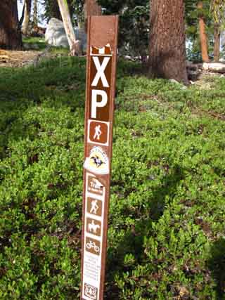 |
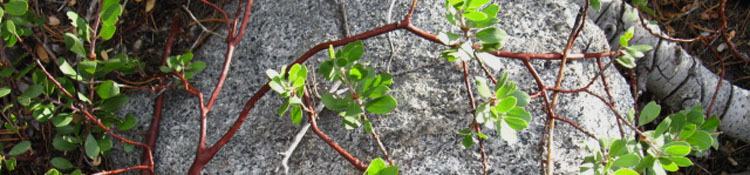
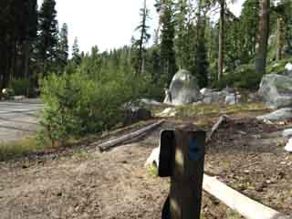
| Above: Snow markers in trees approaching Echo Summit. | Above: What's this? A Pony Express Trail marker. |
 |
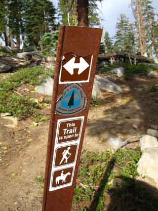 |
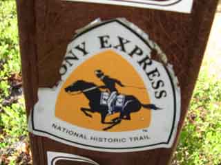
Above: Close up, Pony Express Trail marker. |
Above: Pony Express Trail in background heading West towards Strawberry. |
Trail Information
| Highway 50 to Echo Summit |
Desolation Wilderness ended on the North side of Upper Echo Lake, but the Lake Tahoe Basin Administrative Unit continues to the Carson Gap. The Meiss Roadless Area, AKA Meiss Country, begins South of Echo Summit. These are the last steps we will take along this 30.71 mile hike we've done from the Meeks Bay Trailhead to the Echo Summit Trailhead. Our next section of trail is the brief hike across 10 mile hike from Echo Summit to the Carson Gap across the Meiss Country Roadless Area. From the Carson Gap to a mile past Carson Pass Tahoe to Yosemite hikers will encounter three junctions branching off to the Southwest and the Tahoe to Yosemite Trail's 25 rough miles to Lake Alpine. Southbound hikers will reamain on this main trail, the Pacific Crest Trail, for the 27.88 mile hike down to Ebbetts Pass. Echo Lake to Echo SummitElevations Lake Level Top of rise between Echo Lake and Echo Summit Highway 50 crossing Echo Summit trailhead Lower Echo Lake to Echo Summit Mileage 29.71 miles South from the Meeks Bay Trailhead. 1 mile South of the Echo Lake Trailhead. 1 mile South to Echo Summit Trailhead. 13 miles South to Carson Pass. |
Camp Notes: Departing Highway 50Location: On South Side of Highway 50 about 35 yards up trail towards Echo Summit. I found a a big enough spot for my pad and Sleeping bag. This location is a little short of a mile North of Echo Summit trailhead. Sunrise, Late September, 6:42 am or so Temp before Sunrise: 43° No weather, no mosquitoes: no tent. Clouds in the morning, cleared nicely. "or so" note: I record the Sunrise/Sunset times, the time of the transit of the Sun, and the Moon Phases for the day each trip begins as the header of my journal. This allows me to use the Sun as a compass and a clock. The times above reflect the time of the start day of the trip. In fact, each day the Sunset and Sunrise change, so my accuracy diminishes. The rate of change is up to a minute a day for both Sunrise and Sunset. |
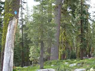
The trail on the South side of Highway 50 from our crossing point at Little Norway parallels the Highway to Echo Summit. Lots of car noise. The South Fork of the American River flows to our West, between our position on the trail and Highway 50. The South American River dries out late in the Summer season. |
Arriving at the Echo Summit Trail Head
 |
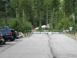 |
| Above: Last steps to the Echo Summit trailhead | Above: Echo Summit trailhead. Pacific Crest Trail is to the Right of the locked gate to Adventure Mountain |
 |
|
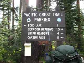
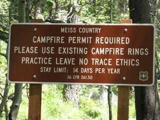
| Above: Sign at Echo Summit trailhead | |
North: Highway 50 campsite South: Echo Summit
Highway 50 to Echo Summit |
After crossing Highway 50 and heading South towards Echo Summit, we will encounter the Pony Express Trail junction. The Pony Express Trail heads West down to the town of Strawberry on Highway 50 from the junction pictured above. Heading East, the Pony Express trail follows our trail to Echo Summit, then continues East to descend into the Tahoe Basin via the Hawley Trail into Christmas Valley, Meyers. The Hawley trail intersects with the South Upper Truckee Road a half mile to/from our third Lake Tahoe trailhead option, the Round Lake trailhead at the end of South Upper Truckee Road's year-round maintained road. This would make an excellent loop: Echo Summit down Hawley Trail to Round Lake. From Round Lake to Showers Lake, and out to Echo Summit.
Above: Trailhead on South Upper Truckee Road, Meyers Trailhead, just South of the bottom of Hawley Trail from Echo Summit. Check the Echo Summit to Carson Pass Map for location details. Information: Pony Express Route Backpacking Topo Map North: Echo Lake to Echo Summit Map South: Meiss Country Roadless AreaMiles and ElevationsNext page South: Echo Summit |
Backpacking Trail Guide North |
 |
Backpacking Trail Guide South |
Backpacker ForumsPost it on: TahoetoWhitney.OrgEcho Summit: What's your favorite trip through this trailhead?Experiences, comments, or pictures about this Section of trail around Echo Summit: Let it Rip HERE.Section: Meeks to Echo SummitSegment: Highway 50 to Echo Summit |
North: Highway 50 campsite South: Echo Summit
Home Page
Contact Alex Wierbinski

Backpacking Lake Tahoe to Mount Whitney
Your guide to the High Sierra Crest, including the Tahoe to Yosemite, Pacific Crest, and John Muir Trails
