

The Trails
Guide
Maps
Miles/Ele
Permits
Resupply
Forum
Weather Conditions
Weather Notes
Northern High Sierras
Central High Sierras
Southern High Sierras
Gear
Gear List
Gear Forum
Gettin Started
Layering
Testing yourself and your gear
Gear Reviews
Backpacking Camp Highway 50: It's Dark! Campsite #3
Hiking between Lower Echo Lake to Echo Summit, The Tahoe to Yosemite and Pacific Crest Trails
Translate
Languages
Trail Prep
The art of walking
Physical Preperation
Planning
Trail Skills
The trail
Off the trail
Scrambling
Maps
Navigation
Camp skills
Food
Resupply
Food
Other
Photo Catagories
Trail Stories
Trail Culture
News and Science
Links
Groups
Books
Terms and Conditions of Use
Last Steps of Day 3
Tahoe to Yosemite Trail
Hiking across Highway 50
and
Camping
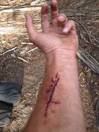
After a long day hiking South through the Desolation Wilderness from Fontanillis Lake, I began to run out of daylight between the South end of Desolation Wilderness and the North side of the Meiss Country Roadless Area. I decided to push on as far as I could before complete darkness ended my hiking day. Then I took a minor injury. Twilight ended a short ways South of where the combined Pacific Crest, Tahoe to Yosemite, and Tahoe Rim trails cross Highway 50. Don't let this happen to you. I'm an idiot. I could have staged up at Tamarack Lake North of Upper Echo Lake. I wanted to squeeze out as many miles as possible, and I knew I could get water, if with difficulty, where the outflow from Echo Lakes drained into the American River. So I pushed ahead. It turned out that the American had dried out way up here, the beginning of the flow had retreated down-mountain. This "retreat" of the tops of rivers and drainages down the mountain always happens during late-Summer into Fall and Winter, earlier during dry years and later during wet, up and down the High Sierra Crest Trails. I was lucky the water managers had opened up the Echo Lakes. Transition from Desolation to Meiss Roadless Area Maps
Miles and Elevations
|
The Tahoe to Yosemite, Pacific Crest, and Tahoe Rim trails
on the
South side of Highway 50
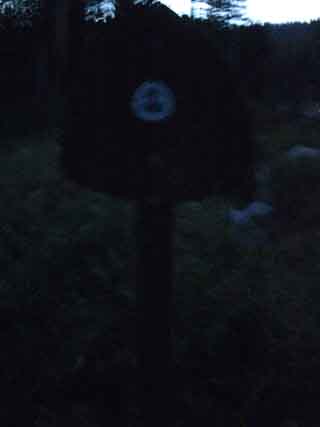
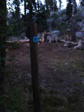
| After we cross Highway 50 southbound we walk about 30 yards East towards Echo Summit along Highway 50 to this sign. | ||
 |
||
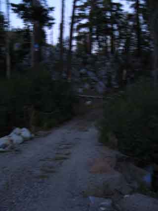
| This sign marks the dirt road pictured below. |
Final Loading 16 days unresupplied to Tuolumne Meadows.
|
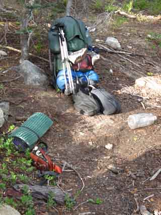
At the tiny emergency "throw-down" backpacking camp about 100 feet up the trail East of the dirt road. It is a camp because I camped there. Note the two large food bags in front of my pack. The Garcia bear-proof canister is already inside the pack, above the sleeping bag. The two huge food bags will be firmly secured to the outside of the pack. No bounce. The external food bags are securely attached to the frame and slung low on the pack to keep the center of gravity low and controllable. Trail Skills: Backpack Lashing System |
Information
| Echo Lake Trailhead to Echo Summit |
Desolation Wilderness ended on the North side of Upper Echo Lake, but the Lake Tahoe Basin Administrative Unit continues to the Carson Gap, the very point where we step South out of the Lake Tahoe Basin. The Meiss Roadless Area, AKA Meiss Country, begins South of Echo Summit and runs all the way up to the Carson Gap. Echo Lake to Echo SummitElevation
Highway 50 crossing Echo Summit trailhead Highway 50 Crossing
|
Camp Notes
|
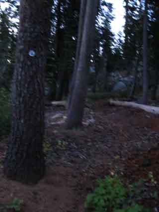
Morning 4, Highway 50 just North of Echo Summit
 |
|
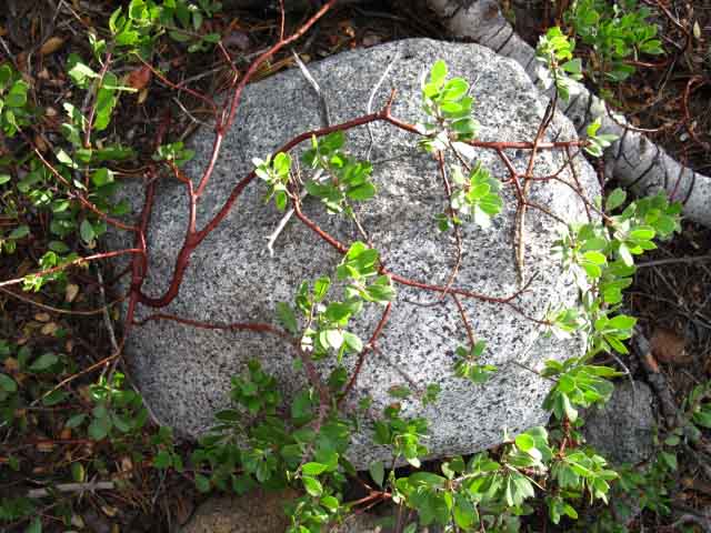
| Natural decor: Rock trussed up by shrub at my little backpacking camp. | |
 |
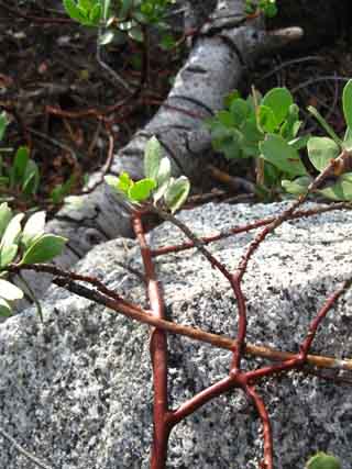 |
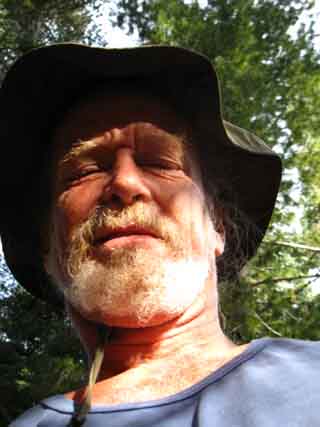
| Happy Camper. Not the best camping spot, but sweet nonetheless. Looking forward to the day! | Rock and plant detail. |
North: Echo Lake to Echo Summit 2 South: Highway 50 to Echo Summit
Emergency Camp by Highway 50 |
It was a brief hike South down to Highway 50 after my almost disastrous ford. On my immediate right (West) at the Pacific Crest Trail junction with Highway 50 is Little Norway. Between Little Norway and the Pacific Crest Trail on the North side of Highway 50 sits the raging torrent of the very same creek that I had almost fallen into minutes before. The creek runs into a rock lined culvert that passes under Highway 50 into the South Fork of the American River. Its flow is determined by the operation of the flood gate at the Lower Echo Lake dam. It was a raging torrent the evening I passed by. It was now completely dark, but on the positive side I now knew where I was going to get water. Now I just had to figure out where I could throw down my pad and sleeping bag. I crossed to the South side of Highway 50 and proceeded East along the shoulder for the brief walk to the Southbound Pacific Crest Trail marker posted at the junction of a dirt road and Highway 50. About 100 feet down this road our Pacific Crest/Tahoe to Yosemite Trail route turns Left off of the dirt road to parallel Highway 50 Eastbound up to the Echo Summit trailhead. About 100 feet up the trail I noted a small flat shelf in the forest floor debris to my immediate left off the trail. It was also equipped with a nice little granite boulder that I could use as a backrest. Perfect. This would be where I would spend night 3. Because it was so late in the season, the American River, here a little creek running along the South side of Highway 50 down from its headwaters at Echo Summit, was not flowing. I hung my two big bags of food on the trees at the trail junction with the dirt road, pulled the Garcia bear canister out of the pack, and set off for the big creek from Echo Lakes next to Little Norway to fill my water jug so I could make dinner and filter some fresh water. I sure would have liked to camp at a better site. But sometimes this is how things work out when you are pressing hard on the trail, and you have to make due. I knew this would happen as I constantly stopped to meet other backpackers along the trail throughout the day, took detours to chase interesting bugs, and stopped to take pictures for this trail guide. No big deal. Tomorrow morning we will have a very short hike up to the Echo Summit trail head. Topo Hiking Map: Echo Lake South Topo hiking Map: Echo Lake to Echo SummitMiles and ElevationsNorth: Highway 50 to Echo Summit |
Backpacking Trail Guide North |
 |
Backpacking Trail Guide South |
Backpacker ForumsHave a great Sierra Nevada route or trip to relate?Post it on: TahoetoWhitney.OrgEcho Lake: What's your favorite trip through this region?Add your experiences, comments, or pictures about the trail crossing Highway 50:Section: Meeks to EchoSegment: Highway 50 camp |
North: Echo Lake to Echo Summit 2 South: Highway 50 to Echo Summit
Home Page
Contact
Alex Wierbinski

Backpacking Lake Tahoe to Mount Whitney
Your guide to the High Sierra Crest, including the Tahoe to Yosemite, Pacific Crest, and John Muir Trails
