Tree, Poison Flat, Carson Iceberg Lake Tahoe to Mount Whitney: Your Backpacking Guide to the High Sierras Yellow Flower
Brief View of Lake Tahoe along PCT North of Showers Lake.
South Lake Tahoe view, for a moment, from Southwestern edge of the Basin in the Meiss Country Roadless Area


The Trails

Guide
Maps
Miles/Ele
Permits
Resupply
Forum

Current Weather Conditions

Weather Notes
Northern High Sierras
Central High Sierras
Southern High Sierras


Gear

Gear List
Gettin Started
Layering
Discussion


Testing yourself and your gear


Gear Reviews


top of page

Backpacking
Southwestern Edge of the Lake Tahoe Basin

South to Showers Lake from Echo Summit in the Meiss Country Roadless Area


Languages

Languages


Trail Arts

The art of walking
 
Physical Preperation


Trail Skills

The trail
Off the trail
Scrambling
Maps
Navigation
Camp skills
 

Food

Resupply
Food


Other

Photo Catagories
Trail Stories
Trail Culture
News and Science
Links
Groups
Books


Terms and Conditions of Use


top of page

Trail Guide


INDEX
North

Frog
Lake
Loop
South

Meiss Roadless
Area Rock
Topo Map

Echo 
Summit
to
Carson
Pass
Maps
INDEX
MILES
and
ELEVATIONS
Miles
and
Elevations
INDEX

Lake Tahoe
Basin
PERMITS

Meiss
Country
PERMITS

All
High Sierra
PERMITS

Local
Weather


All Sierra Weather
Tahoe
to
Whitney
on
YouTube

South of the footbridge the trail gets harder as we begin climbing
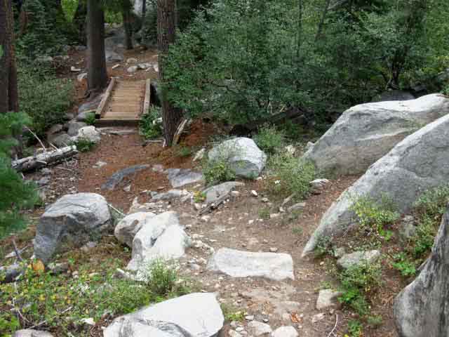
Bridge South of Frog Lake Loop junction, Meiss Country Roadless Area.

1.40 miles south of Echo Summit we encounter this foot Bridge across the creek feeding Benwood Meadow, off to the Left.

Trail difficulty increases after the bridge.

Hiking Map South
Meiss Country Roadless Area
Echo Summit to Carson Pass
Backpacking Miles and Elevations

Video Playlist
Echo Summit to Carson Gap

Comments-questions-experiences here?

Bridge South of Echo Summit Rock in forest
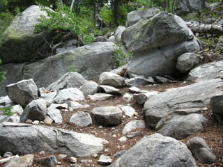
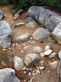
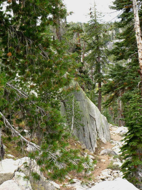
Soft but rocky trail approaching foot bridge. Though the terrain provides an excellent soft yet firm forest trail surface, the forest is a just a thin cover upon great granite outcroppings.
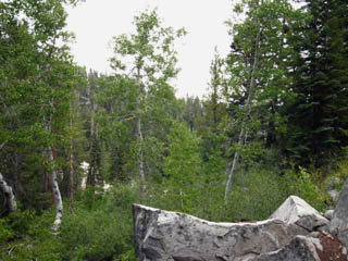
Aspen runs in lodgepole and California White Pine forests: Wet Spots

Aspens grow thickly along the damp drainages.

top of page

Only brief views of Tahoe appeared South of Echo Summit

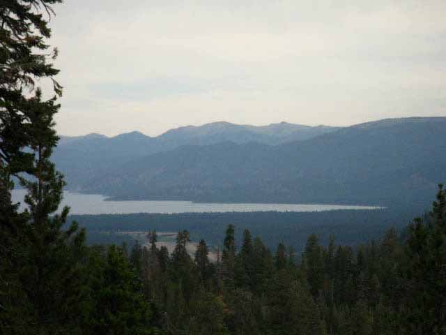
Looking across the South end of Lake Tahoe.

We are on the Southwestern rim looking over at the Carson Range on the Southeastern rim.

There are very few views of Lake Tahoe from Echo Summit to the Carson Gap. This is one of them.

Mostly we wind around through deep forest and sheer rock, suddenly emerging onto an crack in the terrain or forest cover opening up quick views into and across the surrounding terrain every now and again.

Keep your eyes open!

Though the trailbed is soft from thick forest floor liter, it is still the rock that characterizes the trail. And it is the Massive rock formations that determine the trail route.
Trail winds around fine rock features

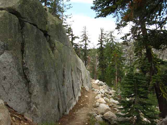
The Pacific Crest - Tahoe to Yosemite trail works its way South around a great granite wall. This is a very nice trail thorough densely forested granite terrain here.

Our direction above is Southwest by the compass moving into the ravine running Southwest up to the crest of Peak 8905. This explains our lack of views climbing this part of the trail. We are pointed Southwest climbing in a deep granite ravine.

Our views East, the direction of Christmas Valley, and Northeast at Tahoe itself will open up as we approach an excellent break spot located in a gap a bit more that halfway up our climb.

This break spot has an expansive view overlooking Christmas Valley and the South end of the Tahoe Basin.

We'll take a break there to take it all in.

Views
Northwest to Northeast
Lake Tahoe's Rim is cut in Granite South Lake Tahoe Airport

Northwest
Turning around to look to our Northwest we see the top of the Sierra ridge rising to the Southwest of Echo Summit dropping down to Echo Summit. That ridge marks the Western extent of the Tahoe Drainage above Christmas Valley.

Our trail South (behind us) arcs Southeast following the Tahoe Rim along the Southwestern edge of the Basin's drainage towards our first goal of Showers Lake.

Northeast
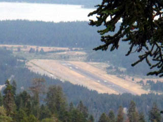
The South Lake Tahoe Airport with Lake Tahoe in the background looking Northeast through a break in forest cover.

top of page

Comments-questions-experiences in here?

Stateline
Harveys Casino at Stateline South Lake Tahoe from the Tahoe Yosemite trail in Meiss Country

Check out the long view to the Northeast, at Stateline in South Lake Tahoe.

It looks like Harvey's Casino, Stateline, from our position on the far Southwestern edge of the Tahoe Rim.

Trail Information

Footbridge
past
Echo Summit
Backpacking
Meiss Country Roadless Area

Elevation
7600
+223 feet above Echo Summit

Mileage
1.4 miles South from Echo Summit.

1.48 miles to high point of trail.

5.4 miles South to Showers Lake.

10.6 miles South to Carson Pass.

Backpacking Map South
Meiss Country Roadless Area

Miles and Elevations

top of page

North: Frog Lake Loop                                                                               South: Meiss Roadless Area Rock

The Meiss Country Roadless Area

Hitting the footbridge marks the point where the trail difficulty transitions from Intermediate difficulty 3, the lowest level of intermediate difficulty, to Intermediate difficulty 1, the hardest of the three levels of intermediate difficulty.
(See the trail rating system)

From the footbridge to the Sayles Canyon junction we will be going constantly up and down, as if on a washboard or roller coaster tilted mostly upward for 1383 feet over almost three miles.

Our first target is the gap with a fantastic overlook of the Tahoe Basin about halfway up our climb.

Once we get over the highpoint of this section of trail across Peak 8905 our descending trail relaxes to Easy 1, South through the Sayles and Schneider trail junctions to Showers Lake.

Easy 1 is the most difficult degree of easy level trail.

7.5 min hiking Topo Map
Echo Summit
to
Carson Pass
30 min hiking Topo Map
Echo Summit
to
Round Top and The Sisters

Miles and Elevations

Next page
South
Meiss Roadless Area

Comments-questions-experiences in here?

Video Playlist
Echo Summit to Carson Gap

top of page

Backpacking Trail Guide

North

Frog Lake Loop

Trail Guide internal Compass.

Backpacking Trail Guide

South

Deeper
into
Meiss Roadless Area

Backpacker Forums

Have a backpacking issue to relate?

Post it on
TahoetoWhitney.Org
The Backpacker's Forum.

On the TRAILS Forum you can browse the locations and add your experiences, comments, questions (or pictures and videos) about hiking South out of the Echo Summit Trail Head.

The TOPICS Forum deals with backpacking issues.

High Sierra Backpacking
Trails
High Sierra Backpacking
Topics

General comments about the Echo Summit to Carson Pass section of the trail:

Section
Echo Summit to Carson Pass
Segment
Footbridge to Showers Lake

North: Frog Lake Loop                                                                               South: Meiss Roadless Area Rock

Trailhead
Contact
Alex Wierbinski

top of page

Frosted Backpack

Backpacking Lake Tahoe to Mount Whitney

Your guide to the High Sierra Crest, including the Tahoe to Yosemite, Pacific Crest, and John Muir Trails

Snug tent after Snow Storm
© Lake Tahoe to Mount Whitney: Crown Jewel of the Pacific Crest Trail