The Trails
Guide
Maps
Miles/Ele
Permits
Resupply
Forum
Current Weather Conditions
Weather Notes
Northern High Sierras
Central High Sierras
Southern High Sierras
Gear
Gear List
Gettin Started
Layering
Discussion
Testing yourself and your gear
Gear Reviews
Backpacking
Meiss Cabin
in
Meiss Meadow
in the
Meiss Country Roadless Area
Junction of the Tahoe to Yosemite, Pacific Crest, and Tahoe Rim Trails in the Southern Lake Tahoe Basin
Languages
Languages
Trail Arts
The art of walking
Physical Preperation
Trail Skills
The trail
Off the trail
Scrambling
Maps
Navigation
Camp skills
Food
Resupply
Food
Other
Photo Catagories
Trail Stories
Trail Culture
News and Science
Links
Groups
Books
Terms and Conditions of Use
Trail Guide INDEXES |
NORTH |
NORTH |
SOUTH |
7.5 min Topo Map 30 min Topo Map |
Miles and Elevations INDEX |
Tahoe to Whitney on YouTube |
Trail Junction
with
Pacific Crest - Tahoe Yosemite - Tahoe Rim
Trails
 The trail Northeast, back the way we came up six miles from the South Upper Truckee Trailhead past Big Meadow junction and Round Lake. |
||||
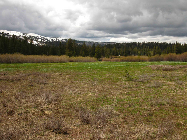
Meiss Meadow Trail Junction Arriving at Meiss Meadow we have arrived at the central "Hub" of the Meiss Country Roadless Area. As we're going to continue our long hike South towards Tuolumne Meadows and on down to the Whitney Portal, at the Meiss Meadow trail junction we're now positioned to make our Southbound exit from the Tahoe Basin through the Carson Gap. Local Backpackers will arrive at this trail junction in Meiss Meadow to make their final turn towards their destination trailhead. This is because the triangular shape of the Meiss Country puts the Meiss Meadow trail junction in a central position for most of the trailheads encircling the perimeter of the Meiss Country to access each other. The remaining three trailheads into the Meiss Country, being Big Meadow, Schneiders Cow Camp, and Sayles Canyon are accessible off of the line of these three main trails. Though the terrain of the Meiss Country is delightfully complex, the basic layout of the trails is simple: A Hub with Three Spokes. Maps
Miles and Elevations
|
| INDEX On this page |
|||||||||||||||||
Directions:
MAP
MILES and ELEVATIONS
Miles, Elevations &
Video
Views of
All Weather All High Sierra Weather Resources
|
Weather and Road Information Below find the closest Ground Stations, Point and Regional Forecasts near Meiss Meadow. We're between Echo Summit and Carson Pass, though closer to Carson Pass while still within the Lake Tahoe Basin. Satellite and Radar Imagery provides Long Range and Regional overviews.
Local Resupply Resources |
||||||||||||||||
| > Forum < | |||||||||||||||||
Add to the Guide Check out all the Tahoe to Whitney .org Tell us what you see. |
|||||||||||||||||
Meiss Meadow Trail Junction
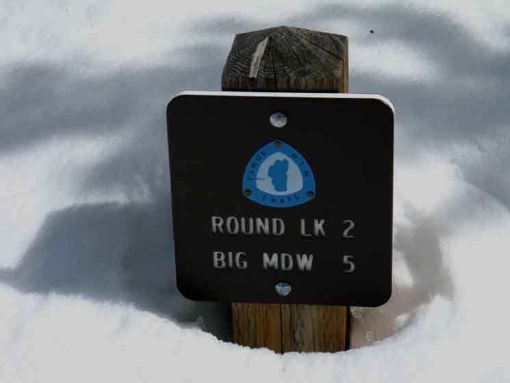
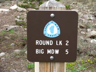
Big Meadow-Round Lake Trail Junction Hikers continuing South up from Round Lake or Big Meadow take a Southbound hiker's Left turn here, as we are hiking South out of the Tahoe Basin through the Carson Gap towards Highway 88 and Carson Pass. All backpackers on the TYT-PCT route between Echo Summit to Highway 88 hike straight through this trail junction. Southeast 30 min Hiking Map Northeast The trail leading Northeast from the Meiss Meadow trail junction passes Round Lake and then the Big Meadow trail junction on its way down to the South Upper Truckee Trailhead in Meyers. Northeast |
| Northeast on the Tahoe Rim Trail. |
No trail yet, but a good landmark. | |||||
 |
 |
|||||
South Upper Truckee Trailhead |
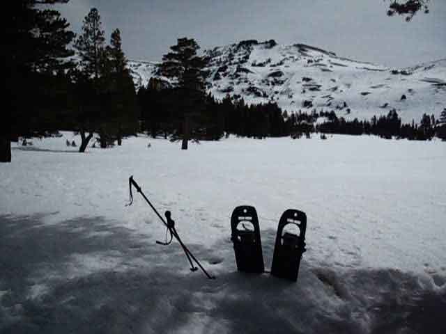
Meiss Country Roadless Area is delightful for experiencing the Sierra in Snow Conditions. Trail Guide Northeast |
|
15 min Hiking Map |
Northwest |
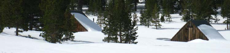
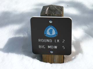
Meiss Cabin during March
 |
| Meiss Cabin is offset to the South-Southeast of the Round Lake-Big Meadow trail junction. Saturday, March 20, 2010. Second day up from South Upper Truckee Trailhead via Round Lake. What sweeeet snow! Fat. I'm sinking about an inch into the surface with each step of my snow-shoed feet. Each step makes a "fat" sound. |
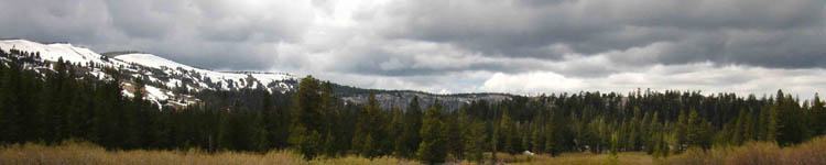
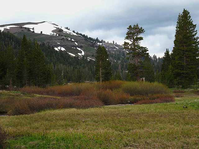
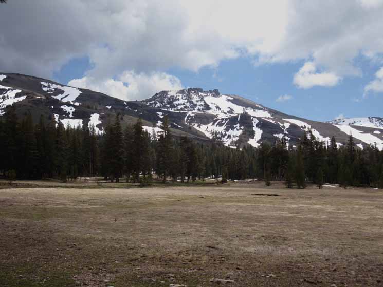
Looking North
towards
Showers Lake from Meiss Meadow
Under Darkening Skies
Little Round Top is out of frame Left along the the most-distant Left Ridgeline
 Fall of 2001 in Meiss Meadow, Hiking to Tuolumne Meadows late in the season. |
Though we are looking at the terrain the trail North along the PCT-TYT-TRT routes is crossing as it bends around the Southern end of the Tahoe Basin, we are actually looking almost directly West. Let's get our bearings. The second peak from the Left edge of the image is the ridge arm extending Northwest from the top of Little Round Top. The peak closest to the Left edge of the image sits above Showers Lake. See that ridge arm descending off the Right side of that peak? That point is hard to see in the image above, and the image below, but we can see it clearly on this image. The nearest low ridge running into the center of the image above, with the barren spot, is the ridge dividing the North end of Meiss Meadow from the shelf Showers Lake sits upon. Let's take another look at this same terrain from a slightly different perspective, in the image below. Let's also take a closer look at this ridge from a position North of the ridge along the PCT-TYT looking South towards Meiss Meadow from above, and a little North of Showers Lake from the same shelf in the terrain holding Showers Lake. The low ridge in the middle distance of the image linked to above is the same ridge as depicted in the images above and below, but looking at it from its Southern rather than its Northern side. |
Above and Below:
Views across North Meiss Meadow towards Little Round Top and Showers Lake.
We can see the Low Ridge separating Meiss Meadow from the shelf Showers Lake sits on in the image above. It is the nearest ridgeline with the barren patch. Showers Lake lays behind that ridge and in front of the ridgeline running off the peak on the furthest Left. The next peak further down the ridge is the end of the ridge arm extending Northwest from Little Round Top, which is out of view from the above perspective.
On the Meiss Meadow Trail Junction To the Northeast At this trail junction
the counter-clockwise Tahoe Rim Trail turns Northeast towards Big Meadow, and the trailhead of the same name situated on Highway 89. PCT & TYT North Two TRT Turns North Counter-clockwise TRT hikers turn Northeast towards Big Meadow Trailhead on Highway 89. Here at the Southern End of the Lake Tahoe Basin all Tahoe Rim Trail hikers bend a turn North through this Southernmost TRT trail junction. Southbound Hikers Southbound backpackers hiking up past Round Lake from the South Upper Truckee or hiking out of the Big Meadow trailhead to Meiss Meadow have a decision. Which Way to Go If we are hiking South out of the Lake Tahoe Basin through the Carson Gap, to where the TYT and PCT routes split apart, we turn Left at this junction. We could be ending a local trip through the Carson Pass trailhead, or we could be continuing South into the Mokelumne Wilderness for the hike down to Highway 4, and maybe even points further South. If we are heading North towards Showers Lake or Echo Summit beyond, we take a right. |
Meiss Meadow Trail Junction
Miles, Elevations & Route Options
Backpacking OptionsWe can follow this Trail Guide in Three Directions from this trail junction in the Heart of the
|
Meiss Country Roadless AreaLocation: Meiss Cabin
|
|||||
Short Hiking Trips These trailheads located around the triangular shape of the Meiss Country Roadless Area offer a wealth of short backpacking trip options. A party with two cars can easily stash a car on one side of the Meiss Country and start their trip off from the other side. An individual or two hikers can even hike out of their finishing trailhead to hitch a ride back to their car or their home base. Or not. It's pretty easy hitching down to Sonora Pass from 89 and 88, if we are not walking down there on the trails... All the mountain folks, skiers, backpackers, and other cool locals and visitors make this a fairly easy area to hitchhike around. I love those Sierra Folks, from the grizzled old ninety year old lady I met at Round Top Lake who'd been hiking these mountains over her whole life, to the baby slung up on dad's back for the trip into and out of Meiss Meadow from Carson Pass. And the rest of us too, each walking the distance from the one bookend to the other through Sierra Beauty. Tahoe to Whitney! Happy Trails! |
||||||
|
Video
How our Lake Tahoe Trailhead Selection
affects our
Tahoe to Whitney & Tahoe to Yosemite mileage,
and the
Character of our Backpacking Trip
The Round Lake Trail Junction at the Meiss Cabin
Video Playlists |
Seasonal Conditions
in
Meiss Country Roadless Area
Some Recent Visits to Meiss Cabin
|
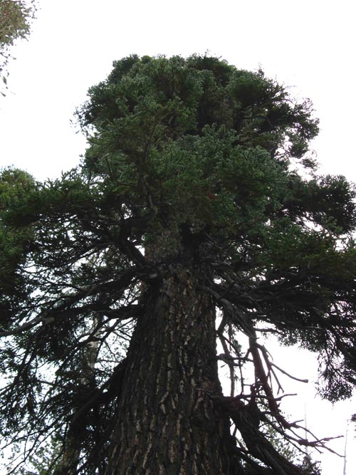
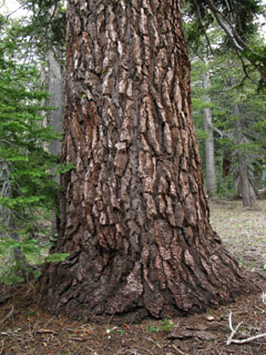
The Tree at the Round Lake Junction
Good Shady Back Rest from which to observe Meiss Cabin
and the
Trail North and South.
| Canopy | ||
 |
||
| Round Lake Trail Junction. |
| But the Trunk does... | ||
 |
||
Using my sleeping pad properly made this a fine place to sit. |
What do YOU think?
This Guide Is set up so that backpackers can add your perspective & experiences here to broaden the trail guide's view of Meiss Meadow and your favorite hiking options and backpacking trips through it. Day hikers, horsemen, and trail crew welcome too! Check out the Forum for every trail guide page for supplemental information, in this case about Meiss Meadow, or to add your insights. My perspective alone is insufficient to describe the terrain or the experience. Your perspective adds another dimension to the experience. Questions and comments are always welcome. Good questions answer a lot of folks' questions. Many birds, one stone... We've got Trails Forums linked to every trail guide page. We've got Topics Forums about every Backpacking Topic. Check them out. General Topics This Location |
Let's Review
The Round Lake-South Upper Truckee-Big Meadow
Trail Junction
with the
PCT and TYT
at
Meiss Cabin
| Northeast to South Upper Truckee Trailhead | Tahoe Rim Trail Northeast to Big Meadow | |||||
|
 |
|||||
The South Upper Truckee Trailhead is 4 miles further Northeast beyond Round Lake. |
The Tahoe Rim Trail follows both the Round Lake-Big Meadow Trail to the Northeast, and the trail Northwest from Meiss Meadow to Echo Summit. Trail Guide |
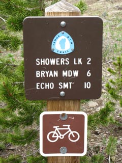
Trail Signs
at the
Junction
| North Northbound Pacific Crest Trail Northbound Tahoe to Yosemite Trail |
South Southbound Pacific Crest Trail Southbound Tahoe to Yosemite Trail |
|||||
 |
 |
|||||
Two miles South to the Carson Gap, three to the Carson Pass. Hiking Map South |
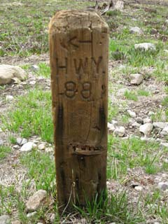
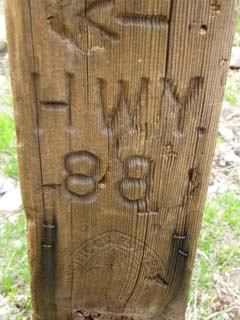
Trail Signs at the Junction
| South to Carson Pass |
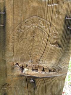
Pacific Crest Trail Brand | |||||
 |
 |
|||||
Old School PCT brand below carving.
|
Close up, Old School PCT Brand. Trails should re-brand all the posts, if they can find the branding iron... |
Meiss Country Roadless AreaMeiss Cabin-Round Lake Trail JunctionTriple Trail TEE
|
At the Meiss Meadow Trail Junction
A Massive Trail Score?
Naw, I'm already carrying too much weight
Northeast: Approach to Meiss from Round Lake Northwest: Meiss to Showers South: Towards Carson Pass
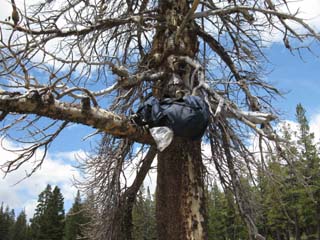
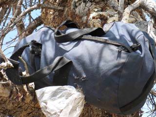
Ground Score
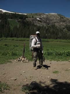
I was approaching the Round Lake Trail Junction Southbound up from the South Upper Truckee Trailhead on my way to Mount Whitney on July 16, 2009. (correction: June trip from South Upper Truckee Trailhead to Round Top Lake and back.) My practice of carrying out the trash I find along the trail was broken by what I saw next. In the open dry meadow terrain off to my Left, to my East while approaching the trail junction at Meiss Cabin I noticed the ratty looking duffel bag pictured above sitting on the ground about forty yards off the trail. Curious, I checked it out, and found it filled with about 40 lbs of various dried pastas, beans, soups and assorted backpacker, no, most likely horsepacker, supplies. This fell off the back of a mule or horse. The weathered condition of the bag, combined with the scratch and bite marks that varmints and coyotes had put on it, convinced me that I could not leave this on the ground in the obscure meadow where I found it. It would eventually be torn apart, especially if a bear caught wind of it, rather than the varmints that were presently trying to work it open with tooth and claw. Bigger teeth and claws would make short work of the canvass bag. But it weighed at least 40 lbs, which meant that it was way too heavy for me to carry out, and I did not have the spare rope to properly hang such a heavy load. So I carried it up to the Meiss Cabin trail junction, to figure out what to do with it during my break at the junction. I decided that this duffel bag full of food would be better off in a tree at the trail junction than on the ground. Although a tree stash would not protect it from bear, it would keep it out of the coyotes' mouths. It would also make it visible from all trails approaching the Meiss Meadow trail junction. It's previous position was only obliquely visible from the trail up from Round Lake. I figure the coyotes were slowly dragging it further and further from the trail as they diligently worked it open. I laugh at my imagination's depiction of a lone coyote dragging it around, trying to rip it open with its teeth, and I especially laugh at the image of three coyotes, each latched onto it by tooth and jaw, spinning around with the duffle bag as the pivot point, as they reluctantly join forces to pull it apart. It was all that I could do to get it wedged up into the tree. At least in the tree it had some chance of making it until the time the misguided horsepacker or backpacker who left it improperly stored came back to get it. I've seen cowboy/ranchers up here a few times, and I figure it was likely part of their stash. I generally pick up and carry out all the trash or other stuff I find along the trail, but this duffle bag was too heavy for me to carry out. I came through again on July 16, and the duffle bag was gone with no sign of it having being ripped apart and spread across the terrain. I figure the cowboys/ranchers saw it up there the next time they rode through. |
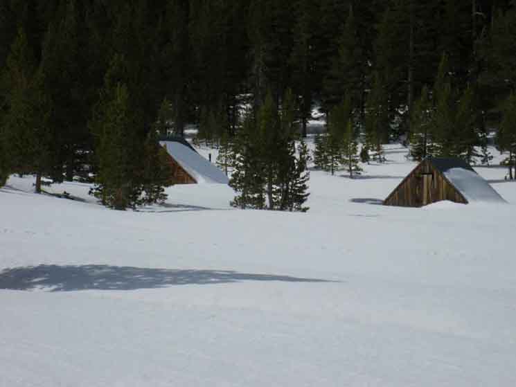
Meiss Cabin
during
Fall
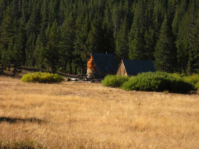 |
Meiss Cabin, Meiss Meadow, Meiss Country. This is a Fall view of the Meiss Cabin & barn from the Round Lake-Big Meadow trail junction during Fall. Besides being virtually devoid of mosquitoes, the golden colors of Fall are well contrasted by the lower angle of the sun in the sky. Colors get richer, the contrasts on the rocky mountain faces deepen, and all of nature seems to be hunkering down, and taking the upcoming Winter seriously. I like Fall. Hiking Map South |
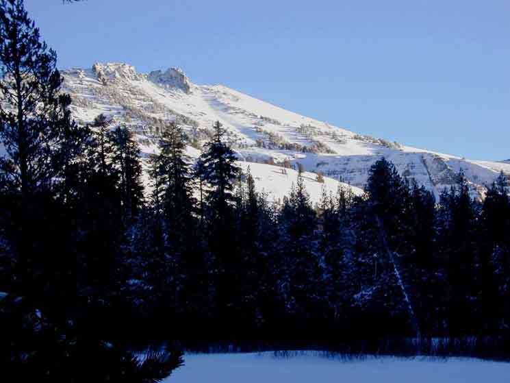
Early Spring at Meiss Cabin
| The Meiss Cabin |
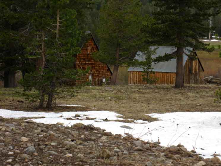 |
The Meiss Cabin viewed as the trail winds around Meiss Cabin South of the Round Lake trail junction on the Pacific Crest-Tahoe to Yosemite Trail. The green of Spring is just stirring. Let's hike over there and check it out. |
The Meiss Cabin History
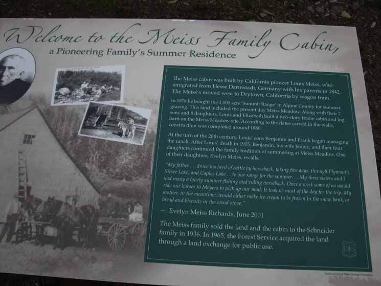 |
Historical Information at the Meiss Cabin. |
Meiss Historical Landmark Welcome to the Meiss Family Cabin In 1878 he bought the 1000 acre "Summit Range in Alpine County for summer grazing. This land included the present day Meiss Meadow. Along with their 2 sons and 8 daughters, Louis and Elizabeth built a two-story frame cabin and log barn on the Meiss Meadow site. According to the dates carved in the walls, construction was completed around 1880. At the turn of the 20th century, Louis' sons Benjamin and Frank began managing the ranch. After Louis' death in 1905, Benjamin, his wife Jennie, and their four daughters continued the family tradition of Summering at Meiss Meadow. One of their daughters, Evelyn Meiss, recalls: "My father...drove his herd of cattle by horseback, taking five days, through Plymouth, Silver Lake, and Caples Lake...to our range for the summer... My three sisters and I had many a lovely summer fishing and riding horseback. Once a week some of us would ride our horses to Meyers to pick up our mail. It took us most of the day for the trip. My mother, in the meantime, would either make ice cream to be frozen in the snow bank, or bread and biscuits in the wood stove." -Evelyn Meiss Richards, June 2001 The Meiss family sold the land and the cabin to the Schneider family in 1936. In 1965, the Forest Service acquired the land through a land exchange for public use. Meiss Cabin History Forum High Sierra Historical Monuments Can I stay at the Meiss Cabin? I understand that the Meiss Cabin was sold to a David Beck, who rented it out for backpackers and skiers under the restrictions required of its status as a National Historic Site in a National Forest. Dave Beck was running ski tours and classes out to the Meiss Cabin, and may still be doing so. Check out the Meiss Cabin Page on Dave Beck's website. This site also features ski tours, avalanche training, and dogsled travel. There are no email links, but an address and phone number are provided. (This site is no longer online 6-2012-anyone have any leads?) Dave Beck Site, 2014 |
| The Meiss Cabin in Meiss Meadow. |
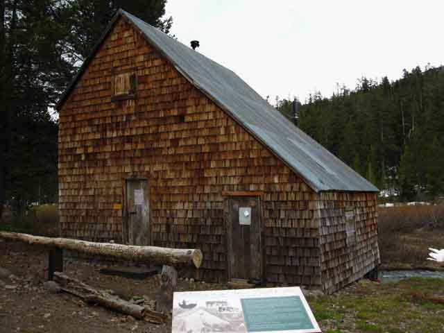 |
| Above: The Meiss Cabin. Note the South Upper Truckee behind. |
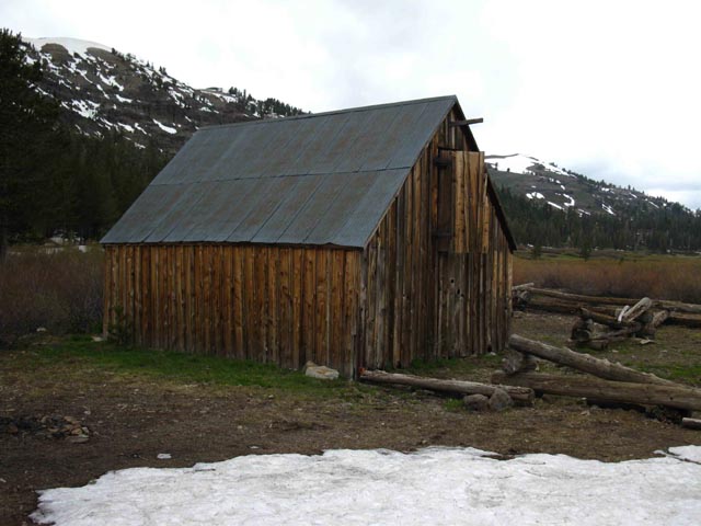 |
The Meiss Cabin's Barn. |
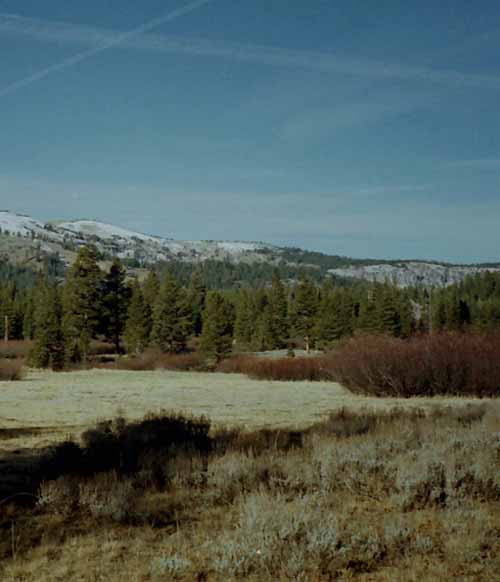
Views of Meiss Meadow
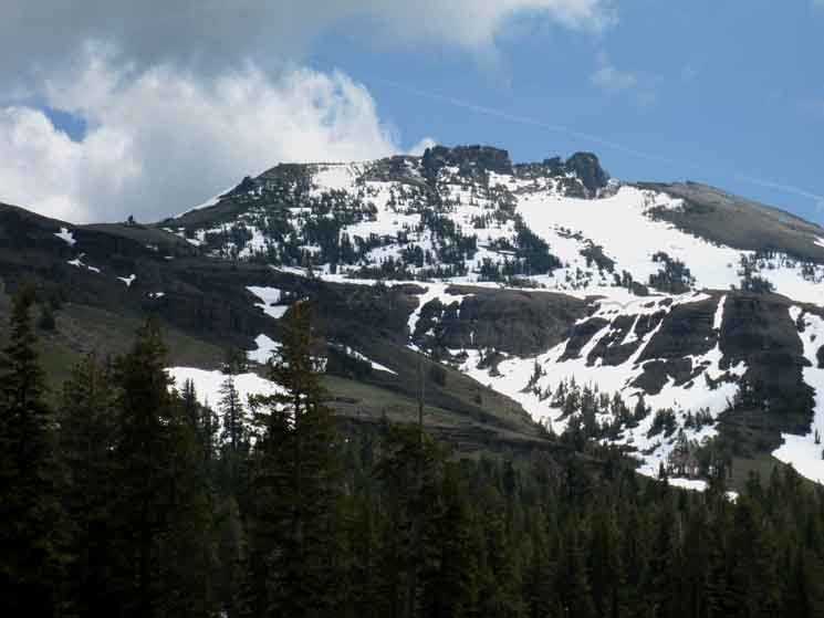
North End of Meiss Meadow
Meiss Cabin Looking Northwest towards Echo Summit
North End of Meiss Meadow
| Looking North along the Tahoe Rim, Pacific Crest, and Tahoe to Yosemite Trail routes from Meiss Cabin, early Spring. |
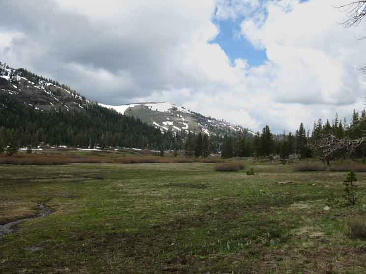 |
We're looking across the Northern expanse of Meiss Meadow, just free of snow, June. Showers Lake sits on a fairly flat shelf on the other side of the low ridge running across the center of the image. In the distance we can see the ridge arm descending off of Peak 9325, which is a subordinate peak to the South of Little Round Top, which also towers above Showers Lake. |
The Beauties of Meiss Meadow under lowering skies
North End of Meiss Meadow
View West-Northwest
across the
North End of Meiss Meadow towards Showers Lake
North End of Meiss Meadow, by direction of the trail.
| Meadow Brush taking on colors before blooming. Early June, 2009. |
 |
First Blush of Spring Coloring Grass and Brush on the North End of Meiss Meadow. The mosquitoes are DEADLY. This resurgence of life we see above is a real nifty stage in Spring meadow development. Two things happen with the advent of deep cold and heavy snows in the Sierra Nevada: the thickets of dense brush go dormant, and the grass dies. The grass eventually gets crushed and compressed by the heavy weight of the snowpack, while the brush becomes inert skeletons threaded through the snowpack. Beautiful things happen as the rising Sun of Spring uncovers them. Retreating snow first reveals the tips of the branches of the brush, which grow into dead gray thickets as the snows melt down to the meadow floor. The exposed meadow bottoms reveal the dark brown flattened mat of last season's dead and compressed grasses, making the meadow look like a brown carpet of its own dead grass was woven together and laid over it. The seemingly dead branches begin to glow, then increasingly begin radiating with growing strength a range of vibrant colors, of glowing reds, yellows, and greens which appear to grow outward from deep inside each branch, which appear to evaporate the gray color of dormancy away. I consider this meadow brush to be a big, beautiful pain in the ass. I avoid traveling through it like I avoid the plague. And I know what I'm taking about. We do avoid the plague up here, for the fleas on the small ground mammals in the High Sierra carry the plague!
And this meadow brush is a plague on cross-country travelers! Yet the beauty of this meadow brush when it begins surging with its colors of resurgent Spring is sublime. The dead matted grasses on meadow bottoms have no such luck. They are dead. But the great web of roots underlying the meadow is not, and soon waves of sprouts begin to poke up into and through the dead brown mat of last year's growth. Soon we have the amazing sight of the dead brown matted meadow bottom looking like it is being crossed by subtle waves of green, as millions of green sprouts find their way through the brown mat, creating the effect of life growing through death. At the same time as the grasses are resurging up from the meadow floor the gray of the meadow bush is half-turning to fluorescent reds, yellows, and greens. I think this is my favorite time of Spring, when the pallor of death of Winter has receded, and the inherent colors of life are marshalling their powers, when the browns and grays of Winter are interwoven with the surging colors of impending Spring. I warn of the mosquitoes three times because they are a big part of the Spring Thaw and subsequent explosion of life, and to enjoy one you have to deal with the other. It is hard to enjoy these sublime beauties of resurgent life if part of it is eating you. Spring's beauty comes with a bite. Lay of the Land Beyond the shrubbery in the North end of Meiss Meadow we can see the low forested ridge arm extending across the middle of the image in front of Peak 9325. Showers Lake sits on the far side of a fairly flat shelf in the terrain on the far side of that ridge, to the Right of the volcanic face on the Right end of the ridge descending from the Right side of Peak 9325. |
Hiking South Past Meiss Cabin
Center of Meiss Meadow

View East of Red Lake Peak
South End of Meiss Meadow
 |
Winter break in Meiss Meadow with a fine view East of Red Lake Peak. We're taking a break about 40 yards to the Southeast of Meiss Cabin where a great tree always melts out a dry spot around itself early every year. This was in March, and the tree would melt out snow between storms. We're going to hike East towards Red Lake Peak, but bend our route to the Right as we line up with the South Upper Truckee's cut in the Ridgeline up to the Carson Gap. Hiking Map South
The Harness of Pain and Pleasure takes on a chilly aspect. |
Below:
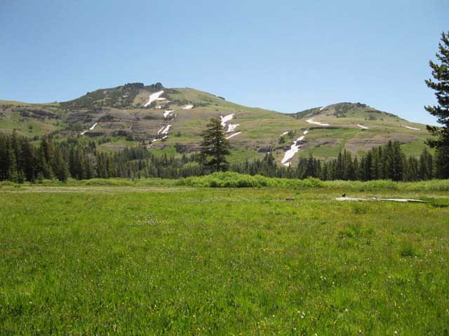
Spring bloom looking South-Southeast at Upper Meiss Meadow towards Carson Pass
Spring in Meiss Meadow
Red Lake Peak and the Peak East of Carson Gap
Early Spring
Mountains Ringing the East End of Meiss Meadow
Early June 2009
South End of Meiss Meadow
Red Lake Peak
South End of Meiss Meadow
 |
Detail of Red Lake Peak. Red Lake Peak above Meiss Meadow at the edge of the South Tahoe Basin. Though still cold, and not yet blooming, the mosquito population had already begun to surge. From June to early August we must be prepared for serious mosquitoes. Below, not so much.
|
 Fine Winter View above the maze of forest we are finding our way along the Eastern route to Meiss Meadow from Round Lake and the South Upper Truckee Trailhead. Winter of 2007.
 Spring
across
Meiss Meadow
South End of Meiss Meadow
Red Lake Peak on the Left, the peak above the East side of Carson Gap on the Right. Spring has Sprung. Looking South at the head of the Upper part of Meiss Meadow getting into full Spring bloom condition during mid-July, 2009. The Carson Gap is not visible on the right side of the image. The ridgelines on the right of the image are both descending to the Carson Gap. |
 |
The verdant green and thick mosquitoes go hand in hand. The half-dead half-alive phase of early Spring is a memory. Hiking Map South |
Trail Culture
A Pacific Crest Trailer, a Dayhiker, and Alex
The Round Lake Trail Junction
at
Meiss Cabin
| Rocket Man PCT |
Charlie Tobias Day Hiker |
|||||
 |
 |
|||||
| Rocket Man was looking strong and fast. Notice how he just stopped briefly in the trail. Not much time to stop for anything, if you want to make the Canadian Border before the Snows fall. |
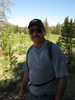
Trail CultureRocket Man and Charlie Tobias On my second day towards Whitney (of 45) I encountered Rocket Man and Charlie Tobias at the Round Lake trail junction in Meiss Meadow. I watched Rocket Man coming South down the trail from my fine overlooking break spot at the junction. I could recognize the gait of a Pacific Crest Trailer. Rocket Man executed short, quick steps paced by a quick body rhythm. I could see his trail-focus from quite a ways out. But it was July 16, which put him late in the season for his position, and explained his focus on speed. Charlie Tobias was walking around the Meiss Country Roadless Area on a day hike, really enjoying himself. He was well equipped for long day hikes with pack, insulation, snacks and water. |
| Break's Over! | ||
 |
||
| Resuming my way South. I'll take my next break when we meet up on the trail... |
Next Map The Carson Pass Region map shows where the Pacific Crest and Tahoe to Yosemite trails part company on the South Side of the Carson Gap to follow their divergent routes South across the Mokelumne Wilderness and down the Sierra to where they eventually rejoin in the Northwest corner of Yosemite National Park.
This Map
Next Map The PCT, TYT, and TRT continue North together out of Meiss Country, across Highway 50 and into Desolation Wilderness. On the way they pass by our next potential resupply spot at Echo Lake Chalet and the opportunity for long distance backpackers hiking North on the PCT to rest, repair, and resupply in South Lake Tahoe. |
Showers Lake to Meiss Cabin
|
I ran through this trail junction three times in 2009. I came through in early June, before the big bloom while snow still covered the higher mountains, in mid-July during the height of the Spring Bloom, and in mid-September, when the bloom was over, and the flowers had pulled in their blossoms, and were forming seeds. I was not able to make my annual mid-Winter trip through here in 2009, so I missed that aspect of these fine mountains that year. Three important things about the changing seasons in the High SierrasThree things strike me as being very important to backpackers about the seasonal changes between early Spring and late Fall in the High Sierras. #1> The High Sierra Mosquito CycleThe first is the mosquito cycle. The mosquitoes follow the melting snow. As soon as the snow melts, there are mosquitoes. As the snow melts higher up the mountain, the mosquitoes follow the melt up the mountain. As soon as enough ground is exposed, a critical mass is achieved, and from that time until the ground once again dries out the mosquitoes literally dominate the physical environment. Serious measures are required to tolerate the mosquitoes. I have seen people literally crying in frustration and pain while stumbling down trail from inadequate mosquito protection. I stopped the unfortunate backpacker, calmed her down, DEETed her up, gave her proper directions, the exact mileage, and the estimated time to her trailhead. Don't underestimate the mosquitoes.
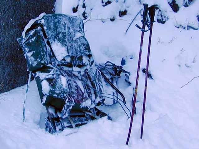
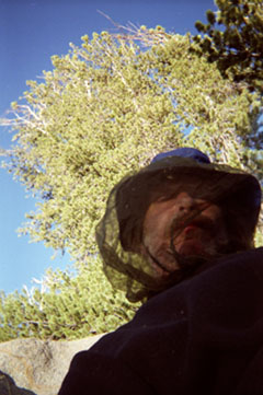
Above: I'm in full mosquito protection in camp easily withstanding a full-on Spring mosquito attack in the Emigrant Basin, High Emigrant Wilderness. Ultralighters notice that I'm wearing a Navy issue peacoat... how's that for ultralight?Travel Measures against mosquitoesYou must have the proper protection to hike through the mosquito high season in comfort. Walking into a light breeze is generally sufficient to out-run the mosquitoes. On calm days, or when walking with the wind, the mosquitoes can and will follow you, and bag on you for miles. The Basics Long Sleeve shirt with good stiff collars that is mosquito-proof. Loose fitting with a tight fabric weave is suggested. Long Pants that are mosquito-proof, and long enough to be tucked into your socks. Zip to Shorts pants work really well. Hat: Keep them off my head and bald spot. Gloves: I do not recommend gloves while hiking. DEETing the backs of your hands is sufficient. DEET: The only effective insecticide. The measures above also protect against the golden biting flies in Northern Yosemite, which are little bastards all Summer long. You will never forget their bite. I don't preemptively kill anything, or any insects, except mosquitoes and Yosemite's golden biting flies. Everything else has to bite me first, except for golden biting flies and mosquitoes. I have tried everything. Most compounds work poorly. Only DEET is reliable. I bring no other insecticide except 100% DEET into the mountains. INFORM YOURSELF:Recent Scientific Research on DEET Camp Measures against mosquitoesWhen you make camp the mosquitoes will zero in on you. You must have the proper mosquito gear to be comfortable in camp during full mosquito inundation. I prefer proper clothing and physical protection in camp rather than DEET usage. A full coverage tent is mandatory. Unless you want to be eaten alive all night long. Be my guest! There is no question about putting up my tent during mosquito season. Not only do I put up my tent, but I also have an entry system that scrapes most of the mosquitoes off my clothes when I enter the tent. I only open the door zipper a crack, then sit down into the cracked zipper, pushing it open with my weight. My body falling through the unzipping door scrapes all the mosquitoes off my clothes. I then flip my legs into the tent, quickly zip the door, and then begin the hunt for all the skeeters that did get into the tent. If your tent is not securely set up, or your zippers are weak, be careful about using my skeeter-scraper technique of sitting into a partially zipped door. You could damage your tent, or just bring it down. Before entering the tent I try to brush all the mosquitoes off my clothes that I can. Remember, each time you enter the tent you must take the time to kill off all the mosquitoes that entered with you. Or they will eat you. And search well. Mosquitoes know when they are being hunted, and they will try to hide. Mosquito Netting: I am talking about the hat-brim to shirt-collar nets that protect your head. Though these nets restrict vision, they are a welcome relief from the constant use of DEET. Gloves: I use gloves against the mosquitoes in camp. Properly set-up, your clothes should protect you in camp from mosquitoes. The only problem is during heat waves, when you really don't want to wear long pants and long sleeves. From Trail to CampIf I am rolling down the trail wearing shorts and a tank top while completely DEETed out, I will have to make the transition to long pants and long sleeves for camp. That's another reason I carry my lightweight plastic water jug. Remote baths. Tahoe to Whitney Member Wisdom I fill my jug up and walk a safe distance from the water source, and sit on a rock for my de-DEETing. I rinse off all DEETed skin with water. Then I am ready to put on my camp clothes. Don't wash chemicals, be it DEET, suntan lotion, or moisturizer off anywhere near the water source. If you want to swim, wash the chemicals off first, then jump in! DEET is already contaminating American Streams. Safe Application of DEETI only apply DEET to the backs of my hands, and then rub the DEET from the backs of my hands onto my arms, face, legs, and neck. I never apply DEET to the fronts of my hands, as I want to prevent contamination of my food and water. By keeping my hands DEET-free I am able to avoid eating and drinking it. INFORM YOURSELF:Recent Scientific Research on DEET A fascinating array of scientific papers and research. The Heat and the DEETHot mosquito-filled early Summer days demand light clothing and lots of DEET. In 2009 the high mosquito season in the Sierras spanned the mid July heat wave that brought temps up to the low 90s at 8000+ feet in the Northern Sierras. Thus I was hiking in shorts and a tank top, slathered with DEET. But you must make your own hot weather decision. You can wear long pants and long sleeves to protect yourself against mosquitoes, and sweat like a pig. Or you can use DEET, and wear shorts and a tank top to keep cool in the heat. In that case you will still become a mosquito target as you sweat the DEET off. And when the DEET is on you are subject to becoming a victim of your own self-induced chemical warfare. The Annual End of the MosquitoesThe mosquito domination begins to seriously diminish at the beginning of August as the ground dries out. By August 15 the mosquitoes have generally receded into a minor irritation. This will be different for different parts of the Sierras, as the decline of the mosquitoes is dependent on local drainage and soil moisture levels. Wet meadows will hold mosquitoes in any month. Especially bad are the High Sierra granite basins holding lakes and meadows. These granite basins tend to hold wet soils late into the Summer. A good example is the Emigrant Basin in Emigrant Wilderness. This bowl tends to hold moisture and mosquitoes longer than well-drained areas. Beauty has a bite in the Sierra Nevada Mountains. Especially if we want to experience the amazing vortex of life that rises out of the diminishing snow during the Spring Thaw. Once things dry out and the mosquitoes decline, tents are no longer required for protection, shorts and the tank top can be worn without chemical protection, and your mosquito net can be stowed until next Spring. #2>The Warming WeatherThe Second Important thing about Seasonal Change in the Sierras are the basic seasonal temperature changes. The Temp changes from Winter to Spring that drive the Spring thaw and Vortex of Life soon moderate into the transition from Spring to Summer. It is important to observe these changes accurately, as we really don't want to get caught-out in early or late Winter storms in our mid-weight Fall and Spring gear when our heavy Winter gear is required.
|
| Backpacking Trail Guide Pages from Meiss Cabin |
||
Northeast on the
Towards |
North on the Towards |
South on the Towards |
Backpacker ForumsHave Specific or General Information about Backpacking to relate ?Post 'em on
On the Trails Forums you can browse trail locations and add your experiences, comments, questions (or pictures and videos) about hiking South out of the Echo Summit Trail Head. About the Meiss Country Roadless Area. The Topics Forums deal with everything else backpacking. Post your comments and questions on the relevant Segment Pages of the Forum, or Register to post your own pages about your trips and the trails through the Meiss Country Roadless Area in the Echo Summit to Carson Pass Forum. Forum
|
Northeast: Approach to Meiss from Round Lake Northwest: Meiss to Showers South: Towards Carson Pass
Trailhead
Contact
Alex Wierbinski

Backpacking Lake Tahoe to Mount Whitney
Your guide to the High Sierra Crest, including the Tahoe to Yosemite, Pacific Crest, and John Muir Trails
