PRECAUTIONS AND OPPORTUNITY
Some backpackers are observing patterns and trajectory of Winter storms and temps to find Hiking Windows into the
Winter Wonderland.
Others are watching the snow activity/pack to determine when the trails will clear enough to begin their Pacific Crest Trail or John Muir Trail backpacking trips.
2018 UPDATE
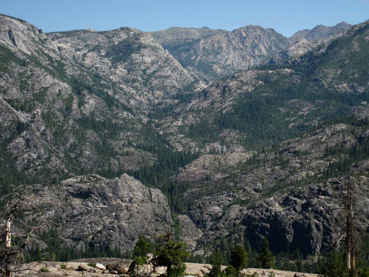
Weak Snows on the Mountains!
2018
FULL WINTER CONDITIONS
2018:
WINTER
COLD
The Fall Gear has long been stowed or complimented by the heavy Gear of Winter.
What's Going On?
See
November 28 of 2017 Report:
FULL WINTER GEAR REQUIRED
WINTER of 2018
All
High Sierra Weather Info
Latest Daily Snow Depth Summary
Daily Sierra Snowpack % of Normal pdf
Daily Snow-Water & Percent of Average
All Precipitation-Snow Data
All Snow Surveys
SWC & Snow Depth
Summer of 2018 Backpacking Plans?
Yosemite-Hoover-Desolation
&
John Muir Trail Hikers:
Time to
Order Next Year's Permits!
Reserved permits for June 2018 now available from Yosemite, Hoover, and Desolation Wilderness Areas. In other words, Yosemite, Desolation, and Hoover Wilderness Areas all offer advanced reservations about six months ahead of your desired hiking dates.
This means now is the time to get your JMT permit application, along with other popular hikes, into the Man.
Feb 18
Last year, during 2017, at this point in time I was estimating a powerful, potentially catastrophic Spring Thaw.
We had snow along the Sierra Crest through the whole Summer. Again, each year's thaw depends on the Winter snowpack against the profile of Spring temps and precip.
All Permits
Yosemite Permits Desolation Wilderness
All Snow Information
December
Road News & Status Links |
30
End of January |
31
Big High
Generating Heat
Top
2018
Snowpack:
Percent of Average for
January 31.
(Change since Jan 26.)
N Sierra: 29%
(+2%)
Cen. Sierra: 35%
(+0%)
S Sierra: 21%
(-3%)
Ca State: 30%
(+0%)
Last
Jan 26, 2018
Statewide Summary of Snow Water Content PDF
Next
February 24
Top
2017
First "REAL" Winter since the Winter of 2010-2011
Top |
1
Big High
Generating Heat
Unseasonably Warm
2018
HIGH SIERRA
--WINTER--
Temp-Snow Check
"Miderm" -long after the 17th* Snow-storm this Fall & Winter.
The last front came across on the 25th of Jan.
Let's check our reporting station snow & temp readings.
Below: Watershed Snow Water Content Charts followed by individual reporting station's Snow Depth and
24 hour high-low temps.
Last Report:
Jan 25, 2018
A NEW WATER YEAR
N Sierra Reporting Stations
On a Map
Scroll over stations for snow & temps. Click for
full report.
"+/- & =" below are changes since last reading.
Tahoe Basin
Watershed
Rubicon 7" -9
7618 feet
(16.1 H2O) +.3
53 & 37 +/+
Echo Peak 25" -10
7652 feet
(24.6 H2O) +0
53 & 37 +/+
American-Yuba Watersheds
Carson Pass 26" -7
8388 feet
(12.4" H2O) =.-
51 & 28 +/+
Carson-Walker
Watersheds
Ebbetts Pass 31 "-10
8660 feet
(18.00" H2O) +.5
54 & 33 +/+
Leavitt Lake 61 " -5
(errors)
9602 feet, East Flank
(17.8" H20) +.3
50
& 37 +/+
Marine Base
6748 feet East Flank
FULL REPORT
VIS-CHIL-WEA-MB-WIND
xx & xx:
(New readout page sucks... & Tech issues)
Mokelumne-Stanislaus Watersheds
Deadman Creek
9250 feet, West Flank
000.0 Snow (BAD?)
(18.00" H20) +0.37 (BAD?)
56
& 21 +/+
Tuolumne-Merced
Watersheds
Tuolumne Meadows
8600 feet, West Flank
18.03" Snow -5.96
55
& 15 +/+
Tioga Pass/Dana
9798 feet
25.78" Snow -5.05
--.--" H20) (ERROR?)
(Temps NONE)
Mammoth Mountain Ski
Mono Lake-Owens Basin
Gem Pass
10750 feet
SNO " Depth Suspect
(11.26" H2O) -.13 Suspect Suspect
temps suspect
Mammoth Pass
9500 feet
47.24" Snow -22.96
(14.16" H2O) +.96
57 & 30 +/+
South Lake Cabin
9580 feet, East Flank
(Snow BAD")
(16.0 H2O) = 0.0
56 & 27 +/+
Big Pine Sawmill
10200 feet, East Flank
2.5" Snow -1.8
48 & 23 +/+
Kings River
Bishop Pass
11972 feet
BAD- BAD
Charlotte Lake
10398 feet, West Flank
TEMPS ONLY
-- & -- BAD
(The coldest station)
Kern Watershed
Upr Tyndall Creek
11441 feet
21.71" Snow -1.15
53 & 29 +/+
(station
reporting again!)
All High Sierra
Reporting Stations
* We've had more than seventeen fronts come across the Sierra, and periods of spitting snow, but only seventeen fronts of any substance.
Watersheds and Selected Network of Crestline Sensors
2016
Above Average
Warmer Temps
&
Higher Humidity
Not a whole lot of strong weather, despite strong El Nino
|
2
Big High
Generating Heat
Unseasonably Warm
LAST MONTH
NEXT WEEK
Top
Top |
3
Big High
Generating Heat
Unseasonably Warm
Feb 3
Report
Winter of 2018
2018
Snowpack:
Percent of Average for
February 3.
(Change since Jan 31.)
N Sierra: 27%
(-2%)
Cen. Sierra: 30%
(-5%)
S Sierra: 25%
(+4%)
Ca State: 27%
(-3%)
Last
Jan 31, 2018
Statewide Summary of Snow Water Content PDF
2017
Snowpack:
Percent of Average for
February 3.
N Sierra: 145%
Cen. Sierra: 174%
S Sierra: 198%
Ca State: 171%
Statewide Summary of Snow Water Content PDF
Last Reading:
Jan. 20, 2017
All Snow and Rain Precipitation Forecasts,
&
Snow Depth and/or
Inches of Water
Top
LAST MONTH
NEXT WEEK
2017
Current Snowpack:
Percent of Average for
February 3.
N Sierra: 145%
Cen. Sierra: 174%
S Sierra: 198%
Ca State: 171%
Statewide Summary of Snow Water Content PDF
Last Reading:
Jan. 20, 2017
Also See
Norms, Accumulations, and Anomalies
2017
Weak Low & Front Offshore moving North under overcast with light showers.
Top |
4
Winter of 2018
Big High
Generating Heat
Heat Wave
DROUGHT CONDITIONS EMERGE IN MID-WINTER
United States Drought Monitor: West
High Sierra Weather Page
Drought & Flood
Winter Gear
I typically give a Winter Warning here, but the current HEAT WAVE makes it a bit more important...
Don't get complacent
Standard WARNING:
Be geared for
sub-freezing and sub-zero temps with wind chill
High Sierra Reporting Stations
Top
2016:
NOT TOO COLD AT ALL. |
5
Big High
Generating Heat
Heat Wave
View of Sierra on February 5 by the...
MODIS
SIERRA SATELLITE
All Sat Views
Top
2017
Cloudy & Cool.
Showers & Light Precip continues between Frontlines, PM showers.
2016
5
RECORD
AND
NEAR RECORD
HIGH TEMPS
Great
Northeast Pacific Highs deflecting weak storms OUT OF THE SW around the Sierra. |
6
Big High
Generating Heat
Heat Wave
2018
HIGH SIERRA
--WINTER--
Temp-Snow Check
"Miderm" -long after the 17th* Snow-storm this Fall & Winter.
The last front came across on the 25th of Jan.
Let's check our reporting station snow & temp readings.
Below: Watershed Snow Water Content Charts followed by individual reporting station's Snow Depth and
24 hour high-low temps.
Last Report:
Feb 1, 2018
A NEW WATER YEAR
N Sierra Reporting Stations
On a Map
Scroll over stations for snow & temps. Click for
full report.
"+/- & =" below are changes since last reading.
Tahoe Basin
Watershed
Rubicon 7" =0
7618 feet
(16.2 H2O) +.1
54 & 36 +/-
Echo Peak 21" -4
7652 feet
(24.3 H2O) -.1
54 & 35 +/-
American-Yuba Watersheds
Carson Pass 24" -2
8388 feet
(12.6" H2O) +.2
51 & 29 =/+
Carson-Walker
Watersheds
Ebbetts Pass 31" =0
8660 feet
(18.00" H2O) +.5
54 & 33 +/=
Leavitt Lake 60" -1
(errors)
9602 feet, East Flank
(17.7" H20) -.1
48
& 32 =/=
Marine Base
6748 feet East Flank
FULL REPORT
VIS-CHIL-WEA-MB-WIND
xx & xx:
(New readout page sucks... & Tech issues)
Mokelumne-Stanislaus Watersheds
Deadman Creek
9250 feet, West Flank
000.0 Snow (BAD?)
(17.64" H20) -0.36 (BAD?)
52
& 18 -/-
Tuolumne-Merced
Watersheds
Tuolumne Meadows
8600 feet, West Flank
9.61" Snow -8.42
55
& 18 =/+
Tioga Pass/Dana
9798 feet
24.48" Snow -3.3
--.--" H20) (ERROR?)
(Temps NONE)
Mammoth Mountain Ski
Mono Lake-Owens Basin
Gem Pass
10750 feet
SNO " Depth Suspect
(11.18" H2O) -.08 Suspect Suspect
temps suspect
Mammoth Pass
9500 feet
43.9" Snow -3.34
(14.16" H2O) =.00
57 & 27 =/-
South Lake Cabin
9580 feet, East Flank
(Snow BAD")
(16.0 H2O) = 0.0
56 & 24 =/-
Big Pine Sawmill
10200 feet, East Flank
0.2" Snow -2.3
47 & 21 -/-
Kings River
Bishop Pass
11972 feet
BAD- BAD
Charlotte Lake
10398 feet, West Flank
TEMPS ONLY
-- & -- BAD
(The coldest station)
Kern Watershed
Upr Tyndall Creek
11441 feet
20.88" Snow -0.83
48 & 27 -/-
(station
reporting again!)
All High Sierra
Reporting Stations
* We've had more than seventeen fronts come across the Sierra, and periods of spitting snow, but only seventeen fronts of any substance.
Watersheds and Selected Network of Crestline Sensors
2017
Steady Showers, warm
Top |
7
Big High
Generating Heat
Unseasonably Warm
All Temperatures
Graphical Interface
All Snow Data
Surface Low Pressure Tracks
Selected Resources
Radar
Visible Satellites
Water Vapor Satellites
MAPS
Sierra Forecasts
Western US Forecasts
Precip Animation & Charts
Graphical Precip Forecast
All Sierra Snow Info
Sierra Sensor Networks
Watersheds and Selected Network of Crestline Sensors
High Sierra Highways
All Weather Information
2017
Snow & Temp Report
Top |
8
Big High
Generating Heat
Unseasonably Warm
Top
2017
PM:
Big Tropical Flow out of
SW hits the Coast of Ca.
PM:
Raining across
Sierra Crest
Most stations above freezing to 40 degrees
ALL STORMS THIS SEASON HAVE COME OUT OF THE WEST & SOUTHWEST: Warm Storms...
Oroville Dam Crisis News
2017
No information about a 2017 ADZPCTKO
2017
La Nina looks ended by this date.
ADZPCTKO
"PLANNING STAGES"
2016
NONE IN 2016
TWO EVENTS
IN
2015
April 22-24
April 24-26 |
9
Big High
Generating Heat
Unseasonably Warm
All Snow Information
All High Sierra
Reporting Stations
LAST WEEK
NEXT WEEK
2017
AM:
Rain & Snow across
Sierra Crest
AM:
Most stations above freezing & below 40 degrees
Top
2016
Record Level Temps
High Heat and Humidity...
Plum and Cherry trees blossoming at Sea Level. |
10
Big High
Generating Heat
Cooler, but Warm
2018
HIGH SIERRA
--WINTER--
Temp-Snow Check
"Miderm" -long after the 17th* Snow-storm this Fall & Winter.
The last front came across on the 25th of Jan.
Let's check our reporting station snow & temp readings.
Below: Watershed Snow Water Content Charts followed by individual reporting station's Snow Depth and
24 hour high-low temps.
Last Report:
Feb 1, 2018
A NEW WATER YEAR
N Sierra Reporting Stations
On a Map
Scroll over stations for snow & temps. Click for
full report.
"+/- & =" below are changes since last reading.
Tahoe Basin
Watershed
Rubicon 5" -2
7618 feet
(16.1 H2O) -.1
52 & 38 -/+
Echo Peak 21" =0
7652 feet
(24.6 H2O) +.3
55 & 38 +/+
American-Yuba Watersheds
Carson Pass 26" +2
8388 feet
(12.4" H2O) -.2
53 & 31 +/+
Carson-Walker
Watersheds
Ebbetts Pass 30" -1
8660 feet
(17.9" H2O) -.1
56 & 35 +/+
Leavitt Lake 59" -1
(errors)
9602 feet, East Flank
(17.7" H20) =.0
51
& 36 +/+
Marine Base
6748 feet East Flank
FULL REPORT
VIS-CHIL-WEA-MB-WIND
xx & xx:
(New readout page sucks... & Tech issues)
Mokelumne-Stanislaus Watersheds
Deadman Creek
9250 feet, West Flank
000.0 Snow (BAD?)
(17.64" H20) =.0 (BAD?)
55
& 34 +/+
Tuolumne-Merced
Watersheds
Tuolumne Meadows
8600 feet, West Flank
9.61" Snow -2.42
54
& 21 -/+
Tioga Pass/Dana
9798 feet
23.06" Snow -1.42
--.--" H20) (ERROR?)
(Temps NONE)
Mammoth Mountain Ski
Mono Lake-Owens Basin
Gem Pass
10750 feet
SNO " Depth Suspect
(11.32" H2O) -.14 Suspect Suspect
temps suspect
Mammoth Pass
9500 feet
42.38" Snow -1.52
(14.16" H2O) =.00
58 & 29 +/+
South Lake Cabin
9580 feet, East Flank
(Snow BAD")
(16.0 H2O) = 0.0
58 & 32 +/+
Big Pine Sawmill
10200 feet, East Flank
2.1" Snow +1.9
48 & 29 +/+
Kings River
Bishop Pass
11972 feet
BAD- BAD
Charlotte Lake
10398 feet, West Flank
TEMPS ONLY
-- & -- BAD
(The coldest station)
Kern Watershed
Upr Tyndall Creek
11441 feet
20.52" Snow -0.36
48 & 30 =/+
(station
reporting again!)
All High Sierra
Reporting Stations
* We've had more than seventeen fronts come across the Sierra, and periods of spitting snow, but only seventeen fronts of any substance.
Watersheds and Selected Network of Crestline Sensors
All Sierra Forecast Zones
All Precip Forecasts
2017
Snow & Temp Report
2017
Clearing & Drying After nine days of various degrees of precip...
Top |
11
Winter of 2018
High Pressure Heatwave Broken-Weakened
HIGH PRESSURE ZONE MOVES NORTHWEST:
A weak Low dragging a weak Cold Front tracked Southeast around this High's Northern end, and down its Norheast flank, finally bringing cloud cover and very light precip to the Sierra with the front, and cold air coming in behind the Cold Front.
Temps down about ten degrees.
2017
Clear & Drying, High Building |
12
Offshore High
Weak Cold Front Passing
Much Cooler, light Clouds Clearing
COLD
Nights
2018
Snowpack:
Percent of Average for
February 12.
(Change since Feb 3.)
N Sierra: 17%
(-10%)
Cen. Sierra: 24%
(-7%)
S Sierra: 17%
(-10%)
Ca State: 17%
(-13%)
Last
Feb 3, 2018
Statewide Summary of Snow Water Content PDF
2018
HIGH SIERRA
--WINTER--
Temp-Snow Check
"Miderm" after-during the 18th* Front-"storm" this Fall & Winter.
The last front came across on the 11th of Feb-today.
Let's check our reporting station snow & temp readings.
Below: Watershed Snow Water Content Charts followed by individual reporting station's Snow Depth and
24 hour high-low temps.
Last Report:
Feb 10, 2018
A NEW WATER YEAR
N Sierra Reporting Stations On a Map
Scroll over stations for snow & temps. Click for
full report.
South Sierra Stations
"+/- & =" below are changes since last reading.
Tahoe Basin
Watershed
Rubicon 8" +3
7618 feet
(16.1 H2O) =.0
43 & 22 -/-
Echo Peak 22" +1
7652 feet
(24.9 H2O) +.3
43 & 21 -/-
American-Yuba Watersheds
Carson Pass 28" +2
8388 feet
(12.4" H2O) =.0
39 & 17 -/-
Carson-Walker
Watersheds
Ebbetts Pass 36" +6
8660 feet
(17.9" H2O) =.0
39 & 17 -/-
Leavitt Lake 61" +2
(errors)
9602 feet, East Flank
(17.7" H20) =.0
35
& 18 +/+
Marine Base
6748 feet East Flank
FULL REPORT
VIS-CHIL-WEA-MB-WIND
xx & xx:
(New readout page sucks... & Tech issues)
Mokelumne-Stanislaus Watersheds
Deadman Creek
9250 feet, West Flank
000.0 Snow (BAD?)
(17.52" H20) -.12 (BAD?)
39
& 13 -/-
Tuolumne-Merced
Watersheds
Tuolumne Meadows
8600 feet, West Flank
5.66" Snow -3.95
40
& 15 -/+
Tioga Pass/Dana
9798 feet
23.35" Snow +.29
--.--" H20) (ERROR?)
(Temps NONE)
Mammoth Mountain Ski
Mono Lake-Owens Basin
Gem Pass
10750 feet
SNO " Depth Suspect
(11.22" H2O) -.1 Suspect Suspect
temps suspect
Mammoth Pass
9500 feet
38.84" Snow -3.54
(14.16" H2O) =.00
41 & 16 -/-
South Lake Cabin
9580 feet, East Flank
(Snow BAD")
(16.0 H2O) = 0.0
42 & 17 -/-
Big Pine Sawmill
10200 feet, East Flank
3.8" Snow +1.7
36 & 13 -/-
Kings River
Bishop Pass
11972 feet
BAD- BAD
Charlotte Lake
10398 feet, West Flank
TEMPS ONLY
-- & -- BAD
(The coldest station)
Kern Watershed
Upr Tyndall Creek
11441 feet
19.99" Snow -0.53
18 & 8 -/-
(station
reporting again!)
All High Sierra
Reporting Stations
* We've had more than eighteen fronts come across the Sierra, and periods of spitting snow, but only seventeen fronts of any substance.
Watersheds and Selected Network of Crestline Sensors
All Sierra Forecast Zones
All Precip Forecasts
2017
High moving South and East,
Overcast & Dry
Oroville Dam Crisis News
Last Day
2016
CCC
Backcountry Trail Crew
Applications due
Top |
13
High Building Back-In
over
West Coast of USA
High moving Southeast
into blocking position
Top
2017
High Overcast, Altocumulus leading edge (?), & High Pressure Zone dropping South, Dry
Oroville Dam Crisis News
Oroville predicted to see 7.6 inches of precip next 7 days.
All Precip Forecasts, Averages, & Anomalies.
California Major Reservoir current and historical levels
2017
Plum and Cherry trees blossoming at Sea Level. |
14
Valentine's Day
Big High
--Clear Days-Cold Nights--
COLD
Nights
View of Sierra on February 14 by the...
MODIS
SIERRA SATELLITE
All Sat Views
2017
Clear and Warming.
|
15
Big High
--Clear Days-Cold Nights--
MAPS
2017
Snow & Temp Report
Top
LAST WEEK
NEXT WEEK
2017
Snow & Temp Report |
16
Big High
--Clear Days-Cold Nights--
2015 CHANGE POINT
All Snow Data
Surface Low Pressure Tracks
Selected Resources
Radar
Visible Satellites
Water Vapor Satellites
MAPS
Sierra Forecasts
Western US Forecasts
Precip Animation & Charts
Graphical Precip Forecast
All Sierra Snow Info
Sierra Sensor Networks
Watersheds and Selected Network of Crestline Sensors
High Sierra Highways
All Weather Information
2017
NOTE
2015 CHANGE POINT |
17
Yosemite Firefall
Big High Moving
Offshore
-Clear Days-Cold Nights-
POLAR VORTEX SPLITS
MAPS
Winter of 2018
Weak Cold Front Approaches
COLD
WARNING
NATIONAL HAZARD MAP
ALL HIGH SIERRA FORECASTS
2017
Constant precip from light to moderate intensity. Except SoCal & S Sierra. They got pounded.
Top
Top |
18
Big High Moving
Offshore
-Clear Days-Cold Nights-
Weak Low & Cold Front Approaches
Sat View
MAPS
COLD
WARNING
NATIONAL HAZARD MAP
ALL HIGH SIERRA FORECASTS
2017
Snow & Temp Report
2018
HIGH SIERRA
--WINTER--
Temp-Snow Check
"Miderm" after the 18th* Front-"storm" this Fall & Winter.
The last front came across on the 11th of Feb.
Let's check our reporting station snow & temp readings.
Below: Watershed Snow Water Content Charts followed by individual reporting station's Snow Depth and
24 hour high-low temps.
Last Report:
Feb 12, 2018
A NEW WATER YEAR
N Sierra Reporting Stations On a Map
Scroll over stations for snow & temps. Click for
full report.
South Sierra Stations
"+/- & =" below are changes since last reading.
Tahoe Basin
Watershed
Rubicon 6" -2
7618 feet
(16.2 H2O) +.1
50 & 33 +/+
Echo Peak 21" -1
7652 feet
(24.9 H2O) =.0
52 & 33 +/+
American-Yuba Watersheds
Carson Pass 25" -3
8388 feet
(12.8" H2O) +.4
49 & 27 +/+
Carson-Walker
Watersheds
Ebbetts Pass 31" -5
8660 feet
(18.3" H2O) +.4
50 & 32 +/+
Leavitt Lake 61" =0
(errors)
9602 feet, East Flank
(17.9" H20) +.2
45
& 32 +/+
Marine Base
6748 feet East Flank
FULL REPORT
VIS-CHIL-WEA-MB-WIND
xx & xx:
(New readout page sucks... & Tech issues)
Mokelumne-Stanislaus Watersheds
Deadman Creek
9250 feet, West Flank
000.0 Snow (BAD?)
(17.76" H20) +.24 (BAD?)
46
& 25 +/+
Tuolumne-Merced
Watersheds
Tuolumne Meadows
8600 feet, West Flank
5.19" Snow -.47
53
& 21 +/+
Tioga Pass/Dana
9798 feet
24.57" Snow +1.22
--.--" H20) (ERROR?)
(Temps NONE)
Mammoth Mountain Ski
Mono Lake-Owens Basin
Gem Pass
10750 feet
SNO " Depth Suspect
(11.73" H2O) +.51 Suspect Suspect
temps suspect
Mammoth Pass
9500 feet
39.49" Snow +0.65
(14.36" H2O) +.20
52 & 24 +/+
South Lake Cabin
9580 feet, East Flank
(Snow BAD")
(16.1 H2O) + 0.1
51 & 29 +/+
Big Pine Sawmill
10200 feet, East Flank
2.83" Snow -1.5
43 & 26 +/+
Kings River
Bishop Pass
11972 feet
BAD- BAD
Charlotte Lake
10398 feet, West Flank
TEMPS ONLY
-- & -- BAD
(The coldest station)
Kern Watershed
Upr Tyndall Creek
11441 feet
19.99" Snow +2.41
45 & 22 +/+
(station
reporting again!)
All High Sierra
Reporting Stations
* We've had more than eighteen fronts come across the Sierra, and periods of spitting snow, but only eighteen fronts of any substance.
Watersheds and Selected Network of Crestline Sensors
All Sierra Forecast Zones
All Precip Forecasts
2017
Snow & Temp Report
|
19
President's Day
Weak Front
&
Low Passed
Cloudy to Clearing
Maybe 6" on the Crest
Low Overnight Temps
Winter of 2018
COLD
WARNING
2017
Yosemite Natural Firefall
History of,...
History
Tourist Fire Version
2017
Constant precip from light to moderate intensity.
Soil Saturation and rivers and creeks at high levels.
The Spring Thaw is going to be a MESS.
Yosemite Natural Firefall
History of,...
History
Tourist Fire Version
Top |
20
Between Weak Fronts/Lows
Cloudy to Clearing
COLD
WARNING
2018
HIGH SIERRA
--WINTER--
Temp-Snow Check
Between Fronts after the 19th* weak Front-"storm" this Fall & Winter, before 19th.
The last front came across on the 19th of Feb.
Let's check our reporting station snow & temp readings.
Below: Watershed Snow Water Content Charts followed by individual reporting station's Snow Depth and
24 hour high-low temps.
Last Report:
Feb 18, 2018
A NEW WATER YEAR
N Sierra Reporting Stations On a Map
Scroll over stations for snow & temps. Click for
full report.
South Sierra Stations
"+/- & =" below are changes since last reading.
Tahoe Basin
Watershed
Rubicon 8" +2
7618 feet
(16.3 H2O) +.1
19 & 10 -/-
Echo Peak 24" +3
7652 feet
(25.5 H2O) +.6
22 & 9 -/-
American-Yuba Watersheds
Carson Pass 28" +3
8388 feet
(12.7" H2O) -.1
19 & 2 -/-
Carson-Walker
Watersheds
Ebbetts Pass 33" +3
8660 feet
(18.5" H2O) +.2
20 & 2 -/-
Leavitt Lake 64" +3
(errors)
9602 feet, East Flank
(18.5" H20) +.6
13
& -1 -/-
Marine Base
6748 feet East Flank
FULL REPORT
VIS-CHIL-WEA-MB-WIND
xx & xx:
(New readout page sucks... & Tech issues)
Mokelumne-Stanislaus Watersheds
Deadman Creek
9250 feet, West Flank
000.0 Snow (BAD?)
(17.64" H20) -.12 (BAD?)
15
& -13 -/-
Tuolumne-Merced
Watersheds
Tuolumne Meadows
8600 feet, West Flank
5.53" Snow +.34
18
& -13 -/-
Tioga Pass/Dana
9798 feet
26.38" Snow +1.81
--.--" H20) (ERROR?)
(Temps NONE)
Mammoth Mountain Ski
Mono Lake-Owens Basin
Gem Pass
10750 feet
SNO " Depth Suspect
(11.85" H2O) +.12 Suspect Suspect
temps suspect
Mammoth Pass
9500 feet
40.65" Snow +1.16
(14.36" H2O) =.00
18 & -6 -/-
South Lake Cabin
9580 feet, East Flank
(Snow BAD")
(16.1 H2O) = 0.0
26 & -6 -/-
Big Pine Sawmill
10200 feet, East Flank
1.5" Snow -1.33
18 & -11 -/-
Kings River
Bishop Pass
11972 feet
BAD- BAD
Charlotte Lake
10398 feet, West Flank
TEMPS ONLY
-- & -- BAD
(The coldest station)
Kern Watershed
Upr Tyndall Creek
11441 feet
22.82" Snow +2.83
14 & -8 -/-
(station
reporting again!)
All High Sierra
Reporting Stations
* We've had more than nineteen fronts come across the Sierra, and periods of spitting snow, but only nineteen fronts of any substance.
Watersheds and Selected Network of Crestline Sensors
All Sierra Forecast Zones
All Precip Forecasts
2017
Constant precip from light to moderate intensity, diminishing.
BACKPACKER ALERT
February 20, 2017
PCT PLANS/START TIMES GOING TO BE ADJUSTED FOR
HEAVY SNOW
&
DANGEROUS THAW CONDITIONS THIS YEAR.
|
21
Between Weak Fronts/Lows
Clearing to Cloudy
Front Arrives this Evening
Top
COLD
WARNING
2018
Yosemite Firefall
Top
2017
Steady light precip, diminishing.
News of Note
Feb 2017:
Record Precip
Record Snopack
State fully saturated
Oroville Dam Crisis |
22
Weak Front
&
Low
Passed/Passing
Little Precip last Overnight, Much Cold
Cold Snowing all day long
Winter of 2018
COLD
WARNING
Cold Snowing all day long
OUR OWN POLAR VORTEX
LAST WEEK
NEXT WEEK
2018
HIGH SIERRA
--WINTER--
Temp-Snow Check
Tail end of the 20th* weak Front-"storm" this Fall & Winter, before this.
The last fronts before this came across on the 19th of Feb.
Let's check our reporting station snow & temp readings.
Below: Watershed Snow Water Content Charts followed by individual reporting station's Snow Depth and
24 hour high-low temps.
Last Report:
Feb 20, 2018
A NEW WATER YEAR
N Sierra Reporting Stations On a Map
Scroll over stations for snow & temps. Click for
full report.
South Sierra Stations
"+/- & =" below are changes since last reading.
Tahoe Basin
Watershed
Rubicon 13" +5
7618 feet
(16.4 H2O) +.1
28 & 12 +/+
Echo Peak 36 " +12
7652 feet
(25.8 H2O) +.3
31 & 10 +/+
American-Yuba Watersheds
Carson Pass 34" +6
8388 feet
(13.1" H2O) +.4
29 & 2 +/=
Carson-Walker
Watersheds
Ebbetts Pass 42 " +9
8660 feet
(18.8" H2O) +.3
29 & 5 +/+
Leavitt Lake 72 " +8
(errors)
9602 feet, East Flank
(18.5" H20) +.=
23
& 4 +/+
Marine Base
6748 feet East Flank
FULL REPORT
VIS-CHIL-WEA-MB-WIND
xx & xx:
(New readout page sucks... & Tech issues)
Mokelumne-Stanislaus Watersheds
Deadman Creek
9250 feet, West Flank
000.0 Snow (BAD?)
(18.12" H20) +.48 (BAD?)
23
& 4 +/+
Tuolumne-Merced
Watersheds
Tuolumne Meadows
8600 feet, West Flank
8.72" Snow +3.19
24
& 0 +/+
Tioga Pass/Dana
9798 feet
32.61" Snow +6.23
--.--" H20) (ERROR?)
(Temps NONE)
Mammoth Mountain Ski
Mono Lake-Owens Basin
Gem Pass
10750 feet
SNO " Depth Suspect
(11.97" H2O) +.12 Suspect Suspect
temps suspect
Mammoth Pass
9500 feet
00.00" Snow ERROR
(14.64" H2O) +.28
21 & 8 +/+
South Lake Cabin
9580 feet, East Flank
(Snow BAD")
(16.1 H2O) = 0.0
18 & 0 -/+
Big Pine Sawmill
10200 feet, East Flank
3.1" Snow +1.6
15 & -5 -/+
Kings River
Bishop Pass
11972 feet
BAD- BAD
Charlotte Lake
10398 feet, West Flank
TEMPS ONLY
-- & -- BAD
(The coldest station)
Kern Watershed
Upr Tyndall Creek
11441 feet
24.24" Snow +1.42
12 & -1 -/+
(station
reporting again!)
All High Sierra
Reporting Stations
* We've had more than twenty fronts come across the Sierra, and periods of spitting snow, but only twenty fronts of any substance.
Watersheds and Selected Network of Crestline Sensors
All Sierra Forecast Zones
All Precip Forecasts
2017
Clearing and Cooling, High Building in Gulf Alaska.
2017
Snow & Temp Report |
23
Weak Front
&
Low
Passed/Passing
Little Precip Overnight, Much Cold
Clearing
Daytime snowing clearing
COLD
WARNING
2018
HIGH SIERRA
--WINTER--
Temp-Snow Check
Tail end of the 20th* weak Front-"storm" this Fall & Winter, before this.
The last fronts before this incident came across on the 19th of Feb.
Let's check our reporting station snow & temp readings.
Below: Watershed Snow Water Content Charts followed by individual reporting station's Snow Depth and
24 hour high-low temps.
Last Report:
Feb 22, 2018
A NEW WATER YEAR
N Sierra Reporting Stations On a Map
Scroll over stations for snow & temps. Click for
full report.
South Sierra Stations
"+/- & =" below are changes since last reading.
Tahoe Basin
Watershed
Rubicon 11" -2
7618 feet
(16.4 H2O) +.0
20 & 10 -/-
Echo Peak 33 " -3
7652 feet
(--.- H2O) +.0
19 & 9 -/-
American-Yuba Watersheds
Carson Pass 32" -2
8388 feet
(13.0" H2O) -.1
19 & 4 -/+
Carson-Walker
Watersheds
Ebbetts Pass 40 " -2
8660 feet
(19.0" H2O) +.2
17 & 6 -/+
Leavitt Lake 70 " -2
(errors)
9602 feet, East Flank
(19.0" H20) +.5
13
& 3 -/-
Marine Base
6748 feet East Flank
FULL REPORT
VIS-CHIL-WEA-MB-WIND
xx & xx:
(New readout page sucks... & Tech issues)
Mokelumne-Stanislaus Watersheds
Deadman Creek
9250 feet, West Flank
000.0 Snow (BAD?)
(18.00" H20) -.12 (BAD?)
14
& -14 -/-
Tuolumne-Merced
Watersheds
Tuolumne Meadows
8600 feet, West Flank
-.--" Snow error
26
& -3 +/-
Tioga Pass/Dana
9798 feet
30.94" Snow -1.67
--.--" H20) (ERROR?)
(Temps NONE)
Mammoth Mountain Ski
Mono Lake-Owens Basin
Gem Pass
10750 feet
SNO " Depth Suspect
(12.01" H2O) +.04 Suspect Suspect
temps suspect
Mammoth Pass
9500 feet
00.00" Snow ERROR
(14.92" H2O) +.28
17 & 4 -/-
South Lake Cabin
9580 feet, East Flank
(Snow BAD")
(16.1 H2O) = 0.0
20 & -2 +/-
Big Pine Sawmill
10200 feet, East Flank
2.5" Snow -.6
12 & -6 -/-
Kings River
Bishop Pass
11972 feet
BAD- BAD
Charlotte Lake
10398 feet, West Flank
TEMPS ONLY
-- & -- BAD
(The coldest station)
Kern Watershed
Upr Tyndall Creek
11441 feet
24.24" Snow +1.42
11 & -4 -/-
(station
reporting again!)
All High Sierra
Reporting Stations
* We've had more than twenty fronts come across the Sierra, and periods of spitting snow, but only twenty fronts of any substance.
Watersheds and Selected Network of Crestline Sensors
All Sierra Forecast Zones
All Precip Forecasts
2017
Clearing and Cool. High Building in Gulf Alaska.
This Winter is very much different from last year's Winter:
2016
Carson Pass
53 & 28 degrees 26 inches
Ebbetts Pass
54 & 33 degrees 63 inches
Sonora Pass
53 & 27 degrees 55 inches
Tuolumne Meadows
55 & 14 degrees 51 inches
NOTE
Top |
24
Clear & Cold
Afternoon Cold Clouds
COLD
WARNING
SERIOUS COLD SNAP
All Sierra Temps
All Snow Data
Surface Low Pressure Tracks
2018
Snowpack:
Percent of Average for
February 22.
(Change since Feb 12.)
N Sierra: 17%
(=)
Cen. Sierra: 23%
(-1%)
S Sierra: 19%
(+2%)
Ca State: 19%
(+2%)
Last
Feb 12, 2018
Statewide Summary of Snow Water Content PDF
Next
March 1
Selected
Weather
Resources
Radar
Visible Satellites
Water Vapor Satellites
MAPS
Sierra Forecasts
Western US Forecasts
Precip Animation & Charts
Graphical Precip Forecast
All Sierra Snow Info
Sierra Sensor Networks
Watersheds and Selected Network of Crestline Sensors
High Sierra Highways
All Weather Information
Top
2017
Clear and Cool. High Building in Gulf Alaska.
COLD WARNING |
25
Clear & Cold
WEAK FRONT APPROACHES
Afternoon Cold Clouds
&
Light Precip
COLD
WARNING
Still Cold, but not as Cold
SERIOUS COLD SNAP
2018
HIGH SIERRA
--WINTER--
Temp-Snow Check
After the 20th* weak Front-"storm" this Fall & Winter, before this.
The last fronts before this impending incident came across on the 23rd of Feb.
Let's check our reporting station snow & temp readings.
Below: Watershed Snow Water Content Charts followed by individual reporting station's Snow Depth and
24 hour high-low temps.
Last Report:
Feb 23, 2018
A NEW WATER YEAR
N Sierra Reporting Stations On a Map
Scroll over stations for snow & temps. Click for
full report.
South Sierra Stations
"+/- & =" below are changes since last reading.
Tahoe Basin
Watershed
Rubicon 9" -2
7618 feet
(16.8 H2O) +.4
26 & 17 +/+
Echo Peak 27 " -6
7652 feet
(26.6 ?H2O) +.0
26 & 15 +/+
American-Yuba Watersheds
Carson Pass 28" -4
8388 feet
(13.0" H2O) -.1
26 & 8 +/+
Carson-Walker
Watersheds
Ebbetts Pass 35 " -5
8660 feet
(19.3" H2O) +.3
26 & 12 +/+
Leavitt Lake 68 " -2
(errors)
9602 feet, East Flank
(19.3" H20) +.3
23
& 8 +/+
Marine Base
6748 feet East Flank
FULL REPORT
VIS-CHIL-WEA-MB-WIND
xx & xx:
(New readout page sucks... & Tech issues)
Mokelumne-Stanislaus Watersheds
Deadman Creek
9250 feet, West Flank
000.0 Snow (BAD?)
(18.60" ?H20) +.6 (BAD?)
40
& 5 +/+
Tuolumne-Merced
Watersheds
Tenaya Lake 19.71"
8163 feet, West Flank
(12.32") ?H20 +.0
40
& 3
Tuolumne Meadows
8600 feet, West Flank
8.53"
40
& -2 +/+
Tioga Pass/Dana
9798 feet
29.61" Snow -1.33
--.--" H20) (ERROR?)
(Temps NONE)
Mammoth Mountain Ski
Mono Lake-Owens Basin
Gem Pass
10750 feet
SNO " Depth Suspect
(11.89" H2O) -.12 Suspect Suspect
temps suspect
Mammoth Pass
9500 feet
50.23" Snow
(15.56" H2O) +.64
42 & 8 +/+
South Lake Cabin
9580 feet, East Flank
(Snow BAD")
(16.1 H2O) = 0.0
40 & 9 +/+
Big Pine Sawmill
10200 feet, East Flank
3.1" Snow +.6
37 & 19 +/+
Kings River
Bishop Pass
11972 feet
BAD- BAD
Charlotte Lake
10398 feet, West Flank
TEMPS ONLY
-- & -- BAD
(The coldest station)
Kern Watershed
Upr Tyndall Creek
11441 feet
24.24" Snow +1.42
37 & 14 +/+
(station
reporting again!)
All High Sierra
Reporting Stations
* We've had more than twenty fronts come across the Sierra, and periods of spitting snow, but only twenty fronts of any substance.
Watersheds and Selected Network of Crestline Sensors
All Sierra Forecast Zones
All Precip Forecasts
2017
Snow & Temp Report
2017
Clear and Cool. High Building in Gulf Alaska.
COLD STORM WARNING |
26
WEAK FRONT PASSING
Cold Clouds
&
Light Precip
Winter of 2018
latest Reports
COLD
WARNING
Still Cold, but not as Cold in the N Sierra, Colder in the South!
All Sierra Temps
All Snow Data
Surface Low Pressure Tracks
2018
HIGH SIERRA
--WINTER--
Temp-Snow Check
During the 21st* weak Front-"storm" this Fall & Winter.
The last fronts before this incident came across on the 23rd of Feb.
Let's check our reporting station snow & temp readings.
Below: Watershed Snow Water Content Charts followed by individual reporting station's Snow Depth and
24 hour high-low temps.
Last Report:
Feb 25, 2018
A NEW WATER YEAR
N Sierra Reporting Stations On a Map
Scroll over stations for snow & temps. Click for
full report.
South Sierra Stations
"+/- & =" below are changes since last reading.
Tahoe Basin
Watershed
Rubicon 17" +8
7618 feet
(17.1 H2O) +.3
38 & 17 +/=
Echo Peak 37 " +10
7652 feet
(26.6 ?H2O) +.0
38 & 15 +/=
American-Yuba Watersheds
Carson Pass 38" +10
8388 feet
(14.0" H2O) +1.0
36 & 11 +/+
Carson-Walker
Watersheds
Ebbetts Pass 40 " +5
8660 feet
(19.7" H2O) +.4
39 & 11 +/-
Leavitt Lake 70 " +2
(errors)
9602 feet, East Flank
(19.3" H20) +.3
34
& 9 +/+
Marine Base
6748 feet East Flank
FULL REPORT
VIS-CHIL-WEA-MB-WIND
xx & xx:
(New readout page sucks... & Tech issues)
Mokelumne-Stanislaus Watersheds
Deadman Creek
9250 feet, West Flank
000.0 Snow (BAD?)
(18.40" ?H20) -.2(BAD?)
29
& 13 -/+
Tuolumne-Merced
Watersheds
Tenaya Lake 18.96" -.75
8163 feet, West Flank
(12.32") ?H20 +.0
29
& 12 -/+
Tuolumne Meadows
8600 feet, West Flank
9.02" +.49
29
& 6 -/+
Tioga Pass/Dana
9798 feet
29.91" Snow +.3
--.--" H20) (ERROR?)
(Temps NONE)
Mammoth Mountain Ski
Mono Lake-Owens Basin
Gem Pass
10750 feet
SNO " Depth Suspect
(11.95" H2O) +.06 Suspect Suspect
temps suspect
Mammoth Pass
9500 feet
50.99" Snow +.76
(15.56" H2O) =.00
34 & 14 -/+
South Lake Cabin
9580 feet, East Flank
(Snow BAD")
(16.1 H2O) = 0.0
27 & 17 -/+
Big Pine Sawmill
10200 feet, East Flank
1.6" Snow -1.5
26 & 13 -/-
Kings River
Bishop Pass
11972 feet
BAD- BAD
Charlotte Lake
10398 feet, West Flank
TEMPS ONLY
-- & -- BAD
(The coldest station)
Kern Watershed
Upr Tyndall Creek
11441 feet
23.95" Snow -.29
27 & 11 -/-
(station
reporting again!)
All High Sierra
Reporting Stations
* We've had more than twenty-one fronts come across the Sierra, and periods of spitting snow, but only twenty fronts of any substance.
Watersheds and Selected Network of Crestline Sensors
All Sierra Forecast Zones
All Precip Forecasts
2017
Cear and Cool to Cold.
COLD STORM WARNING
We are entering a very much needed gap in the series of storms out of the Southwest that have dominated the last three month's weather. |
27
WEAK FRONT PASSING
Cold Clouds to CLEAR
with
Light Precip
Altitude Weather in Sierra
COLD
WARNING
Getting real Cold tonight
High Configuration & Performance is acting like a
CLASSIC WINTER
STORMGATE
FINALLY!
Top
2017
Clear and Cool to Cold.
Fierce T-Storm activity off NE Indonisia lofting huge plumes of Hot Tropical Moisture.
Watch the Tropical Weather
These are being deflected to S of Sierra by Big High in Gulf Alaska, moving South. |
28
BETWEEN FRONTS
Cold Clouds to CLEAR
Stronger
Cold Northern Front
Approaches
Arrived Evening-Time
COLD
WARNING
STORM WARNINGS
NATIONAL HAZARD MAP
ALL HIGH SIERRA FORECASTS
Surface Low Pressure Tracks
Winter of 2018
latest Reports
2018
HIGH SIERRA
--WINTER--
Temp-Snow Check
After the 21st* Front-"storm" this Fall & Winter.
The last fronts before this incident came across on the 26th of Feb.
Let's check our reporting station snow & temp readings.
Below: Watershed Snow Water Content Charts followed by individual reporting station's Snow Depth and
24 hour high-low temps.
Last Report:
Feb 26, 2018
A NEW WATER YEAR
N Sierra Reporting Stations On a Map
Scroll over stations for snow & temps. Click for
full report.
South Sierra Stations
"+/- & =" below are changes since last reading.
Tahoe Basin
Watershed
Rubicon 14" -3
7618 feet
(17.4 H2O) +.3
26 & 14 -/-
Echo Peak 31 " -6
7652 feet
(26.5 ?H2O) -.1
30 & 13 -/-
American-Yuba Watersheds
Carson Pass 36" -2
8388 feet
(14.2" H2O) +.2
25 & 10 -/-
Carson-Walker
Watersheds
Ebbetts Pass 47 " +7
8660 feet
(20.5" H2O) +.8
26 & 9 -/-
Leavitt Lake 72 " +2
(errors)
9602 feet, East Flank
(19.7" H20) +.4
22
& 5 -/-
Marine Base
6748 feet East Flank
FULL REPORT
VIS-CHIL-WEA-MB-WIND
xx & xx:
(New readout page sucks... & Tech issues)
Mokelumne-Stanislaus Watersheds
Deadman Creek
9250 feet, West Flank
000.0 Snow (BAD?)
(18.60" ?H20) +.2(BAD?)
36
& 1 +/-
Tuolumne-Merced
Watersheds
Tenaya Lake 16.98" -1.98
8163 feet, West Flank
(12.48") ?H20 +.16
37
& 2 +/-
Tuolumne Meadows
8600 feet, West Flank
8.65" -.37
35
& -3 +/-
Tioga Pass/Dana
9798 feet
30.52" Snow +.61
--.--" H20) (ERROR?)
(Temps NONE)
Mammoth Mountain Ski
Mono Lake-Owens Basin
Gem Pass
10750 feet
SNO " Depth Suspect
(12.08" H2O) +.13 Suspect Suspect
temps suspect
Mammoth Pass
9500 feet
54.24" Snow +3.25
(15.88" H2O) +.32
36 & 8 +/-
South Lake Cabin
9580 feet, East Flank
(Snow BAD")
(16.2 H2O) +.1
38 & 1 +/-
Big Pine Sawmill
10200 feet, East Flank
3.1" Snow +1.5
32 & -2 +/-
Kings River
Bishop Pass
11972 feet
BAD- BAD
Charlotte Lake
10398 feet, West Flank
TEMPS ONLY
-- & -- BAD
(The coldest station)
Kern Watershed
Upr Tyndall Creek
11441 feet
26.11" Snow +2.16
32 & 6 +/-
(station
reporting again!)
All High Sierra
Reporting Stations
*We've had more than twenty-one fronts come across the Sierra, and periods of spitting snow, but only twenty-one fronts of any substance.
Watersheds and Selected Network of Crestline Sensors
All Sierra Forecast Zones
All Precip Forecasts
2017
Clear and Warming
The tropical weather observed & mentioned yesterday pounded San Diego and Southern-most US...
Top |
1
March
LAST WEEK
NEXT MONTH
2018
HIGH SIERRA
--WINTER--
Temp-Snow Check
During the 22nd* Front & "storm" this Fall & Winter.
The last fronts before this incident came across last night & today.
Let's check our reporting station snow & temp readings.
Below: Watershed Snow Water Content Charts followed by individual reporting station's Snow Depth and
24 hour high-low temps.
Last Report:
Feb 28, 2018
A NEW WATER YEAR
N Sierra Reporting Stations On a Map
Scroll over stations for snow & temps. Click for
full report.
South Sierra Stations
"+/- & =" below are changes since last reading.
Tahoe Basin
Watershed
Rubicon 21" +7
7618 feet
(18.1 H2O) +.7
35 & 18 +/+
Echo Peak 39 " +8
7652 feet
(27.4 ?H2O) +.9
35 & 18 +/+
American-Yuba Watersheds
Carson Pass 47" +11
8388 feet
(15.2" H2O) +1.0
31 & 10 +/=
Carson-Walker
Watersheds
Ebbetts Pass 52 " +5
8660 feet
(21.4" H2O) +1.7
37 & 14 +/+
Leavitt Lake 82 " +10
(errors)
9602 feet, East Flank
(19.6" H20) -.1
33
& 17 +/+
Marine Base
6748 feet East Flank
FULL REPORT
VIS-CHIL-WEA-MB-WIND
xx & xx:
(New readout page sucks... & Tech issues)
Mokelumne-Stanislaus Watersheds
Deadman Creek
9250 feet, West Flank
000.0 Snow (BAD?)
(18.72" ?H20) +.12(BAD?)
36
& 18 =/+
Tuolumne-Merced
Watersheds
Tenaya Lake 34.49" +17.51
8163 feet, West Flank
(12.48") ?H20 =.0
34
& 22 -/+
Tuolumne Meadows
8600 feet, West Flank
22.28" +13.68
34 & 20 -/+
Tioga Pass/Dana
9798 feet
43.59" Snow +13.07
23.33" H20) (ERROR?)
(Temps NONE)
Mammoth Mountain Ski
Mono Lake-Owens Basin
Gem Pass
10750 feet
SNO " Depth Suspect
(12.75" H2O) +.67 Suspect Suspect
temps suspect
Mammoth Pass
9500 feet
??.??" Snow +?.00
(16.64" H2O) +.76
36 & 16 =/+
South Lake Cabin
9580 feet, East Flank
(Snow BAD")
(16.2 H2O) =.0
37 & 18 -/+
Big Pine Sawmill
10200 feet, East Flank
6.1" Snow +3.0
30 & 16 -/+
Kings River
Bishop Pass
11972 feet
BAD- BAD
Charlotte Lake
10398 feet, West Flank
TEMPS ONLY
-- & -- BAD
(The coldest station)
Kern Watershed
Upr Tyndall Creek
11441 feet
27.86" Snow +1.75
32 & 15 =/+
(station
reporting again!)
All High Sierra
Reporting Stations
*We've had more than twenty-two fronts come across the Sierra, and periods of spitting snow, but only twenty-two fronts of any substance.
Watersheds and Selected Network of Crestline Sensors
All Sierra Forecast Zones
All Precip Forecasts
|
2
Selected
Weather
Resources
Surface Low Pressure Tracks
Radar
Visible Satellites
Water Vapor Satellites
MAPS
Sierra Forecasts
Western US Forecasts
Precip Animation & Charts
Graphical Precip Forecast
All Sierra Snow Info
Sierra Sensor Networks
Watersheds and Selected Network of Crestline Sensors
High Sierra Highways
All Weather Information
Top
|
3
Backpackers
Time again to begin observing Winter transitioning into Spring
Top
LAST WEEK
NEXT MONTH
Top |