LAST MONTH
NEXT WEEK
TOP
JULY 2019
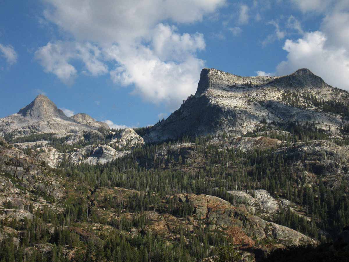
Backpackers
Shift to Summer Gear well under way. Be ready for last bursts of Spring Weather.
Ignore the Calendar.
Gear up for the Conditions on the Ground, not a Date on the Calendar.
High Sierra Backpacker Weather
ON THE TRAIL
2019 REPORTS
Chaos on the Crest
2018 REPORTS
Trails Open on the Crest
2017 REPORTS
Chaos on the Crest
2015 REPORTS
July 2015
Current chances of experiencing
SEVERE WEATHER are INCREASED.
|
1
Clear
Temperate
Rapid Thaw Underway
Rivers Fierce
HEAVY FLOWS
FORDING
HAZARDS
HAZARDS
Fording Hazard
Snow Travel Hazard
Highway 120,
Tioga Road
Fully Opening July 1, 2019
Road Information
LAST MONTH
NEXT WEEK
TOP
2019
Heavy Spring Snowpack Persisting into Summer
2018
Snowpack
(June 14-snow about gone)
2017
Snowpack
(extensive at this time)
2015
Snowpack
(nothing at this time)
2017
WARNINGS
through
Fourth of July:
Fording Hazard
Snow travel Hazard
Top |
2
Clear
Temperate
Rapid Thaw Underway
Rivers Fierce
HEAVY FLOWS
FORDING
HAZARDS
HAZARDS
Fording Hazard
Snow Travel Hazard
2019
Current Snowpack:
Percent of Average for
July 2.
N Sierra: 108%
+28% in 5 days
Cen. Sierra: 73%
−18% in 5 days
S Sierra: 27%
−32% in 5 days
Ca State: 71%
−9% in 5 days
Last Reading
June 27
Next Reading
July 8
Statewide Summary of Snow Water Content PDF
2019
JULY 2
HIGH SIERRA
SECOND
--Summer--
Temp-Snow Check
Last Report:
June 23, 2019
Next Report:
July 7, 2019
Let's check our reporting station snow & temp readings after the last 9 days of warm weather bringing heavy thaw and runoff through the Sierra.
Click the stations below for their latest reports.
Below: Watershed Snow Water Content Charts followed by individual reporting station's Snow Depth and
24 hour high-low temps, noting the change in snow depths and temps since our last readings.
A NEW WATER YEAR:
LAST YEAR
Total Precipitation
58 % of Average
A NEW WATER YEAR: Reservoirs
The Thaw: It's Coming
N Sierra Reporting Stations On a Map
Scroll over stations for snow & temps. Click for
full report.
South Sierra Stations
"+/- & ="
below are changes since last reading.
Tahoe Basin
Watershed
Southwest Tahoe
Trail Map with Stations
PCT-TYT-TRT
Rubicon
0.00"=
7618 feet
Trail Map
(49.00 H2O) + 0.1
64 & 45 −/−
PCT-TYT-TRT
Echo Peak
0.0" =
7652 feet
Stations Map
(68.40 H2O) =0.0
61 & 47 −/+
American-Yuba Watersheds
PCT-TYT
Carson Pass
0.0"
8388 feet
Trail Map
Stations Map
(49.90" H2O) =0.0
60 & 40 −/+
Carson-Walker
Watersheds
PCT-TYT
Ebbetts Pass
0" =
8660 feet
Trail Map
(66.30 H2O) = 0.0
58 & 44 −/+
West of PCT
Highlands Meadow
0.29" +.29
8360 feet
Trail Map
(49.78) + 0.03
58 & 38 −/+
EAST FLANK
Leavitt Lake
76" −22
9602 feet, East Flank
Trail Map
(67.80 H20) − 0.2
55
& 45 −/+
EAST FLANK
Marine Base
Cold Weather Training
6748 feet East Flank
Trail Map Above
FULL REPORT
VIS-CHIL-WEA-MB-
WIND
95 &40 +/+
Mokelumne-Stanislaus Watersheds
PCT-TYT
Sonora Pass
Kennedy Meadows
RESUPPLY
Deadman Creek
0.64" +0.32
9250 feet,West Flank,
Trail Map
(32.76" H20) −0.27"
58 & 33 =/+
Tuolumne-Merced
Watersheds
SW of TYT
Horse Meadow
ERROR" − ??
8602 feet
Trail Map
(No H2O)
57 & 31 −/=
Tenaya Lake
0.06" -0.06
8163 feet, West Flank
Trail Map
(23.19") H20 =0.00"
65
& 34 =/−
JMT-PCT-TYT
Tuolumne Meadows
3.21" +2.57"
8600 feet, West Flank
Trail Map
(9.34") H20 =0.00"
66
& 30 +/−
Tioga Pass/Dana
180.3" +0.8 ??
9798 feet
Trail Map
15.90 H20 =0.00
59
& 33 +/+
Mammoth Mountain
Mono Lake-Owens Basin
East of PCT-JMT
Above Gem Lake
Gem Pass
143.60" −2.8 ???
10750 feet
Trail Map
(00.00 H2O) −00.00 ??
temps bad
JMT-PCT Junction
Devils Postpile
2.26" -0.11
8004 feet
Trail Map Above
(0.0) =
67 & 32 +/−
NE of JMT-PCT
Mammoth Pass
22.71" Sno −23.59
9500 feet
Trail Map
59.32" H2O =0.00
61 & 38 +/+
JMT-PCT
E of Bear Ridge
Volcanic Knob
1.10" −6.6"
10100 feet
Trail Map
(0.00)
59
& 32 −/+
East Flank
South Lake Cabin
(Snow removed ")
9580 feet, East Flank
Trail Map
(27.20 H2O) =0.00
67 & 43 +/+
East Flank
Big Pine Sawmill
2.0" Snow +2.0
10200 feet, East Flank
Trail Map Above
61 & 38 +/+
Kings River
Just East JMT-PCT
Bishop Pass
--.--
11972 feet
Trail Map Above
BAD- BAD
Just West JMT-PCT
Charlotte Lake
0.00" Snow −.41
10398 feet, West Flank
Trail Map
60.39 H2O -0.13
58 & 34 +/+
(Typically the coldest station)
Kern Watershed
JMT-PCT
Upr Tyndall Creek
23.33" −18.83"
11441 feet
Trail Map
(x.xx" H2O +x.xx")
63 & 44 +/+
JMT
Crabtree Meadow
0.00" Snow =0.00"
10,700 feet
Trail Map
(25.36 H2O) −0.25
65
& 38 +/+
All High Sierra
Reporting Stations
More Stations, by Watersheds
|
3
Clear
Temperate
Rapid Thaw Underway
"Temperate"
Not too Hot,
Not too Cold!
Rivers Fierce
HEAVY FLOWS
FORDING
HAZARDS
HAZARDS
Fording Hazard
Snow Travel Hazard
SPRING THAW
RIVER INFORMATION
RESERVOIRS
Watersheds and Selected Network of Crestline Sensors
LAST MONTH
NEXT WEEK
TOP
|
4
Clear
Temperate-Warming
Rapid Thaw Underway
Minaret Summit Road
OPENS TODAY
Rivers Fierce
HEAVY FLOWS
FORDING
HAZARDS
HAZARDS
Fording Hazard
Snow Travel Hazard
|
5
Clear
Temperate-Warming
Rapid Thaw Underway
Modis Satellite
Views
Compare
2015, 17, 18, & 19
Current Sat Views
Rivers Fierce
HEAVY FLOWS
FORDING
HAZARDS
HAZARDS
Fording Hazard
Snow Travel Hazard
LAST MONTH
NEXT WEEK
TOP
2017
Snowpack & Temps
|
6
Clear
Warm
Afternoon Cloudy
Rivers Fierce
HEAVY FLOWS
FORDING
HAZARDS
HAZARDS
Fording Hazard
Snow Travel Hazard
BEST
FORECASTS
Precipitation
General
Quantitative Precipitation Forecasts:
ALL
RAIN FORECASTS
&
MODELS
Direct to
Seven Day Precip
Animation
Precipitation
Geographic
All High Sierra
ZONE & POINT
FORECASTS
All High Sierra
ZONE
FORECASTS
Now
RADAR
Direct
to
GRAPHICAL INTERFACE
Forecast
Winds? Weather?
NorCal Graphics
Region, SW US
Forecast
Temperatures
Model
Five Day Mean
Low Temps
Click Green "Latest" Model,
observe using step button
All Temps
Let's look at the
Big Picture
Surface Map
The Pacific Ocean
US Weather Map
All Maps
2018
HEATWAVE WEATHER HAZARD WARNINGS
Looks Hot for the Next Five Days...
T-Storms
Wednesday
TRANSPO
Most 2017
Trans-Sierra Highways & Road NEWS
Very Late Openings
High Points:
June 21
Bishop Creek Shuttle runs
June 21
Lakes Basin Road open, Mammoth
June 28
Road to Spicer Open
Reds Road Closed
June 29
Tioga Pass Opens
June 30
Ebbetts Pass Opens
High Sierra Transportation Resources
LAST MONTH
NEXT WEEK
TOP
LAST MONTH
NEXT WEEK
TOP |
7
Clear
Warm-Cloudy
Rivers Fierce
HEAVY FLOWS
FORDING
HAZARDS
HAZARDS
Fording Hazard
Snow Travel Hazard
2019
JULY 7
HIGH SIERRA
THIRD
--Summer--
Temp-Snow Check
Last Report:
July 2, 2019
Next Report:
July ?, 2019
Let's check our reporting station snow & temp readings after the last 5 days of warm weather bringing heavy thaw and runoff through the Sierra.
Click the stations below for their latest reports.
Below: Watershed Snow Water Content Charts followed by individual reporting station's Snow Depth and
24 hour high-low temps, noting the change in snow depths and temps since our last readings.
A NEW WATER YEAR:
LAST YEAR
Total Precipitation
58 % of Average
A NEW WATER YEAR: Reservoirs
The Thaw: It's Coming
N Sierra Reporting Stations On a Map
Scroll over stations for snow & temps. Click for
full report.
South Sierra Stations
"+/- & ="
below are changes since last reading.
Tahoe Basin
Watershed
Southwest Tahoe
Trail Map with Stations
PCT-TYT-TRT
Rubicon
0.00"=
7618 feet
Trail Map
(49.10 H2O) + 0.1
62 & 52 −/+
PCT-TYT-TRT
Echo Peak
0.0" =
7652 feet
Stations Map
(68.50 H2O) +0.1
66 & 50 +/+
American-Yuba Watersheds
PCT-TYT
Carson Pass
0.0"
8388 feet
Trail Map
Stations Map
(49.90" H2O) =0.0
58 & 42 −/+
Carson-Walker
Watersheds
PCT-TYT
Ebbetts Pass
0" =
8660 feet
Trail Map
(66.20 H2O) −0.1
58 & 44 =/=
West of PCT
Highlands Meadow
0.44" +.15
8360 feet
Trail Map
(49.75) −0.03
59 & 38 +/=
EAST FLANK
Leavitt Lake
61" −15
9602 feet, East Flank
Trail Map
(67.80 H20) = 0.0
55
& 46 =/+
EAST FLANK
Marine Base
Cold Weather Training
6748 feet East Flank
Trail Map Above
FULL REPORT
VIS-CHIL-WEA-MB-
WIND
93 & 43 −/+
Mokelumne-Stanislaus Watersheds
PCT-TYT
Sonora Pass
Kennedy Meadows
RESUPPLY
Deadman Creek
0.72" +0.08
9250 feet,West Flank,
Trail Map
(32.87" H20) +0.11"
58 & 34 =/=
Tuolumne-Merced
Watersheds
SW of TYT
Horse Meadow
ERROR" − ??
8602 feet
Trail Map
(No H2O)
57 & 33 =/+
Tenaya Lake
0.07" +0.01
8163 feet, West Flank
Trail Map
(23.19") H20 =0.00"
64
& 36 −/+
JMT-PCT-TYT
Tuolumne Meadows
2.61" −0.6"
8600 feet, West Flank
Trail Map
(9.34") H20 =0.00"
62
& 33 −/+
Tioga Pass/Dana
180.7" +0.4 ??
9798 feet
Trail Map
15.90 H20 =0.00
55
& 33 −/=
Mammoth Mountain
Mono Lake-Owens Basin
East of PCT-JMT
Above Gem Lake
Gem Pass
15X.XX" −2.8 ERROR
10750 feet
Trail Map
(00.00 H2O) −00.00 ??
temps bad
JMT-PCT Junction
Devils Postpile
2.39" +0.13
8004 feet
Trail Map Above
(0.0) =
64 & 36 −/+
NE of JMT-PCT
Mammoth Pass
7.69" Sno −15.02
9500 feet
Trail Map
59.32" H2O =0.00
59 & 40 −/+
JMT-PCT
E of Bear Ridge
Volcanic Knob
1.0" −0.1"
10100 feet
Trail Map
(0.00)
57
& 34 −/+
East Flank
South Lake Cabin
(Snow removed ")
9580 feet, East Flank
Trail Map
(27.20 H2O) =0.00
63 & 45 −/+
East Flank
Big Pine Sawmill
2.3" Snow +0.3
10200 feet, East Flank
Trail Map Above
57 & 38 −/=
Kings River
Just East JMT-PCT
Bishop Pass
--.--
11972 feet
Trail Map Above
BAD- BAD
Just West JMT-PCT
Charlotte Lake
0.00" Snow −.41
10398 feet, West Flank
Trail Map
60.35 H2O −0.04
56 & 36 −/+
(Typically the coldest station)
Kern Watershed
JMT-PCT
Upr Tyndall Creek
14.44" −8.89"
11441 feet
Trail Map
(x.xx" H2O +x.xx")
60 & 42 −/−
JMT
Crabtree Meadow
0.00" Snow =0.00"
10,700 feet
Trail Map
(25.36 H2O) = 0.0
61
& 36 −/−
All High Sierra
Reporting Stations
More Stations, by Watersheds
|
8
Clear
Warm-Cooler
Rivers Fierce
HEAVY FLOWS
FORDING
HAZARDS
HAZARDS
Fording Hazard
Snow Travel Hazard
2019
Current Snowpack:
Percent of Average for
July 8.
N Sierra: 176%
+68% in 6 days
Cen. Sierra: 0%
−73% in 6 days
S Sierra: 0%
−27% in 6 days
Ca State: 33%
−38% in 6 days
Last Reading
July 2
Next Reading
July ?
Statewide Summary of Snow Water Content PDF
Still
LOTS of SNOW
at
High Elevations and Protected NE Facing Aspects, See:
Modis Satellite
Views
Compare
2015, 17, 18, & 19
Current Sat Views
2018
GEORGES FIRE Whitney Portal
Top
|
9
THE
CURRENT SNOWPACK
Current Conditions
All Snow Information
GRAPHICS
Date-Adjustable Multi-Aspect
High Sierra
Snowpack Status
THE 7th
NOAA-NOHRSC
SNOWPACK
The High Sierra
7-7-19
OBSERVATIONS
All
High Sierra
Reporting Stations
Temp & Snow Tables
by Watershed and Highway Corridor
LAST WEEK
NEXT WEEK
Top
|
10
Clear
Warming
Rivers Fierce
HEAVY FLOWS
FORDING
HAZARDS
HAZARDS
Fording Hazard
Snow Travel Hazard
LAST WEEK
NEXT WEEK
Top
2017
Snowpack & Temps |
11
Clear
Warm to Hot
Rivers Fierce
HEAVY FLOWS
FORDING
HAZARDS
HAZARDS
Fording Hazard
Snow Travel Hazard
BEST
FORECASTS
Precipitation
General
Quantitative Precipitation Forecasts:
ALL
RAIN FORECASTS
&
MODELS
Direct to
Seven Day Precip
Animation
Precipitation
Geographic
All High Sierra
ZONE & POINT
FORECASTS
All High Sierra
ZONE
FORECASTS
Now
RADAR
Direct
to
GRAPHICAL INTERFACE
Forecast
Winds? Weather?
NorCal Graphics
Region, SW US
Forecast
Temperatures
Model
Five Day Mean
Low Temps
Click Green "Latest" Model,
observe using step button
All Temps
Let's look at the
Big Picture
Surface Map
The Pacific Ocean
US Weather Map
All Maps
|
12
Clear
Hot
Rivers Fierce
HEAVY FLOWS
FORDING
HAZARDS
HAZARDS
Fording Hazard
Snow Travel Hazard
MOSQUITOES
Mosquitoes rise when the snows melt.
Mosquitoes are typically THICK right now.
A dry year? Then less skeeters. A wet year? Then more.
2015 was a good model for dry years, being the driest on record.
2017 provides a good model for wet years, as it recorded the most snow ever measured.
2015 Calendar
2017 Calendar
2018
has come in at roughly 50% of a "normal" Winter's average snowpack, putting us smack-dab in the middle, between the extremes of
2015 & 2017
|
13
Still
LOTS of SNOW
at
High Elevations and Protected NE Facing Aspects
LAST WEEK
NEXT WEEK
Top
SPRING THAW
RIVER INFORMATION
RESERVOIRS
Watersheds and Selected Network of Crestline Sensors
LAST WEEK
NEXT WEEK
Top
LAST WEEK
NEXT WEEK
Top
LAST WEEK
NEXT WEEK
Top
|
14
Clear
HOT
Rivers Moderating
MODERATE FLOWS
Nonetheless...
FORDING
HAZARDS
continue
HAZARDS
Fording Hazard
Diminishing Soon
Snow Travel Hazard
Snow Breaking Down
2019
JULY 14
HIGH SIERRA
FOURTH
--Summer--
Temp-Snow Check
Last Report:
July 7, 2019
Next Report:
Aug 16, 2019
Let's check our reporting station snow & temp readings after the last 7 days of warm weather bringing heavy thaw and runoff through the Sierra.
Click the stations below for their latest reports.
Below: Watershed Snow Water Content Charts followed by individual reporting station's Snow Depth and
24 hour high-low temps, noting the change in snow depths and temps since our last readings.
A NEW WATER YEAR:
LAST YEAR
Total Precipitation
58 % of Average
A NEW WATER YEAR: Reservoirs
The Thaw: It's Coming
N Sierra Reporting Stations On a Map
Scroll over stations for snow & temps. Click for
full report.
South Sierra Stations
"+/- & ="
below are changes since last reading.
Tahoe Basin
Watershed
Southwest Tahoe
Trail Map with Stations
PCT-TYT-TRT
Rubicon
0.00"=
7618 feet
Trail Map
(48.90 H2O) −0.2
70 & 55 +/+
PCT-TYT-TRT
Echo Peak
0.0" =
7652 feet
Stations Map
(68.40 H2O) −0.1
69 & 58 +/+
American-Yuba Watersheds
PCT-TYT
Carson Pass
0.0"
8388 feet
Trail Map
Stations Map
(49.70" H2O) −0.2
68 & 51 +/+
Carson-Walker
Watersheds
PCT-TYT
Ebbetts Pass
0" =
8660 feet
Trail Map
(66.30 H2O) + 0.1
67 &54 +/+
West of PCT
Highlands Meadow
0.02" −.42
8360 feet
Trail Map
(50.08) + 0.33
54 & 43 +/+
EAST FLANK
Leavitt Lake
39" −22
9602 feet, East Flank
Trail Map
(68.00 H20) + 0.2
64
& 53 +/+
EAST FLANK
Marine Base
Cold Weather Training
6748 feet East Flank
Trail Map Above
FULL REPORT
VIS-CHIL-WEA-MB-
WIND
99 & 45 +/+
Mokelumne-Stanislaus Watersheds
PCT-TYT
Sonora Pass
Kennedy Meadows
RESUPPLY
Deadman Creek
0.39" +0.33
9250 feet,West Flank,
Trail Map
(33.25" H20) +0.38"
64 & 52 +/+
Tuolumne-Merced
Watersheds
SW of TYT
Horse Meadow
ERROR" − ??
8602 feet
Trail Map
(No H2O)
63 & 39 +/+
Tenaya Lake
0.01" −0.06
8163 feet, West Flank
Trail Map
(23.19") H20 =0.00"
69
& 41 +/+
JMT-PCT-TYT
Tuolumne Meadows
2.59" −0.03"
8600 feet, West Flank
Trail Map
(9.34") H20 =0.00"
69
& 36 +/+
Tioga Pass/Dana
ERROR" 0.0 ??
9798 feet
Trail Map
15.90 H20 =0.00
63
& 40 +/+
Mammoth Mountain
Mono Lake-Owens Basin
East of PCT-JMT
Above Gem Lake
Gem Pass
15X.XX" −0.0 ERROR
10750 feet
Trail Map
(00.00 H2O) −00.00 ??
temps bad
JMT-PCT Junction
Devils Postpile
2.39" −1.2
8004 feet
Trail Map Above
(0.0) =
72 & 38 +/+
NE of JMT-PCT
Mammoth Pass
0.00" Sno −7.69
9500 feet
Trail Map
59.32" H2O =0.00
68 & 48 +/+
JMT-PCT
E of Bear Ridge
Volcanic Knob
1.3" +0.3"
10100 feet
Trail Map
(0.00)
63
& 39 +/+
East Flank
South Lake Cabin
(Snow removed ")
9580 feet, East Flank
Trail Map
(27.20 H2O) =0.00
69 &50 +/+
East Flank
Big Pine Sawmill
0.1" Snow −1.2
10200 feet, East Flank
Trail Map Above
64 & 45 +/+
Kings River
Just East JMT-PCT
Bishop Pass
--.--
11972 feet
Trail Map Above
BAD- BAD
Just West JMT-PCT
Charlotte Lake
0.00" Snow =.00
10398 feet, West Flank
Trail Map
60.77 H2O +0.42
64 & 40 +/+
(Typically the coldest station)
Kern Watershed
JMT-PCT
Upr Tyndall Creek
2.43" −12.01"
11441 feet
Trail Map
(x.xx" H2O +x.xx")
64 & 45 +/+
JMT
Crabtree Meadow
0.00" Snow =0.00"
10,700 feet
Trail Map
(25.36 H2O) + 0.37
64
& 40 +/+
All High Sierra
Reporting Stations
More Stations, by Watersheds
2017
Heat Advisories.
Warm to Hot.
2016
Beautiful weather in the Sierra. Warm to Hot.
2015 REPORTS:
Remnants of Baja Ca Hurricane drawn North into LA, South Deserts, and bringing more tropical storms to Sierra Nevada:
LA Floods
Hwy 10 Closed by Flash Flood
|
15
LAST WEEK
NEXT WEEK
Top
THE
CURRENT SNOWPACK
Current Conditions
All Snow Information
GRAPHICS
Date-Adjustable Multi-Aspect
High Sierra
Snowpack Status
THE 14th
NOAA-NOHRSC
SNOWPACK
The High Sierra
7-14-19
OBSERVATIONS
All
High Sierra
Reporting Stations
Temp & Snow Tables
by Watershed and Highway Corridor |
16
Modis Satellite
Views
Compare
2015, 17, 18, & 19
Current Sat Views
2018
FERGUSON FIRE
Yosemite Foothills
HEAT ADVISORY
Valley-Foothills-Mountains
continuing
Warm to Hot
2016
Hot and Clear
2015 REPORTS:
It has been a "Tropical Summer," so far. This trend began in mid-May. |
17
SPRING THAW
RIVER INFORMATION
RESERVOIRS
Watersheds and Selected Network of Crestline Sensors
2017
Snowpack & Temps
2017
Heavy snow at high altitudes preserves the:
SNOW TRAVEL HAZARD,
but now mostly limited to higher up the flanks & crest.
Still lots of snow on parts of Sierra Crest, less on others.
|
18
BEST
FORECASTS
Precipitation
General
Quantitative Precipitation Forecasts:
ALL
RAIN FORECASTS
&
MODELS
Direct to
Seven Day Precip
Animation
Precipitation
Geographic
All High Sierra
ZONE & POINT
FORECASTS
All High Sierra
ZONE
FORECASTS
Now
RADAR
Direct
to
GRAPHICAL INTERFACE
Forecast
Winds? Weather?
NorCal Graphics
Region, SW US
Forecast
Temperatures
Model
Five Day Mean
Low Temps
Click Green "Latest" Model,
observe using step button
All Temps
Let's look at the
Big Picture
Surface Map
The Pacific Ocean
US Weather Map
All Maps
|
19
Clear
HOT
2017
FULL SMOKE-FIRE ALERT
Detwiler Fire
Smoke inundates Tahoe-Carson-Reno areas, (alert)
All backpackers and visitors to the Sierra should check smoke and fire conditions. Smoke can be a real problem, even with no fire in near proximity.
Fire & Smoke
CalFire
Inciweb Fed
Smoke
All Recent Trail News |
20
Clear
HOT
51 degrees at 8AM at
8000 feet
of Elevation
LAST WEEK
NEXT WEEK
Top
LAST WEEK
NEXT WEEK
Top
LAST WEEK
NEXT WEEK
Top |
21
Clear
HOT
51 degrees at 8AM at
8000 feet
of Elevation
|
22
LAST WEEK
NEXT WEEK
Top
|
23
THE
CURRENT SNOWPACK
Current Conditions
All Snow Information
GRAPHICS
Date-Adjustable Multi-Aspect
High Sierra
Snowpack Status
THE 23rd
NOAA-NOHRSC
SNOWPACK
The High Sierra
7-23-19
OBSERVATIONS
All
High Sierra
Reporting Stations
Temp & Snow Tables
by Watershed and Highway Corridor
|
24
Scouting Trip
to
Sierra Nevada
16th to 22nd
Carson Pass
Ebbetts Pass
Lake Alpine
Not Cold!!
PCT hikers at both Passes report thinning snow across Southern Sierra High passes, (virtually none on North Sierra North of Leavitt Peak), diminishishing rivers & streams, and heavy mosquitoes.
Extensive Snow remaining on NE facing aspects.
Major Rivers are flowing deeply, but slowly.
FIRE NOTE
Ground still Moist
up
High in the Sierra
2018
FIRE-SMOKE-HEAT
-WARNINGS-
Until Further Notice
Yosemite Valley & Wawona to be Closed
to Public
from 25th to 29th
FERGUSON FIRE
Yosemite Foothills
2017
Snowpack & Temps
|
25
Clear
HOT
Rivers Moderating
MODERATE FLOWS
Nonetheless...
FORDING
HAZARDS
continue
HAZARDS
Fording Hazard
Diminishing Soon
Snow Travel Hazard
Snow Breaking Down
2018
Yosemite Valley
Closed |
26
Clear
HEATING FURTHER
T-STORM WARNING
Eastern Sierra
Ending with Day
Valley Heat Adv
(Drives T-Storms)
Sat-Sun
Lightening
Forecasts
&
Safety
Information
LAST WEEK
NEXT WEEK
Top
SPRING THAW
RIVER INFORMATION
RESERVOIRS
Watersheds and Selected Network of Crestline Sensors |
27
Clear
HOTTER
A Brief Heatwave
BEST
FORECASTS
Precipitation
General
Quantitative Precipitation Forecasts:
ALL
RAIN FORECASTS
&
MODELS
Direct to
Seven Day Precip
Animation
Precipitation
Geographic
All High Sierra
ZONE & POINT
FORECASTS
All High Sierra
ZONE
FORECASTS
Now
RADAR
Direct
to
GRAPHICAL INTERFACE
Forecast
Winds? Weather?
NorCal Graphics
Region, SW US
Forecast
Temperatures
Model
Five Day Mean
Low Temps
Click Green "Latest" Model,
observe using step button
All Temps
Let's look at the
Big Picture
Surface Map
The Pacific Ocean
US Weather Map
All Maps
2018
Yosemite Delays opening Valley for five days, until August 3
Fire Information
2017
"The New Normal"
The Drought Never Ended |
28
2018
CARR & CRANSTON FIRES,
Socal
2017
Detwiler Fire being brought under control, Tahoe Basin Fire Resrtictions. |
29
SPRING THAW
RIVER INFORMATION
RESERVOIRS
Watersheds and Selected Network of Crestline Sensors
|
30
LAST WEEK
NEXT MONTH
Top
BEST
FORECASTS
Precipitation
General
Quantitative Precipitation Forecasts:
ALL
RAIN FORECASTS
&
MODELS
Direct to
Seven Day Precip
Animation
Precipitation
Geographic
All High Sierra
ZONE & POINT
FORECASTS
All High Sierra
ZONE
FORECASTS
Now
RADAR
Direct
to
GRAPHICAL INTERFACE
Forecast
Winds? Weather?
NorCal Graphics
Region, SW US
Forecast
Temperatures
Model
Five Day Mean
Low Temps
Click Green "Latest" Model,
observe using step button
All Temps
Let's look at the
Big Picture
Surface Map
The Pacific Ocean
US Weather Map
All Maps
|
31
2018
Valley Opening Delayed to 8-5
ROAD NEWS
June Lake Loop Closed
2017
Snowpack & Temps
2017
Safety News
Fording Fatality on PCT.
Detwiler Fire 90% contained.
Trail News
July 31, 2017
2017
Heavy snow at high altitudes preserves the:
SNOW TRAVEL HAZARD,
but now mostly limited to higher up the flanks & crest.
Still lots of snow on parts of Sierra Crest, less on others.
High Altitude Trips are STILL SNOW TRIPS
Date-Adjustable High Sierra Snowpack Status
Amazing Sat Views
Continuing high runoff flows maintain the
FORDING HAZARD.
HOT TEMPS PERSIST,
and must be monitored.
FIRE & SMOKE
hazards are present & increasing.
MOSQUITOES are a THREAT.
Water & Snow Hazards are gradually narrowing as this unique season progresses, while Heat, Fire, and Skeeter threats are rapidly rising.
|
1August
THE
CURRENT SNOWPACK
Current Conditions
All Snow Information
GRAPHICS
Date-Adjustable Multi-Aspect
High Sierra
Snowpack Status
THE 23rd
NOAA-NOHRSC
SNOWPACK
The High Sierra
7-23-19
OBSERVATIONS
All
High Sierra
Reporting Stations
Temp & Snow Tables
by Watershed and Highway Corridor |
2 August
LAST WEEK
NEXT MONTH
Top |
3 August
LAST WEEK
NEXT MONTH
Top
LAST WEEK
NEXT MONTH
Top |