|
September 2018
Top of Page
| Sunday |
Monday |
Tuesday |
Wednesday |
Thursday |
Friday |
Saturday |
September 2018
FIRE DANGERS
Cooling into early September helping contain the brutal fires of July & August...so far...
2017 HISTORY
Heatwaves, Fire, & Smoke
In 2016 we dodged a bullet, a bullet of fire...
2015 HISTORY
EL NINO BOILING THE CENTRAL NORTH PACIFIC
FIRES BURNING ACROSS CALIFORNIA.
For backpackers these conditions require awareness of potential Fire and Tropical Downpours.
Fire and Smoke Information
El Nino Report
More
High Sierra
Backpacker
Information
Guide Trailhead
Guide Index
High Sierra Magazine
Blog-Forums
|
28
Fire-&-Smoke
Warnings Continue
|
29
Fire-&-Smoke
Warnings Continue
LAST MONTH
NEXT WEEK |
30
COOL-
Fires coming under Containment,
Smoke Diminishing
Donnell Fire
Trails South of 108 Corridor Opened
Kennedy Meadows Pack Station in full Operations
ALL
SMOKE RESOURCES
CURRENT FIRES
TOP |
31
Fire-&-Smoke
Warnings Continue
More
High Sierra
Backpacker
Information
Guide Trailhead
Guide Index
High Sierra Magazine
Blog-Forums
2017
Major Heatwave, Fires, and Smoke covering Western US
2017 Calendar |
1
Trail Status
PCT STILL CLOSED
between Sonora and Ebbetts Passes, across the
Carson Iceberg Wilderness
CARSON ICEBERG WILDERNESS CLOSED
DONNELL FIRE
85% containment
LAST MONTH
NEXT WEEK
|
| Sunday |
Monday |
Tuesday |
Wednesday |
Thursday |
Friday |
Saturday |
| 2
Fire-&-Smoke
Warnings Continue
DONNELL FIRE
approaching containment
Status
PCT STILL CLOSED
between Sonora and Ebbetts Passes, across the
Carson Iceberg Wilderness
CARSON ICEBERG WILDERNESS CLOSED
Weather Page
2017
RECORD-SETTING DANGEROUS HEAT
|
3
LABOR DAY
2017
Major Heatwave, Fires, and Smoke covering Western US
2017 Calendar
|
4
Fire-&-Smoke
Warnings Continue
Boot Fire, Hwys 108-395
TOP |
5 Cooler than Average
Trail Status
DONNELL FIRE
PCT STILL CLOSED
between Sonora and Ebbetts Passes, across the
Carson Iceberg Wilderness
|
6
Fires coming under control, smoke diminishing...
LAST WEEK
NEXT WEEK
|
7
|
8
PCT OPENS
DONNELL FIRE
PCT between Sonora and Ebbetts Passes finally Opens,and...
Carson Iceberg Opening Up Gradually...
|
| Sunday |
Monday |
Tuesday |
Wednesday |
Thursday |
Friday |
Saturday |
9
|
10
DONNELL FIRE
Carson Iceberg Wilderness
OPENS |
11
|
12
Cooler than Average
TOP |
13
Cooler than Average
LAST WEEK
NEXT WEEK
|
14
|
15
|
| Sunday |
Monday |
Tuesday |
Wednesday |
Thursday |
Friday |
Saturday |
16
Cooler than Average
DONNELL FIRE
Last Entry
EXCELLENT HIGH SIERRA BACKPACKING CONDITIONS
Fires Suppressed, Smoke Light or Cleared, Mosquitoes Diminished, Temps looking very comfortable-cool.
|
17
|
18
|
19
|
20
TOP |
21
LAST WEEK
NEXT WEEK
|
22
FALL SOLSTICE
|
| Sunday |
Monday |
Tuesday |
Wednesday |
Thursday |
Friday |
Saturday |
23
Temps running cool |
24
|
25
TOP |
26
|
27
Happy Boo Day!
LAST WEEK
NEXT WEEK
2017
HOT
Days
COLD
Nights |
28
|
29
Temps running cool |
| Sunday |
Monday |
Tuesday |
Wednesday |
Thursday |
Friday |
Saturday |
30 |
1 OCTOBER
|
2 OCTOBER
TROPICAL DOWNPOURS!
Northwestern-Northern California
Oct 2 early AM
First Rain Since May for Most of California
Not much precip, but what did come down fell hard & fell fast!
Past Rainfall
Rain Forecasts & Models
High Sierra Weather Page |
3 OCTOBER
Yosemite Alert
Flash Flood Warning, Esp in Ferguson Fire Areas
Highway 140 Closing 1 to 4 pm and 7 to 9 pm today, October 3, 2018.
LAST WEEK
NEXT MONTH
|
4 |
5
TOP |
6 |
2018
September
Typical Year: The chances of early season cold and even an unexpected snow storm require we gear-up for the expected and the unexpected.
Each month is getting colder, bringing rising potential for some serious unexpected early snow as each day passes. Though hiking the Fall conditions of August, September and October offer some of the most spectacular views and beautiful experiences the High Sierra Nevada Mountain Range offers, we're also under expanding threat and increasing potential for a wide range of Winter weather conditions. We've got to keep an eye on the sky, as always. But especially during Fall.
2015 HISTORY : High temperatures and a boiling El Nino make snow seem like an unlikely memory and impossible future. Cauldrons of hot water from the West Coast of Mexico down to the South of Peru and reaching West across the Central Pacific have created a center of fierce tropical storm production in the Central-East Pacific generating lines of hurricanes it is pushing East-Northeast across the Central Pacific.
A persistent trough over California has been sucking vast unconsolidated chunks of this tropical moisture North in the early days of September. Here's what I see:
El Nino storms will miss California if the weird tropical high that has been setting up over the North Pacific during the drought Winters reestablishes itself and persists. This High will transport El Nino moisture around California and the High Sierra. This High is forming up as strongly in mid-September as are El Nino conditions. That makes sense, as it's the same un-natural heat in water and sky driving both.
We may see a historic flow of tropical moisture into California and the High Sierra If the Winter High Pressure Zone does not set up over the North Pacific, and North Pacific Surface heating and Arctic "weakness" (Another warm Winter Arctic) perpetuates the breakdown of the North Pacific Jet Stream.
Warming Arctic Winters are feeding the growing pattern of Winter storms coming out of the tropics from the West and Southwest. In the case of a warm Arctic Winter without building a Winter High over the North Pacific could transport potentially historically unparalleled storm activity moving vast amounts of tropical moisture across California and the High Sierra.
In other words, we could get slammed or shut down.
In either case these conditions are unique in the span of human history. Enjoy the ride.
2014 Calendar 2015 Calendar 2016 Calendar 2017 Calendar
The
Bookends
of
High Sierra Experience
JULY
2015
RECORD MINIMAL SNOW PACK
JULY
2017
MASSIVE, RECORD MAX SNOW PACK
|
The Season is Tapering Down
Labor Day marks the beginning of the end of the Summer Backpacking Season in the High Sierra.
Resupply Facilities begin closing up for the Season.
Danger
The potential for low temps is increased. Early season storm possibilities rise significantly.
Carefully begin monitoring weather conditions while
considering Fall additions to Insulation and Gear.
2014 Calendar 2015 Calendar
2016 Calendar |
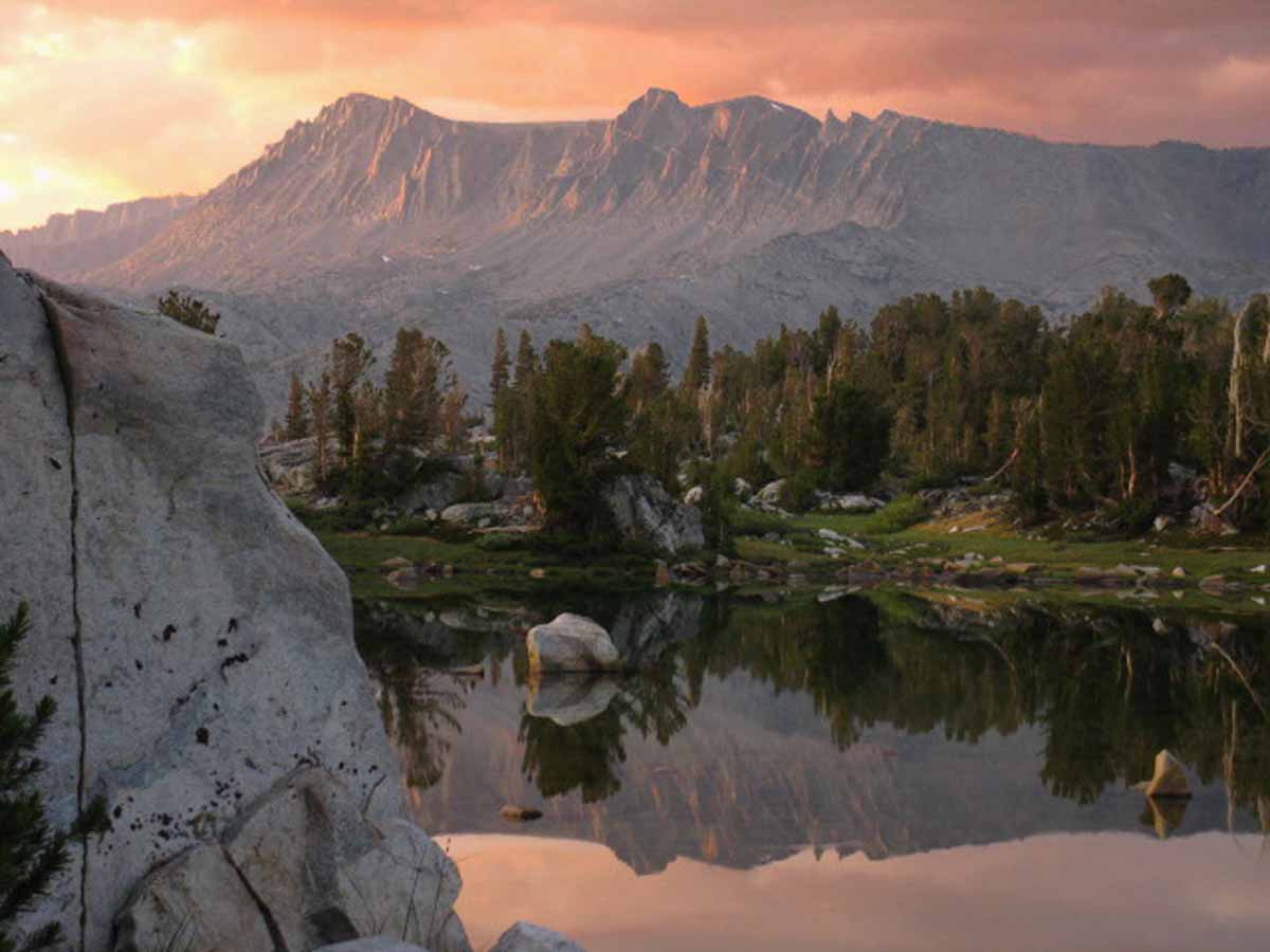
September
September brings the full pallet of Fall beauty as cold conditions return to the High Sierra.
From the golden grasses around diminished lakes to the great sweeps of bright yellow aspens bursting through the uniform evergreen canopy, beauty is bursting forth even as much of life slows down to settle into its Winter sleep.
The weight of the bear-proof can be left behind, but the pack gets heavier as the necessity of thicker insulation and Winter travel gear demands we carry greater weight.
Well, not yet. But we are now watching carefully for the physical signs of impending Fall and the approach of Winter.
2015 HISTORY
BACKPACKER ALERT
The threats are fire and tropical weather.
The enduring trend of shortening Winters and the subsequent significant diminishment of Rain and Snowpack during the last 25 years has evolved into a completely different weather pattern. The storms out of the Northwest, in fact the whole North Pacific Weather Pattern has been disrupted. I would say it has been shattered.
The various unhinged elements of our old pattern have not re-established a new pattern (they are still changing!), but two facts are crystal clear. First, our traditional pattern of Winter storms out of the Northwest has been shattered. It will likely re-occur every 3 to 7 years on a diminishing cycle. Winters dominated by storms out of the Northwest is done as the dominant feature driving Winter weather on the whole Northwest Coast of the US.
(I see two factors driving the Degradation of the North Pacific Winter Weather Pattern:
Factor A> The significant warming of the Arctic Circle during Winter has diminished the polar region's ability to draw West Pacific storms up to the perimeter of its once powerful spinning vortex of brutal cold, to "power them up," and toss them across the West Coast of the US.
Factor B> The warmth of the North Pacific ocean surface and atmosphere during Winter in N Latitudes has deflected the path of the typical North Pacific Winter Jet Stream across the Northeast Pacific, leaving the West Coast of the US dry.
The combined effects of the warming Arctic Circle and North Pacific Jet Stream changes are also responsible for the great "slides" South of Cold Arctic air masses over the Mid-West and East Coast over the last few Winters, causing those "polar vortexes."
Typical Winter storm patterns are not being drawn up to the Arctic Circle, they are not being fired up by the spinning vortex of the North Polar Region during Winter, nor are the resulting super-charged storms riding the Jet Stream down to California. That's the pattern that's over, the old pattern that drove fertility in California and the High Sierra.)
Second, the temperatures and humidity have risen to levels un-natural for the North Latitudes. We appear to be moving towards a tropical "Wet and Dry"-season type of pattern at 38 N. We'll see. We've loosened the forces of chaos, now we will see what happens, and where they end up.
The establishment of new basic metrological conditions in the North Pacific and Arctic Ocean assures that this new weather pattern has just now begun to re-order the type and distribution of plant and animal life rapidly under its changed footprint, forcing all to adjust to the new reality. Here in California that will be through fire for the trees, and lack of water for the animals and humans.
New plants, animals, and trees more suited to the hotter, drier climate will replace those burned, until they too are supplanted.
For backpackers this means that the rising threats into this year's September are massive fires and unexpected tropical downpours. |
Mountain Safety
Thunderstorms?
As snow travel and fording dangers receede on the High Sierra terrain, the next danger grows in the skies.
July brings the peak of the Summer Thunderstorm Season in the High Sierra.
These are typically local weather, caused by heat waves in the San Joaquin Valley swept up the West Sierra Flank.
Hot wet air on a fast ride up the West Sierra flank to high elevations squeezes out what can be substantial daily rain and lightening activity lasting between 2 pm and sunset.
Don’t cross open ground under one of these storms. They are deadly. Lightening and Fording are the leading causes of High Sierra backpacker deaths.
More Lightening Information Lightening Prediction Tools
Typical Scene: Video
Story
Caught Out with Bubba & Dave
Tahoe to Whitney
Top of Page |