

The Trails
Guide
Maps
Miles/Ele
Permits
Resupply
Forum
Weather Conditions
Weather Notes
Northern High Sierras
Central High Sierras
Southern High Sierras
Gear
Gear List
Gear Forum
Gettin Started
Layering
Testing yourself and your gear
Gear Reviews
Backpacking
Lower
Echo Lake to Highway 50
between
Desolation Wilderness and Meiss Country Roadless Area
The Tahoe to Yosemite Trail from Desolation Wilderness South to the Meiss Roadless Area across Highway 50
Translate
Languages
Trail Prep
The art of walking
Physical Preperation
Planning
Trail Skills
The trail
Off the trail
Scrambling
Maps
Navigation
Camp skills
Food
Resupply
Food
Other
Photo Catagories
Trail Stories
Trail Culture
News and Science
Links
Groups
Books
Terms and Conditions of Use
Hiking between Lower Echo Lake & Echo Summit in the Dark
Because this two mile section of trail between Lower Echo Lake and Echo Summit sits between major trailheads to its North and South it is not hiked by most short-distance backpackers. Local backpackers and hikers begin their trips North and South out of Echo Lake and Echo Summit, respectively, so this short section is mostly hiked by Summer residents, local kids, and the visitors-tourists visiting Echo Lake and its facilities. |
Over the end of the ridge and past the Houses Southbound towards Highway 50
| Echo Lake Trailhead |
Desolation Wilderness ended on the North side of Upper Echo Lake, but the Lake Tahoe Basin Administrative Unit continues all the way to the Carson Gap, where we exit the Lake Tahoe Basin. The Meiss Roadless Area, AKA Meiss Country, begins South of Echo Summit and runs all the way to the Carson Gap.
Backpacking
|
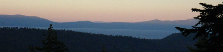
Crossing Highway 50 at twilight
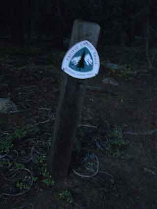
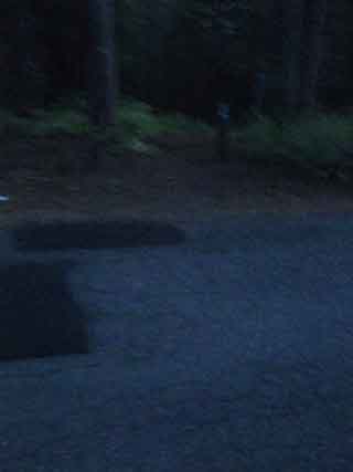
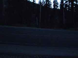
Hiking Southbound to Highway 50 we find the creek out of Echo Lakes crossing under Highway 50 in a culvert to our Right, just beyond which sits the unique wreck of Little Norway. No longer a vacation resort, Little Norway now looks like an interesting rental property for a wide variety of interesting local characters. The Southbound trail turns East along the South shoulder of Highway 50 for a short distance, maybe 30 yards, until we come to a dirt road well posted as the Southbound Pacific Crest Trail. |
 |
 |
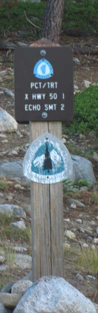
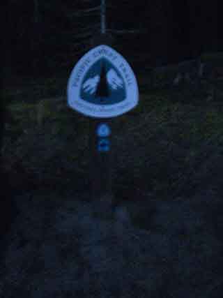
| Above: The HUGE Pacific Crest Trail sign on North side of Hwy 50. The Northbound trail route crosses Highway 50 to the West of Echo Summit. This huge marker is to calm the Pacific Crest Trailers down.. | Above: View crossing Highway 50 backpacking South. Cross over, then turn Left and walk a short distance East to the dirt road on your Right. |
 |
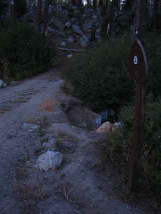 |
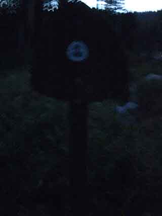
| Pacific Crest Trail marker at the dirt road on the South side of Highway 50, just East of where we crossed Highway 50. | 100 feet down this dirt road we will see another Pacific Crest Trail maker that directs us to make a left turn, East, where the dirt road turns right. From there the TYT-PCT-TRT trail parallels Highway 50 East up to Echo Summit. |
North: Echo Lake to Echo Summit top of page South: Highway 50 campsite
To Highway 50 |
|
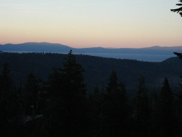
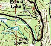
Lower Echo Lake trailhead South to the Echo Summit Trailhead It is two miles South to the Echo Summit trail head from the trailhead at the Echo Lake upper parking lot. As the sun was already down, I had 45 minutes of diminishing twilight to locate the two basic elements of a backpacking camp: Water, and enough flat space to sleep on. Pushing on around the end of the ridge overlooking Lake Tahoe between Echo Lake and Echo Summit, I crossed Echo Lake Road at the Upper Parking Lot and shortly came to an unmapped creek running West hard down the mountain before dropping down to Johnson Pass Road. This is the drainage from Echo Lake, which constitutes a major source of the headwater of the American River. Strangely, the creek does not appear on the 1992 7.5 USGS Topographic of Echo Lake, but it is shown on the 1976 30 minute Placerville map, circled in white below. On the other hand, the Placerville map does not show the Pacific Crest Trail's present route through this section. I understand. Trail routes, as well as rivers, are made to run in different courses over the years.
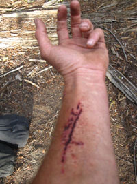
It appears to me that this drainage naturally out of Echo Lake would naturally run into the Lake Tahoe Basin. And with no dam to block and redirect this flow, there would be no or a much lower set of Echo Lakes... I looked about for a flat spot to camp near the ford, and finding none, I decided to continue South across the creek. There is a rather large downed tree crossing the creek to the left of the flooded low-water fording point. It has been dead long enough to have lost its bark. The problem was the trunk was too high off the ground to climb up onto from the side, and the root mat on the back side was a climb-able, but a difficult climb. Especially as heavily loaded as I was. I climbed up the vertical root mat at the bottom of the toppled tree, but the dilemma when I reached the top was, how the hell do I step over the lip from the root mat onto the trunk? Standing up on the top of the root mat put me a good 15 feet off the ground, and stepping over from the back, from the root mat side, onto the very slick taper of the trunk was a little sketchy. Especially as my pack weighed just a bit above 70 lbs. Root ends were sticking up, protruding out from the root mass I had climbed up, so I grabbed one root in my left hand, one in my right, and tentatively put my left leg over onto the trunk side. All good, so far. Then, just as I got my right leg onto the trunk from the the root mat side, the left root that I was using to hold myself steady snapped. As I had not completed my transition from the vertical root ball to the tapering trunk I toppled clumsily over onto the tapering trunk, and started sliding head-first down the smooth surface towards the trunk. I instantly foresaw that I would bounce off the trunk and plunge into the madly rushing ice-cold frkn creek. Nonetheless, I was sprawled face-down in a precipitous position with only my strained grip on a dead root holding me onto this fallen tree. It took a little struggling to completely stabilize myself enough to get my legs under me, and work myself into a standing position. And jeeze, I had already hiked 14 hard miles and was dead beat tired. As soon as I stabilized myself I scurried across the creek atop the downed tree. Once on the other side I inspected my left arm, which had been gouged by the part of the left root which did not break off. When the root broke my fully laden weight dropped onto the unbroken lower part of the root, gouging my arm. I decided it looked ok, though it was bleeding a lot. It had not gouged though all the layers of skin, so I was good to go without trail stitches. No problem. Bleeding cleans the wound. I would let it bleed clean. As it was almost dark, and I had still to find a campsite soon I figured I'd continued South to find a campsite, then clean it up and bandage it when I did find a campsite and could use the flashlight to properly inspect and treat the wound.
View of my scratch the next morning. After scanning the South side of the ford for a suitable camping site and finding none, I continued to press on towards Highway 50, hoping that a site near this runoff from Echo Lake would appear, so I could tap it for water. None did, so I continued South and shortly crossed Johnson Pass Road. In a few minutes I arrived at and crossed over Highway 50 in the dark. I was already planning on pushing as far into darkness as I could, but now this injury had moved finding a spot to camp to my number one goal. Topo Hiking Map: Echo Lake North Hiking Topo Map: Echo Lake to Echo SummitMiles and ElevationsNext page:Highway 50 campsite |
Backpacking Trail Guide North |
 |
Backpacking Trail Guide South |
Backpacker ForumsHave a great Sierra Nevada route or trip to relate?Post it: TahoetoWhitney.Org Echo Lake: What's your favorite trip through this trail head?Echo Summit: which trailhead do you prefer?Experiences, comments, or pictures about hiking the Echo Lake Chalet to Echo Summit? Post them below:Section: Meeks Bay to Echo SummitSegment: Camp at Highway 50 |
North: Echo Lake to Echo Summit South: Highway 50 campsite
Home Page
Contact Alex Wierbinski

Backpacking Lake Tahoe to Mount Whitney
Your guide to the High Sierra Crest, including the Tahoe to Yosemite, Pacific Crest, and John Muir Trails
