

The Trails
Guide
Maps
Miles/Ele
Permits
Resupply
Forum
Current Weather Conditions
Weather Notes
Northern High Sierras
Central High Sierras
Southern High Sierras
Gear
Gear List
Gettin Started
Layering
Discussion
Testing yourself and your gear
Gear Reviews
Our Final Steps
South
to
Showers Lake
Backpacking Schneiders Cow Camp junction South to Showers Lake Junction, Meiss Country Roadless Area, Tahoe Rim, Pacific Crest, and Tahoe to Yosemite Trail routes around the Southern Rim of The Tahoe Basin.
Languages
Languages
Trail Arts
The art of walking
Physical Preperation
Trail Skills
The trail
Off the trail
Scrambling
Maps
Navigation
Camp skills
Food
Resupply
Food
Other
Photo Catagories
Trail Stories
Trail Culture
News and Science
Links
Groups
Books
Terms and Conditions of Use
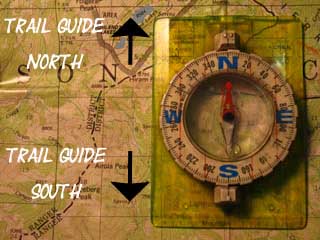
| Trail Guide INDEX |
NORTH Schneider's Camp junction |
SOUTH Showers Junction |
7.5 min Topo Map Echo Summit to Carson Pass |
Maps INDEX |
MILES and ELEVATIONS |
Miles and Elevations INDEX |
Local Weather All Sierra Weather |
Tahoe to Whitney on YouTube |
A brief 1.19 mile hike South
from
Schneiders Cow Camp Junction
brings us to the
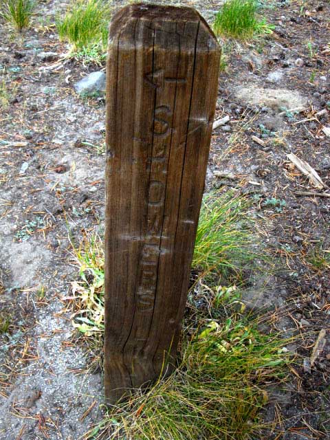
Showers Lake Sign Post
| North Side of Showers Sign Post at the Mystery Junction. |
||
 |
||
| A sign post without a trail junction. |
Showers LakeShowers Lake is a very popular destination for local backpackers. Lots of folks from the Carson Valley and Reno enjoy this place, as well as Lake Tahoe Locals out for a quick weekend getaway. We can approach Showers Lake from many trail heads around the compass. Trails come into Showers Lake from the Southeast out of Carson Pass, from the North from Echo Summit, and from the Northeast out of the Meyers trail head. These trailheads are featured in this trail guide. We can also approach Showers from the South via Schneiders Cow Camp off of Highway 88 near Caples Lake, or from the West via Sayles Canyon Trailhead on Highway 50, a half-mile East of Camp Sacramento. This section of trail guide is hiking South to Showers Lake from Echo Summit along the unified Tahoe to Yosemite-Pacific Crest-Tahoe Rim Trails. We can also reach Showers Lake from the East out of the Big Meadow Trail off of Highway 89, which cuts in to the trail coming up from the Meyers trailhead just below Round Lake. The map below depicts all the trailheads we can use to access Showers Lake. 30 min hiking Topo Map Add your experiences, comments, Questions: |
Information
Meiss Country Roadless AreaEcho Summit to Carson GapShowers Lake "Loop"Elevation Mileage Although the 7.5 min USGS Topographic shows two trail junctions off of the PCT heading to Showers Lake, one to the North of Showers Lake and the other to the South, there is no trail bypassing Showers Lake as the map indicates. Though the signpost pictured above is located at the point the Northern junction was marked at on the map, I found no trail junction. The Pacific Crest, Tahoe-Yosemite, and Tahoe Rim Trails now loop through Showers Lake. It appears that the bypass trail around Showers Lake has been abandoned. I was headed to Showers Lake anyway, so I didn't search too hard for the trail remnants around the South shore of Showers Lake. My notes on this trail junction say, "Signpost, but no Junction." This is good. Showers Lake should not be missed! Check out the Map, and Click the Colored Dots for related trail guide page. |
Dardanelles Lake in Christmas Valley
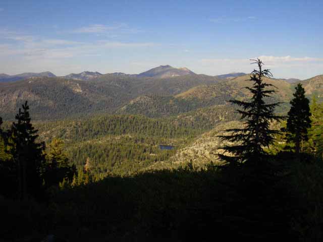
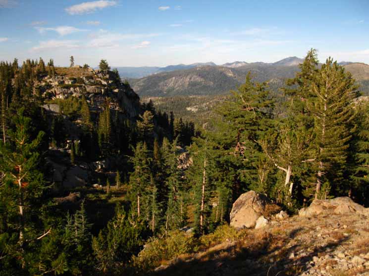
FREEL PEAK and JOBS SISTER| Shortly after departing the Schneiders Junction, the forest thins, and the terrain opens up for Splendid Vistas. | |
 |
|
The View Northeast of Freel Peak with Jobs Sister off to the Right behind Freel Peak's Northeast shoulder viewed from Showers Lake. Dardanelles Lake sits nestled in the foreground forest. Dardanelle Lake is accessible from the South Upper Truckee Trailhead in Meyers and from the Big Meadow Trailhead along Highway 89 below the North side of Luther Pass. Echo Summit to
Carson Pass Cross Country & Winter Travel
|
Video Playlist |
More Videos
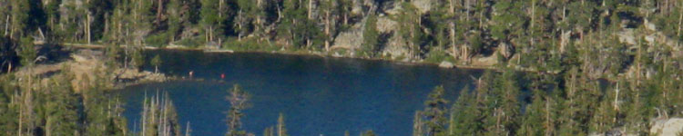
View of Dardanelles Lake from Showers Lake Overlook
| Dardanelles Lake close-up |
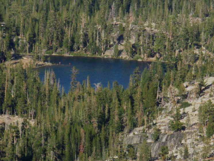 |
Dardanelles Lake. Note the two backpackers on thin point into lake, on the left edge of the Lake. |
Views from the open terrain around Showers Lake
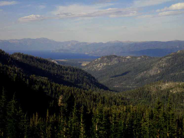
| The View North, approaching Showers Lake. |
 |
| As we enter open the terrain around Showers Lake, a grand view North begins to open up. |
| The same view to the North, but from a little further South on the Trail, reveals a glimpse of Lake Tahoe. |
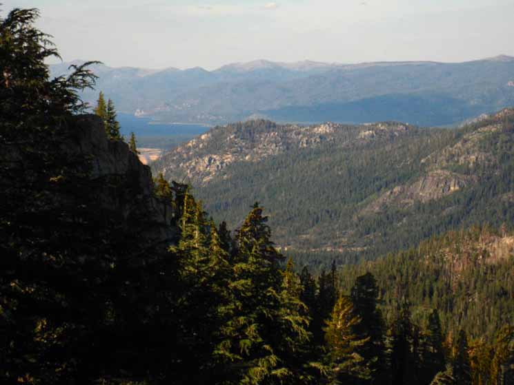 |
Continuing South towards Showers Lake, grand views open up. We see that Showers Lake's location on a flat overlooking Christmas Valley down to Lake Tahoe gives it amazing vistas. |
| South Upper Truckee drainage contours down through Christmas Valley and on to Lake Tahoe. |
 |
| Enjoying an afternoon off with the views from Showers Lake |
Dr. Peter Skaff
Peter took this fine view of the very edge of the thin meadow apron that sits just below this section of the Tahoe Rim crest line. Showers Lake sits towards the North end of this thin meadow-flat, one of the few places along the Southwestern rim of the Tahoe Basin with unobstructed views of Lake Tahoe, and the whole extent of the Southern Tahoe Basin. Below Peter caught a view of what makes the approach to the South Lake Tahoe Airport difficult. |
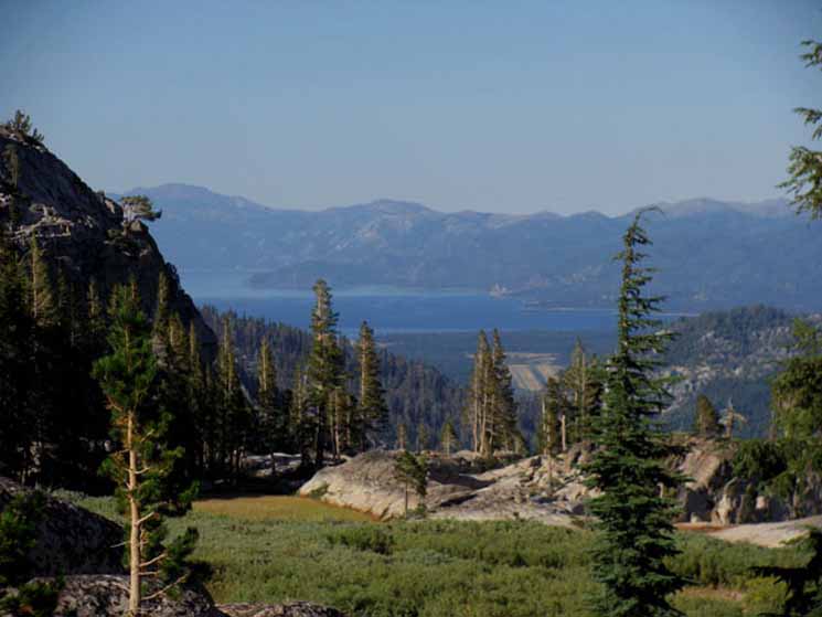 |
The South Lake Tahoe Airport runway is visible in the foreground. |
North: Schneider's Camp junction South: Showers Junction-Showers Lake
Approaching |
||
Breaking out of the forest into open terrain approaching Showers Lake from the North is refreshing. Except a last flank of the Western wall of Christmas Valley is still blocking our view of Lake Tahoe. But rotating around the flank adds a bit of drama as the full view is rotates into view as we South puts us past the obstruction. Christmas Valley, the whole extent of the South Upper Truckee River Drainage, the whole Southern Lake Tahoe Basin, along with Freel Peak and a big chunk of the Carson Range all swing into view. Peter's picture, above, displays many of these elements. The work it took to get here pays off as our physical exertion becomes the personal lens magnifying and gives physical meaning to the aesthetic pleasure of our arrival. The view from Showers Lake, as well as the many beauties of the trail through the deep forest and precipitous granite terrain we backpacked through to get here from Echo Summit explains why this spot is a local's favorite: It's a challenging and rewarding hike that does not ask too much from you, but does demand work. The trail from Echo Summit is the long and hard way to get to Showers Lake, where that work well rewards us. Northbound From Carson Pass it is 5.2 miles of much easier miles hiking North to Showers Lake, compared with the 6.8 mile trail and more difficult terrain backpacking South from Echo Summit. From Carson Pass we only have to get over the Carson Gap, then it is a gentle downhill grade almost all the way to Showers Lake, except for a couple of short climbs from the Northern end of Meiss Meadow where shoulders descending off the Tahoe Rim work us a bit. *** The Echo Summit to Showers Lake round-trip is a excellent place to get yourself and your gear worked out for longer trips, or just have a nice weekend getaway. This route is of intermediate difficulty, but has short difficult sections that keep us on our toes. The altitude requires acclimation, but is not extremely high. The distance to Showers Lake is short, so we can easily do the Showers Lake round trip on a weekend, if we are in intermediate+ condition. Showers Lake is a great place to figure out equipment and physical issues prior to planning or executing an extended long distance High Sierra Nevada backpacking trip.
Next page South |
Backpacking Trail Guide North |
 |
Backpacking Trail Guide South |
Backpacker ForumsGeneral Sierra Nevada hiking thoughts to relate? Post 'em on
On the Forum you can browse trail locations and add your experiences, comments, questions (or pictures and videos) about hiking South out of the Echo Summit Trail Head. General comments about the Echo Summit to Carson Pass section of the High Sierra trails, or this particular location: Section
|
North: Schneider's Camp junction South: Showers Junction-Showers Lake
Trailhead
Contact
Alex Wierbinski

Backpacking Lake Tahoe to Mount Whitney
Your guide to the High Sierra Crest, including the Tahoe to Yosemite, Pacific Crest, and John Muir Trails
