

The Trails
Guide
Maps
Miles/Ele
Permits
Resupply
Forum
Current Weather Conditions
Weather Notes
Northern High Sierras
Central High Sierras
Southern High Sierras
Gear
Gear List
Gettin Started
Layering
Discussion
Testing yourself and your gear
Gear Reviews
Hiking down Peak 8905
to
Sayles Canyon Junction
from
Echo Summit
Backpacking the Pacific Crest Trail South through Meiss Country Roadless Area
Languages
Languages
Trail Arts
The art of walking
Physical Preperation
Trail Skills
The trail
Off the trail
Scrambling
Maps
Navigation
Camp skills
Food
Resupply
Food
Other
Photo Catagories
Trail Stories
Trail Culture
News and Science
Links
Groups
Books
Terms and Conditions of Use
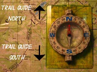
Trail Guide |
North Down to the Overlook |
South Sayles Canyon, Bryan Meadow Junction |
7.5 min |
Maps INDEX |
Miles and Elevations INDEX |
Local Weather All Sierra Weather |
All Wilderness Permits |
Tahoe to Whitney on YouTube |
Two Views
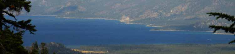
We enjoy the brief views Northeast as we come across Peak 8905 when we get them, for our hike South from Echo Summit continues through deep forest until just North of Showers Lake where we exit the forest into a shelf nestled into the mountainside beginning under Little Round Top. |
Information
Southbound
|
Video Playlist |
High Point
of the
trail
on
Peak 8905
| View Northeast |
 |
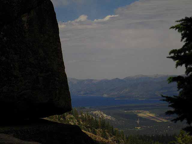
| One more peek at Lake Tahoe Before turning Southeast and heading down to the Sayles Canyon Junction. |
I love Rock
| View Southwest while heading South down the trail through deep forest and rock terrain. |
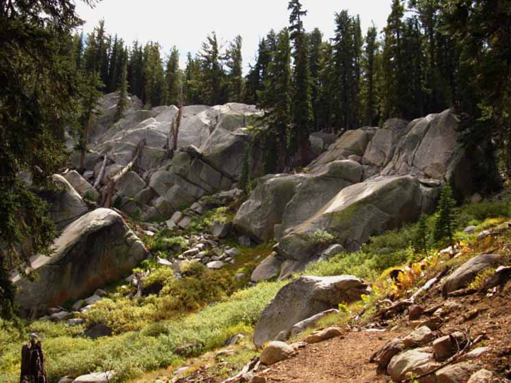 |
| A small clearing reveals the dense nature of the surrounding terrain. Another small rise over rock and forest lay before us, as we begin to drop down towards the Sayles Canyon trail junction off the flank of Peak 8905. |
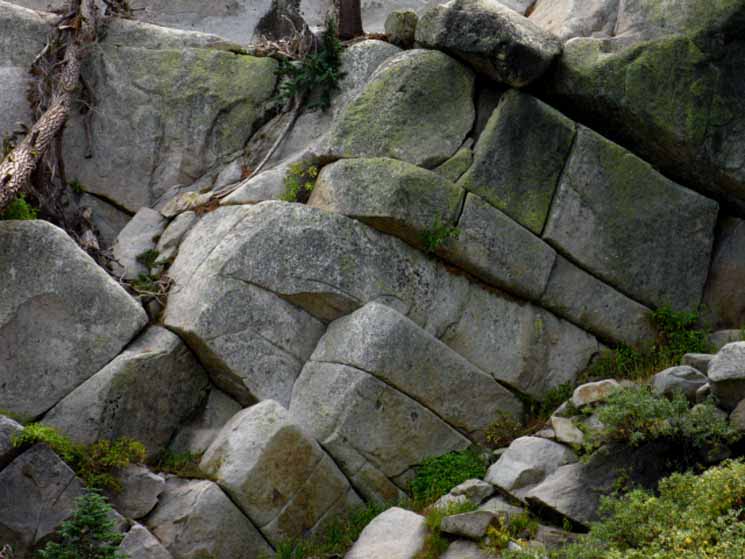 |
The maze of rock formations present many faces. Building blocks for the giants. |
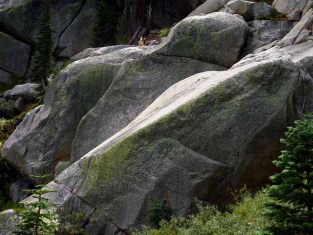 |
The Granite formations range from closely jointed to expanses with no joints at all. |
North: Down to the Overlook South: Sayles Canyon, Bryan Meadow Junction
| I love firm trails with a soft surface! |
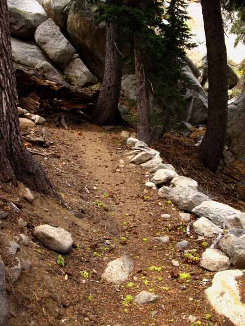 |
| Soft trails wind between the hard rock formations, and are generally strewn with loose rocks. This section was clear, easy walking. |
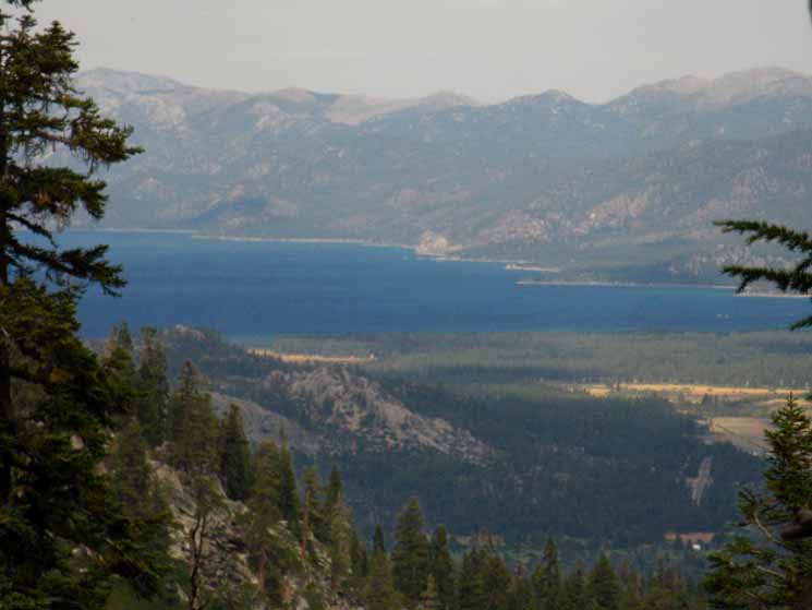
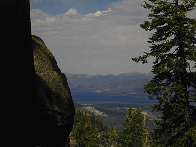
Brief Views of Lake Tahoe through rock and forest North of the Sayles Canyon Junction
| Quick glimpses of Lake Tahoe appear between rock and trees. |
 |
| A last peek at Lake Tahoe before tuning Southwest and dropping down to the Sayles Canyon Junction. |
| Moving a bit South down the trail, a better view opened. |
 |
Close up of Airport and South Lake Tahoe through rock and tree. |
Snow Route out of Highway 50 up Sayles Canyon?
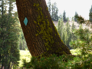 |
|
| A blue diamond snow route marker near the Sayles Canyon Junction. |
Snow Trail?I've got to Scout out the Sayles Canyon trailhead on Sayles Canyon Road. Sayles Canyon Road is on Highway 50 between Twin Bridges and Phillips. I'm figuring that there is a marked snow route coming out of there to the Pacific Crest Trail, judging by the snow markers we encounter as we hike South to the Sayles Canyon trail junction. I've got to see if I can snowshoe into Showers Lake through this route. I generally head in through Meyers and stop by Showers Lake on my way to Round Top. Have you snowshoed in here? I'd love to hear your experiences snow hiking into the Tahoe Basin and to Showers Lake on this route. More Information I received a nice note and some pictures of the hike up to the PCT via Sayles Canyon from Highway 50 in snow conditions from a Sierra Hiker: |
North: Down to the Overlook South: Sayles Canyon, Bryan Meadow Junction
We continue around rock and through forest down fine trail through rough country between our rest spot and the Sayles Canyon trail junction |
|||
Now we are moving Southeast off the Eastern flank of peak 8905, and catch our last glimpse of the Southern expanse of Lake Tahoe and Stateline before the trail bends Southwest again and plunges back into deep rock-strewn forest as it drops us down towards the Sayles Canyon trail junction. Brief glimpses of Lake Tahoe's blue appear through the trees, and a few very small clearings and small breaks in forest cover offer us long views of Lake Tahoe. Any questions or comments about this trail segment? There are links to the Backpacker's Forum for this trail section and this particular segment, as well as forums on backpacking topics. You can post questions, comments, and your experiences (post up trip reports) along this trail through these forum links in the black box below. Or you can contact me. Below the forum links is my email address. I'd love to hear from you.
Next page South |
Backpacking Trail Guide North |
 |
Backpacking Trail Guide South Sayles Canyon, Bryan Meadow Junction |
Backpacker ForumsGeneral Sierra Nevada hiking thoughts to relate? Post it on
On the Forum we can browse various locations up and down the trails and add your experiences, comments, questions (or pictures and videos) about hiking South out of the Echo Summit Trail Head. General comments about the Echo Summit to Carson Pass section of the High Sierra trails, or this particular segment: Section
|
North: Down to the Overlook South: Sayles Canyon, Bryan Meadow Junction
Trailhead
Contact
Alex Wierbinski

Backpacking Lake Tahoe to Mount Whitney
Your guide to the High Sierra Crest, including the Tahoe to Yosemite, Pacific Crest, and John Muir Trails
