

The Trails
Guide
Maps
Miles/Ele
Permits
Resupply
Forum
Current Weather Conditions
Weather Notes
Northern High Sierras
Central High Sierras
Southern High Sierras
Gear
Gear List
Gettin Started
Layering
Discussion
Testing yourself and your gear
Gear Reviews
Backpacking the High Sierra
Two Junctions
One Destination
Sayles Canyon and Bryan Meadow Trail Junctions
to
HIGHWAY 50
Tahoe to Yosemite Trail through Meiss Country Roadless Area
Languages
Languages
Trail Arts
The art of walking
Physical Preperation
Trail Skills
The trail
Off the trail
Scrambling
Maps
Navigation
Camp skills
Food
Resupply
Food
Other
Photo Catagories
Trail Stories
Trail Culture
News and Science
Links
Groups
Books
Terms and Conditions of Use
Trail Guide |
North 8905 to Sayles Canyon Junction |
South Schneiders Camp junction |
7.5 min Hiking Map Echo Summit to Carson Pass |
Maps INDEX |
MILES AND ELEVATIONS |
Miles and Elevations INDEX |
Local Weather All Sierra Weather |
All HIGH SIERRA Wilderness PERMITS |
Tahoe to Whitney on YouTube |
Bryan Meadow and Sayles Canyon This trail leads down through Bryan Meadow to connect with the next trail to our South, the trail running West through Sayles Canyon. After intersecting the now unified trails run down to Highway 50 East of Camp Sacramento where the Sayles Trailhead is located. We will continue South through this junction towards the next junction in this series, the Sayles Canyon trail junction .85 of a mile South on our combined TYT-PCT-TRT route.
Highway 50
All the High Sierra Road Maps
|
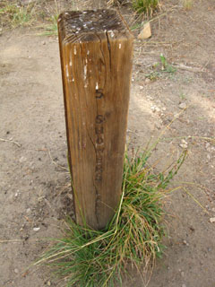
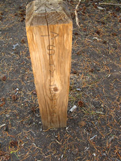
| Well decorated Mileage Post at Bryan Meadow Trail Junction |
||||||
| SOUTH Showers Lake 4 miles |
WEST Highway 50 4 miles |
NORTH Echo Summit 4 miles |
||||
 |
 |
 |
||||
Miles: Post says 4 miles to Showers Lake hiking Southbound on the Pacific Crest Trail. I put it at 3.72 miles. |
Miles: The sign puts it at 4 miles to Highway 50 at the Sayles Canyon Trailhead above Camp Sacramento. I put it at 4.26 miles. |
Miles: The trail post puts it at 4 Northbound miles to Echo Summit, back the way we came. I put it at 3.49 miles. |
||||
| Echo Summit to Carson Pass Backpacking Miles and Elevations |
||||||
Video
Coyote Break
at the
Sayles Canyon-Bryan Meadow Trail Junction
|
A coyote ambled past, stopping to check out some interesting scents, then moved on as I sat quietly and watched. 1:59 |
|
Considerations at the Sayles Canyon trail junction Sayles Canyon Coyote?
|
Bryan Meadow
|
Map
and
Mileage
Issues
Explaining the DifferencesThese differences between my mileage figures and those on these trail posts may very well be because I'm measuring the "modern" route from the Echo Summit Trailhead. These ancient posts may well be measuring out the mileage of the old routes. As you can see from this 1976 USGS 30 minute topo map of this route, the route has been significantly modified over the last few decades. Compare the 1976 map with the route depicted on the 1992 USGS 7.5 topo map. The 1976 map shows that the original trailhead was actually at Echo Summit, rather than its present location West of the Summit. The trail also appears to have been lengthened significantly from the footbridge up to the outlook point, and from the outlook to the top of Peak 8905. The fact is that the mountains are in constant motion, and so too are the trail routes. Forest managers are constantly rerouting trails to stabilize drainages, protect springs and meadows, mostly to limit human-caused damage to the terrain caused by trail erosion. It's not what human feet do directly to the terrain, but what happens to that damage as the weather goes through its annual cycle. The rains, runoff, and runoff from Spring Thaws expand any cuts or damage on the terrain into raging rivers. Each of our seemingly minor physical effects on Nature are amplified over time by the physical powers of Nature itself. These powerful forces translate into rail routes in exposed areas that can change significantly in a very few years, making the USGS maps, trailhead and trail post signs, and trail guide mileage figures inaccurate measurements of a trail's ever-changing length. Or never-changing. We are also going to hike across great spans of trail cut directly into and through solid rock as we continue South to Whitney. Places where the trail will remain stable until great changes in the weather and the Earth itself resculpts the range. Post your comments-questions-experiences on mapping and miles issues. |
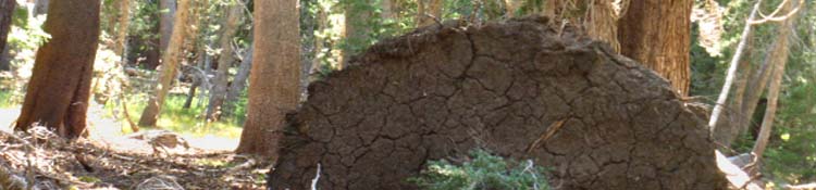
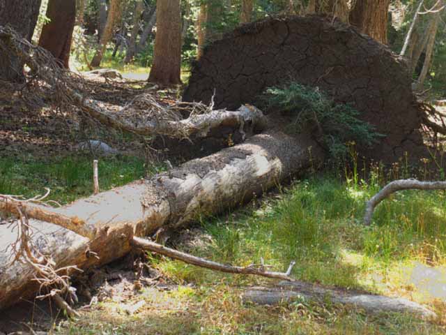
Soft Meadow Soils don't want to hold up the encroaching Lodgepoles
The lodgepoles' relentless march into the top of Bryan Meadow around the trail junction is slowed by the soft soils. But, trees are relentless. Forests move onto rock by using the bodies of their fallen brethren as fertilizer to create soil for their continued march into solid rock. They have little trouble with meadow. |
||
 |
||
The fallen Lodgepole brought up a big root ball up with it. I am looking for an update for this image. Post up through the comments link below. |
2nd Southbound Trail Junction
Sayles Canyon Junction
.85 of a mile South of the Bryan Meadow trail junction
| West | North-South | |||||
 |
 |
|||||
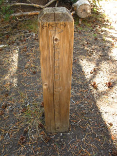
| The sign points South on the TYT-PCT-TYT towards the Schneider's Camp trail junction. |
The Second Junction
|
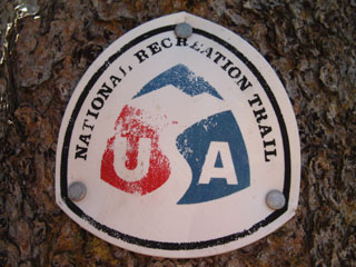
| Old School Tahoe Rim Trail Emblem |
||
 |
||
| Information about National Recreation Trails |
More Information |
North: Almost to Sayles Canyon Junction South: Schneider's Camp junction
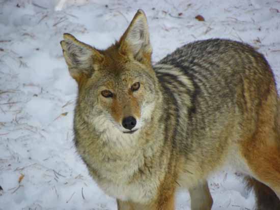
Taking a break with a Coyote |
||
Coming down to the first of two trail junctions tracking West as we come off the upper flank of Peak 8905 brings us to the head of Bryan Meadow. Though no longer an open meadow at the junction, neither has the forest totally filled in and finally transformed this part of the receding meadow into deep forest. But the forest is trying! I stopped and took off my pack and had a smoke and a snack. As I have made a practice of sitting (and hiking) quietly, a medium size coyote ran up from Bryan Meadow, and began scouting about some rocks about 50 yards North of my position. As soon as the Coyote determined there was nothing of value around the base of the rock formation, he climbed up and over and was gone before I could pull my camera out. This Coyote was happy, with a big smile on its face. Its fur was thick, and had cinnamon highlights.
Next page South |
Backpacking Trail Guide North |
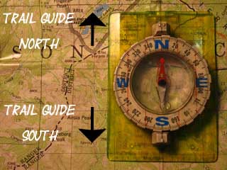 |
Backpacking Trail Guide South Schneider's Camp junction |
Backpacker ForumsGeneral Sierra Nevada hiking thoughts about Trails or Topics to relate? Post it on
On the Forum we can browse locations in the Meiss Country to add our experiences, comments, questions (or pictures and videos) about hiking this sweet little almost-wilderness area. General comments about the Echo Summit to Carson Pass section of the High Sierra trails, or this particular segment: Section
|
North: Almost to Sayles Canyon Junction South: Schneider's Camp junction
Trailhead
Contact
Alex Wierbinski

Backpacking Lake Tahoe to Mount Whitney
Your guide to the High Sierra Crest, including the Tahoe to Yosemite, Pacific Crest, and John Muir Trails
