

The Trails
Guide
Maps
Miles/Ele
Permits
Resupply
Forum
Current Weather Conditions
Weather Notes
Northern High Sierras
Central High Sierras
Southern High Sierras
Gear
Gear List
Gettin Started
Layering
Discussion
Testing yourself and your gear
Gear Reviews
Backpacking
the
Meiss Roadless Area
Continuing South on the Pacific Crest Trail towards Showers Lake
Languages
Languages
Trail Arts
The art of walking
Physical Preperation
Trail Skills
The trail
Off the trail
Scrambling
Maps
Navigation
Camp skills
Food
Resupply
Food
Other
Photo Catagories
Trail Stories
Trail Culture
News and Science
Links
Groups
Books
Terms and Conditions of Use
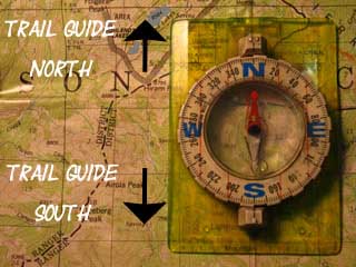
| Trail Guide INDEX |
North View, Rest Spot, Great Company |
South Peak 8905 to Sayles Canyon Junction |
7.5 min Topo Map Echo Summit to Carson Pass |
Maps INDEX |
MILES and ELEVATIONS |
Miles and Elevations INDEX |
Tahoe to Whitney on YouTube |
Backpacking This unique piece of trail work is where the trail begins bending Southwest around the base of the nose of steep ridge dropping 600 feet below Peak 8905, which makes up the upper end of this gorge. The map below depicts this complex bit of terrain. We will finally exit this interesting fold/drainage in the mountains just below the top of the North side of Peak 8905. We climb out of this drainage just below the top of Peak 8905. Our trail finally emerges from the sheer granite walls of the gorge to cross the high point of our trail across the low-rounded East Flank of Peak 8905. That's one of these views pictured on the banner above. For the better part of our hike South from Echo Summit we have been hiking upward within the close confines of the narrow valley-gorge cutting into the mountain below the rim of the Tahoe Basin and set back from Christmas Valley. That orientation only offered views of the precipitous granite terrain surrounding us through dense forest and close-in rock formations. Climbing out of the top of the gorge we find the loss of the views of the granite gorge has actually diminished our views: Now we've just got dense forest and some low granite emerging from the flanks!
The following page brings us up through the top section of this gorge from our break spot in the gap up to the high point of the trail crossing Peak 8905. |
| The trail a few feet South from our break flat. | Detail | |
 |
 |
|
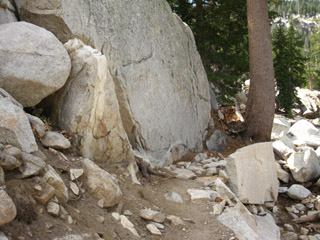
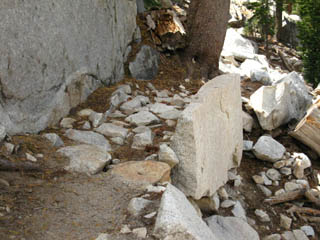
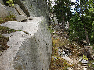
Trail crew used a slab to hold large pieces of fill they fit and placed between the slab and boulder to forestall a serious line of runoff erosion cutting the trail. Trail crew created a short walkway between boulder and slab. Very nice work. |
||
Climbing over Peak 8905
| Location Past the Rest Stop, halfway up to the high point of Peak 8905 from our break spot. Southbound on the Tahoe to Yosemite, Pacific Crest, and Tahoe Rim Trails. Backpacking
|
| Runoff was running around the base of the boulder and cutting the trail. A nice fix. |
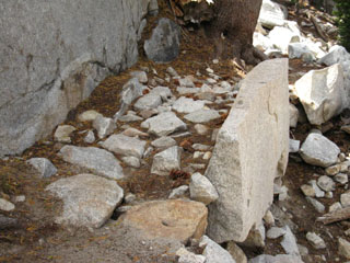 |
| Slab used to anchor build-up, to preserve trail bed. Note the two flakes in foreground laid as paving stones across designed drainage point. |
One fine feature of Trail Work is followed by another.
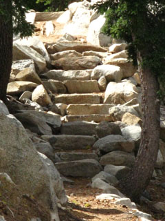
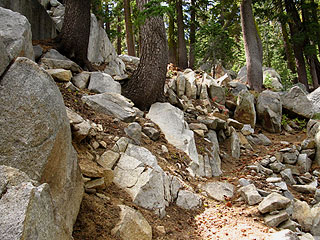
| Past the slab the rocky trail leads to a fine granite staircase. |
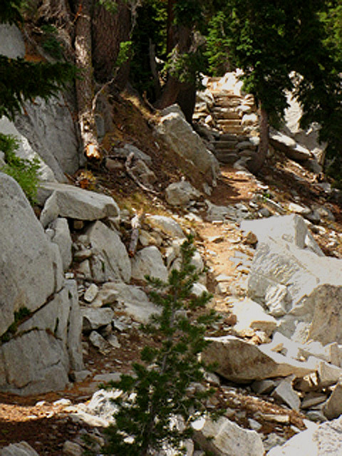 |
The trail winds its way through enchanting rock and forest to a fine granite staircase. Note the proliferation of loose rock on the trail. Though the dense fir forest makes for a soft trail coming up the mountain from the Frog Pond junction, the trail is full of loose rocks of every size, shape, and description. Watch your step to avoid twisting an ankle. |
North: View, Rest Spot, Great Company South: Off 8905 to Sayles Canyon Junction
Map NotesFrom our overlook break point we are now hiking up the final 600 feet of elevation through the headwaters of the creek's drainage. This is the creek feeding the swampy Benwood Meadow. Check out the 30 minute USGS topo map, published in 1976. Note the real changes in the trail route between then and now. From the different position of the trailhead, the lack of a footbridge, and significant differences of the route from Echo Summit to our present position at the high point of the trail crossing the SE flank of Peak 8905. The trail was routed on the W side of the creek on that map, and is currently located on the East side. Each route change over the years degrades the accuracy of the mileage posted at the trailhead and on the trail posts along the way. I have corrected the 30 min map to a limited extent by tracing out most elements of the modern route. But you can see that this route has changed significantly over the last 2.5 decades. The USGS 7.5 minute map from 1992 reflects the current route, except for the section I noted approaching our overview/break spot. Map Anomaly My point is that the trail is constantly being rerouted by man and nature to accommodate the constant movement of the mountains. Well, the erosive forces of man and Nature are moving the mountain terrain. The mileages I call out for the distances of many trail segments varies from those given by other sources for precisely this reason. Thus I call the distance from Echo Summit to the Carson Pass at 12 miles, rather than the 11 miles on the Echo Summit Trailhead sign. The mileages are changing out from under measurements every year. These particular mileage figures are derived from trips through here in 2009 &2010. |
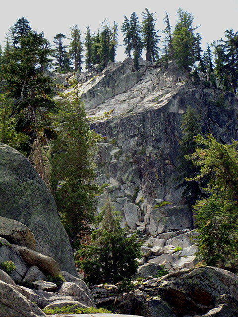 |
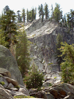
Viewing the timeless nobility of rock and tree are the priceless rewards for every sweaty step we take. I particularly enjoyed the look and feel of this massive rock formation emerging out of deep forest along the drainage towards the top of Peak 8905. This is a closeup of this formation before the trail swings Southeast and finally brings us out of this fold in the mountains we have hiked up since hiking out of Echo Summit. |
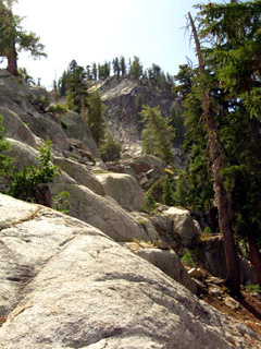
Darkness, Light, and Shadow Hiking up through the the top of the gorge we hope the Northeastern flank of Peak 8905 offers some grand views. But the dense forest only grants us a few brief, obscured glimpses of the grandeur of the Tahoe Basin below. Hurrumph! It is amazing that we see less of Lake Tahoe and its basin than the forests and rock surrounding while hiking through this section of Meiss Country Roadless Area. There are not many grand views of the Lake & Basin between Echo Summit and Showers Lake. But no worries. The terrain and views open up at Showers Lake, while the hike up through these dense forests offers its own observational benefits. People seek out the grand view and the sublime feelings magnificent views inspire. They are disappointed when they do not see them. I always begin getting that feeling hiking here. The environment and the humans within encompass a wide range of experience. Backpacking brings us though our range of experience, it puts us "though our paces," both physically and psychologically. While the breathtaking nature of a beautiful view inspires a sublime psychological response, other terrains we backpack through will each inspire their own physical and psychological responses. We will go high and low, long and short, hungry and full, hot and cold; everything that is possible will happen along the long trails, both physically and psychologically, if we spend enough time out there. The full range of engaged experience reveals itself with enough time and distance. The closed in nature of dense forest and rock South of Echo Summit almost generates a claustrophobic response to the terrain. Sometimes the beautiful view is not expansive, but the beauty is much closer in. Backpacking the long trails is like walking along a great changing natural mirror, a magic mirror where each different part of the trail reflects and reveals different aspects hidden within our minds and bodies. The different aspects of nature will reflect different aspects of you. Within these darker and closer pieces of terrain we are almost forced to look within ourselves to understand what we are seeing, and what what are seeing it with. This darker mirror clarifies, anchors, and gives context to the sublime vistas from the high points along the trail. Sometimes the psychological response to engaging the terrain are a bit discomforting rather than sublime. Sometimes the best view the terrain brings us is the view inside. *** Though we have now climbed out of the drainage fold, out of the gorge to the top of the mountain, and now that we are crossing much more "open" terrain, yet our views from this position along the Tahoe Rim are still almost completely obscured by the forest and terrain irregularities. At a couple of points along the trail grand views do open up, as you can see from the pictures below, enjoyable for a brief moment before the trail plunges us back into forest and rock. Mostly forest South of peak 8905. But don't worry too much about the lack of long views, as the forest and rock are themselves the show. It is beautiful. It is shaded, cool, and quiet, and offers the long distance backpacker soft trails, which are always welcome. And we are now losing elevation and rapidly approaching Showers Lake, where excellent views of the Lake Tahoe Basin abound, from very comfortable overlook points which are close to our awesome campsite. In any case, we should enjoy the deep forests of the Tahoe Basin now, as we will soon be leaving them and the Tahoe Basin behind for far different terrain South of Carson Pass. |
North: View, Rest Spot, Great Company South: Off 8905 to Sayles Canyon Junction
The High Point
|
Coming out of the forest cover, for a moment, on the Southeast side of Peak 8905. Our view here is towards the Northeast. South Lake Tahoe in Sun and Shadow during Fall. |
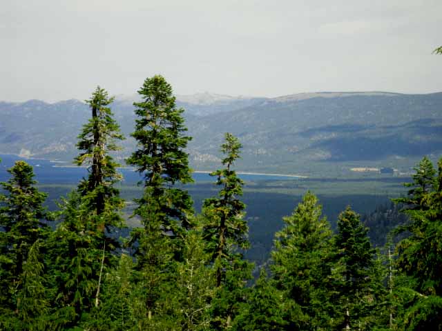 |
I never get tired of seeing all the different perspectives of Lake Tahoe revealed by our ever changing position on the trail. Our starting point through Meeks Bay and our hike South across Desolation Wilderness to our current position has given us a rotating perspective of this unique place. |
Long Views Northeast of Lake Tahoe from the Southwest corner of the Lake Tahoe Rim
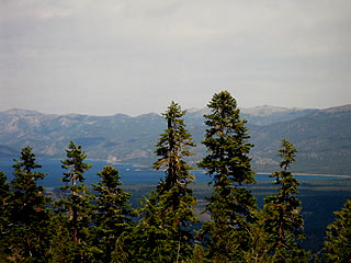
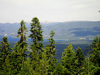
| Lake Tahoe. For a second... | Great shadows speckling the Tahoe Basin. | |
 |
 |
|
| Crossing a short open spot Southbound, a longer view to the North opened up. The East shore of Lake Tahoe. Before dropping down to the Sayles Canyon junction, we get a brief view of Southern Lake Tahoe, Casino and Cloud Shadows. | ||
| After a brief opening in the forest big enough to see a long view of Lake Tahoe, the trail again submerges us in rock bound forest. |
| And then we continue hiking the dense forest. "Close-in" terrain obscures long views, but is an experience of forest and rock all it's own. |
Rounding Peak 8905. Sweet. | |
 |
 |
|
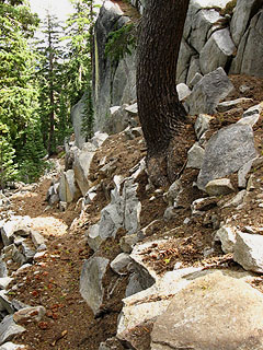
| The Trail passes by beautiful Granite formations Meiss Country is rough country | ||
| Close-in terrain of rock and dense forest. | Signs of the upcoming Winter. | ||
 |
 |
||
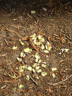
| Looking back down the narrow trail. Squirrel eviscerated cone. | |||
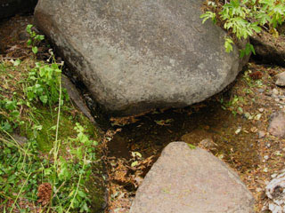
| The quiet of the forest was accented by the gentle sound of trickling water. | |||
 |
|||
| Small creeklet/spring running along trail | |||
North: View, Rest Spot, Great Company South: Off 8905 to Sayles Canyon Junction
Fine Trail through rough country from our rest spot to Sayles Canyon trail junction |
||
Just South of our overlook-break spot we hike up a gently graded section along the mountainside before the trail steepens as we finish climbing this segment of the trail where we hike up and over the East shoulder under the top of peak 8905. Rounding the high point of our hike under the peak we get a couple of brief but fine views Northeast of the Southern expanse of Lake Tahoe, the South and East Basin, along with looking into Stateline before turning West away from the chance for long views to begin dropping down to the Sayles Canyon trail junction.
Next page South |
Backpacking Trail Guide North View, Rest Spot, Great Company |
 |
Backpacking Trail Guide South |
Backpacker ForumsGeneral Sierra Nevada hiking "Trails" thoughts to relate? POST UP ! Post it on
On the Forum we can browse the various locations along the trails through Meiss Country Roadless Area and add your experiences, comments, questions (or pictures and videos) about hiking South out of the Echo Summit Trail Head. General comments about the Echo Summit to Carson Pass section of the High Sierra trails, or this particular location: Section
|
North: View, Rest Spot, Great Company South: Off 8905 to Sayles Canyon Junction
Trailhead
Contact
Alex Wierbinski

Backpacking Lake Tahoe to Mount Whitney
Your guide to the High Sierra Crest, including the Tahoe to Yosemite, Pacific Crest, and John Muir Trails
