|
Tuolumne Meadows
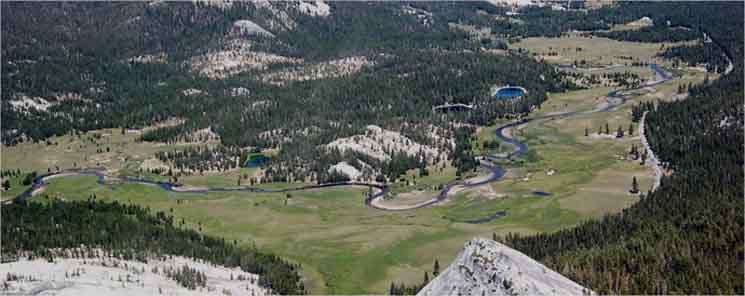
Delany Creek Left, Sewage Ponds Center, Highway 120 near interface of forest and meadow. Visitor Center upper Right. NPS photo.
INDEX
Tuolumne Meadows
Global
Crossroads
along the
Pacific Crest---Tahoe to Yosemite---John Muir
&
Tahoe to Whitney Trail
Routes
Elevation
8561 feet
A Great Place to Rest, Resupply, and Recover
halfway along our hike
from Lake Tahoe to Mount Whitney |
|
| Tuolumne Meadows
RESUPPLY INFORMATION
INDEX
Backpacker's
Facilities
&
Resupply
HIGH SIERRA
TRAIL CULTURE
Your
Backpacker
Input
Art of Resupply
|
Tuolumne Meadows
Road & Facility
MAPS
 |
Tuolumne Meadows Main Tent Cabin Facilities
Tuolumne Meadows
Backpacker Resupply
SERVICES
|
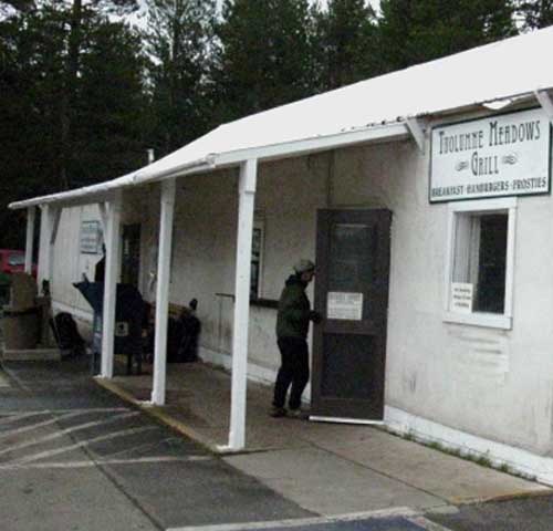 |
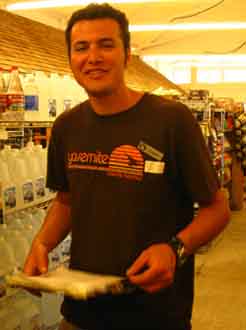
Tuolumne Meadows Grill for breakfast.
BE NICE
Backpacking Resupply
INFORMATION
Tuolumne Meadows Culture
|
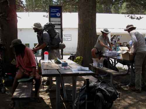 |
Backpackers come and go, congregate and resupply at the Tuolumne Meadows tables.
Backpacking Resupply
INFORMATION
Getting Ready
|
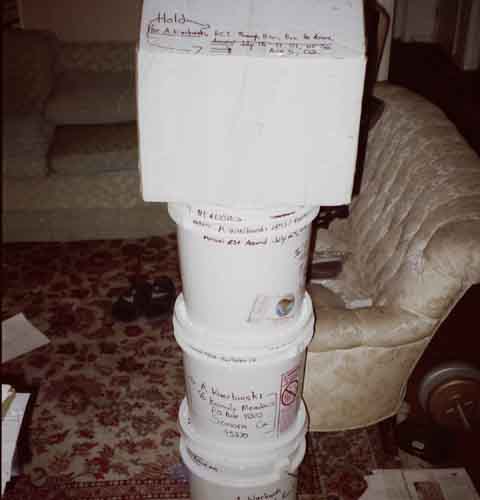 |
Tahoe to Whitney Trip in buckets and a box.
Planning
Considerations and Realities
|
Road Map Facilities Map All Tuolumne Resources Map Topo Maps
Trail Guide Information
|
Tuolumne Meadows
Location-Facilities-Role
of
Tuolumne Meadows
for
Long Distance High Sierra Backpackers
Location
Center of the High Sierra Mountain Range
UNDER CONSTRUCTION-EDITING
Elevation
8561 feet
Tuolumne Meadows
Its Local Context
Auto
The vast majority of folks experience with Tuolumne Meadows is based on, and centered on the automotive perspective, which makes the center of Tuolumne Meadows where it intersects with Highway 120. Since Highway 120 runs the forest-meadow interface along the Southern edge of Tuolumne Meadows, the location where the PCT, TYT, and JMT come together at the Post Office resupply facility and associated Store and Cafe make up both the main access point for auto-travelers to the Natural Wonders of Tuolumne Meadows and a key point where backpackers can touch civilization to resupply.
For car travelers Tuolumne Meadows is a welcome stop after the long climb up the Western flank preceeding its climb over Tioga Pass and steep drop down the Eastern Escarpment to Lee Vining and Mono Lake. Despite all the allure Tuolumne Meadows offers as an crossroads of international tourists accessing the grandure of Nature, and linking backpacker to resupply, there is much more to Tuolumne Meadows than all that.
Physical Hiker View
Tuolumne Meadows is composed of an extensive set of gently-climbing meadows along the Tuolumne River surrounded by dense lodgepole forests, sliced up by intervening fingers of that forest, and dotted with great granite domes rising out of the surrounding forest. Tuolumne Meadows is contained between the bending base of the Cathedral Range to our South, and the Sierra Crestline running roughly North and South to our East.
This fantastic series of Tuolumne Meadows reaches Southeast from its lowest point above "double bridge," bending and twisting along the course of the Tuolumne River up to the mouth of Lyell Canyon.
where it becomes one long meadow along the bottom of the canyon above the center of the facilities in the main meadow. Below the main meadow we find a series of smaller and smaller meadows descend Northwest down along the Tuolumne River for a few miles until the converging granite terrain squeezes the lowest reach of Tuolumne Meadows down into a strip of meadow along the Tuolumne River, which finally ends into the fantastic granite terrain we enter just above the "double bridge."
These lower "shelfs" of Tuolumne Meadows descending to the North, and the great meadow bending Southeast from Tuolumne into Lyell Canyon bracket our focus of interest on the social and physical "center" of Tuolumne Meadows where the backpacker-climber-hiker-tourist-camping services are located along Highway 120.
Both Tuolumne Meadows' natural and human facilities are quite expansive. The human impact is monitored and theoretically mitigated by policy and planning.
Tuolumne Meadows Plan
Southbound
PCT-TYT
into
Tuolumne Meadows
Tuolumne Meadows is an expansive meadowed flat that gives us Southbound PCT-TYT hikers exiting the difficulties of "The Five Canyons" of the North Yosemite Backcountry a bit of relief. Our climb moderates over the final miles of this section of trail as we encounter "shelves" of Tuolumne Meadows. Hiking South from Glen Aulin, Just beyond our 1.1 miles of climbing trails through the rocky terrain up to the double bridge above Glen Aulin, we are going to encounter the first lowest end of Tuolumne Meadow's lowest, "shelf," which is where our ascent moderates, and the difficulty of our next and final 4.5 miles from the double bridge South to TM's Federal Facilities decreases.
Trail Guide Section Index
Northbound
PCT
into
Tuolumne Meadows
Northbound hikes approaching Tuolumne Meadows on the PCT will have
descended continiously since crossing Donohue Pass, then down the long, almost flat length of Lyell Canyon, continuing to descend across Tuolumne Meadows, and into the rocky forests below, until arriving at Glen Alun. Northbound PCT hikers will not climb again until stepping past Glen Aulin.
Trail Guide Page: Glen Aulin to Tuolumne Meadows
John Muir Trail
JMT
Climbing Through
Tuolumne Meadows
Tuolumne Meadows marks the end of the John Muir Trail's epic climb through the Heart of Yosemite from Happy Isles. But this climb's not really over, not until we continue hiking up Lyell Canyon to begin the final stages of our long climb out of the South end of Yosemite National Park. We're finishing our hike through Yosemite by hiking through the Headwaters of the Lyell Fork of the Tuolumne River in the South end of the Cathedral Range to enter Ansel Adams Wilderness through Donohue Pass.
Trail Guide Section Index: Tuolumne Meadows to Happy Isles
Southernmost
Trans Sierra Highway
Highway 120 Tioga Pass
Tioga Pass at 9943 feet is the highest and Southernmost of the Trans-Sierra Highways passing through the Sierra Crest. We have found each of the trans-Sierra passes rising to higher and higher elevations as we've hiked further South from the Tahoe Basin. Tioga Pass at the top of Highway 120 is the highest and last of the five trans-Sierra Highways between Lake Tahoe and Mount Whitney. The other four trans-Sierra Highways to our North are, 108, 4, 88, and finally, Highway 50 into the Tahoe Basin.
Tuolumne Meadows
15 min USGS Trail Map
There are no trans-Sierra highways to the South of Highway 120 until encountering Highway 178 crossing the very low elevation furthest Southern end of the Sierra at Lake Isabella. That highway is way beyond the Southern scope of this trail guide, which turns East to end its coverage with the end of the John Muir Trail passing through the Whitney Portal.
We do investigate the backpacker resources in Lone Pine and at the Portal. South of Tuolumne Meadows our resupply points are no longer located along trans-Sierra highways, but typically at or near the ends of remote mountain roads out to the edge of wilderness. This change makes for a completely different character of resupply spots between the North and South Sierra.
Top
Big Picture
The Tuolumne River is one of two great watersheds draining Yosemite. The Merced is the other. Interestingly, the Tuolumne wraps around the North end of the Merced Watershed above Tuolumne Meadows as the river bends South into Lyell Canyon. About 7 miles downriver from Tuolumne Meadows the Grand Canyon of the Tuolumne River begins it majestic run down to Hetch Hetch Reservoir, draining the whole North Yosemite Backcounty along the way. Hetch Hetchy collects this stolen water for its run down to San Francisco and the Bay Area, providing them with some of the finest-quality water ever tasted in any megacity.
But that's changing too. Too many people stuffed into the Bay Area has been inspiring some water districts to cut their highest quality Sierra water with secondary sources, degrading its quality and taste.
ON THE ROAD
How to Get to Tuolumne Meadows
Surface Streets
&
Trails
Highway 120 begins far to our West at Highway 99 at Manteca in the San Joaquin Valley. Highway 120 ends where it tees-out into Highway 395 under the shadow of the Eastern flank of the Sierra Nevada just South of Lee Vining and Mono Lake.
In Yosemite Highway 120 crosses Tuolumne Meadows on its way East from Crane Flat far down on the Western flank. Crane Flat is where 120 begins its final long climb to Tioga Pass. Crane Flat marks the junction where folks driving East to Yosemite Valley continue East along Big Oak Flat Road, while those continuing on Highway 120 turn Northeast for the final climb to Tuolumne Meadows and Tioga Pass just beyond.
Nonetheless, Tioga Pass is the Southernmost, the highest, and the last of the great trans-Sierra roads. Highway 120 is the last road we Southbound hikers along the Sierra Crest will cross until we exit the Whitney Portal.
All the rest of our resupply points to our South are at the end of roads probing out to the edge of Sierra Wilderness Areas, except Muir Ranch. Muir Ranch sits a few miles and across a lake from the end of its nearest road.
Road Map
<< All links in the section below lead to USGS Trail Maps. >>
By Trail
From the North
Sonora Pass lays 75 miles to our North, and is the second highest High Sierra mountain pass. We have to go all the way South to Lake Isabella on the foothills of the far Southern end of the Sierra Nevada Mountains to find the next East-West road crossing the Sierra Crest to our South.
The Hoover Wilderness offers us access into the heart of the North Yosemite Backcountry via Twin Lakes, and access into the Northeastern corner of Yosemite through Green Creek.
From the Southwest
JMT hikers enter Tuolumne Meadows from the Southwest out of Yosemite Valley to climb the Cathedral Range and drop into Tuolumne Meadows.
From the South
We can hike North into Tuolumne Meadows out of June Lake or from Reds Meadow Pack Station.
By Road
Highway 120 crosses Tioga Pass to drop onto the steep Eastern flank of the Sierra a few short miles East of Tuolumne Meadows. Descending the East flank of the Sierra is a steep, swift, and short journey down all the Eastern flanks of all trans-Sierra Highways.
They are long and hard journeys up the Western Foothills and Flanks, all to be followed by rapid descents down the sheer Eastern Escarpment of the Sierra Nevada.
Highway 120's Eastern end is where it tees-out into Highway 395 at the base of the East Flank of the Sierra on the South side of the cute little town of Lee Vining. Lee Vining overlooks Mono Lake along the Highway 395 corridor.
Highway 395 runs North and South under the shadow of the sheer wall of the East Sierra Flank from the Carson Range wrapping around the East Shore of Lake Tahoe to our North, all the way South past the South end of the Sierra Nevada mountain range, running into the Mojave Desert.
We will hitch down to the town of Lone Pine on Highway 395 after we exit the Whitney Portal, then North on Highway 395 to our selected route West over the Sierra and back to "civilization."
I'll likely point myself towards Tuolumne Meadows...
On the Road
Local Resources
Mammoth Lakes is the nearest full service city from Lee Vining. It is located South down Highway 395. Bridgeport is the next town with services, food, and gas North of Lee Vining along Highway 395.
On the Trail
JMT South
Lyell Canyon leads Southbound John Muir Trail hikers climbing gently to our Southeast out of Tuolumne Meadows until we reach the short but significant climb up to Donohue Pass out of the South end of Lyell Canyon. At Donohue Pass JMT hikers pass out of Yosemite across the boundary dividing Yosemite from the Ansel Adams Wilderness administered by the Inyo National Forest to the South of Yosemite.
TRAIL
Short Gap to Next Resupply
South of Donohue Pass we have two great descents and one small climb separating us from Reds Meadow and the shuttle to Mammoth Lakes. Easy Money. It is quite a short segment of trail between the Tuolumne Meadows and Mammoth Lakes resupply spots. I can do it in one night and two days, but I'd prefer two nights, maybe three, depending on how much scrambling we want to do through this short, but most interesting section. We have Ritter, Lyell, and the Minarettes laying between Tuolumne Meadows and Reds Meadow.
This short distance packed with interesting scrambling allows us to pack extra food to do some extensive scrambling along this next section of trail.
At the base of our Southbound descent from Donohue Pass we have a mild climb up to Island Pass followed by a great nine mile descent to Reds Meadow along the Valley and PCT routes, while the JMT runs past a series of rock and forest-bound lakes. At the trail junction on the East side of Thousand Island Lake we will have to decide between these three routes down to Reds.
Three Routes to Reds
The PCT and JMT routes each stay high up on one side or the other of the canyon wall bracketing the Middle Fork of the San Jouquin River down to Reds Meadow. The PCT route crosses over to and traces out its route along the barren volcanic Eastern flank of the canyon, while the JMT takes a roller coaster ride past a series of stunningly beautiful lakes situated in the granite and hard metamorphic terrain characterizing the Western wall of the canyon, while t e River Route splits the difference between the PCT and JMT by following the River down the center of the canyon to Reds Meadow.
The river route is on soft trails and mostly under shade. This is the way to go if your knees or feet are giving out. The surface is soft, though it is steep.
I've done all three. The PCT route is least preferable, being exposed across barren volcanic terrain. The JMT is the most beautiful route, but the most difficult of the three, being a bit of a roller coaster. The River Route is easiest, with the softest trails composed of very soft river bottom and meadow soils through hot but well shaded forests.
The JMT route is the route to take if you are hiking through here once. |
PCT North
The Hardest Section
of the
Tahoe to Whitney Trails
Northbound PCT hikers have a seven mile downhill hike following the Tuolumne River to Glen Aulin from Tuolumne Meadows.
Then it is "ON!"
A long, hard climb to Miller Lake follows our departure from Glen Aulin. Departing Glen Aulin we are hiking into the jaws of the famous five canyons of the North Yosemite Backcountry, considered one of the hardest, if not the hardest section of trail along the whole length of the PCT. The long climb to Miller Lake is just the warm-up.
Northbound hikers of all stripes, and especially PCT hikers, are well advised to be well-rested and ready for a hard, physically demanding 75 mile section of trail from Tuolumne Meadows to Sonora Pass.
Northbound PCT hikers are approaching 925 miles on the trail, and arguably the hardest section of the whole PCT lays ahead, the hike across the North Yosemite Backcountry. Don't be surprised if your daily miles go below 20.
JMT Hikers
Tuolumne Meadows Rest and Resupply
JMT hikers have just had a strong taste of the degree of difficulty of the work required to hike the JMT during their very difficult climb out of Yosemite Valley up to Tuolumne Meadows. How deeply this climb drained your energy and ability to recover will determine the length of your rest in Tuolumne Meadows, and even the vailidity of your trip planning.
It behooves everyone to rest, recharge, and resupply properly for the next section of their respective trails, and Tuolumne has the facilities necessary to rest and recharge.
Top of Page
Tuolumne Meadows
Global Crossroads Culture
Backcountry Travelers
Yosemite National Park is a global landmark and destination for us backpackers who submerge ourselves in Nature. Yosemite National Park is a destination for local, regional, national and international backpackers.
I literally mean destination. Of all the times I've visited Yosemite over the past twenty years, I've only driven to Yosemite once (I hitched from Lake Alpine), and therefore was forced to pull a permit from Yosemite. Every other time I've hiked into Yosemite from other National Forests, and pulled my permits from those forests.
Frontcountry Visitors
There are many more visitors to Tuolumne Meadows than us backpacker folks submerging ourselves into the wilderness experience, and coming up for "air" in Tuolumne Meadows. There are literally millions of visitors to Yosemite National Park who remain on, near, or very close to the access roads, campgrounds, and facilities required to provide them with resources.
How Big is Too Big?
These millions of visitors span a wide range of international and national tourists, day hikers, climbers, car campers, and I even include the armies of Yosemite employees in this number. Long distance backpackers on the Classic High Sierra Trails find increasing trail traffic approaching Tuolumne Meadows from any direction, and those driving to TM may very well find actual traffic at the parking lot for Tuolumne Meadows Federal Facilities, and extensive lines inside the facilities.
Physical Crossroads
For our purposes, Tuolumne Meadows and its extensive facilities are where the routes of the TYT, JMT, and PCT come together at a point where significant backpacker resources are positioned.
Tuolumne Meadows marks where the Tahoe to Yosemite Trail ends, also ending its unified run with the Pacific Crest Trail from the top of Jack Main Canyon down to TM.
Tuolumne Meadows
is where the John Muir Trail ends its climb out of Yosemite Valley by hiking over the Crest of the Cathedral Range, and replaces the TYT accompanying PCT for the majority of our hike along the South Sierra Crest to Crabtree Meadow.
Crabtree Meadow is where the JMT turns East to make its dramatic ending climbing to the top Mount Whitney before exiting the Sierra down its steep Eastern Escarpment to Lone Pine in Owens Valley.
Besides being a crossroads of classic long distance backpacking trails and hikers, Tuolumne Meadows is also where the vast infrastructure supporting both road and trail operations is stashed. An extensive water, sewer, garbage, food, power, permits, rescue, rangers, and support staff/infrastructure is centered in Tuolumne Meadows.
Cultural Crossroads
Tuolumne Meadows brings together every type of backpacker possible. Just the range of folks attempting the PCT every year is simply amazing, not to mention the very, very different character of those folks hiking the JMT. This is in part due to the huge size of each group. The JMT and PCT both have over a thousand backpackers attempting their respective trails every year.
Nonetheless, the JMT and PCT hikers are two very different groups of backpackers...
National & Global
BACKPACKERS
Then we have backpackers who have come a long ways to backpack in Yosemite itself. If we spend any time at all in Tuolumne Meadows and on the surrounding trails we are going to regularly meet backpackers from Tennessee, Germany, Michigan, Spain, Paris, and around the country and the whole world.
We find these folks exploring every variation of local and long distance backpacking trip possible, from the
Tahoe to Yosemite Trail, to the JMT and the whole PCT, to section hikes and loops to suite every type of preference and level of capacity.
We find this international activity centered in Tuolumne Meadows.
Throw the trail crews and High Sierra Camp staffs into the mix, add in the rest of the government employees and the DNC facilities staff, and we really have the, "cultural construction materials" for a number of unique social groups all centered on supporting wilderness engagement and experience.
BOTTOM LINE
We can depend on the fact that lots and lots of backpackers of every type and description are going to backpacking into, and come into contact with each other and a whole lot of other "Nature Lovers" at this international crossroads of trails and travelers called Tuolumne Meadows.
I find it most entertaining.
Find the Center
I take the time to be friendly to everyone, and check out the drive-through tourists, the car campers, the climbers, the folks working, as well as the international cast of backpackers we find in Tuolumne Meadows. Sometimes I walk over to Bug Camp to see the trail crew there, when there's a trail crew staying in the official federal tent cabins over there.
Virtually all the folks here are because they love it. |
Top
Federal Facilities
Hard Assets
The Human Effect
Tuolumne Meadows supports Ranger Stations, a Permit Station, a Visitor Center, Horsepacker Facilities, Trail Crew accommodations, extensive car campgrounds, tent cabin campgrounds, and our walk-in Backpacker's Camp.
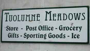
These "public" federal facilities are also supplemented by "contract" private facilities. These are the seasonal Store, Post Office, Gas Station, Sports Shop, and Cafe.
Each of these public and private facilities all require permanent construction features and a permanent infrastructure to support them, and the many visitors who pass through every season. All are shut-down and sealed up during Wintertime. Tuolumne Meadows tent cabins are assembled sometime approaching mid-June and disassembled sometime after mid-September, depending on each year's conditions. All the public and private facilities at Tuolumne Meadows draw considerable Summertime traffic and use.
Road Conditions
See the maps below for the layout and locations of Tuolumne Meadows' various facilities.
YOSEMITE NATIONAL PARK
Huge City--Small Town
Physical and Social Infrastructure
The thing that makes Tuolumne Meadows a resupply spot is the same thing that brings all the visitors to Yosemite: Highway 120. This one piece of infrastructure brings so much attention, so many people to Yosemite that substantial additional infrastructure is required.
Though substantial, the traffic through Tuolumne Meadows visible infrastructure is nothing like that of the "Disneyland for Nature Tourists" atmosphere we encounter in Yosemite Valley. Tuolumne Meadows is like a small town to Yosemite Valley's big city size, traffic, and infrastructure.
If Yosemite Valley is the "Big City" of Yosemite National Park, then Tuolumne Meadows
is Yosemite's little, "country town," its, "village." What's that saying about villages?
It takes Idiots to make a Village...
No...
It takes a Village to raise an Idiot...
No...
It Takes Values to Preserve Nature.
YES.
My point here is that values determine outcome, not participation.
Values are like good infrastructure: You don't see them, but you feel their beneficial effects
guiding us to good outcomes.
Tuolumne Meadow's visible backpacker, car camper, and all the visible supporting federal facilities require a significant invisible infrastructure to support them. The significant sewage, water, garbage, and electrical systems are all hidden around Tuolumne Meadows.
No matter how we got here, driving or hiking, our presence in Tuolumne Meadows makes a significant impact on the environment here, and leaves a significant footprint. It is not human contact itself that causes problems, but it is our loss of control of the outrageous size and scale we have bloated our super-sized population out to, and the unecessary damages to Nature and our society done by the very size and scale our corporate masters have irresponsibly grown our obese, "body politic" into.
The size, density, and intesity of damage brought by any contact with our super-sized gross "consumer" "body politic," is very bad for the spiritual and physical health of man and deadly to Nature. It is not our "loving Nature too much" which is killing Nature, it is our inability to control ourselves, to limit our gross growth, and show some restraint with our base desires.
Our relentless growth is what's killing Nature.
Our relentless greed drives the relentless growth.
It is less than ironic that the flood tide of urban dwellers into Yosemite bring
the same things with them into Nature they are attempting to flee.
Eat Until You PoP,
PIG
This over-population "obesity" has allowed population growth that now constitutes the core direct and indirect threats to Yosemite and every other remaining National Park and all Natural Places in our country and around the World.
This growth has significantly shifted the
Weather in our country and on this whole planet out of their traditional patterns. These seismic shifts have already happened, and the changed conditions are becoming the "new normal," and deepening. The very size of our population has long been squeezing life directly out of Nature's Web through direct depredations. We long ago cut down all the forests and plowed up all the Plains, killed the indians and their buffalo while draining aquifers and cutting the web of life as we "progressed" across the continent.
The duration and scale of our frontal assualt on Nature is now manifesting indirect consequences that are even more damaging than our frontal assualt. The double-edged nature of these direct and indirect threats to Nature are devastating when combined.
Our inextricable growth has not just broken the superficial manifestations of the Web of Life, but has triggered unstoppable changes to the weather patterns underpinning global fertility.
Our double-barrled assualt on the physical manifestations of the web of life directly, our cutting down all the forests, draining all the water, mining all the coal and oil have created and combined with fundamental chemical changes to our atmosphere to have significantly damaged both the root and branch of the Web of Life in our country and around the whole world.
These damages are sourced to interlocked individual and corporate greed pushing larger and larger populations. These social and economic forces have morphed into a vast expression of large scale collective, social greed formed under the identity of "consumerism."
Corporate consumerism, to be precise.
This distillation, combination, and expression of collective and individual greed has unleashed an identity with a destructive force that has undermined the very roots of Nature's global fertility.
That's not very wise.
This greedy, irresponsible behavior must stop now if we want to stop the destruction of the complexity and fertility of Nature required to support human complexity and fertility.
The one does not exist without the other.
Either we continue our present behavior and lose the remaining bits of the Wild World,
Or we stop the growth of greed, and preserve, even expand what little of the Wild World that remains. |
Top of Page |
Soft Assets
Seasonal
Backpacker and Camper Resources
The main facilities used by resupplying backpackers are the Post Office,
Store, and Grill. These are all located together in the king-sized seasonal tent cabin along Highway 120 in Tuolumne Meadows.
Tuolumne Meadows tent cabins are assembled and the facilities fired-up sometime approaching mid-June and disassembled and put to sleep sometime after mid-September, depending on each year's specific weather conditions and progression.
This includes the Tuolumne Meadows Lodge as well as the Store, Grill, and Post Office.
Each year's specific transition from Winter into Spring conditions determines when and how quickly the Trans-Sierra highways can be safely plowed. This in turn determines when all of the folks who run our resupply spots up and down the Sierra Nevada can open.
Road Conditions
&
Opening Dates
Open roads bring car campers as well as backpacker resupplies:
Tuolumne Meadows Car Campground |
Top
Backpacker
Luxuries and Necessities
at
Tuolumne Meadows
LUXURIES
Tuolumne Meadows Lodge
About a mile to the East of the Tuolumne Meadows Store, Post Office and Cafe is the pinnacle of luxury at Tuolumne Meadows:
The Tuolumne Meadows Lodge.
The Tuolumne Meadows Lodge maintains tent cabins they rent out and also serves up nightly high quality "family" dinners served "family style," that backpackers can enjoy if the Lodge has an open seat (reservation required) and you have 25 bucks. They also serve breakfasts to Tent Cabin guests.
More information about Tuolumne Lodge below.
NECISSITIES
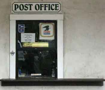
Tuolumne Meadows Post Office
Backpacker Resupply Information
What's most important to backpackers hiking down the Sierra Crest are the facilities where we can buy food for eating now and food for carrying down the trail when we depart.
The most important of these facilities are the ones that allow us to send food resupply packages to ourselves. Because of its location in relation to the distances of the next resupply spots to our North, Tuolumne Meadows Post Office is one of the most important of these resupply facilities along the Sierra Crest.
To the South we have a quick series of closely spaced resupply spots: Reds, VVR, and Muir are all closely spaced. Muir Ranch is our "money" resupply, because Muir Ranch is the last Southbound Resupply for over 130 miles to the South along the JMT. We can dispense with Reds and VVR but not Muir.
To the North we have no such luxury. Kennedy Meadows is 75 miles North, Echo Chalet and Lake Tahoe about 150 miles.
That's why the Tuolumne Meadows Post Office is the most important of our Tuolumne Meadow's backpacker resources. The store is nice for extra snacks, some fresh food, and cold frigging beer, and actually eating a burger and fries from the Tuolumne Grill (with an ice cold beer from the store) is total joy, but, what actually gets and keeps us going on the next section of trail is the resupply package we sent ourselves via the Tuolumne Meadows Post Office.
The treats in the Tuolumne Meadows Store make the store the next most important destination for backpackers, but for a different reason. Since we've walked 75 miles since our last resupply and 181 miles from the beginning of the Tahoe to Yosemite Trail (from the West Shore of Lake Tahoe), we are going to take a little "luxury" break at the store and cafe by eating some ice cream, drinking some beer, as well as eating a few burgers, fries, breakfasts, and salads at the Grill before we hit the trail down to Yosemite Valley.
Food tastes much better after extended periods in the field.
The services at Tuolumne Meadows constitute an excellent rest and restoration stop for the long distance backpacker. The next section of our hike will bring us down into Yosemite Valley via the John Muir Trail. We will also hike back out of the Yosemite Valley via the JMT, but we will continue up the Merced River past Little Yosemite to rejoin the JMT in Lyell Canyon via Vogelsang Pass into the South end of Lyell Canyon.
This fantastic "triangle" route through the Heart of Yosemite allows us to incorporate an extensive tour of Yosemite National Park as part of our Tahoe to Whitney hike before we continue South along the JMT down to the Mount Whitney Portal.
I call this section through the Heart of Yosemite, "The Golden Triangle."
In the meantime I figure I need a full day without any hiking at all in Tuolumne Meadows before beginning the Southern half of this trip down to the Whitney Portal... via Yosemite Valley.
Sports Store and Gas Station
NO MORE GAS STATION
A few feet to the West of the Post Office-Store-Cafe facility there is a permanent gas station who's office has been converted into a sports shop.
Closed as of 2016 Season
The sports shop caters mostly to climbers. If you lost or broke some gear or clothing this is the place to go.
 |
|
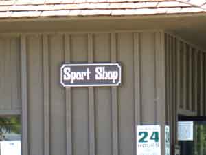 |
The gas station is 24 hour automated credit cards only and the "Sport Shop" occupies the associated building.
Top of Page |
|
Tuolumne Meadows
Backpacker Resources and Services
Be Nice
The Post Office distributes resupply packages backpackers sent there to themselves, while the store is very well stocked with backpacker and fresh foods that backpackers will really enjoy eating here in Tuolumne Meadows and further down the trail. The store is remarkably reasonable priced while the grill is a bit expensive, but neither is the fault of the fine folks who work there.
Be very nice to the folks who work there. They work really hard to provide quick and excellent service in hard conditions to huge numbers of people. This is Yosemite, and it gets busy during the peak of the tourist season. Busy on the trail, in the store and cafe, and even at the Post Office. So be nice. Don't make me kick your ass...
The food in the Tuolumne Grill is prepped and served at the highest level the staff is capable of with the ingredients and menu they are given. Despite these limitations the menu is remarkably large and varied. The store stocks a remarkable range of food and supplies. Both the store and cafe offer remarkable service in a remarkable place.
This is the best store on the trail between Tahoe and Whitney. Kennedy Meadows Pack Station has the next best store.
Both the store and cafe benefit from the fact that everything tastes better in the Sierra Nevada.
I still say the Grill is a bit expensive. We paid the same for a burger in Kennedy Meadow's fine restaurant as we do in the Tuolumne Meadows Grill. That is DNC's fault, not the fine folks who work for them.
 |
|
 |
|
 |
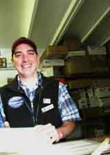
| Michael Kochakji runs the Tuolumne Meadows Post Office like a well-oiled machine.... |
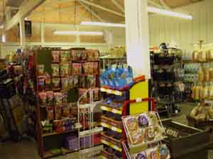
Very well stocked store at Tuolumne Meadows.
Top of Page |
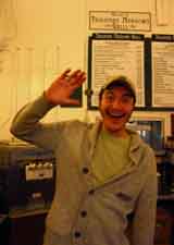
Jamie in The Tuolumne Grill. |
|
Tuolumne Meadows Store
This place is remarkable. It is tuned for the car campers and passing tourists, but has a wide selection of food suitable for backpackers. There is concern among locals and backpackers that the percentage of tourist crap in the store is much too high. I would tend to agree. Coffee cups, calendars, and other kitschy stuff does not compliment the natural environment in Tuolumne Meadows.
The car camping food available in the store gives us the opportunity to cook up some not-freeze dried food rather than solely rely on the Tuolumne Grill for all of our meals during our period of rest and resupply at Tuolumne Meadows.
I always end up buying groceries for a couple of days of camp eating as well as setting up the next supply of food for the quick walk down to Reds Meadow.
 |
 |
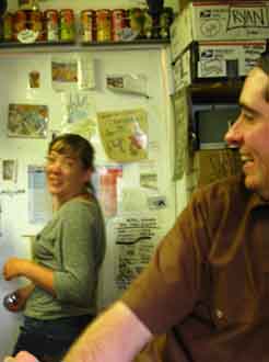 |
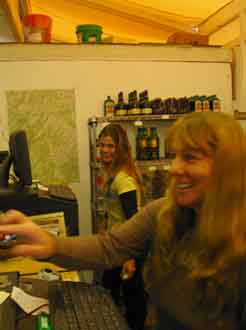
| Dianne and Sarah |
Jamie taking inventory. |
Jamie and Michael in the Post Office. |
|
Store
Partial Inventory
FORUM
What have you seen in the store?
2016
UPDATE
NO CIGS or TOBACCO
No Tobacco at Tuolumne Meadows
Quaker Oats Oatmeal
Cheese-Milk-Yogurt
Gourmet Ice Cream (Ben&Jerry)
Fresh veggies
Apples-Bananas-Corn-Potatoes
Tortillas
pre-made Deli sandwiches
pre-made Deli salads
Juices-Jamba Juice-fancy Juices |
Lunch Meats
Bread-Crackers
Lots of nuts and dried fruits
Energy Bars
Beef Jerky
Ramen Noodles cup and block
Killer dried Soup Cups: Black Bean
Split Pea & so on...
Freeze Dried Dinners
Good Beer
Hard Alcohol
No Smokes |
Hiking Maps
DEET-Suntan Lotion-chapstick-Moisturizer- and personal care products
Batteries
Full Car Camper Grocery
Cans of Food
Ice--Fire wood
Hats-Gloves-socks
Variety Fuel Canisters
White Gas
Denatured Alcohol
|
This is a partial list. The Tuolumne Store has much more.
This is one good store for backpackers.
FORUM
What have you seen in the store?
Top of Page |
|
Tuolumne Grill
 |
|
 |
Breakfast from opening to 11:30 am, Lunch menu served until close.
Breakfast: Biscuit and Gravy, Buckwheat pancakes.
Eggs, hasbrown patties, breakfast meats. |
Favorites
Lunch: Veggie Chile. Very good! Chicken-burger, Burgers, fries, and Salads. Good Salads. |
Heck, "it's all good."
Not great, but good.
Frosties. Everyone loves the frosty cones....
The Trailside Gourmet
Now you see why I say the "home cooking" and prices at Kennedy Meadows are the best on the trail. Despite the best efforts of the Tuolumne Meadows Cafe staff, they are working within the limits of their food system. Tuolumne Meadows Grill is "Fast," while Kennedy Meadows and VVR offer "classic" home cooking.
The staff at the Tuolumne Meadows Grill maximizes what they are given to work with.
The prices at Tuolumne Meadows rival those at Kennedy Meadows and VVR!
The other places with quality home cooking style service, such as at VVR, are more expensive than Kennedy Meadows Pack Station!
FORUM
What did you like in the Grill?
Top of Page |
|
July of 2016
Tuolumne Meadows Grill
Menu
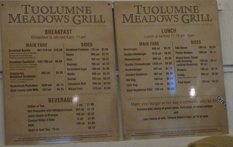
Tuolumne Meadows Food
Prices Clarified
JULY 2016
BREAKFAST
MAIN FAIR
Breakfast Bundle 10.50
Choice of Bacon, ham, or sausage served with scrambled eggs, breakfast potatoes and a biscut.
Breakfast Sandwich 6.00
Choice of bacon, ham, or sausage
served with scrambled eggs and
cheese on a biscut
Vegetarian
Breakfast Sandwich 6.00
Tomato, Scrambled eggs and
cheese on a biscut
Buckwheat Pancakes 5.75
Cold Cereal with Milk 4.25 |
SIDES
Breakfast Potatoes 3.50
Bacon 3.75
Ham 3.75
Sausage 3.75
Scrambled Eggs 2.00
Muffin 3.25
Danish 3.25
Cinnamon Role 3.50
Whole Fruit 1.50 |
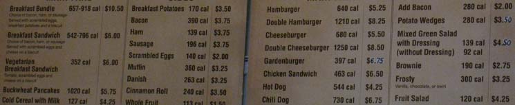
Tuolumne Meadows Cafe
Prices Clarified
JULY 2016
LUNCH
MAIN FAIR
Hamburger 5.25
Double Hamburger 8.25
Cheeseburger 5.50
Double Cheeseburger 8.50
Gardenburger 6.75
Chicken Sandwich 8.50
Hot Dog 4.25
Chili Dog 6.75
Bowl Vegetarian Chili 5.00 |
SIDES
Add Bacon 2.00
Potato Wedges 3.50
Mixed Greed Salad
with Dressing 4.50
Brownie 2.75
Frosty 3.25
Fruit Salad 4.25
|
Prices Subject to Change!
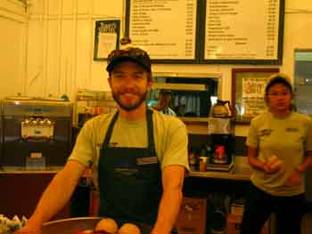
2016 Crew in Action
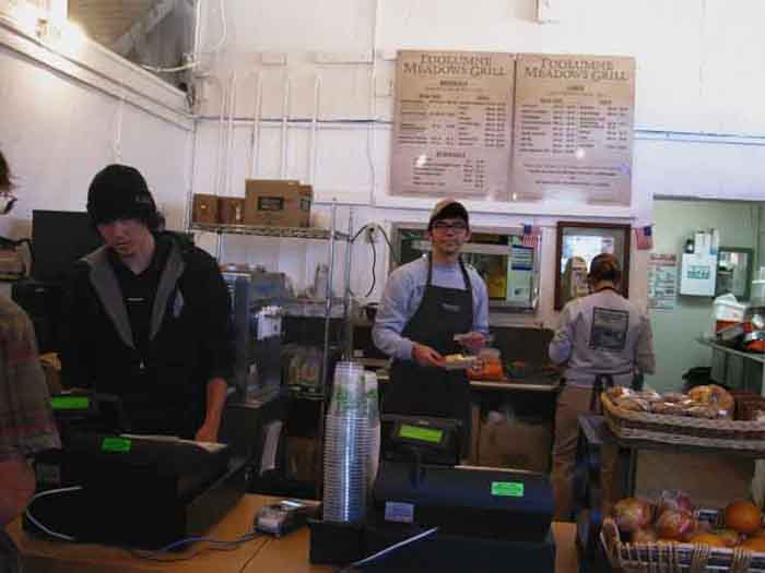
Dominic in the center of grill activity.
Tuolumne Meadows
Staff Culture

Also See
Tuolumne Meadows 2016 Report
Top
Tuolumne Meadows Lodge
Tuolumne Meadows Lodge Information
There are no shower or laundry facilities available to backpackers at Tuolumne Meadows.
I've been known to walk the mile down to the Tuolumne Lodge and try to look like I'm a tent camper there as I stroll into their shower facilities with a towel over my shoulder.
That's worked every time I've tried it. But I have to pre-clean up a bit to pass as a tent camper... act a bit stupid, wear a hawaiian shirt, funky sandals...ect...
|
Tuolumne Lodge does have one Backpacker Resource I've seen a few enjoy.
Their Food.
A family-style dinner is served from 5:45 pm to 8:00 pm. Reservations are required. Backpackers can walk down to the lodge and make a reservation if there are empty seats available.
I believe dinner is around 25 bucks.
For those driving up, reservations can be made by calling (209) 372-8413. |
Note on Employees
The folks working up here at the store, post office, and grill all live in the quarters behind the main tent cabin. They have a little employee community up here in the mountains.
They hang out with trail crew passing through on weekends, High Sierra Camp staff, and the various maintenance, horsepackers, and non-LE rangers who stay up there. Most of them hike and climb extensively on their days off. They are full of information about current conditions.
They generally head out to Mammoth Lake for concerts, great food, personal supplies, and to get the heck out of Tuolumne Meadows.
Each year the staff changes a bit, but keeps many of its core folks.
Everyone in the commercial concessions within Yosemite works for Delaware North Companies, or "Devil Never Cares," as the kids call it.
FORUM
How'd you like the folks working up there?
Top of Page |
|
Backpackers Camp
In the back of the car campground on the hill above the Dana Campfire Circle we find the Tuolumne Meadows Backpacker's Camp for walk-ins only. I believe the Backpacker's Camp is limited to one night, and it costs five dollars per night self-payable at the bulletin board via envelopes into a steel post with a slot.
 |
Sometimes it is empty late in the season, and it is certainly busy during the peak of Summer, but I've always met a bunch of good backpacker dudes at the Tuolumne Meadows Backpacker Camp every year. |
 |
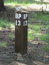
| Camp 13, where I stay at Tuolumne Meadows. |
|
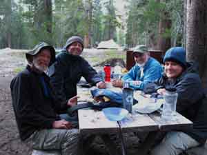
Backpacker Dudes enjoying the environment at Campsite 13: It was very good, |
I've seen people stay here a long time (I'm taking about you, Ethan...), but the majority of campers here are either backpackers on the PCT or JMT, or backpackers waiting to get a permit to hit the trail. I always stay there two nights, the first night after walking in, and the second night after a full day of rest off the trail.
Nobody has ever bothered me for staying an extra night. Tuolumne Meadows marks the end of our 181 mile hike down the Tahoe to Yosemite Trail from Meeks Bay, and I don't know about you, but I need a full day off before continuing South.
Our last section of trail to get to Tuolumne Meadows was the 75 miles from Highway 108 (Sonora Pass or Kennedy Meadows) that we just finished. It is justifiably noted as one of the hardest sections, if not the hardest section of the whole PCT...
And I am so hungry that a full day of eating and resting feels just right!
Yogurt, Salad, Bananas, Beer, and a Bacon Burger!
Hurray!
Yosemite Federal Website
Backpackers Camp Information
Sometimes the Backpacker's Camp gets overwhelmed with folks. It is customary for us folks with campsites to offer folks without a campsite the extra flat spots in ours.
It's also nice if we don't party too loudly late into the night and keep our neighbors awake. Hey, I say party all you want, but shut the fuck up about it. Nobody wants to hear your bullshit out here, and about everyone here is at least here to get away from loudmouths.
Don't be the camp idiot...
Backpackers
Tuolumne Meadows hosts large numbers of local, national, and international backpackers. The majority of backpackers at the Tuolumne Meadows Backpacker Camp are, in my experience, medium and long distance backpackers on about every type of trip imaginable.
Life in Tuolumne Meadows Backpackers Camp
FORUM
Comments-thoughts on Tuolumne Meadows Backpackers Camp |
Top of Page |
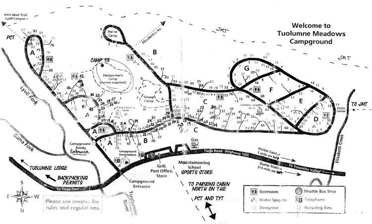
Map
of
Tuolumne Meadows Campground
with
Store, Cafe, Post Office, Backpacker's Camp, and Trails
South on Top
 |
Large
Tuolumne Meadows
Campground MAP
Also See
Facilities Map, below
Road Map, above
Tuolumne Meadows Facilites
and the
TYT-PCT-JMT
The map above locates the campground and associated backpacker services at Tuolumne Meadows in relation to the main trails running through Tuolumne Meadows, along with the site numbers in the car campground.
PCT-TYT
North of Tuolumne Meadows
Note that I've marked the maps above and below to show the route of the PCT-TYT from the Tuolumne Meadows Store and Post Office to Parsons Cabin, rather than the dirt road from the Visitor Center to Parsons Cabin. The dirt road connecting the Visitor Center to Parsons Cabin is significantly offset from our actual destination, the Tuolumne Meadows's Facilities. The Visitor Center is located a bit over a mile to the West down Highway 120 from the Post Office, and not visible off the Right edge of the map above. The map below shows the location of the Visitor Center and the road to Parsons Cabin and our trail from TM to the wilderness boundary just beyond Parsons Cabin.
JMT
Visitor Center Trail Junction
to
Store, Cafe, and Post Office
The maps above and below also show the short trail connecting the West edge of the Car Campground to the John Muir Trail's Visitor Center Trail Junction. This trail is the most direct and easiest-to-find route for John Muir Trail hikers hiking out of Yosemite Valley to get to the Tuolumne Meadows Store, Cafe, and Post Office facilities. Check out the map below for a broader context & overview of the trails and facilities at Tuolumne Meadows.
NOTE
The map above has South at the top of the map, the map below puts North at the top.
That's not normal...
JMT ROUTE
Also note that the Southbound JMT route coming up from Yosemite Valley (upper Right of map above) circles around the backside, the South side of Tuolumne Meadow's facilities. Most JMT hikers are not bypassing Tuolumne Meadows, so when we hikers out of Yosemite Valley arrive at the trail junction above the visitor center we hike a few steps North towards the Visitor Center before we turn Right, to follow a trail Northeast into the Car Campground where we parallel Highway 120 hiking East to make our way to the Tuolumne Meadows Store, Post Office and Grill.
I find this middle route through the Tuolumne Meadows Car Campground to be better than than following the JMT route around the backside of the car campground or walking along Highway 120. The "middle" route through the Car Campground is a much more direct route to the store than our other two options.
At the Post Office
Though we will check on the status of our resupply package to make sure it is in the Post Office, we will not
pick it up until the next day, when we are going to actually pack the food for our next section of trail South. Tomorrow will be our full day off, during which we will pack for our departure the following morning during our FULL DAY with ZERO MILES, to depart the second morning we wake at TM, after breakfast at the Grill...
First Order of Business
HOWDY, TM !
We are initally hiking into the store
first for a refreshing beverage, to see how many backpackers are passing through and meet them, and say hello to the folks working at Tuolumne Meadows. Then we will hike over to the Backpacker Camp to set up this evening's camp and kick back...
TM
BACKPACKER CAMP
Note the location of the backpacker's camp. Note the small trail around the East side of the store into the car campground, and our short route through the campground to the trail on the East side of the Dana Campfire Circle leading us up to the main entrance to the backpacker camp. The Backpackers Camp is located on the top of the rise above and behind the Dana Campfire Circle.
This trail also passes by bathroom and water facilities, as does the trail marked on the East side of the Backpacker's Camp on the map above. |
Top of Page
Accomodation
&
Transportation
Top of Page
Backpacking Permit Station
at the
Wilderness Center
in
Tuolumne Meadows
North on Top
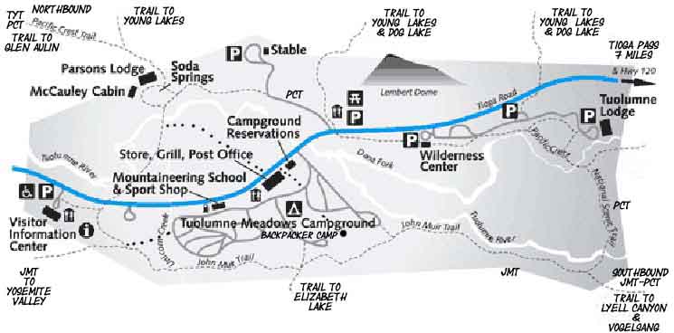
Both of the Tuolumne Meadows campsites and facilities maps above are products of, and thanks to, the National Park Service. The official map above does not show the direct route from the visitor center to the West side of the car campground, but it is there so I black-dotted it in.
I also marked the trail between facilities and Parsons Cabin omitted on the map above with black dots.
Note
The John Muir Trail tracks around the Southern perimeter of Tuolumne Meadows Facilities.
Tuolumne Meadows Hiking Map |
Top of Page
Top of Page |
| Trail Guide Information |
|
|
|
|
TRAIL GUIDE
Under Construction
As of early 2014 the draft pages of the guide covering the Pacific Crest and Tahoe to Yosemite Trails between Meeks Bay and Tuolumne Meadows are substantially complete.
As of June of 2016 the South Sierra Maps and miles pages are laid out in "unfinished" form, the South Sierra Index pages are up, and I have finished most of the Yosemite Section of the Guide.
After some finish work on the North Sierra Guide's index and organization, and fixing up the maps as well as making progress on the big rewrite of all completed content, I've begun the Guide South to Mount Whitney.
Our first goal will be to describe two ways to Donohue Pass. One follows the JMT South from Tuolumne Meadows and the second route hikes through the Yosemite Valley before returning to Lyell Canyon via an alternative route over Vogelsang into Lyell Canyon for the hike to Donohue, which I call, "The Golden Triangle" route.
Top of Page |
|
Permits
General Information
about
Permits
Tahoe to Whitney
Yosemite-Tuolumne Meadows
Permit Information
Most long distance backpackers (excepting John Muir Trail hikers) pulled their permits for hiking through Yosemite far from Yosemite. Permits for backpacking trips are drawn from the unit that administers your starting traihead.
THE TRADITIONAL SYSTEM
Permits issued from your starting trailhead are good through all subsequent National Forests, Wilderness Areas, Special Zones and National Parks that you named on your permit. Generally no additional permits are required, though forest managers sometimes come up with novel ways of limiting access to specified areas, such as during the era of the "Whitney Zone" stickers.
PCT through hiker permits are only good along the PCT corridor, and NOTHING ELSE.
For Tahoe to Whitney hikers right now (2014) there is only one "special zone" operating between Tahoe and Whitney at the Carson Pass Management Unit. This mostly affects Tahoe to Yosemite Trail hikers, as that route crosses over the center of the CPMU hiking over Round Top. The Pacific Crest Trail skirts the Eastern Edge of the CPMU, and most PCT hikers do not venture off-route to stay at either Winnemucca or Round Top Lakes. TYT hikers will be attracted to campsites around Round Top Lake as it is the highest camping spot for miles, has the best vistas and sunsets, and is a generally delightful place to be.
If you think you want to camp at Round Lake make sure you specify this on your permit. The CPMU likes to think they are the only issuer of permits for their zone, but they are not. They, like every other federal unit between Tahoe and Whitney, must honor permits issued by other units.
Specify "Round Top Lake" on your PCT or TYT permit, and the CPMU must honor it.
At the time of this writing (2014) there are no additional special permits necessary to hike between Tahoe and Whitney. Ask the person issuing your permit if there are any extra restrictions they are aware of, and make sure you name all the locations you wish to camp on your permit to avoid problems down the trail.
Also inquire as to fire rules. Some areas that issue permits require a separate permit for fires and stoves than your hiking permit, while others do not. Your permit should suffice, but many high altitude areas are increasingly banning fires, a very good thing. In any case your original permit is sufficient for all subsequent administrative units you will cross into, if they are named on your original permit.
2016 Devolution of Permit Policies
2016 has brought a bevy of policy changes created by secret decisions and communications between the Forest Managers of High Sierra National Forests.
Apparently Yosemite has secretly contacted all the Forest Managers of High Sierra National Forests and convinced them to unoffically change their traditional permit policies without any public announcements, no public meetings or input, or any public announcement of this major change to permit policies in the High Sierra.
It appears that Yosemite has convinced Forest Managers to stop issuing permits that go beyond their own National Forest boundaries. This "secret" policy of permit restrictions effectively ends long distance backpacking in the High Sierra by making it necessary for backpackers to pull individual permits from every National Forest they cross.
"Secret"
Permit Policy
This highlights the problem with Forest Managers and unknown Yosemite authorities making secret policies: They Do Stupid Things without Public Input and Oversight.
As I am overwhelmed with constructing Tahoe to Whitney, I've been a bit slow in responding to these potentially illegal formations of "secret policy and rules," but am moving towards writing formal letters of inquiry to all Forest Managers and Yosemite Administrators to get to the bottom and source of these crazy secret policies.
Post up any weird permit restrictions you've encountered in the High Sierra,
and keep up with events here:
2016 Crazy High Sierra Permit Policy?
FORUM
comments |
Yosemite Permits
Those who are starting their backpacking trips from Yosemite have to deal with the hassle of getting a permit from Yosemite National Park. This is a function of the international and national popularity of Yosemite potentially crowding backcountry trails.
Tahoe to Whitney Yosemite-Tuolumne Meadows Permit Information
Yosemite responded with quotas and designating 60% permits available for pre reservations and 40% of permits for issuing in Yosemite by the Yosemite Permit Stations.
This keeps the trails fairly quiet, while making getting permit reservations or permits at Yosemite fairly hectic, from my observations.
Personally I have never drawn a permit from Yosemite. (One time now) I've walked to Yosemite every time I've visited, at least as an adult. I do remember a couple of car trips to the Valley in the early '60s with the family. Bears at the dump and the fire fall still stick in my mind to this day, along with my amazement at the spectacular rock rising straight up from Yosemite Valley.
Decades of watching backpacker's ordeals obtaining permits has given me a few insights.
1> Flexibility is Key. Don't mark out your vacation days before you get your reservations for a Yosemite permit. You may have to settle for your second or third selection for trip dates, especially if your trip dates are on or near major Summertime holidays on popular trail.
2> Don't bet on getting the permit dates you want in person from the Yosemite Permit Stations. I've watched 25 backpackers line up an hour before the Tuolumne Meadows Permit Station opens, all hoping to get their desired permits, while only a few succeed. Those who don't get permits are fated to repeat this the next day, but the Rangers generally take the names of those who failed to get permits one day to assure they get one the next day. |
Questions
209-372-0826
Monday-Friday, 9 am to noon and 1 pm to 4:30 pm.
This phone line is staffed with wilderness rangers during summer.
Wilderness Permit Reservations
209-372-0740
Monday-Friday, 9 am to noon and 1 pm to 4:30 pm. |
Backpacker Camping
Camping for Through Hikers and Backpackers starting or finishing trips
Backpackers Camp
FORUM
comments
Top of Page |
Tuolumne Meadows
Backpackers' Resupply Package Service
| |
TINY
EXTERIOR
Tardis
INTERIOR |
|
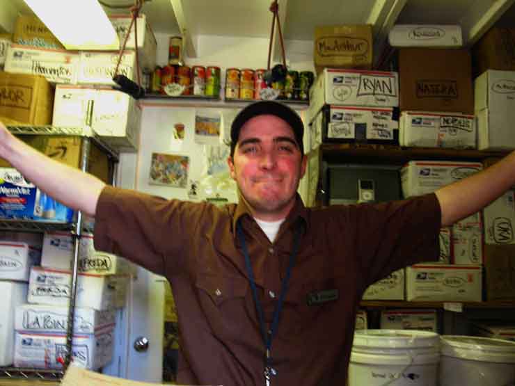
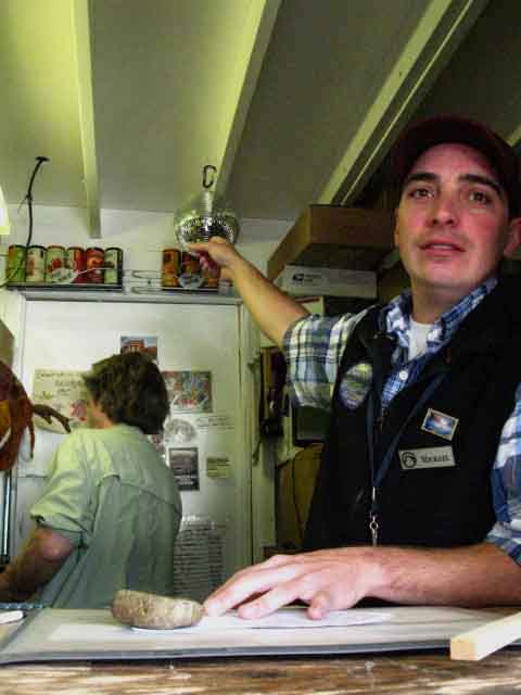
Michael Kochakji,
the Postmaster of Tuolumne Meadows Post Office with his office packed full of Resupply Packages.
Resupply
Position and Strategy
Tuolumne Meadows Post Office
MAILING ADDRESSES
US Post Office
"Hiker's First & Last Name"
C/O
General Delivery
Tuolumne Meadows Post Office
Yosemite National Park, CA 95389 |
|
NO
UPS
&
FEDEX
NO
UPS or FEDEX |
|
MAILING ADDRESS
UPDATE
September 14, 2016
April informs us that
Tuolumne Meadows Post Office
DOES NOT ACCEPT
UPS OR FEDEX
and their current address
is
"Hiker's First & Last Name"
C/O
General Delivery
Tuolumne Meadows Post Office
Yosemite National Park, CA 95389
|
FORUM
Tuolumne Meadows Post Office
2016
Tuolumne Meadows Post Office Staff
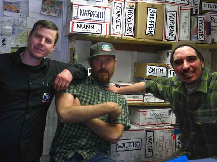
Jeffery Ballard, Andrew Castle, and Michael Kochakji staffing Tuolumne Meadows Post Office during the 2016 backpacking season.
Top
Going Postal
NOTES-ADVICE
No trail name B.S.
I.D. REQUIRED
by
Postal Law
Your real ID will not get your package addressed to, "Trail Glitter" released.
For all packages sent UPS/Fedex or ordered online, have them call us for a secondary address. Our general delivery address only works for the Postal service, since it’s technically not a physical address.
In other words, the address we give to FEDEX and UPS above tells them to deliver the package into the USPS System in Yosemite Valley, where the Postal Employees will finish the delivery up to Tuolumne Meadows.
Well, that's the plan.
Our phone # is still
209 372-8236
BE NICE to ALL
TUOLUMNE MEADOWS WORKERS:
When backpackers see backpackers behaving badly
It is our Duty
to
Curb all Jackasses:
"Chill out Bro..." |
Resupply Package
Procedure
Tuolumne Meadows Post Office
Tuolumne Meadows
Post Office
Hours |
M-F
9am-4pm |
Saturday
10am -1pm |
SCOPE
Tuolumne Meadows Post Office is a key Central Sierra resupply point for virtually all backpackers hiking the John Muir, Pacific Crest and of course, those of us hiking from Lake Tahoe to Mount Whitney.
This means that the Tuolumne Meadows Post Office gets to meet and deliver a resupply package to virtually all, if not each and every backpacker hiking the PCT, JMT, and TWT each and every year. Those who fail to make it to TM leave a package noone will pick up.
Though the number of trans-Sierra hikers has grown steadily and substantially over the last couple of decades, the last few years prior to this being writeen in 2016 have brought unprecendeted growth of backpacker traffic on the John Muir and Pacific Crest Trails, all of which has passed through Tuolumne Meadows, and of course its Post Office.
This means that these postal facilities are operating beyond their capacity.
Exceptionl steps have been taken to meet exceptional demand.
SCALE
Recent Years (2014-16) have brought substantial increses to the numbers of hikers on the John Muir and Pacific Crest Trails. These increased numbers have brought confused responces from Yosemite Park Managers, which have triggered them to push crazy informal (unofficial) permit policy changes to National Forests up and down the Sierra Crest.
This increase in hiker traffic has not confused or befuddled the Postmaster and Staff of the Tuolumne Meadows Post Office. It has simply pushed them to Max Effeciency.
This means that you should show great courtesy and patience when looking into the face of your needs. The Post Office will be very busy during peak periods of hiker traffic.
RESPONSE
The Tuolumne Meadows Post Office has stepped up with new procedures to streamline the confusion, shorten all delays, and to pull and get backpackers requesting their packages served in a timely and efficient manner. These demands require a system that allows a limited staff to pull a large number of requested packages out of a huge number of packages in storage.
Therefore the request and delivery of packages have been split into a two-part process.
This requires the cooperation of all long distance backpackers to operate effectively.
OLD PROCEDURE
dies by
AVALANCHE
Seeing their number of resupply packages triple between 2015 and 16 bringing a volumne of resupply packages that exceeded both their manpower and their physical capability to efficiently store, retrieve, and deliver the daily volumne of packages demanded through the "traditional method."
The "traditional method" was backpackers lining up for "General Delivery," at the Post Office, showing their ID, then waiting while the clerk individually retrieved the package and handed it over. There were not enough hours in the day for the number of packages.
Backpackers were not able to get their package the day they wanted it! "Regular" Post Office patrons were driven to frustration by the virtual denial of service the long line of long distance backpackers represented. Long distance backpackers were threatened with having their schedule altered/delayed by congestion at the Post Office!
The Mother of Invention
This overwhelming volumne caused the Postmaster of Tuolumne Meadows to reform and reorganize their system of resupply package delivery to meet the new higher volumne of demand within the man-hours.
The Need
This huge scale of deliveries & pickups required a new system capable of getting every day's batch of backpackers their "General Delivery" resupply package using the limited human resources and physical storage available at Tuolumne Meadows.
The Solution
Rather than individually deliver each package to backpackers through the Post Office window, the Tuolumne Meadows Post Office instituted a sign-up sheet and pre-verification to support hourly "group" deliveries for backpacker's resupply packages. This system requires backpackers sign up within the previous hour for a package they want to pick up on the hour.
Sign up and show ID at least 15 minutes before the next distibution time to be included.
2016
PACKAGE PICKUP PROCEDURE
Backpackers arriving at Tuolumne Meadows seeking to pick up their resupply package should check into the Post Office, show ID to put their name on the list for the hourly pick-up.
Each hour the Postmaster will use this list to fill up a couple of big carts with resupply packages, roll them outside, and quickly and efficiently call out the whole group of backpacker's names who signed up for that hour's resupply packages deliveries.
Your job is to show up at the Post Office, put your name on the resupply list if and when you want to pick up your resupply package at the next hourly distribution, verify your identity, then return at the appointed time to listen for your name to be called. Show your ID when you're called, and pick up your resupply package.
Easy-Peasy!
End Game
This allows the Post Office to rapidly list, verify, effeciently pull the package from their storage and thereby distribute many more packages per hour than through the old system of individuals lining up at the Post Office to individually pickup their resupply package through the window. That system was crushed under the massive growth of the numbers of Pacific Crest and John Muir Trail backpackers.
This new system works out much more efficiently for both the Backpackers and the Post Office.
This new system assures each day's backpackers can actually receive their resupply packages
on the day they want them.
Help Keep The Disco Ball Spinning at TM!
Be the Lubricant--Not the Rust
Be a Spinner!
You can Do your Part to Keep the Tuolumne Meadows Post Office Disco Ball Spinning!
Spinning!
A Better Post Office for All
This new system makes the Post Office line work better for all those picking up resupply packages, and especially for those non-backpackers who want other postal services, and especially for the Postmaster and his Crew.
These folks were putting in a lot of extra time over the last few years to make sure
as many backpackers as humanly possible-and beyond office hours-could get their vital resupply.
Those of you who know Micheal and the Tuolumne Meadows Folks
have watched him/them sprout the wings of a trail angel more times than clouds in the sky.
FORUM
Tuolumne Meadows Post Office
Top |
|
|
TM
Tuolumne Meadows
is a vital resupply spot for long distance backpackers on Tahoe to Yosemite, John Muir, Pacific Crest and Tahoe to Whitney backpacking trips.
Tuolumne Meadows
is the end of the Tahoe to Yosemite Trail, and a vital resupply spot for the Pacific Crest and John Muir Trails, but for very different reasons.
Tuolumne Meadows
Is a real pleasure, and is full of great folks both working, hiking, climbing, car camping, and doing the tourist thing...
Top of Page |
|
Nice note on my resupply bucket from the PO staff...
|
|
Tuolumne Meadows Vital Role in Long Distance Backpacker Resupply
NORTHBOUND
RESUPPLY
For Northbound Pacific Crest Trail hikers Tuolumne Meadows is the last resupply spot until reaching Kennedy Meadows (75 miles North on Highway 108, roughly halfway to Lake Tahoe), but for many PCTers Tuolumne Meadows will be their last resupply stop until arriving at Lake Tahoe (144 miles to Echo Chalet). In either case the resupply picked up at Tuolumne Meadows is vital for the potentially long, or very long next section(s) of upcoming trail.
Yet it does not have to be so, Joe!
We can significantly shorten our resupply distances between Tuolumne Meadows and Lake Tahoe.
Kennedy Meadows Pack Station lays roughly 75 miles to the North of TM, and 35 miles North of Kennedy Meadows the Lake Alpine Lodge is a 15 mile hitch hike West down Highway 4 from Ebbetts Pass. Kennedy Meadows and the Lake Alpine Lodge both accept resupply packages through United Parcel Service EXCLUSIVELY, and the Lake Alpine Lodge offers this service free.
Bloom at Kennedy Meadows was charging 10 or 15 bucks. I'm trying to get Bloom to bump up the resupply fee and use those extra bucks to set up a little free campsite for us long distance backpackers passing through Kennedy Meadows. Or you can be like me, and just pirate camp there.
Don't tell Joan. She would frown, and tell you whynot.
Everyone else is cool, as long as we behave, and are clean and quiet.
Thus Pacific Crest Trail hikers have the options of picking up one, two, or no resupplies between Tuolumne Meadows and Lake Tahoe. I have great "pirate" campsites near both locations...
The Sectional Solution
For the rest of us medium and long distance backpackers the sections of trail North to Lake Tahoe can be broken down into a series of seven fine "section" hikes, being Tuolumne Meadows to Kennedy Meadows, Kennedy Meadows to Lake Alpine, and Lake Alpine to Echo Chalet, and Echo Chalet to Meeks Bay. But, "Alex," you say, "That's only Four Sections? Have you gone crazier?"
2X
Seven section hikes because each section (except the Echo Chalet to Meeks Bay section) can be hiked on either the Pacific Crest or Tahoe to Yosemite Trail routes. The bisection of the North Sierra by two fantastic trans-Sierra trails, unlike the South, beckons us rise to the occassion, that we, "Love Me Two Times," as James Morrison once sang, to find the full scope of North Sierra trails...
The TYT and PCT routes offer at least two ways to cross each of the sections of trail North of Yosemite, and even more potential routes as we begin to tie these two classic routes together into unique combinations of route North, and into potentially vast hiking loops around each of the North Sierra Wilderness Areas they cross.
That's really fun...
Some long distance backpackers go around in circles, others point it in one direction or the other.
It's all good. |
SOUTHBOUND
RESUPPLY
On the other hand, the Tuolumne Meadows resupply facilities allows Southbound John Muir Trail hikers to pack lightly for the short but very steep great climb out of Yosemite Valley to Tuolumne Meadows. Though the distance is fairly short from Yosemite Valley to Tuolumne Meadows, the rigors of the steepness of the climb along with the quick gain in elevation on steep trails with a heavy pack makes starting with as light a pack as possible quite intelligent.
The first few days on the trail can be pretty tough, so take it easy on yourself until you are broken in.
How we set up our resupply at Tuolumne Meadows depends on our resupply plans further down the trail. Tuolumne Meadows is the first of four closely placed resupply spots to our South. Reds Meadow, Vermilion Valley and Muir Ranch come as a quick series hiking South out of Tuolumne Meadows.
Currently I've been hiking South into Tuolumne Meadows then down to Yosemite Valley, rather than continuing South along the JMT into Lyell Canyon.
This little segment of trail down to The Valley requires a very light resupply, depending on how long we want to stretch this out. The key resupply is for our return hike out of Yosemite Valley to Reds Meadow, which starts Southbound along the JMT, but we will break off the JMT to continue up the Merced River where the JMT climbs towards Half Dome from Little Yosemite.
As we came down via Half Dome from Tuolumne Meadows we will continue up the Merced River to just past Merced Lake, where we turn Northeast to climb over Vogelsang Pass. From Vogelsang we drop down into Lyell Canyon to pick up the JMT just a few miles South of Tuolumne Meadows.
I call this beautiful deflection off the most direct route of our Lake Tahoe to Mount Whitney hike the,
"Golden Triangle."
How we resupply ourselves in Yosemite Valley depends on if and how we set up our subsequent resupplies at Reds Meadow, Vermilion Valley Resort, and Muir Ranch.
On one hand we can pack light and resupply at all of them. On the other hand we can pack heavy, and push all the way down to Muir Ranch for our next resupply. |
More on Northbound Resuppy
North & South
Options
Three Directions
Three Different Resupply Plans
Top |
Backpacker Resupply Package
Notes, Issues, and Options
Tuolumne Meadows
Resupply
Via
United States
Postal Service.
Package address to Tuolumne Meadows Post Office:
Post Office
Mailing
Address
"Your Name"
GENERAL DELIVERY
C/O Postmaster
14000 Highway 120 E,
Tuolumne Meadows
Yosemite National Park, CA 95389
See above for
Non-US Postal Service
address.
OFFICE HOURS
2015 Hours
Mon-Fri 9:00am - 5:00pm
Sat 9:00am - 12:00pm
Closed Sun.
2016
Hours
Mon-Fri 9:00am - 4:00pm
Sat 10:00am - 1:00pm
Closed Sun.
Why Different?
The huge Increase in Packages
&
Associated Workload.
(Pickup, Sorting, & Storage Time!)
Tuolumne Meadows
Post Office
Phone
209-372-8236 |
NEW ISSUES
There has been a monumental increase in the numbers of backpackers on both the John Muir and the Pacific Crest Trails. This has overwhelmed the Natural landscape and human resupply facilities during the peak periods of backpacker traffic.
This reality requires all backpackers seeking resupply demonstrate patience when confronted by the popularity of these trails.
And especially when you have to wait in lines to sign-up to pick-up your package.
Find out about the backpackers around you in the line. Bet they've got some good stories!
OLD ISSUE
Recent years have seen the majority of resupply packages to Tuolumne Meadows Post Office arriving in those pre-paid Post Office parcel boxes.
This is not a great idea.
Every now and again something goes wrong. In 2002 it was thunderstorms sufficient to flood Tuolumne Meadows.
The flood conditions drove the mice out of Tuolumne Meadow proper, up to the high ground around the Post Office, where they entered and ate through all the cardboard resupply boxes.
All of them.
Only the backpackers who packed their resupply packages in plastic buckets received their resupply packages that year. |
NOTES
TIMING
Time sending your package with your arrival. You don't want it too early, and certainly not late.
Especially now, post 2016, with the massive expansion of John Muir and Pacific Crest Trail backpackers.
All the resupply spots up and down the Sierra Crest will appreciate keeping their food storage issues to a minimum.
CONTAINERS
Short and Tall plastic paint buckets are available for smaller individual resupply needs as well as larger buckets for groups.
Another option is to package the food contents of the cardboard mailing box in more mouse-proof enclosures.
TREATS
Consider sending yourself a resupply "treat," such as a bottle of wine or spirits & treats you cannot obtain locally.
DETAILS-DETAILS
COUNT!
Make sure you designate the address as "Tuolumne Meadows," NOT just "Tuolumne," or the package may well sit in General Delivery in the distant town of Tuolumne.
That happens a few times every season. |
|
More Thoughts on Resupplying
| Resupply Strategy |
Northbound Hikers
Resupply strategy for Northbound backpackers on the Pacific Crest Trail
When hiking North from Tuolumne Meadows I suggest that backpackers along the Pacific Crest Trail resupply at the Kennedy Meadows Pack Station, Lake Alpine Lodge, and Echo Lake Chalet. These are all of the resupply spots between Tuolumne Meadows and Lake Tahoe. I suggest that both Pacific Crest Trail and other long distance High Sierra backpacker visit them all.
For long distance backpackers on a tough timeline, such as Pacific Crest Trail hikers during years shortened by deep late season snowpacks, stopping everywhere may not be feasible. I strongly suggest seeing it all during long Summers with early Spring thaws, when you may have sufficient time to both see it all, and do it all.
The route of the Tahoe to Yosemite Trail passes through Kennedy Meadows Pack Station and very close to Lake Alpine along its route. Kennedy Meadows Pack Station is located 9 miles West of the Pacific Crest Trail down Highway 108 while Lake Alpine is 15 miles West off the Sierra flank down Highway 4.
I have always found it easy to hitch hike down the mountain to both Kennedy Meadows and Lake Alpine from the PCT, even in late Fall and early Spring when traffic is very light. Sometimes we have to wait some considerable time between passing cars, but that's no problem. The country folk, sportsmen, backpackers and tourists who drive these roads are much more likely than the average urban weirdos are to pick up backpackers.
Our new crop of folks who've stuffed our cities full of people are very unfriendly to hitch hikers. It is a hell of a lot easier to hitch hike into our massive cities than get the hell out of them!
I suggest not walking these mountain highways down to Kennedy Meadows or Lake Alpine. If we want to hike into Kennedy Meadows and Lake Alpine there are backpacking trails into both for Northbound hikers on the PCT, but Kennedy Meadows can only be accessed by trail from the South to the North.
The Southbound Tahoe to Yosemite Trail is offset by 9 miles West down Highway 108 from Saint Marys Pass to where
the TYT continues South through Kennedy Meadows.
Hiking the TYT requires a nine mile hitch between Tahoe to Yosemite Trail North through Saint Marys Pass on Highway 108 down to where it continues South through the Kennedy Meadows Pack Station.
PCT NORTH
Many Pacific Crest Trailers are ready to use Kennedy Meadows Pack Station as their first resupply point, as it's position 75 miles North of Tuolumne Meadows almost splits the distance to Lake Tahoe. This in turn causes many Pacific Crest Trail hikers to bypass the Lake Alpine Lodge, because it is only another 30 miles North of Kennedy Meadows.
The vast majority of Pacific Crest Trail hikers choose to pick up their next resupply at the Echo Lake Chalet, which sits 69 miles North of Kennedy Meadows on the rim of the Tahoe Basin above South Lake Tahoe.
This backpacking resupply strategy roughly splits the 144 mile distance between Tuolumne Meadows and Echo Lake Chalet in half, putting each resupply point about 75 miles apart. Most Pacific Crest Trail hikers find this the most efficient plan.
I have found that a large percentage of Northbound Pacific Crest Trail hikers are ready to take a couple of days off to rest and resupply in South Lake Tahoe, where all backpacker resources are available in ample quantities.
I suggest stopping everywhere, seeing everything, and talking to everyone:
The Full Tour.
Distances
on the
Pacific Crest Trail
RESUPPLY
North of Tuolumne Meadows
Echo Lake Chalet
144 miles
South Lake Tahoe is also in close proximity
Resupply Information. Map.
For Southbound backpacker's Resupply Strategies between Lake Tahoe and Tuolumne Meadows, see the Resupply discussion on the Echo Lake Chalet Resupply page.
Also refer to my musings about "Planning the TYT-PCT" at the Meeks Bay Trailhead up along Lake Tahoe in the North Sierra. Then we keep track of how well we are staying on plan as we hike South with our Daily Calculation.
comments |
TUOLUMNE MEADOWS BACKPACKER CAMP
A
Notable Focus
of
GLOBAL-NATIONAL-REGIONAL-LOCAL
Backpacker Trail Culture
A Sample-View of the Range of Folks
at
BACKPACKERS CAMP
Over the last couple of decades I've met some of the best folks along the High Sierra trails, and found concentrations of most excellent backpackers at various trailheads and resupply spots up and down the Sierra Crest.
But there is no place like Tuolumne Meadows to get a big sample of each year's crop of backpackers. Vermilion Valley was close, until their 2012 meltdown of rudeness and shitty services demonstrated they are parasites on the backpacking community, rather than a resource to the backpacking community.
Harsh, crude times at VVR.
Tuolumne Meadow's position as a pinnacle of backpacking culture is a function of its location in the world-renowned Yosemite National Park and its location roughly in the middle of the high elevation trails between Lake Tahoe and Mount Whitney.
We have a couple of hundred miles of High Sierra trails stretching North and South from Tuolumne Meadows. All of these factors act as a giant backpacker magnet.
Over the years I've recorded lots of great friends I've never met before at Tuolumne, and what follows is a sample of those remarkable experiences and the people who made them possible. Rather than trying to capture every person, I look for representatives of the different ways people group themselves up, including the "group" of solo backpackers.
If your image is not here don't feel bad. Just post it up.
We had a great time nonetheless.
Top of Page |
Tuolumne Meadows Backpackers Camp
Camp 13
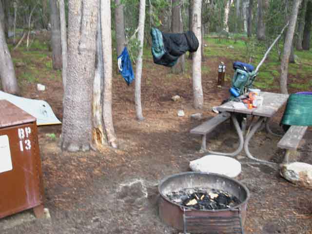 |
Site 13 is where I hang out when I am at the Tuolumne Meadows Backpackers Camp. If I am at Tuolumne Meadows this is where I am camping. This is the same location that a number of other guys like me camp at, so we can meet up if we are here at the same time.
Camp 13 is in the far Southeast corner of the Backpackers Camp situated in such a way that we in Camp 13 can see folks approaching before they see us.
Note the wet-dry line left temporarily behind after the afternoon thunderstorm depicted in the video below passed overhead. We can see the fleeting outline of white left by rain-puddle driven pollen remaining after the water that collected it had soaked into the ground, and before backpacker's boots spread the pollen back out across the terrain.
comments |
Tuolumne Meadows Backpackers Camp
Life in Camp 13
Tuolumne Meadows Backpackers Camp
Hanging at Camp 13
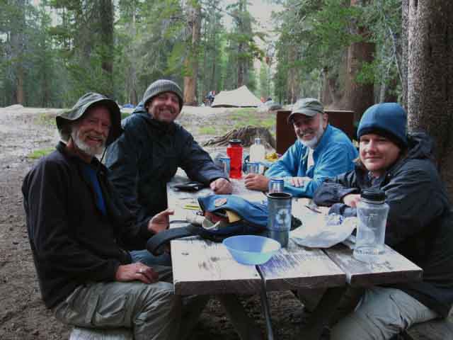 |
You meet the best folks out here...
Al and his pals.
Great crew of backpackers at Tuolumne Meadows. Me on Left, Mike behind, Aaron on near Right, Dennis in back.
We were all out in the backcountry, we are all heading back out to the backcountry, and we are enjoying the hell out of meeting in-between.
This, my friends, is what life is all about...
comments |
Good Dudes
Tuolumne Mike and Aaron
 |
|
 |
Tuolumne Mike is a hell of a good guy even though he's a crazy backpacker/fisherman.
comments
Top of Page |
|
Aaron at Tuolumne Meadows explaining problems with the Steripen.
Aaron explains that a thin layer of corrosion on the electrodes kills the steripen.
The electrodes must provide and pick up current through the water to start the UV.
SOLUTION: clean the electrodes. |
 |
I finished walking my fourth Tahoe to Whitney backpacking trip in early September 2009.
My return to "civilization" was not real rewarding, and I was quite frustrated.
So I decided to hike the Tahoe to Yosemite Trail. To prevent myself from being frustrated with society upon my return, I decided to hike the TYT without resupply.
My thinking was that there would be nothing like carrying a monster heavy pack for 181 miles to make me appreciate the couch, running water, and toilet that "civilization" represents, I thought.
God, my pack was dastardly heavy. I had my garcia inside the pack, and was hanging two ditty bags off the pack, each with five days food and weighing about 15 pounds apiece.
My "trail guide" pack with tripod, two cameras, lots of batteries and a charger adds 9 frkn pounds to my "base" weight of 27 lbs.
The pack tipped the scales above 80 pounds. That can make anyone appreciate civilization.
I arrived at Highway 120 just West of Tuolumne Meadows tent cabin on Oct. 2. As soon as I hit the road a car pulled over, and out hops Tuolumne Mike.
We were going in opposite directions, but it mattered not to TM. He looks at me, and says, "you need food," and proceeded to pull out his ice chest. Within was sliced meat, cheese, greens and condiments. Mike soon had this all loaded up between slices of bread, and I had my first fresh food since Kennedy Meadows Pack Station. Good thing, too, as Mike informed me that the Tuolumne Meadows facilities all had closed up the previous day.
Mike's information saved me a futile walk down to the Store, so I planted where I was, sat back, and began my hitch home from roadside Highway 120 in Tuolumne Meadows. Ten minutes later, Brendan, the lead fishing/hunting guide running Dipper Fishing, picked me up and gave me a ride to one block away from my front door in Berkeley.
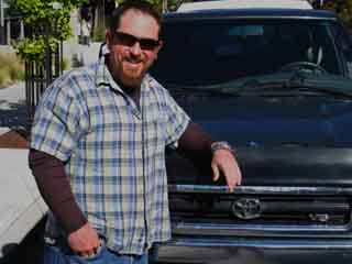
Brendan drops me off a block from my door...
Mountain Magic.
UPDATE: Brendan has pulled up stakes from Lee Vining and moved to Toulon, France, opening up a California Fusion restaurant. Brendan brings culinary experiences with him that French Cuisine is incapable of producing.
Chez-Gringo
If you are heading to the South of France and hunger for a little taste of home from a legit ex-High Sierra mountain guide, visit Brandon in Toulon, and give him my regards. He would love to hear your mountain stories over a big glass of French wine and tapas...
Overall...
2009 was a crazy year. Winter snow camping hiking from the Tahoe Basin to Round Top and back, followed by hiking up the East Carson during the deep wet snows of early Spring, into Lost Coast during late Spring for some rain camping, then the Tahoe to Whitney and Tahoe to Yosemite Trails during the Summer.
That was my best year in recent memory.
Top of Page |
Tuolumne Meadows Backpackers Camp
Gear-Gear-Gear
 |
Want to see the latest gear from around the world? The best ideas for gear and gear use? Innovative home made gear?
I believe this was Aaron's cooking setup....
Tuolumne Meadows Backpacker Camp hikers have it all... for you to see and check out.
Above: Fine ultra lightweight alcohol cooking kit.
Gear Forum
comments |
Tuolumne Meadows Backpackers Camp
The German Influence
 |
|
 |
Michael Braun from Schneinfurt Germany hiking the "Golden Triangle" route through the heart of Yosemite late in the season.
We were the only two backpackers in the Tuolumne Backpackers Camp the night before Yosemite Closed during the government shutdown of 2013.
I celebrated this rare condition by walking down to the Valley.
Michael was sporting this nifty ultralight tent from Germany.
comments
Top of Page |
Tuolumne Meadows Backpackers Camp
More Good Dudes
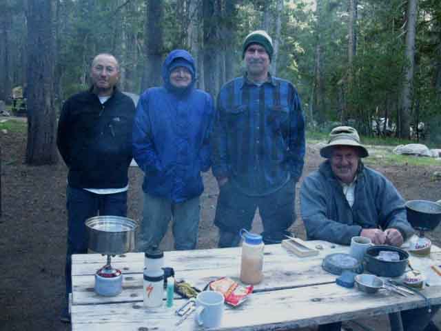 |
Gary, Phil, Gary and Greg.
Greg on the far Right is a Golden Bear, as am I.
Gary on the far Left from the UK.
Go Bears!
comments |
Tuolumne Meadows Backpackers Camp
Let's Resupply
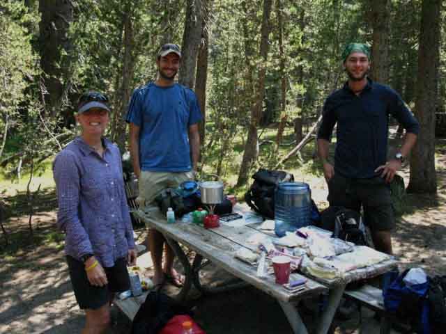 |
Amber, Aidin, and Ari resupplying at TM backpackers camp.
Ari has become a good friend, and has subsequently accompanied me on one of my Wintertime snow backpacking trips in the High Sierra, as well a big loop of the Carson Iceberg Wilderness.
comments
Top of Page |
Evaluating the Resupply
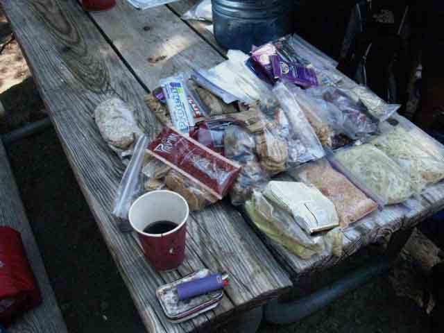 |
Counting out meals and measuring the calories of snacks to determine the proper amount of food for the next section of trail is one of the common activities at the Tuolumne Meadows backpacker camp.
Hikers in a hurry, most notably Pacific Crest Trail hikers, often pack their resupply on the benches in front of the Tuolumne Meadows Post Office and hit the trail as soon as they are done.
Other hikers, like me, will bring the resupply back to camp and leisurely repack the garcia with a cup of coffee and a smoke.
In the image above I was consulting with Aidin and Ari about their needs for the upcoming trip they were doing.
comments |
Tuolumne Meadows Backpackers Camp
Ranger Ashley
with
Information
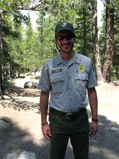 |
Ranger Ashley comes through the backpackers camp to warn of fire restrictions due to the Big Meadow Fire of 2009.
Ranger Ashley, like most of the nature rangers, is a real nice guy.
Most of the law enforcement Rangers are boneheads. Most of the Wilderness Rangers are great folks.
Rangers Vs. Climbers
I've met a couple of exceptions to this rule over the years... but it pretty much applies uniformly.
Uniformly. Get it?
How about this "rule of thumb:"
If the Ranger hangs a gun they are no fun.
comments
Top of Page |
Tuolumne Meadows Backpackers Camp
Spider Man Joe
on the
Roper High Sierra Route
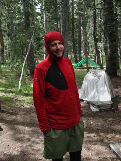 |
Joe Rowley
Spidey man solo Joe finishing the Roper Route.
I was sitting in camp a long while after dark, and noticed a flashlight bouncing around, obviously looking for a place to camp.
I made a noise, "Ay," and said, "hey, need a site?"
"Yeah" came the reply.
This tall lanky kid ambles up, sits down, and almost goes to sleep as soon as he sat down. I began to urge him to set up his dinner. This guy needed dinner bad.
Listening to me, he made up a dinner, and as he was eating I could see that life was returning to his body.
Joe had just walked some incredible distance from before Sunrise to after Sunset, and he was clearly bonking.
The confused daze dissipated as the food went in, as I anticipated it would.
Hung out with Spidey Joe for a great next day and a lot of fun with him, Charley's Angels, Mike, Aaron and the backpacking crew at TM.
What a blast...
Spidey Joe's Website: TheEpicAdventurer
comments |
Tuolumne Meadows Backpackers Camp
Jose and Monika
from
Spain
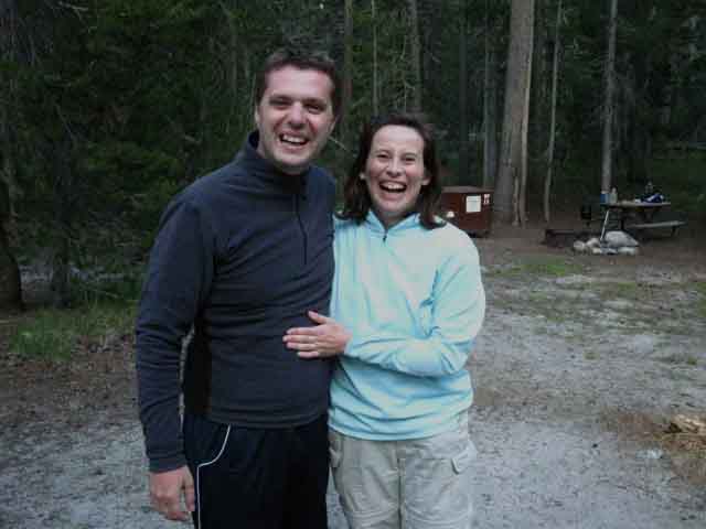 |
Jose and Monica, a fantastically delightful couple from Spain.
Europe is well represented in Yosemite every Summer.
While passing through Tuolumne Meadows we will have the chance to meet like-minded people from around the world.
I mean in the broad sense of loving the beauty of nature.
Europe is very well represented in Tuolumne Meadows by Jose and Monica.
comments
Top of Page |
Tuolumne Meadows Backpackers Camp
It's not all Dudes...
Charley's Angels JMT Team
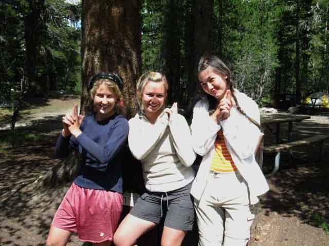 |
Charley's Angels JMT hiking team.
Ali, Lauren, and Grace make the best of the Summer Break by forming up a John Muir Trail hiking Team.
Women are a powerful presence in the High Sierra Backcountry in backpacking, climbing, and anything else they set themselves to.
It seems to me that the only barrier to greater female participation in the backpacking arts is communication.
That would be communicating to women who are unaware that they have great inherent physical and psychological capabilities that are not even tapped by our social environments. Social questions are irrelevant on the long trails. The relevant issue is that the great strengths resident in women emerges in the backcountry.
This may be even more important for
women than men. Men are more inclined to be socially encouraged to backcountry travel than women. Thus women hitting the trail and developing these strengths can fill voids in identity and capability left unfilled in our pathetic society.
Further down the trail we'll meet the "Sexy Librarians," four amazing ladies who enjoy both their inherent backcountry capabilities and playing with the contrary cultural stereotypes defining the limitations of femininity.
"Charley's Angles" and the "Sexy Librarians" both showed me examples of powerful females who's John Muir Trail hikes demonstrated that femininity and strength are complimentary, not antagonistic.
And this is just the tip of the iceberg.
I've always thought that the High Sierra brings out the best qualities in both the Boys and the Girls...
Both sides of the gender divide reap great rewards finding their true capabilities on the long trails.
comments |
Father-Daughter JMT Team
The Kundells
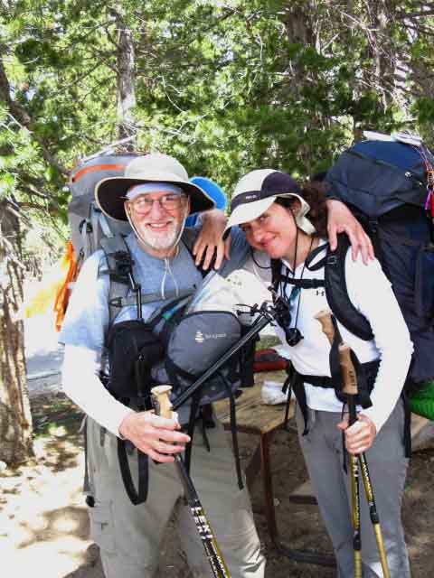 |
Doc Kundell and daughter Elana out of Thousand Oaks and Los Angeles California, respectively.
In the image above they had just hiked up from Yosemite Valley to resupply at Tuolumne Meadows, and were just about to hike South on the JMT down Lyell Canyon, on the same day.
Doc was ready to rock.
I had to catch, and slow him down enough to snap this shot.
Doc's Pack
Earlier, I had a good talk with Doc. Note his interesting pack setup. There is "front pack" a counterweighted across the shoulder straps against the weight of a traditional backpack.
I'm a traditional old-school external frame pack guy. I use internal framed packs when climbing or during Winter. In the former case I want the weight close to my center of gravity, in the latter I seek both balance and the extra heat of having the pack against my back.
But during every other backpacking situation I far far prefer the stability, lightness, organization, and superior carrying capacity of an external framed pack.
I could see the logic of Doc's setup. It would not screw up balance too bad, and if you could "ride" the counterweight, well, it might prove advantageous.
My major concern was "flexibility." I need to turn and pivot on a dime, changing the orientation of my pack load before I actually change direction. Looking at this rig I could see that the balance between front and back would slow changes in pack orientation, in how I shift my body as I move down the trail. I use the "imbalance" to my advantage. Having a load on both sides of my body would always negate part of that advantage.
Doc Kundell
Doc and Elana JMT images
The subjects of Doc and Elana's images indicate not just their appreciation of the beauty of the physical colors, forms and textures in nature along the John Muir Trail, but how they look at nature.
We all sweat, but why differs.
This is a fine set of High Sierra Images. It tells us that they sweat to engage the beauty and art of life.
Elana Kundell
Elana is an artist exploring emotional and intellectual aspects of human experience using color, form, and texture through oil on panel and canvas.
Elana Kundell
Paintings
A fine series of works.
Meeting people like Doc and Elana is reason enough to hit the trails. Then add to folks like them the colors, forms, and textures this experience carves onto your sweaty canvass of life.
comments
Top of Page |
International Automotive Tourists
The Kleins
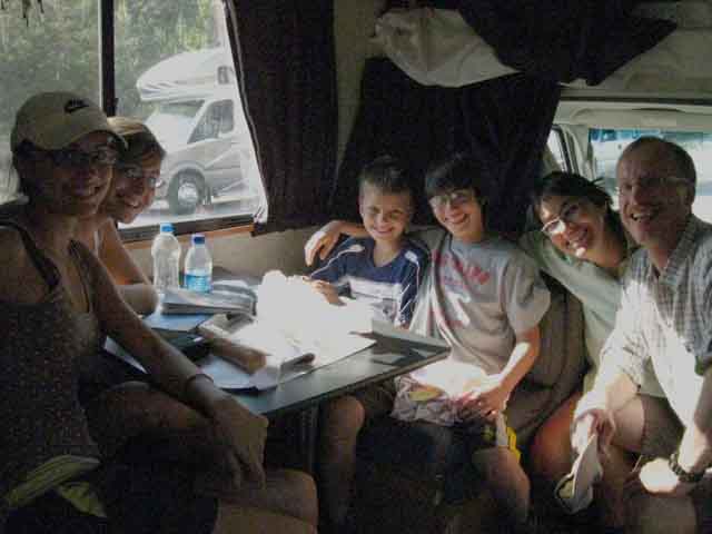 |
You know all those big RV's we see driving by?
This is what the inside of one of them look like.
A family from Germany, The Kleins, were touring the beautiful spots in the USA with a big RV. They saw this grungy backpacker hitch-hiking out of Tuolumne Meadows, and decided the best way to understand the country was to talk to Americans.
I was moving into position to hitch hike down to Lee Vining (long story!), and this long string of kids and parents (There are six Kleins) walked past, each interacting with me in their own way, but interacting.
They all load up into this big rented RV, and see that I'm thumbing it along a cutout. They all looked one at the other, and said "Yes."
So, unlike about every American with an RV, the Germs picked me up, and I had a great time riding with them down to Lee Vining.
They asked me about Yosemite, the Sierra, America, and backpacking.
I asked them about Germany, what they saw here in the good old US of A, and how they felt about it. I productively engaged the kids to expand their knowledge and understanding of what they were seeing.
My Philosophy:
Let's
Observe-Analyze-Engage!
What a blast!
Germs are good at O-A-E.
Thanks for the ride, you cool Germs!
Hitchhiking Note
Three out of the last four times I've hitched home from Tuolumne Meadows I've gotten a ride directly to my front door!
Wow!
So don't dog the RV tourists, engage them!
comments |
Climbing Culture
Dave Yerian
&
Sammy Shannon
Dave Yerain  |
Dave Yerian is sitting in as our token climber.
Tuolumne Meadows is a crossroads of High Sierra Climbers as well as Backpackers. It is nice, and beneficial to both when the two mix.
Dave was part of the physical and cultural evolution of the clean and free climbing movement of the '70s which laid the foundation and standards of today's climbing world.
In 1981 Yerian teamed up with John Bacher to establish the seminal Bacher-Yerian route up Mendicott Dome near Tuolumne Meadows.
John Bacher on "That's Incrdible."
From
The Daily Hatch,
October 2011:
"On a rope, the Bachar-Yerian (5.11c R/X), a route he climbed on Medlicott Dome with Dave Yerian in 1981, still remains as one of Tuolumne Meadows’ most notorious routes, with only 13 bolts — all placed on the lead and ground-up — in 500 exposed feet of climbing. Along with fellow free soloist Peter Croft in 1986, the pair made the El Capitan and Half Dome link-up in only 14 hours, a feat that to this day is still considered incredible.John was 52 years old leaves behind his son Tyrus. Pete Thomas of the Los Angeles Times has written an informative obituary here."
and
"On July 5, the climbing world lost one of its greatest icons: John Bachar. While climbing alone at the Dike Wall near Mammoth Lakes, California, Bachar fell to the ground, though the circumstances of the fall remain unclear. Bachar died later at Mammoth Hospital on Sunday afternoon. The free-spirited Californian was a symbol of American free climbing and free soloing, with a strong traditional climbing ethic. Bold, blonde-haired, surfer-esque and ever-charismatic Bachar will be remembered for many of his earlier achievements, including his daring 1980s free solos of Yosemite routes like Outer Limits (5.10c) (Climbing Magazine Issue no. 84), New Dimensions (5.11a), Butterfingers (5.11a), Butterballs (5.11c), as well as the sport routes Enterprise (5.12b), in the Owens River Gorge, and The Gift (5.12c), at Red Rocks (Climbing Magazine Issue no. 192)."
History of Yosemite Climbing
Dave well represents and reflects decades of climbing culture at Tuolumne Meadows, and Yosemite generally.
Dave Yerian
Yerian on SuperTopo
Bacher-Yerian Route: Mountain Project
Bacher-Yerian Route: Capturethelight
Bacher-Yerian First Ascent: Rock and Ice
Video: Hayden Kennedy climbing Bacher-Yerian 2012
Dave, give me a call.
comments
Top
Yosemite Climbing Culture
During my 2001 Tahoe to Whitney Hike I met Sammy Shannon in Tuolumne Meadows. Sammy's a member of a loose confederation of individuals who's focus in life is/was directed at being on the face of the steepest mountains in Yosemite each Summer, and Joshua Tree during Winter.
This "club" always meets up every Summer at Yosemite. Membership appears to be centered on the willingness to attempt to climb in Yosemite all Summer long.
Meeting Sammy gave me entry into this unique, but changing group of individuals who inhabit Yosemite every Summer. They know each other, have various social and age groups, even to the point of having generations of these climbing bums converging in Yosemite every Summer.
New members show up every year, old climbers come out to watch the youngsters and put in face time.
They seem to find each other because they are all doing exactly the same thing, despite any cultural, age, gender, or social differences.
They are going to stay in Yosemite and climb all Summer long, no matter what the Rangers say. Rangers are always telling them they must leave. Then the climbers all run around and hide.
This is productive of and Old West style Rangers vs. Rustlers mentality. The Rangers chase the climbers around, and the climbers scurry around for cover, picking off climbs all the while.
In 2001, the year Sammy introduced me to him, Chango had taken to living in an "elevated" campsite, slung up a hundred feet above the valley floor on a vertical rock face. Chango was driving the Rangers crazy. He would "hide" from them in the damndest places!
The point about all this activity is these crazy climbers are going to climb.
I'm a fan of culture, especially one so specialized on such an intense specific aspect/reality of natural engagement as climbing. Having spent time exploring cross country and mountain routes during Summer and Winter has put me in physical "climbing" situations before, generally reluctantly, as one aspect of multi-day multi-faceted off trail wilderness explorations.
I've been wearing a heavy pack every time I've been thrust into climbing situations. In Yosemite the climbers do not wear backpacks, and the backpackers don't generally climb.
This is productive of a cultural divide.
Rangers chase climbers, climbers laugh at backpackers, and backpackers know climbers never really emerse themselves in the wilderness, but only scratch its sheer surface for their momentarily thrills.
Backpackers go Deeper, Longer. Yup, I'm a backpacker...
Well, once I met Sammy he started thinking about how he could load my backpack with climbing gear, and get me to lug it out to isolated climbs he'd be delighted to do.
But this would not be without reward. Once I met Sammy in Tuolumne Meadows during my 2001 Tahoe to Whitney hike I was brought up a couple of amazing climbs, learned a tremendous amounts of climbing wisdom, and met a cross-section of the amazing climbing culture that has evolved in Yosemite Valley and the Backcountry for generations.
Each season evolves the climbing culture in Yosemite as surely as the rains feed the trees and erosion cuts the mountains. Every year new folks grow into the identity of the "Yosemite Pirate Climber" as the older generation slips away, and rents campsites only to dutifully depart on Ranger's orders.
These are Yosemite's "locals," along with the Trail Crews, High Sierra Camp staff, and many of the dedicated wilderness folks keeping close to Nature by working in DNC's evil corporate empire of mass Yosemite tourism.
Great kids "stuck in the machine," in Yosemite! That's a hell of a trade off, a deal with the Devil, so to speak!
(The Joke: The kids working for DNC call it "Devil Never Cares.")
The Yosemite "locals' " main tie that binds them together appears to be their dedication and determination to engage the beauty in Yosemite for as long a time span as possible within the limits of their particular lives.
This is distinct from others who's reason for being there are "rules" or money. Where you center your beliefs and values determines the nature and character of your engagement with Nature and other people.
Hey, I'm not advocating breaking the rules. I'm observing the social and cultural expressions we find blooming as reliably as the wildflowers in Tuolumne Meadows every Spring.
If anything I'd be pushing to make our rules reflect our values, rather than be a failed attempt to correct previous mistakes while we continue to make the same mistakes into the foreseeable future.
We must undo our damages, not grow them into the future.
We must undo our irresponsible growth, end control of policy and politics by the greedy, and bring our population back down to levels that allow Nature to heal. Quickly. We have already run out of time to preserve the natural world. Now we must strive to preserve its remnants.
Yosemite Climbing Pirates are as natural as rain.
And, I never actually had to carry a packful of heavy climbing gear for five days to the base of a remote Yosemite face for a bunch of Yosemite climbing crazies.
Yet!
Chango Update
Top
Sammy Shannon
Sammy Shannon, 2006 I believe.
After meeting Sammy in the parking lot of the TM storm he ran me up the Southwest side of Lembert Dome, which is a "walk" I will never forget.
It was my fault. He was bragging about his recent ascents of El Capitan. He was really excited, but it did not seem real to me. So I look up at Lembert Dome and say, "Can you climb that?
I pointed at the flank of Lembert Dome facing the Tuolumne Meadows facilities, the Store, Post Office and Cafe. He laughed, and said, "can you?"
I knew I was fucked right then. I had trapped myself with my own factiousness. I was unsure but intrigued. I have put myself in some pretty hairy situations and gotten out, and this potential scramble up the flank of Lembert Dome would likely be easier.
I was wrong. This is a sustained piece of steep terrain with excellent but small ledges.
It is a series of ledges 1/2 inch wide leading like a mini-staircase for munchkins up its Southwestern facing flank. I was wearing medium-heavy hiking boots.
For a climber like Sammy a set of 1/2 inch ledges is little more than a Sunday walk in the park. He was literally running up and down it. I was clinging on for dear freeking life!!!
I got half-way up and told Sammy to fuck himself. Seriously. Exact quote. I was going down. I told him, "FUCK YOU, I'M GOING DOWN NOW," and I was dead serious.
I don't freeze up in hairy situations. I observe carefully, and make a decision about my best chances to get out.
Sammy RAN over to me. He was running up and down the face, while I was trying not to tumble off while wedging my huge boots on tiny ledges..
Sammy recognized my sincerity, ran over, and said, "You won't die. The worse is that you'll break a bunch of bones."
Oh, I felt better.
Then he said, "Easier up than Down."
His logic was impeccable. My fear had conditioned my decision to "down," but in fact my best way out was up, so I took it.
Sammy looked at my boots and said, "Stop trying to wedge yourself in. Relax." He pointed out my stress was not assisting my traction, and gave me a few basic "climbing style" pointers.
On the flank of Lembert Dome...
After not killing myself going up Lembert Dome Sammy gave me some rope climbing lessons, climbing shoes, a rack of gear, then brought me out for some rope climbing. We did Golf Course Route the next day.
Crashed out at his buddy's employee tent cabin, and got a quick introduction to the climbing culture at Tuolumne Meadows that night and the next day we went down into the Valley after climbing Golf Course. Sammy had a big farmer truck from his family's ranch in the valley.
Sammy introduced me to both Royal Robbins and Chango, who represented the A to Z of Yosemite climbing culture of the time, and about everyone in-between. Sammy knew everyone, and everyone liked him.
What a crew of amazing skills and diverse personalities!
Seeing these things, meeting these folks, and learning these lessons radically improved my scrambling skills. I climbed the 5.8 Golf Course route my first time out, followed by a five day trip to Joshua Tree with Sammy that Winter, where I learned more.
And out there in the desert and rock of Joshua Tree I met a consolidated group of climbers from all around the world, Colorado, and California who flock to Joshua Tree to climb hard rock during the Winter months.
The Colorado and Euro folks come out to warm up from their ice climbing.
I already knew I was a backpacker, not a climber, but adding climbing insights to my observation-analysis-engagement of High Sierra terrain opened up new possibilities.
Each aspect of Trail Culture provides valuable information for the others.
I was already scrambling-climbing over crazy stuff, so I might as well learn how to do it correctly from the climbing experts.
Though this trail guide and forum are backpacker-centric, we would be crazy not to respect and learn from all the different ways folks approach wilderness, and share ours.
Climbers' route selection skills and their technical knowledge of gravity vs. friction, being the basis of traction, are very informative for backpackers.
Once we figure out the basics we don't really need a lot of gear. This simple approach to mountain travel and safety was first explored in
Mountaineering: The Freedom of the Hills,
The Mountaineers, Seattle,
Sharing knowledge, experiences, brotherhood and technology
is vital to give each of us as wide of a range of skills to engage and survive as big of a chunk of the wilderness experience as Nature can throw at us while enjoying It...
...Safely.
Fundamentals of Navigation
comments
Top of Page |
TRAIL GUIDE
NORTH-SOUTH
&
SOUTHWEST
North TYT-PCT: Glen Aulin to Tuolumne Meadows. South JMT: Tuolumne to Vogelsang Junction.
Southwest JMT: Tuolumne to Valley.
Index
of
Backpacker Rest, Recover, and Resupply Points |
The Resupply Points
Our resupply options are bracketed between out starting trailhead at Meeks Bay and the end of our trail at the Whitney Portal. Meeks Bay is located on the West Shore of Lake Tahoe roughly halfway between its North and South ends. Our trail begins climbing into the granite wonders of Desolation Wilderness as we begin our short hike to the Sierra Crest wrapping around the West Shore of Tahoe just yards from its fine West shore beaches.
The Tahoe Basin Resupply and Resources Page can help you find your way to Meeks Bay and locate local resources along the way:
Central and South
Lake Tahoe Basin
Region Resources and Transportation
NORTH SIERRA
Our access to Echo Chalet and Highway 50 down in the South End of the Tahoe Basin gives us, I should say, "gave us," access to resupply 30 miles hiking South out of our starting trailhead at Meeks Bay. I say "gave" because Echo Chalet no longer offers resupply package services.
Hiking South from Highway 50 across Echo Summit we find our next resupply opportunities along each of the trans-Sierra Highways we encounter, excepting Highway 88. Highway 88 runs through Carson Pass just outside the South end of the Tahoe Basin. Highway 88 does offer fairly easy hitch-hiking access to South Lake Tahoe, but I have never found it useful or necessary, except in emergency conditions.
I've bailed-out by hitch-hiking from Highway 88 near Carson Pass a couple of times after getting hit with huge Winter storms. South of Carson Pass on Highway 88 we find two more North Sierra resupply spots along trans-Sierra Highways 4 and 108:
Into the Heart of the Matter
Hiking South of Kennedy Meadows Pack Station or Sonora Pass on Highway 108 I figure we are making a gradual but clear transition from the North to Central Sierra. Our gradual increases in altitude have built up, the balance between granite and volcanic terrain is shifting clearly towards the granite, and our relationships with the forests, meadows, and mountains are moving higher and higher with each step we take South of Sonora Pass.
North and South
North Sierra: Tahoe to Hwy 108.
I measure the North-Central Sierra from Highway 108 to Tuolumne Meadows, and
the South-Central from Tuolumne Meadows to Reds Meadow Pack Station.
South Sierra: Reds to Mojave.
High and Low
The High Altitude Center of the Sierra is Tuolumne Meadows, while
Yosemite Valley marks the Low Altitude Center of the Sierra Nevada Mountain Range.
My initial hikes from Tahoe to Whitney stayed up on the Crestline across Yosemite.
Recent trips have brought me down to visit The Valley before climbing back to the Crest,
which necessitated a Yosemite Valley Resupply Page.
CENTER SIERRA
The Golden Triangle Route
SOUTH SIERRA
Hiking South of Tuolumne Meadows's ample resupply facilities we find that Reds Meadow Pack Station at the end of a long paved road served by a shuttle bus out of Mammoth Lakes. The Minaretts Road is closed to auto traffic daytime hours during the Summer Season.
South of Reds Meadow we also find that the VVR and Muir Ranch resupply facilities are established at the ends of rough and remote roads reaching up steep mountain tracks and out through extensive forests to the very edge of remote high altitude wilderness areas to provide us with supplies along our Crestline hikes.
Bravo!
The difference between Reds and the other two resupply spots is that Reds is very close and easily accessible to the major tourist town of Mammoth Lakes, and access to Highway 395, while VVR and Muir are lonely outposts on the edge of wilderness very distant from any urban center or major highways.
Muir Ranch
Backpacker Resupply
Once we get out of the mountains the first things I seek are food and shelter.
Our needs remain the same, but how we fill them changes radically.
Whitney Portal-Lone Pine
Backpacker Resupply
Top of Page |
Caltrans Mountain Pass Route Closures
2004 to 2007
| Mountain Pass |
Route |
2004/05 |
2005/06 |
2006/07 |
| Ebbetts Pass |
SR 4 |
10/29 - 5/26 |
11/28 - 5/25 |
12/11 - 5/10 |
| Monitor Pass |
SR 89 |
11/25 - 4/26 |
12/05 - 4/27 |
12/11 - 3/16 |
| Lassen Loop |
SR 89 |
10/29 - 6/02 |
11/08 - 7/06 |
11/13 -5/18 |
| Sonora Pass |
SR 108 |
10/17 - 5/25 |
12/05 - 5/25 |
11/16 - 5/11 |
| Tioga Pass |
SR 120 |
10/17 - 6/24 |
11/29 - 6/17 |
11/27 - 5/11 |
| June Lake Loop |
SR 158 |
11/26 - 4/22 |
12/19 - 4/25 |
12/06 - 4/25 |
| Mammoth Lakes |
SR 203 |
10/21 - 6/28 |
11/08 - 6/23 |
11/27 - 5/18 |
| Lake Sabrina to Aspendell |
SR 168 |
11/16 - 4/22 |
12/05 - 4/27 |
12/26 - 4/05 |
All Mountain Road Conditions Resources
|
Tuolumne Meadows
Backpacker
Resupply Information |
Mapping, Miles, and Trails Information
This Tahoe to Whitney High Sierra Trail Guide is under construction.
A draft edition of the TYT and PCT from Lake Tahoe to Tuolumne Meadows is now online and being brought to a finished draft form, for its final editing.
As soon as this is done we will start constructing trail guide South on the JMT and PCT routes both down to the Yosemite Valley and South to Mount Whitney.
Stay Tuned!
Much More Coming.
NORTH
of
Tuolumne Meadows
SOUTH
of
Tuolumne Meadows
Top of Page |
Backpacker Forums
Covering
High Sierra
Backpacking Trails and Backpacking Topics
Have a Sierra Nevada route, trip, or experience to relate?
Post it on
TahoetoWhitney.Org
The two links below bring us to the Resupply Forum and comments. The link above brings us to the whole forum index.
If you've more to contribute than text-only comments, such as trip reports, images of locations, and information worthy of a topic in the High Sierra Trails or Backpacking Topics forums you need to post up as a member.
Become a Member
Post up your experiences, comments, questions, or advice about resupplying in general through the upper link and about resupplying at Tuolumne Meadows below:
Tuolumne Meadows Backer Resupply Forum |
The Tahoe to Whitney Trail Guide and Forum have been built, funded, and supported by my individual efforts, with help from friends and family.
THANKS!
If you feel these efforts are valuable to you,
you are invited to help support them here:
This is the first full and free classic trail guide of and on the web.
A True, Living, Changing
"Digital Book"
Why Support Tahoe to Whitney?
Mission Statement
Tell Me About Bad Links! |
top of page |

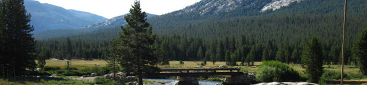
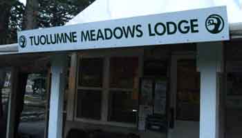
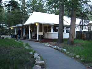
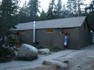
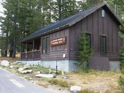