
High Sierra
Backpacking
Trail Guide
Forums
Sierra
Weather
WeatherNotes Northern
Sierra Weather
Gear
Backpacking Desolation Wilderness
Dicks Pass
Hiking the Pacific Crest and the Tahoe to Yosemite Trails in Desolation Wilderness
Languages
Trail Skills
Mountain
Safety
Food
Planning
Trail Arts
More
Information
Social
| Trail Guide Section INDEX |
North |
South |
Map |
Miles & Elevations |
Miles & Elevations INDEX |
Lake Tahoe Basin Management Unit PERMITS |
All forest-wilderness PERMITS |
all pages |
Video
Backpacking South to Dicks Pass
Desolation Wilderness
|
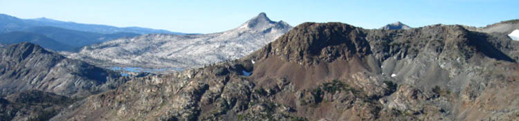
Man, this place has incredible views. Dicks Pass sits on a great rounded "flat." On the far South side of this flat there is a nice shaded place to take a break overlooking Half Moon and Alta Morris Lakes in the valley below, between Jacks Peak and the ridge running Southeast from Dicks Pass and our position below Peak 9579. Beyond these unique lakes sitting in their upper canyon we can see the channel between the South end of the Crystal Range and and Heather Lake that will bring us up to Lake Aloha. To the Southwest we look over this gap in the mountains at Pyramid Peak with Lake Aloha set in the expansive field of granite that makes up its Eastern flank and base. A grand view. Quite a nice place to take a break, have a snack, and take in the view. |
| Dicks Pass Desolation Wilderness |
Desolation WildernessMeeks Bay to Dicks PassSo far Backpacking to Dicks Pass
|
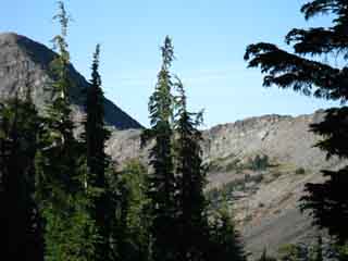
View South from Dicks Pass
 |
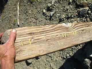 |
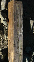
| Final approach to Dicks Pass. Dicks Peak in near foreground Right. | Dicks Pass Sign Post has seen better days. It was downed behind a bush. |
 |
 |
| Ridgeline across to Jacks Pass from Dicks Peak. There's a trail from Dicks Pass to Dicks Peak. Rockbound Valley is over on the other side. |
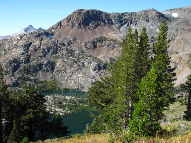
Alta Morris and Half Moon Lakes nestled between the shoulders of Jacks and Dicks Peaks, viewed dropping off the South side of Dicks Pass. |
 |
|
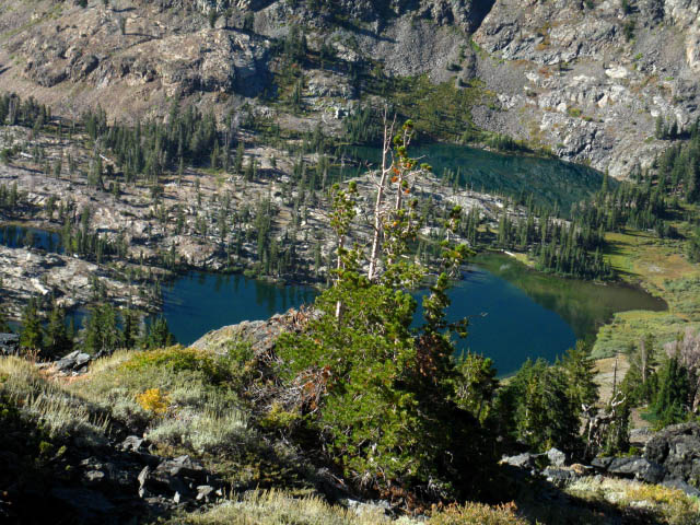
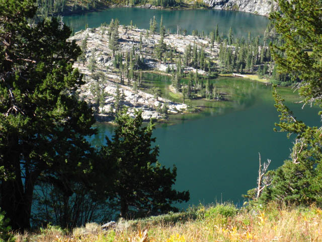
Above: Susie Lake. We will be hiking clockwise around the Left, the South shore of Susie Lake around to the middle of the "top" of the lake to find our way into the rocky channel for the little climb up to Heather Lake. Phipps Pass to Heather Lake
|
|
 |
|
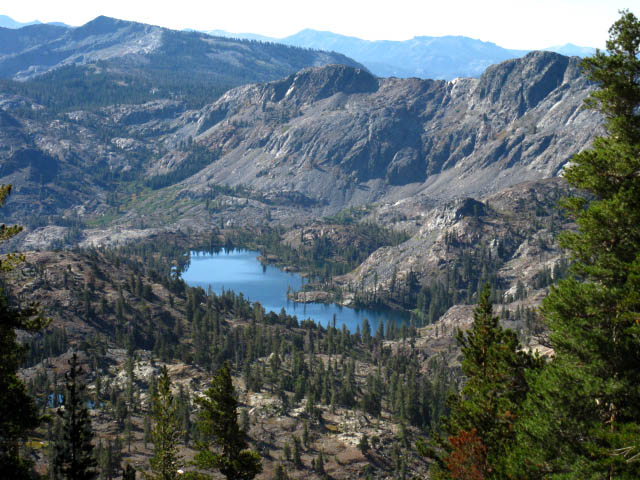
Two Aspects of Lake Aloha Jacks Peak sits across from our position with Half Moon Lake and Alta Morris Lake laying between our position and Jacks Peak.
|
|
 |
|
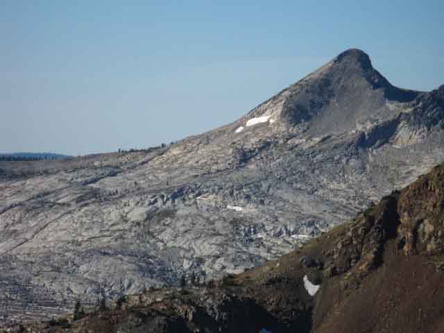
| Above: Pyramid Peak and the late fall remnants of Lake Aloha at its feet. Ridgeline coming off of Jacks Peak in foreground. Off on the left edge of the granite apron around Lake Aloha is where Pyramid Creek runs off a cliff on its way down to Twin Bridges on Highway 50. | |
 |
|
Above: Pyramid Peak detail. |
|
|
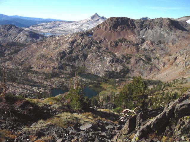
The South side of Dicks Pass is a visual treat. At our feet between the descending shoulders coming off of Dicks and Jacks Peaks are a series of delightfully shaded lakes. The colors of the lakes, from the various shades of crystal blues transitioning into a shimmering mossy green along the shores of Half Moon and Alta Morris Lakes, to the deep blue of Susie Lake, takes your breath away. Well, maybe the climb up here and the altitude took your breath away. To the West, beyond the series of little lakes nested in the crumpled terrain at our feet, the massive granite foundations of Pyramid Peak spread out from its distinctive summit. The lateness of the season has depleted Lake Aloha down to a series of ponds held within the irregularities of its granite basin. That's where we're headed. Check the map through this section, and match up the pictures with the map. We will pass through the terrain pictured above. These sheets of granite flatten out enough below the Eastern side of Pyramid Peak to provide a granite basin, the Desolation Valley, to contain Lake Aloha. Our trail will follow along the Eastern shore of the remnants of Lake Aloha through Desolation Valley on our way down to the Echo Lake trail head. This whole section is a visual treat. |
North: Fontanillis Lake to Dicks Pass South: 3 Trail Junctions
Dicks Pass |
From Dicks Pass' height of 9390 we will now be steadily losing elevation backpacking down to Echo Lake's elevation of 7414'. Though you will still experience numerous little ups during this long downward hike, we will be going generally down mountain from here to the end of the Desolation Wilderness, and on to our next destination, The Echo Lake Trailhead..
North Topo Hiking Map
South
Next page South |
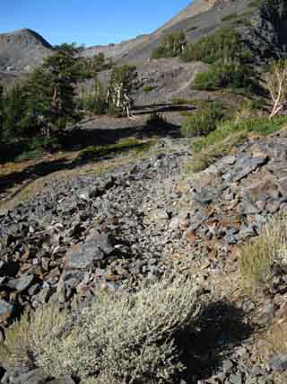
Hiking to the South Flank of Dicks Pass
Looking to our Left we can see that the expansive rounded flat below the Southwest side of Peak 9579 marked as Dicks Pass on the USGS maps runs out about a half mile to the Southeast, making up the backside of the sheer crestline above Azure Lake.
Meeks Bay to Echo Summit
Though the trail turns West, away from the bluff, to thread itself through the gap between Dicks Pass and Dicks Peak (check out the MAP), the trail turns out of the gap back towards the Southeast towards Gilmore Lake and into the valley below by descending along the South side of this huge spur ridge. The map shows Jacks Peak, Dicks Peak, Peak 9579, and the spur ridge off the Southeast flank of 9579 make up a horseshoe shaped set of mountains surrounding Alta Morris and Half Moon Lakes below. When we pass South through the gap below Dicks Pass separating the back-to-back canyons, holding Dicks Lake to the North and Half Moon Lake to the South, our trail begins a long 1.33 mile traverse along the South face of this ridge dropping 800 feet down to the Glimore Lake trail junction.
|
| View Southeast from a few feet South of Dicks Pass. | ||
 |
||
A spur ridge runs Southeast from Dicks Pass. Check the grade of this terrain against the contours on the map to calibrate your map reading skills. The South side of the Dicks Pass "flat" has seats under shade that overlook Half Moon Lake, glimpse Pyramid Peak above Lake Aloha, and view the Sierra Crestline tracking South. |
Video
Down from Dicks Pass towards Susie Lake on the Tahoe Yosemite and Pacific Crest Trails
| Fine views of the lakes in the two valleys as hiking South of Dick's Pass. |
| Dicks Pass to West Shore of Susie Lake, Desolation Wilderness |
Desolation Wilderness Meeks Bay through Dicks Pass Following the Classic Tahoe to Yosemite Trail route, which also covers the PCT and TRT.
Backpacking South
Elevation Dicks Pass (9390 feet) to Susie Lake (7800 feet) drops 1590 feet in 2.93 miles.
Mileage .
Hiking NorthMileage Dicks Pass is 16.83 miles South from the Meeks Bay trail head. The West side of Susie Lake is 19.76 miles South from the Meeks Bay trail head.
|
Hiking South off of Dicks Pass
Two Views Looking Back, Northward, at Dicks Pass and Peak
 |
 |
| Looking North back at our shaded break spot in the trees on the South side of Dicks Pass while hiking South from Dicks Pass dropping down into the gap between mountaintops. | Hiking South out of the gap below Dicks Pass. We're looking North at the gap in the mountains below Dicks Pass. |
Looking South-Southeast at Valley and Lakes
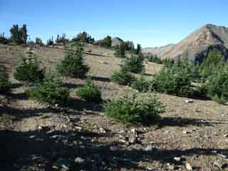
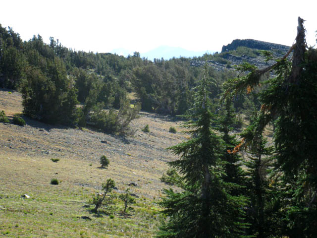
Standing in the Gap Standing in the gap below Dicks Pass we are at the head of the valley running up from Alta Morris and Half Moon Lakes. Two valleys actually, as this gap divides the the valley from the North holding Dicks and Fontanillis Lakes from Alta Morris and Half Moon Lakes on the South. We are going to be hiking South down the Northeast wall of the valley above Half Moon and Alta Morris Lakes at the top, and Suzie Lake below, down to the point where the trail crosses the small valley below, passing around the South shore of Susie Lake to enter the gap in the mountains containing Heather Lake, and the passage up to Aloha Lake behind it. Half Moon Lake and Alta Morris Lake sit at the very top of this valley, which widens out below into a chaotic terrain filled by Suzie Lake and lots of tiny lakes. This little valley is surrounded by and filled with "small" granite mounds and ridges decorated with what looks like thin tendrils of forest connecting the scattering of dense stands of trees. This whole terrain drains East around the South flank of Tallac Peak, all flowing down to Fallen Leaf Lake. As we drop down into the valley the page below shows how our view of the terrain shifts and rotates to reveal details and aspects hidden from our grand view above at Dicks Pass. For Northbound hikers here this means "Turn Around and check the View," but this axiom equally applies to all backpackers hiking in all directions. |
 |
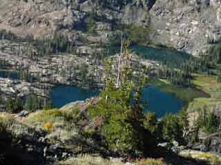
Half Moon Lake and Alta Morris Lake in the foreground with Aloha Lake visible between Jacks and Pyramid Peaks in the background. |
Hiking South and Losing Elevation
 |
Light breeze rippling across Susie Lake, view from the North below Dicks Pass, Pacific Crest Trail. Our hike along the Tahoe to Yosemite Trail bends around the South shore of Susie Lake, the far side of the lake, to continue West through a passage between the South base of Jacks Peak and the North end of Cracked Crag. Phipps Pass to Heather Lake |
The Trail passes by the East Side of Jacks Peak and Half Moon & Alta Morris Lakes
 |
| Dropping down almost to Half Moon Lake Level. Jacks Peak sits behind the Lakes with Pyramid Peak peeking over the top. |
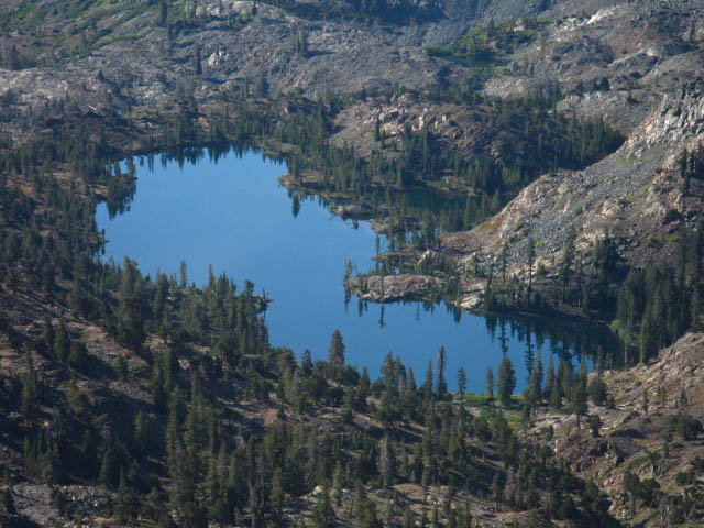
Half Moon and Alta Morris Lake
 |
Dropping down almost to Half Moon Lake level reveals terrain details including the reflections of forest and rock superimposed above the lakeshore shelf. Alta Morris Lake is the far lake. |
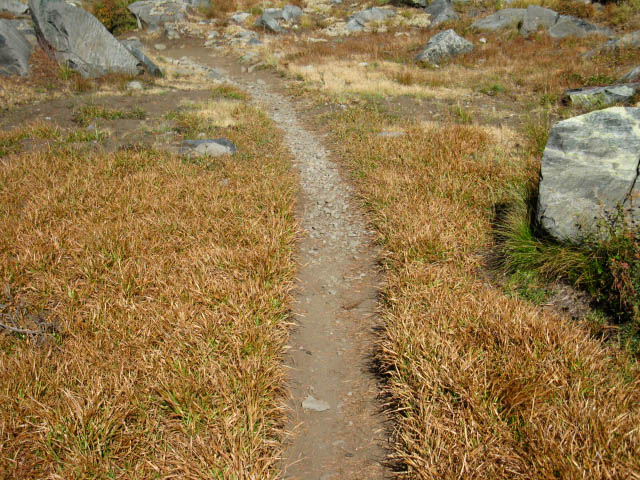 |
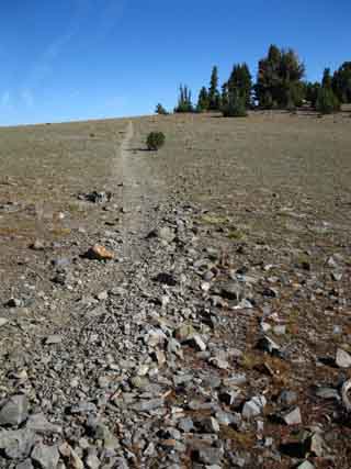
Golden Trail below Dicks Pass during Fall. How delightful. |
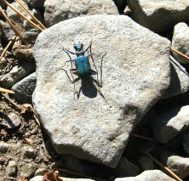
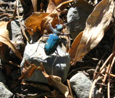
Bug Encounter: Royal Blue Beetle
 |
||
Royal Blue Beetle in Desolation Wilderness below Dicks Pass. Beetle: "Oh-Oh." Me: "Cool Beetle!,"while pulling out the camera. Beetle: "I'm frkn outta here." Beetle runs for cover. I follow. The bug either runs remarkably fast, or I am remarkably slow. Humm. Altitude and Heavy Pack degrade my pursuit skills, and huffing and puffing makes it hard to bend over, track bug and take shot. I took maybe ten shots chasing the bug and deleted eight of blue beetle blur, retaining these two. |
||
 |
||
Scurrying away from the pursuing backpacker as quickly as possible. Seen any good High Sierra bugs lately?
|
||
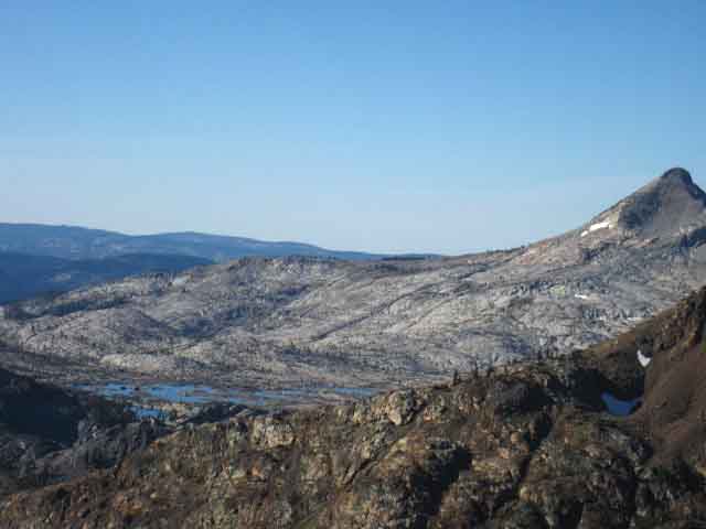
Looking Southwest into the Big Granite of Pyramid Peak at the South End of the Crystal Range.
EXPANSIVE GRANITE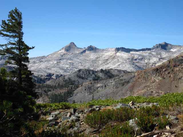 |
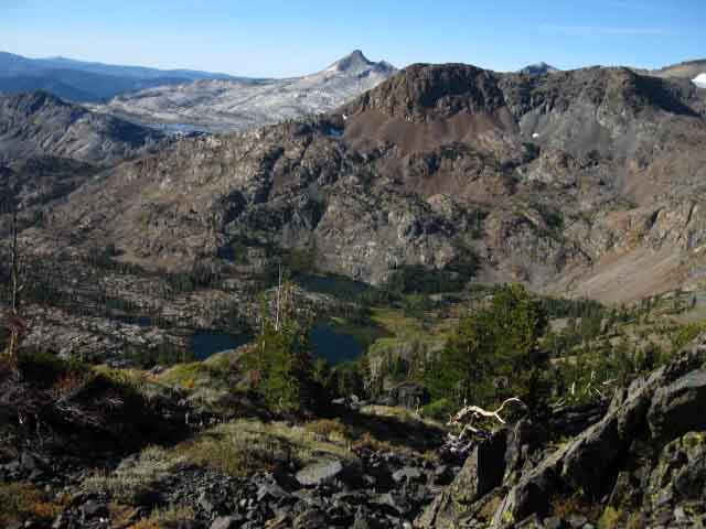
| Above: Pyramid Peak towering above Desolation Valley and Lake Aloha. Desolation's Big Granite. We've dropped down far enough to once again see Pyramid Peak past Southeast descending flank of Jacks Peak, but will again lose this view dropping into the valley and entering the forest. |
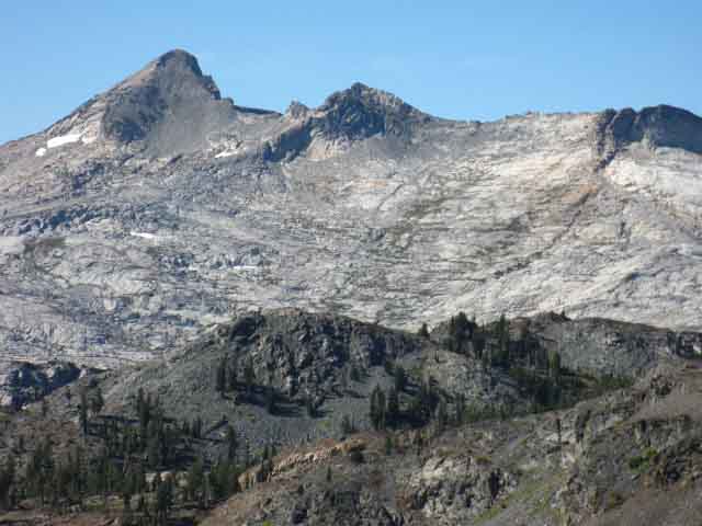 |
Above: Pyramid Peak granite detail. Ridgetops separating Suzie Lake from Lake Aloha with Heather Lake between. These shots are why I lug a tripod around. Now I've got to get a real camera. |
Dicks Pass, Desolation Wilderness |
Hiking PlanCrossing Dicks Pass traveling South marks the last major climb we will do in the Desolation Wilderness. It's almost all downhill from here all the way to the Echo Lake trail head. Though we still have 11.88 miles of exceptional Desolation Wilderness terrain to cross until we reach the trailhead at Lower Echo Lake, we are now headed down and out of Desolation Wilderness. It's time to think about our upcoming encounter with "civilization" at Echo Chalet. Hiking Plan for Resupply and/or lunch at Echo Chalet
2017 UPDATE
Now we've got to think about hitting the Echo Lake Chalet. If we are picking up a food resupply, we want to pick it up with enough time to get ourselves down the trail to our next campsite to the South, as well as timing our arrival to coincide with lunchtime. The plan is to hike into Echo Lake early enough to make it to our next campsite past Echo Lake before dark. Our next campsite South of Echo Lake will likely be at Showers Lake, which sits about 9 miles South of Echo Lake. Our goal is to have enough time to eat at the Echo Chalet deli and hang out for awhile, while still giving ourselves enough time to get to Showers Lake. These constraints are why we want to properly stage-up our campsites before and after arriving at our backpacking resupply spots. The same plan applies if we are not resupplying at Echo Chalet, with the difference being that we will not have to spend time repacking our food supply. We will just be packing our stomachs... This means we are going to want a campsite that puts us close enough to Echo Lake to get there no later that mid-morning. We've got to get in and out of Echo Chalet with enough daylight to make it to our next campsite 9 miles South of Echo Chalet at Showers Lake. How you figure this, and how you should figure this, depends on your daily miles and just when you cross Dicks Pass. Many long distance backpackers North on the Pacific Crest Trail hitch down to South Lake Tahoe to rest, feed up, and Resupply in South Lake Tahoe's ample comforts. Some have loved ones drive in to Echo Lake to express their love by pampering them for a few days. Seriously, I've seen that scenario played out dozens of times over the years. Check out our resources in South Lake Tahoe and Meyers...
South Lake Tahoe Backpacker Resources
Hiking Topo Map: Phipps Pass to Susie Lake Hiking Topo Map: Dicks Pass to Echo Lake Trailhead
Next page:
|
Backpacking North Trail Guide |
 |
Backpacking South Trail Guide |
Backpacker Forums Post it on Welcome to Tahoe to Whitney
Anyone can post text comments in the existing forums, but only members can post up new topics, along with images, maps, and formatting. As we addressed some gear issues on the page above,
If you have experiences, comments, questions, trip reports, trail conditions updates or pictures and/or videos of the Tahoe to Yosemite Trail from Meeks Bay to Lake Genevieve, and camping around Lake Genevieve and up the valley, post up your images, experiences, notes, and advice here as an unknown hiker or as a member: Section
|
North: Fontanillis Lake to Dicks Pass South: 3 Trail Junctions
Trailhead
Contact
Alex Wierbinski

Backpacking Lake Tahoe to Mount Whitney
Your guide to the High Sierra Crest, including the Tahoe to Yosemite, Pacific Crest, and John Muir Trails
