

High Sierra
Backpacking
Trail Guide
Forums
Sierra
Weather
WeatherNotes Northern
Sierra Weather
Gear
Backpacking
through
Three Quick Trail Junctions
South of Dicks Pass and North of Susie Lake
Hiking through Desolation Wilderness on the Tahoe to Yosemite and Pacific Crest Trails
Languages
Trail Skills
Mountain
Safety
Food
Planning
Trail Arts
More
Information
Social
Three Quick Trail Junctions
South
of
Dicks Pass
Gilmore Lake to the Northeast,
|
||||||||||||||||||
Weather and Road Information Below find the closest Ground Stations, Point and Regional Forecasts along the West shore of Lake Tahoe. Satellite and Radar Imagery provides Long Range and Regional overviews.
All All
|
Phipps Pass to Heather Lake
South Desolation Wilderness
Meeks Bay to Echo Summit
Long distance backpackers will hike straight through all three to remain on the main Yosemite to Yosemite-Pacific Crest Trail route. These trail junctions are important for local backpackers. This series of junctions offer two different routes to access the center of the Desolation Wilderness, one dropping into Desolation by hiking over the tallest mountain along the West shore of Lake Tahoe, Mount Tallac, and the other climbs up into Desolation Wilderness through the Glen Alpine drainage. Both of these trails begin from trailheads off the Northwest shore of Fallen Leaf Lake including the trailhead at the end of Spring Creek Road between Fallen Leaf Lake and Cascade Lake.
|
||||||||||||||||
1st, Northernmost, Trail Junction
Gilmore Lake to the North
Then East over Mount Tallac
Gilmore Lake Junction To Mt. Tallac, Cathedral Lake, and on to Fallen Leaf Lake and the Tallac Trailheads along Highway 89. |
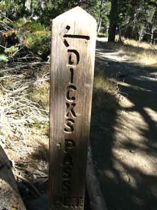
Desolation Wilderness1st Trail Junction South of Dicks PassA Left turn North for Southbound backpackers.
Backpacking South from Dicks Pass to the Gilmore Lake JunctionThe Gilmore Lake Junction is the Southwestern approach to climb Mount Tallac, and exits the Desolation Wilderness around the Southeastern flank of Tallac after approaching the crest. 2.59 miles from this Gilmore Lake trail junction, and after climbing just below the crest of Mount Tallac, the trail drops down to a trail junction North of Cathedral Lake above Fallen Leaf Lake. From this trail junction a bit North of Cathedral Lake we can hike North 2.2 miles to Spring Creek Road off of Highway 89, for a total of 4.79 miles from this trail junction to Gilmore Lake. Continuing North on Spring Creek Road it is another 2.92 miles to Highway 89, making the total distance from the Gilmore Lake trail junction on the Tahoe to Yosemite Trail to Highway 89 at 7.71 miles. Gilmore Junction to Cathedral Lake: 2.59 miles Cathedral Lake to Spring Creek Road: 2.20 miles Spring Creek Road to Highway 89: 2.92 miles Total 7.71 miles Note that these miles cited above and below include hiking over the 9735 foot Mount Tallac.
We also have the option of hiking East from trail junction at Cathedral Lake. We can hike East .99 of a mile down to the West shore of Fallen Leaf Lake. From the West shore of Fallen Leaf Lake we either hike to the Northeast or the Southwest to trailheads along the West shore of Fallen Leaf Lake. The total distance East from this Glimore Lake trail junction to the West shore of Fallen Leaf Lake is 3.58 miles, plus either another .77 or a mile North to Cathedral Road or .34 of a mile South to Fallen Leaf Road.
Got that? Check out the East side of the map below, which depicts our hiking options hiking coming off the Southeast flank of Mount Tallac: Dicks Pass to Echo Lake Trailhead Gilmore Junction to Cathedral Lake: 2.59 miles Cathedral Lake to West shore Fallen Leaf Lake: .99 mile North to Cathedral Lake Road: .77 mile South to Fallen Leaf Lake Road: .34
Totals Gilmore to Cathedral Lake Road: 4.35 miles Gilmore to Fallen Leaf Lake Road: 3.92 miles |
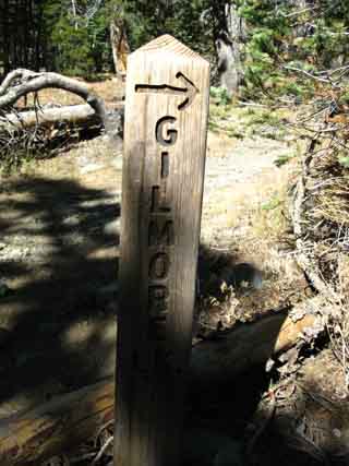
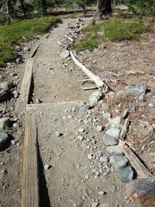
Gilmore Lake Trail Junction
A very clearly marked trail junction
What Does this all Mean?
These three trail junctions leading to two distinct exits from the center of Desolation Wilderness give us another set of options for local and long backpacking backing trips into and around Desolation Wilderness, rather than hiking across its full length, as we are. The last series of three trail junctions we encountered to the North of Dicks Pass, the Bayview and Eagle Falls trail junctions, pointed us Eastward to Lake Tahoe and West into Rockbound Valley. This set of trailheads into Desolation Wilderness are located South of the Eagle Falls and Bayview Trailheads along Highway 89. Check out the Lake Tahoe Trailheads roadmap. This means that we have a series of 5 trailheads along Highway 89 (including Meeks Bay) that can be the basis of many potentially long and short backpacking trips around the Central-North Desolation Wilderness from trailhead to trailhead of increasing length. When we include the Rubicon Trail through Rockbound Valley as a potential leg of hiking trips South from Meeks Bay, we can see that the the Eagle Falls, Bayview, Tallac, Cathedral Lake and Glen Alpine Trailheads give us many options for lots of interesting backpacking loops and trailhead to trailhead hikes around the North-Central Desolation Wilderness. A couple of big loops around Desolation Wilderness will give us good context on the trails and terrain. Once we get the overall picture in focus we will se that Desolation Wilderness is full of scrambling routes. The 30 minute Southern Desolation Wilderness Backpacking Map lays out our hiking options to the Northeast and Southeast into and out of the Desolation Wilderness through these Tallac, Cathedral Lake, and Glen Alpine Trailheads. The Lake Tahoe Basin Management Unit permits page has bunches of great information about Desolation Wilderness, Desolation Wilderness rules and quotas, and of course links to the Desolation Wilderness online Permit System, and about everything I can find to help you operate it. I've also included advice for drawing a permit for the Tahoe to Yosemite Trail. We've got lots of information about Desolation Wilderness here. |
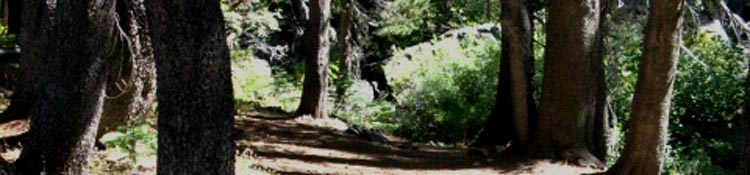
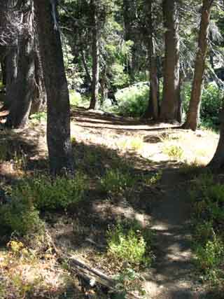
A
Short Hike Downhill
through forest
from the
Gilmore Lake
to the
Half Moon Lake, and Glen Alpine
trail junctions
Forest trail losing elevation
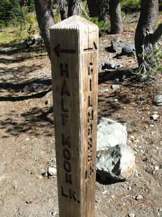
2nd Trail Junction
Glen Alpine to the East
Half Moon Lake to the West
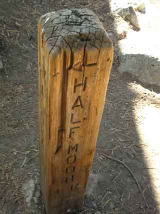
2nd Trail Junction Glen Alpine Southbound Left, or Southeast, And Half Moon Lake |
| Desolation Wilderness
2nd Trail Junction Backpacking South from The Gilmore Lake Trail Junction to the Glen Alpine-Half Moon Lake JunctionWe encounter the next junction in this series of three trail junctions, the middle one, hiking .59 of a mile South of the Gilmore Lake Junction. This is the Glen Alpine/Half Moon and Alta Morris Lake Junction. Glen Alpine The Southbound backpacker on the Tahoe to Yosemite Trail continues straight through this junction. The Glen Alpine Trail tracks East (Southbound hiker Left) off of our Pacific Crest-Tahoe to Yosemite Trail route to the road on the Western edge of Fallen Leaf Lake located 3.83 miles to the Southeast of this junction. 4.59 miles past that point this road intersects with Highway 89 after bending around the Eastern Shore of Fallen Leaf Lake. The total distance from the Glen Alpine junction to Highway 89 is 8.42 miles, if we have to hike it all. To the Southbound backpacker's Right this trail junction marks the beginning of the 2.07 mile trail Northwest to dead end at Alta Morris Lake, just past Half Moon Lake. |
The Glen Alpine - Half Moon Lake Trail Junction
 |
 |
| Above: Half Moon and Alta Morris Lakes trail Junction: Southbound hiker Right turn to Northwest | Above: Glen Alpine Junction: Southbound hiker Left to the Southeast |
 |
|
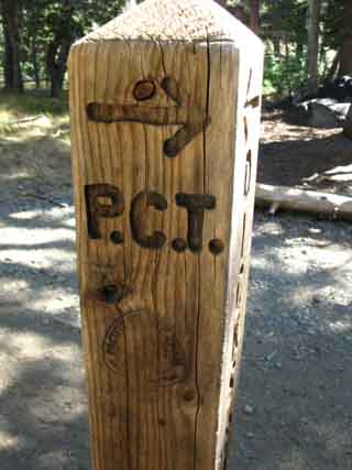
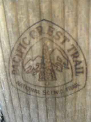
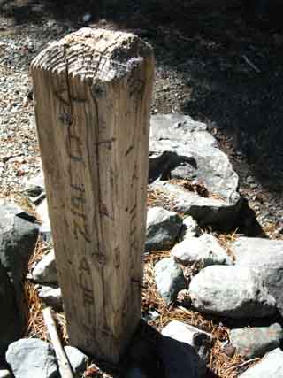
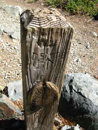
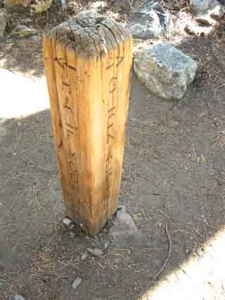
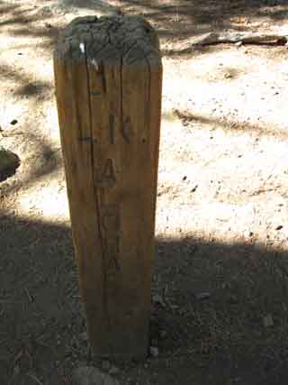
Above: Old Pacific Crest Trail wooden emblem. Here in Desolation Wilderness we have seen a few unique bits of trail-sign culture. Here in Desolation Wilderness is one of two Tahoe to Yosemite Trail signs along the whole route of the Tahoe to Yosemite Trail. Here in Desolation Wilderness we saw the branded trail post. |
|
Graffiti?
|
A third of a mile further South
we come to the
Southernmost Trail Junction
Glen Alpine Trail
to the
Southeast
So Many Trails, so Little TimeThe trails junctions described above link two basic routes from the Western shore of Lake Tahoe to the main Tahoe to Yosemite-Pacific Crest Trail route passing through the heart of the Desolation Wilderness. These trails, from Meeks Bay and the Bayview/Eagle Falls Trail junctions to our North, through the Gilmore and Glen Alpine junctions described above to our East, and the Triangle Lake Trail to Fallen Leaf Lake trail junction further to our South, all contribute to make the Desolation Wilderness chock full of potential short and medium distance backpacking opportunities. It's the perfect combination: All of these side trails East to the West shore of Lake Tahoe are not too long, they are not too difficult, and they all access world-class beautiful terrains and trails. It's a win-win-win situation. This series of West shore trailheads can be used for short, medium and long distance hikes into and around the Desolation Wilderness. Check out the Full Desolation Wilderness Topo Map to get a broad context on how to access the main Tahoe to Yosemite and Pacific Crest Trails across the Desolation Wilderness from this series of trailheads along the West shore of Lake Tahoe. Though this trail guide does not depict these trails in detail yet, the mileages from their trail junctions on the main PCT-TYT route to their trail heads are included for many of them. Desolation is a good place to develop and practice backpacking skills, starting with small excursions into the mountains and woods to work out your gear and training issues, then building up to a 30 mile backpacking trip down the whole length of the Desolation Wilderness. And beyond! You have no limits. Just logical steps. Desolation Wilderness offers the new backpacker the comfort of having many many other backpackers nearby. Especially during the peak Summer backpacking months. It's a backpacker's disneyland in there during the peak months. Using these trails, some sound planning, good gear, and adding a little imagination, we can easily lay out miles and miles of short and long trips and backpacking loops through Desolation Wilderness starting from and ending through any one of these Western Lake Tahoe trail heads. All of these West shore trailheads are located fairly close to one another on Highway 89 along Lake Tahoe's beautiful Western shore. On the other hand, if any of these trails lead to your favorite trailhead along the Western shore of Lake Tahoe, post up your notes and thoughts about it. You can launch your trip from Tahoe to Yosemite, and on to Mount Whitney, from your favorite Desolation Wilderness trailhead. The Lake Tahoe to Mount Whitney trails have many potential trailheads, by definition. Check out my Google Map of the West Tahoe Shore below to understand the relationship of the main trail through the Desolation Wilderness in relation to Highway 89's position along the Western shore of Lake Tahoe. Check out my large West Lake Tahoe Topo Map to get a complete view of the relationship between Highway 89 and the trails through Desolation Wilderness. |
| This map identifies some of my favorite resources and trail heads around South Lake Tahoe | ||
The Western Shore of Lake Tahoe is where the the trails from the Meeks, Bayview, Gilmore Lake, and Glen Alpine trail junctions reach their respective trailheads. These are Great Places to launch short backpacking trips and day hikes. |
North: Dicks Pass South: Susie to Heather Lakes
Backpacking Desolation WildernessThe Triple Trail Junctions between Dicks Pass and Susie Lake |
Bailout OptionsLong distance backpackers, and all backpackers may occasionally need to bail out off the main trails. Food, injury, illness, and broken gear are the common motivations for bailing out of the Wilderness. Hiking East from these Three Trail Junctions along the PCT-TYT The two Southern trail junctions of the three trails intersecting with the Pacific Crest Trail between Dicks Pass and Susie Lake point Southeastward out of the Desolation Wilderness to the Southwestern end of Fallen Leaf Lakes via Glen Alpine Creek past Lily Lake. Both of these two trails heading Southeast from these two junctions merge together a short distance East of their respective junctions. The Northernmost Trail Junction The third trail junction, the Northernmost of the three junctions near Gilmore Lake, heads North-Northeast to climb the Southwest flank of Mount Tallac before bending Southeast to pass around the sheer Eastern flank of Mount Tallac down to the trail junction at Cathedral Lake. This distance between the trail junction near Gilmore Lake to the trail junction at Cathedral Lake is 2.59 miles. When we reach the trail junction at Cathedral Lake we can either hike .99 of a mile East down to Fallen Leaf Lake, or 2.2 miles North to Spring Creek Road off of Highway 89. Spring Creek Road lays between Cascade Lake to the North and Fallen Leaf Lake to the South. If you hike down to Fallen Leaf Lake you have a .77 mile hike North to Cathedral Road on the Northwest shore of Fallen Leaf Lake or .34 of a mile South to Fallen Leaf Road on the Southwest shore of Fallen Leaf Lake. The two trails to the Southeast offer quicker bailout routes off of the Pacific Crest-and-Tahoe to Yosemite Trails than continuing South to the Echo Lake Trailhead. The distance between Gilmore Lake to Highway 89 via Spring Creek Road is 7.71 miles, while the distance from the nearby Glen Alpine Junctions to Highway 89 at Fallen Leaf Lake is 8.42 miles. The distance to the Echo Lake trailhead is 10.55 miles. I mention all these miles because I walk and hitch hike in and out of trailheads. But, the Gilmore Lake trail takes us almost up to the top of Mount Tallac over 9440 feet of elevation on our way over to Cathedral Lake, over one of the highest peaks in the region. This may not be a suitable bailout route if you are injured. The two trail junctions to the South of the Gilmore Lake junction, the two trail junctions to Glen Alpine descend all the way down to Fallen Leaf Lake along Glen Alpine Creek. The Glen Alpine trail avoids climbing Mt. Tallac, and begins encountering Forest Service summer cabins as it approaches Fallen Leaf Lake. This may well be a suitable bailout point for the injured or hungry backpacker. Continuing South on the Pacific Crest Trail the Echo Lake trailhead is 10.55 miles distant from the Gilmore Lake trail junction. The trail route over Mt Tallac may well be the hardest route out of the wilderness from here, though it is the 2nd longest route out of the Desolation Wilderness from these trail junctions. Though the Tahoe to Yosemite Route is longer down to the Echo Lake Trailhead it is downhill. The trail East from Gilmore Lake hikes over Mount Tallac, unlike the downhill routes out on the Glen Alpine trail or along the Southbound PCT-TYT routes towards Echo Lakes.
Hiking Topo Map: Phipps Pass to Susie Lake Hiking Topo Map: Phipps Pass to Susie Lake
Next page |
Backpacking North Trail Guide |
 |
Backpacking South Trail Guide |
Backpacker Forums Post it on Welcome to Tahoe to Whitney
Anyone can post text comments in the existing forums, but only members can post up new topics, along with images, maps, and formatting. As we addressed some gear issues on the page above,
If you have experiences, comments, questions, trip reports, trail conditions updates or pictures and/or videos of the Tahoe to Yosemite Trail from Meeks Bay to Lake Genevieve, and camping around Lake Genevieve and up the valley, post up your images, experiences, notes, and advice here as an unknown hiker or as a member: Section
|
North: Dicks Pass South: Susie to Heather Lakes
Trailhead
Contact
Alex Wierbinski

Backpacking Lake Tahoe to Mount Whitney
Your guide to the High Sierra Crest, including the Tahoe to Yosemite, Pacific Crest, and John Muir Trails
