High Sierra
Backpacking
Trail Guide
Forums
Sierra
Weather
WeatherNotes Northern
Sierra Weather
Gear
to the
1st Trail Junction
Hiking to Lake Genevieve on the Tahoe to Yosemite Trail in the North End of the Desolation Wilderness
Languages
Trail Skills
Mountain
Safety
Food
Planning
Trail Arts
More
Information
Social
| Trail Guide Section Index |
Road Map Lake Tahoe TRAILHEADS South |
SOUTH |
Topo Backpacking Map Meeks Bay to Dicks Pass |
Miles & Elevations Meeks Bay to Echo Lake |
All Miles Index |
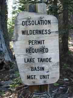
PERMITS Lake Tahoe Basin Management Unit |
All |
All |
End of the Dirt Road
Desolation Trail Junction
1.2 miles South of Meeks Bay Trailhead
See
Maps-Miles-Elevations
Meeks Bay to Echo Summit
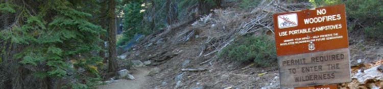
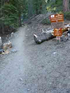
The Trail Begins Here our trail transitions from the "Easy" degree of trail difficulty to the "Intermediate" degree. Note the extensive restrictions cited on the signs. No fires. Good thing. I never make fires. Exception: when I meet a group of folks. They generally make fires. I've always said I'd make a fire in an emergency, but so far have not yet hit that point, despite a few wild times. Almost year-round dry conditions combined with the now over-bloated, massive population of California make prohibiting fires wise. On the other hand, this low-elevation forest is so packed with forest floor liter that any safe way to thin it out would be helpful. Backpackers pulling out firewood would help, if someone did not start a destructive fire. The problem is that the backpacking areas have already been picked clean of firewood due to over-population/over-use, while the rest of the forest floor is deeply cluttered with litter. The campsites along Lake Genevieve, Crag Lake, Shadow and Stony Ridge Lakes are all highly used and demands for firewood long ago stripped out burnable wood. As our forests fertilize and expand their own soils using their own dead parts and dead brethren, completely stripping out the forest floor liter is not good. On the other hand, suppressing fires for so long that the liter has built up to a level sufficient to fuel a conflagration in the surrounding National Forests is far worse. Ironically, our behavior/policies have brought the extremes of both too much and too little forest floor liter sitting in close proximity to each other in the forests along the West Shore of Lake Tahoe.
High Sierra Weather Information Local Temp and Snow Reporting Stations
Lake Tahoe Basin 7-Day Weather Forecast
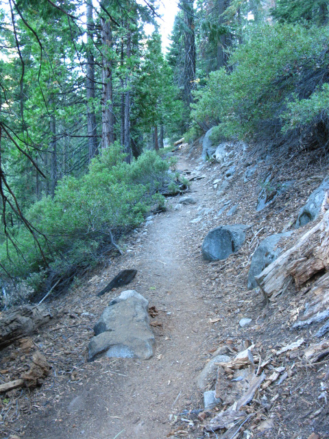
Nonetheless, despite all the various hazards, passing this trail junction marks the beginning of our climb. The sandy trail of the meadow-side fire road hardens up as it thins into a trail climbing to traverse up along the length of the ridge arm to the wilderness boundary. This is the same ridge who's base we traced out along the sandy road since hiking through the Meek Bay trailhead. We are now under more of its forest cover for the gentle hike up to our entry into the Desolation Wilderness and our ford of Meeks Creek.
|
||||||||||||||

Desolation Trail Junction
TYT
Hike right
 |
 |
Veer Right up the trail at this Junction. |
Sign close up |
Desolation Trail Junction
Detail
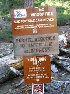
| The Laws of the Desolation Wilderness. |
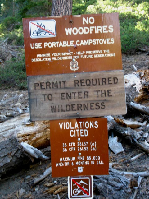 |
Desolation Trail, Desolation Wilderness, 1st Junction. Look at all those signs! Nothing that I disagree with, though it is sad that there are so many people that you need a permit to day hike... This level of regulation requires information. Lake Tahoe Basin Management Unit |
Current Location Elevation Mileage End of the Road Down to our Left it looks like there is a nice picnic area, a group camp site, and possibly for backpackers a campsite location for late-night arrivals at the Meeks Trailhead. If it's not being used by groups, I'd guess.
Next That's not too bad if we are in reasonable fitness. I still suggest "taking it easy" on our first day. From Lake Genevieve our trail climbs a gentle 400 feet of elevation over a mile and a half past series of bucolic lakes within a valley capped by a series of majestic mountains on one side, and a stony ridge capped by Rubicon Peak dividing us from Lake Tahoe on its far side. Nice campsites surround each lake up to narrowing end of the valley, which pinches right up to the shore of Stony Ridge Lake at the top of the valley. Above the Southernmost Shore of Stony Ridge Lake the top of the valley holds a productive marsh that's full of life. We begin a short but steep climb up to Rubicon Lake and then Phipps Pass from the far South Shore of Stony Ridge Lake. |
Tahoe-Yosemite Trail
Sign Post
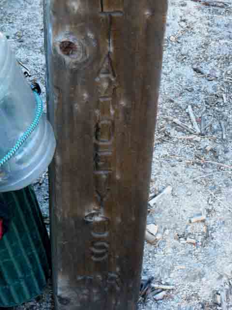 |
Tahoe to Yosemite Trail Two TYT signs along the whole route Tahoe-Yosemite trail sign post at 1st trail junction, Desolation Trail I figure this lack of signage is because the Tahoe to Yosemite Trail (TYT intro) is not an official trail. I guess this "unofficial" status means that it is not recognized by the Forest Service or the National Park Service. This lack of recognition may be good. There are two points of interest the informal status of the TYT brings to light. First, the route of the Tahoe to Yosemite Trail was designed by Thomas Winnett and promoted in his nifty little guide. Second, a lack of attention and maintenance due to the failure of "recognition" has kept the unmaintained segments of the TYT in unmaintained status, preserving the original character, challenges and difficulty of the route. Good Wikipedia History of the Tahoe to Yosemite Trail That's why I am of the opinion that this lack of recognition is a good thing. I am also happy that the PCT route swings around the heart of the Emigrant Wilderness by detouring around Emigrant Basin. How you feel about this issue should play a part in your upcoming route selections. The TYT would be a wise choice if you enjoy route-finding and rough, not perfectly laid-out conditions. The PCT would be your first choice if you prefer well-maintained trails to route-finding. The High Sierra has a trail for everyone. One Route-Two Signs
SOUTHBOUND The trail South from the road junction beginning formal trail brings us up 1081 feet along the side of this forested ridge over the next 3.19 miles to Lake Genevieve, the first lake suitable for camping out of Meeks Bay Trailhead, and the first of a series of lakes decorating the length of the gently-rising valley behind Lake Genevieve. It is not a difficult hike up to Lake Genevieve or the series of lakes beyond. I rate it at Intermediate-3. Hiking up to Lake Genevieve is a fantastic place for short trips to check out our skills, fitness, and gear. Here at this trail-Y with the road we exit the meadow and start out hiking up through hot dry forest up to a substantial dry flat wedged in along the side of the ridge. That flat will be where we officially cross into Desolation Wilderness. Unique Terrain Creates Unique Environment We continue on the short flat past the wilderness boundary to enter in-between converging ridge arms that creates and protects a small, narrow zone of temperate forest approaching the nifty little bridge over Meeks Creek. Short Bit of Bliss Have you checked out the local TOPO MAP yet? Click the RED dots along the marked route for the trail guide entry The locations cited on the miles and elevations page are also linked to their corresponding entries in the trail guide. See the whole From the guide pages you can post up your insights and experiences, or ask and answer questions. |
Meeks Bay Trailhead I figure a good way to start a trip is to take the measure of its first miles on our minds and bodies. Our experiences during the first steps of a trip sets the stage for the whole trip. That's why it is good to plan the first days will within the capacity of the weakest hiker in our group. Below find the information for this first bit of our hike on the Tahoe to Yosemite Trail South into Desolation Wilderness.
INFORMATION The
Starting
Distances, Difficulty, Elevations, Lakes, Campsites Hiking Down the TYT Distances Measured from Meeks Bay
Meeks Bay to Dicks Pass
Trail Difficulty to Phipps Pass Lake Genevieve up to the South end of Stony Ridge Lake is Easy. Lake Genevieve is the first of this series of lakes nestled in along the floor of a gently rising valley who's end marks the beginning of the short but steep climb to Phipps Pass. The difficulty of the trail from Stony Ridge Lake climbing to Phipps Pass increases to Hard-3 or Intermediate-1. Though difficult, it is very short. Trail Difficulty Scale |
North to Meeks Bay: Desolation Trail to Meeks Bay top of page South: Lake Genevieve
Traverse
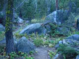
Up Along the Ridge Side
BIG BLACK ANT
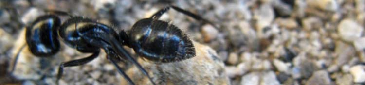
Both of Us
Traversing the ridge towards Lake Genevieve
Trail Junction
(From the First Junction) Maps and Mileages
Meeks Bay to Echo Summit
Environmental Overview Gently Rising Forested Terrain. Passing Right through the road junction onto the trail we have climbed away from the tattered edge of semi-exposed dry meadow onto a partially shaded gently rising ridge traverse to the Southwest. These cooler conditions are offset by the extra heat we generate hiking up the steeper incline of the trail across this long traverse up the Southeast flank of this low ridge arm. We are hiking Southwest towards my favorite part of this segment of trail where the trail runs through temperate forest before cutting a sweet climbing "S" turn through the complex terrain above the bridge. We will pass through a twisting wrinkle of terrain in-between the converging ridge arms holding this sweet little temperate elevated vale within the strangely shaped little bowl at the top of this set of converging ridge arms. Passing through this nifty wrinkle between the ridges we will emerge just below Lake Genevieve. Complex Logic of the Trail
|
Video
Tahoe Basin Forest approaching Desolation Wilderness
Traversing the ridge past the 1st Desolation Trail Junction, Sept. 15, 2009. Duration 1:25.
 |
Rustic |
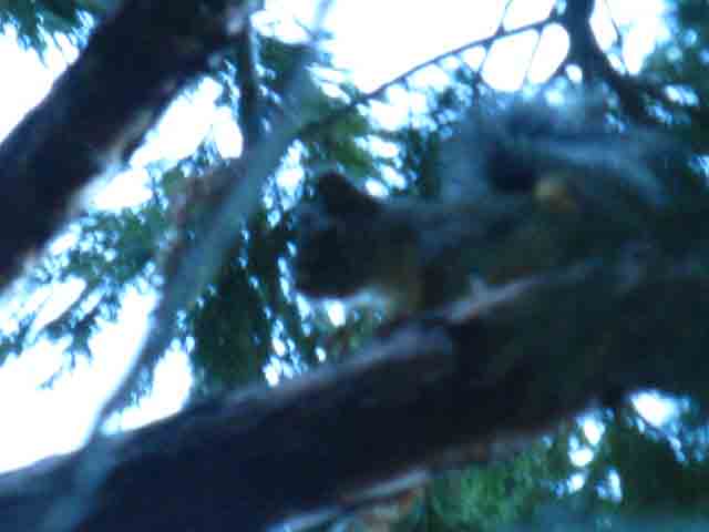
Mad Squirrel
 |
||
This squirrel was mad as hell at me, and was giving me endless crap. He started giving me shit from 25 yards away, as I approached. He was even more unhappy when I reached his tree and stopped, pulled out my camera, and started playing "shoot the mad squirrel." It was on. He was furious. The Mad Squirrel would run out, scream violently at me, and then run and hide from the camera, and then do it again. Little bastard cracked me up. Some years the squirrels seem more animated up and down the trails, other years they are more quiet. 2009 was a loud year for the squirrels. I think changes in squirrel behavior from year to year may be related to their exposure to Bubonic Plague. During plague years the squirrels may act more aggressively. If he was ten feet tall he would have messed me up...
2015
High Sierra Bubonic Plague Information Index
High Sierra Health and Fitness News
The fact is that plague is a constant threat in the Sierra during all years, though its incidence and spread rise and fall each year. Risks of exposure and contraction are only reduced by correct backpacker behavior. Small mammals and their fleas must be avoided. This can be difficult during the fertility of Spring when lots of cute baby squirrels and chipmunks are sweetly begging for food. They must be rebuffed and kept at a reasonable distance. This is both for our safety and theirs. Ours being the protection from plague distance offers, and their safety is not being made dependent on, and vulnerable to humans.
|
Big Black Ant
| Keeping a close eye on the Amazing World at our feet. |
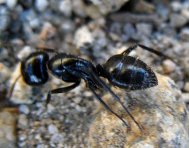 |
Big Black Ants: Backpacker's Constant Trail Companions. Don't step or sit on them! I call this species "blueberry" ants because the segments of their body are as big as, and look like pieces of blueberries with legs. Forum |
North TYT: Meeks Bay Trailhead South TYT: Lake Genevieve
Up to the Flat wedged into the Ridgeside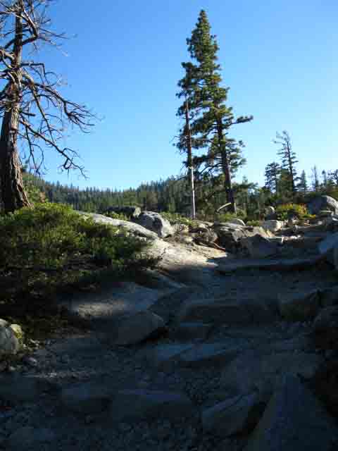 |
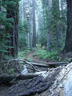
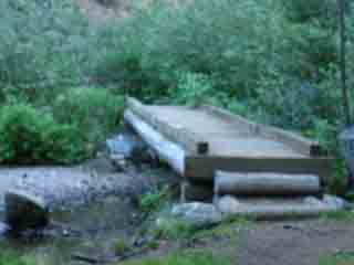
Flat The wilderness boundary is about halfway down this flat. The top of this valley bends us to the Southeast and funnels us into the bottom of the next valley. The upcoming flat in the image above is a substantial shelf wedged into the South side of our ridge arm. Its far end leads us into a channel in the terrain protecting a sweet little temperate zone. We are hiking to get over to the backside of the little peak at the center of the image above, where we will follow the trail through the nifty "S" turn through the hilltops beyond the bridge. From our position in the image above we will begin a steady climb from the end of the upcoming flat up to a little flat around the Meeks Creek Bridge. |
Exposed High Point on the Ridge
Meeks Bay Traversing up towards the head of this long low valley our trail along the ridgeside traverses onto an exposed flat a half mile before we cross the boundary entering the Desolation Wilderness proper. Entering the Open Flat
.73 mile past the trail junction
Elevation
Mileage 2.46 miles South to Lake Genevieve. 6.95 miles to Phipps Pass.
Meeks Bay to Echo Summit
|
|
That very well may depend on just how far we are hiking on this backpacking trip, which determines how much food we are carrying. How much food we are carrying is a big factor determining how much our pack weighs. How much our pack weighs and how physically prepped we are to carry this weight determines just how we are feeling, my fellow Sherpa. Cowboys laugh at me, until I tell them that only wimps need mules. I am my own mule, self-sufficient within myself. Climbing to the top of this first ridge does not give us much of a view of the surrounding terrain. Great overviews come a bit further down the trail. Sweeping views do not give us a view of what's going on internally, how we are responding after carrying our pack up this little ridge arm. Anything on the body tightening up? Any rubbing boot or gear issues that need to be resolved, before they rub into wounds? Make adjustments now, before irritations compound into wounds. We will adjust our pace to suit how we feel. Don't hurt ourselves over the first miles. Relax! My rule is to stay within my capacities. It's good if you are feeling strong and fast, but don't spend it all the first day in a burst of natural enthusiasm. If you are feeling ragged, then slow down, and in every instance, "Stay within Yourself." Coolness Ahead: Onward Temperate Warriors |
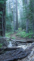
Sweet Meeks Creek
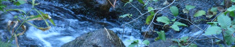
We hike through some Nice Cool Moist Forest after the Hot Dry Ridge Traverse
Hiking
from the
Desolation Wilderness Boundary
to
Lake Genevieve
A Little Temperate Zone The physical layout of Meeks Creek running through a narrow channel pinched into the terrain here induces cool moist shade nourishing a dense stand of forest that appears to protect the moist environment supporting the ferns, ivy, and moss characterizing this sweet little zone as temperate. I find the cool air refreshing after the hot climb. |
Hiking into Desolation Wilderness |
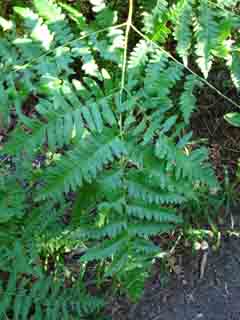
Ladyfinger Fern |
 |
 |
 |
 |
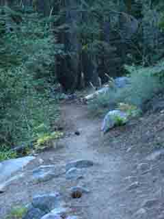
Forest trail approaching Meeks Creek. |
Cool moist location supports a little zone of temperate forest. |
To, and Past the Wilderness Boundary First we'll cross the South end of this open ledge wedged in the side of the ridge as we enter a narrowing channel of cool forest reaching to the top of the valley along Meeks Creek. At the far end of the open rocky flat we enter a deeply muffled temperate forest before we come upon Meeks Creek and its convenient bridge. We recognize a natural "sweet spot," where the nifty shape of the terrain works with prevailing winds and character of the weather cycle to create this unique little self-perpetuating bubble of biological lushness. Man, we've barely entered the Desolation Wilderness and encounter a wide range of Natural Treasures, and we have barely begun. Sometimes these "sweet spots" are as simple as a circle of grass growing out of a gravel bed, other times they are crowns of temperate lushness concentrated and focused by terrain complexities and wedged atop an otherwise dry dry strip of forest. Like this little zone. The air is enriched and sweetened by cool moisture within this special zone, this little concentration of environmental energy and and the The terrain steps up in complexity on the other side of the bridge as we climb out of the temperate zone. The trail bends a set of U-turns around the hilltops through an interesting close-in section of terrain as part of an even larger S-turn around and between the hilltops wedged in the top of this valley. The ridge arm we have been traversing up was pinching up to the unique head of this low valley, this sweet little vale, as we climbed. Now the route of the TYT is bringing us into the mouth of the next valley.
Meeks Bay to Dicks Pass
|
Video
Just past the Desolation Wilderness Boundary
Hiking the Desolation Trail, just after crossing the
Desolation wilderness boundary,
from Meeks Bay Trail Head. Duration 1:12.
Desolation Wilderness Desolation Wilderness Boundary Elevation Meeks Bay to Dicks Pass Mileage 1.05 miles from the Trail Junction
2.14 miles to Lake Genevieve 6.63 miles to Phipps Pass We are almost exactly halfway to Lake Genevieve at the Desolation Wilderness boundary. |
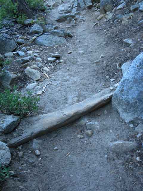
Last Steps to Meeks Bridge
Desolation Wilderness
A Zone of Moist, Dark, Muffled Temperate Forest
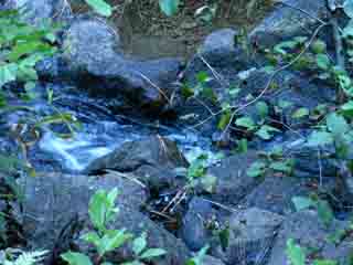
TransitionsThe exposed heat of hiking along the edge of the dried out meadow from the trailhead to the ridge, albeit a meadow that is being filled up with lodgepoles, swiftly transitions into a still hot, but shaded hike traversing the ridge arm up towards the head of the valley carrying Meeks Creek down to Lake Tahoe below Lake Genevieve. At the head of this little vale the junction of its convoluted ridge arms forces the terrain to focus a temperate zone, which our trail passes through as it tracks around and through a nifty set of close-in wrinkled terrain features. A whole lot of natural complexity and beauty, and we've hardly begun! Approaching the head of the valley below Lake Genevieve your body will not fail to notice the transition from hot, dry forest into this small protected cool zone sheltering temperate conditions, replete with lady finger ferns and ivy, all part of a deep green layer of undergrowth, with a refreshing cool and moist feel to the air. Then we turn up and out of the coolness for the final hot climb to Lake Genevieve.
The Roar of Silence The absence of noise itself can roar during our first days on the trail. The auditory sensory-shift is just the first of what will be many examples of backpacking not just through nature, but through profound internal transitions created by departing an environment dominated by man into one run by nature. These will be internal as we adjust our goals and expectations, and external as our capacities and engagement adjust and increase. The strains and pains of hiking with a heavy pack are immediately psychologically offset by the beauty of the terrain and deeply engaged experiences our packs allow us to access. Balance of Factors We should be getting a picture of the balance between the bookends of our experience, of our fundamental operating relationship between the pleasures and pains of backpacking. This relationship deepens where the trail steepens. The trail turns up , being significantly steeper than the trail from trailhead up to Lake Genevieve, once we hike past the boggy zone off the South shore of Stony Ridge Lake. Then we climb! 1000 feet in 2.11 miles between the South shore of Stony Ridge and Phipps Pass. A Hard-3 or Intermediate-1 little segment of trail.
Meeks Bay to Dicks Pass
|
Hiking North |
Hiking South |
Backpacker Forums Post it on Above we come to the Front Page of the High Backpacking Trails and Topics Forums. Below we break the forums down into their constituent categories:
Any unidentified hiker, or even civilians, can post text comments, questions, feedback and tips in the existing forums, but only registered TW members can post up new topics, along with images, maps, and formatting. The whole point of becoming a member is to share information. Give it, get it, share it. If you have experiences, comments, questions, trip reports, trail conditions updates or pictures and videos of the Tahoe to Yosemite/Pacific Crest Trail from Meeks Bay to Echo Summit, post up here as an unknown hiker or as a member: Section
|
North to the Meeks Bay Trailhead South to Genevieve Lake
Trailhead
Contact
Alex Wierbinski

Backpacking Lake Tahoe to Mount Whitney
Your guide to the High Sierra Crest, including the Tahoe to Yosemite, Pacific Crest, and John Muir Trails
