


South Desolation Wilderness Topo Hiking Map
The Tahoe to Yosemite, Pacific Crest, and Tahoe Rim Trails
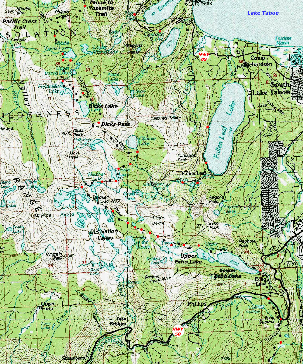
USGS 30 minute backpacking topo map of Desolation Wilderness

| Topo Maps INDEX Meeks Bay to Echo Summit |
NORTH 30 min topo Map Meeks Bay to Middle Velma Lake |
SOUTH 7.5 min topo Map Echo Summit to Carson Pass |
SOUTH 30 min topo map Echo Lake trail head to Round Top Lake Meiss Country Roadless Area |
Detailed 7.5 maps NORTH |
Full Desolation Wilderness Topo Map |
Click Map Dots & Map for links to Trail Guide Pages & Maps |
Trail Guide |
all maps |
all pages | miles and elevations |
map info |
Backpacking Central & Southern Desolation Wilderness
LINKED
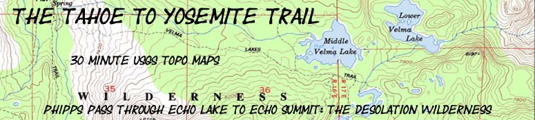
30 minute Topo Map
Phipps Pass through Echo Lakes to Echo Summit
21.83 miles
| Click BLACK DOTS & MAP for Detailed Maps |
Click RED DOTS for Trail Guide Information |
| NORTH 30 min topo map Meeks Bay to Middle Velma Lake |
Mileage and Elevations |
Click the Red Dots Click the Black Dots Click the Map |
SOUTH 30 min topo map Echo Lake to Round Top Lake |
|
| Central-Southern Desolation Wilderness 30 minute USGS topo hiking map with PCT-TRT junction with TYT and the transition South from Desolation Wilderness into the Meiss Country Roadless Area. Click Red Dots. |
| NORTH 30 min topo map Meeks Bay to Middle Velma Lake |
Mileage and Elevations |
Click the Red Dots Click the Black Dots Click the Map |
SOUTH 30 min topo map Echo Lake to Round Top Lake |
Above
30 min map of Phipps Pass through Echo Lake out of Desolation Wilderness crossing Highway 50 into the Meiss Country Roadless Area
Highly Detailed 7.5 map series covering this area
Phipps Pass to Susie Lake
Phipps Pass through Southern Desolation Wilderness into Meiss Roadless Area through Echo Summit |
||||
Map Notes Corrections to the trail route as depicted on the 30 minute map above include the trail rerouting from Phipps Pass to the Pacific Crest Trail Junction, the rerouting of the PCT-TYT by placing a trail junction South of Middle Velma Lake up to Fontanillis Lake rather than around Upper Velma Lake, and the route from Echo Summit South to the Frog Pond trail junction. Also note there are three trail junctions between Gilmore Lake and Suzie Lake, so I added the Southern junction North of Susie Lake omitted from the topo hiking map above. This Southern Junction connects our combined TYT, PCT, and TRT with the trail to Glen Alpine Springs and on East to Fallen Leaf Lake. The middle trail junction has a branch of the Glen Alpine trail coming in from the East and a trail West to Half Moon and Alta Morris Lakes. Click the map to be brought to the detailed 7.5 minute maps of each area the trail crosses. These 30 minute maps do not offer the detail and accuracy of the 7.5 minute maps, but have the advantage of giving a broader understanding of the terrain surrounding our trail and our route options. Consult the 7.5 minute maps for greater detail and accuracy. I strive to make these older maps reflect trail status as of 2015 by marking and pointing out the changes. Keeping up with route changes is also one of the roles of the Tahoe to Whitney Trails Forum. These are high resolution maps and will zoom effectively through most browsers for closer inspection. Additional information, corrections, trail and hiking notes, and your experiences can be added to each Trail Guide and Map Page through the Forum for that particular page. Information you add will be available for subsequent hikers. Trail Notes Main Features: Middle Velma marks both the end of the descent from Phipps Pass, and is just a bit South of our Tahoe to Yosemite Trail's junction with the Pacific Crest and Tahoe Rim Trails. Middle Velma Lake is a great place to take a break. Shade, nice views of rock and water, and good water. South from the TYT-PCT-TRT junction below Phipps Pass the Tahoe Rim Trail will correspond with our route until we arrive at Meiss Cabin, where the Counter-Clockwise Tahoe Rim Backpacker will turn Northeast to hike past Round Lake to pass through the Big Meadow trail head on Highway 89 on the way to Freel Peak, the dominant peak on the Carson Range as it wraps around the East Shore of Lake Tahoe. We Southbound Hikers will continue to follow the combined Pacific Crest and Tahoe to Yosemite Trails South as far as the Carson Gap, where we will either turn Southwest to follow the Tahoe to Yosemite Trail to Lake Alpine on the Western Flank of the Sierra along Highway 4, or we will continue South on the Pacific Crest Trail to Ebbetts Pass crossing Highway 4 near where it crosses the Sierra Crest.
Continuing South from the low point of Middle Velma Lake begins our next Southbound ascent, to Dicks Pass. Dicks Pass elevation of 9390 will be the highest point on our trail until we reach Round Top Lake on the TYT Route West of the Carson Pass. MAP NOTE What's important for our general reference purpose is that From my point of view that is 1093 yards or .62 of a mile. Diagonal: 1414.22 meters, if my trig is correct. That converts into 4,639.8 feet or .88 of a mile.
|
Desolation Wilderness Mileage and Mapping Information |
|
MileagesMiddle Velma to Dicks Pass Dicks Pass to Gilmore Lake Junction Gilmore Lake Junction to Fallen Leaf Lake Junction Fallen Leaf Junction to Aloha Lake Junction Middle Velma to N. Aloha total trail mileage
Meeks Bay to Echo Summit Meeks Bay trail head to Lake Genevieve Lake Genevieve to Middle Velma Lake Middle Velma to N. side, Aloha Lake Aloha Lake to Echo Lake trail head
Totals Meeks Bay trail head to Echo Lake trail head 28.71 miles Meeks Bay trail head to Echo Summit trail head 30.71 miles
Back to Tahoe to Alpine Trail Guide Index Back to Meeks Bay Trail Guide Page |
USGS
|
NORTH 30 min map: Lake Genevieve to Middle Velma Lake SOUTH 30 min map: Lake Aloha to Echo Lake trail head
| Elevations | More Information | |
Phipps Pass Middle Velma Lake Dicks Pass: 9390 feet Susie Lake Aloha Lake Echo Lake |
Trail Guide, Section
Trail Guide, Segment
Google Map |
|
Map Credit |
U.S. Geological Survey, Department of the Interior: Get this topo map FREE from the:USGS Topographic Map Information |
Trail Guide
Meeks Bay Trailhead Echo Lake Trailhead Echo Summit Trailhead
Tahoe to Whitney
Trailhead
Post your comments, questions, impressions, trail reports, & experiences in the forum covering that part of
Desolation Wilderness you're interested in.
BACKPACKER'S FORUMS
Meeks Bay to Echo Summit
Post your comments & questions about
Desolation Wilderness Maps